Image

“Some beautiful paths can’t be discovered without getting lost.” ― Erol Ozan


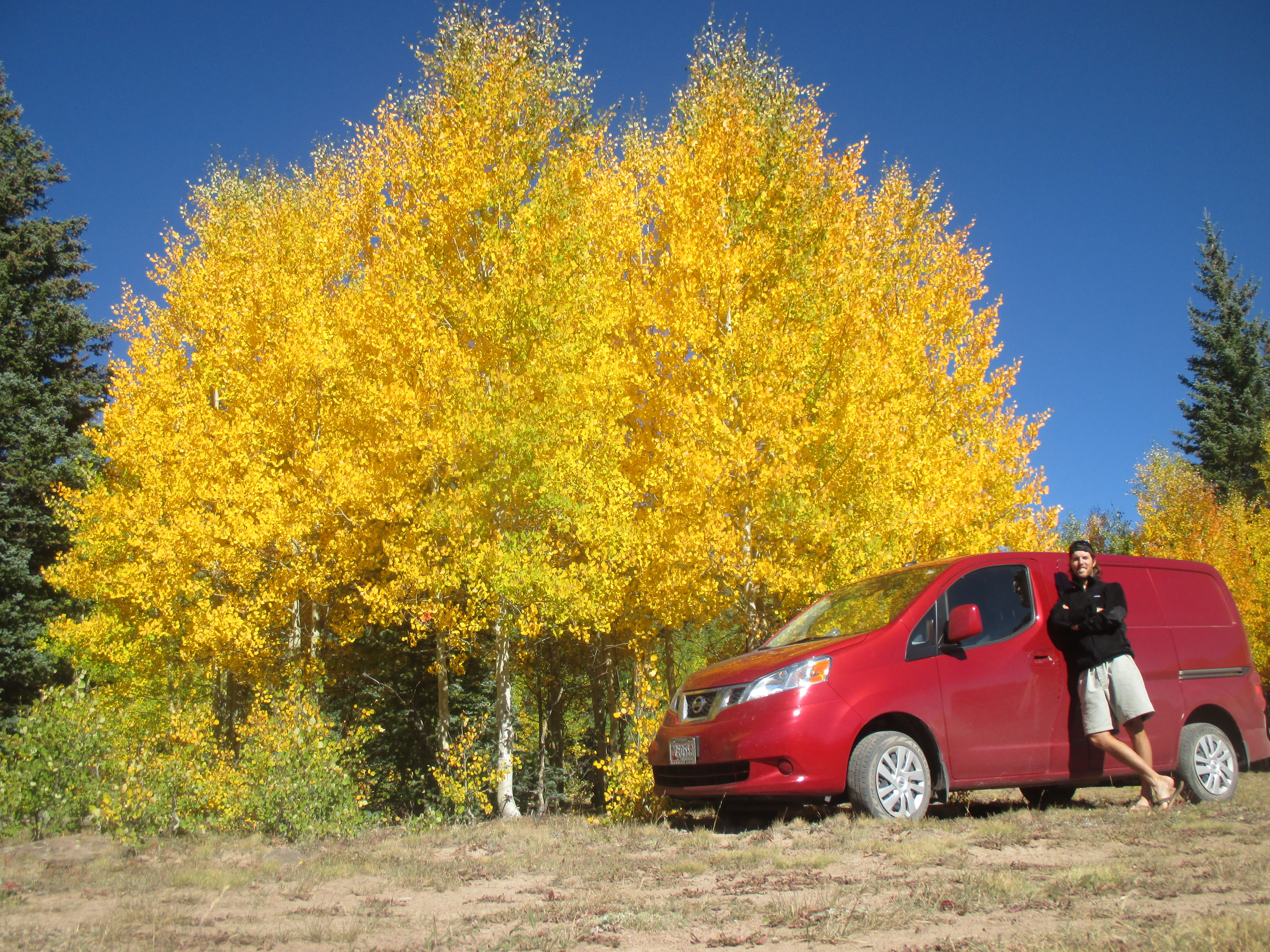
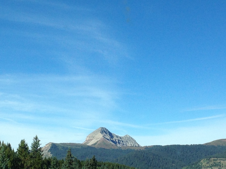
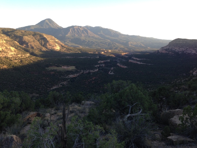
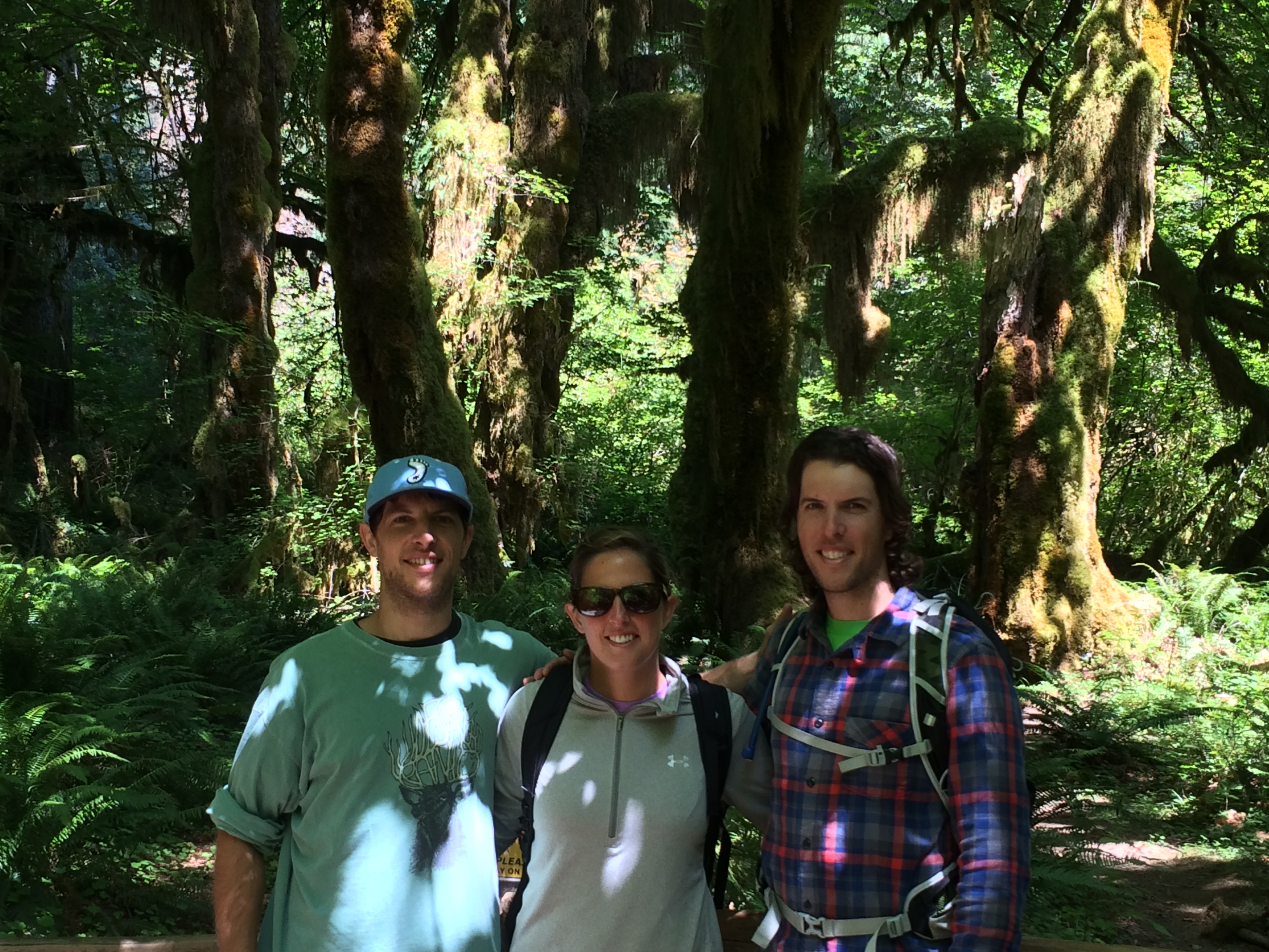
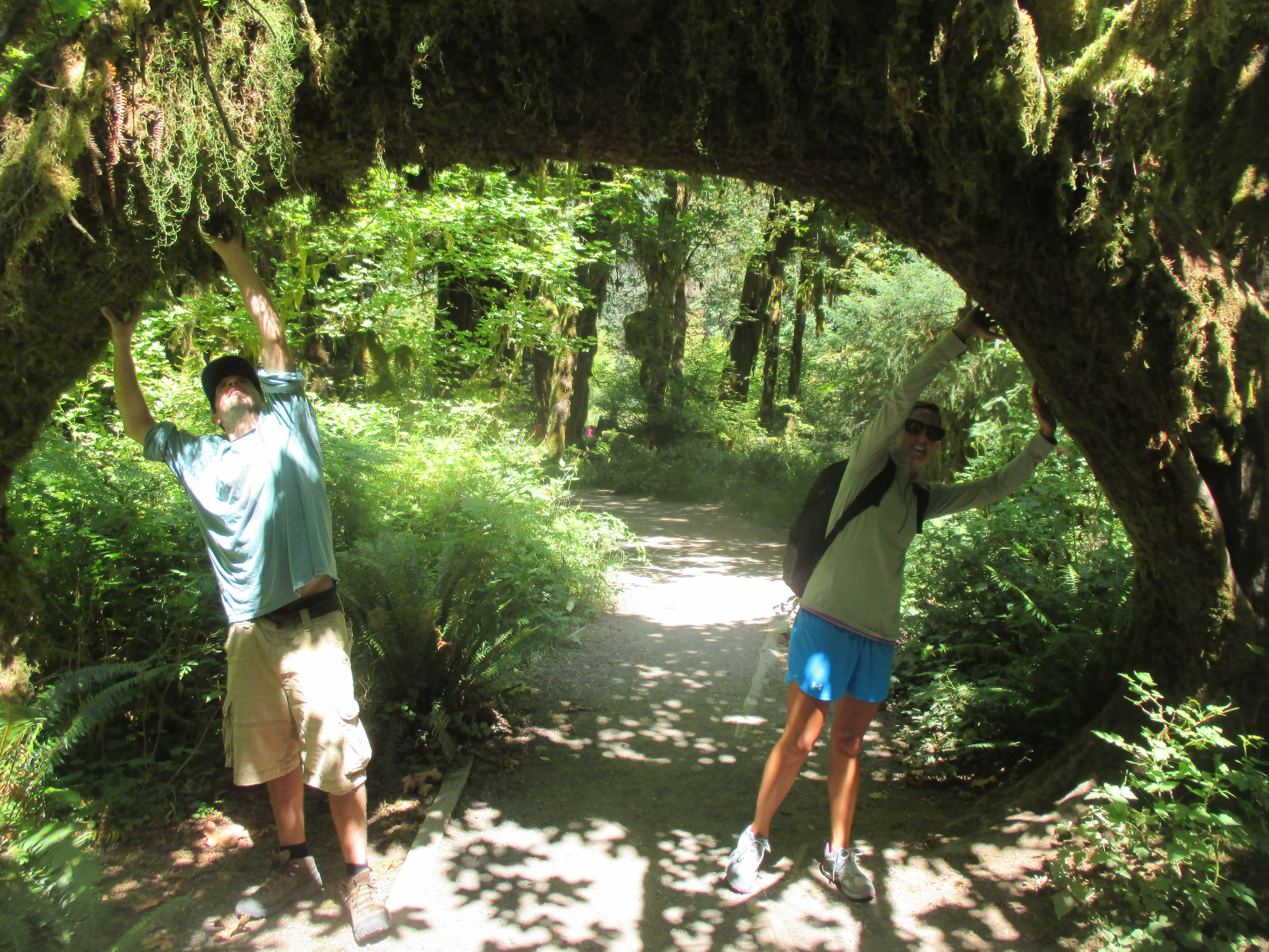
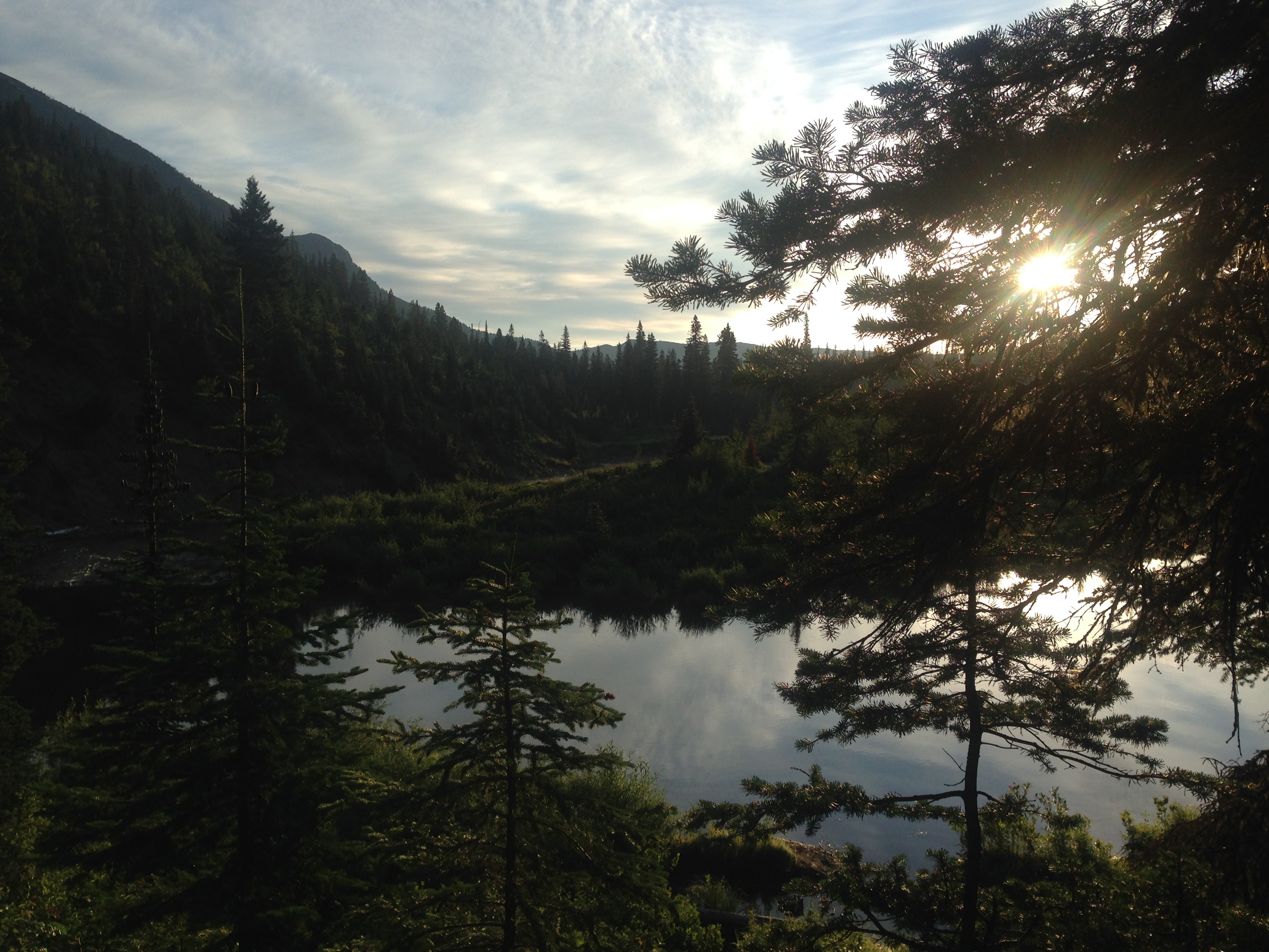
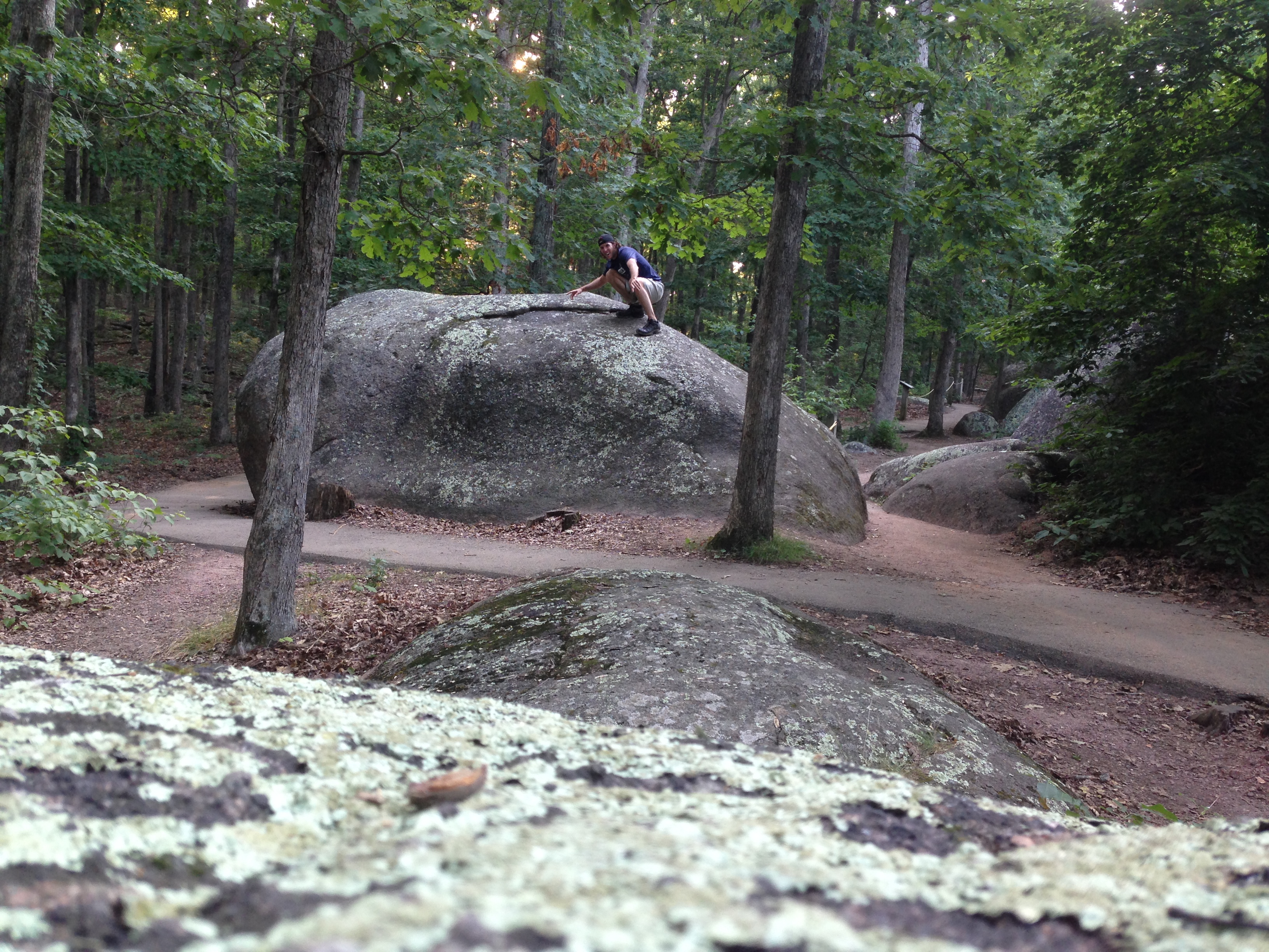
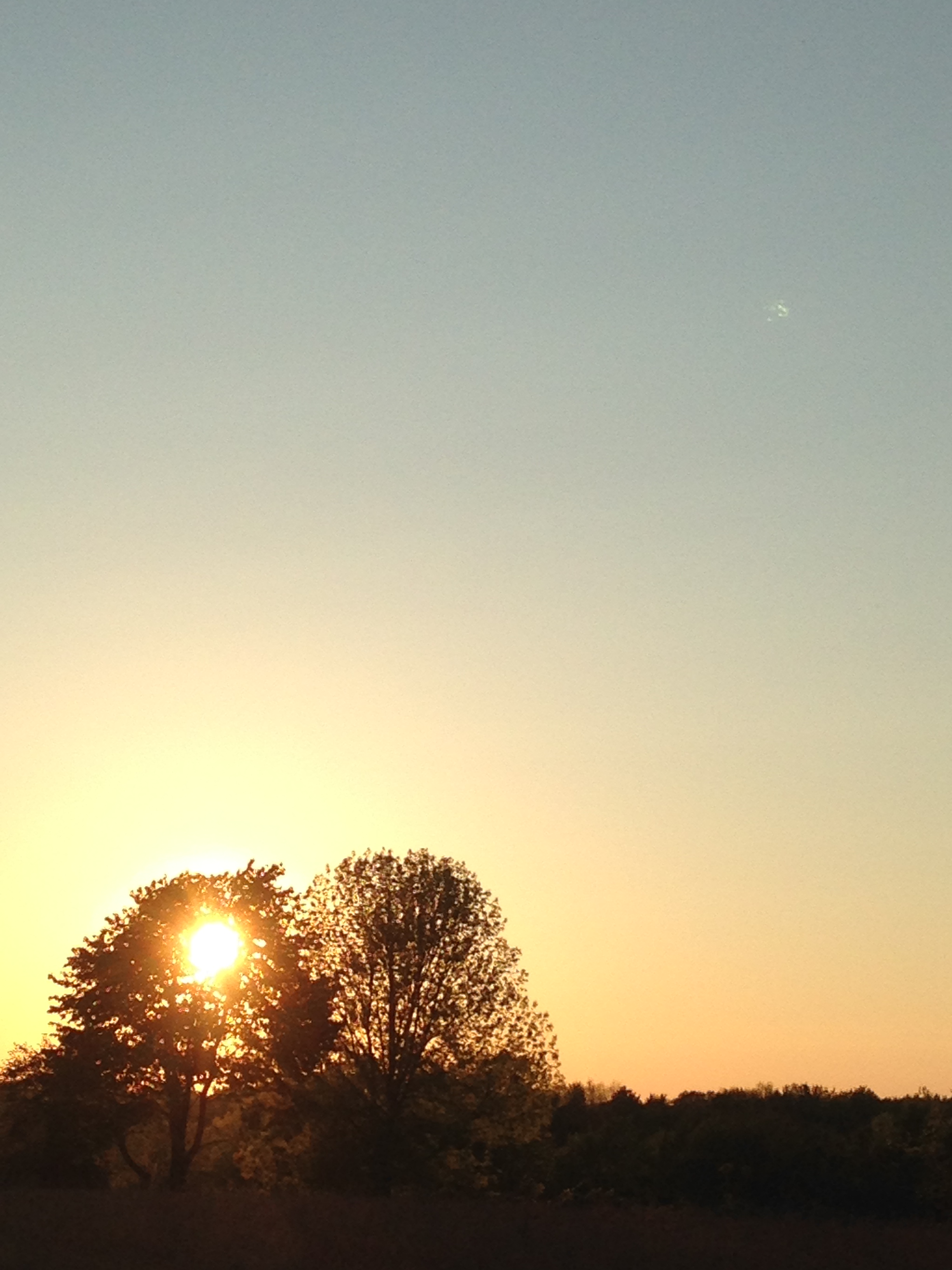
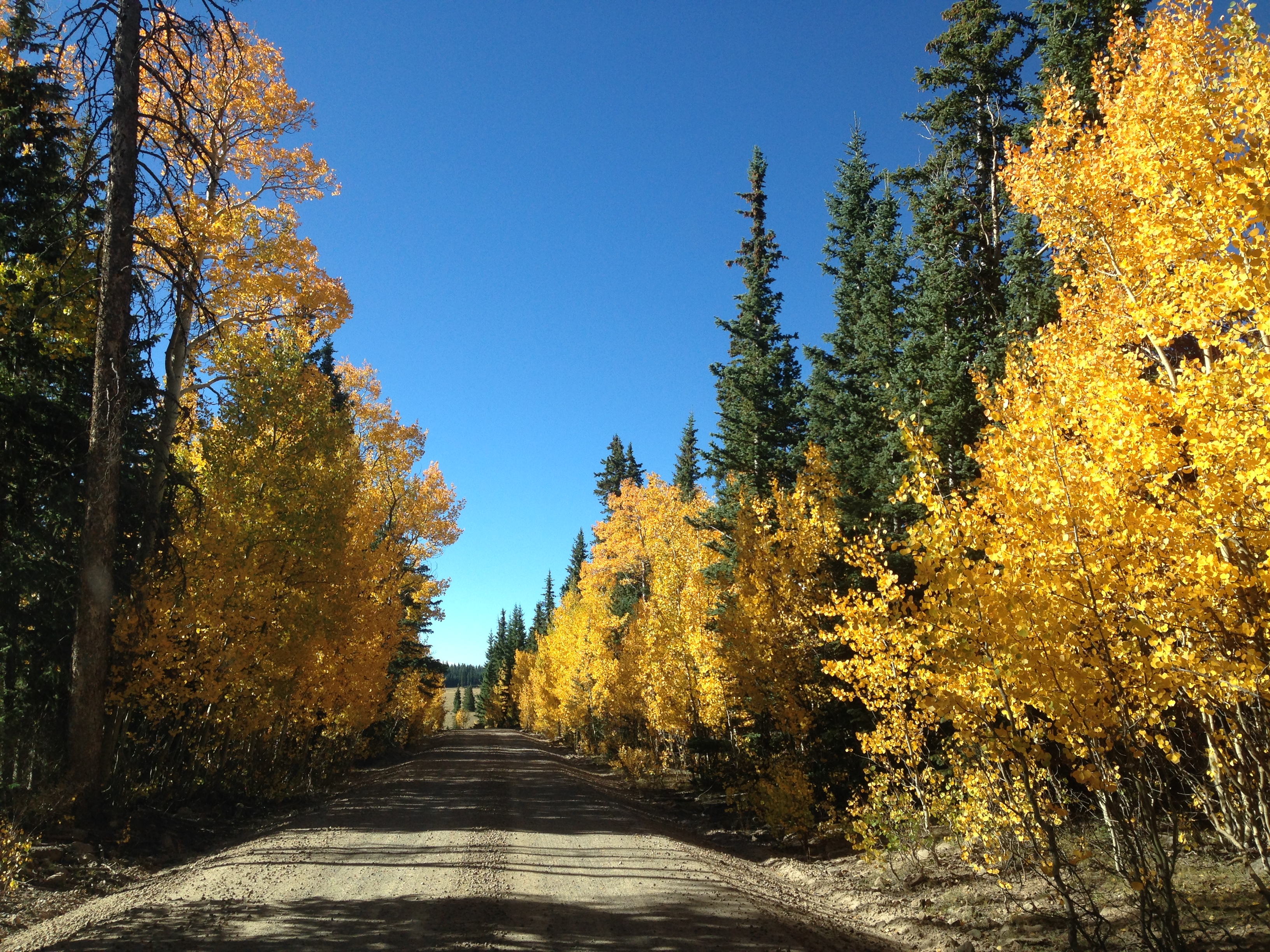
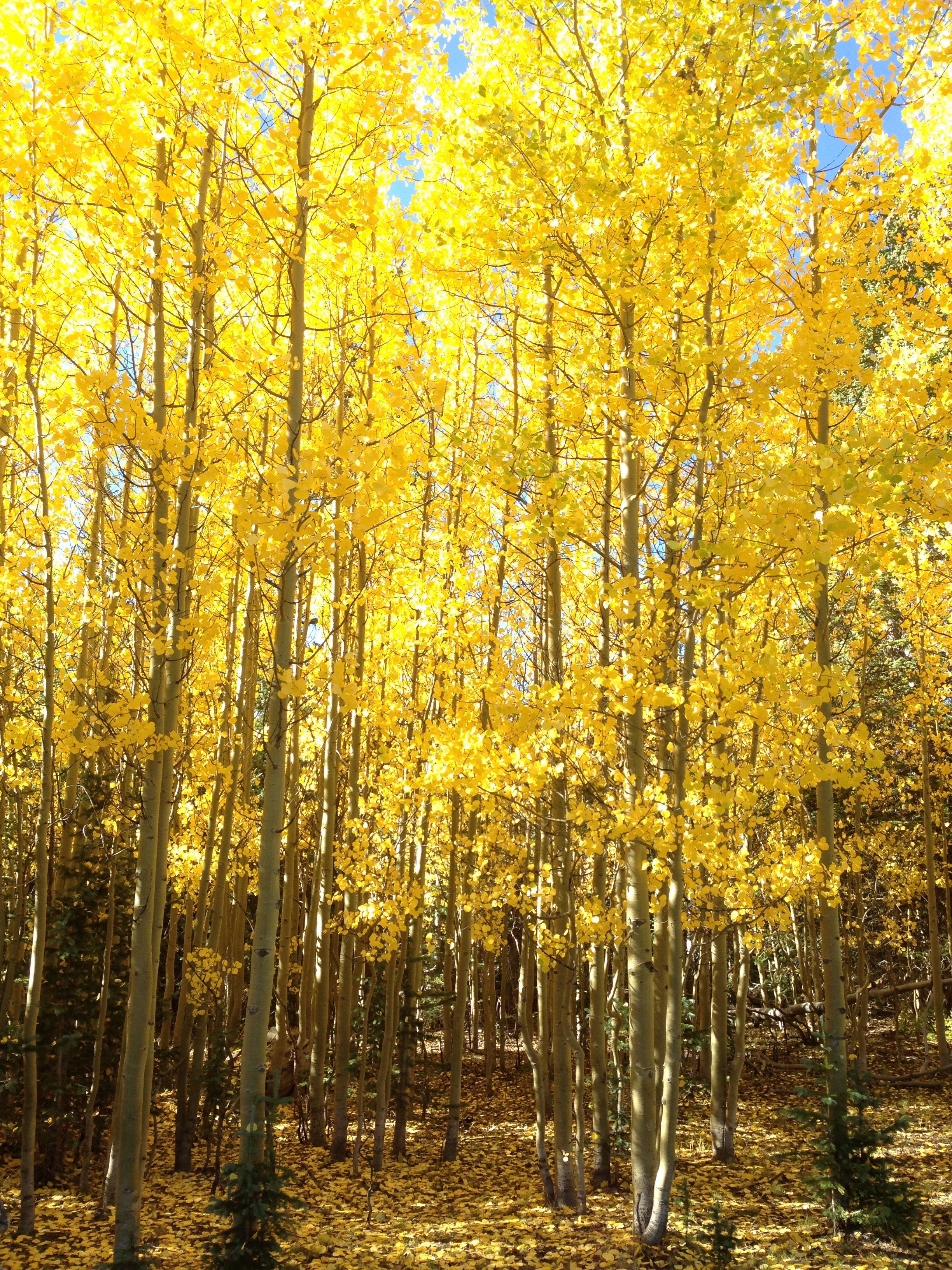
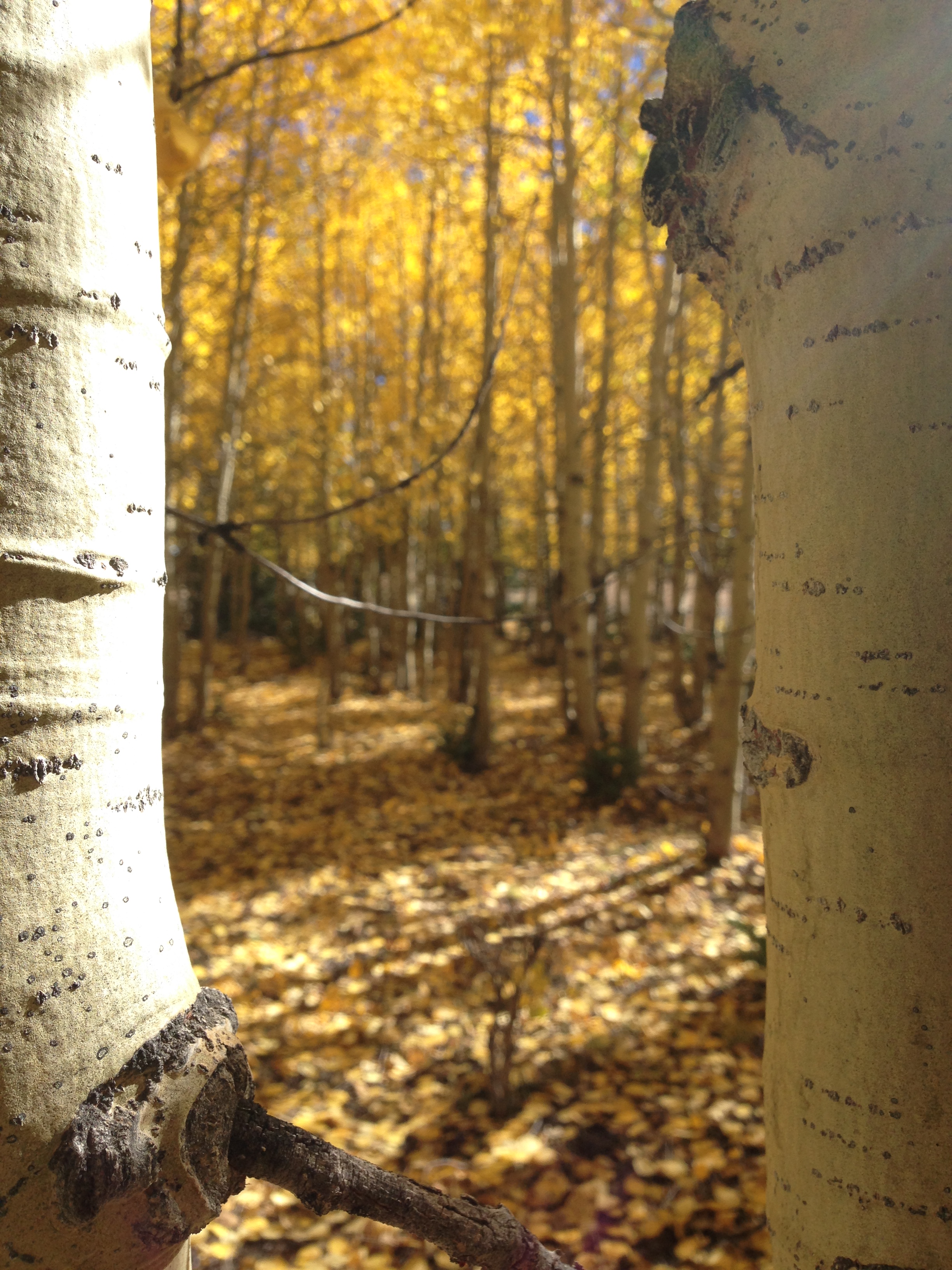
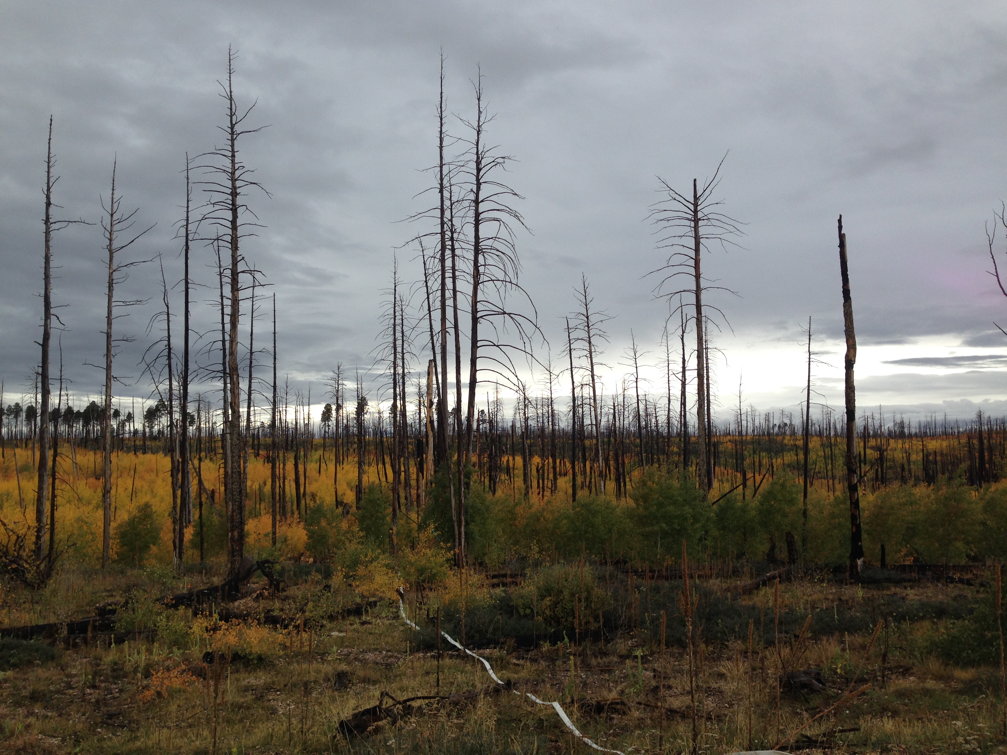
Driving through the open spaces and arid landscape of Southern Utah, I was shocked to discover Dixie National Forest. Dozens of miles of gravel roads lead me through a wonderland of lush vegetation, expansive grassland, and Aspen trees flaunting golden leaves. I always thought that the Cambodian rice fields were the green-ist green I had ever seen, now I can add to the list with yellow Aspen leaves being the yellow-ist yellow. I couldn’t help but drool looking out the windows, stopping around every turn to admire the beauty. I strung up the hammock and watched the sunset over the rolling hills.

img_2438 img_2440 img_2448


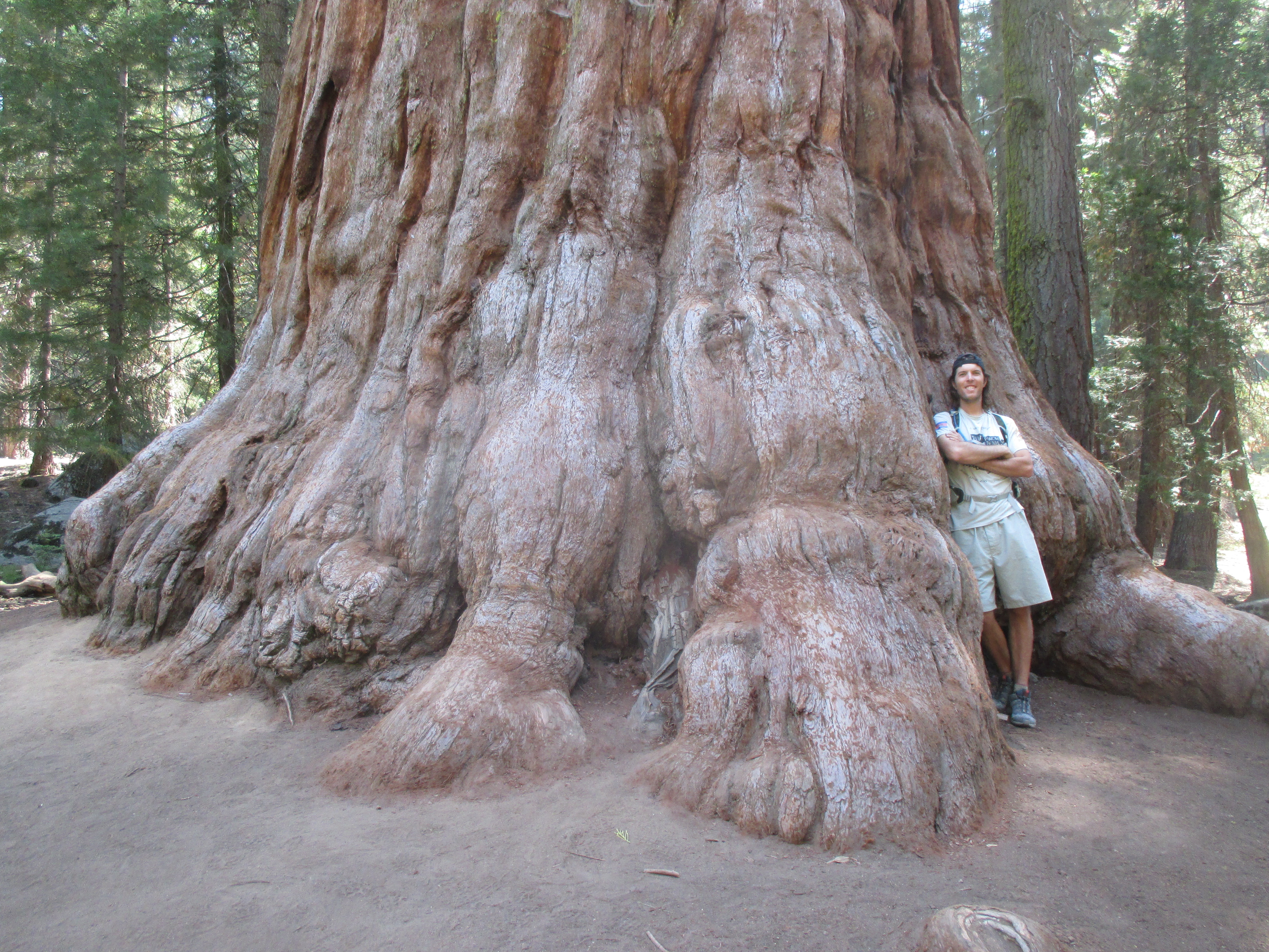
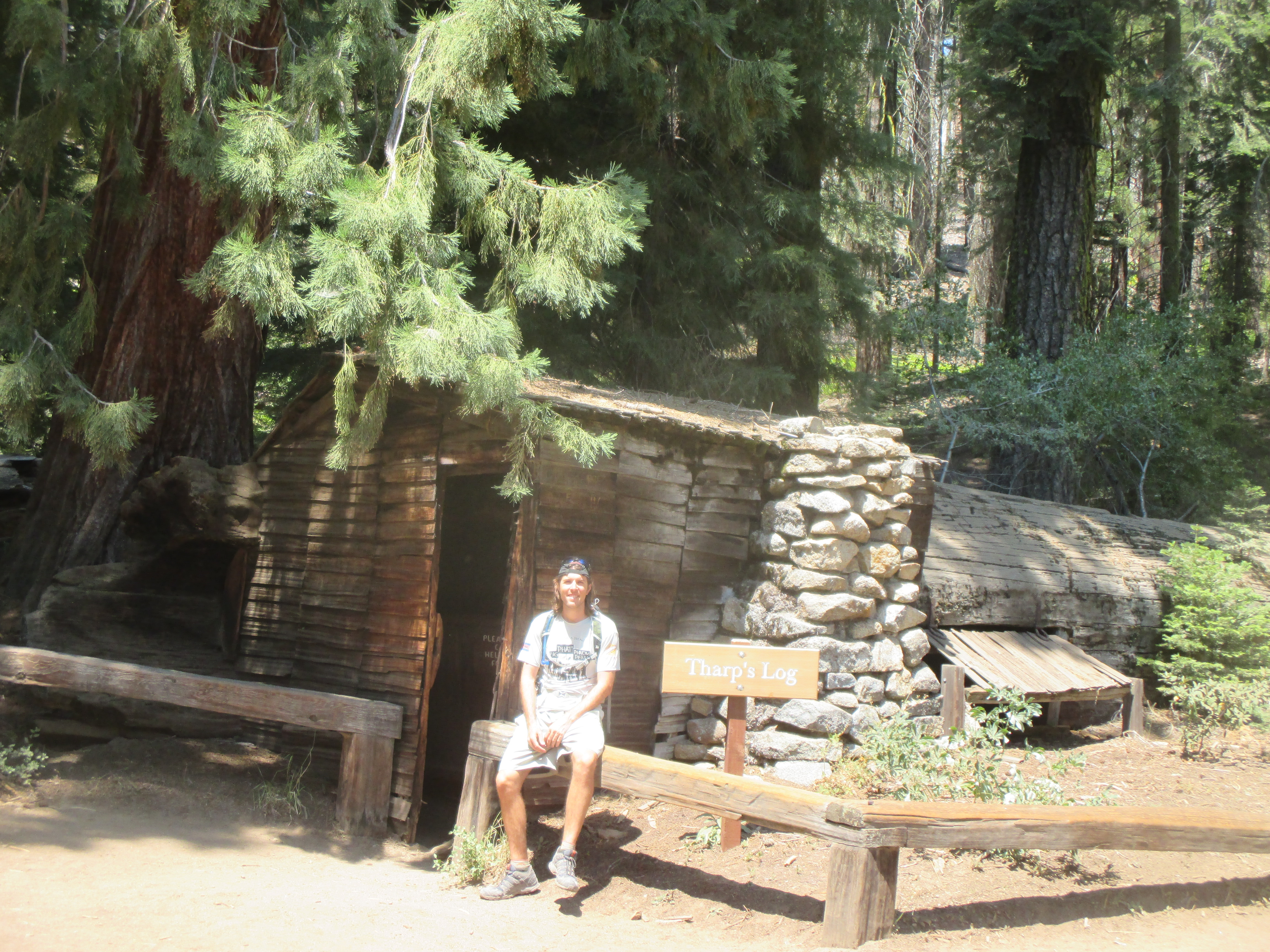
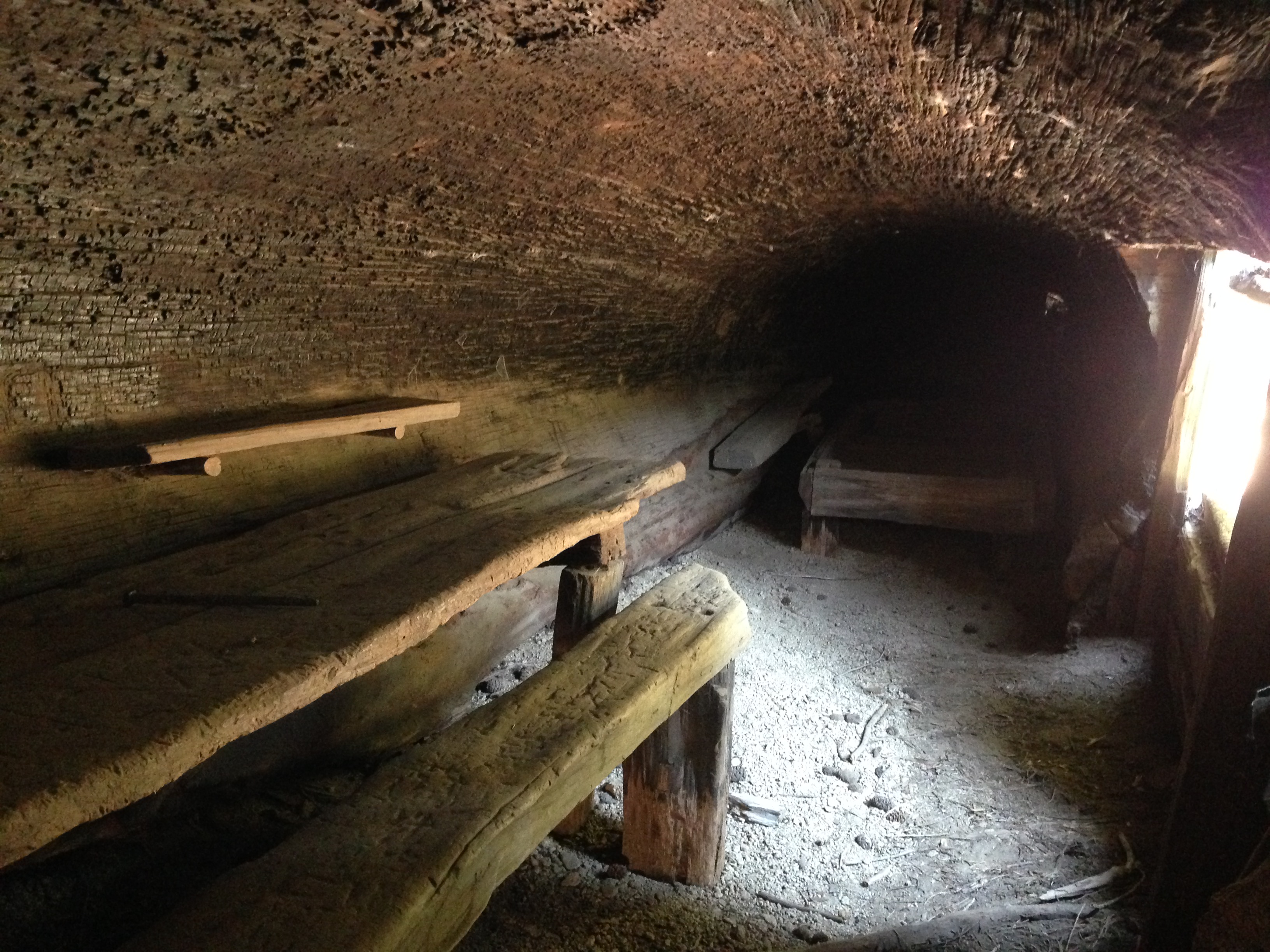
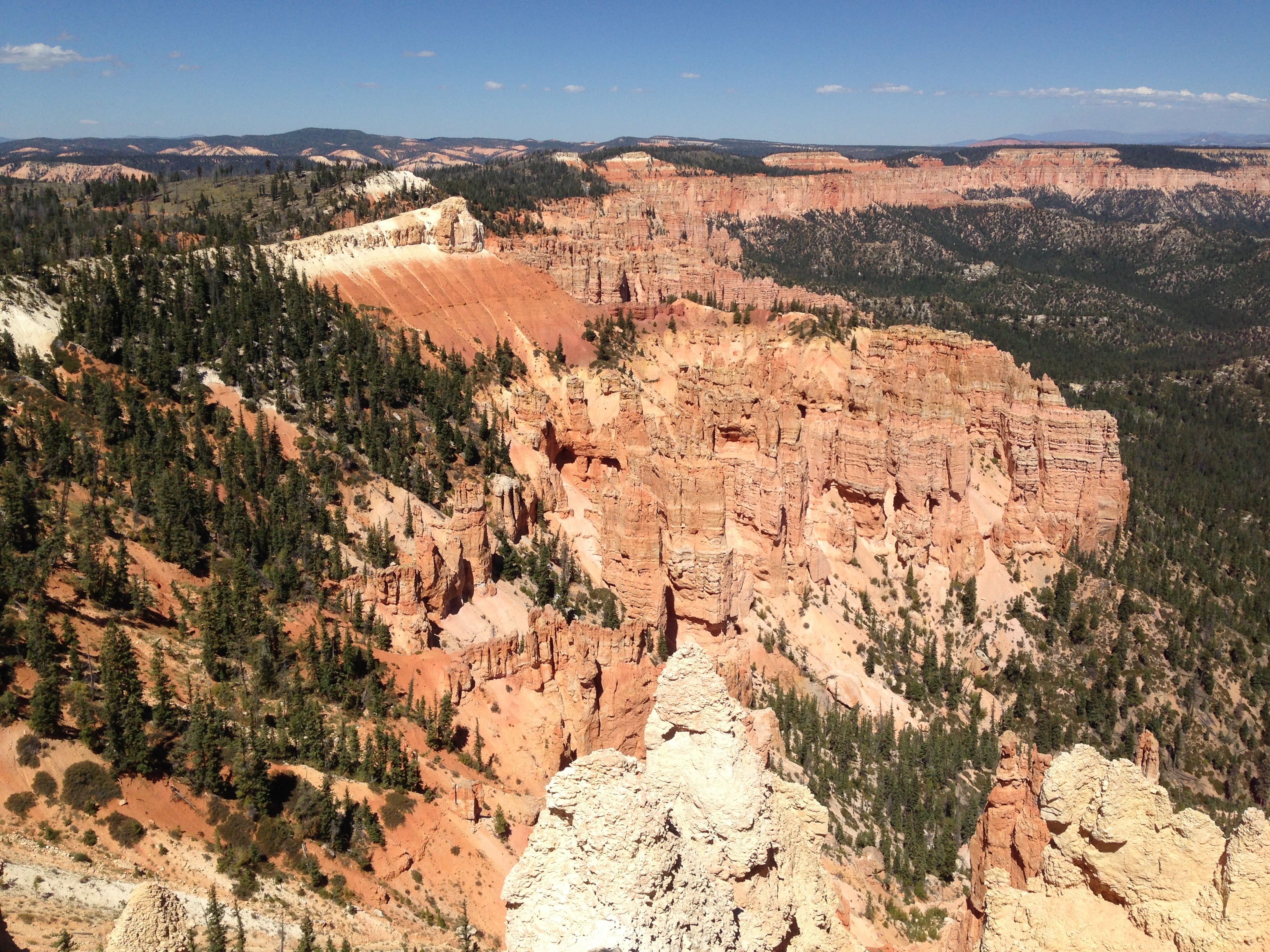
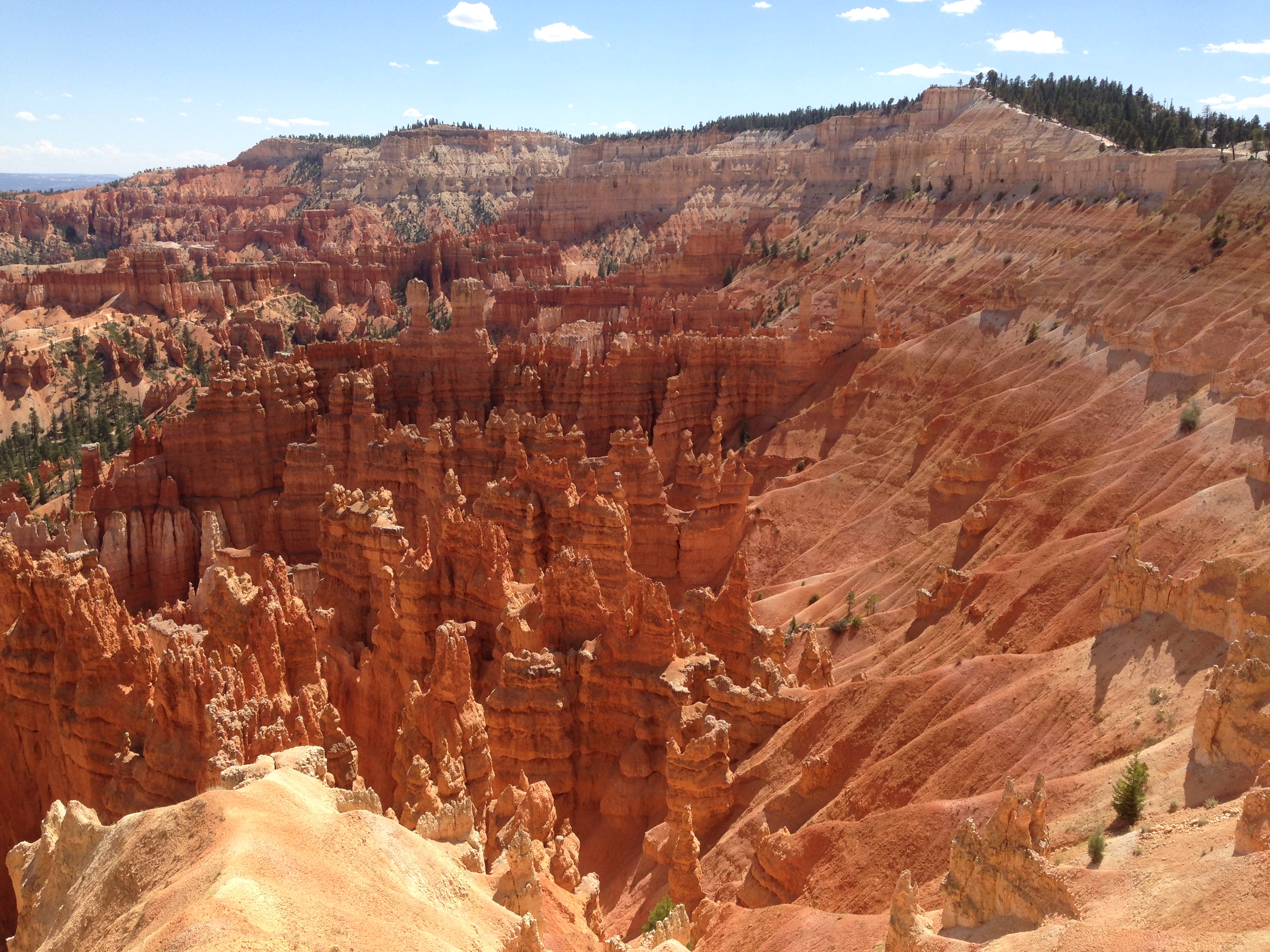
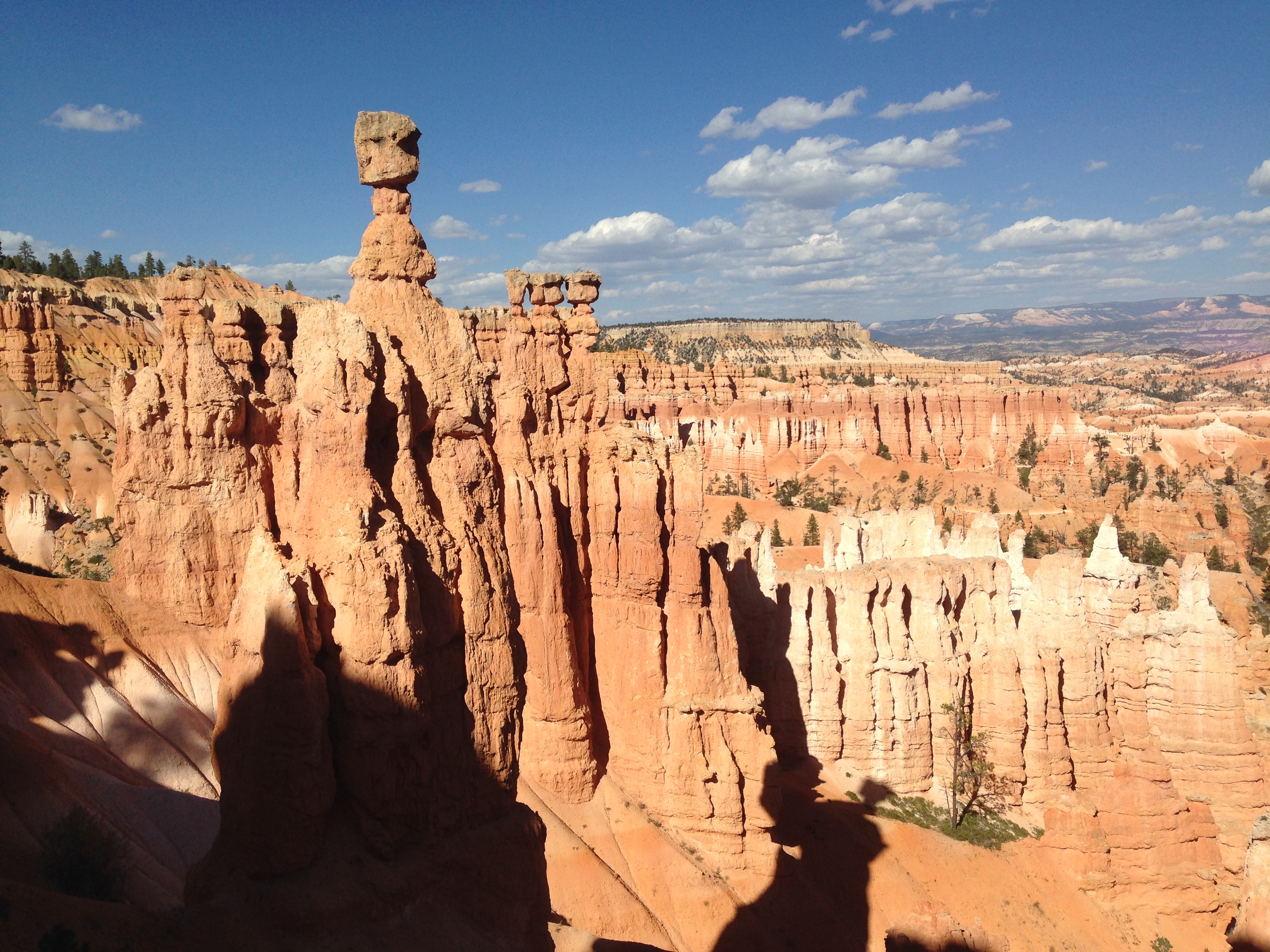
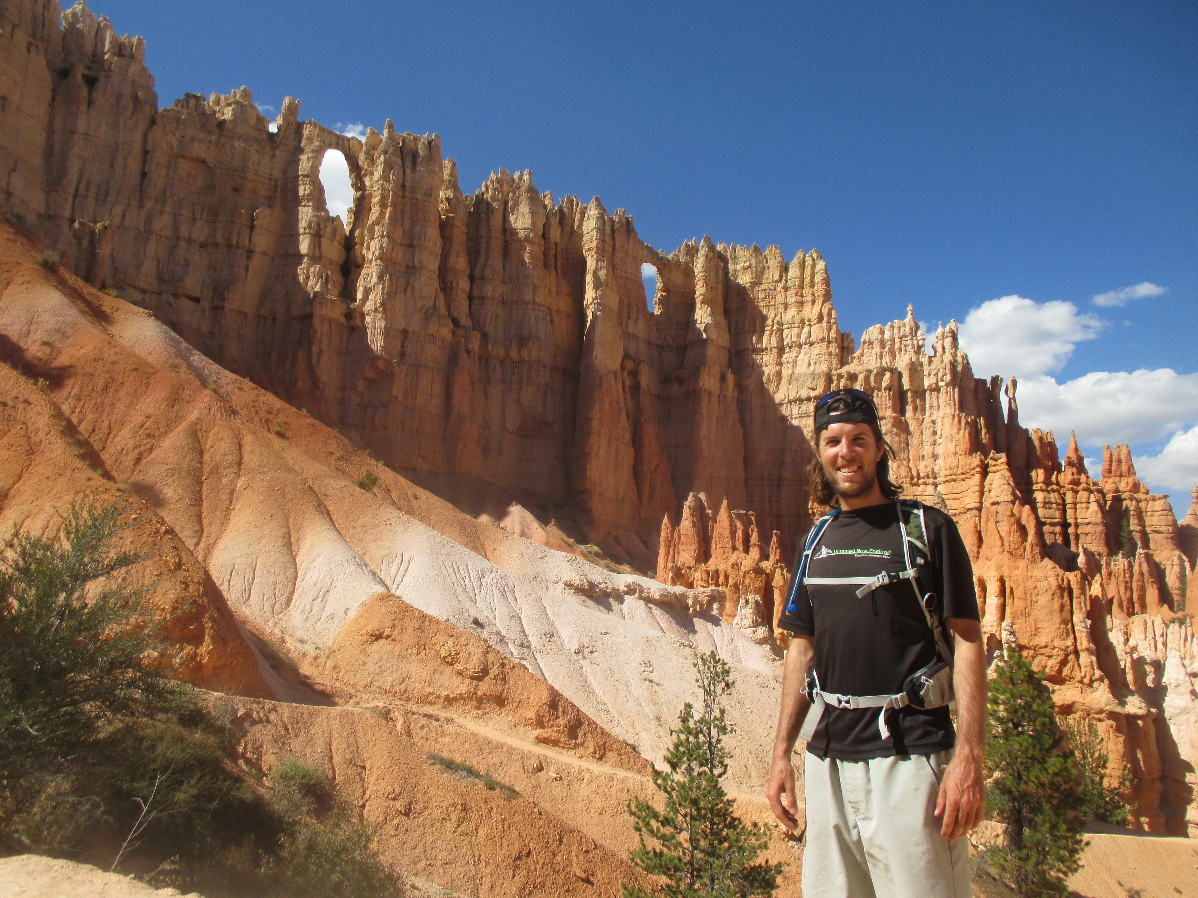
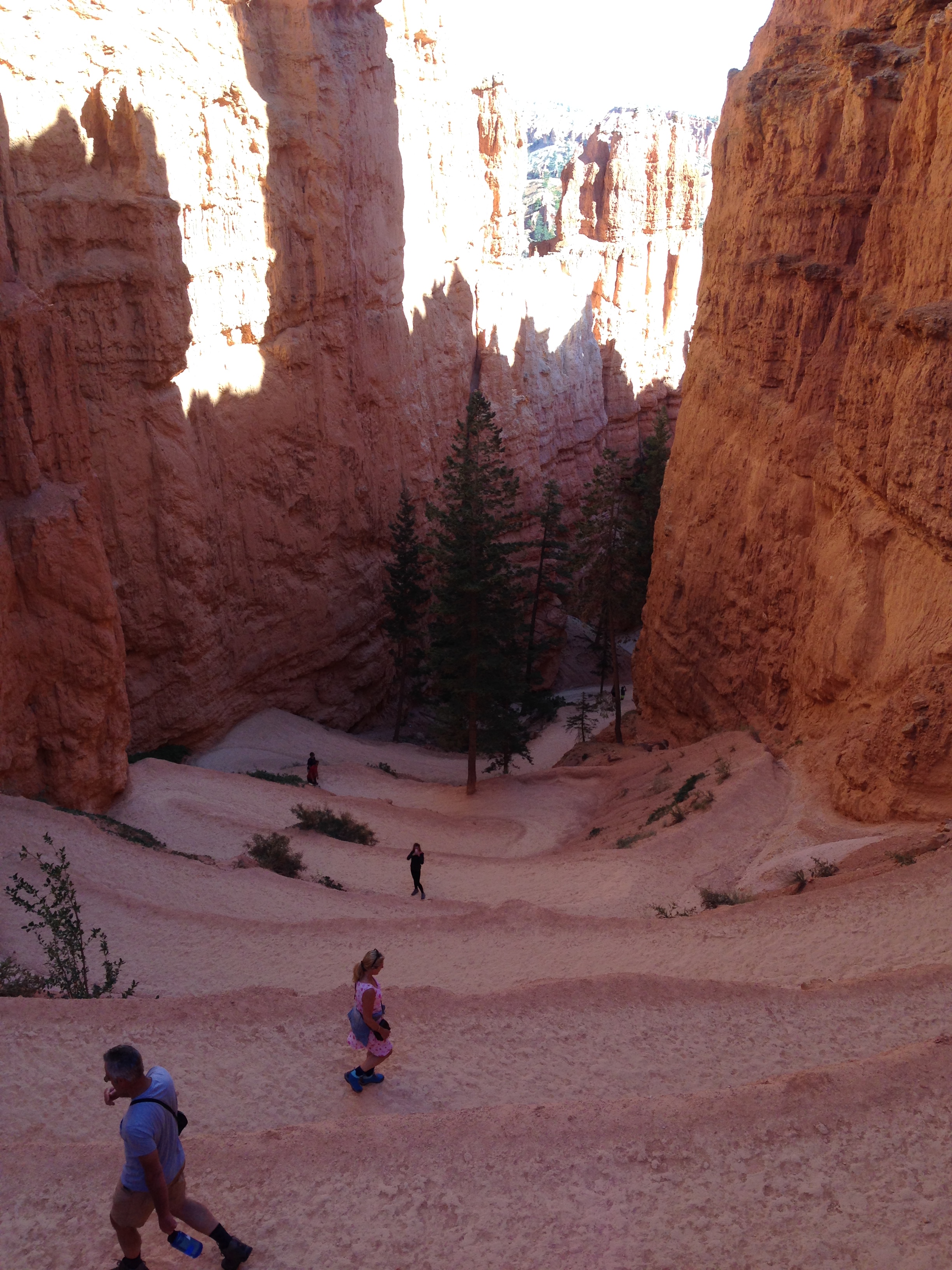
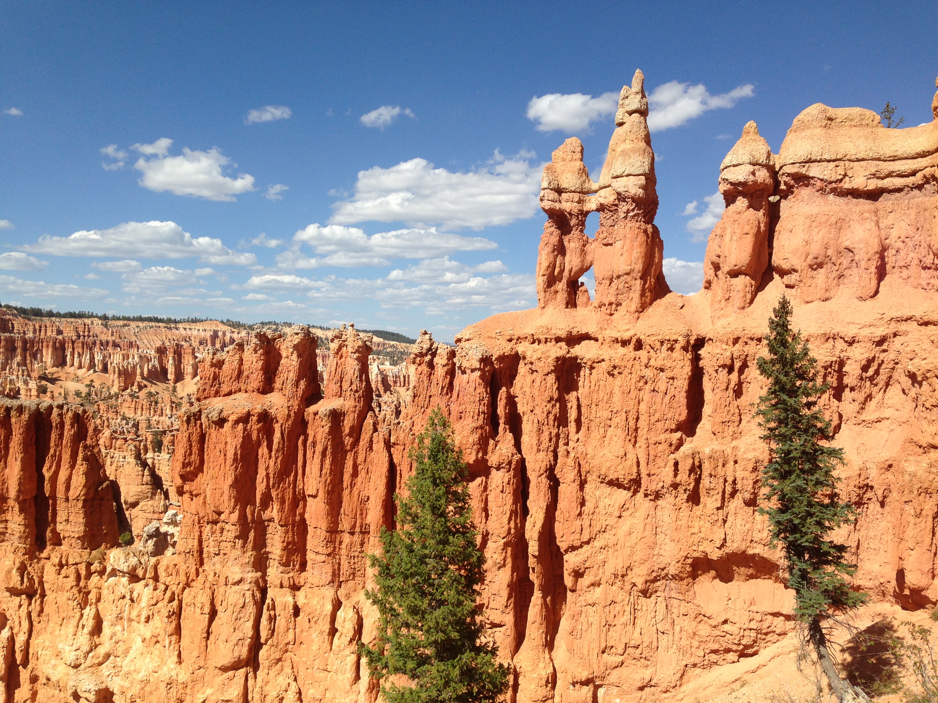
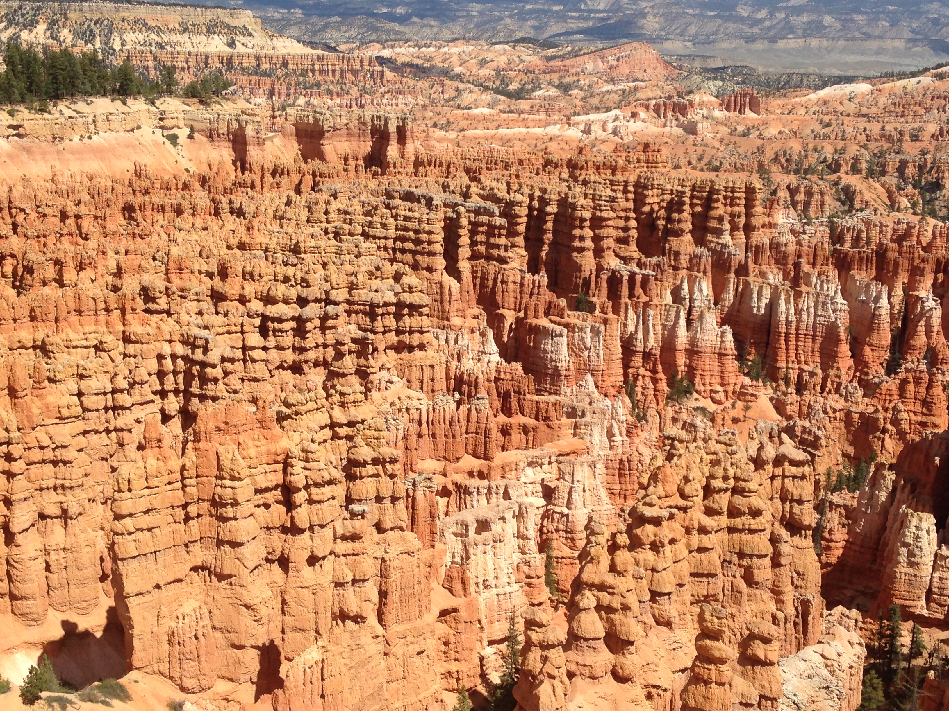
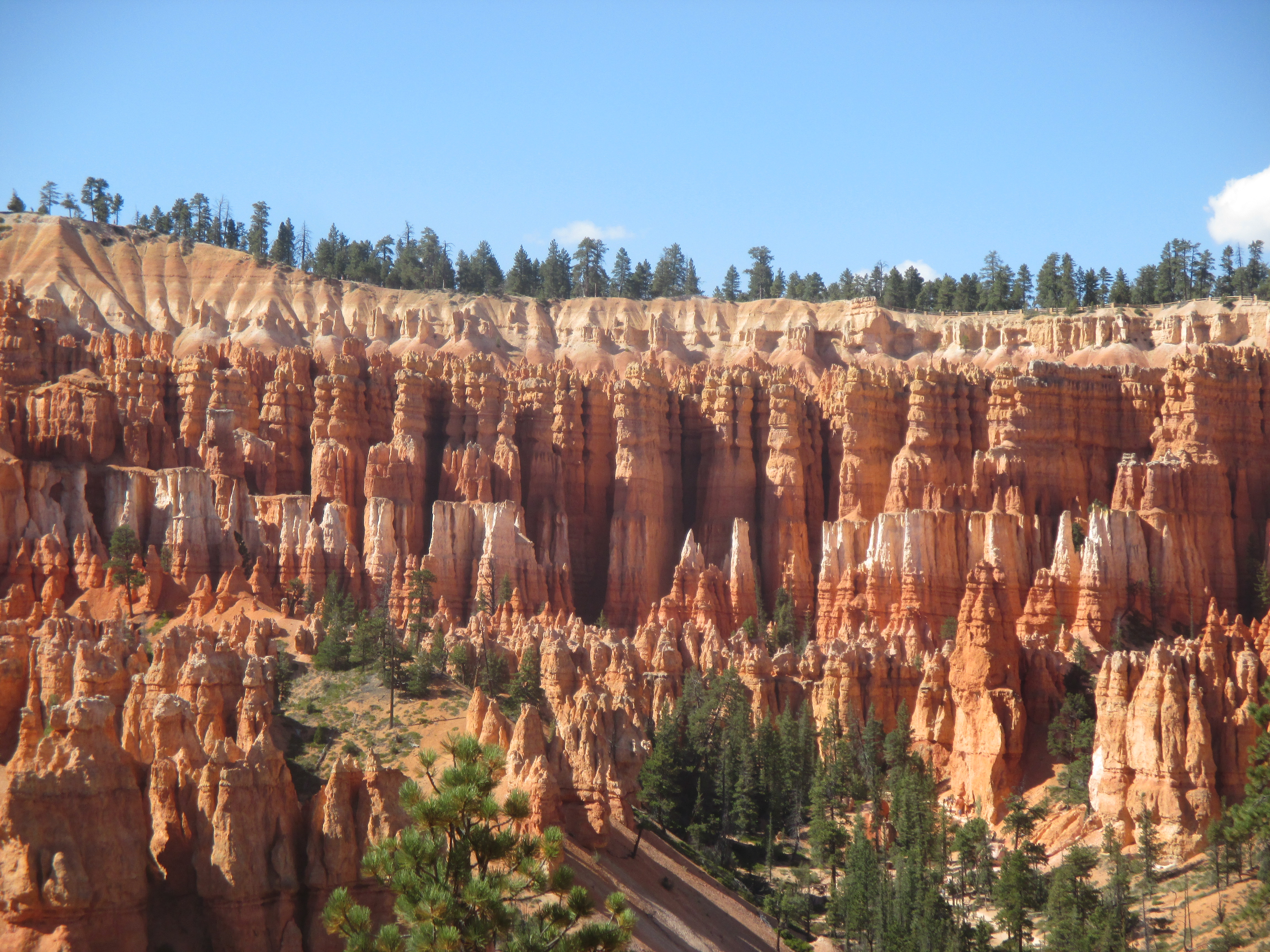
Continuing through Utah, I visited Bryce Canyon, an iconic landscape famous for its many pillars or “hoodoos”. These red and white stripped formations seem tiny from the overview, but walking amongst them revealed their gargantuan size! The climb back up to the rim of the canyon from the canyon floor followed many tight switchbacks up a slim section between two hoodoos. The trails were incredibly well maintained and it’s impressive to think about how many hours went into building the trail systems in the National Parks. The Native Americans who once lived here believed that the hoodoos were created when there ancient people were behaving bad, so the coyote god turned them to stone!

img_2461 img_2467 img_2511 img_5583 img_2510 img_2488 img_2470 img_5585

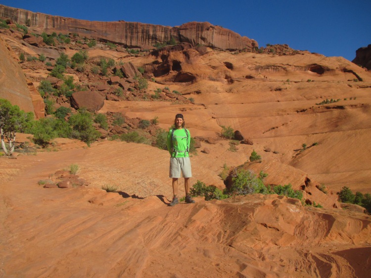
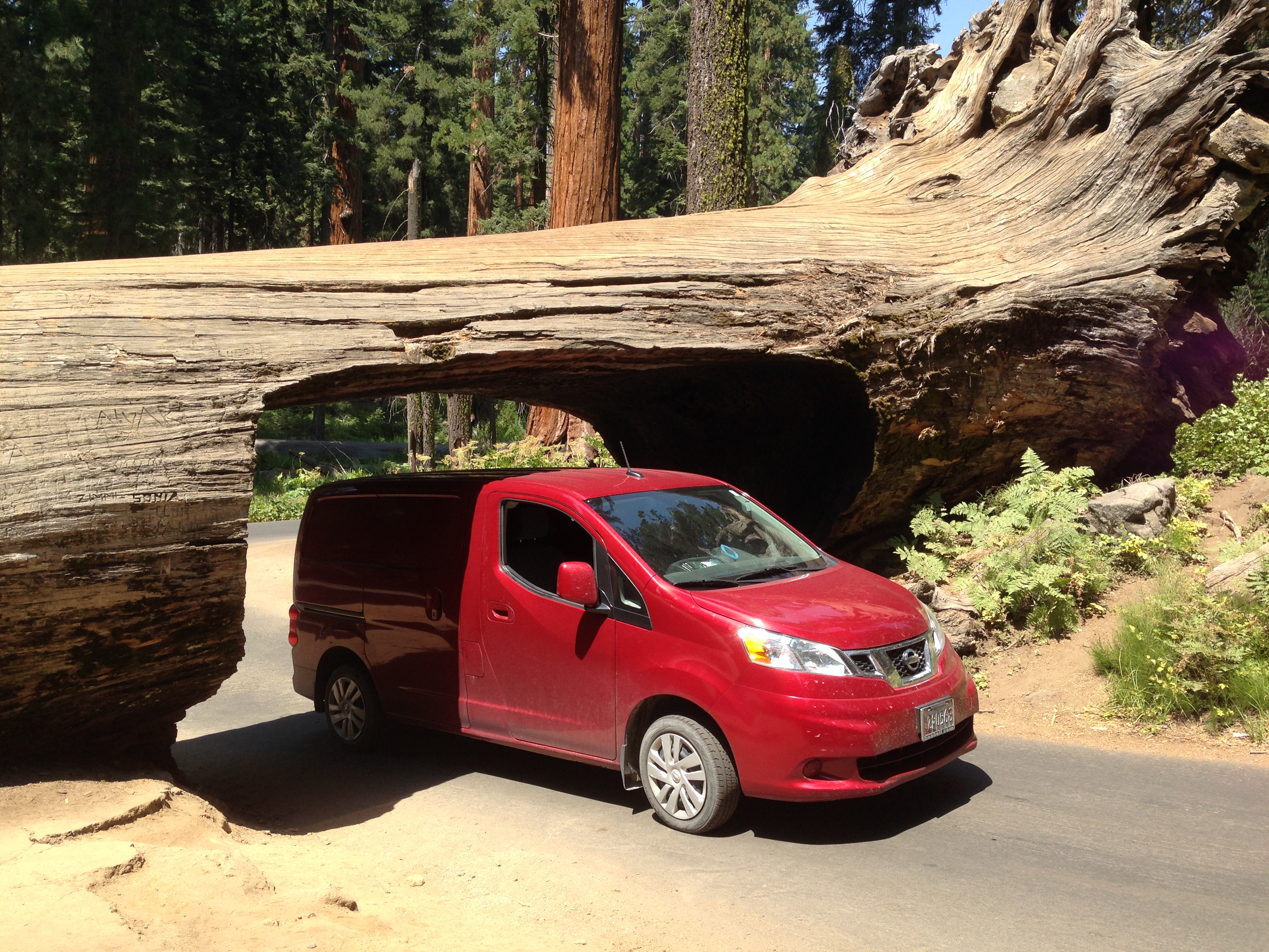
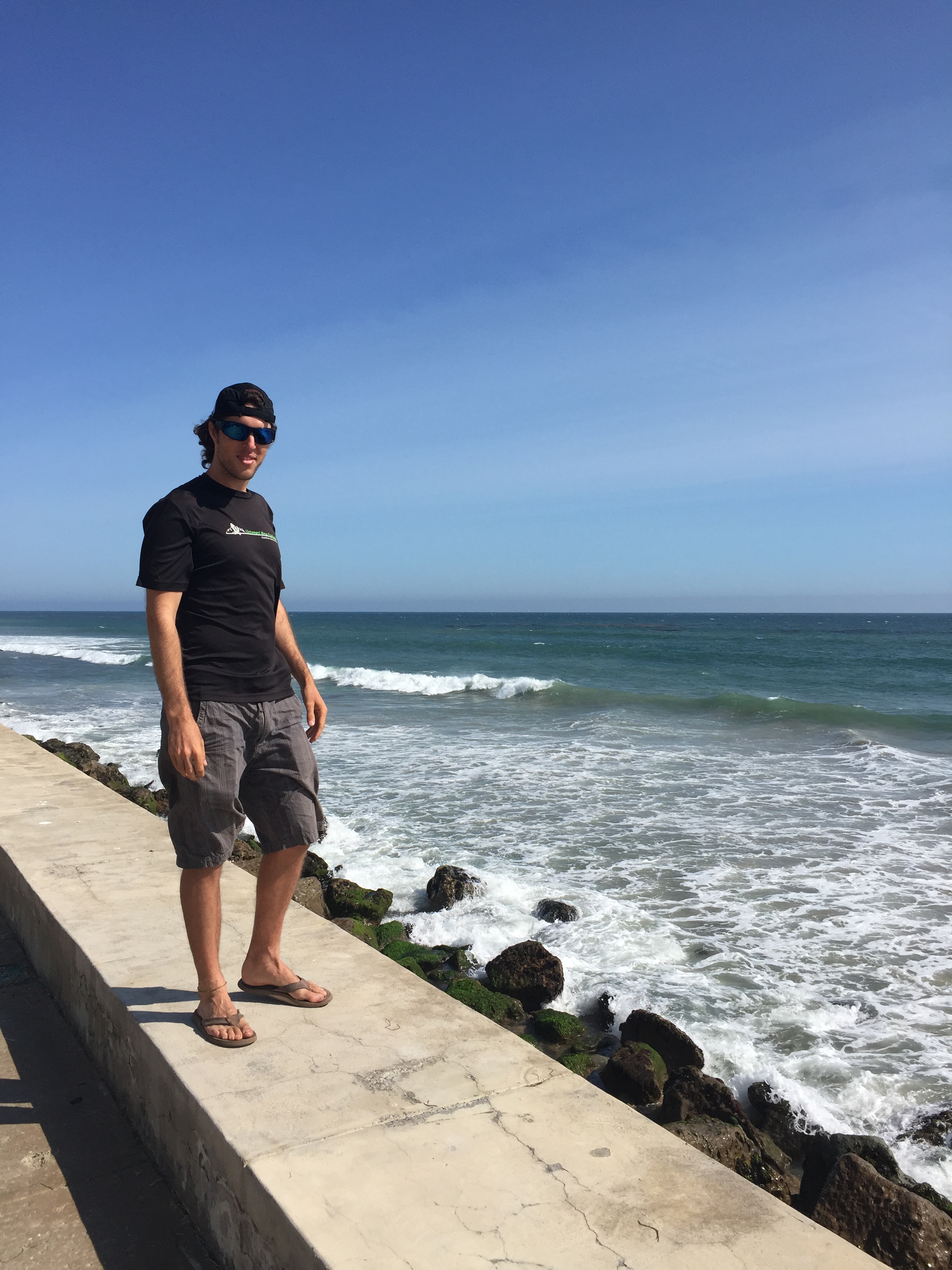
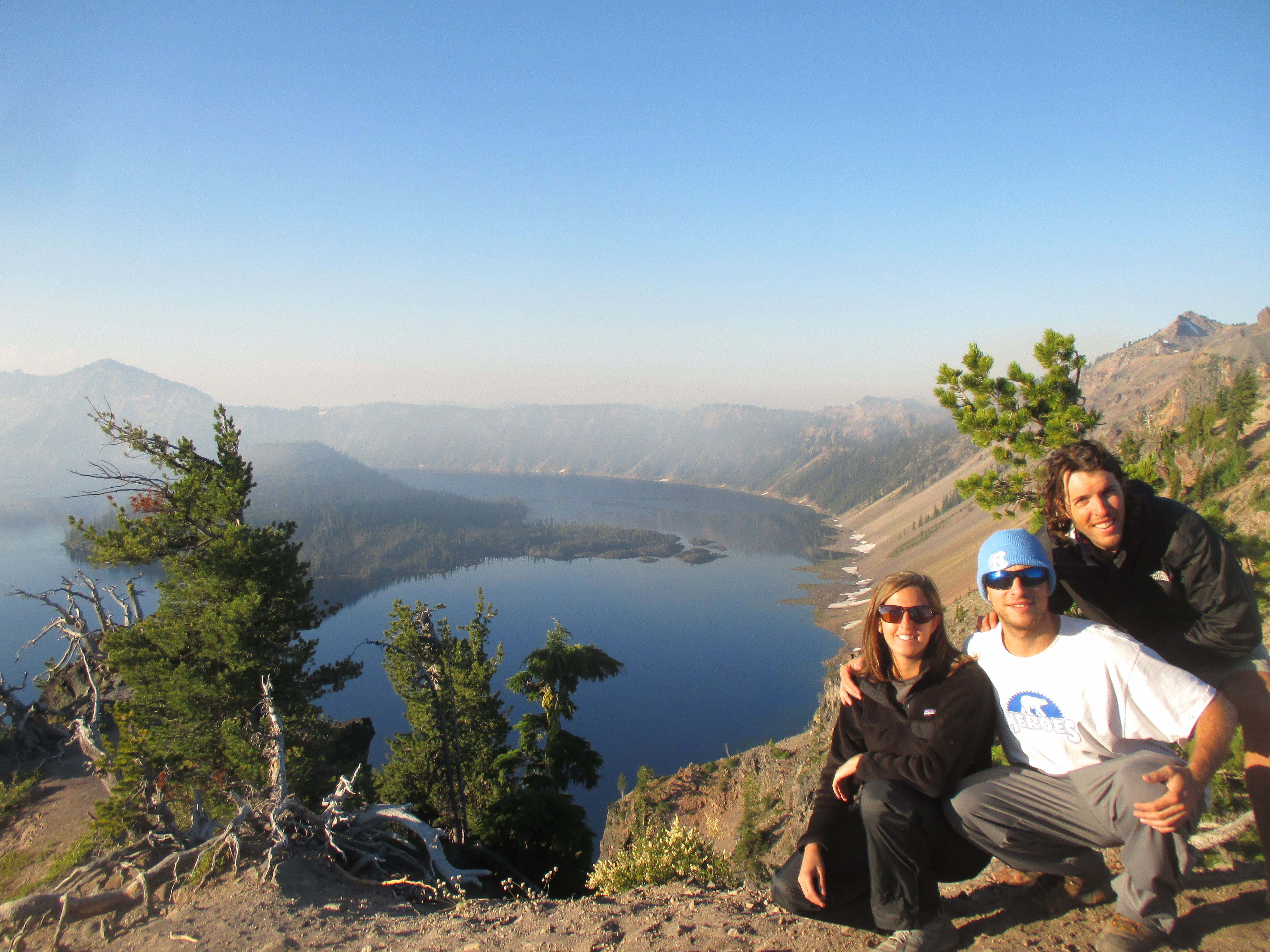
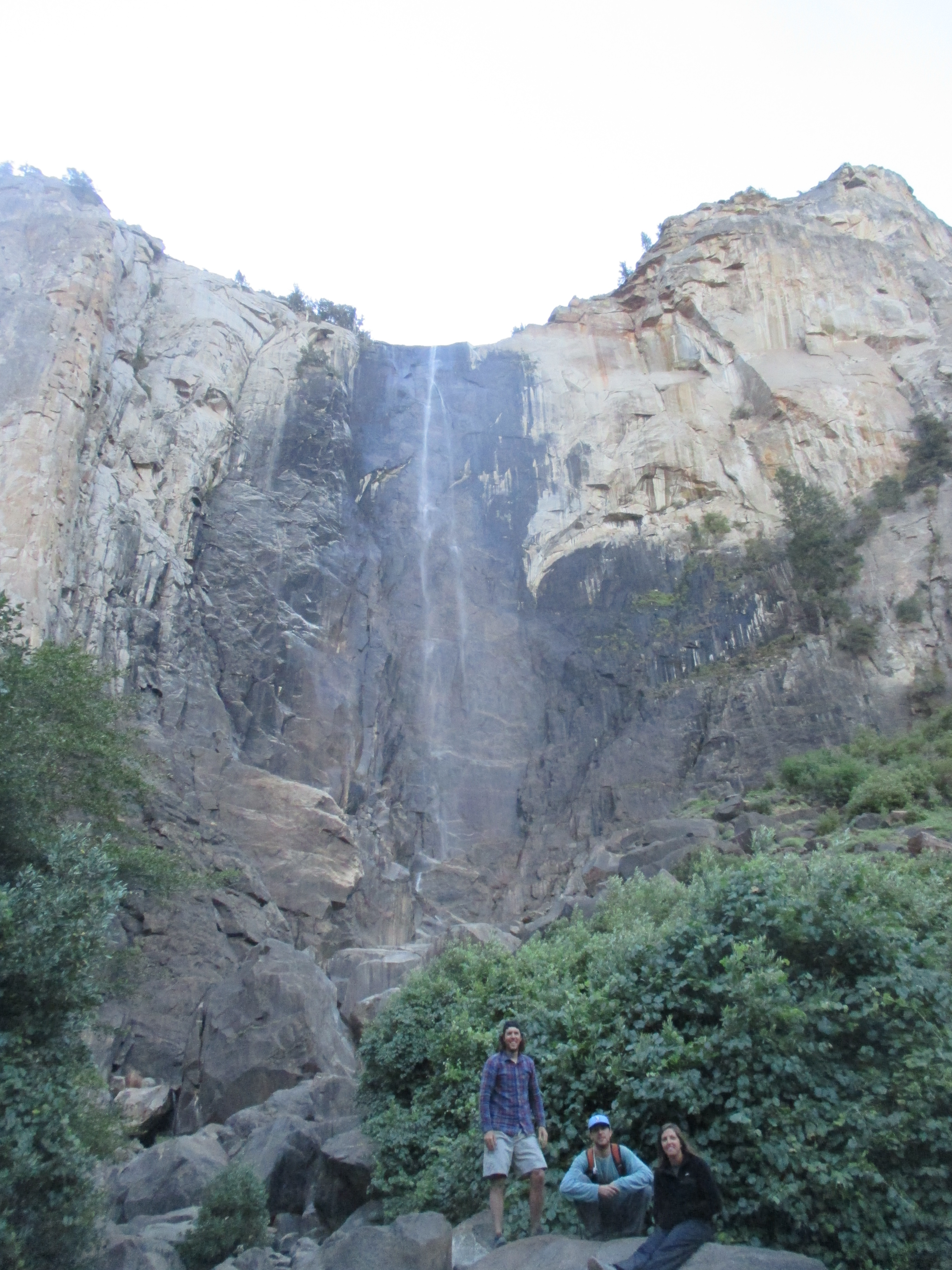
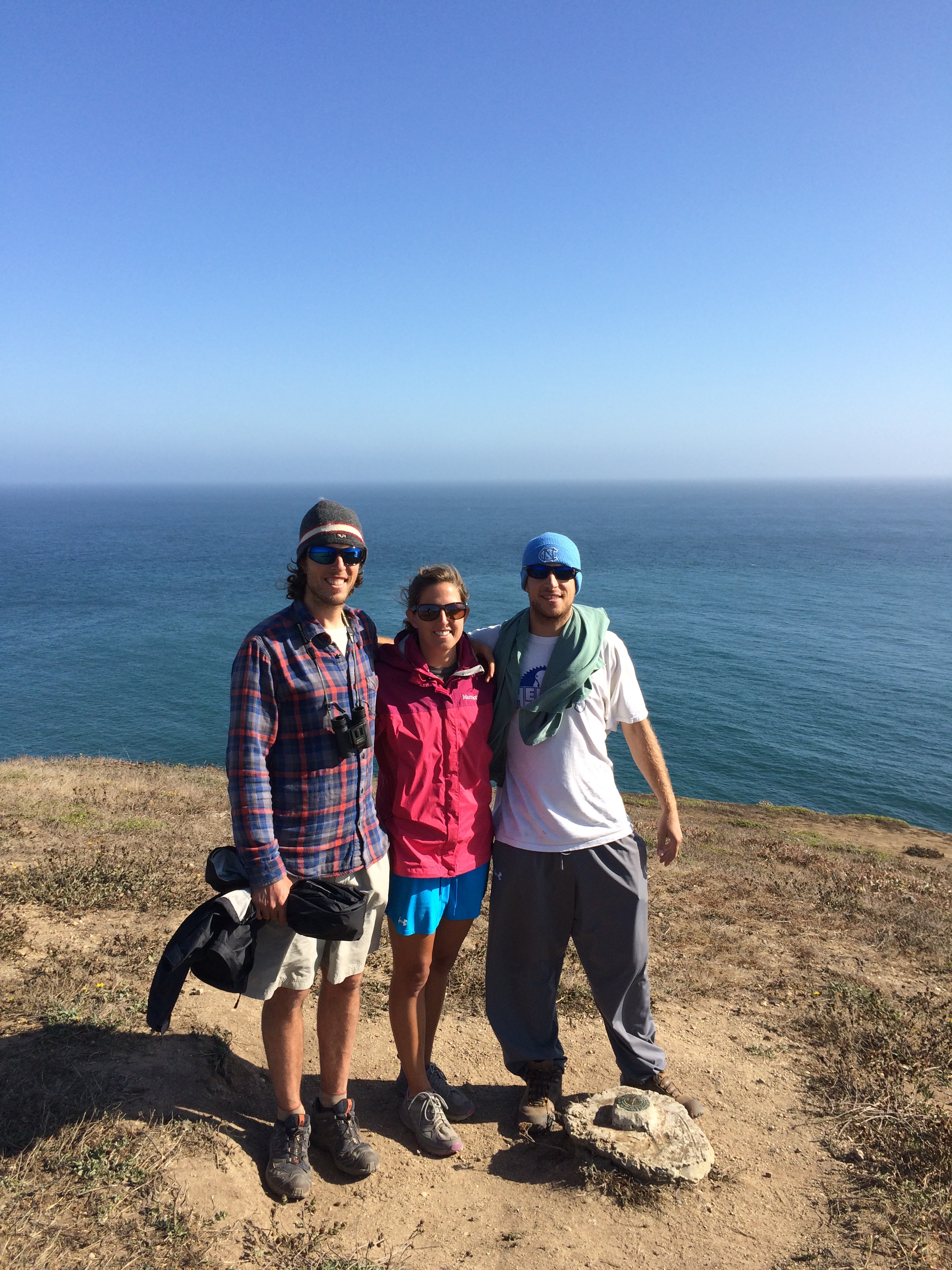
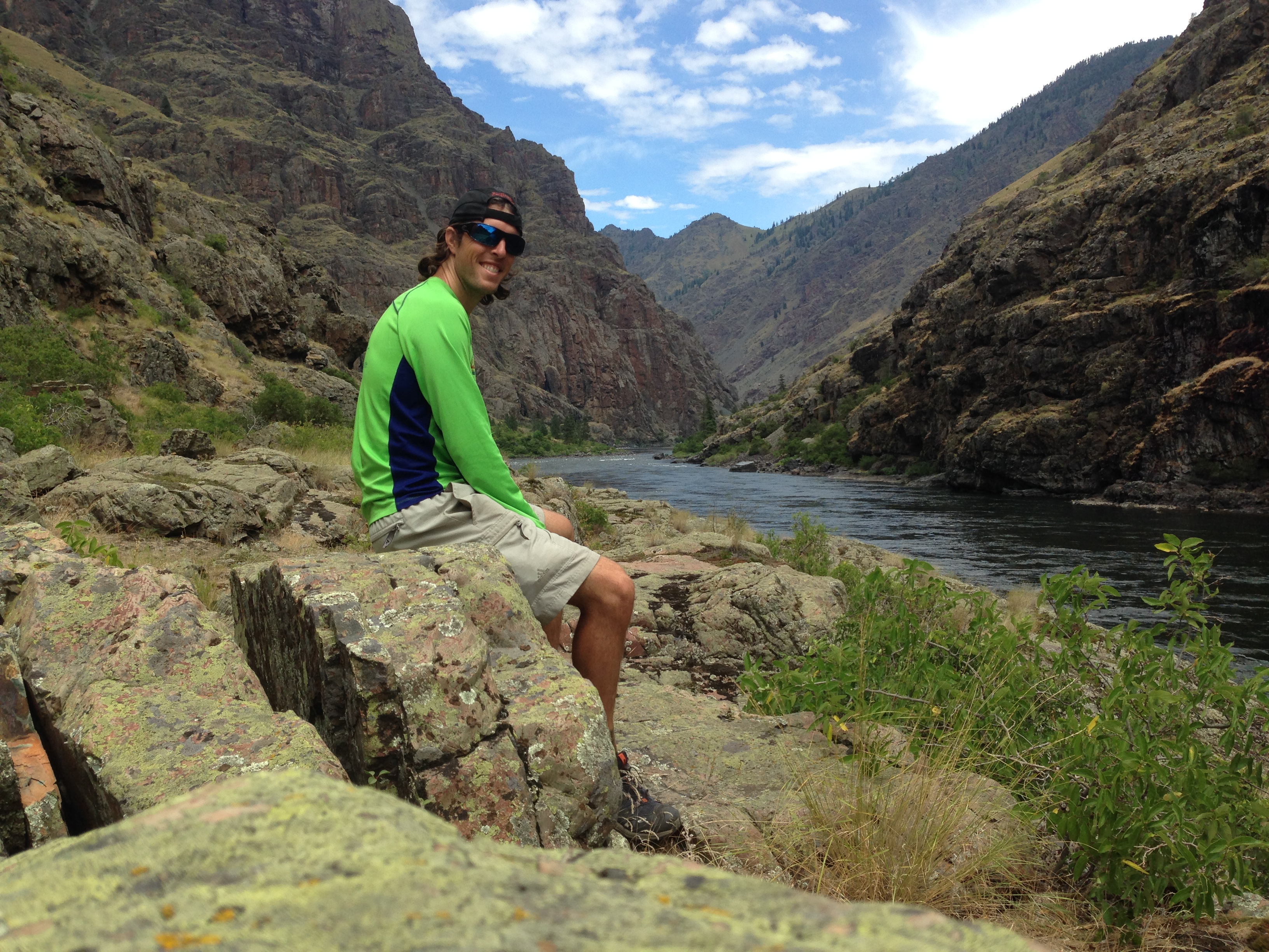
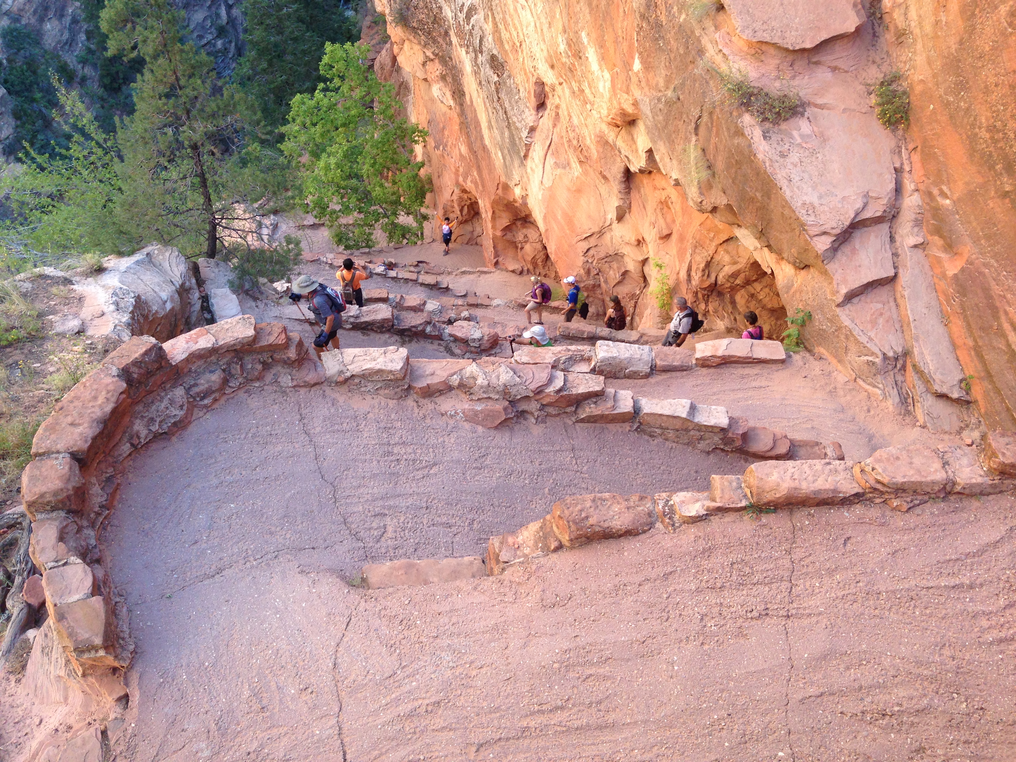
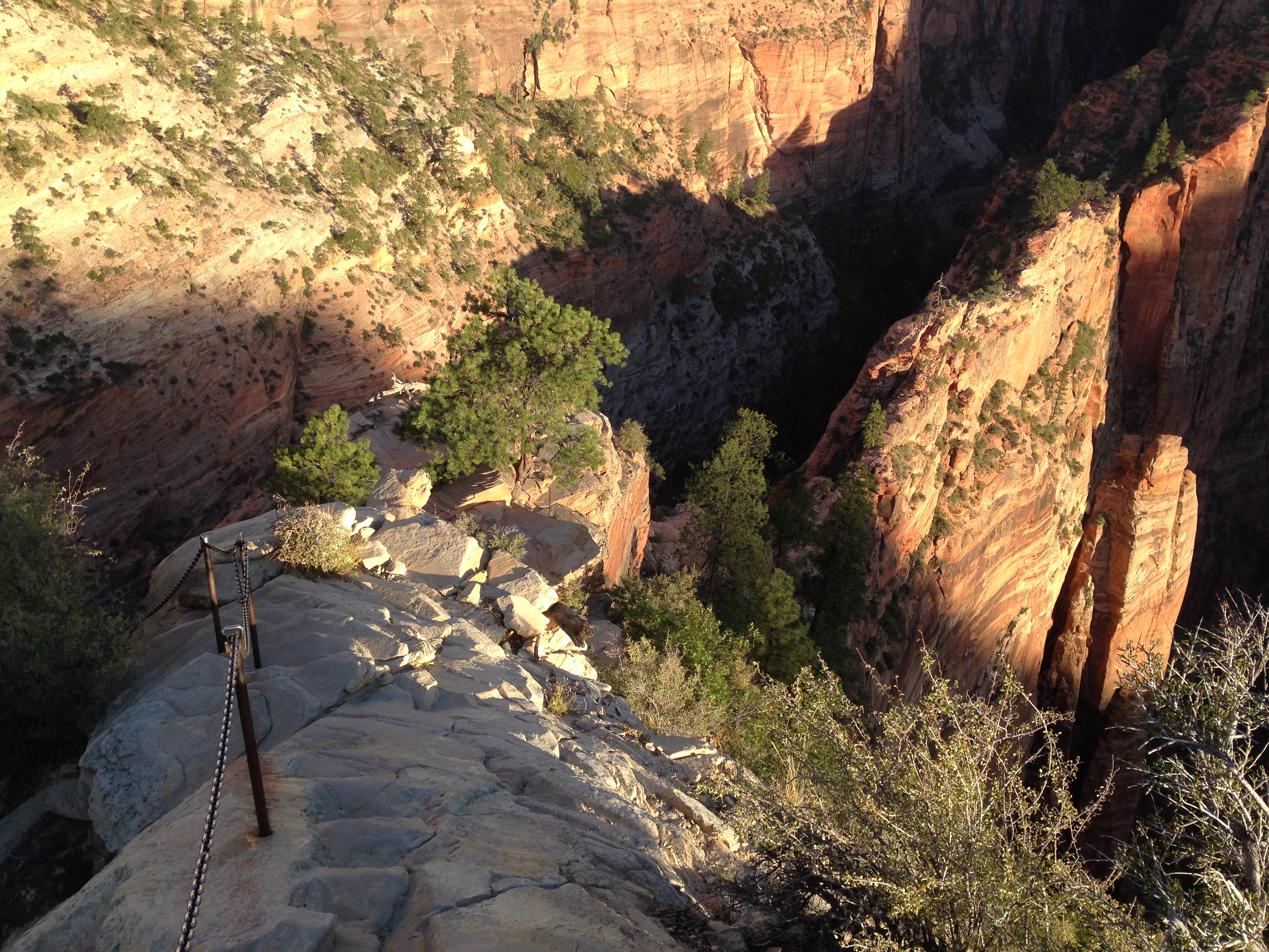
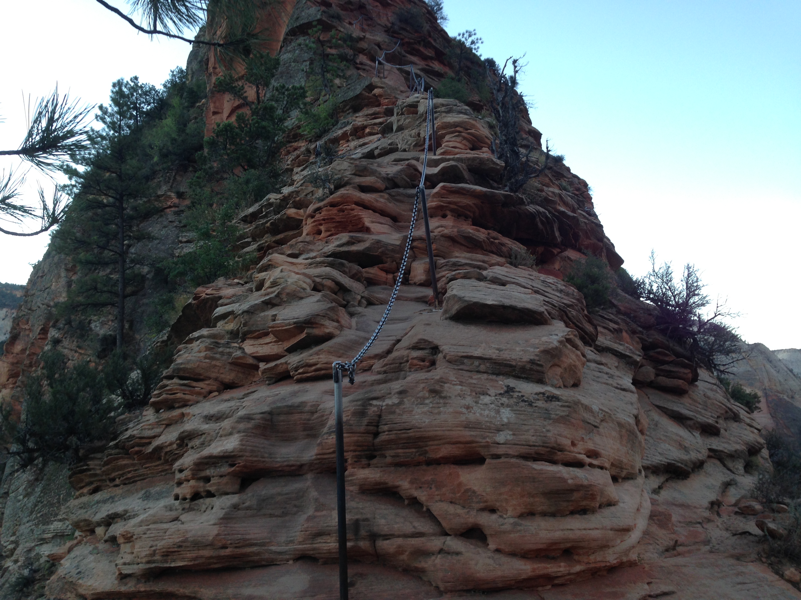
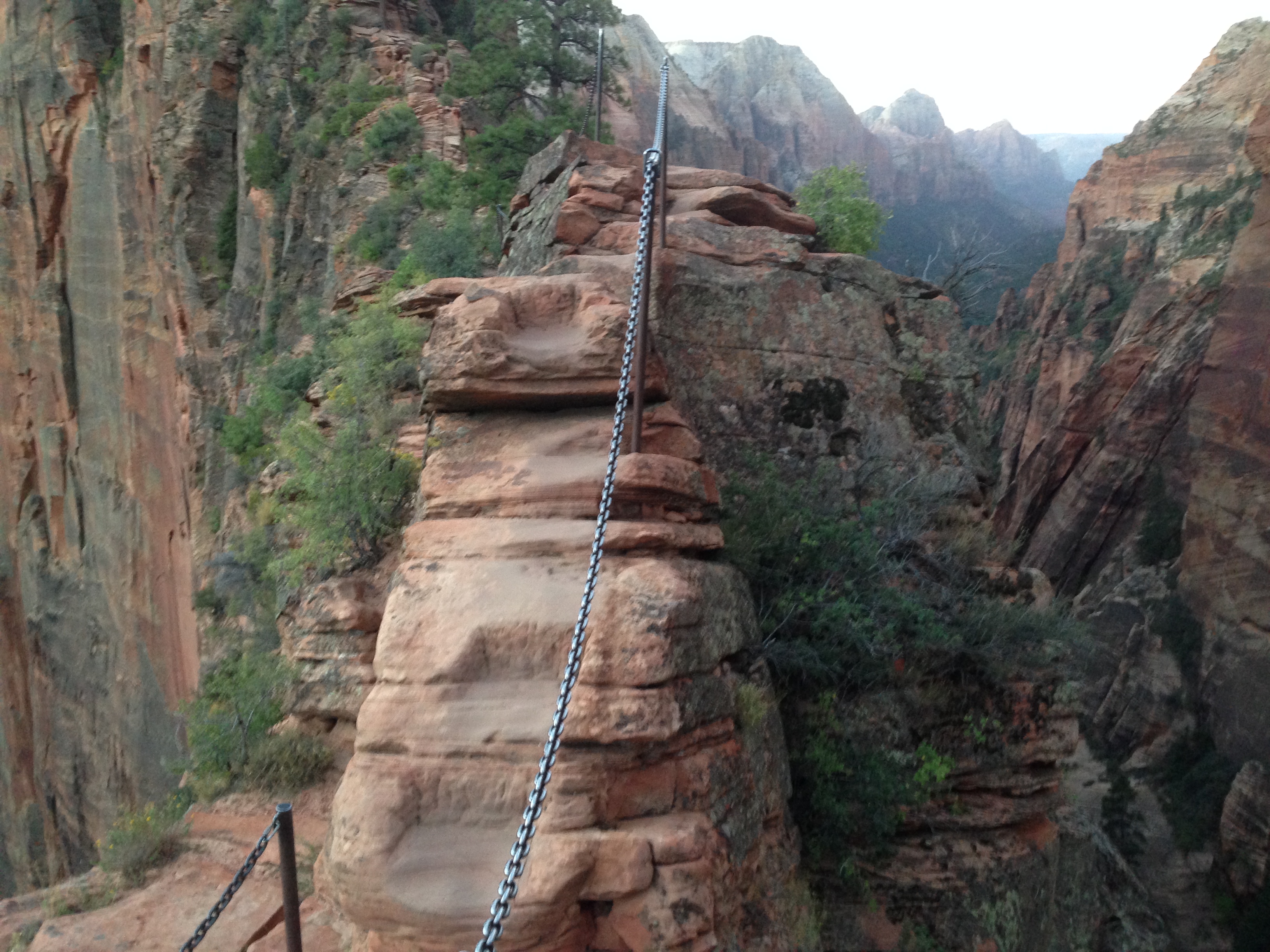
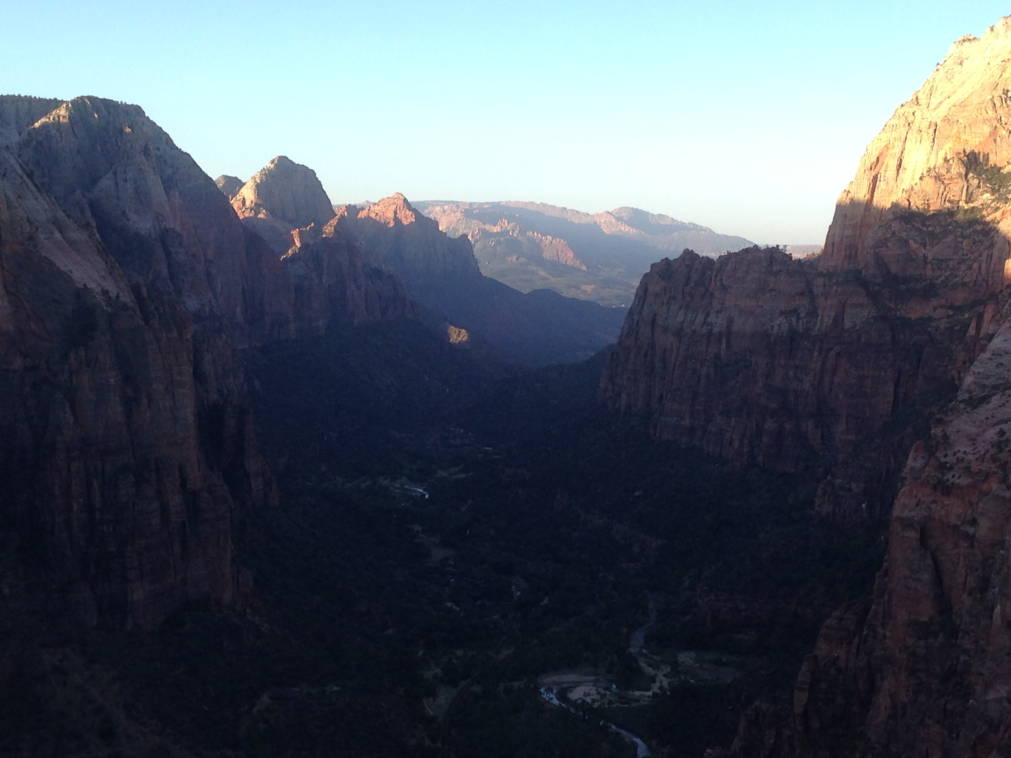
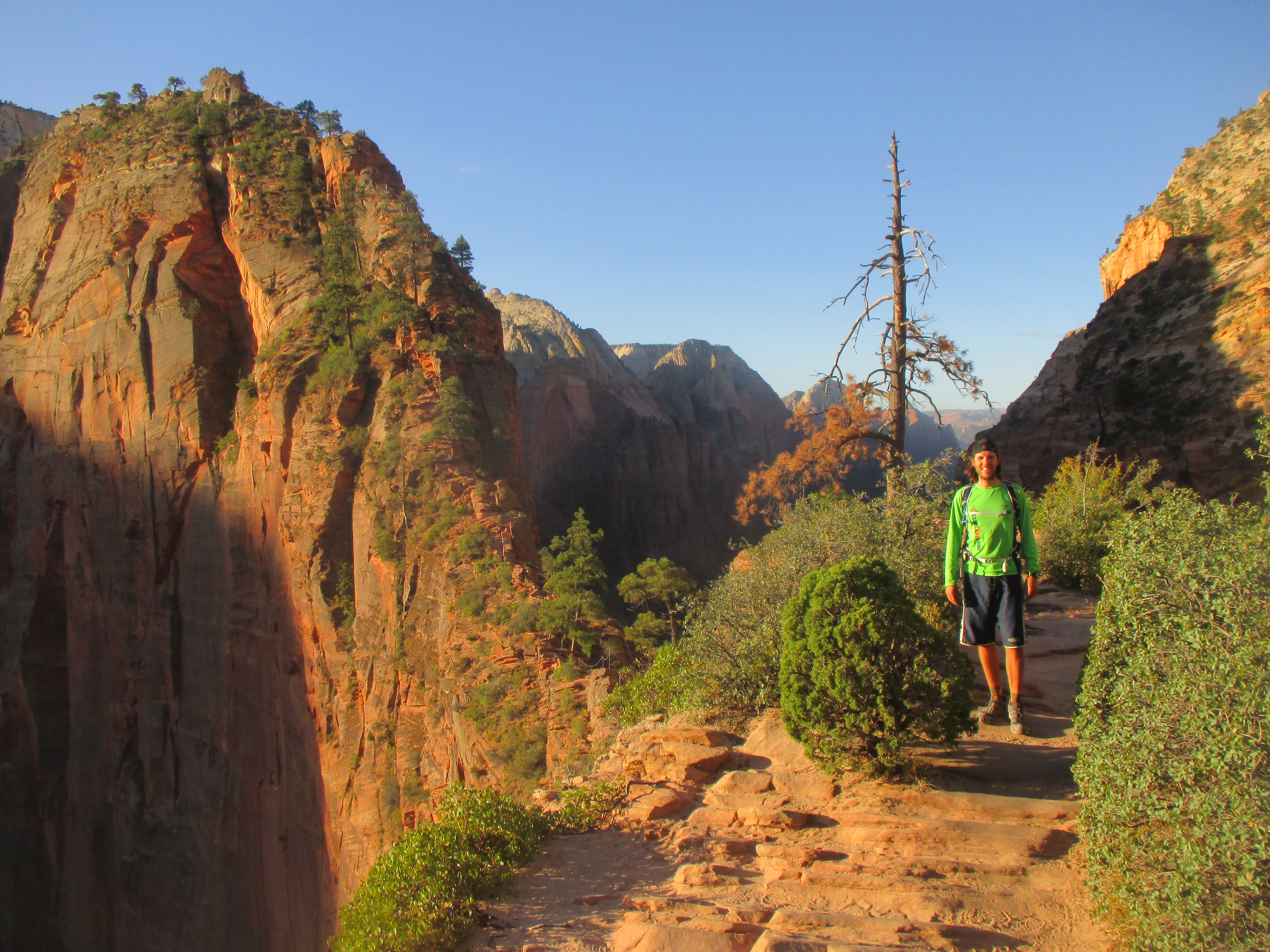
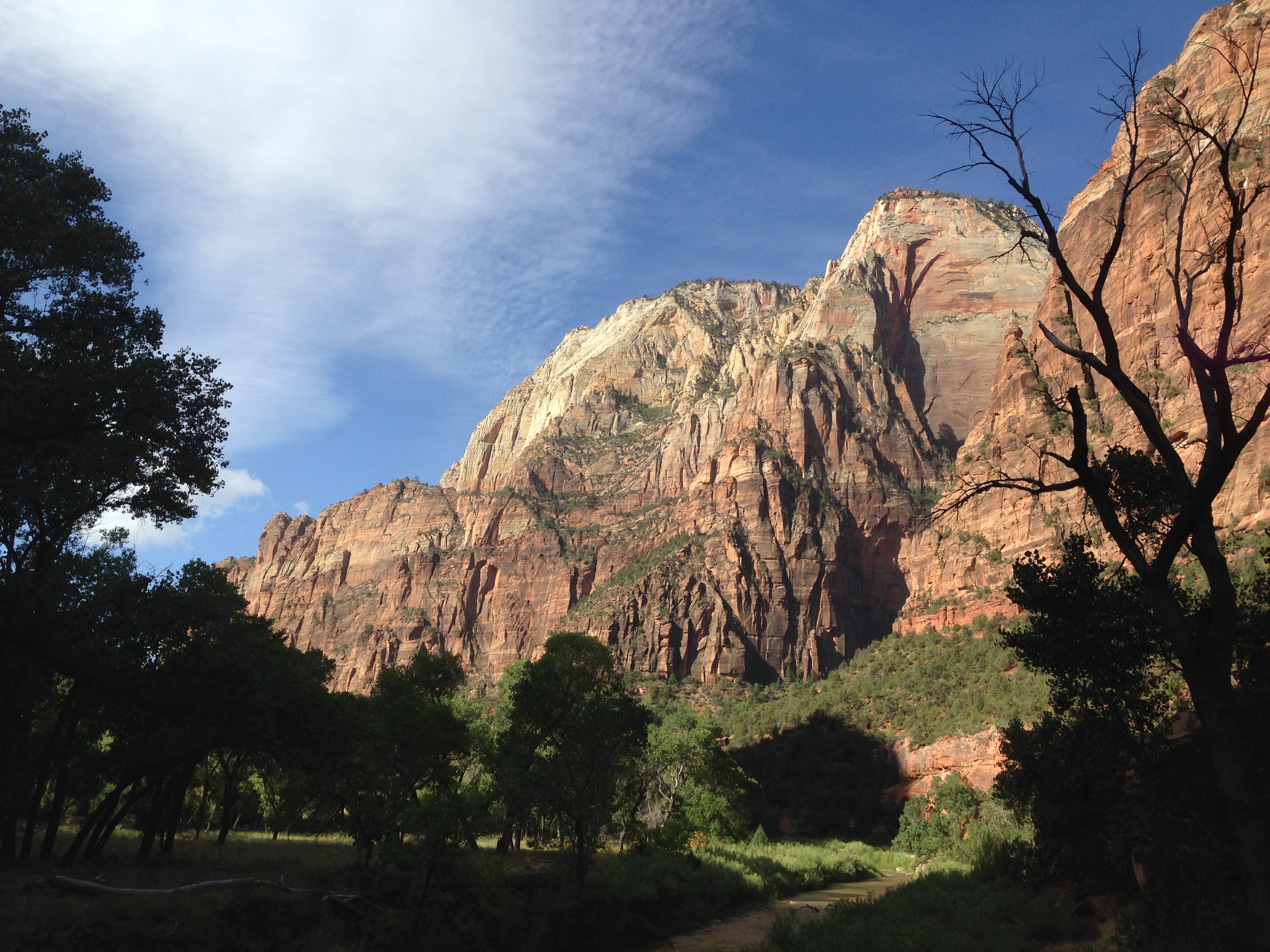
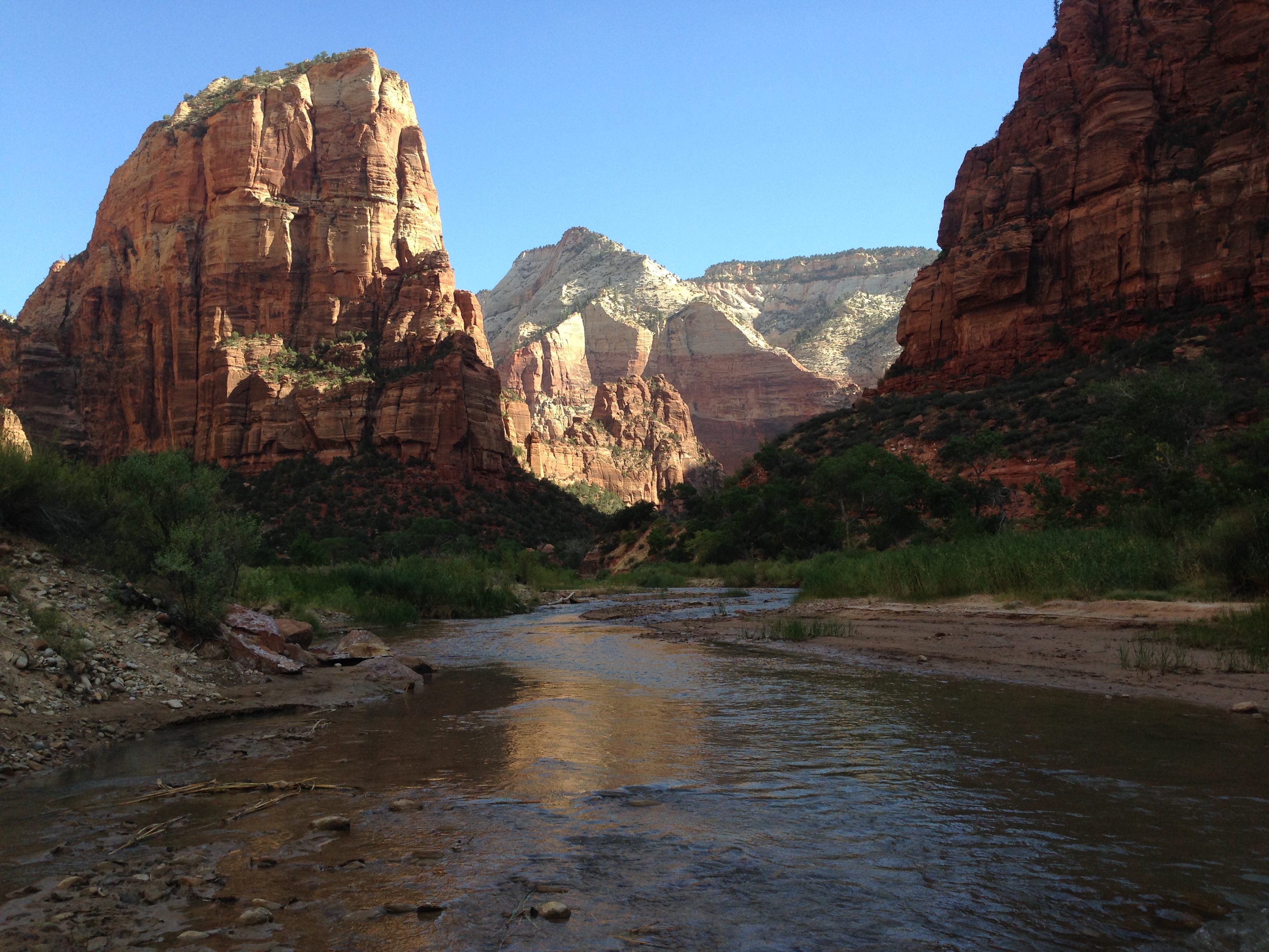
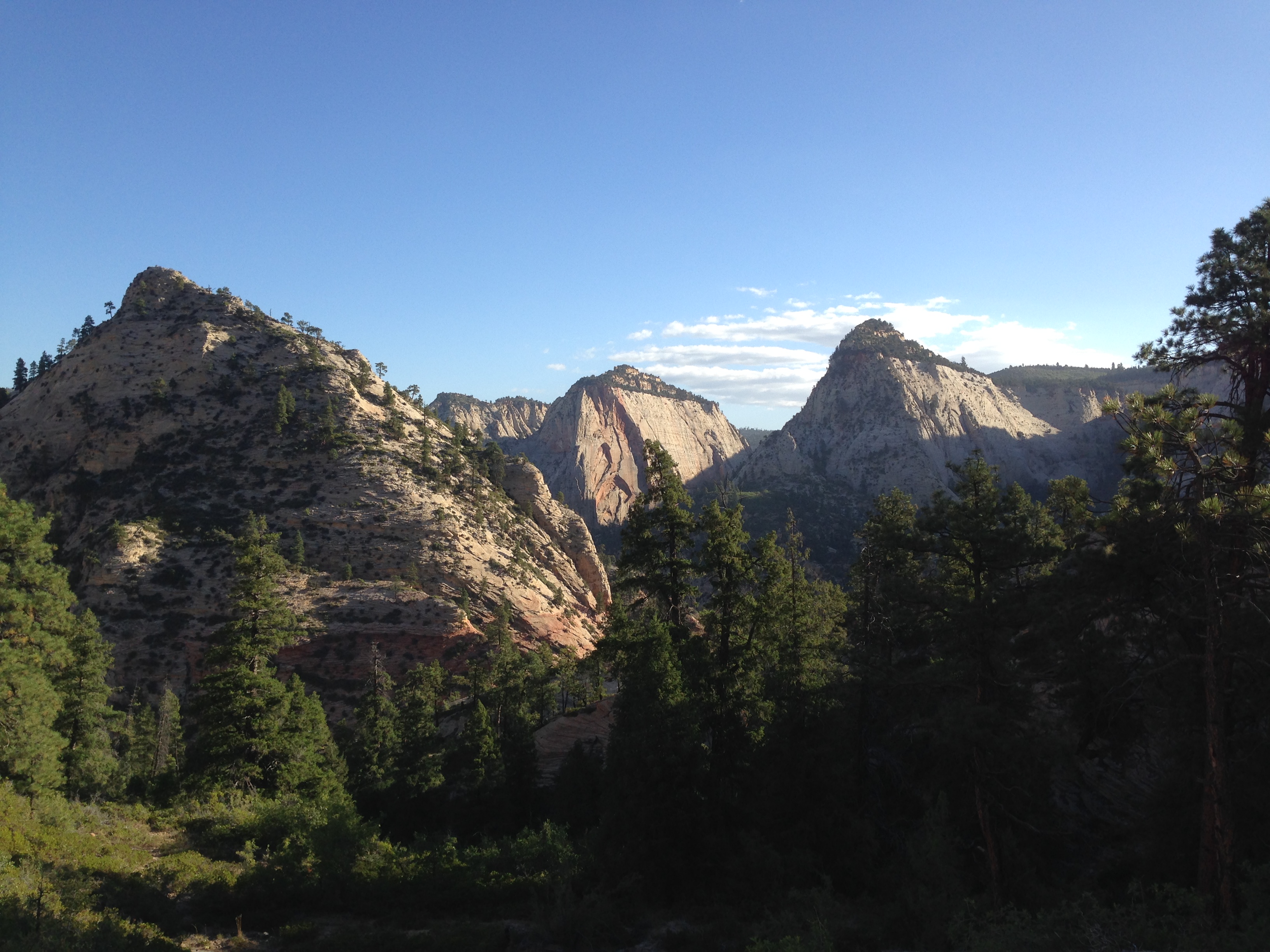
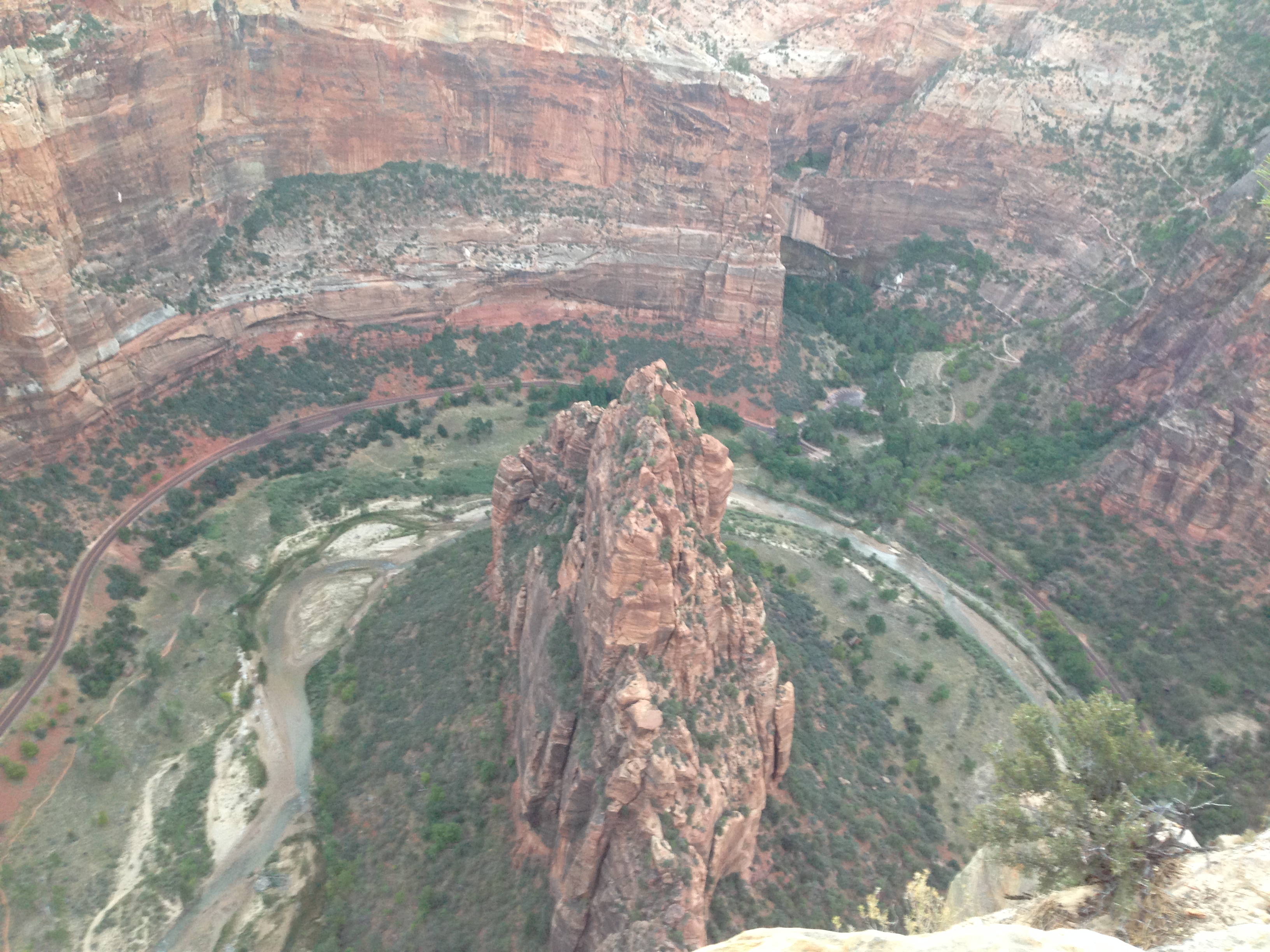
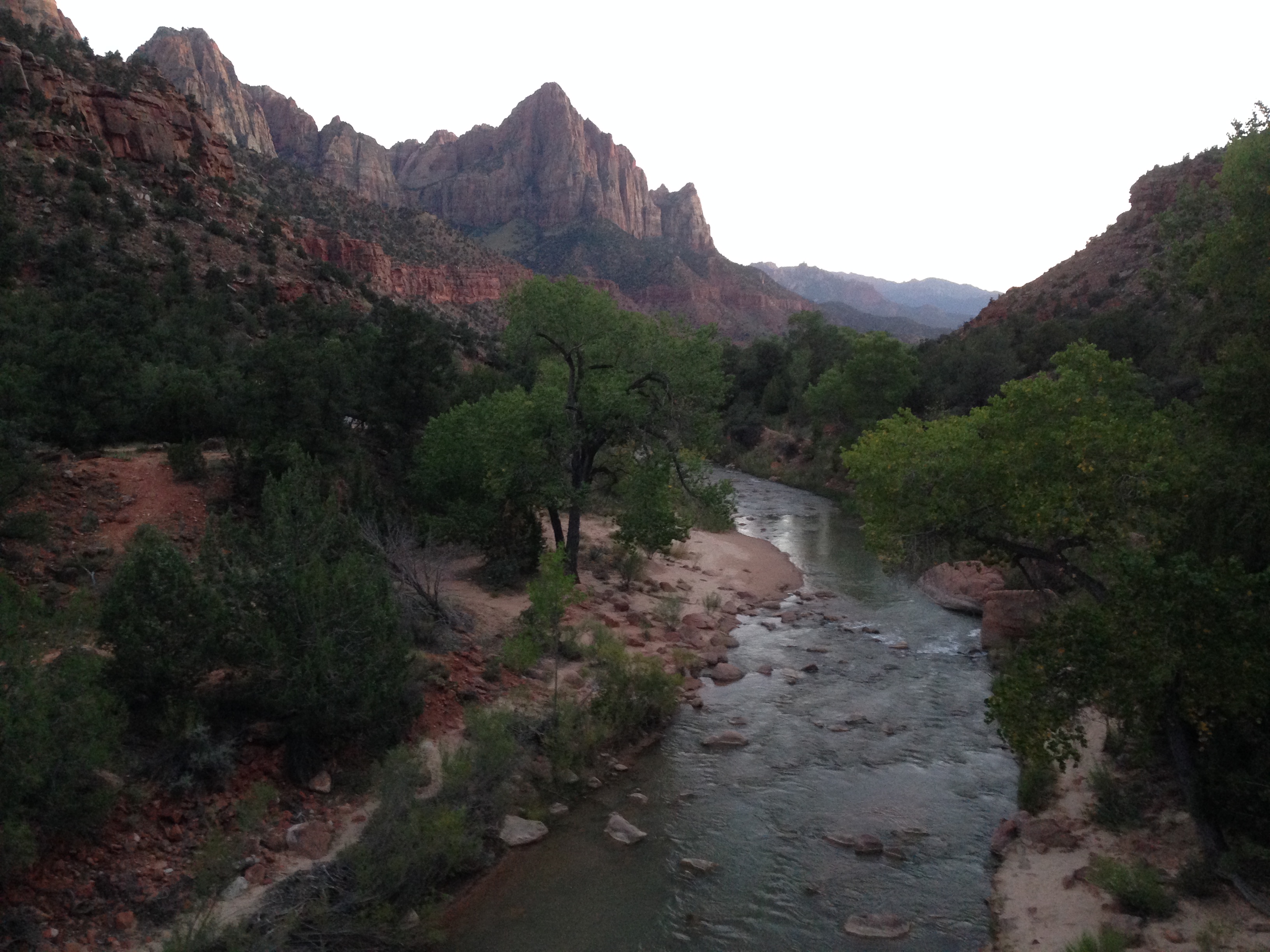
Next stop was Zion National Park. Incredibly textured canyon walls, as tall as can be, and a mile long drive through a tunnel along the canyon road. Following the recommendations of some travelers I met in Goblin’s Lair, I took the first shuttle in the morning to a famous hike known as Angels Landing. The bus dropped us off at 6:30 AM, still dark outside, I turned on my headlamp and followed the path under the stars, 2.5 miles and 1,400 feet of elevation gain. The canyon walls are so high that they appeared to blend into the starry night, as if they contained the universe. The trail climbed from the get go and had endless switchbacks for the first two miles. The last half mile however, is a five foot wide ridge with 1,000 foot drops on both sides, and a metal chain to hold onto! It was a blast and I arrived to the summit just before sunrise, around 7:20. This hike is so beautiful that during the day it becomes dangerously crowded and hikers wait in long lines at the chains to navigate around each other. I went up the mountain quick enough that I had the rare honor of the landing all to myself for a half hour before the next person arrived!

img_2605 img_2577 img_2536 img_2534 img_2573

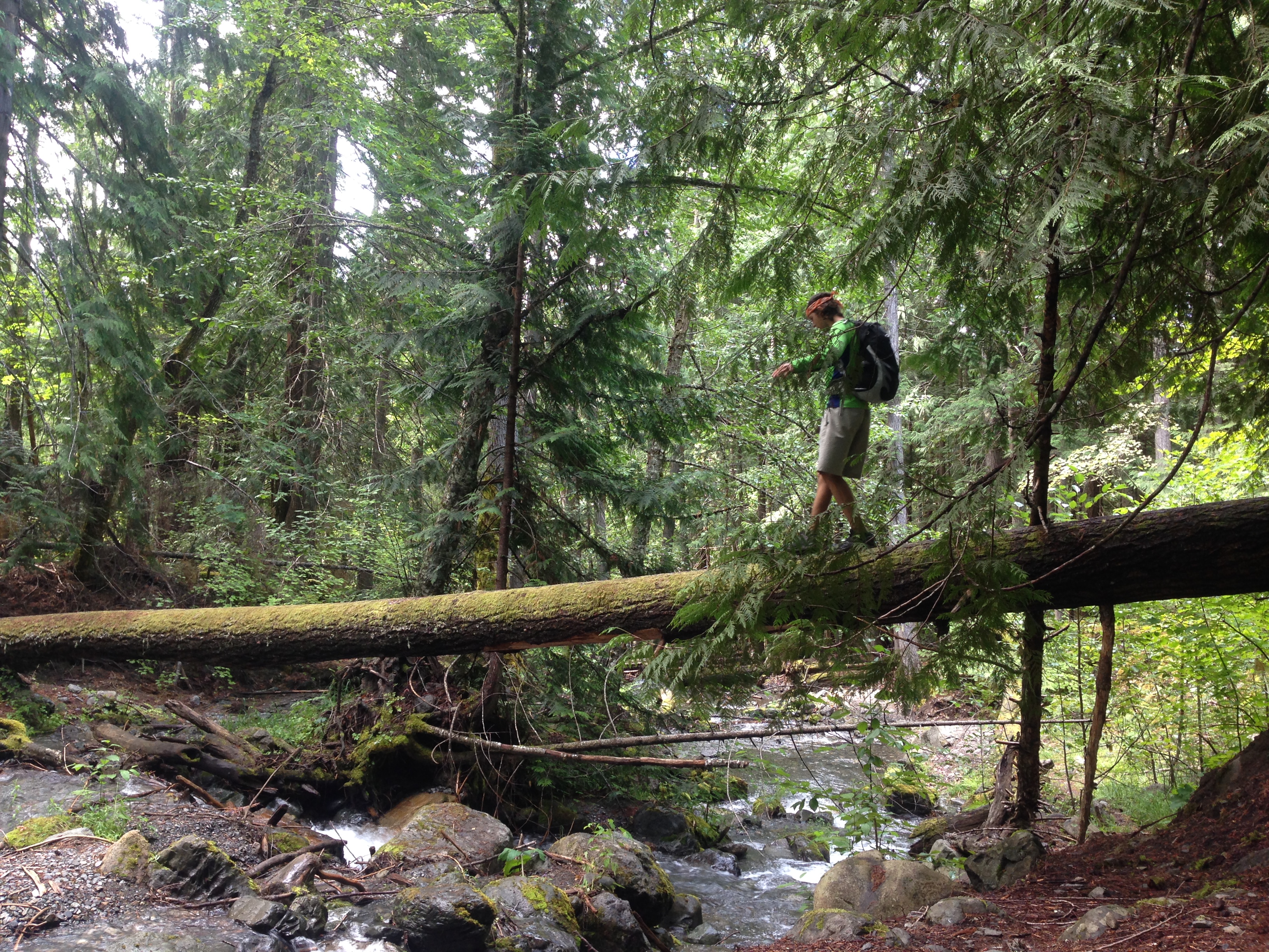
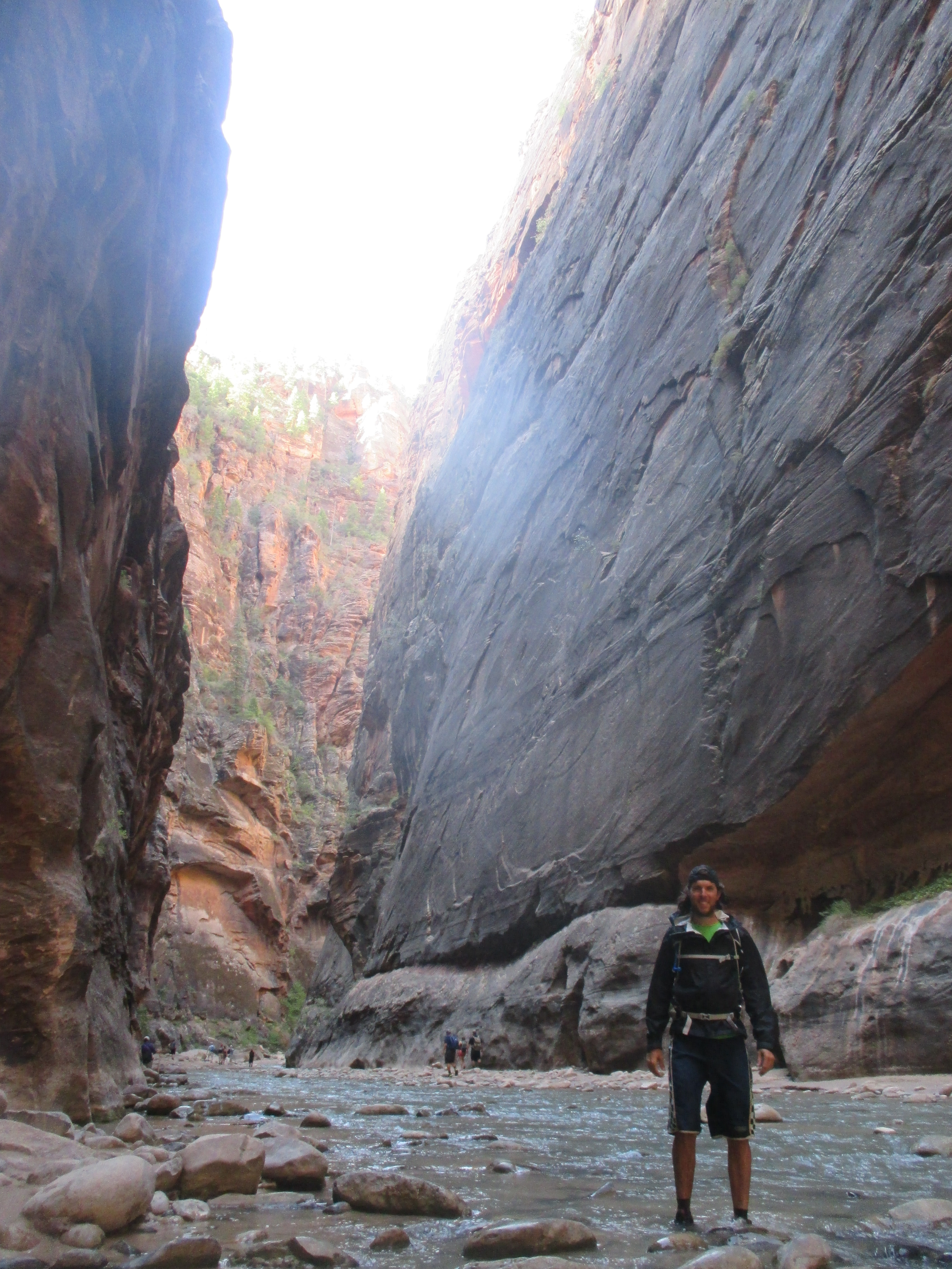
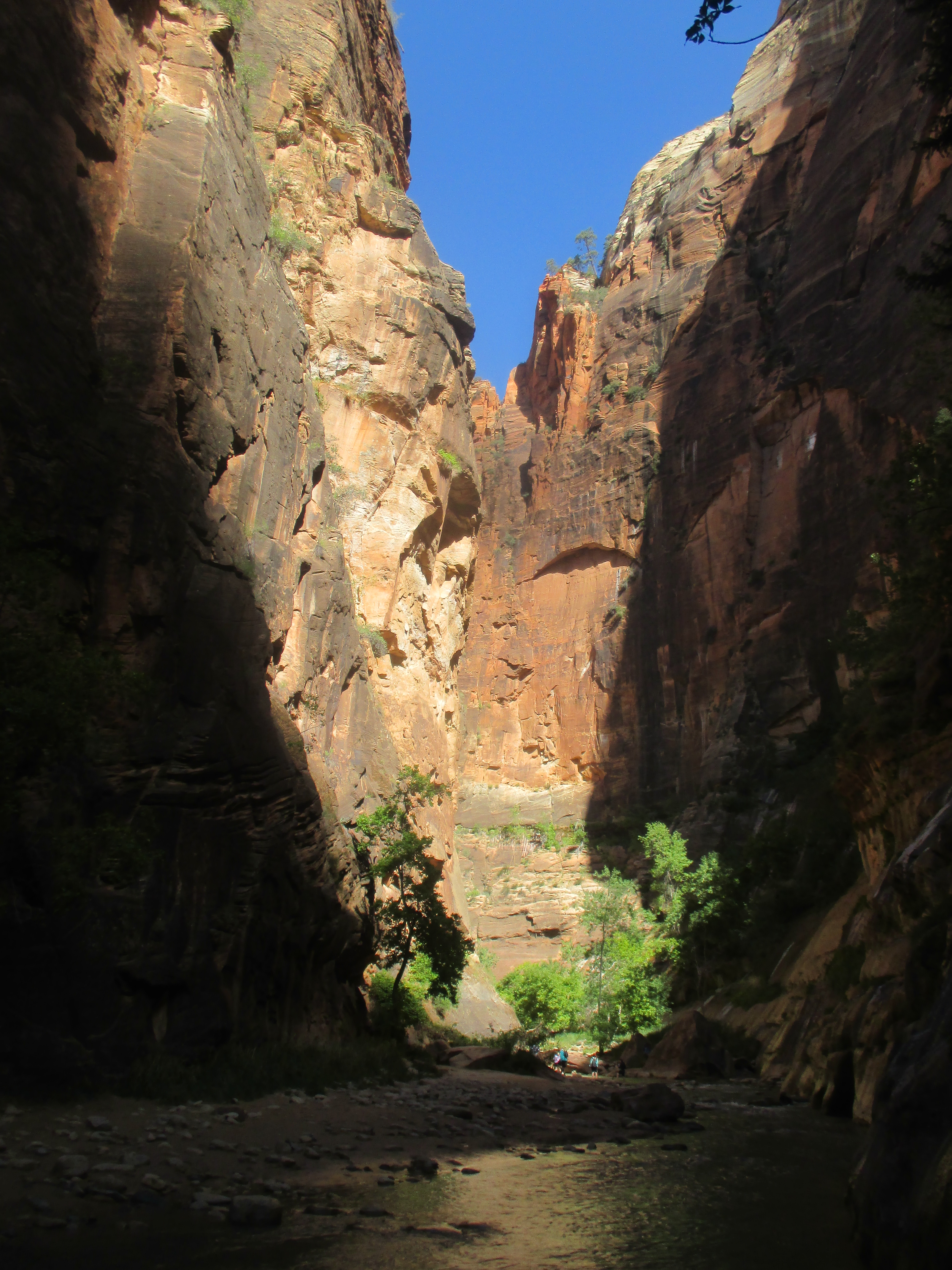
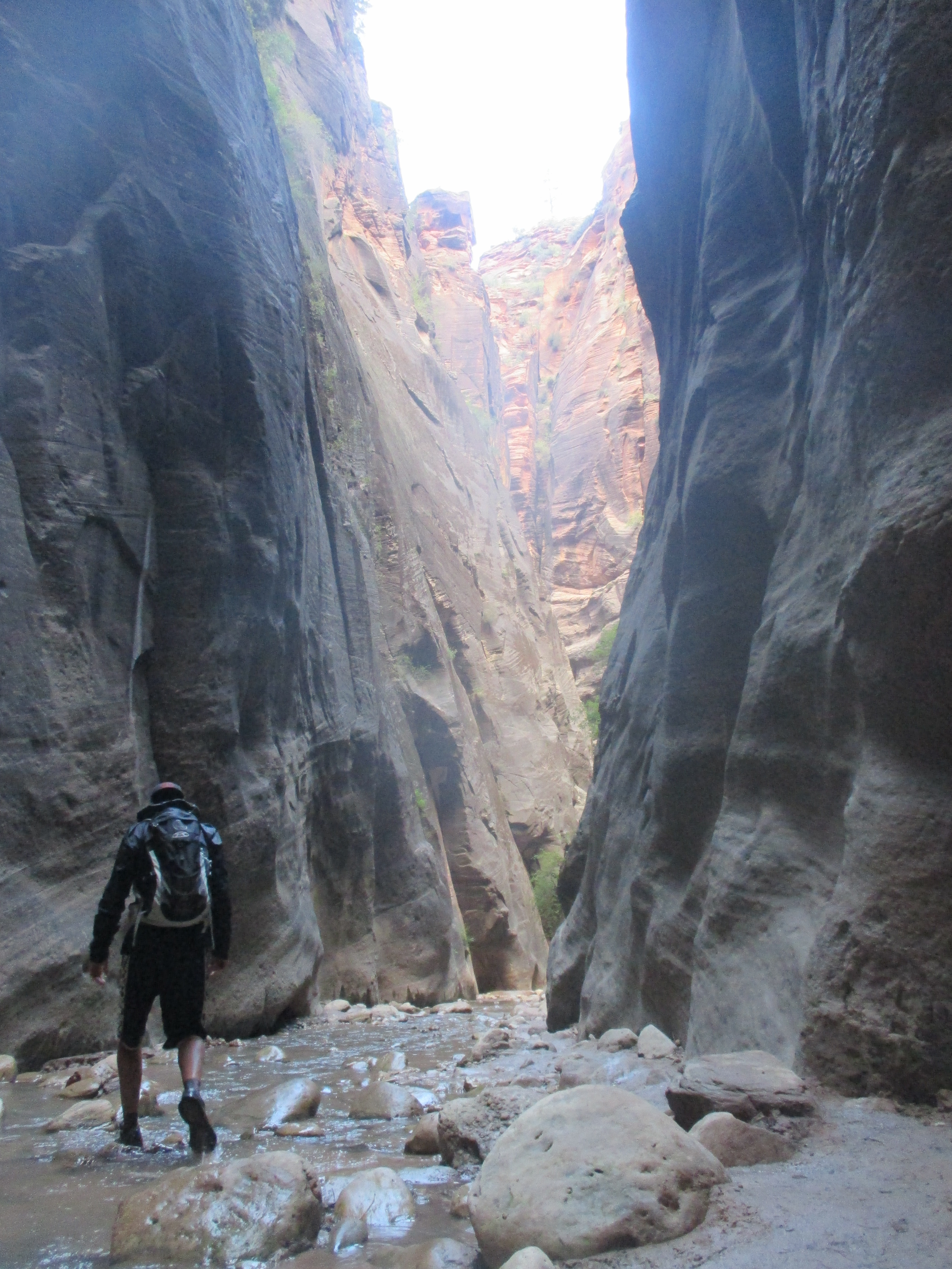
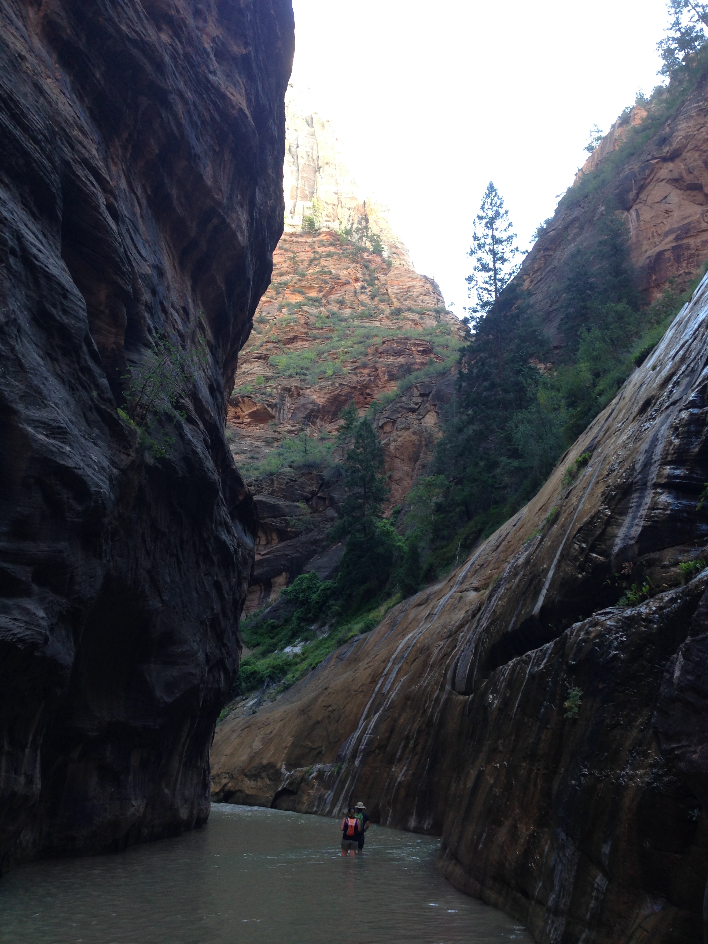
I headed down to get off the sketchy stuff as more people were arriving and took in all the scenery that was shrouded in darkness on the way up. My next hike for the day was an area known as The Narrows. This is the upper end of Zion Canyon where the river has still carved walls thousands of feet high, but the base is only as wide as the river, yet shallow. So, for 16 miles, you can literally just hike up the knee-deep water through the towering canyon walls! The beauty and depth of this canyon were beyond comprehension, it was as if my eyes were deceiving me.

img_5608 img_5605 img_5617 img_5598 img_2635 img_2633 img_2631 img_2592 img_2587 img_2555 img_2537 img_2529

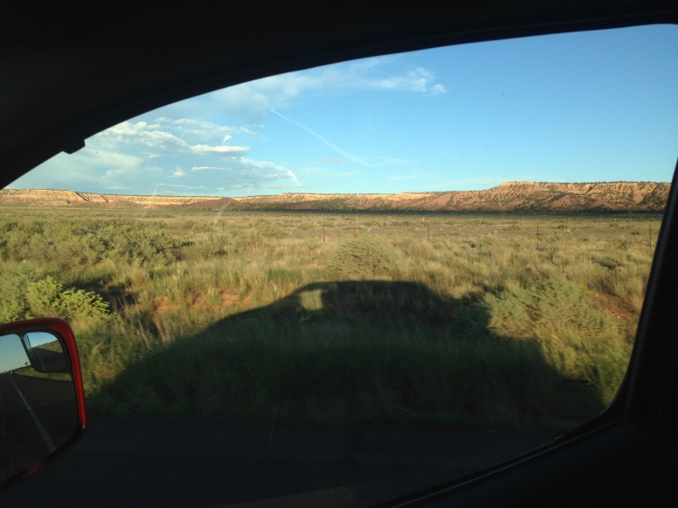
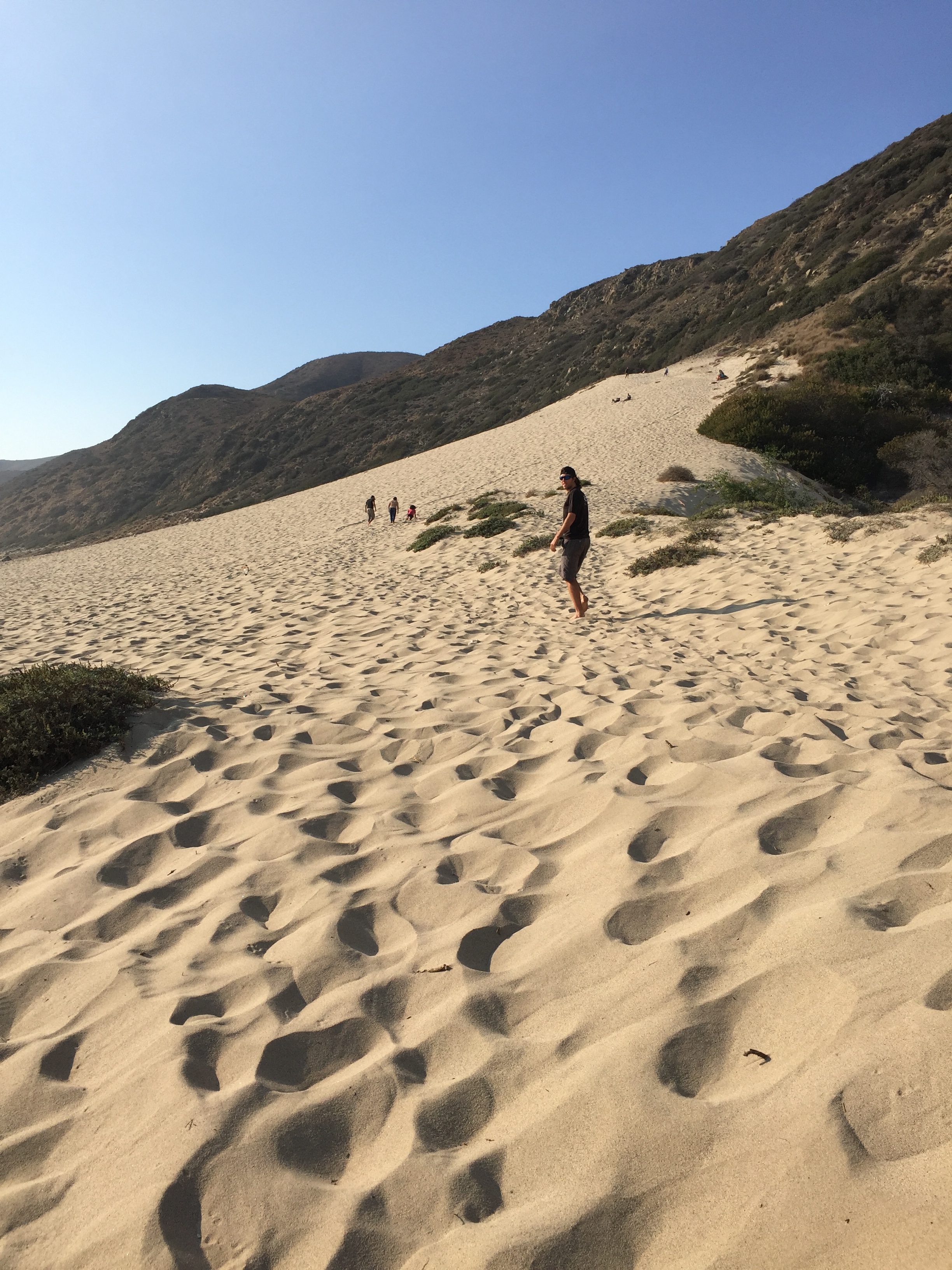
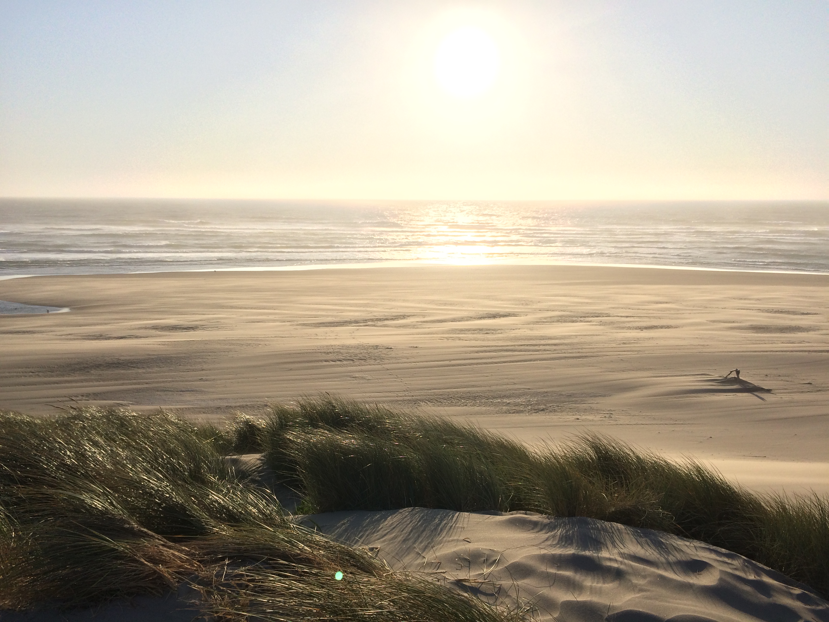
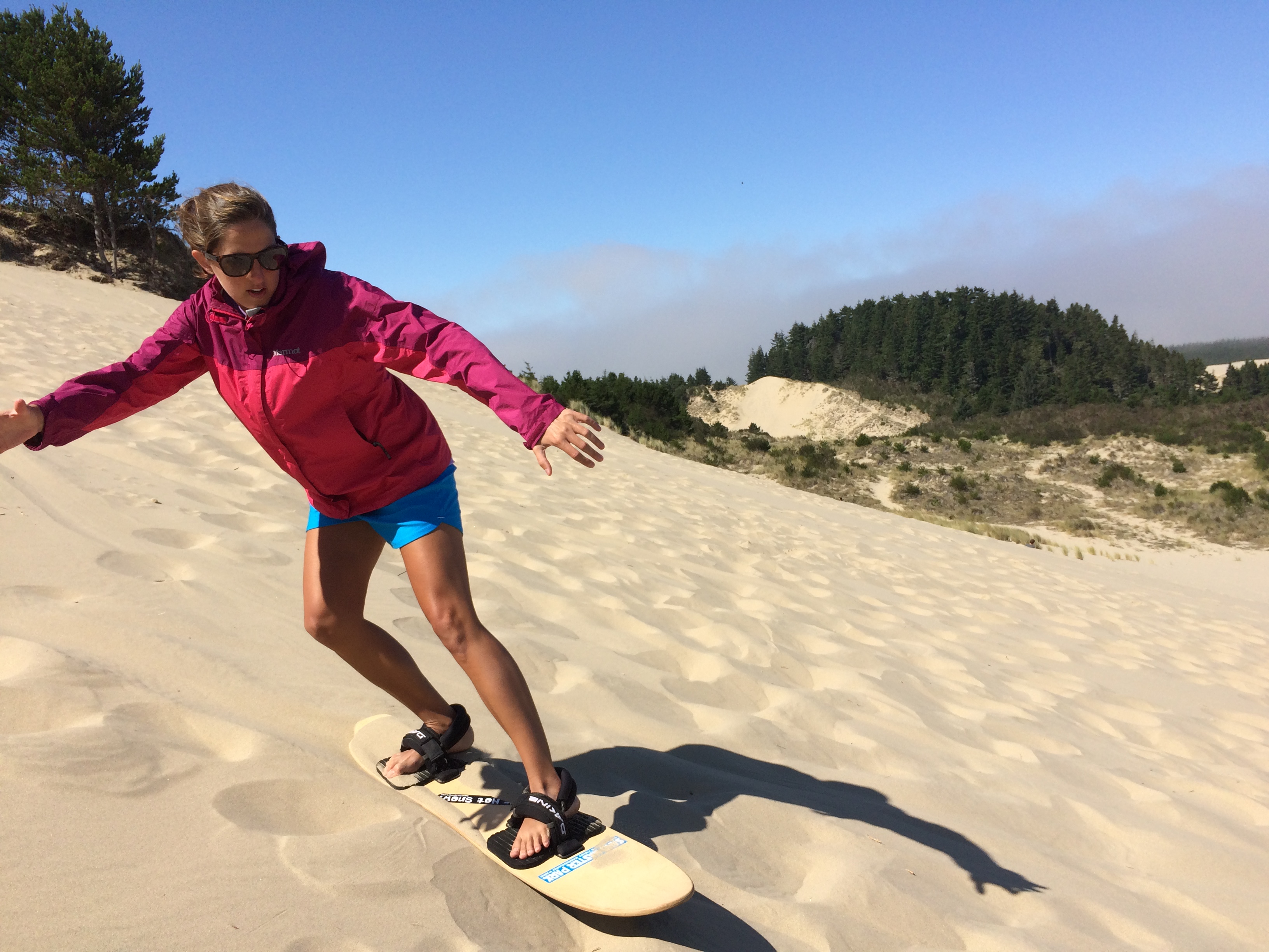
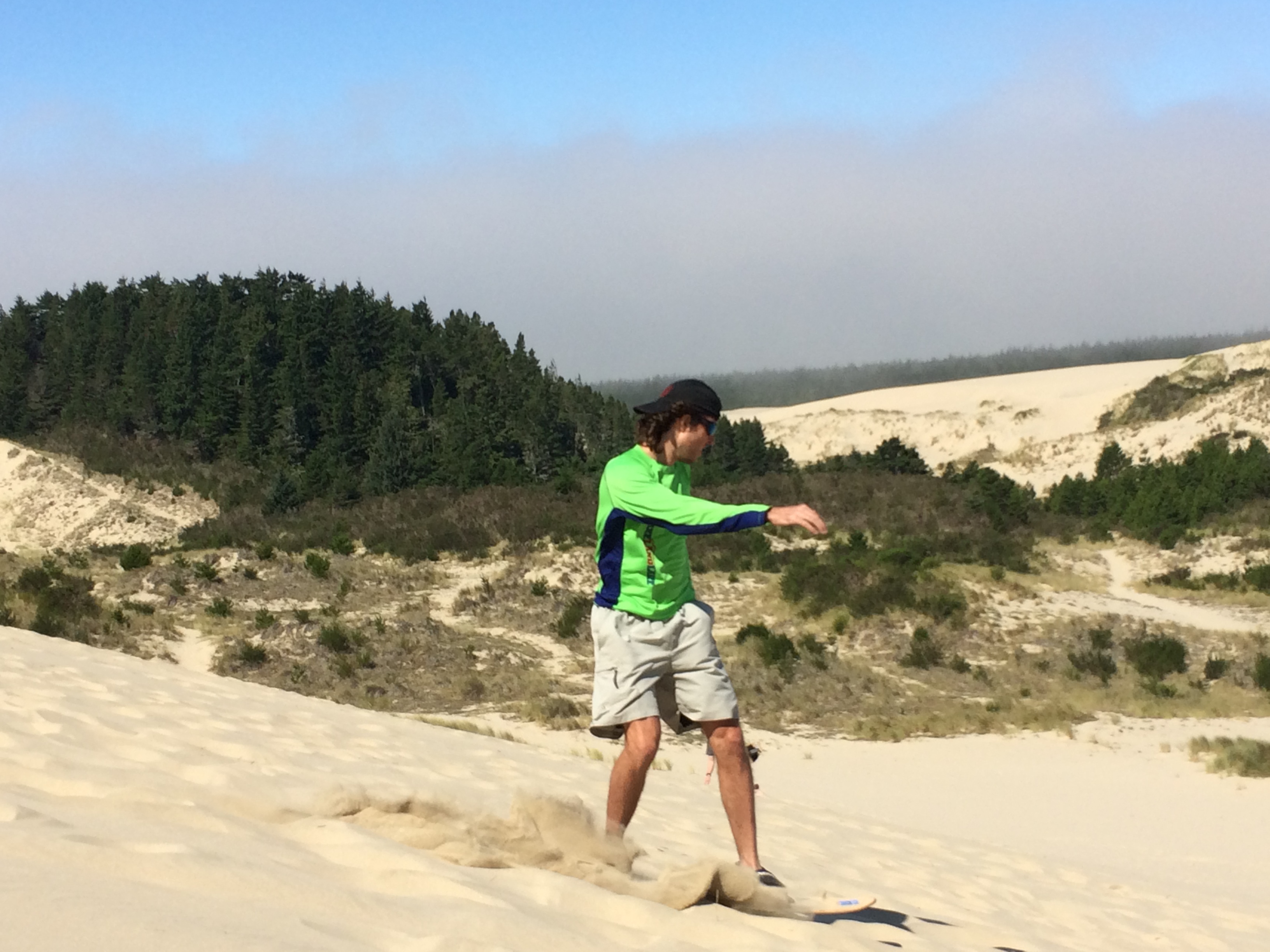
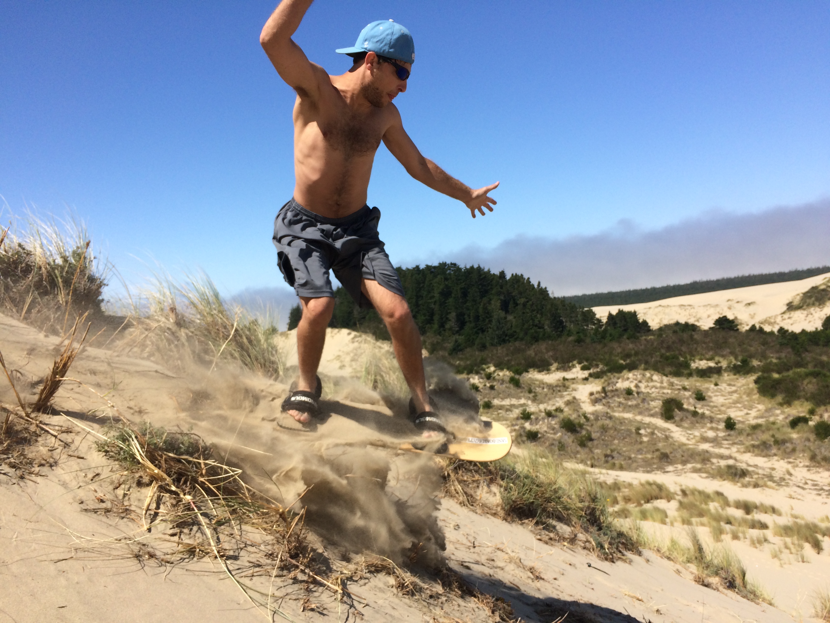
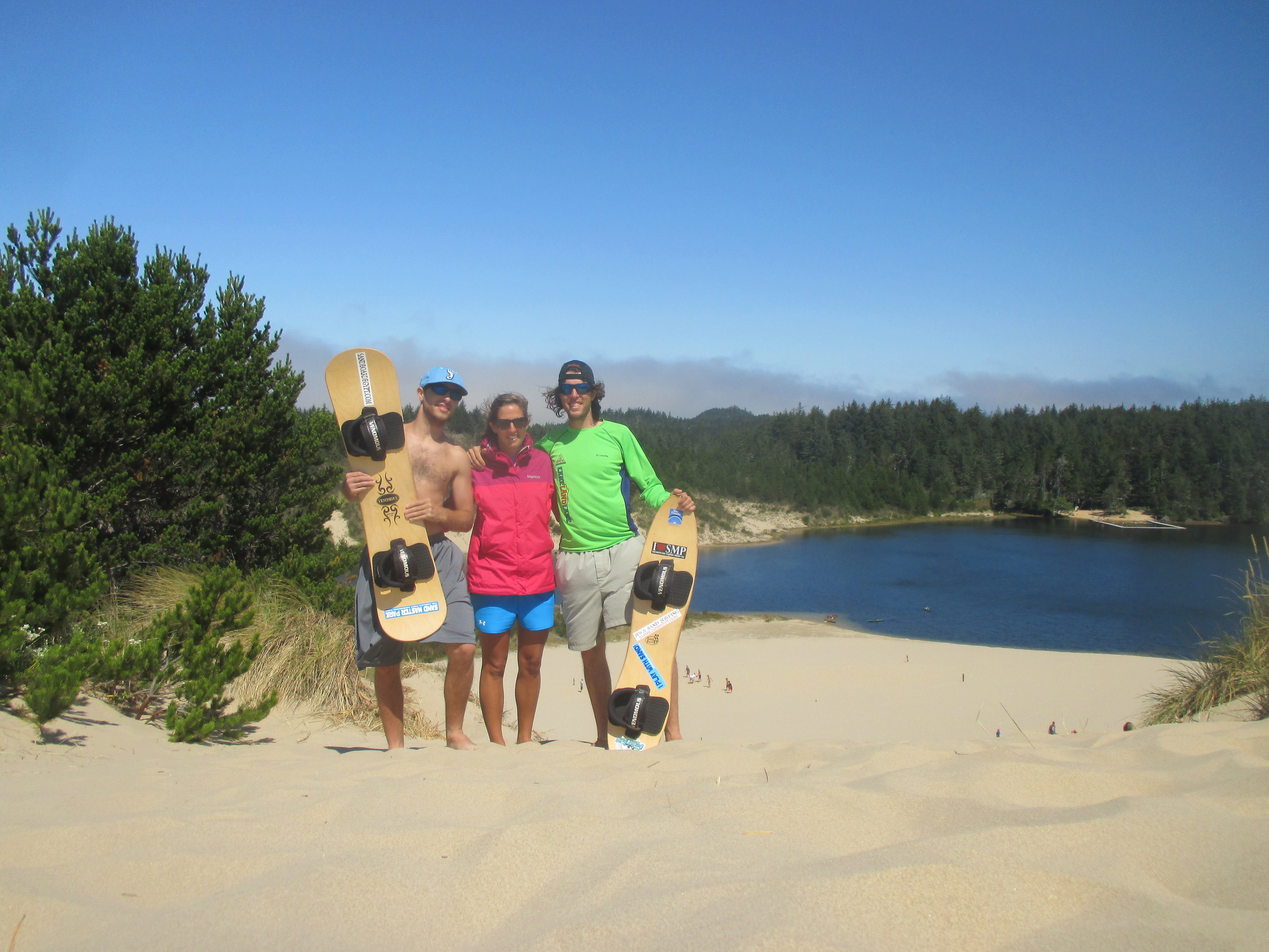
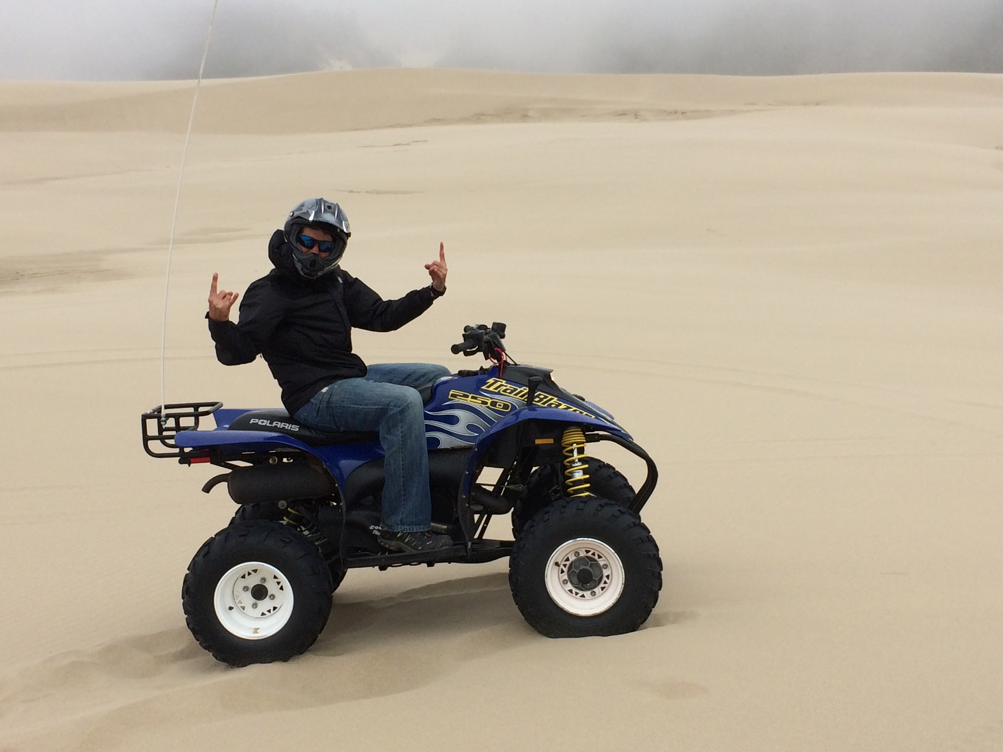
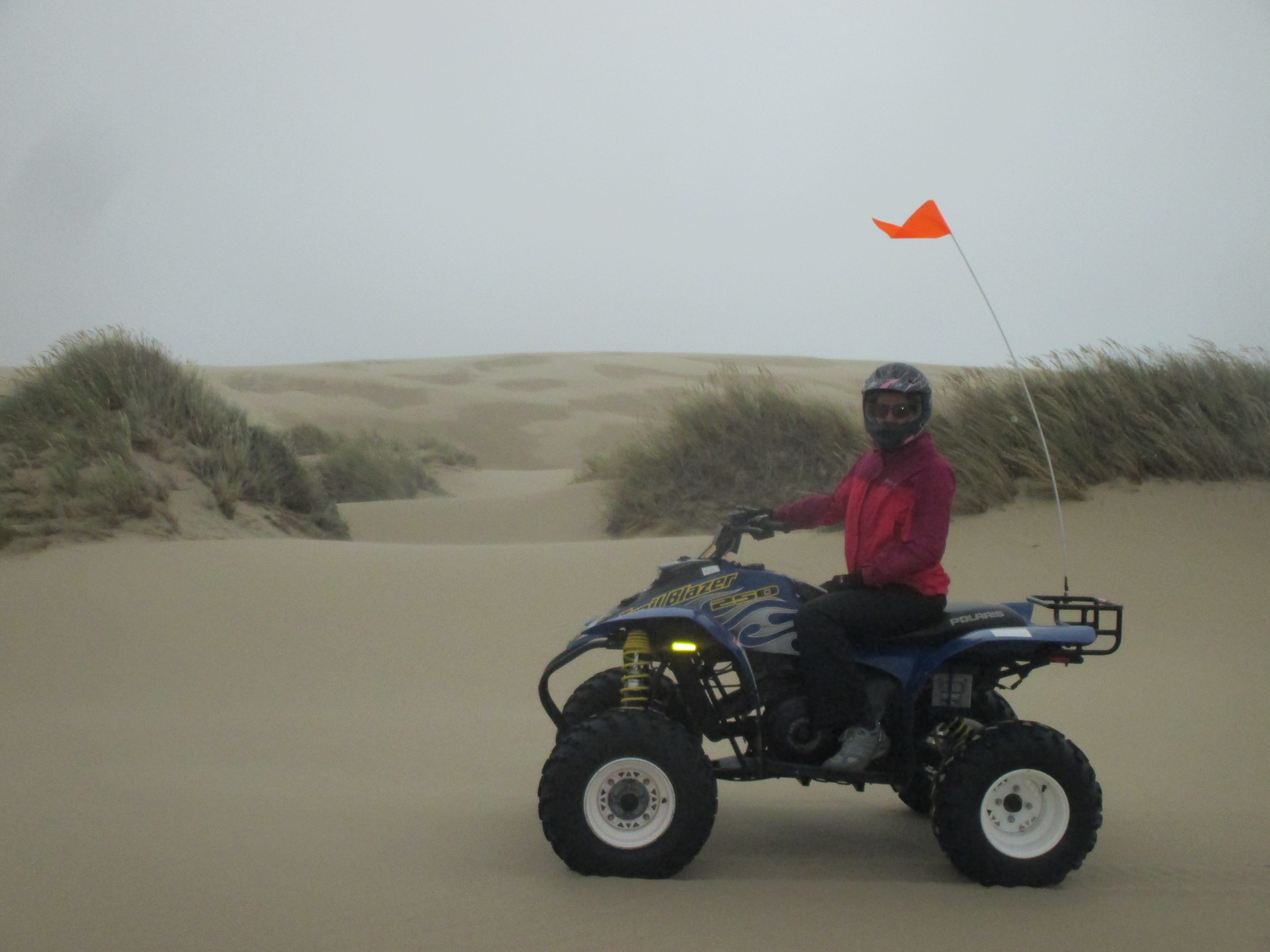
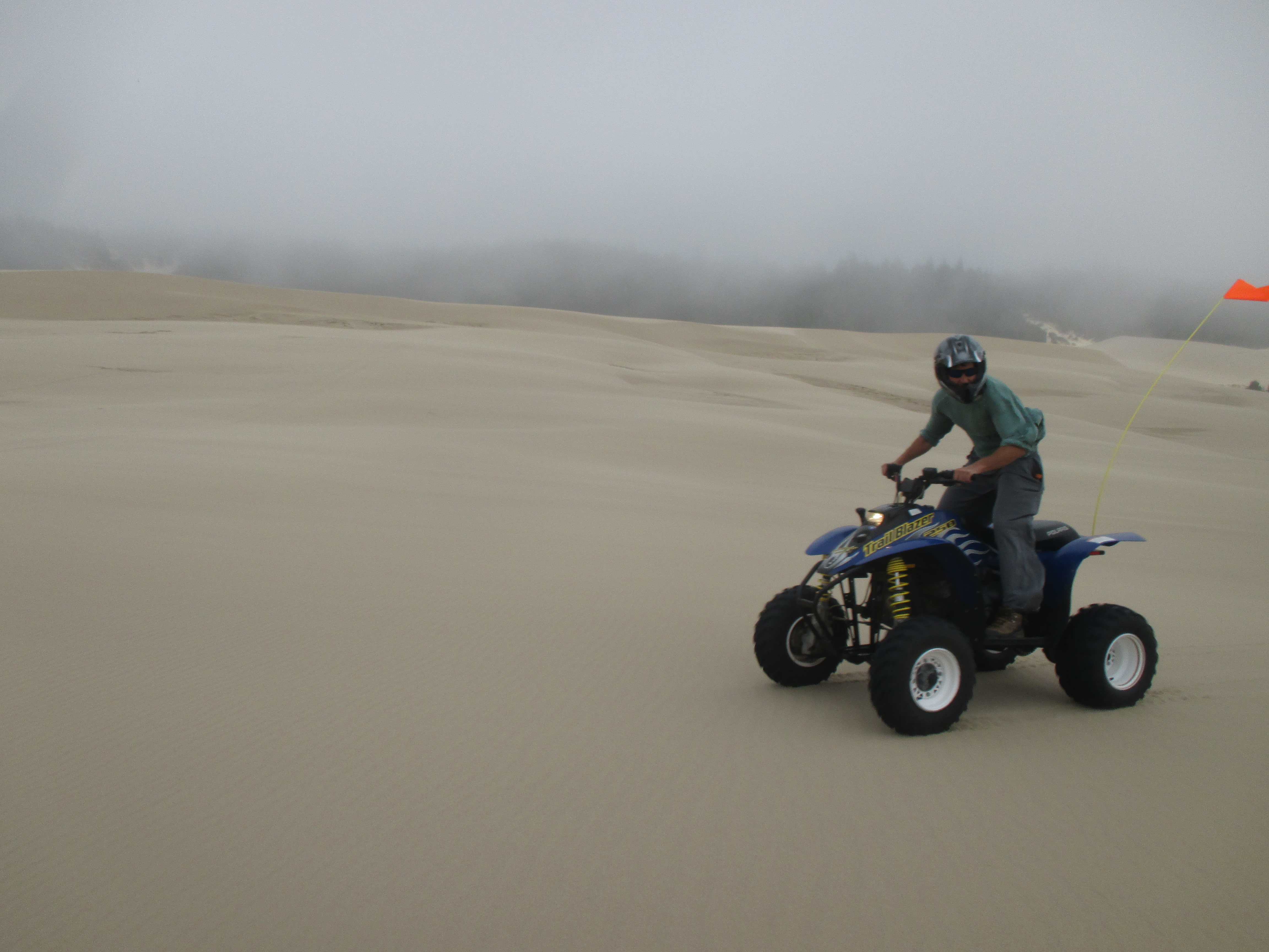
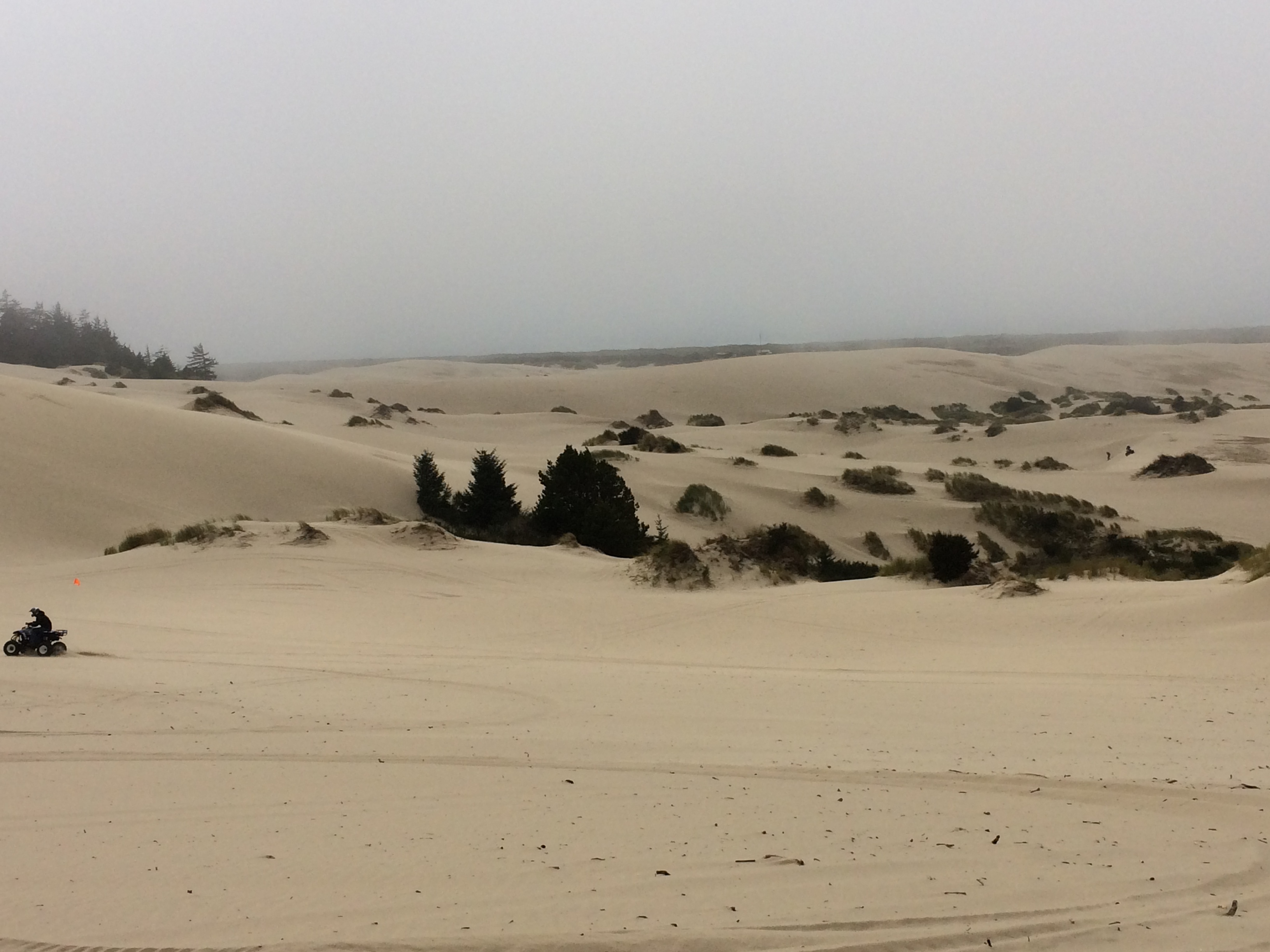
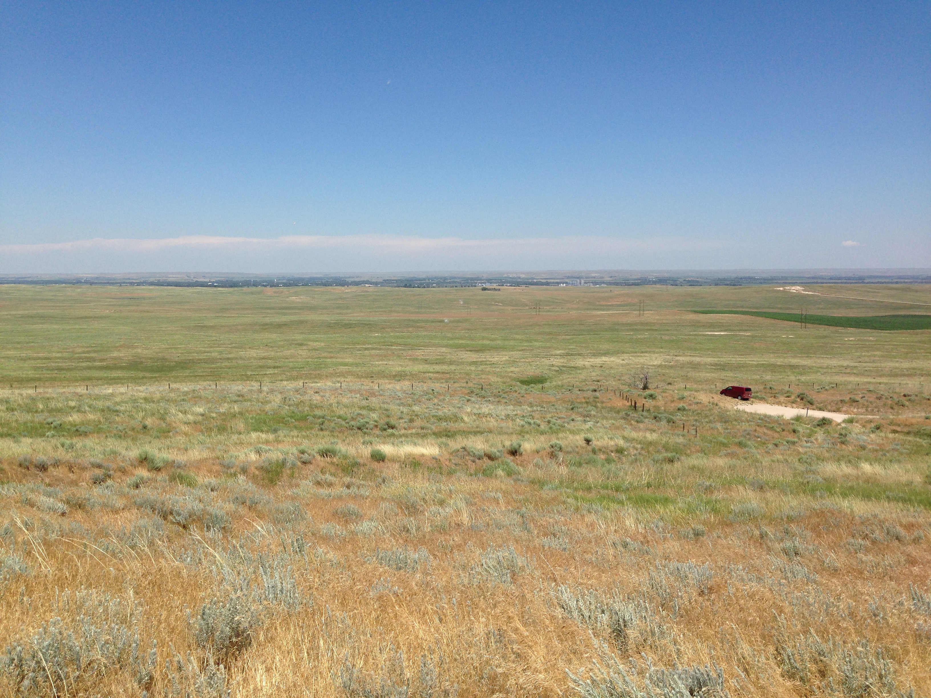
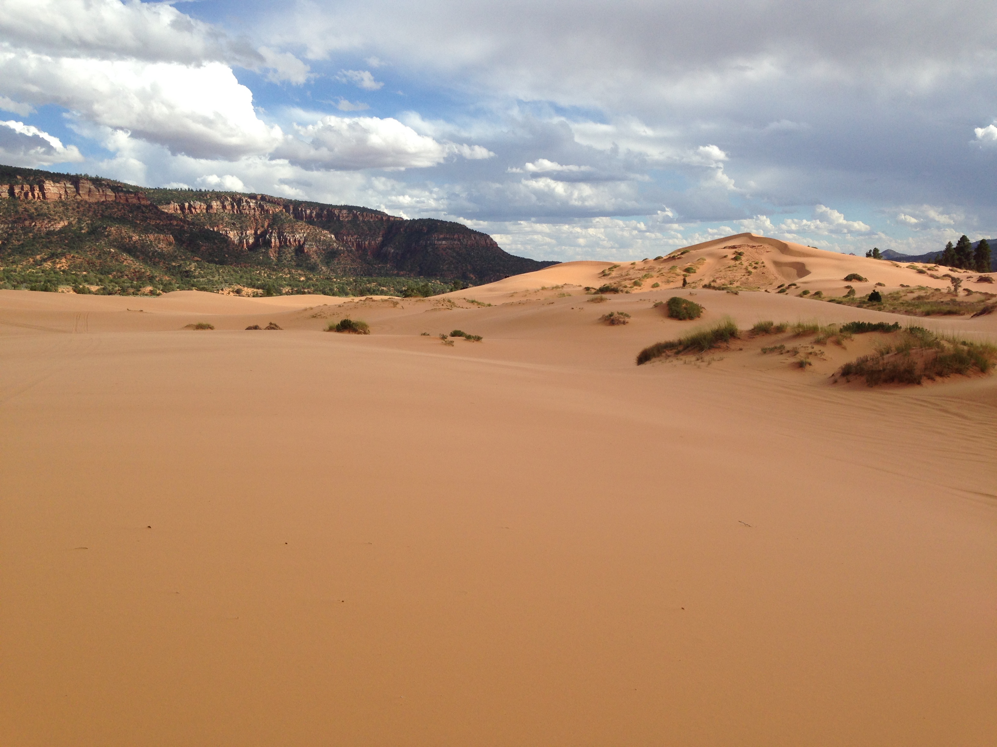
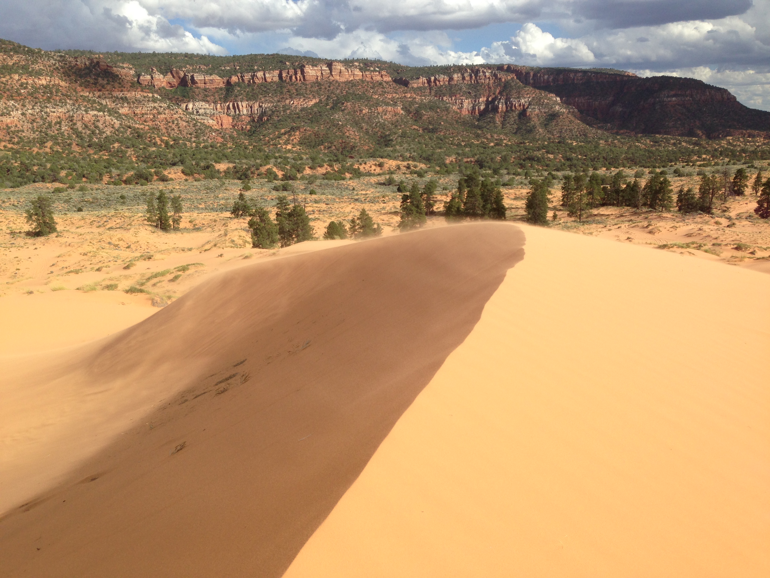
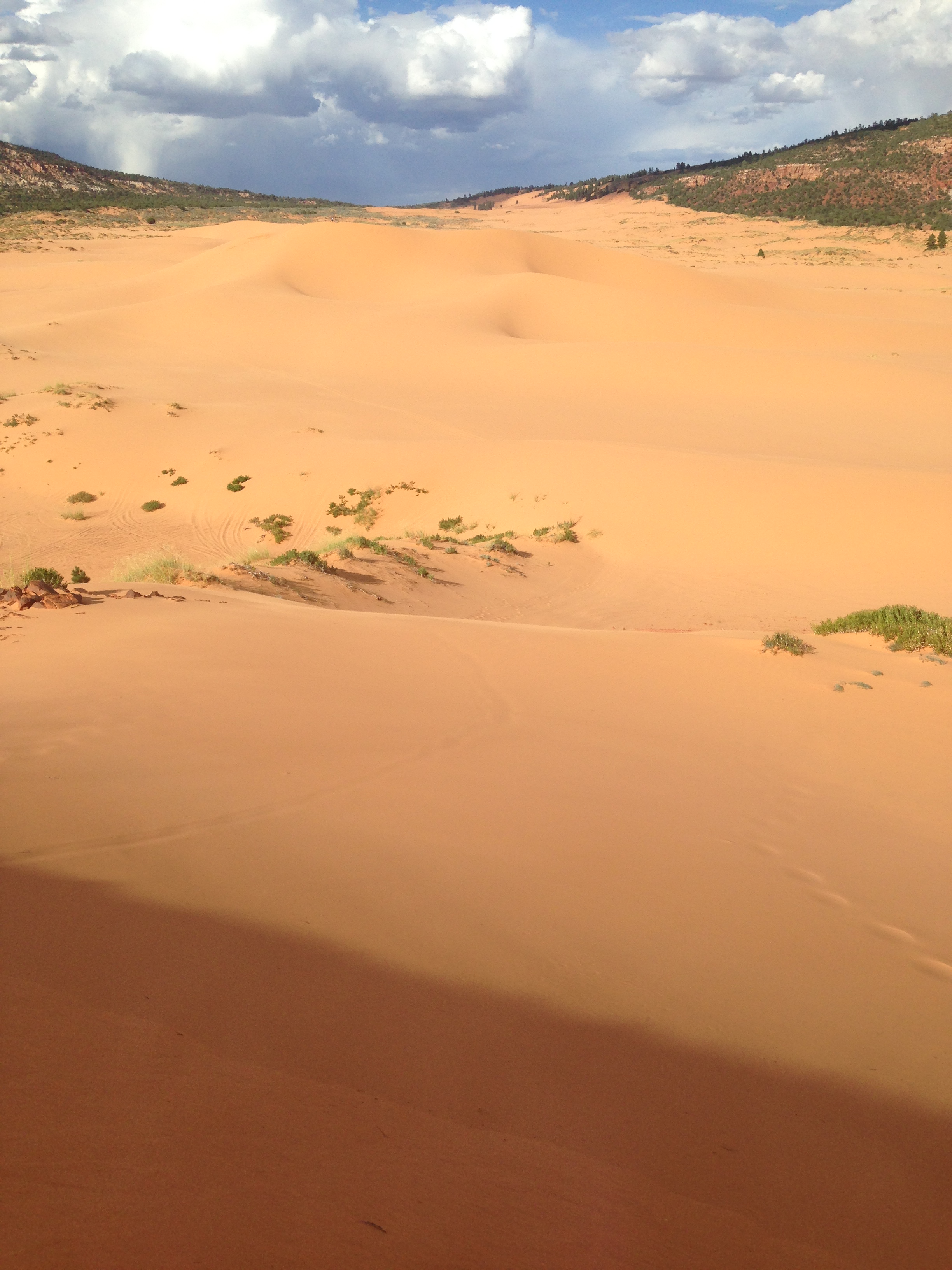
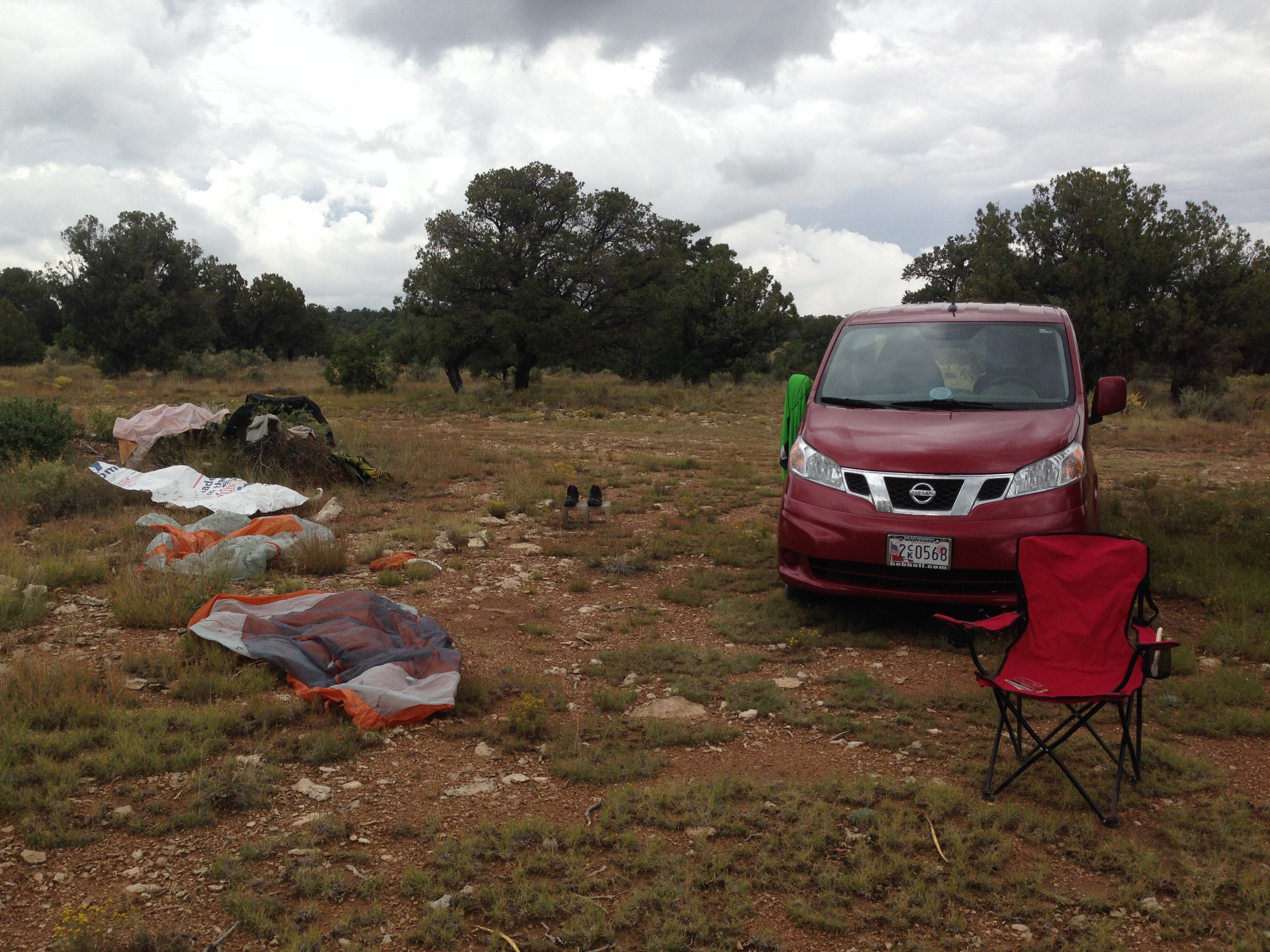
My friends in Durango, CO had told me about a neat State Park in Southern Utah, called Coral Pink Sand Dunes. Not surprisingly, they are just that! Pinkish-orange sand dunes created from deteriorating Navajo sandstone. I hiked out to the largest of them, but with a storm blowing in, I quickly made haste back to the van. I giggled to myself from the warmth of my bed as it rained cats and dogs and people ran off the dunes, soaking wet!

img_2638 img_2644 img_2645

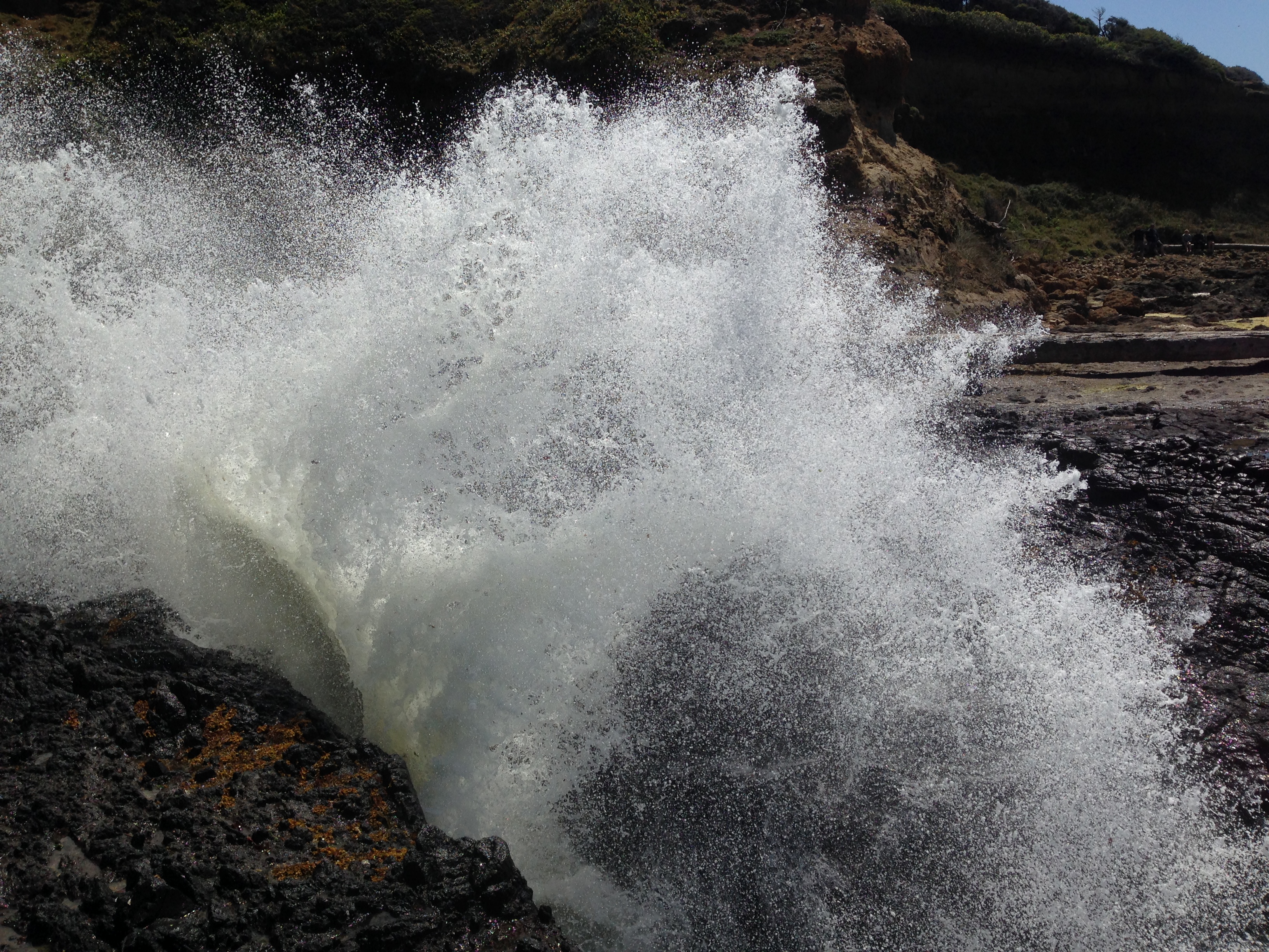
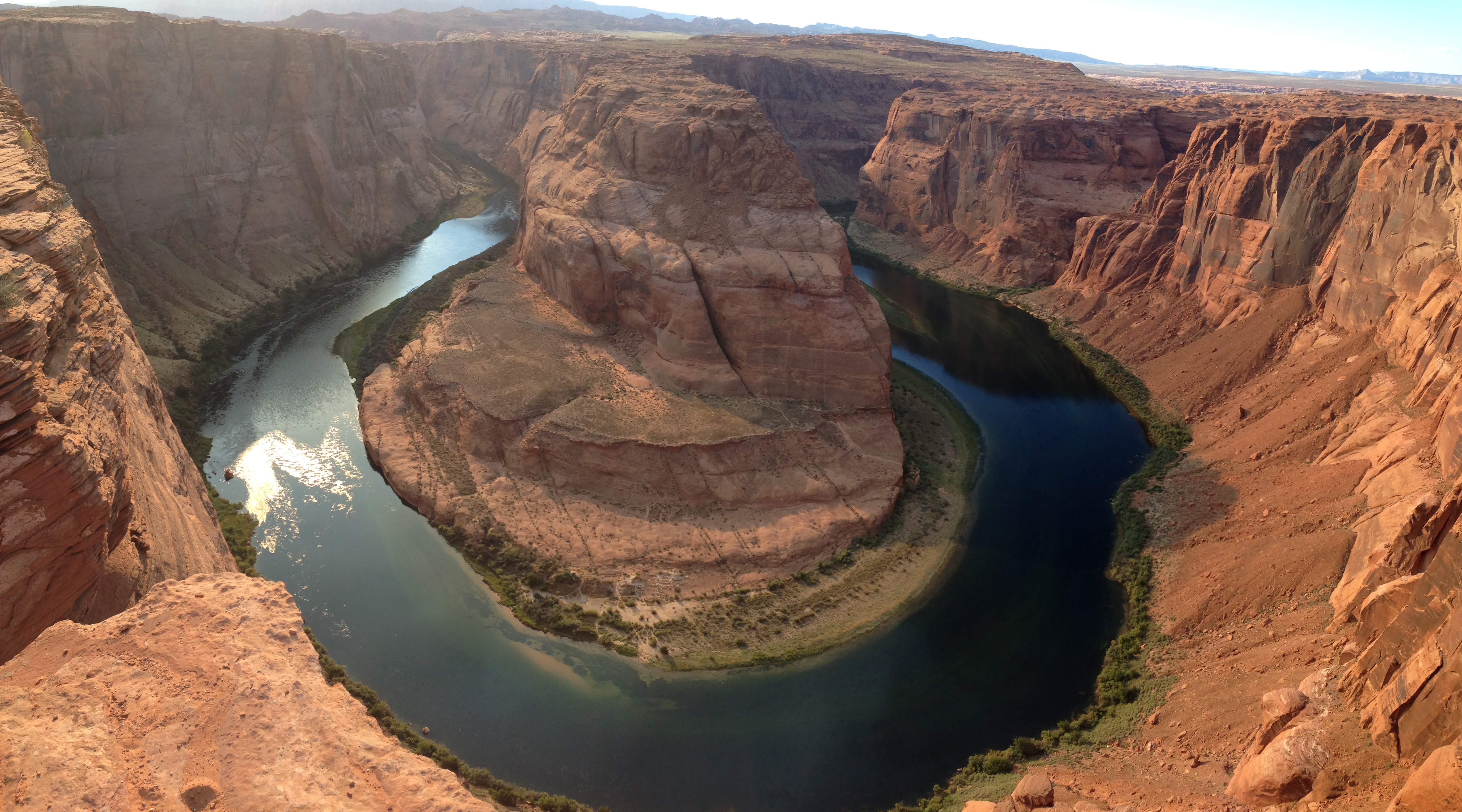
Entering back into Northern Arizona I checked out the point of many photographs, Horseshoe Bend. Here, the Colorado River has eroded a nearly complete loop into the valley floor. The blue water and red rock make for quite a site.

img_2655 img_2951

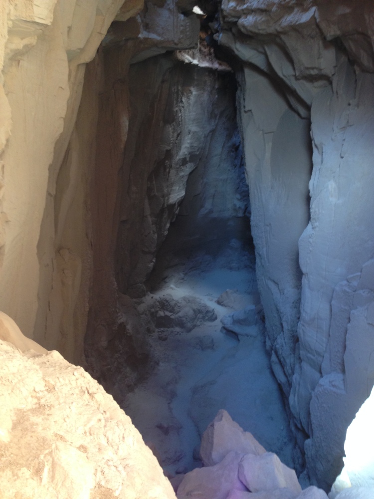
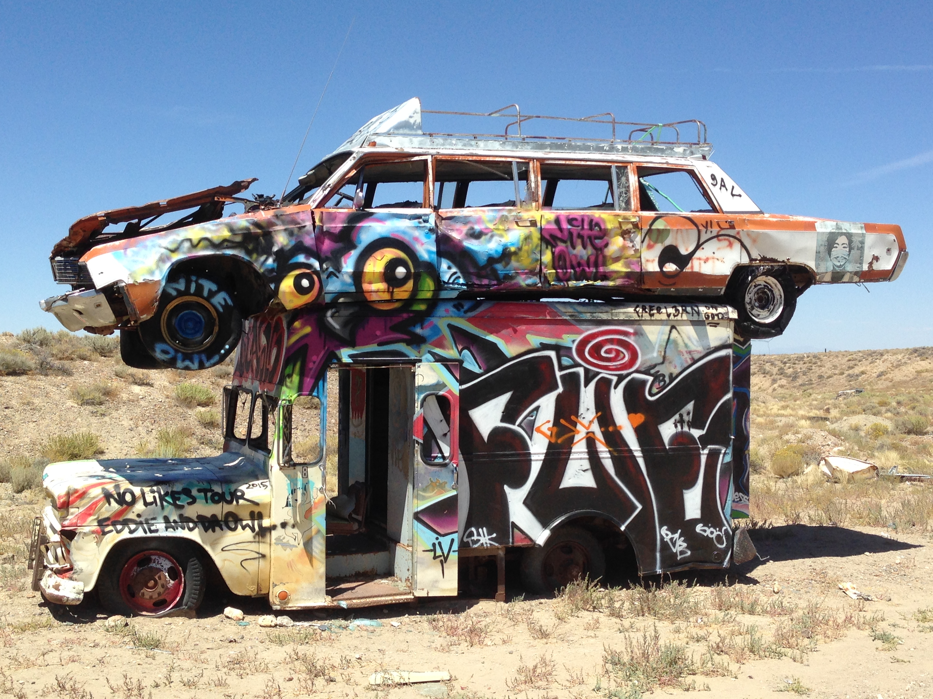
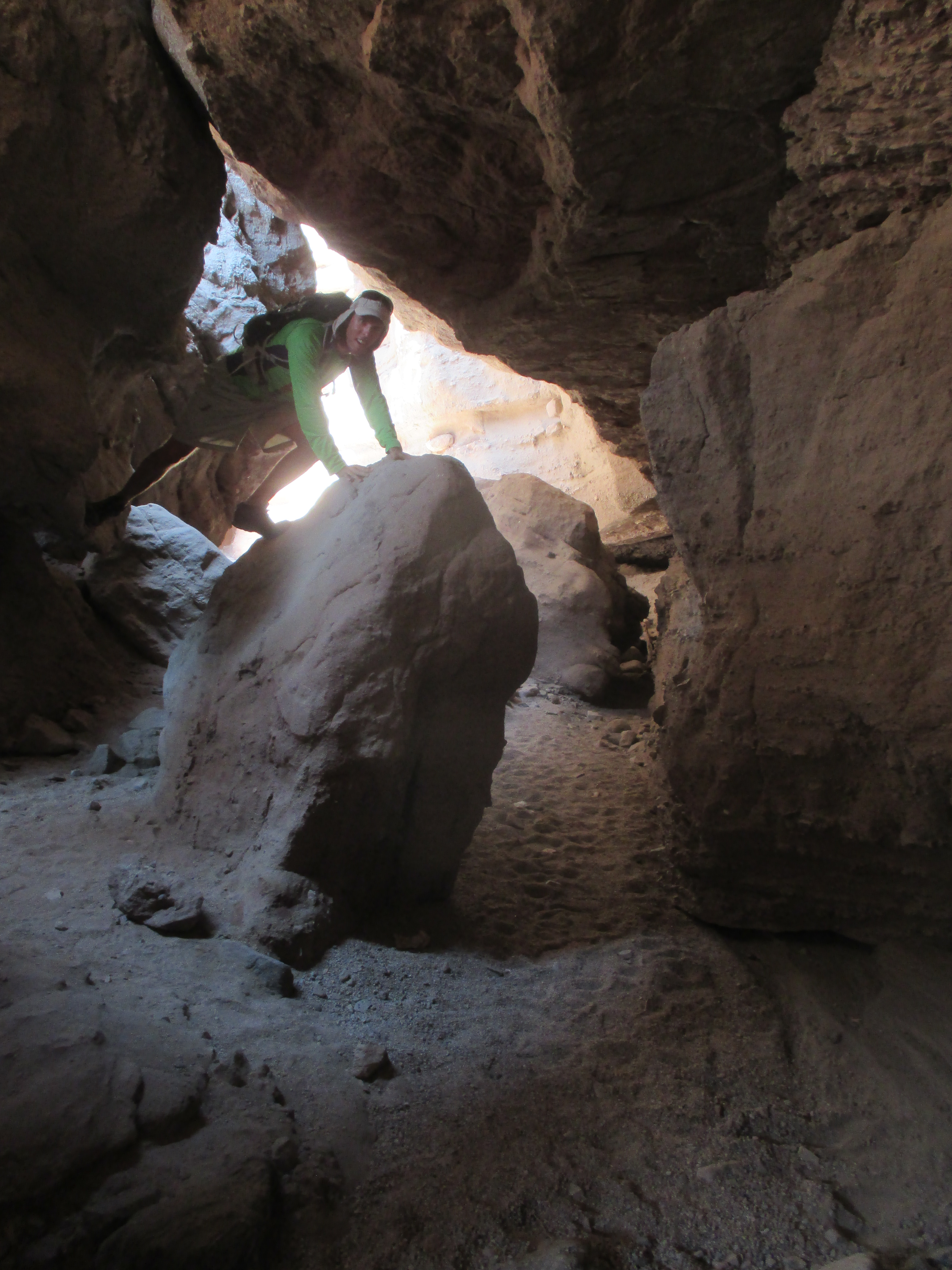
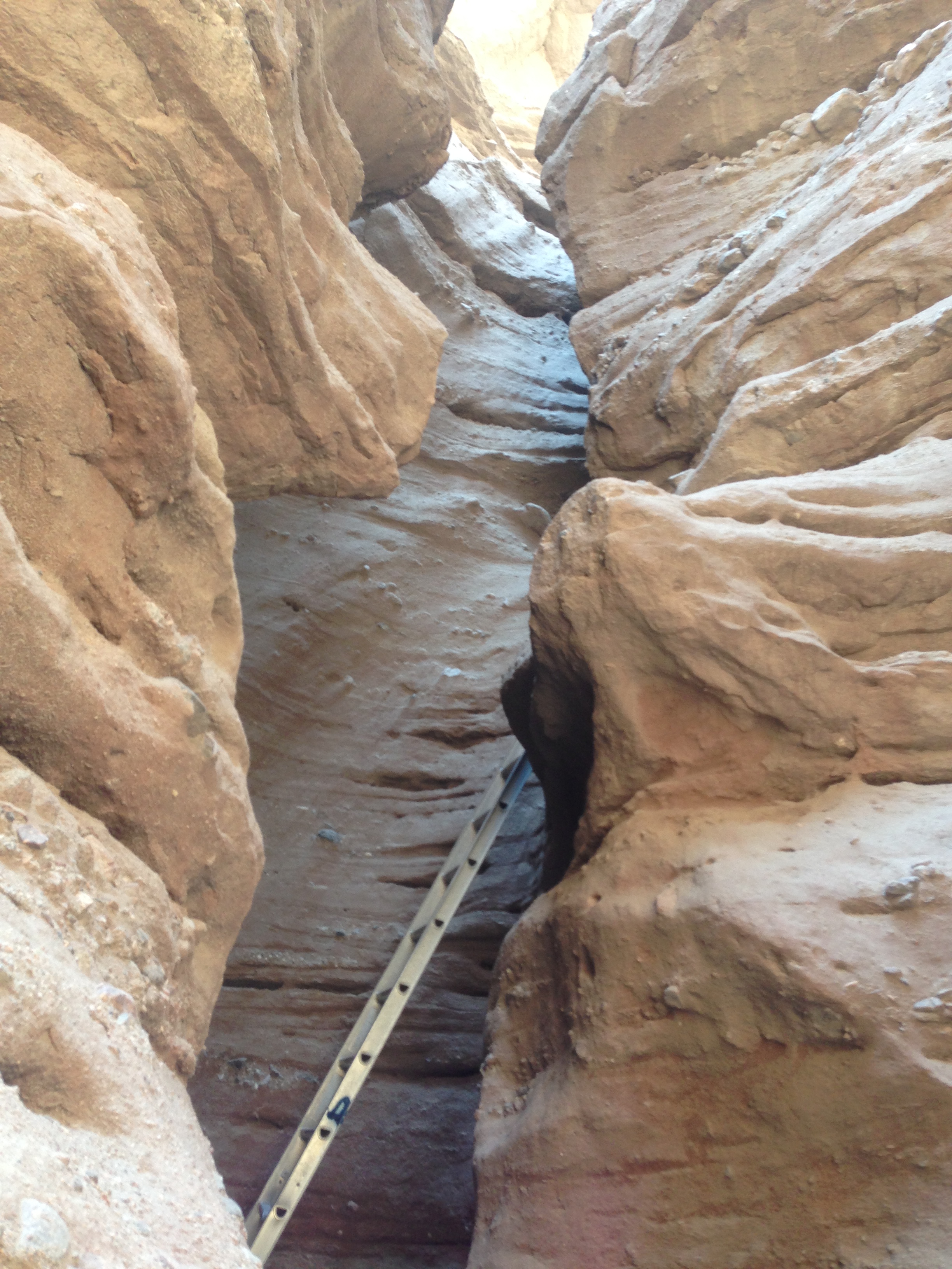
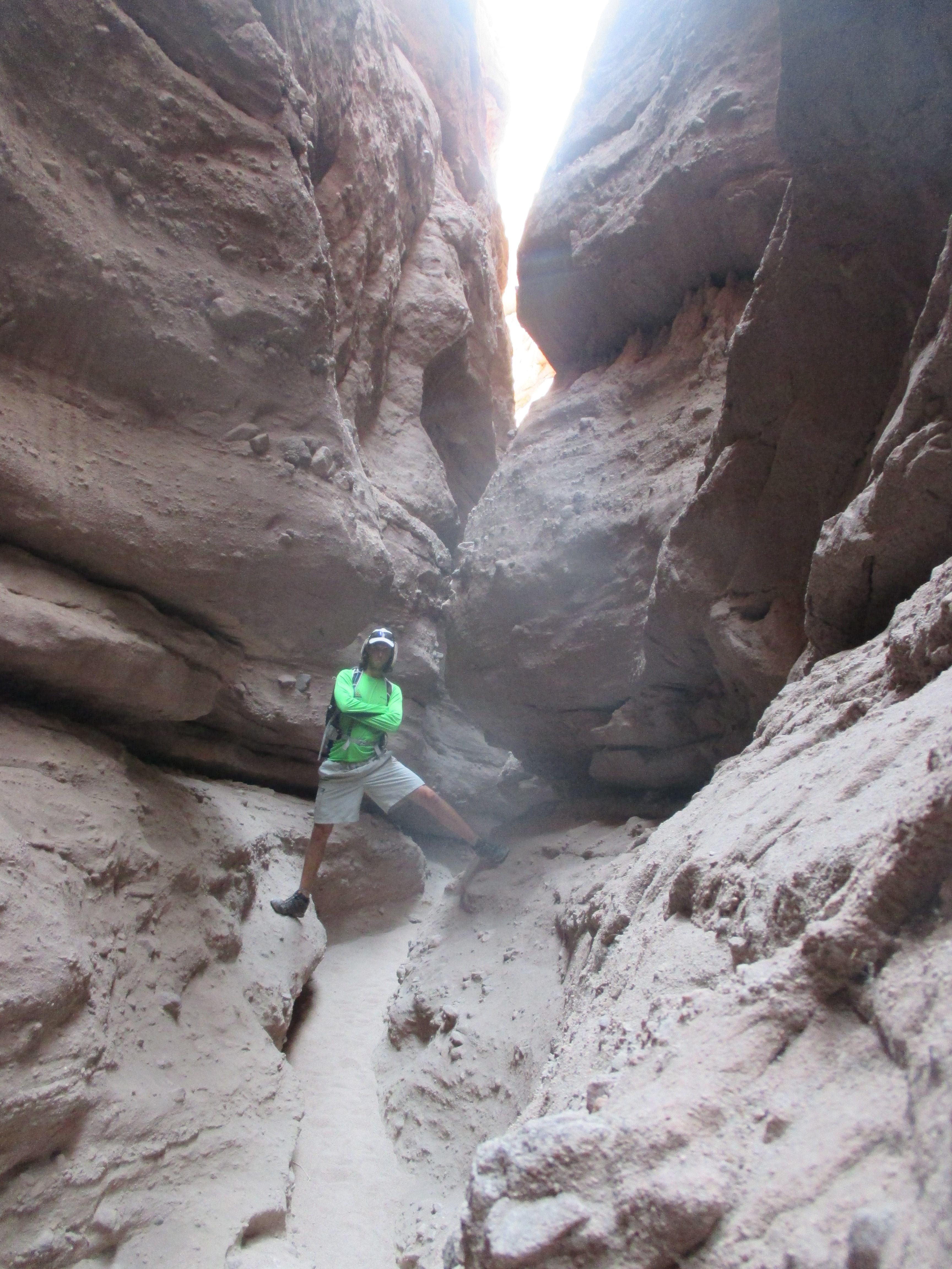
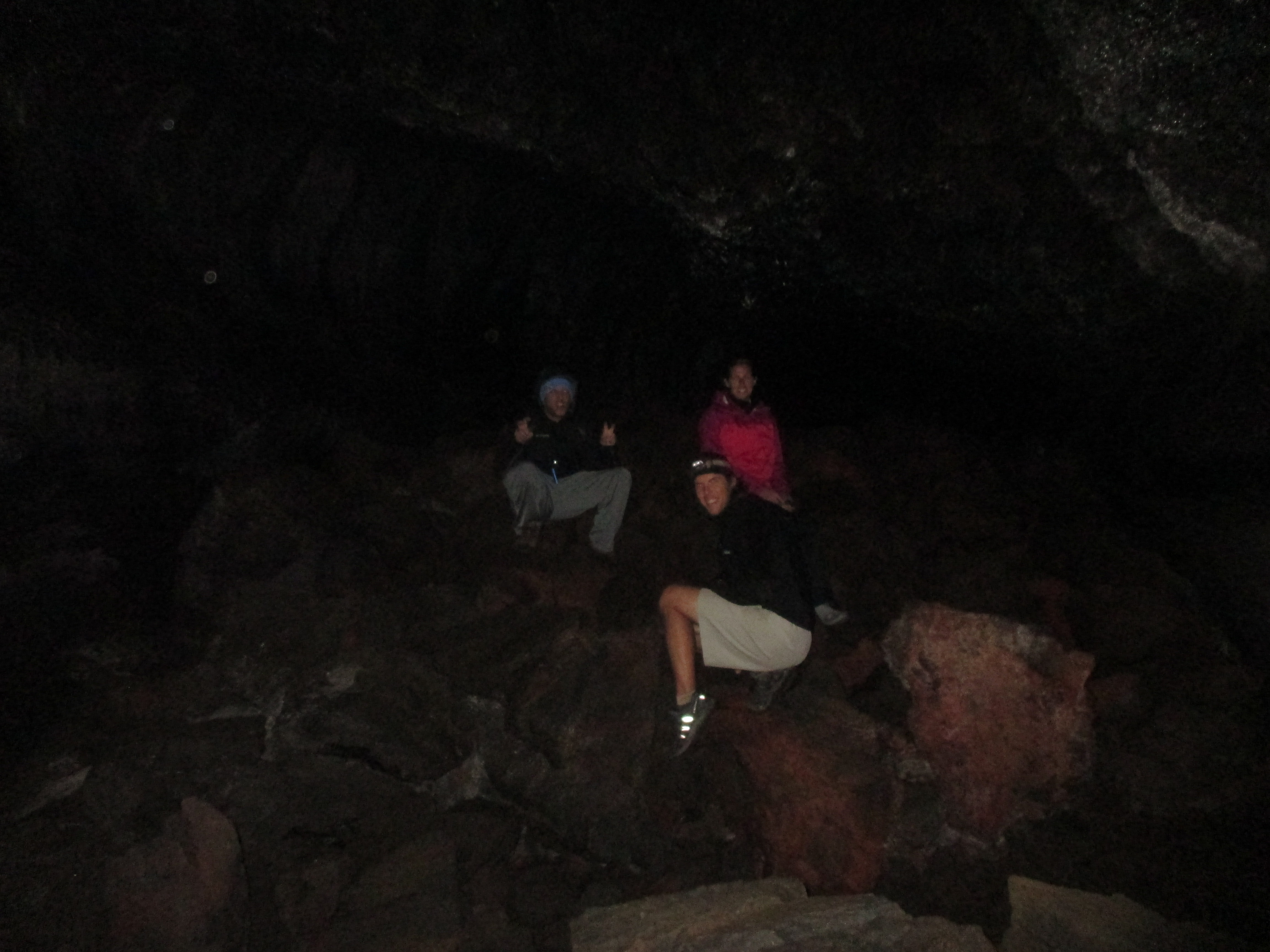
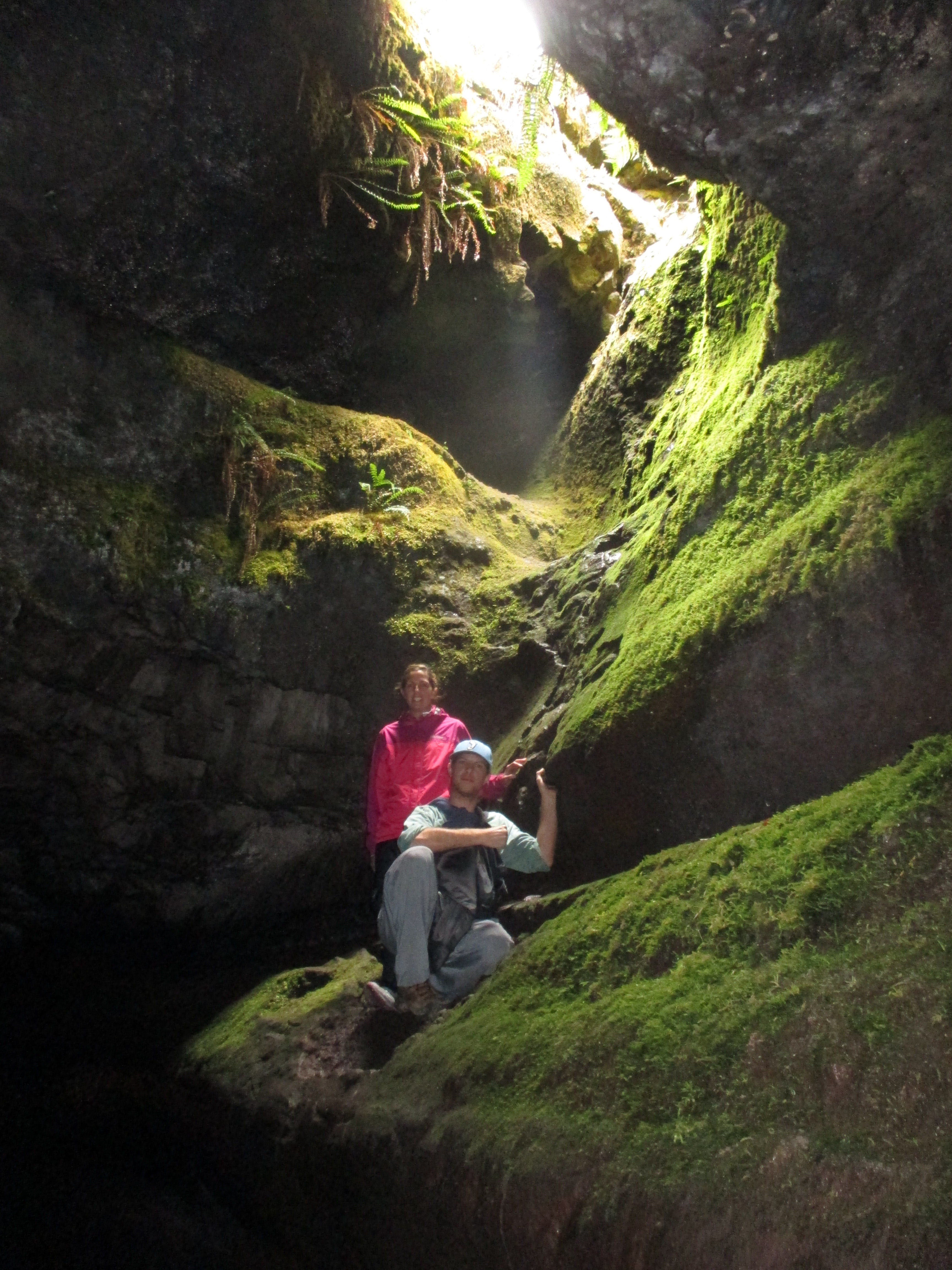
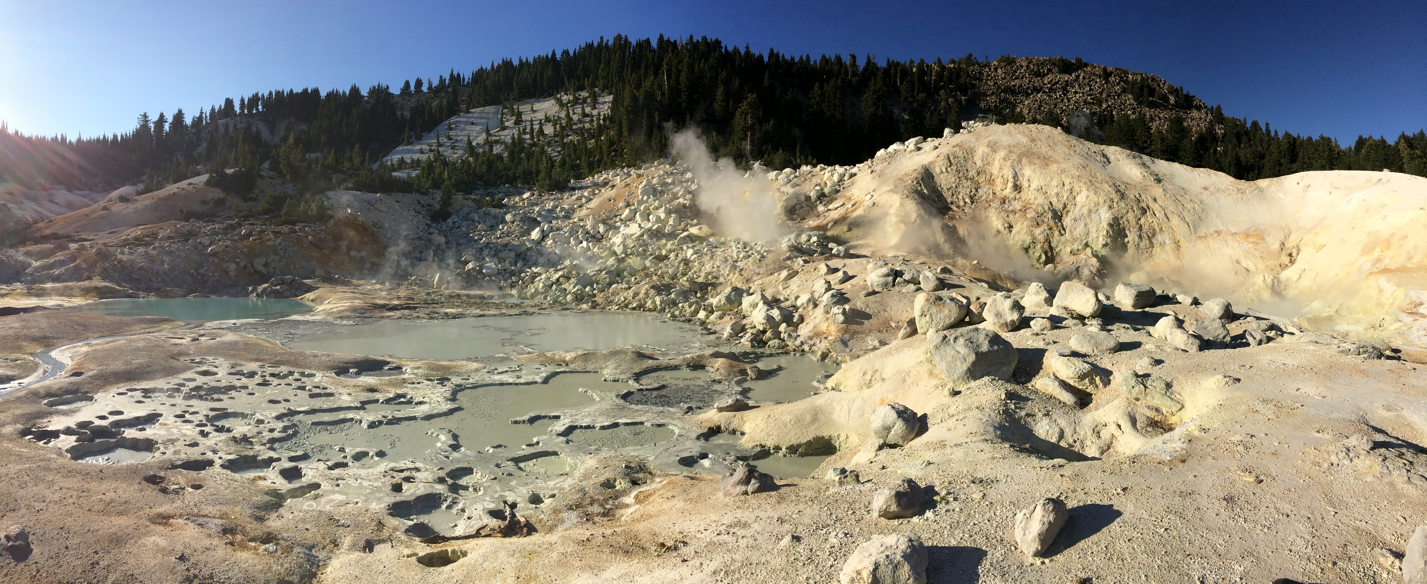
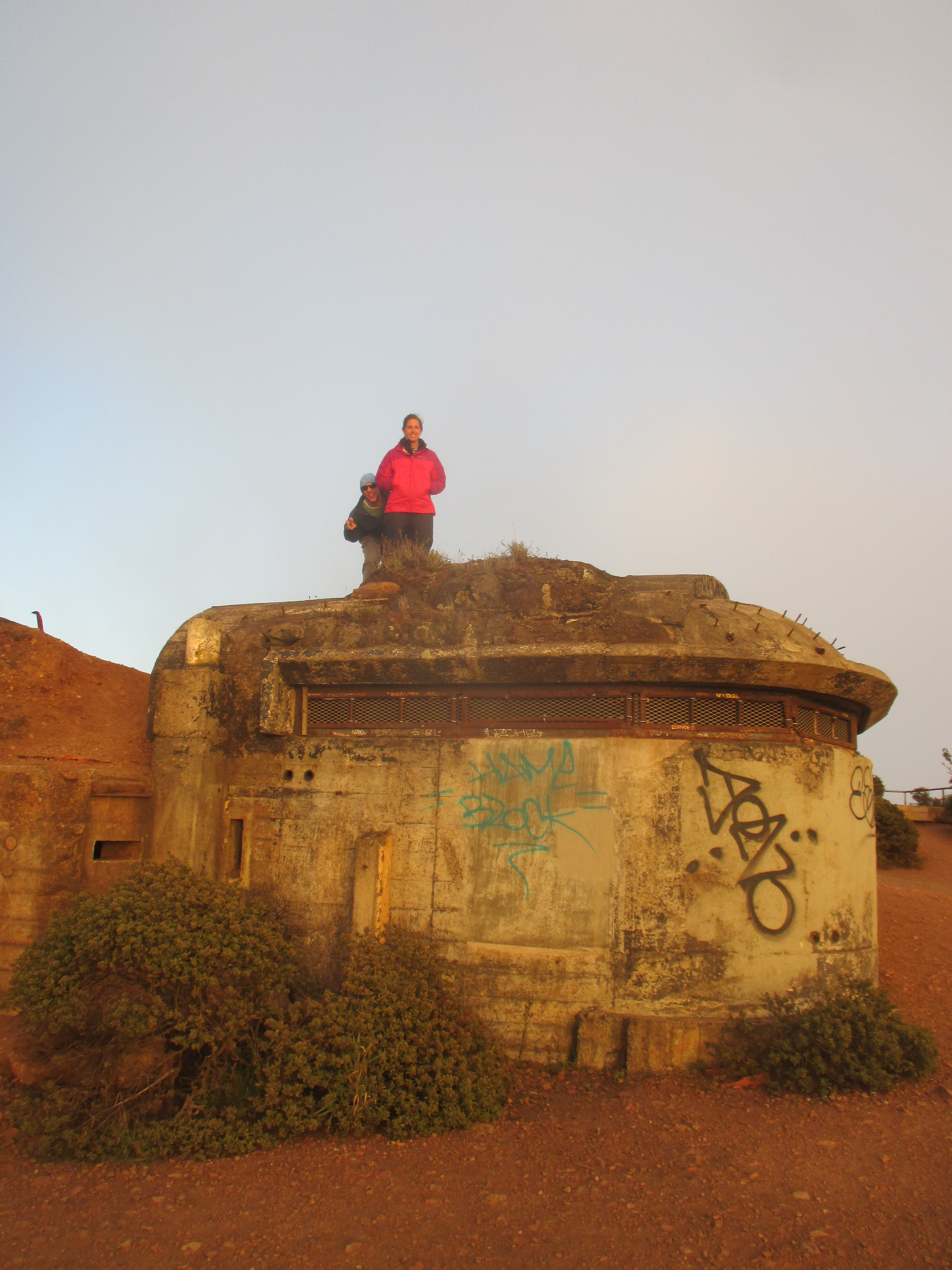
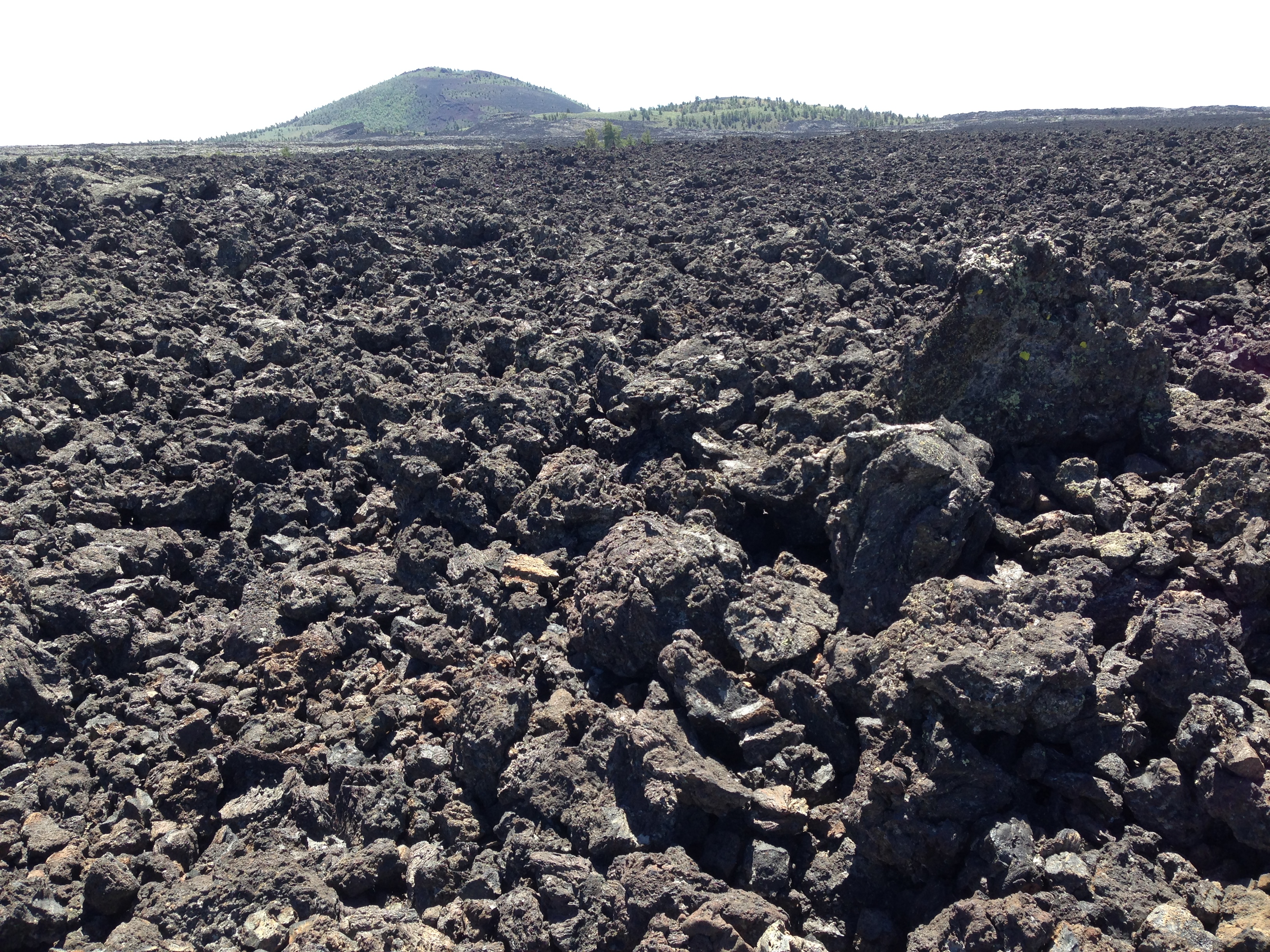
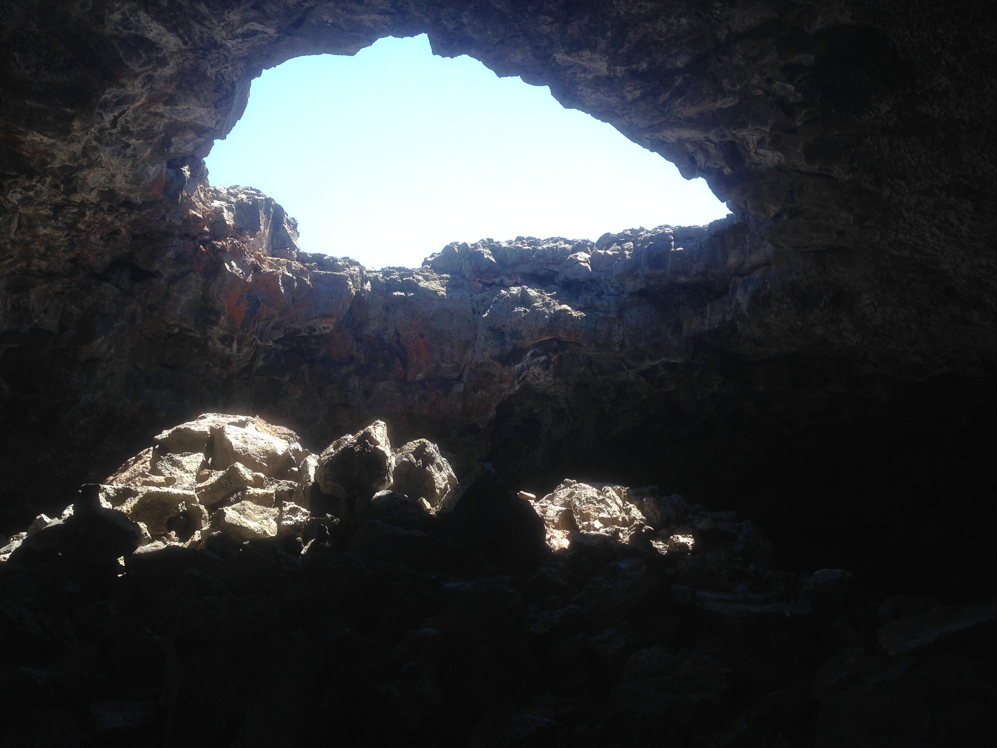
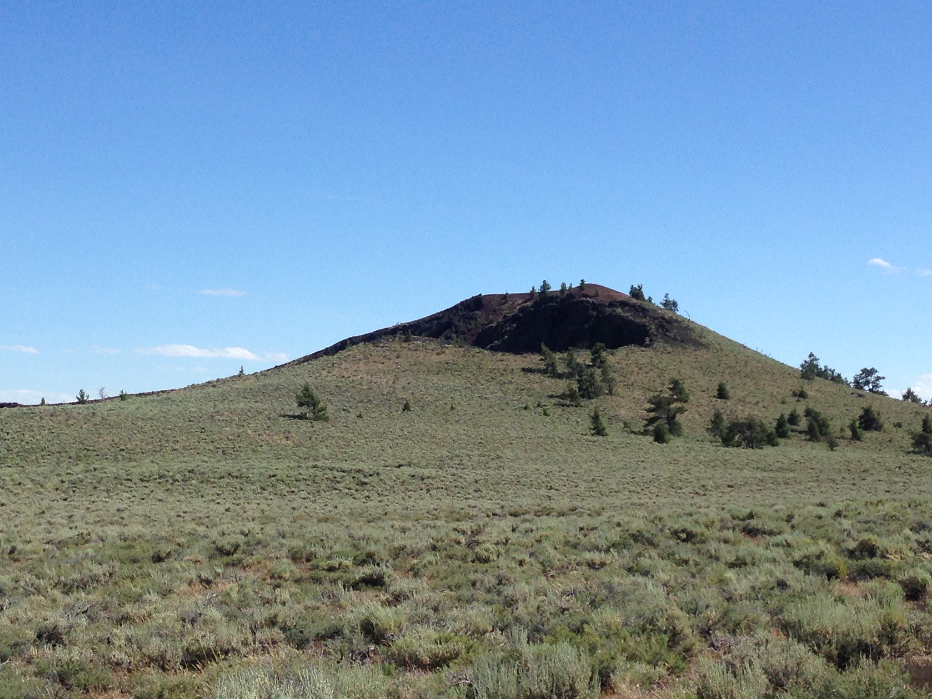
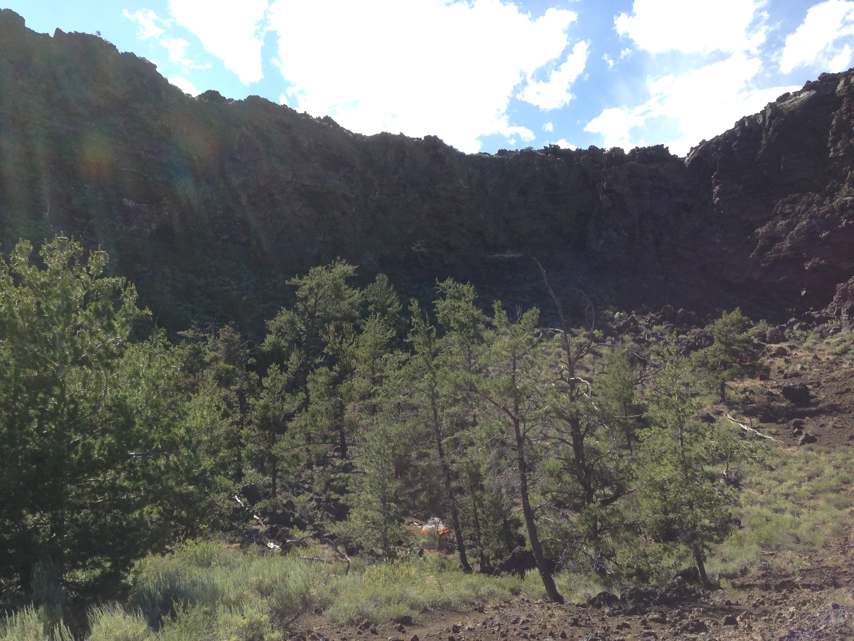
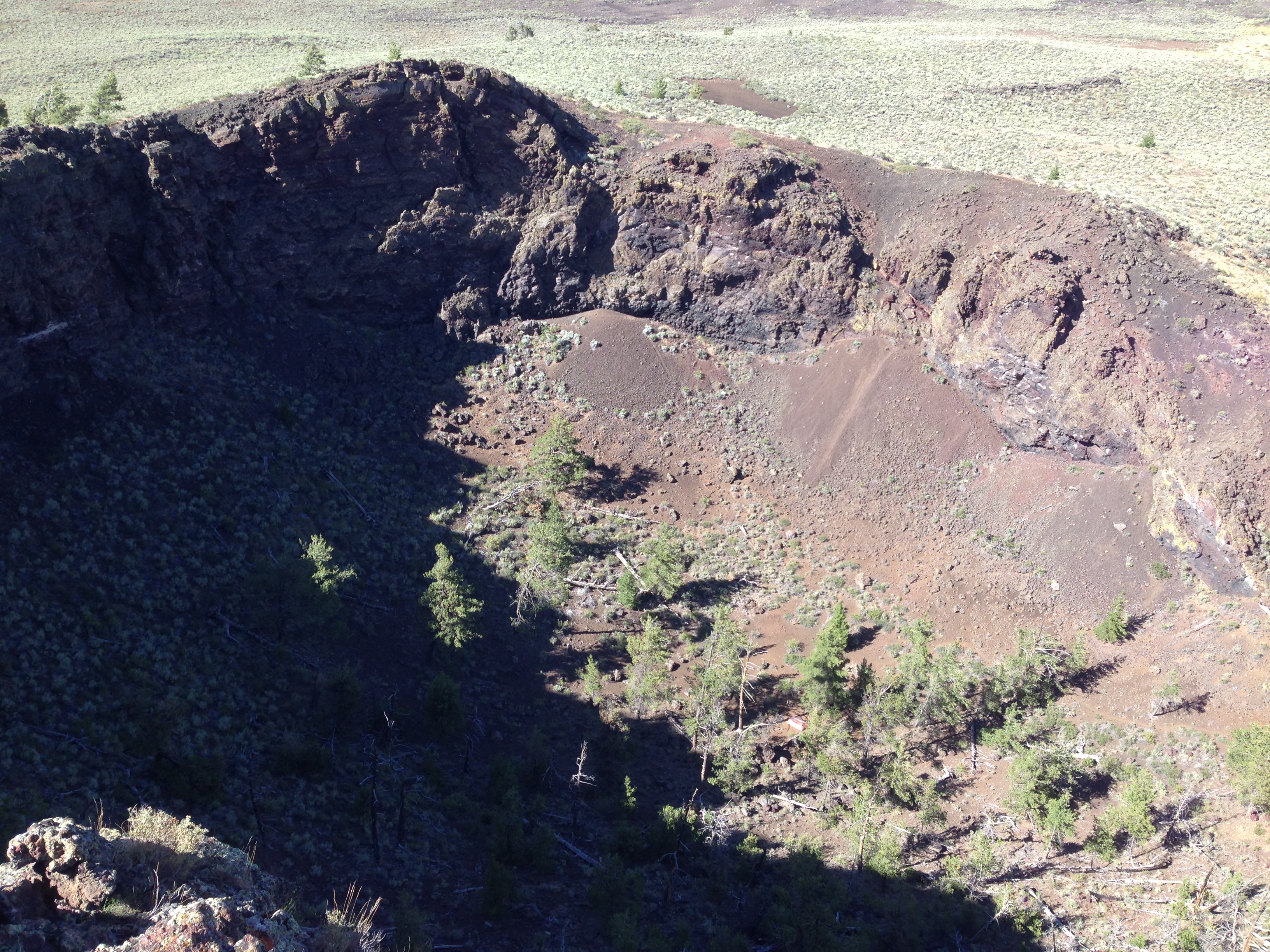
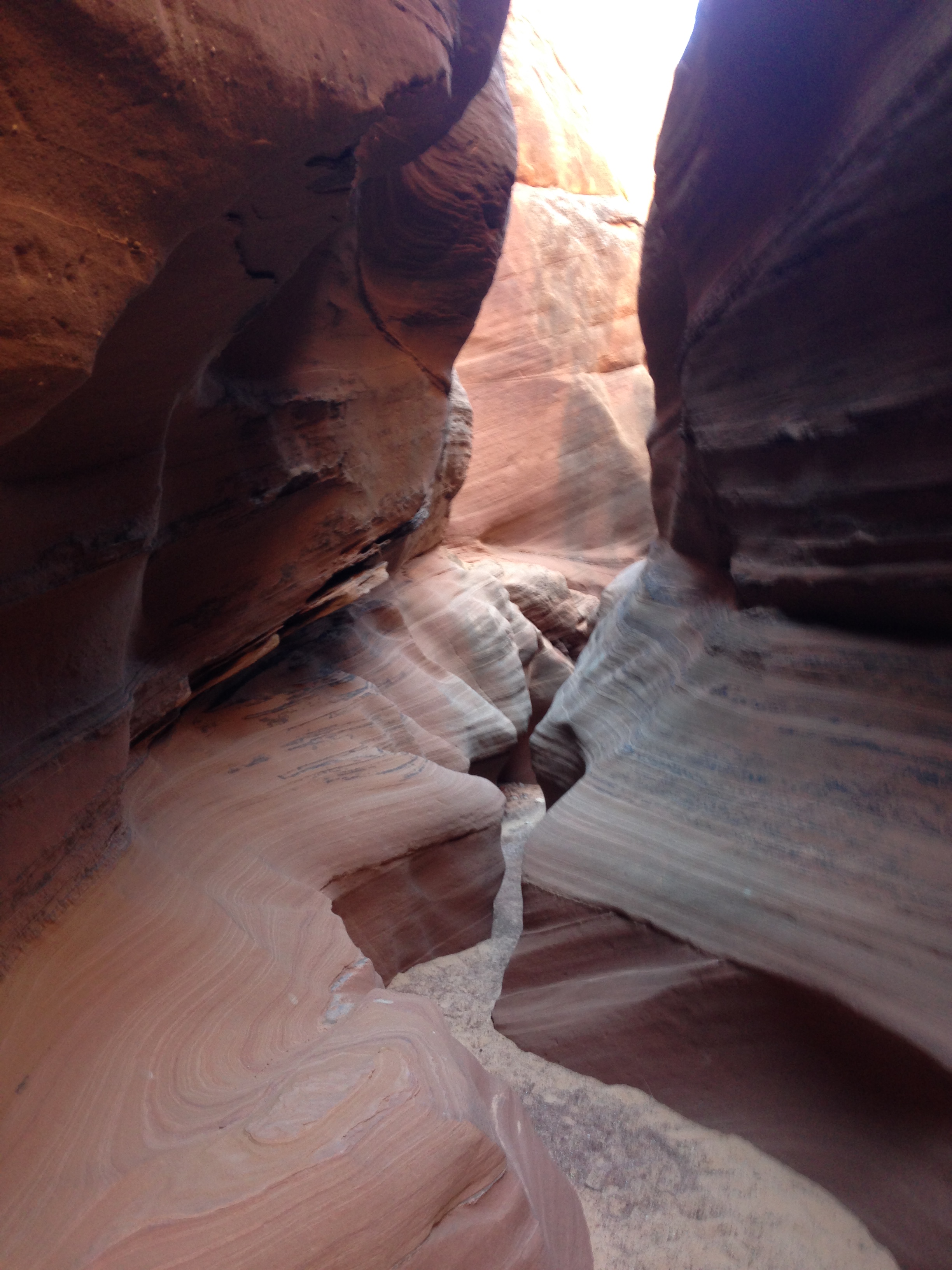
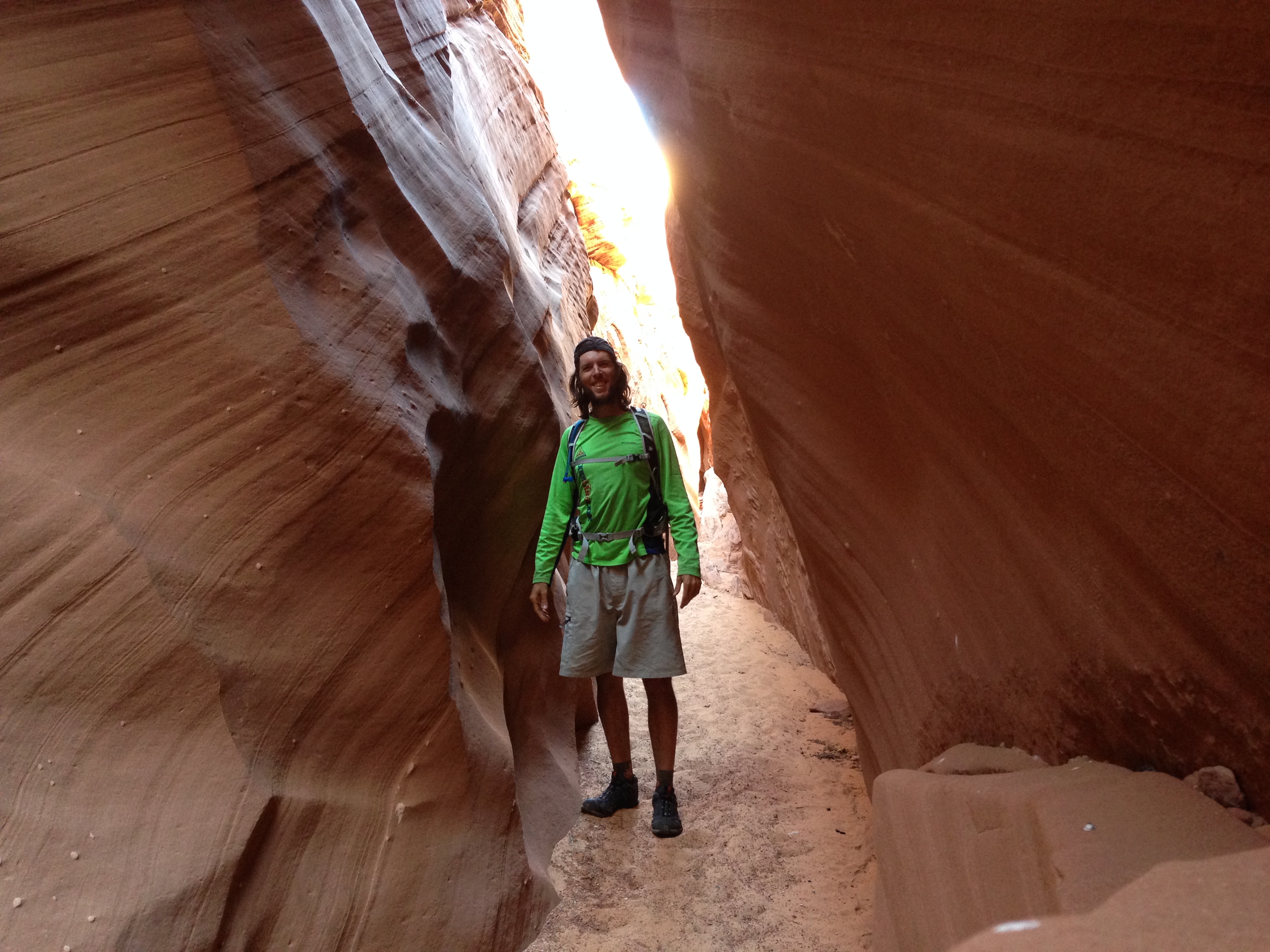
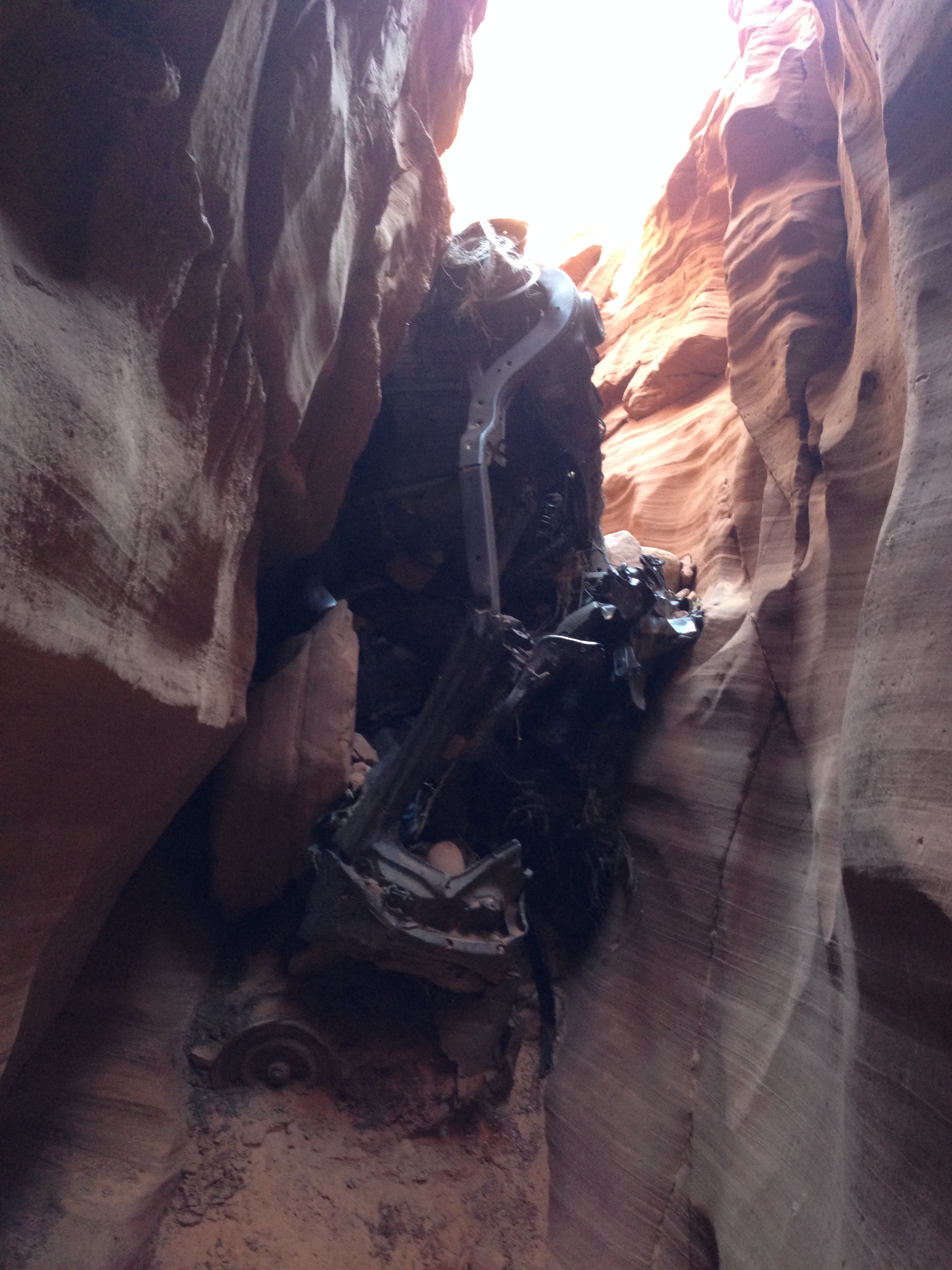
Nearby Horseshoe Bend, I wanted to check out a slot canyon. I could only go a quarter of a mile before hitting a section that would have required ropes and had to turn around. One notable point was a bridge, high above the canyon, and below it was a rusted car, crumpled up in the slot canyon below. I’d like to know the story behind that mishap!

img_2665 img_2664 img_2661 img_2662

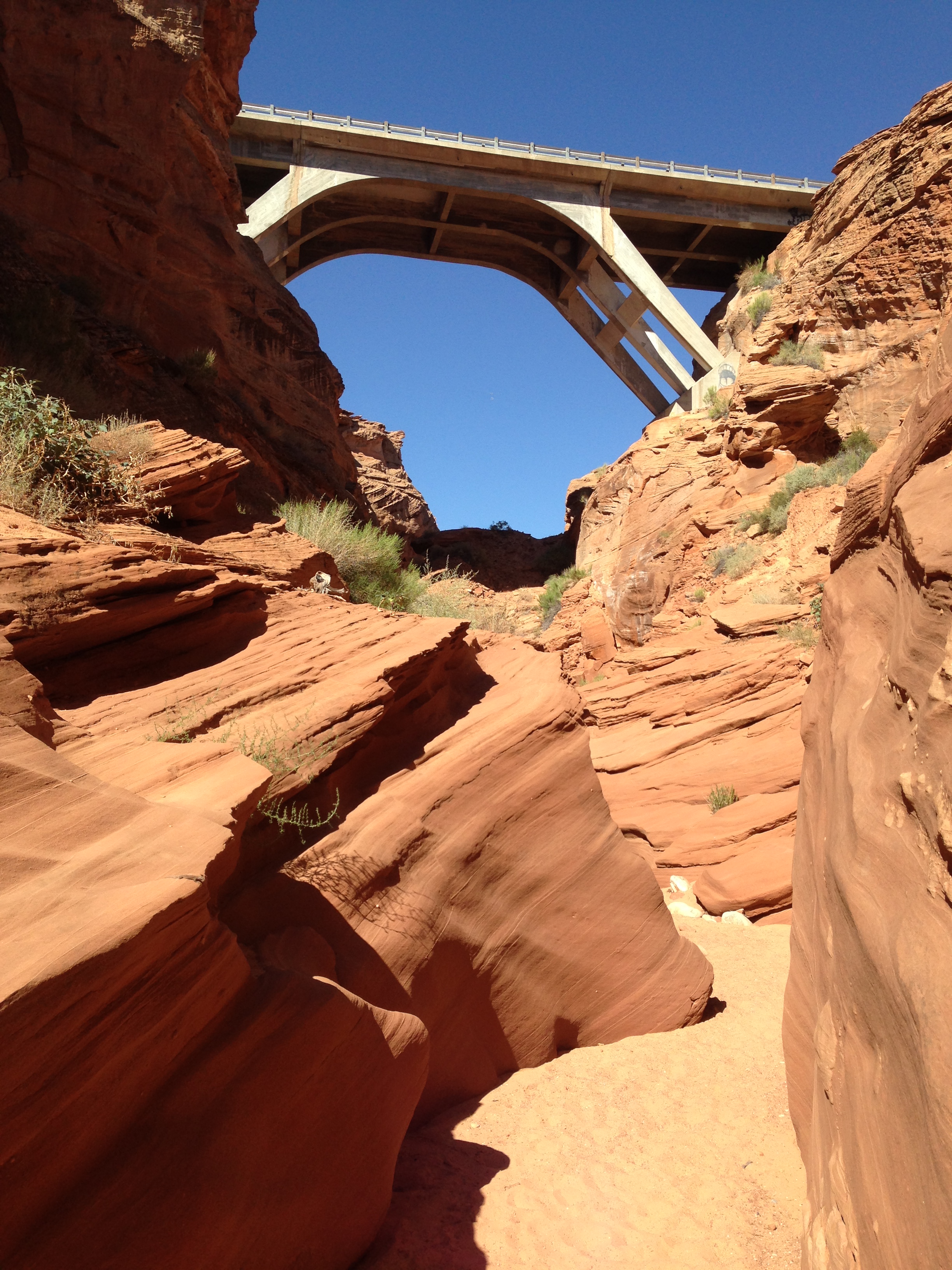
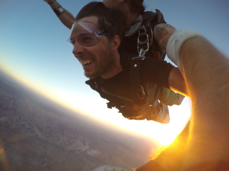
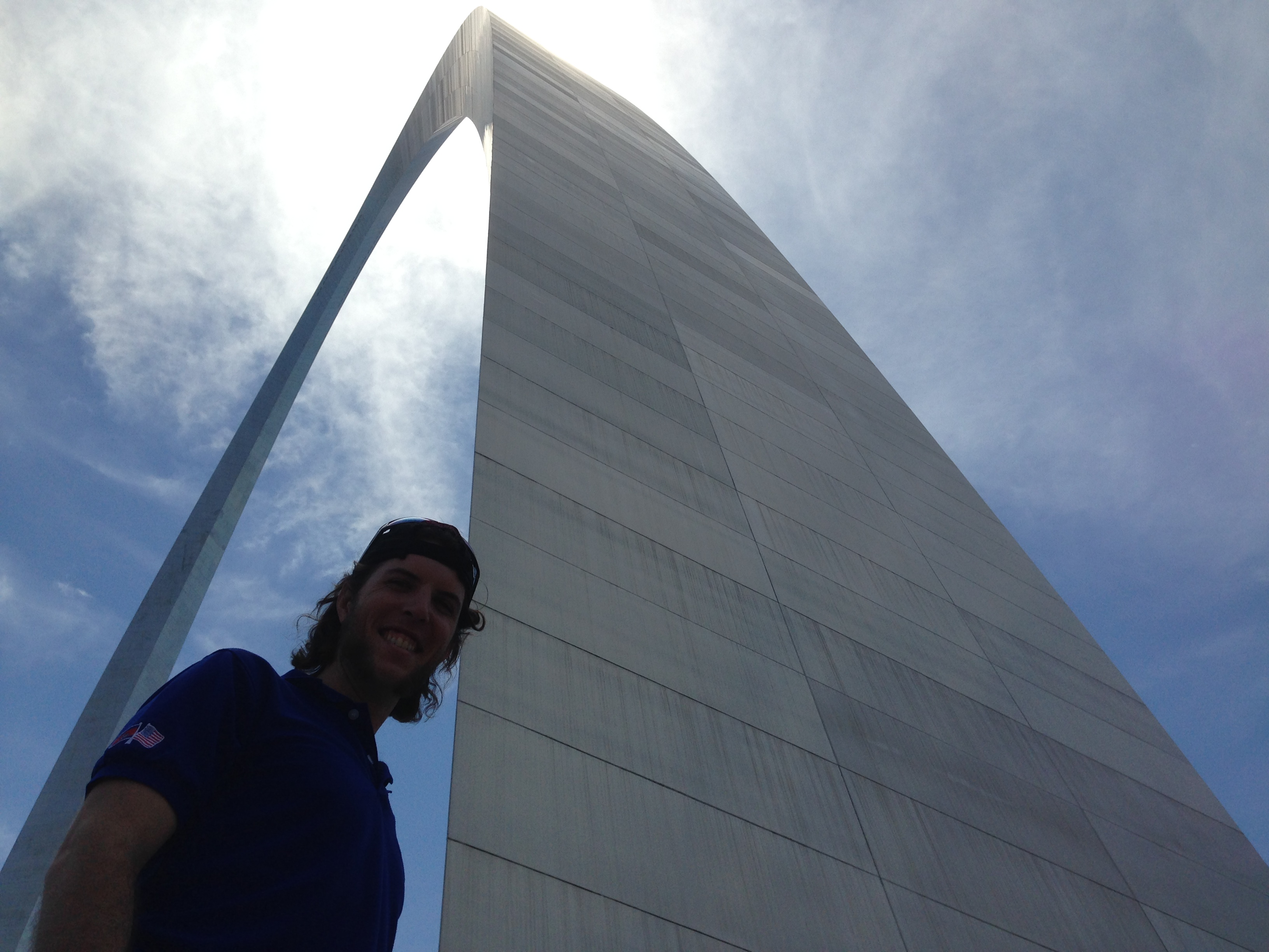
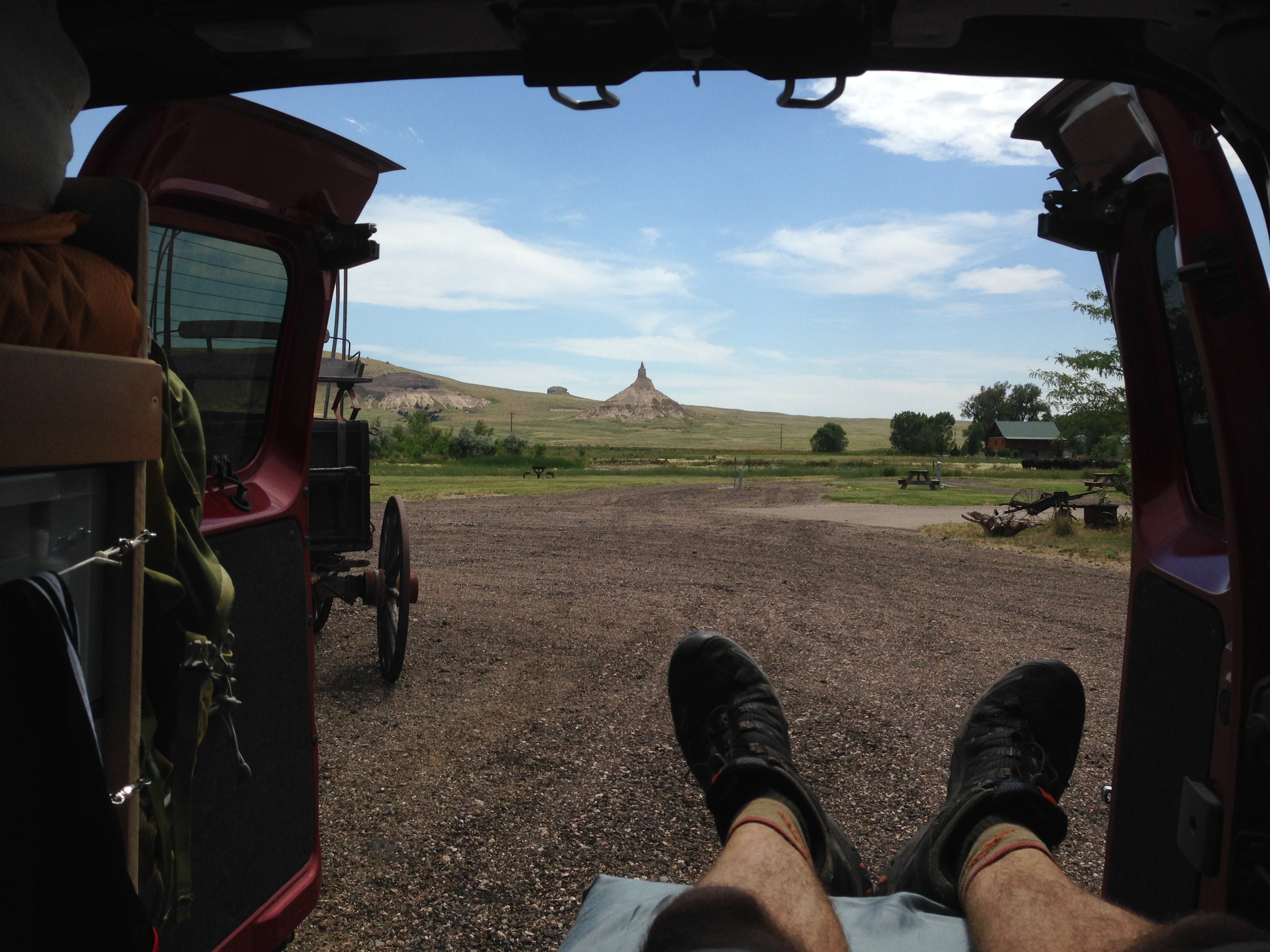
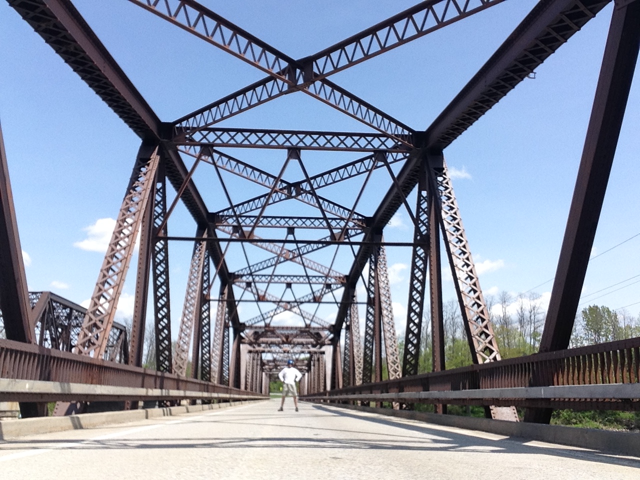
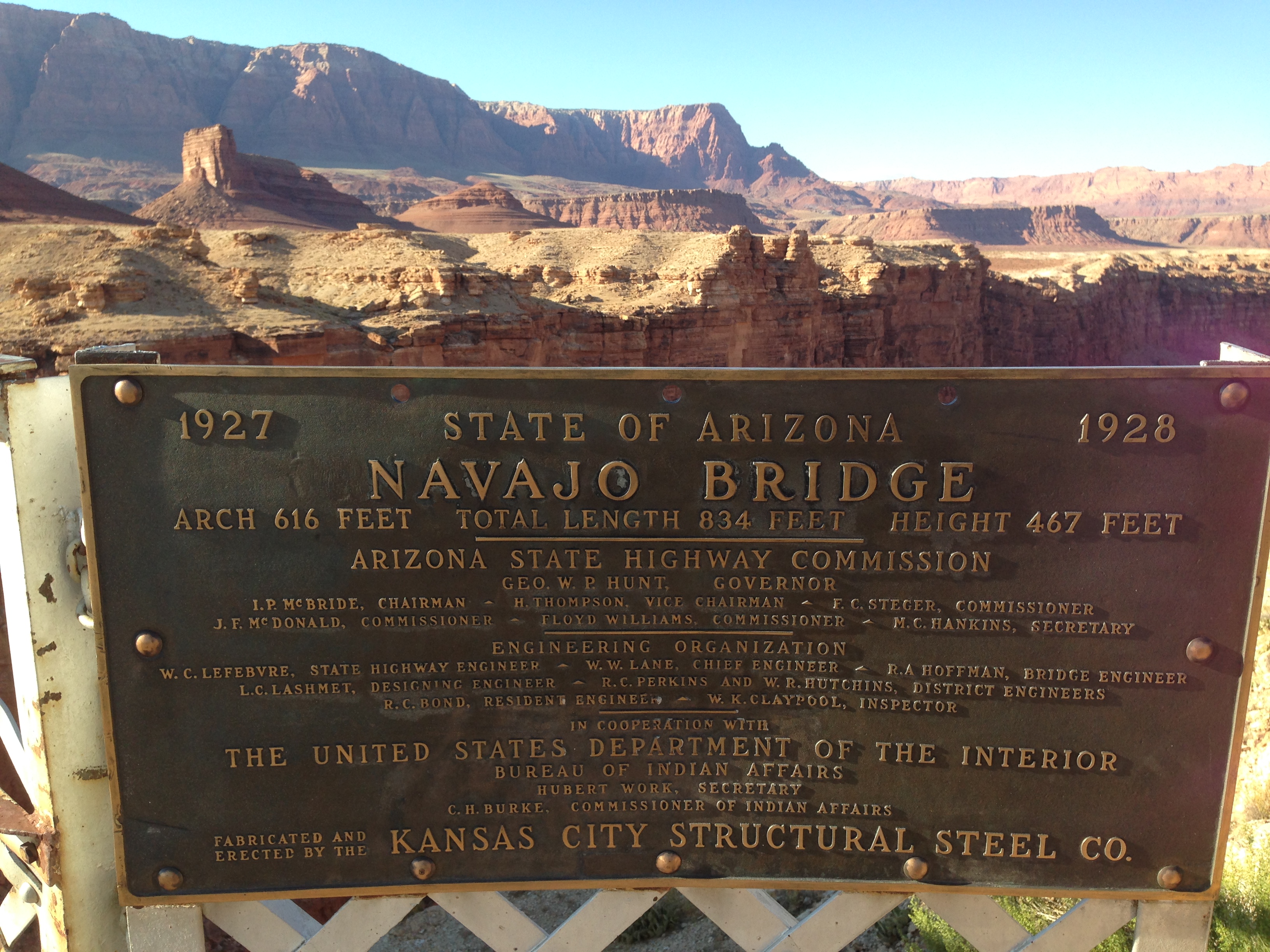
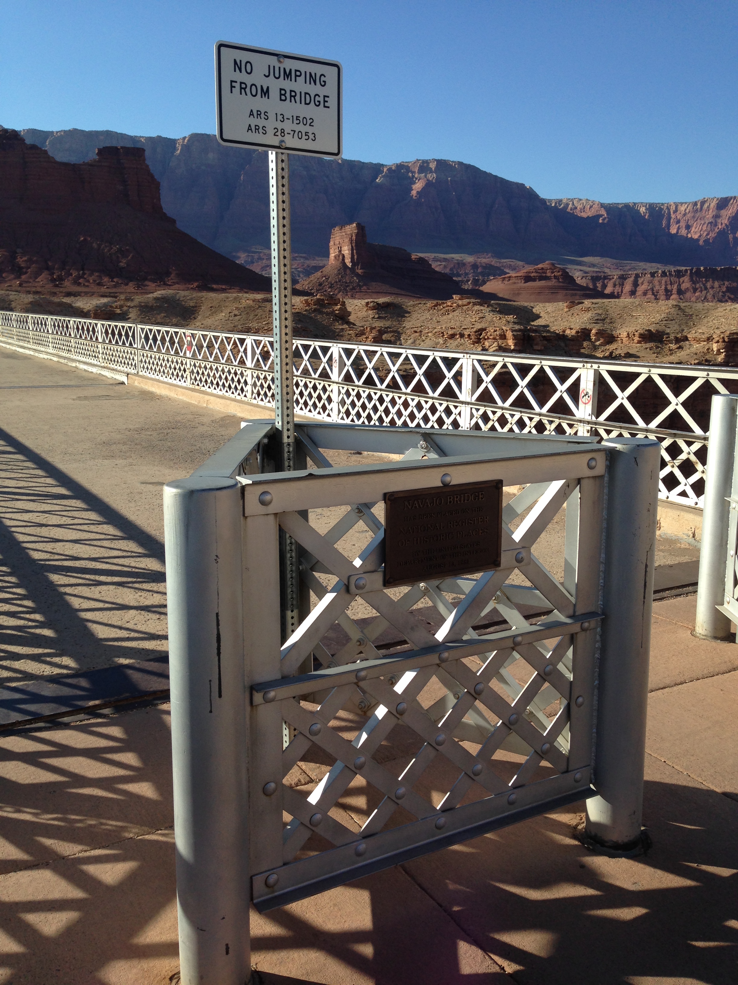
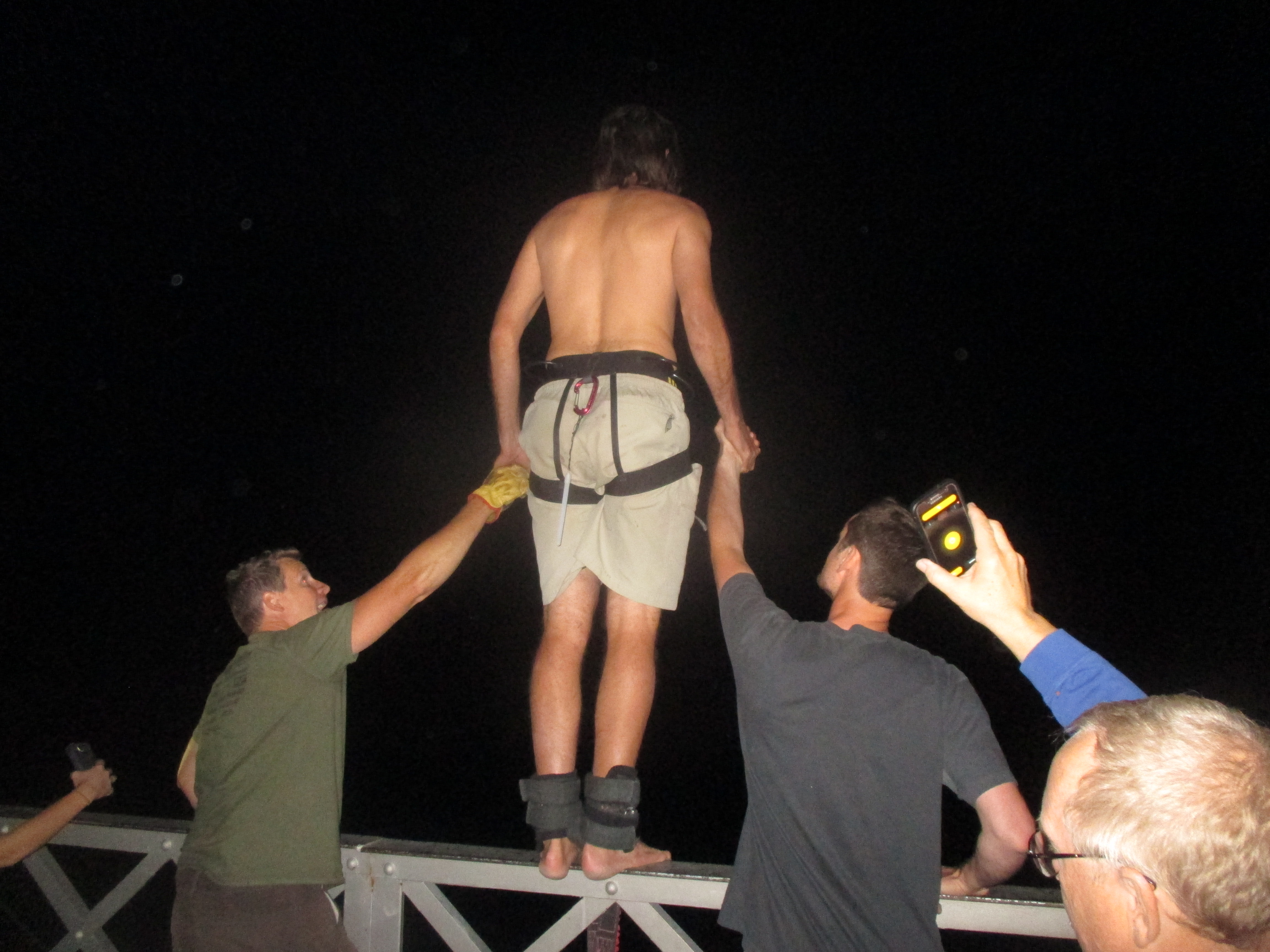
North of the Grand Canyon, along the Colorado River, resides one of the last places to cross this great chasm. An area known as Marble Canyon was the site of an engineering marvel, the 600+ feet long, Navajo Bridge, 467 feet above the river.

img_2675

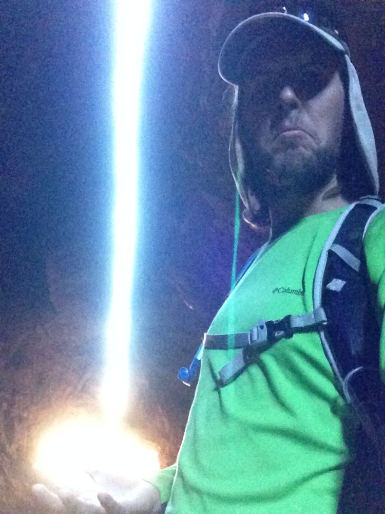
The very bridge that I would soon jump off of, attached to a bungee cord! The jump was scheduled for night-time, during a full moon, partially because the air is calmer at night, and partially because the bridge has “No Jumping” signs posted.

img_2679

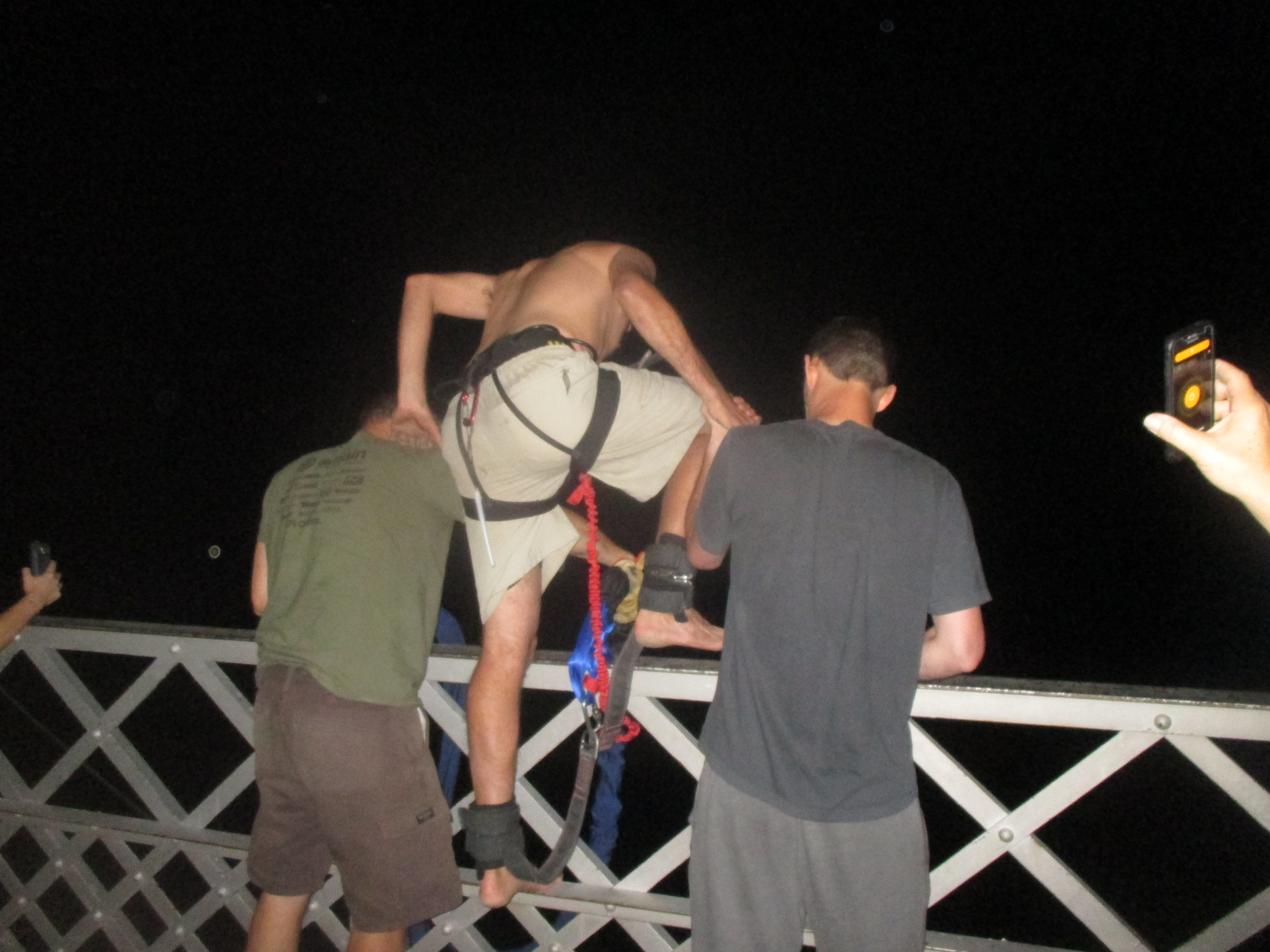
I pulled up at dusk, walked the bridge, and my hands were sweating already. The bungee master, Chris, arrived, then briefed us, before we helped him haul gear out to the center of the bridge. The process sounded simple enough, Chris strapped a huge rubber band to your ankles, you climbed the railing, standing on the brink of the void, then just jump! Afterward, a rope was lowered down, you clipped your harness to the rope, then the other jumpers pulled you up like a team of mules!

img_5630 img_5626

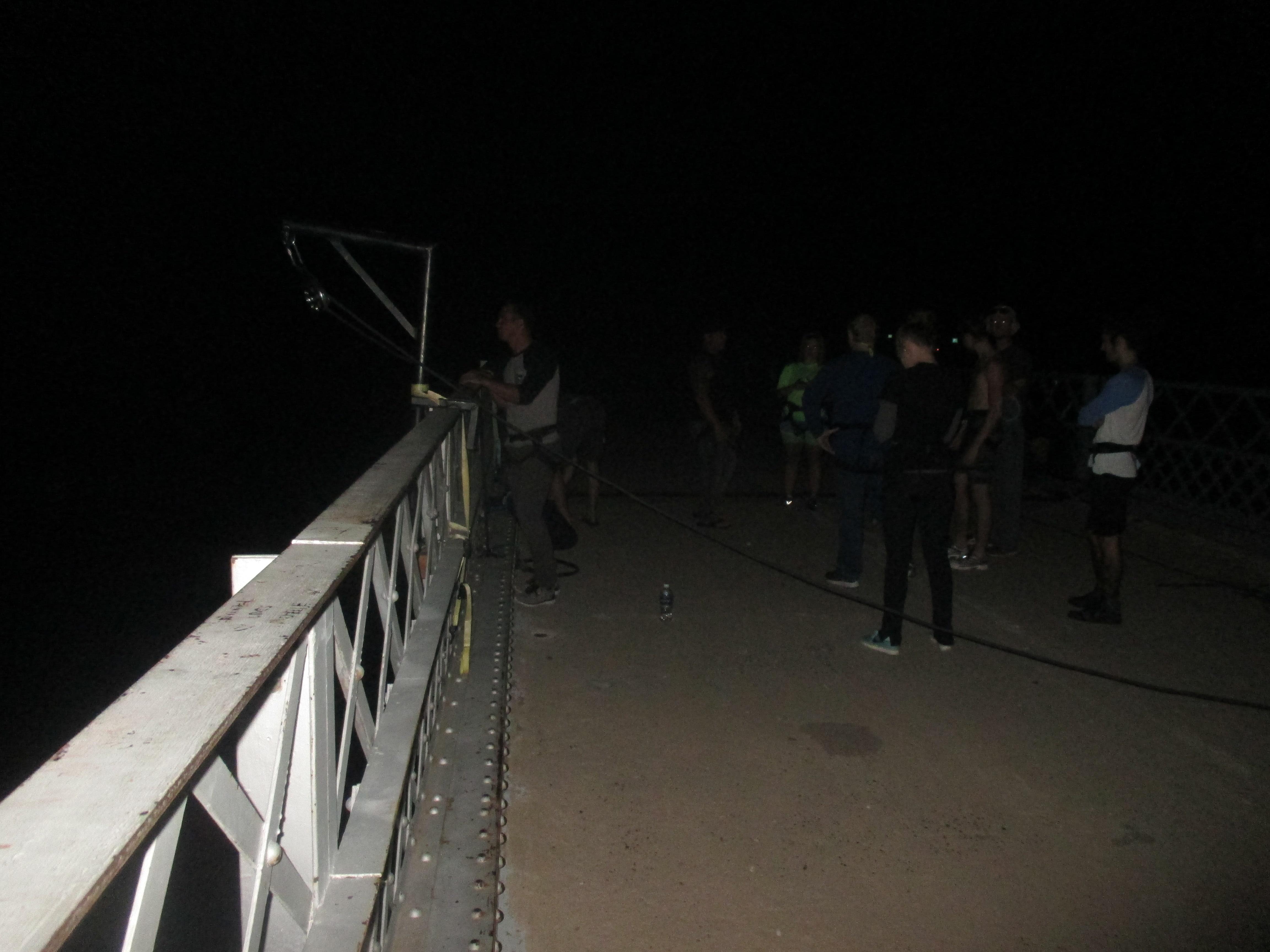
My nerves were pounding as we hauled up the jumper before me…I emptied my pockets, ditched my shoes, shirt, and hat…Chris clamped my ankles and game me the run down one final time…I took two hands and stood surprisingly calm on the five-inch wide railing…I looked out at the distant peaks, bathed in moonlight…Chris counted loudly, “3, 2, 1”…then I leapt, swan dive straight out…I don’t remember much after that point, it was all disorienting in the dark of midnight…but I fell, and fell, and fell…an odd feeling, but the mind had shut down beyond the point of being scared…catch…fling back upwards at 100 miles per hour…then I found myself above the cord and falling again back into the black depths beyond…a few more bounces and I settled, blood rushing to my head…the rope came down…I was seated upright for the ride up and got epic views of the canyon…pushed away from the metal structure of the bridge…and hopped the railing back to concrete underfoot. That was an experience I’ve long wanted, and it lived up to the wait. Great camaraderie with the other jumpers, it was the first time for all 12 of us, one man even jumped twice for his 60th birthday!

img_5636 img_5637

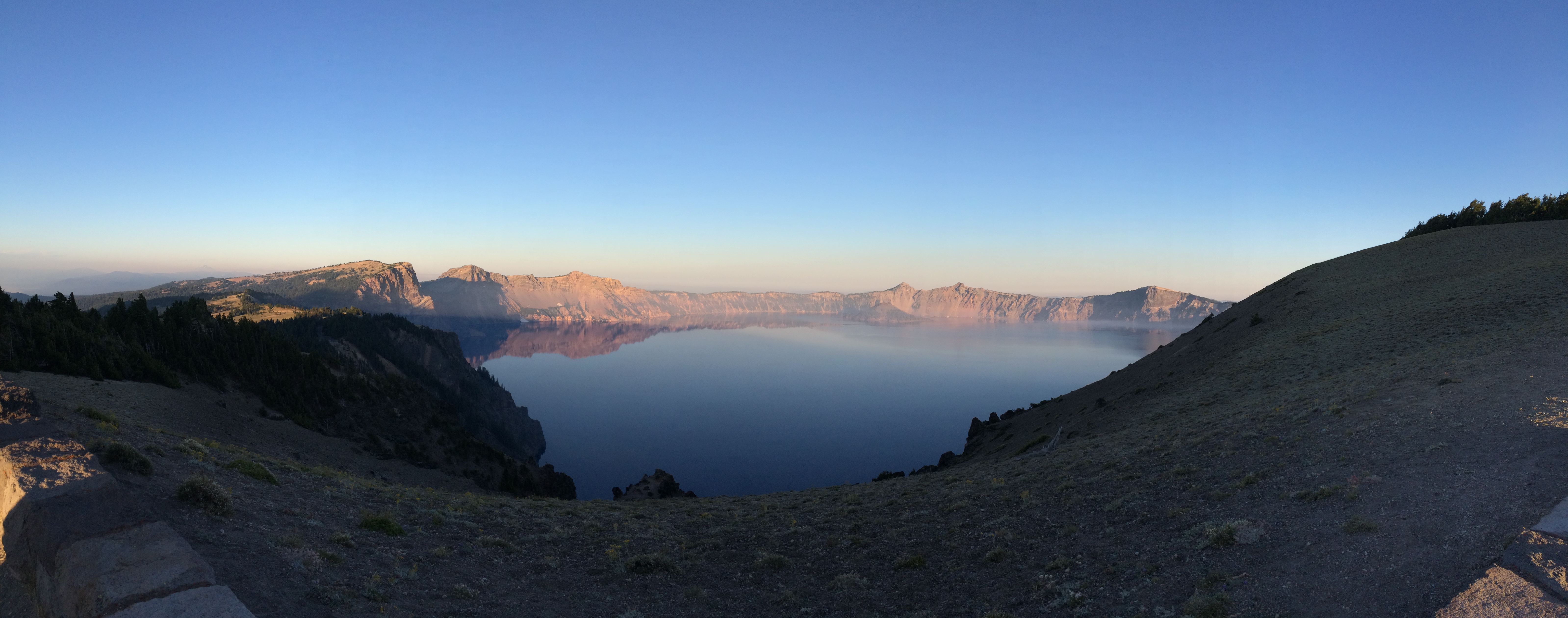
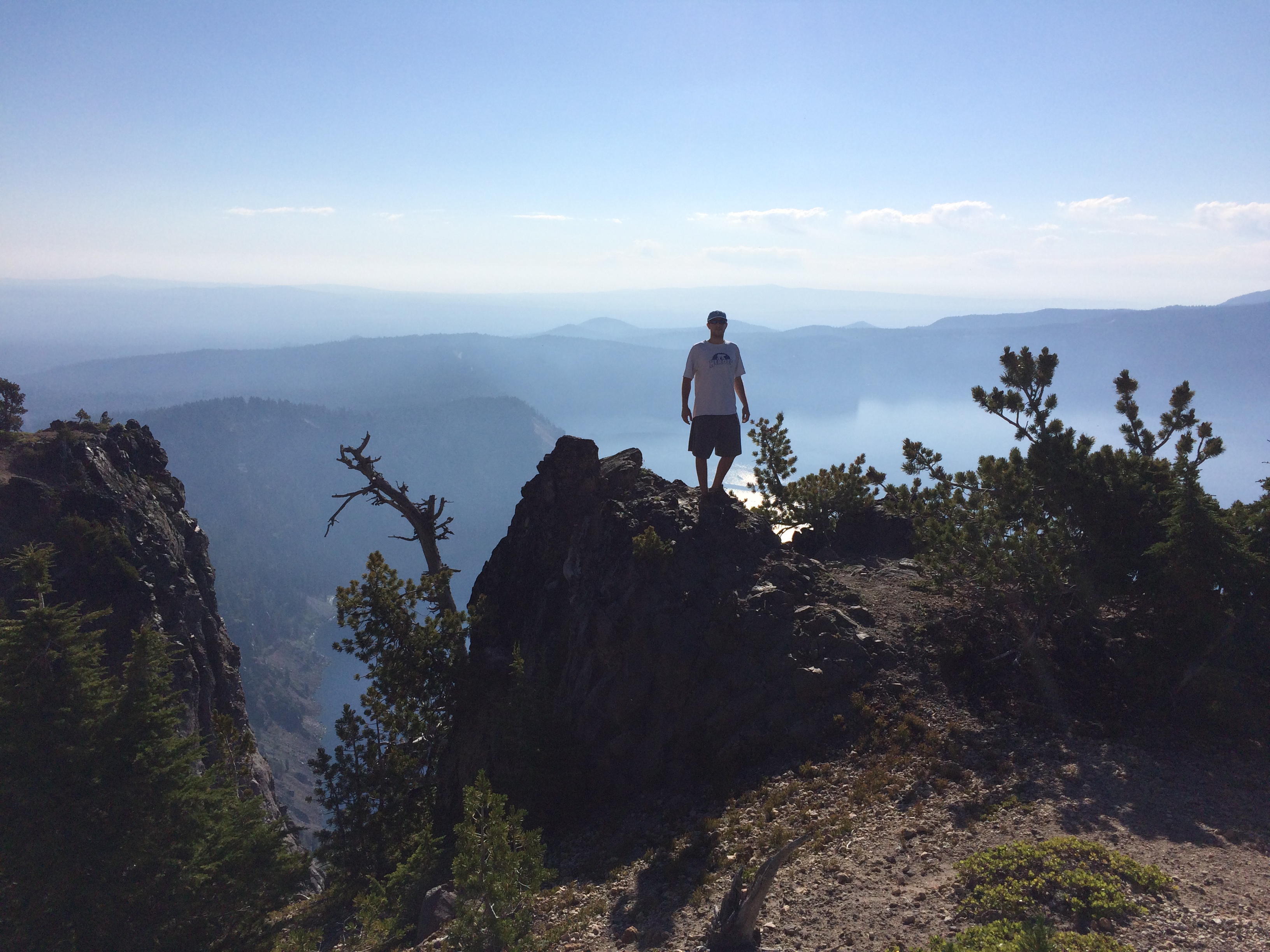
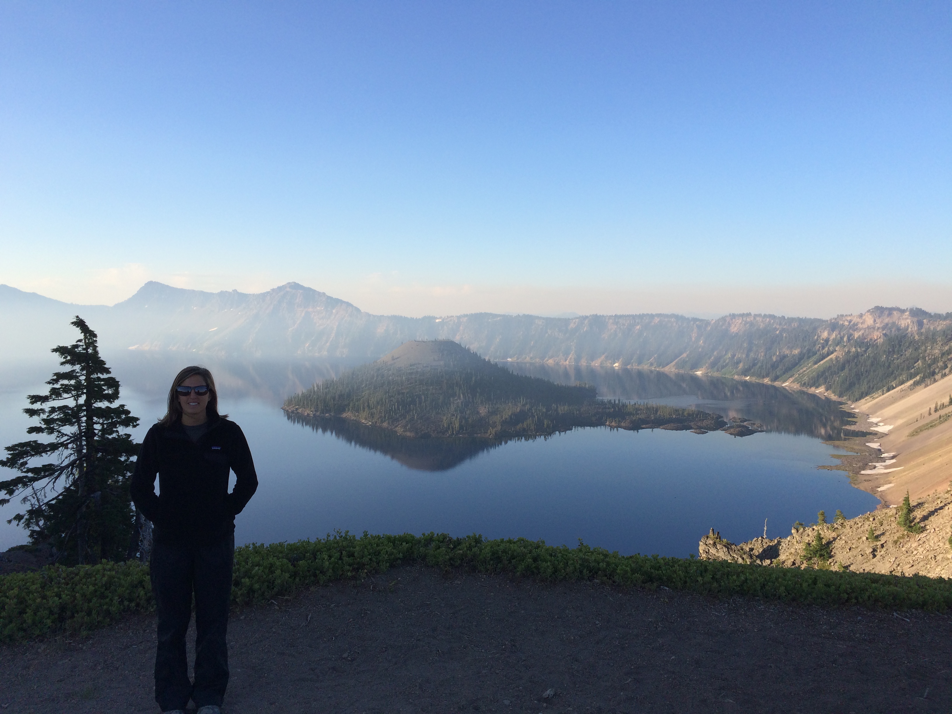
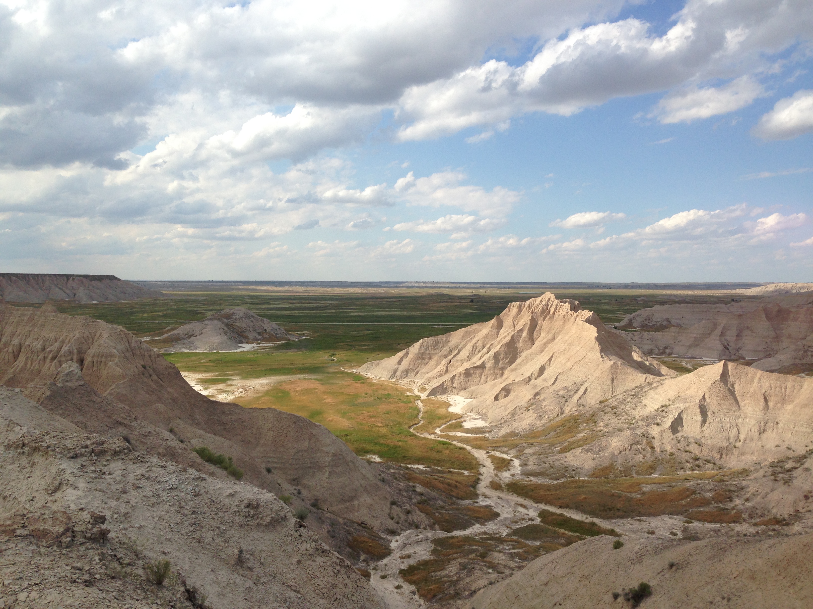
I slept in the woods just above the North Rim of the Grand Canyon, staged to hike to the bottom the following day. I slept snuggly in my winter sleeping bag, but when I woke up in the morning, my thermometer registered 27 degrees. I assembled my pack and hiked down the North Kaibab Trail, descending into the Grand Canyon around 8:30 AM, still in full armaments of clothing due to the cold.

img_5640

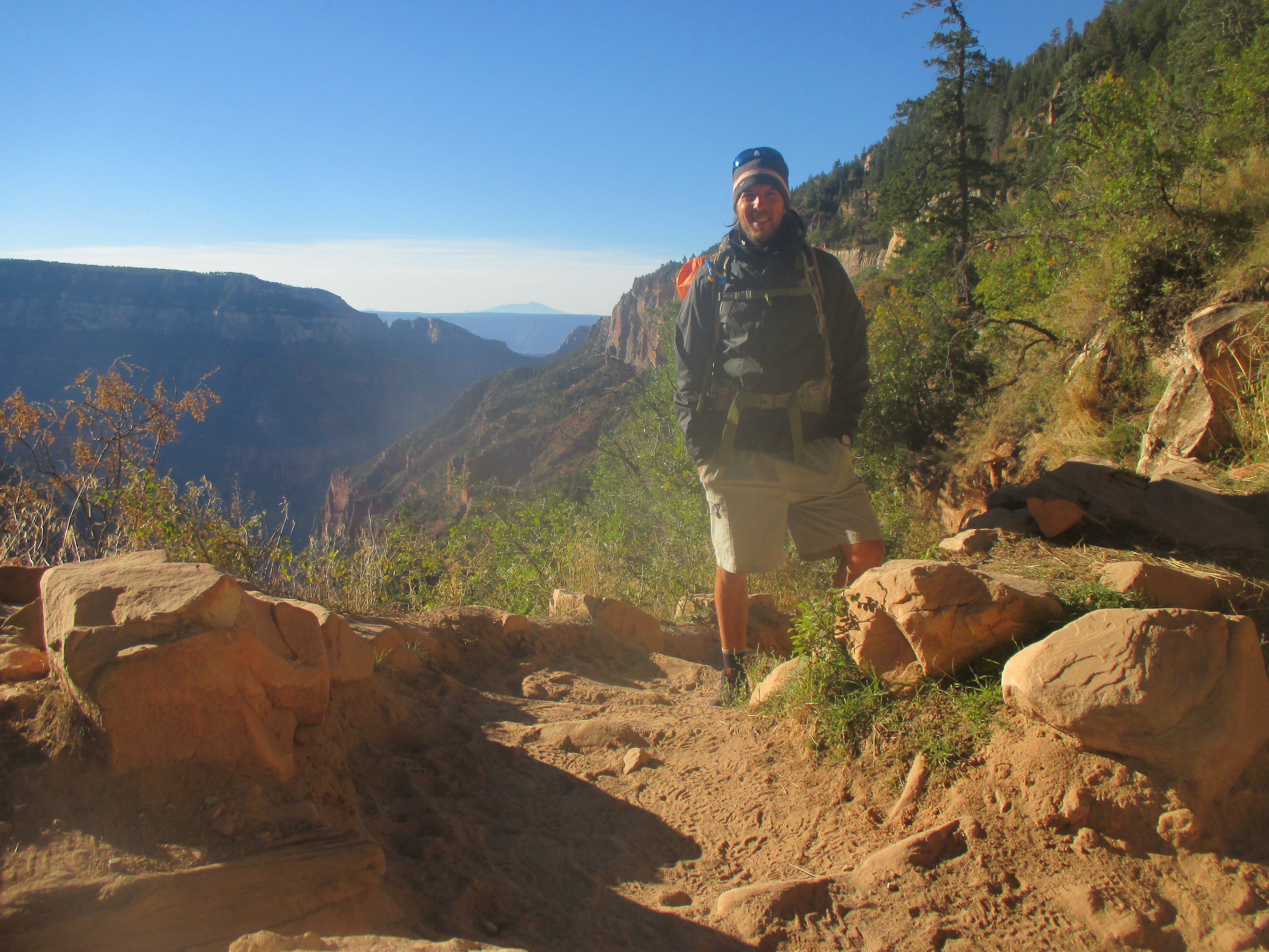
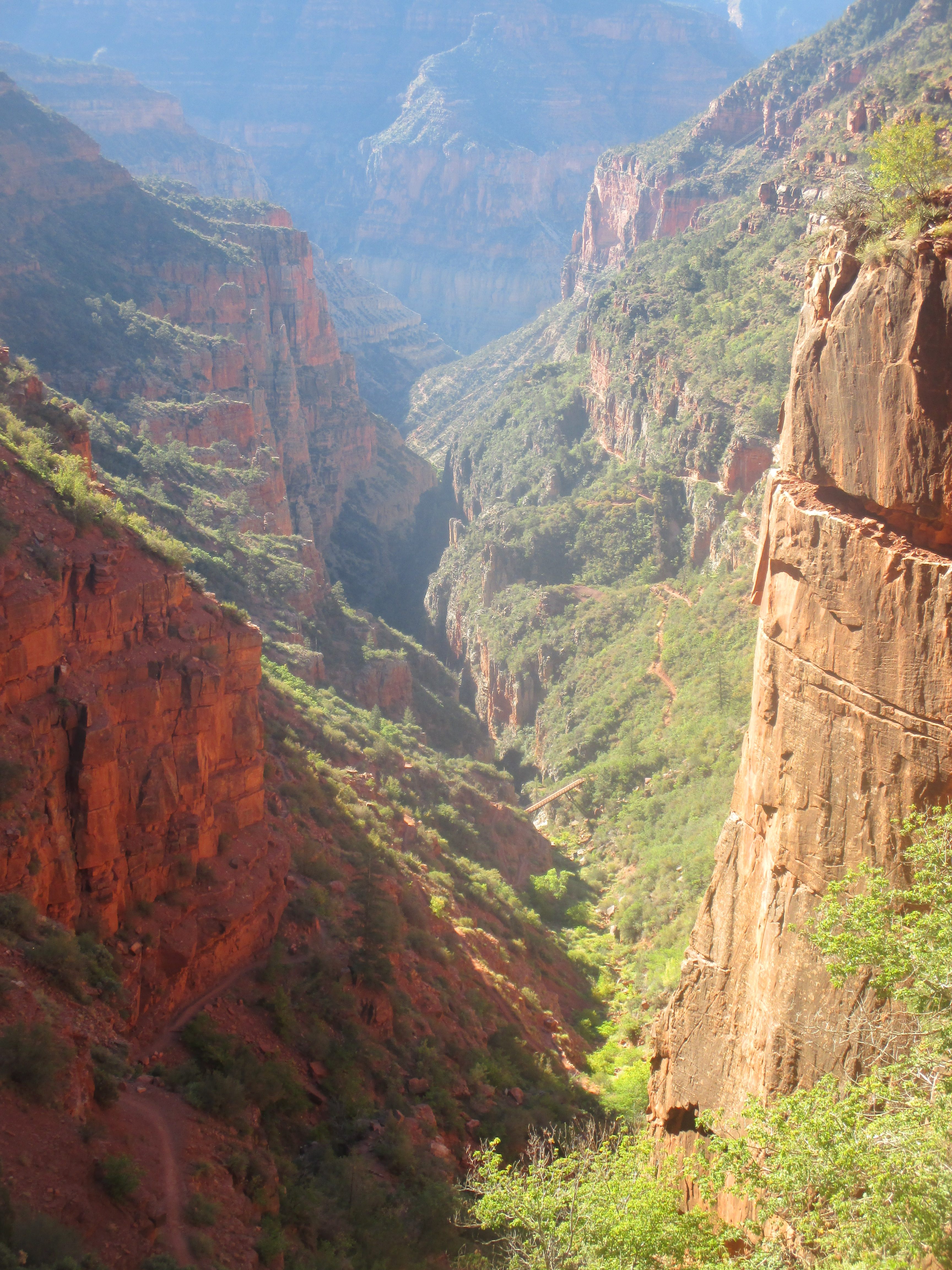
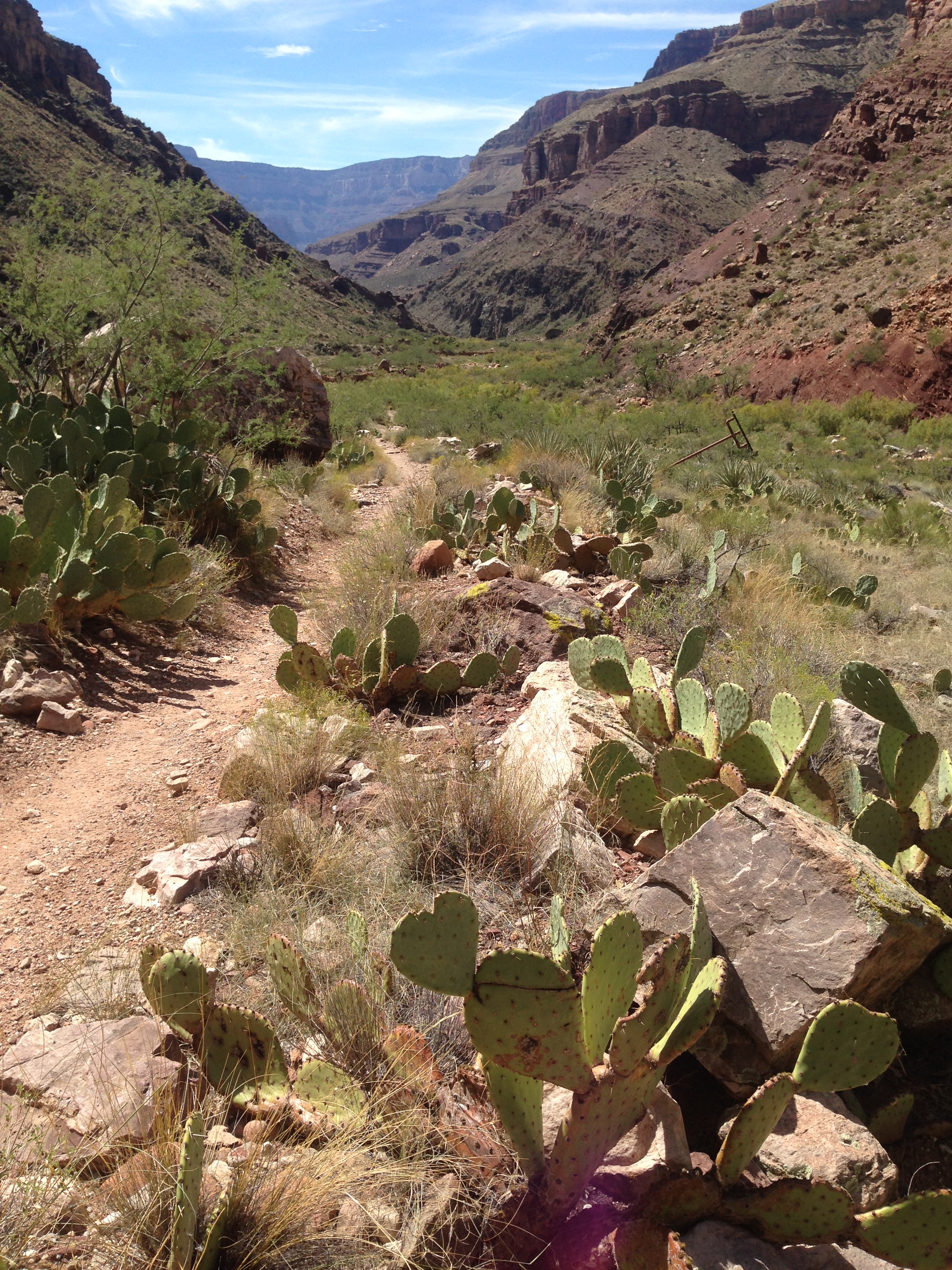
The trail immediately started with switchbacks and offered nice views of the side canyon it followed. It only took about 20 minutes until I shed all my layers and wished I had more to take off! After a substantial descent, the trail hit water, Bright Angel Creek, and would follow it all the way to the Colorado River, for a total of 14 miles and 5740 feet of elevation drop on the day.

img_5646 img_5657

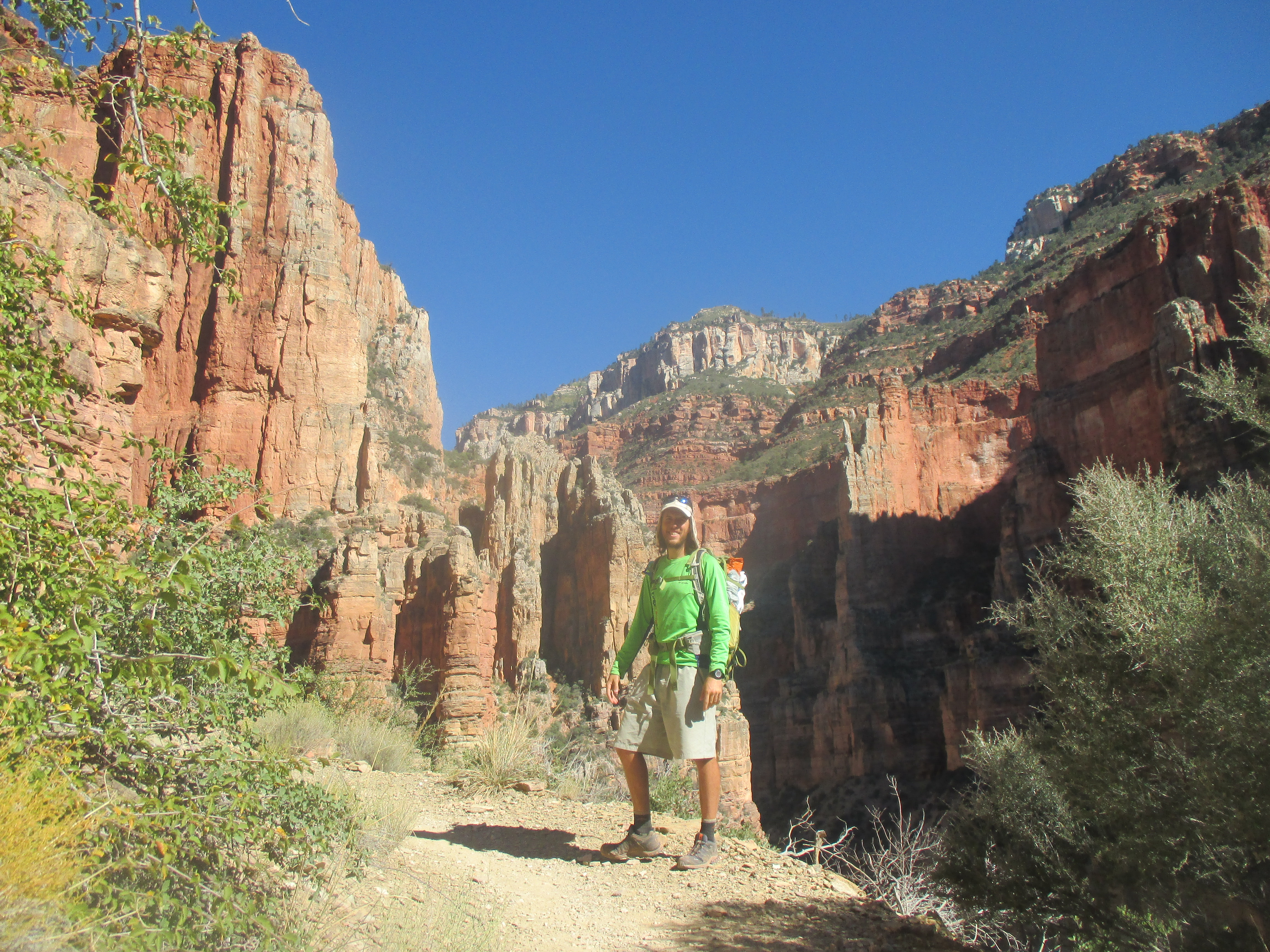
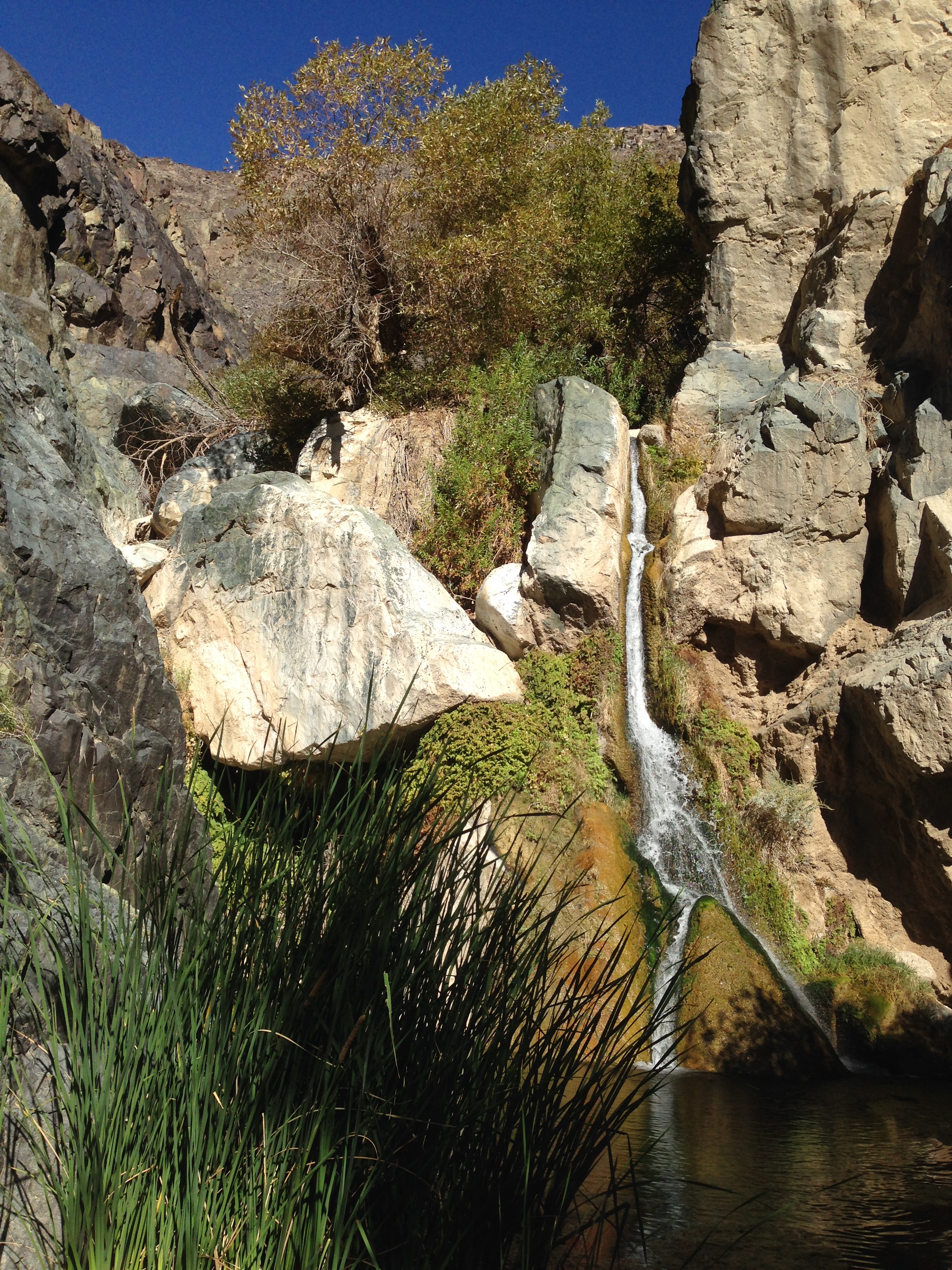
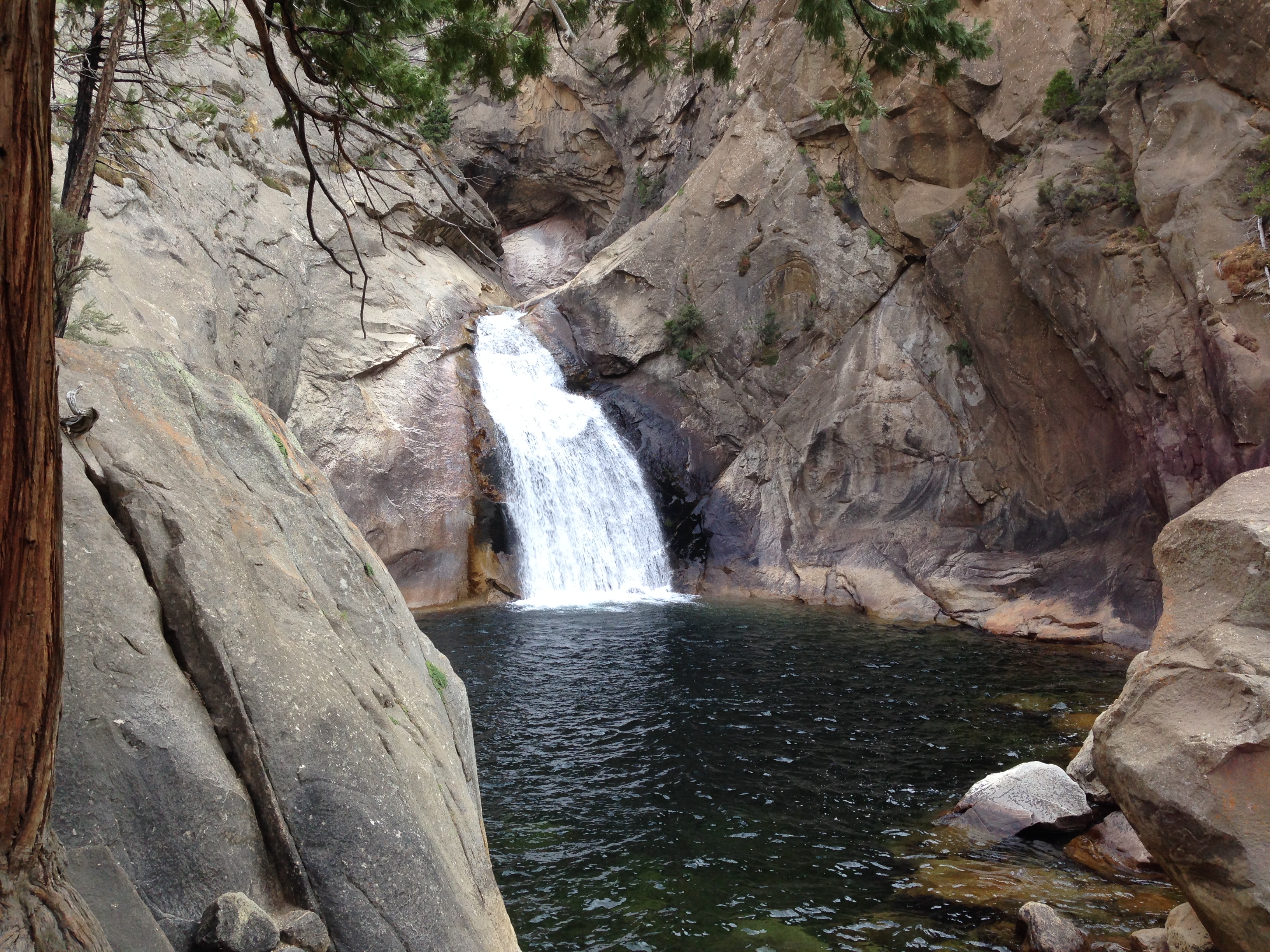
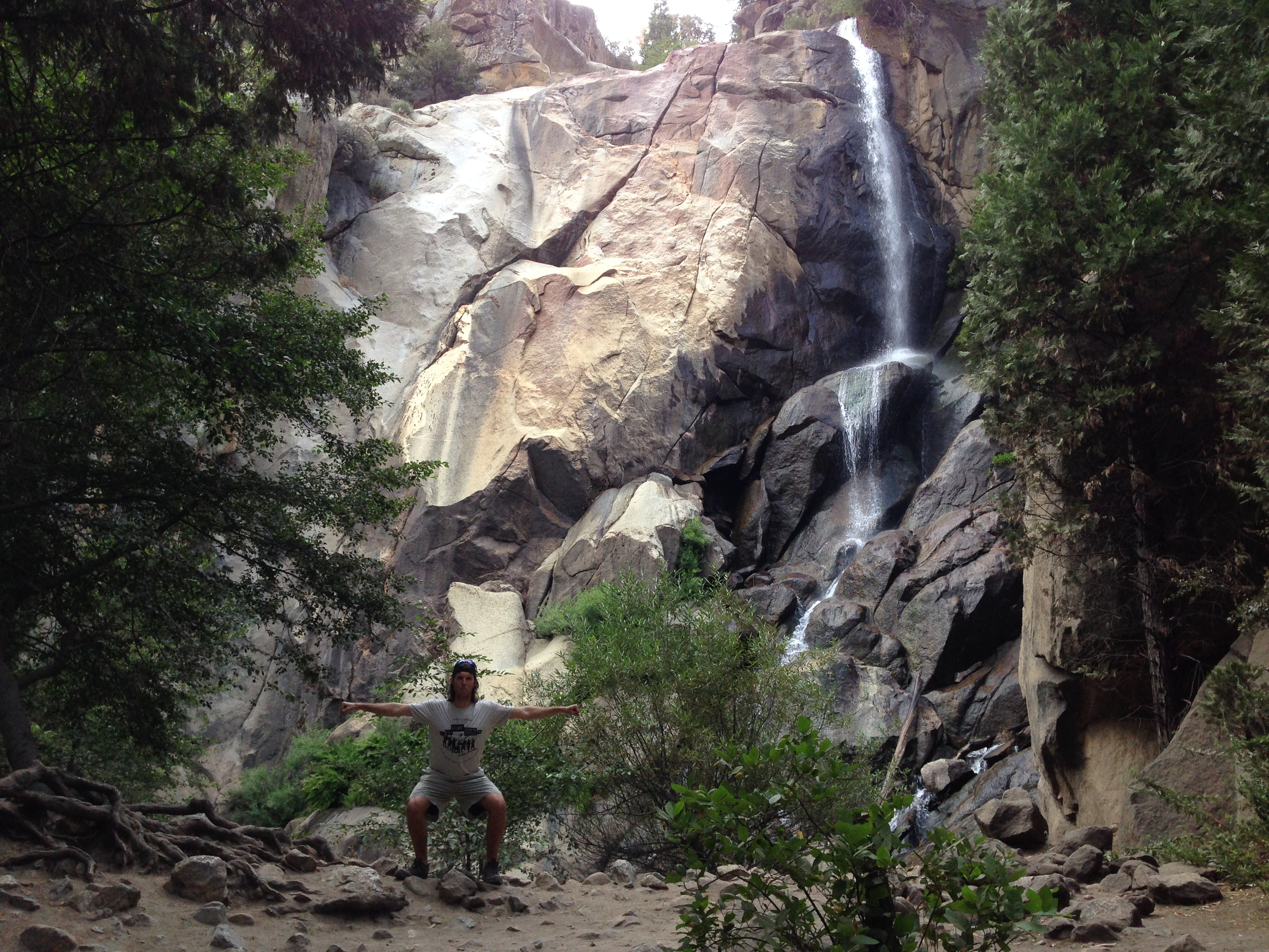
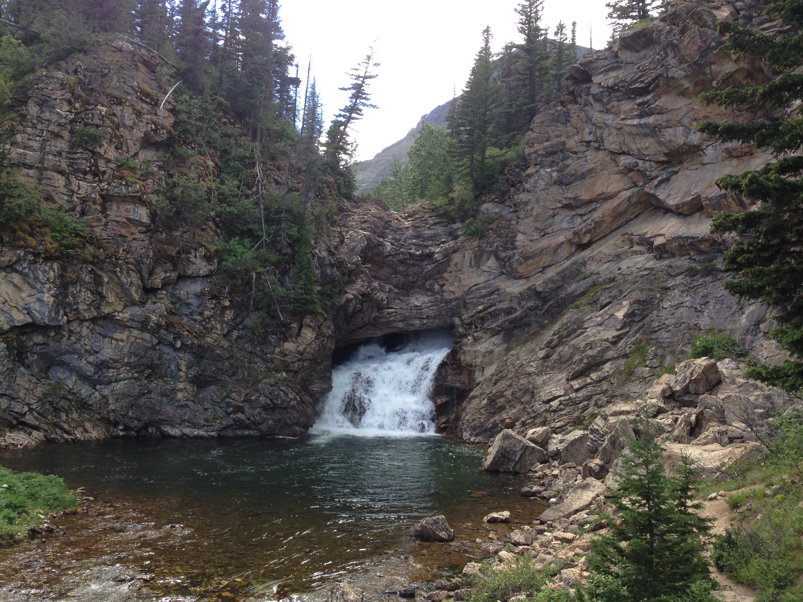
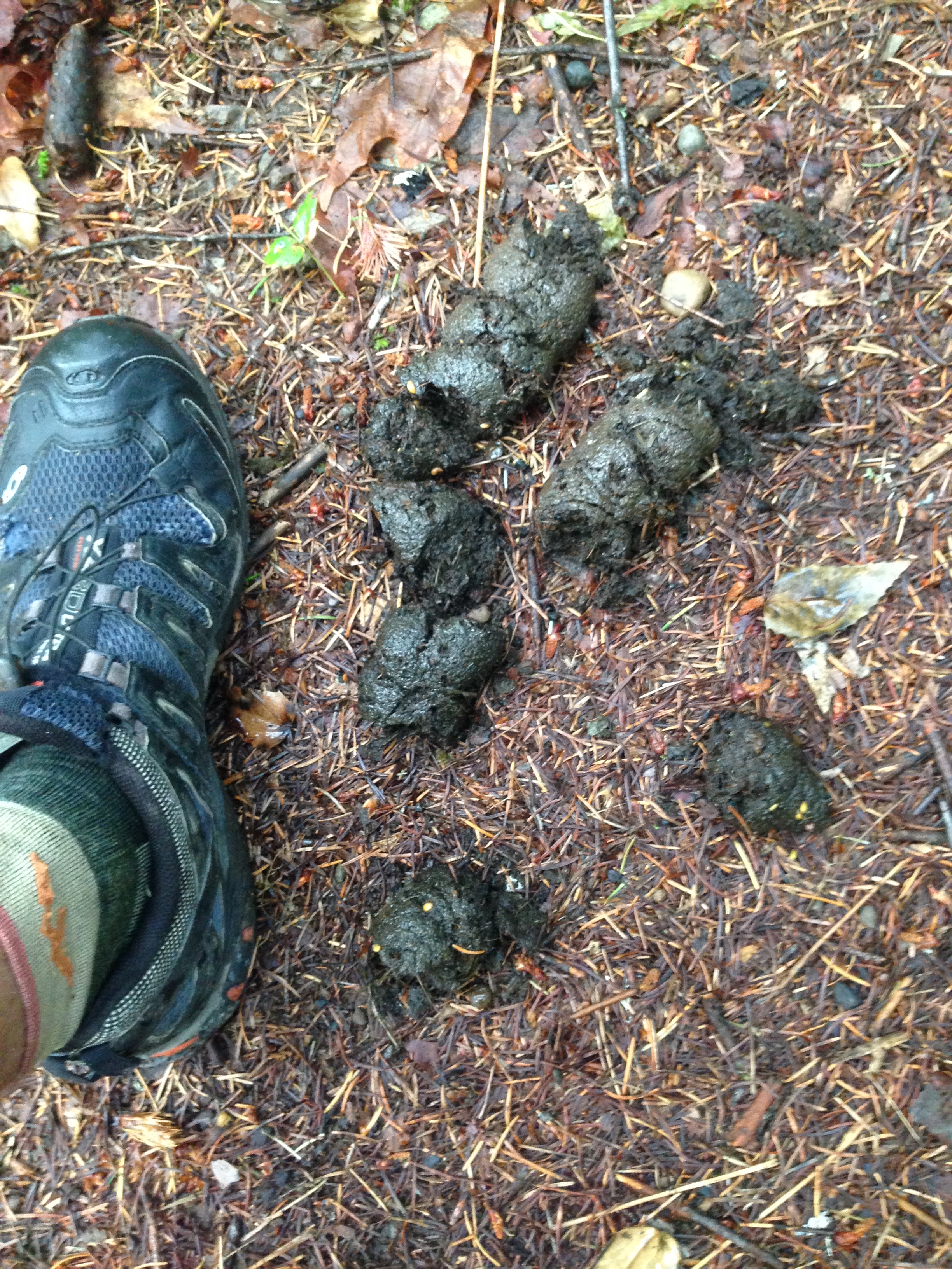
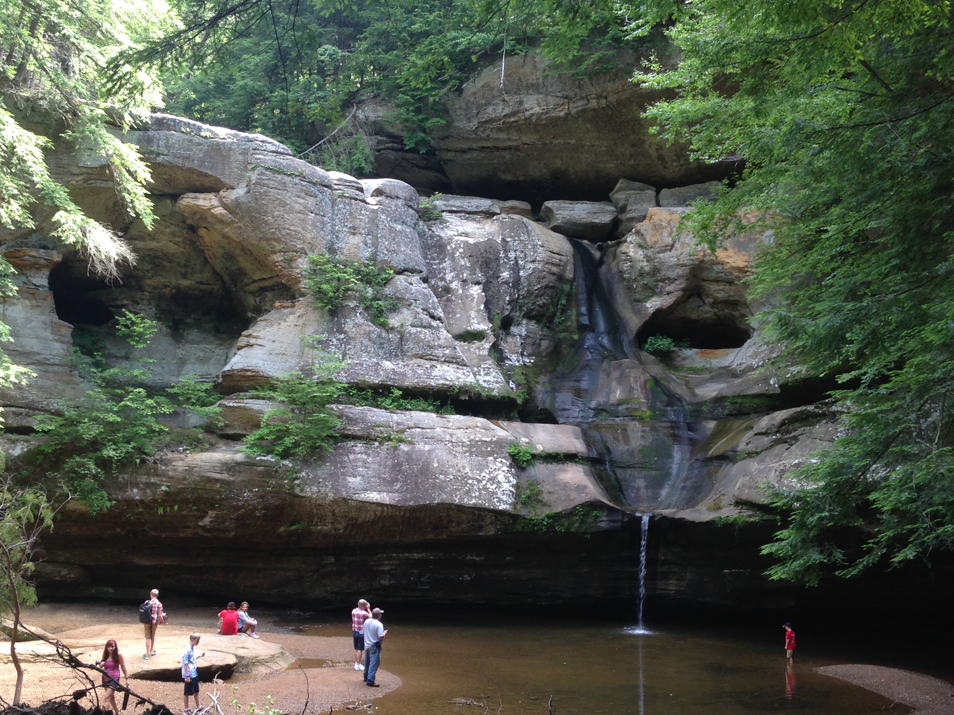
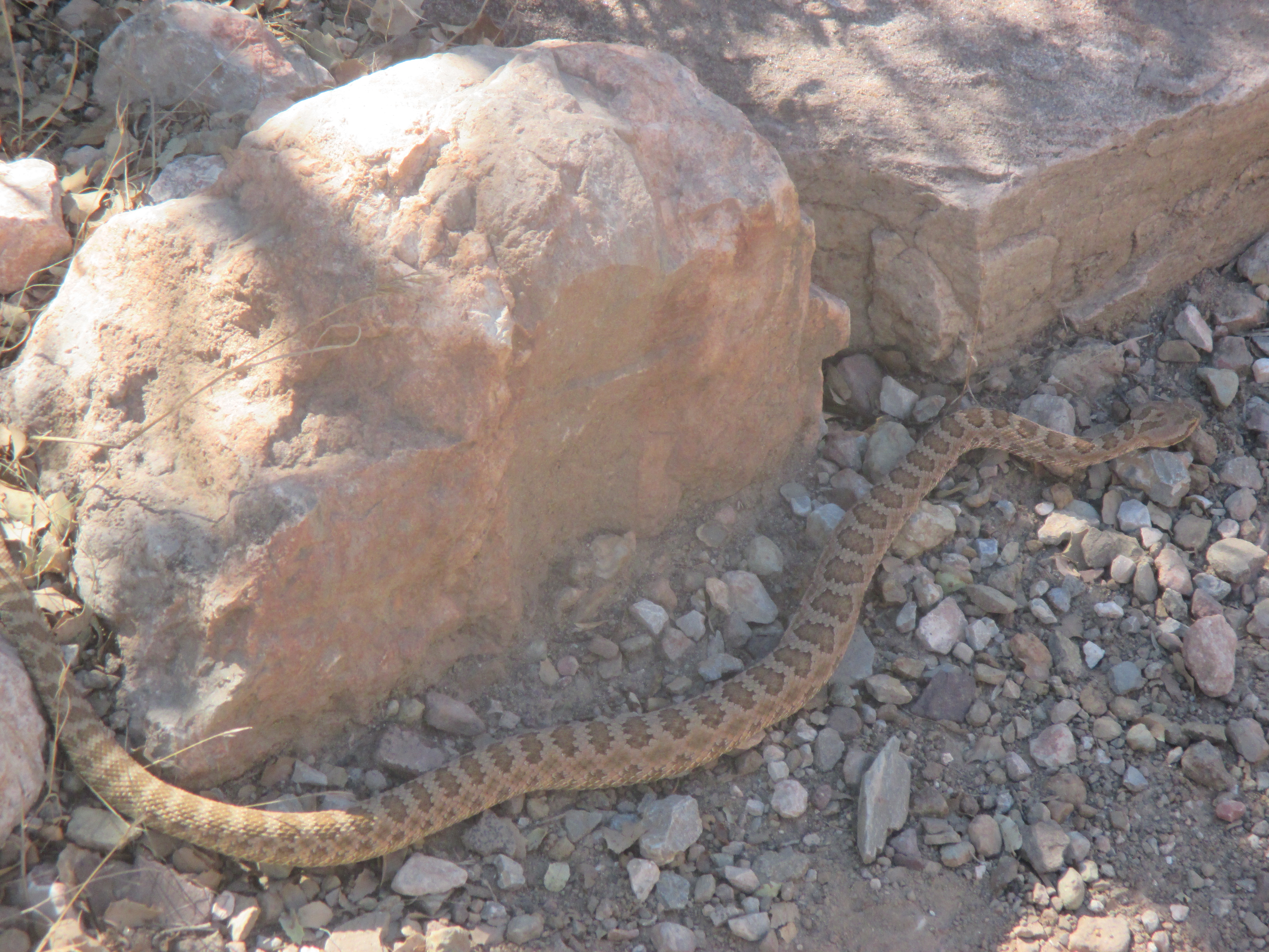
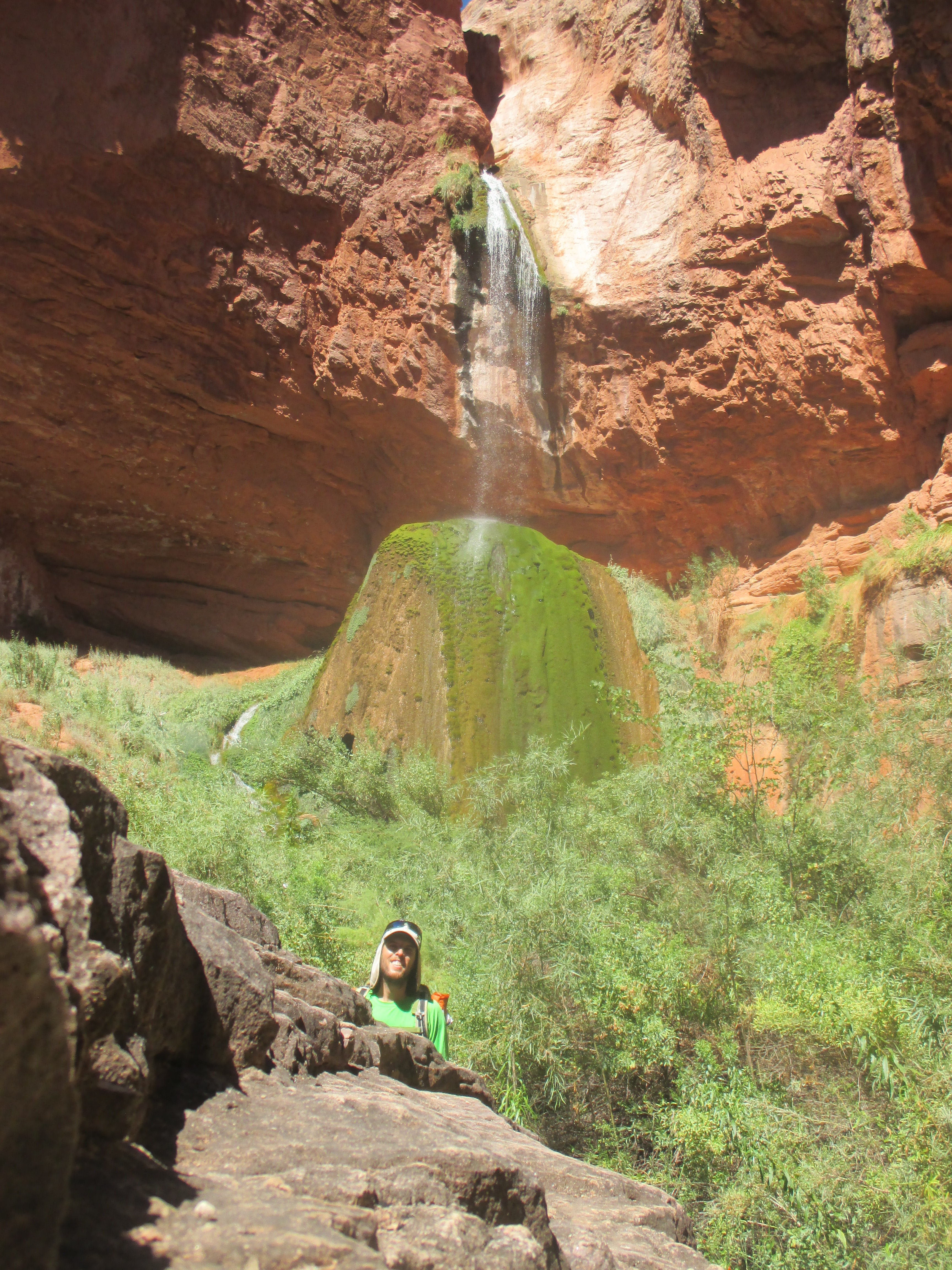
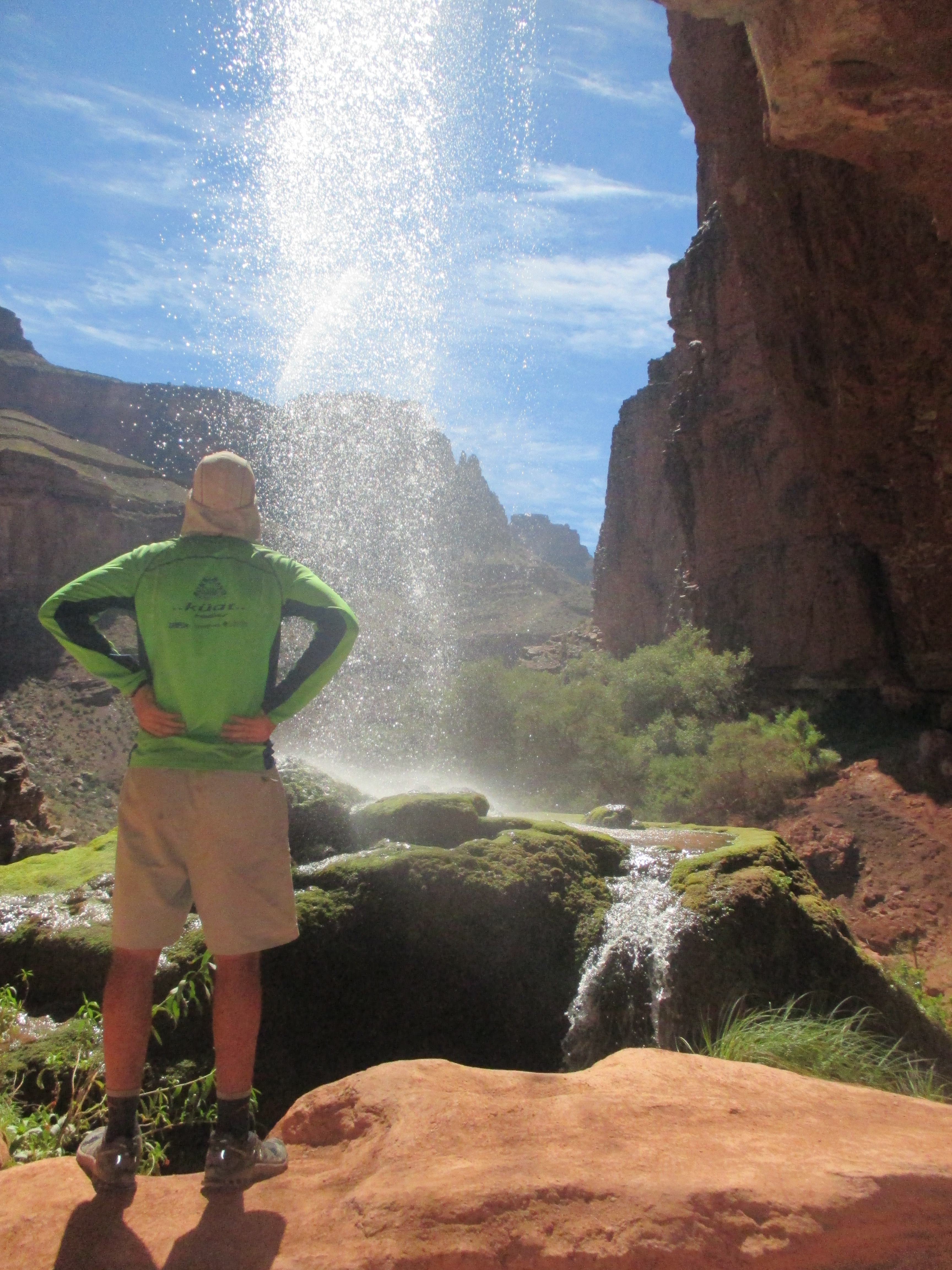
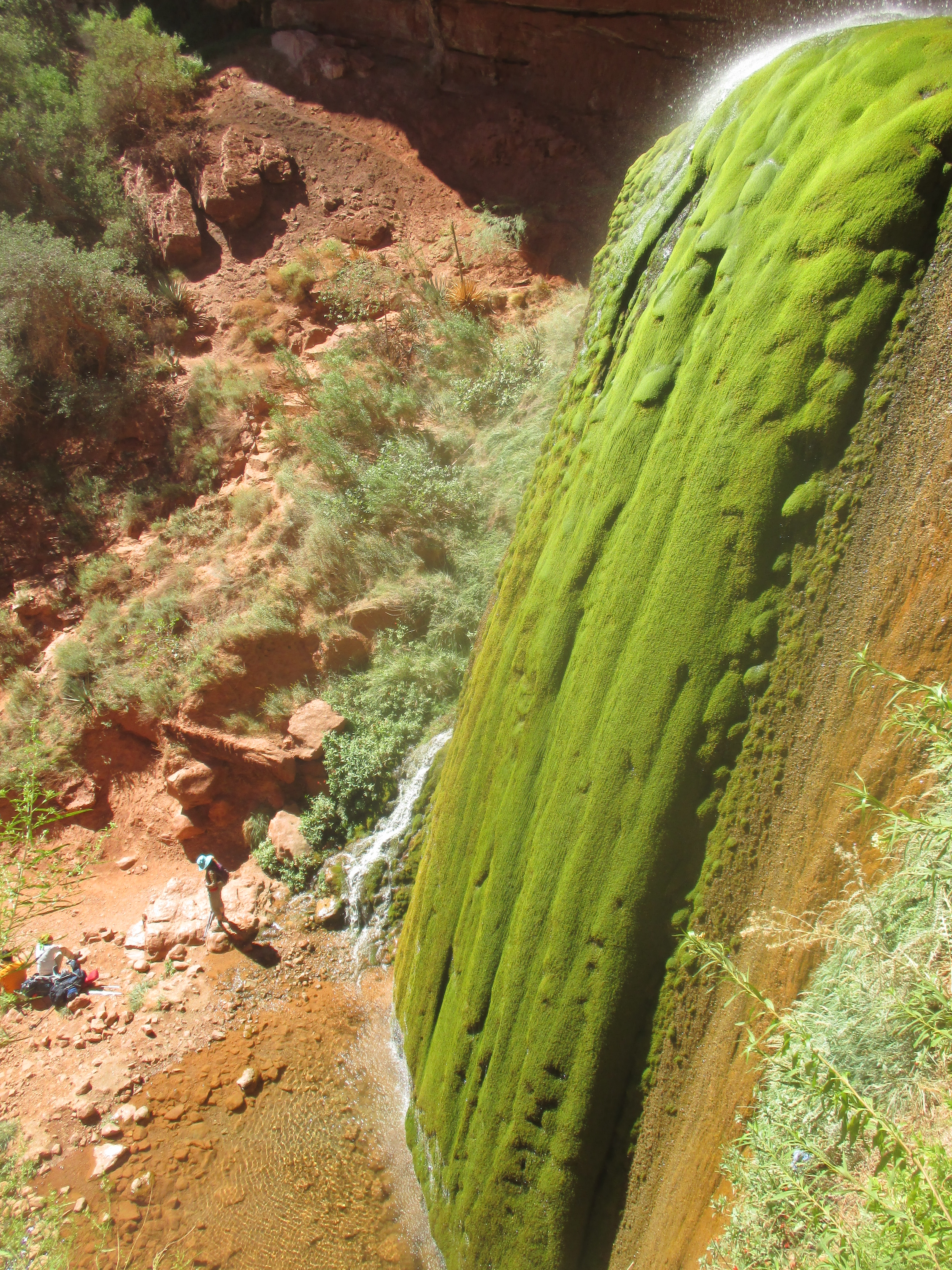
I hung out with a two foot Grand Canyon Rattlesnake in Cottonwood Campground, and another hiker recommended I take the quarter-mile side trail to Ribbon Falls.

img_5667

The Falls were immaculate, the most unique waterfall I’ve ever laid eyes upon. A small stream of water spouting from a sandstone shelf over a cavernous area, then landing on a massive, cone-shaped, stalagmite formation, carpeted in vibrant green moss. When the water hit the stalagmite, it pooled on top, and actually flowed out the back towards the cave, then looped down to the left side of the stalagmite through lush vegetation and created a crystal clear reflection pool on the canyon floor. An outstanding oasis of vegetation and beauty in this rocky, arid environment.

img_5673 img_5686 img_5690

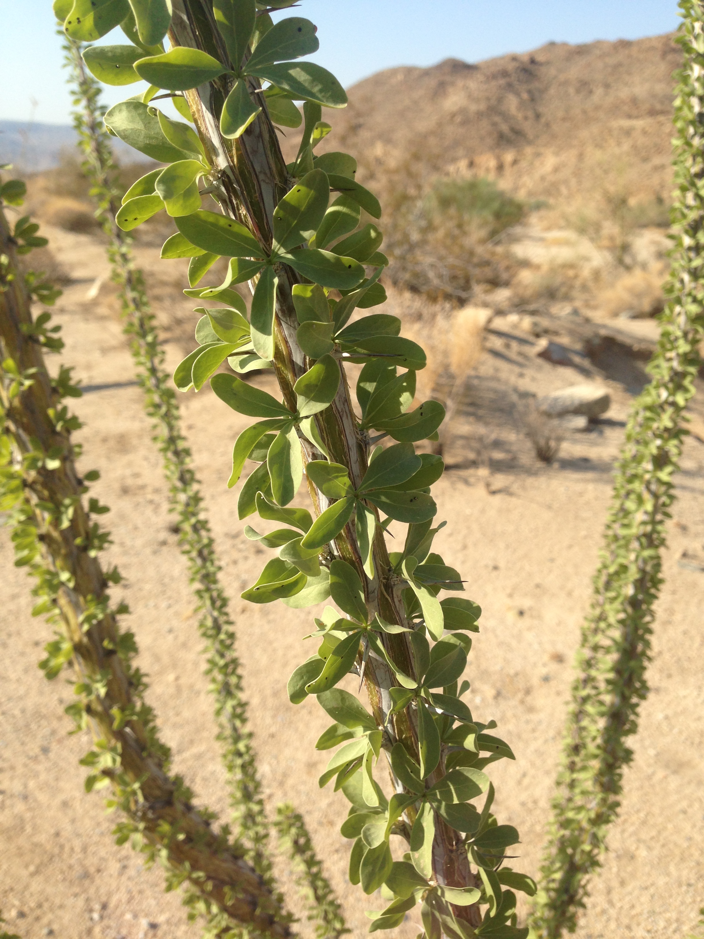
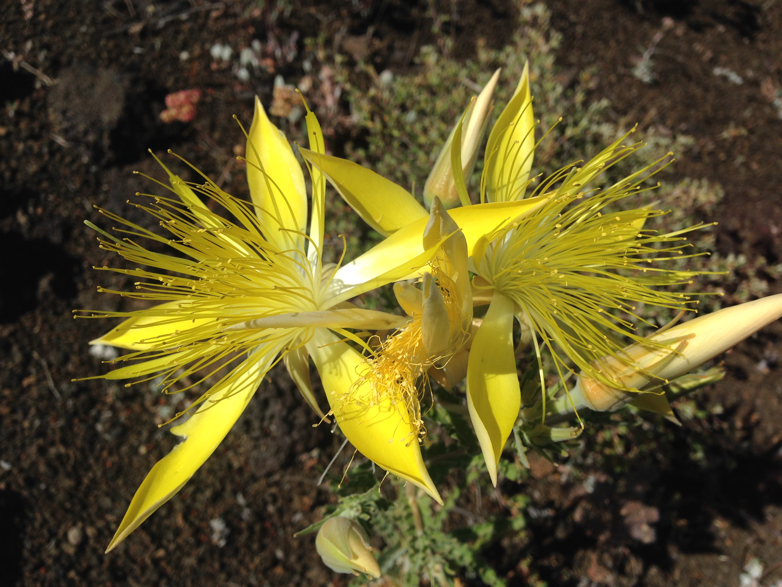
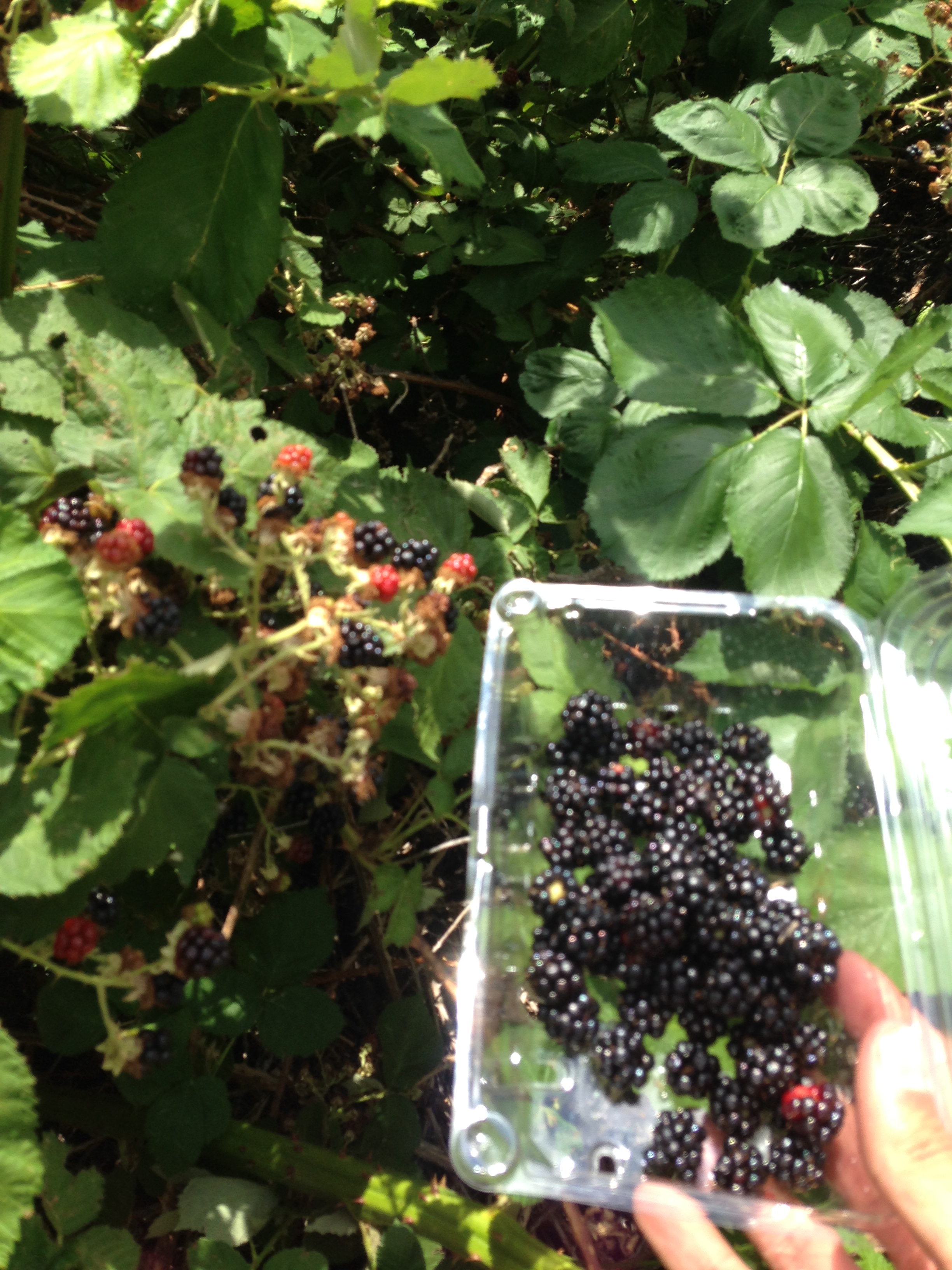
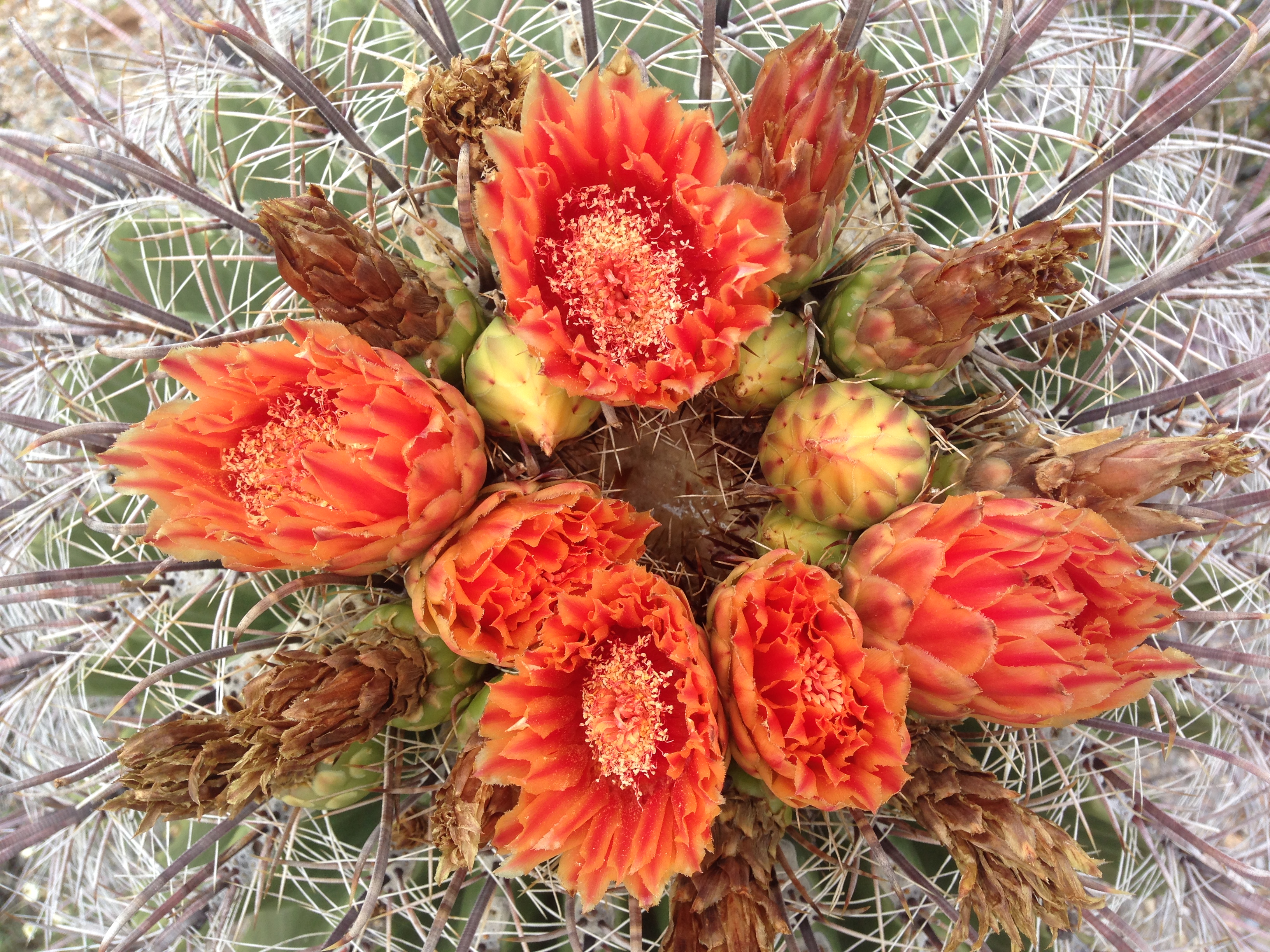
I loved seeing the bright purple fruits of the prickly pear cactus and got the notion to taste one. Behind the skin was the most decadent pink flesh, sweet and juicy, it reminded me of pink dragon fruit, but then I had dozens of micro splinters in my fingertips for the next hour…worth it!

img_2704

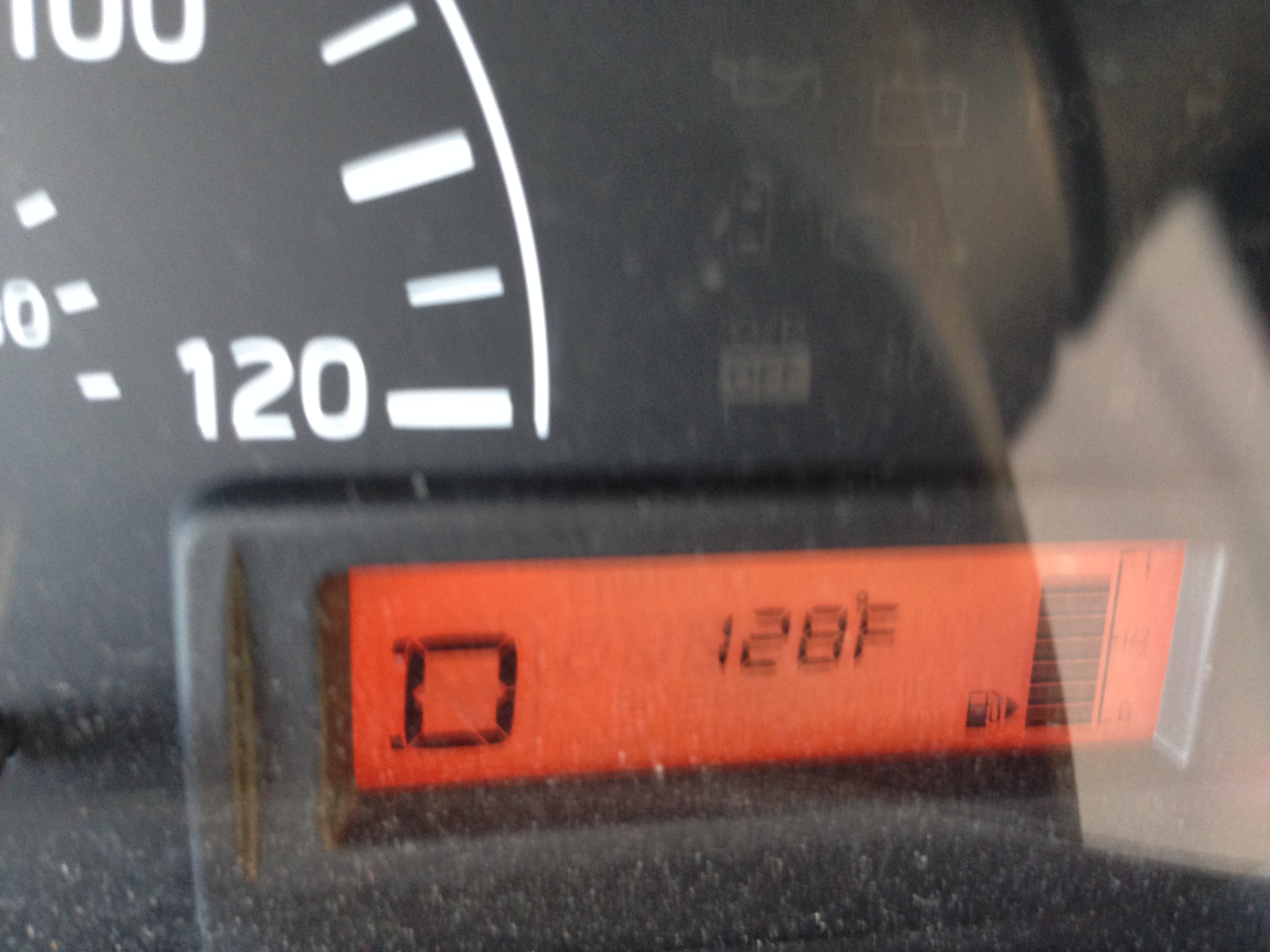
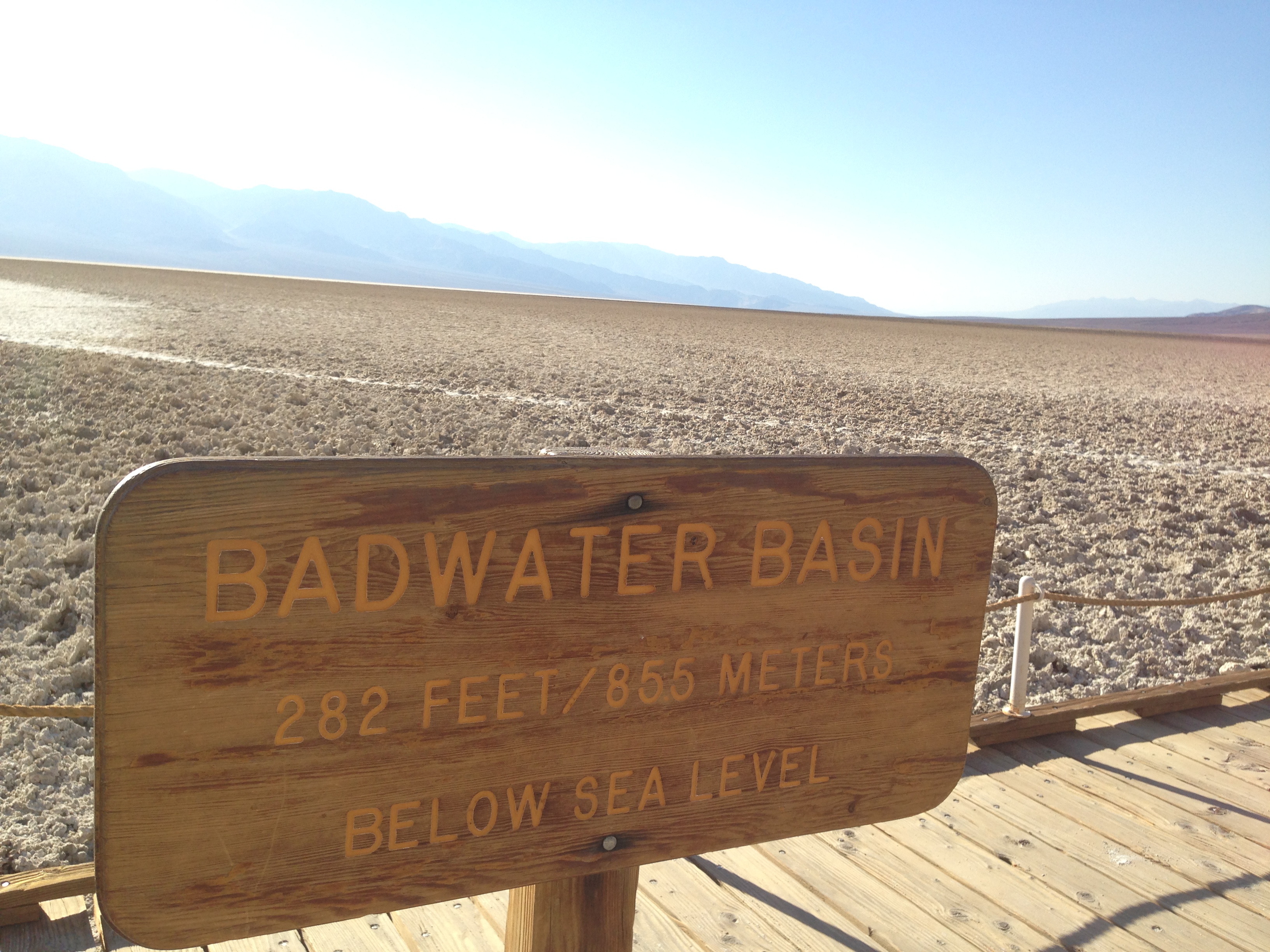
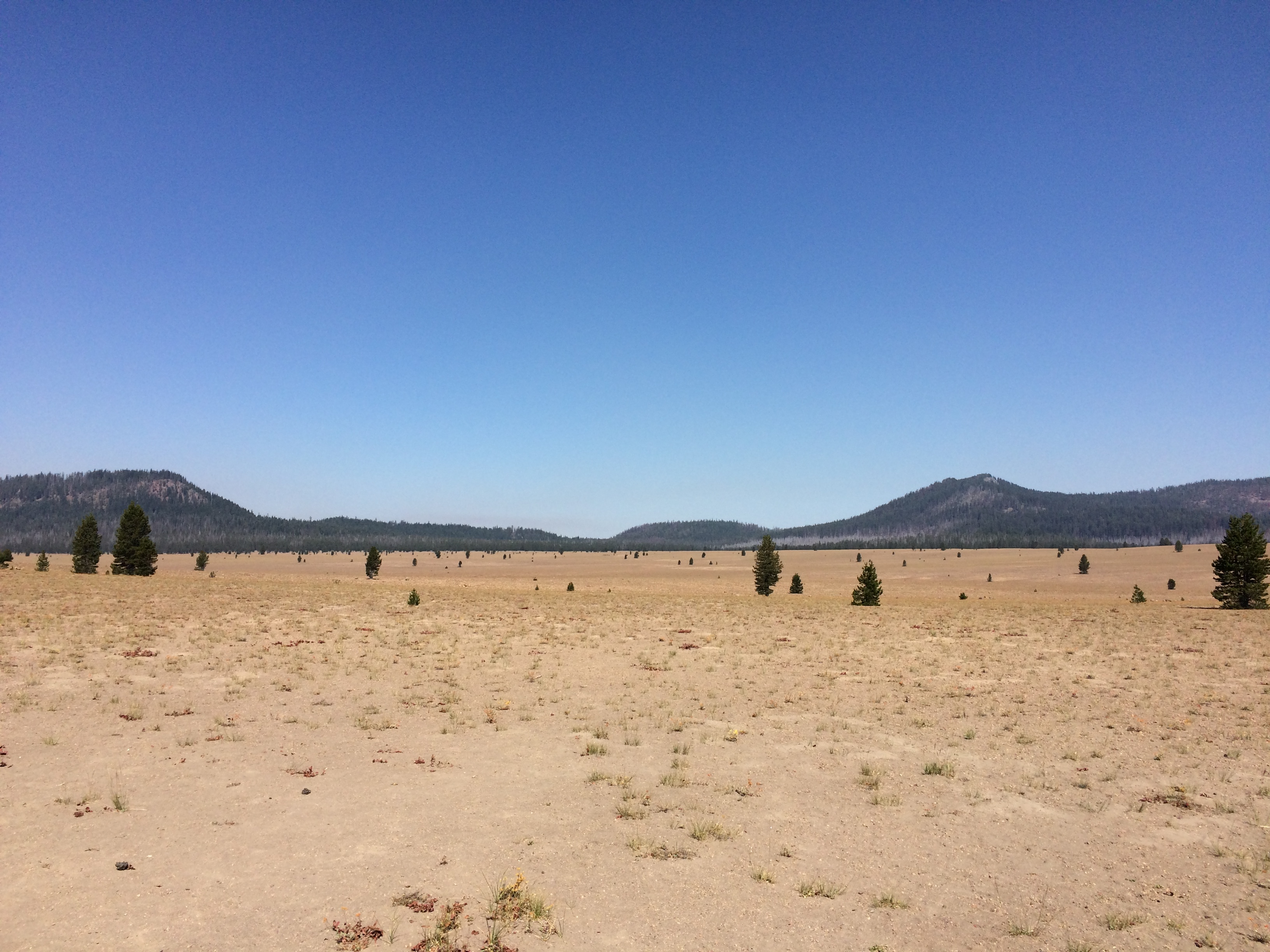
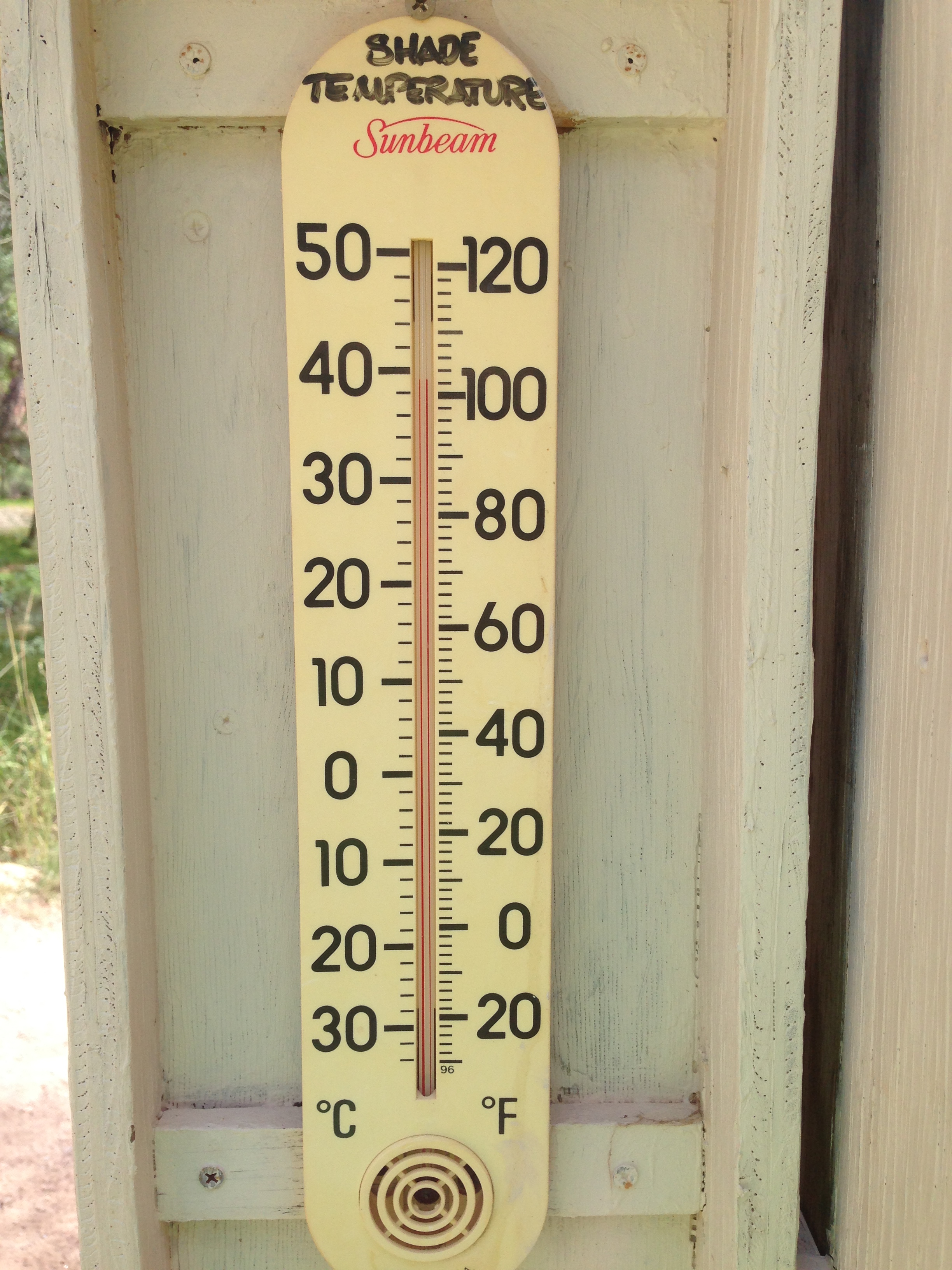
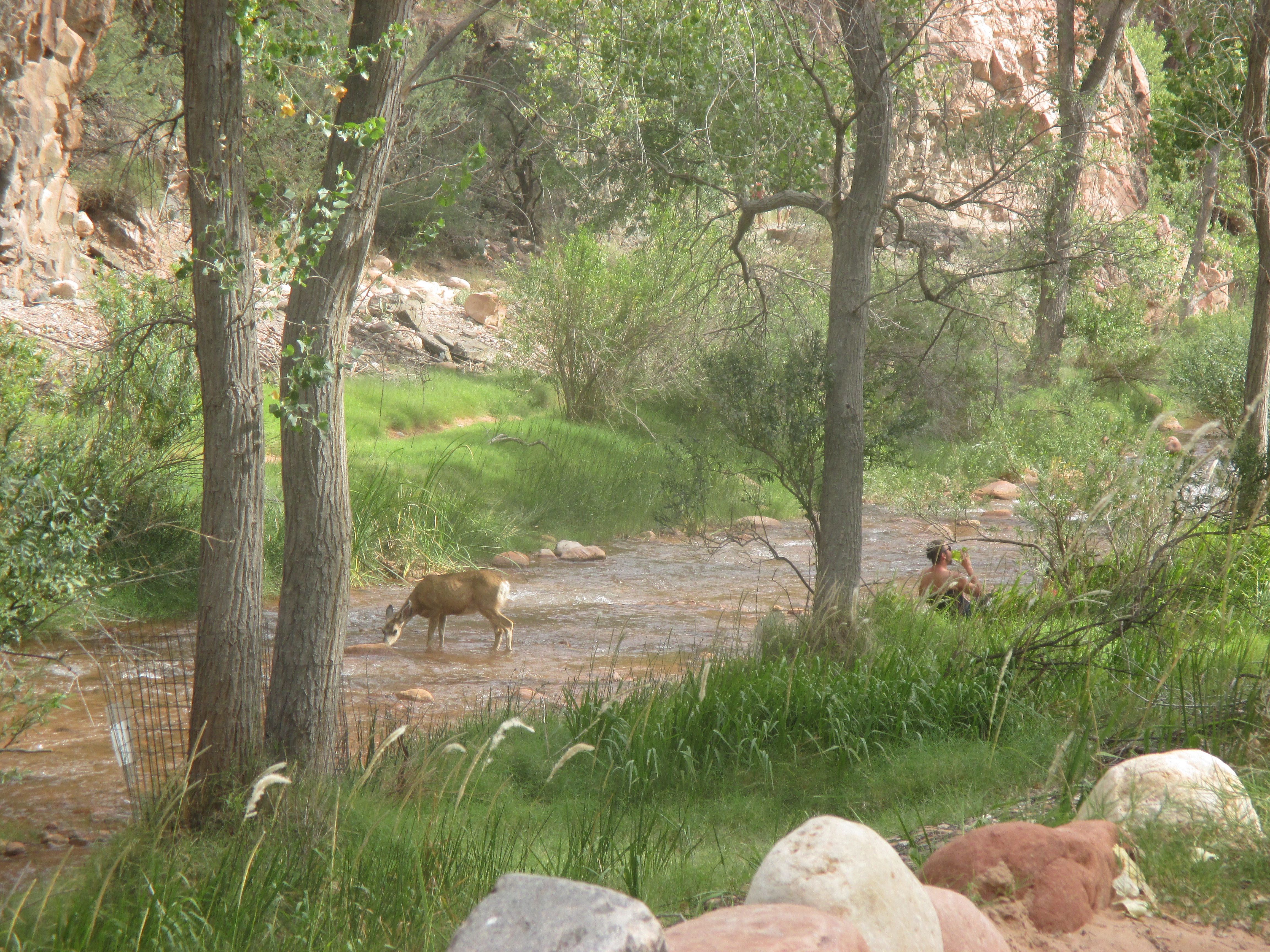
When I finally reached the campground, I discovered sandy sites, right along the river, and two thermometers, reading 102 degrees in the shade, and 120 degrees in the sun. Luckily the creek was icy cold, so everyone sat around in the water when body temperatures creeped up. In eight hours of hiking, the temperatures ranged from the dead of a Maryland Winter to the dead of a Maryland Summer!

img_2713 img_5696

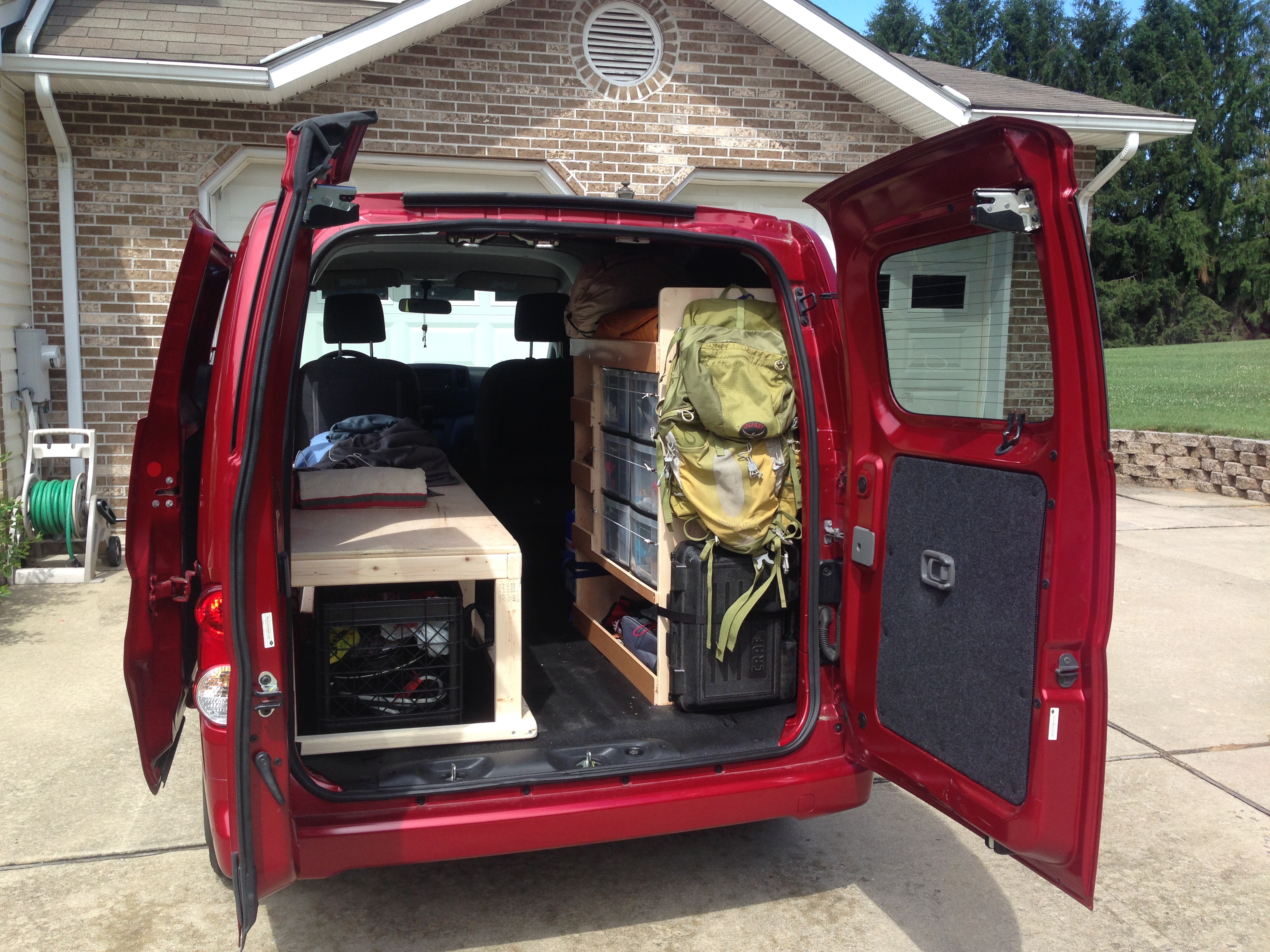
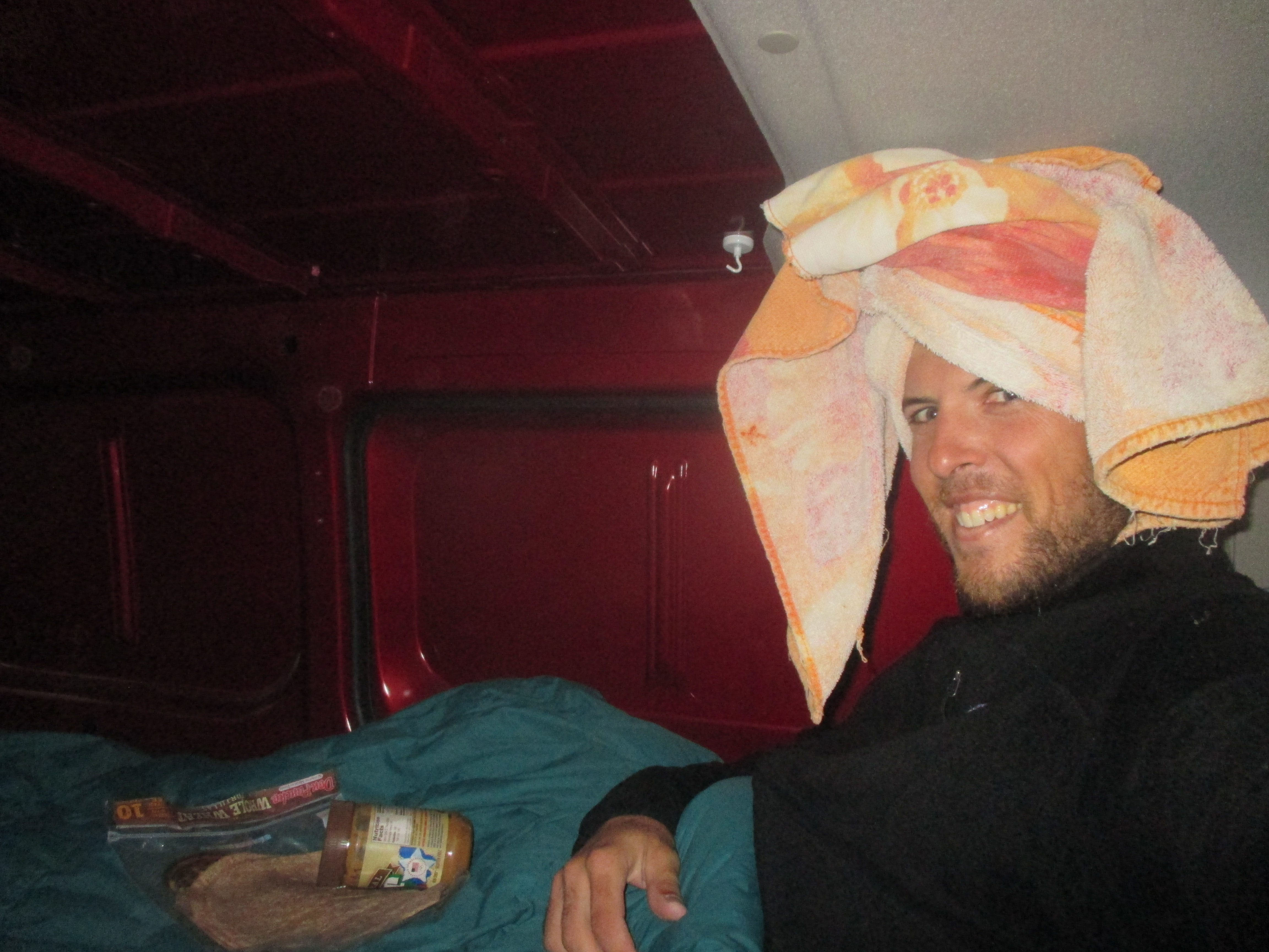
In the evening, a ranger gave an educational talk, then she took us for a scorpion hunt! The scorpions were brown and perfectly camouflaged, only about the size of a quarter. The ranger however, had a flashlight with a black light inside, which makes the scorpions glow neon yellow and very easy to spot in the dark! I slept without the rain fly on the tent that night, due to the high temperatures, but had to put it on in the middle of the night as a drizzle came in. I began my hike back out of the canyon at 6:00 AM, the first seven miles were gradual, and the drizzle and clouds provided a nice reprieve from the heat the day before. The second half of the hike climbed forever, this was the longest continual climb I think of my entire life so far, at nearly 6,000 feet. As the elevation increased, so did the rain. There was no point in wearing a rain jacket, since I sweat just as much inside of it while climbing. It wasn’t a problem until the last hour or so, I was drenched, completely soaked through from head to toe, in a steady rain, and the temperatures dropped to 50 degrees at the rim. I kept moving strong, creating lots of body heat, with thoughts of the van in mind! The last 1.5 miles of the trail were atrocious, loose slimy mud, every inch covered in donkey poop and pee and it all slopped together and ran down the trail like some stinky diarrhea water slide with diarrhea waterfalls trickling down the switchbacks at your side. The van was a welcomed site, both of my thumbs had gone to pins and needles. I got inside the cramped space, threw all my wet gear on the floor, got naked and toweled off, then put on some dry clothes. I tucked myself into the winter sleeping bag and ate everything in site: two tortillas with peanut butter, an apple, a banana, fruit snacks, cheese-its, sun chips, nutrigrain bars, and peanuts…I was ravenous! Still freezing, I fully zipped the sleeping bag and ended up falling asleep, waking up an hour or two later feeling like a human being again!

img_5701

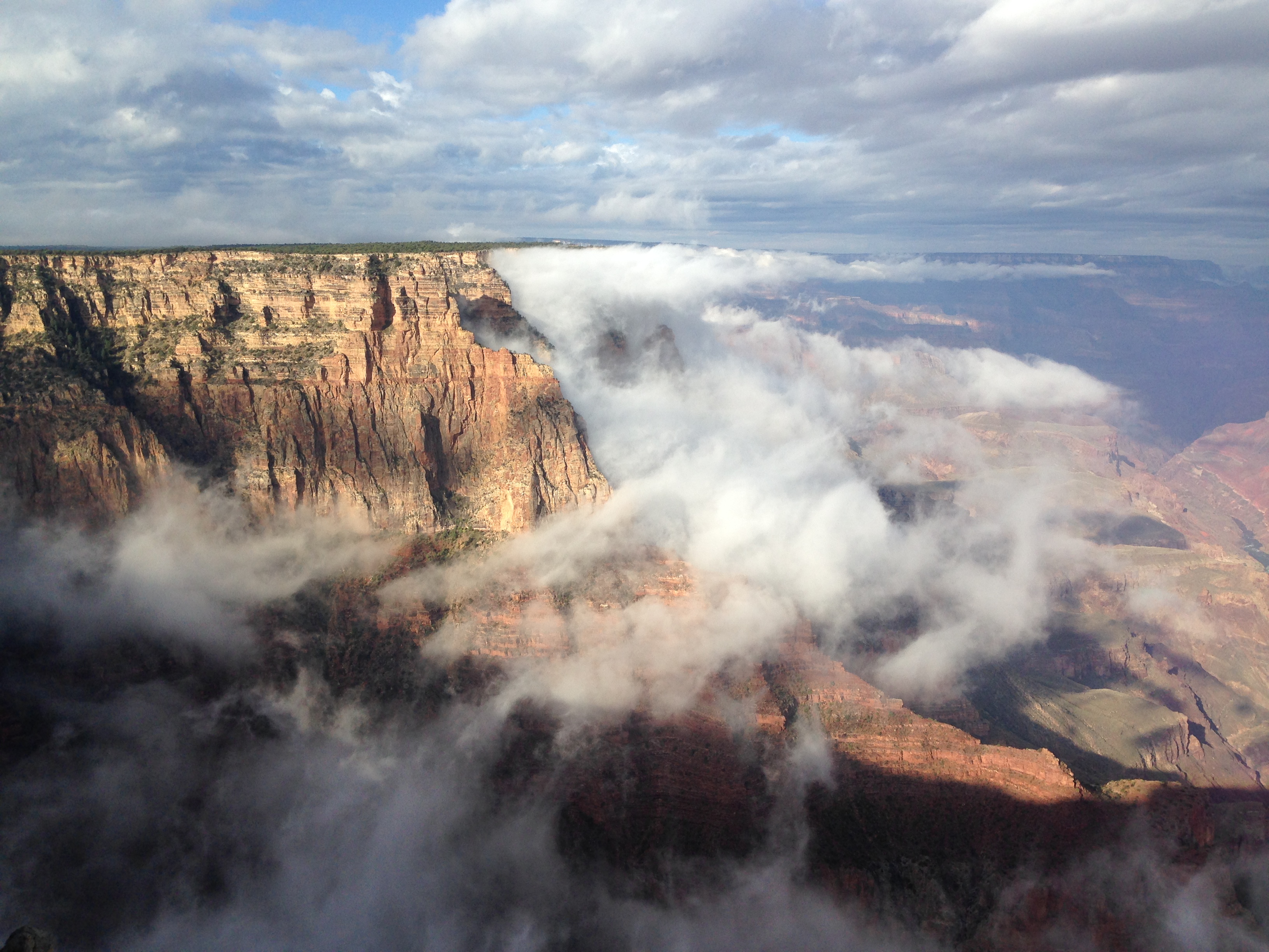
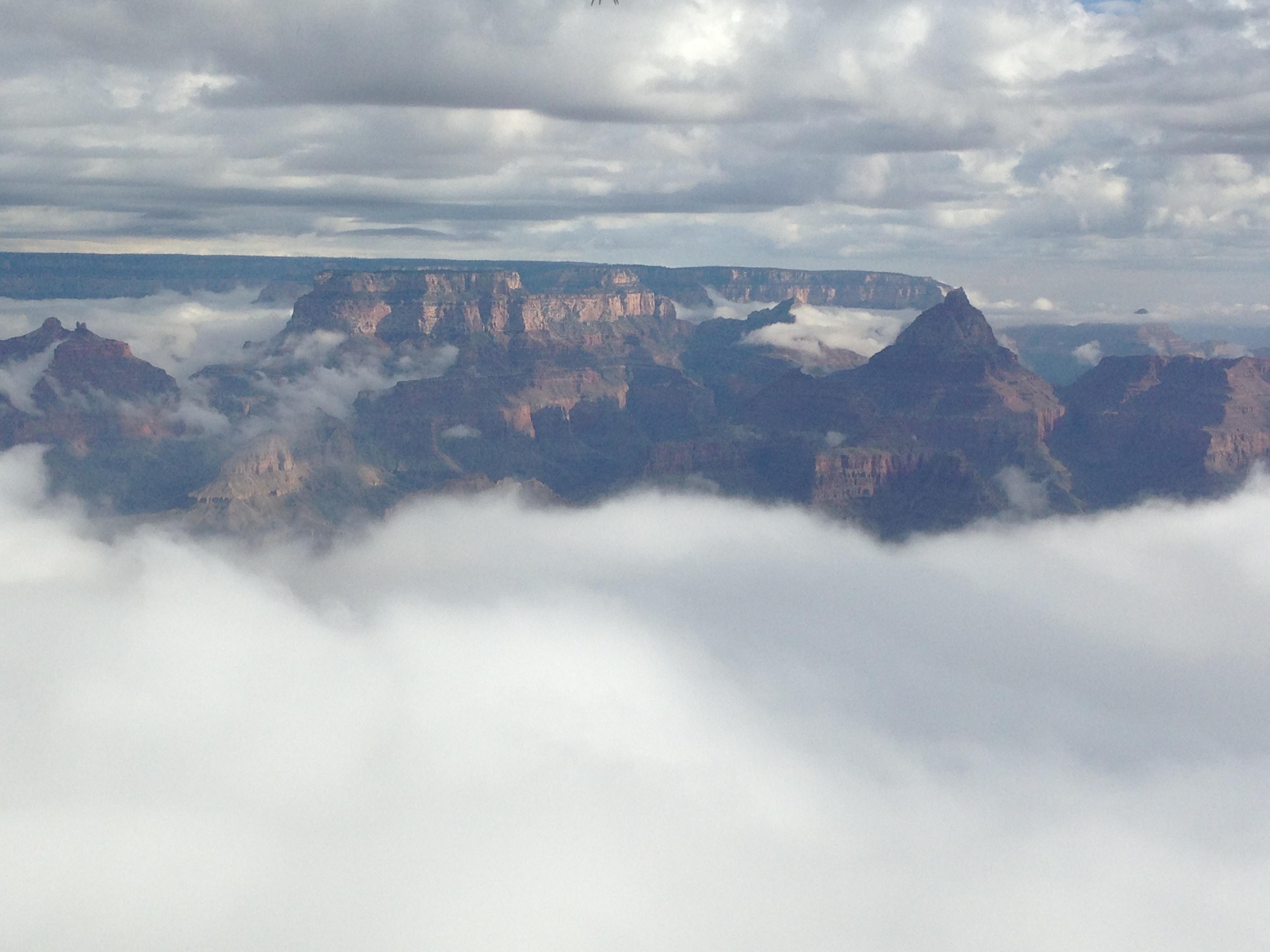
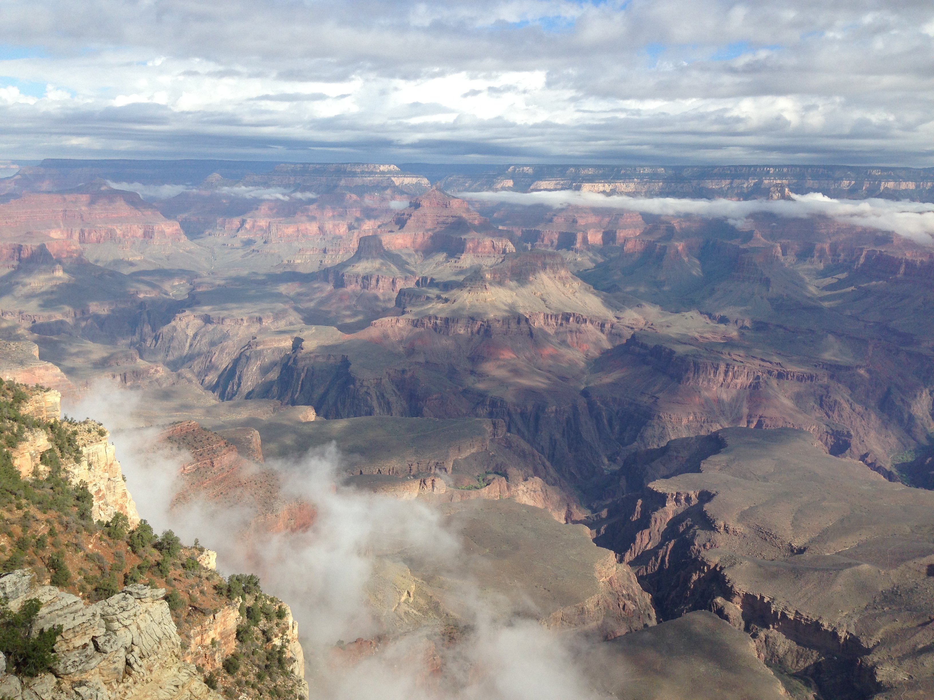
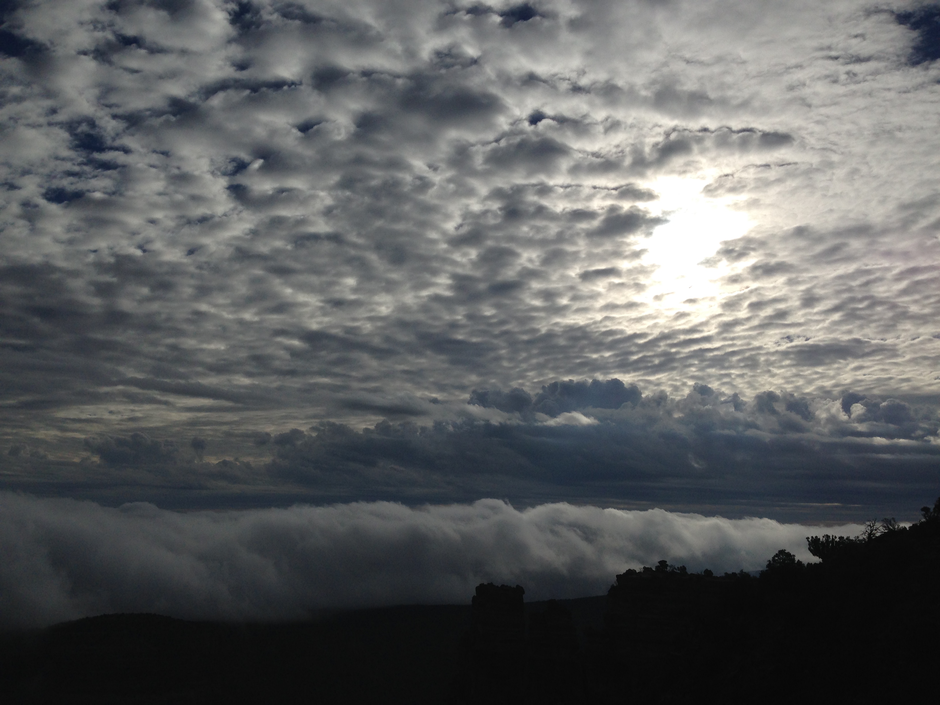
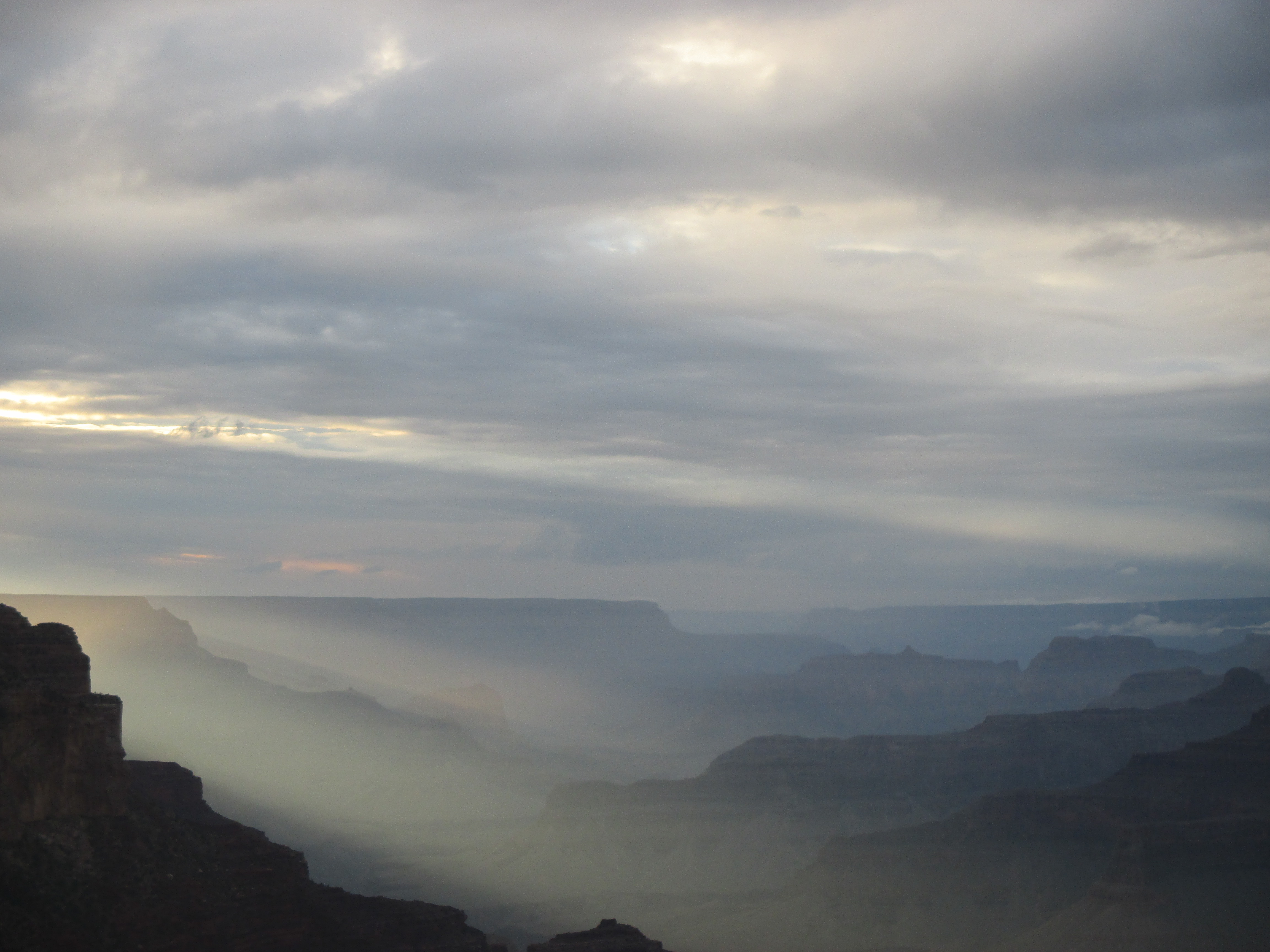
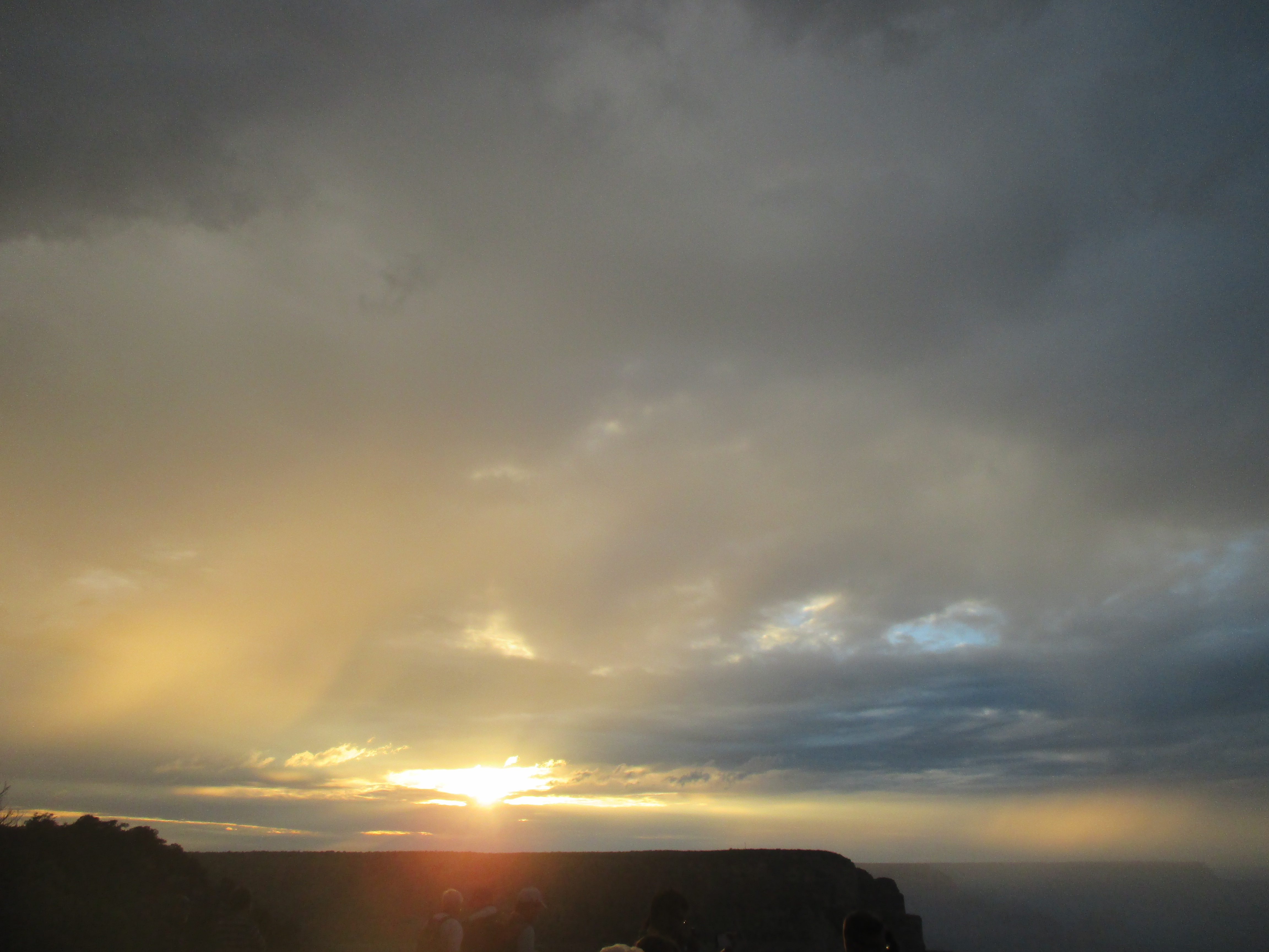
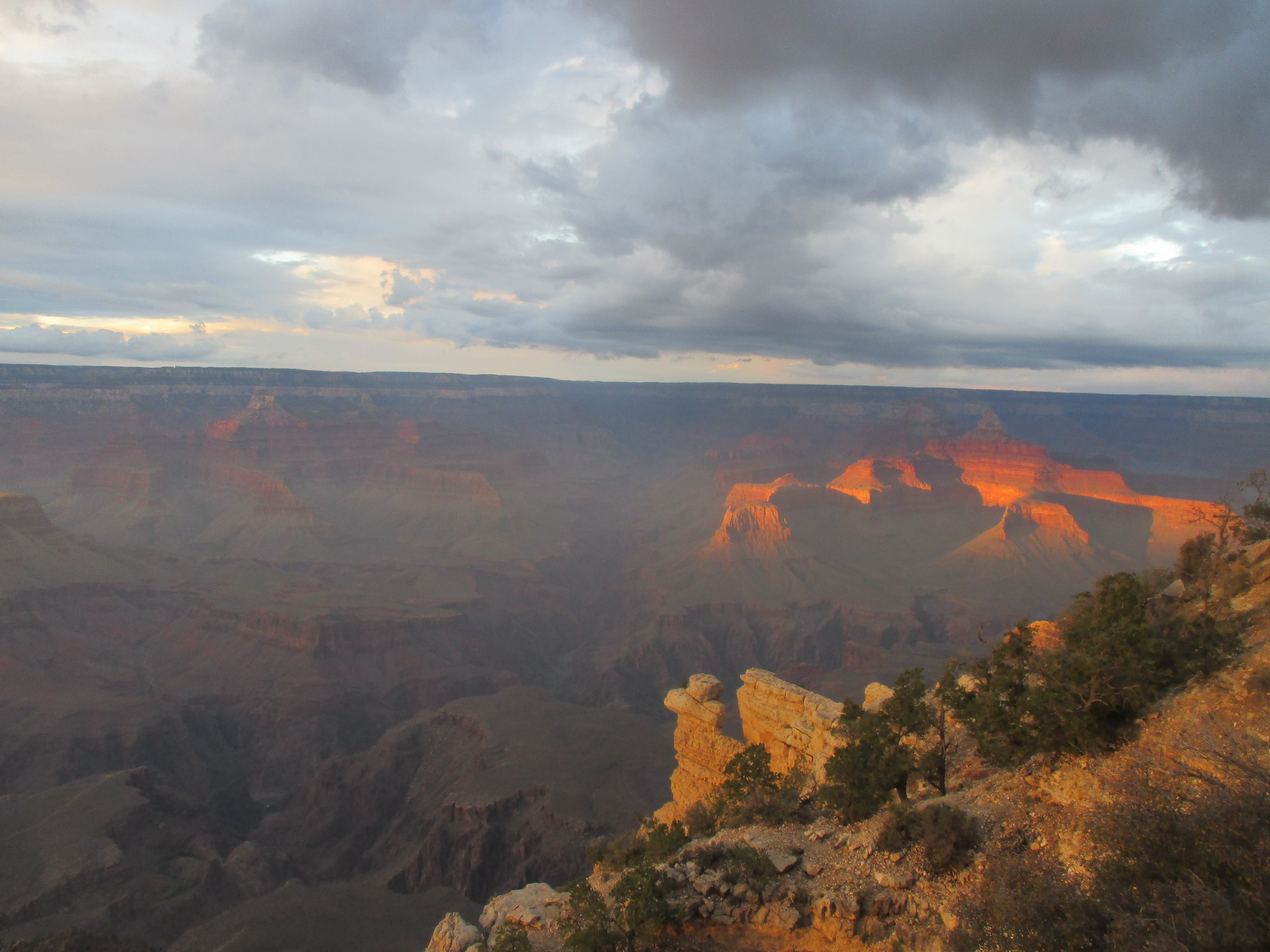
The next day, I drove around to the South Rim of the Grand Canyon to fight the crowds and see the big views of the canyon below. The canyon was still filled with fog from the rain the day before, but offered a neat view. I hung out in the nearby forest, hung my wet gear from the trees and let things air out to dry. I revisited the canyon rim for sunset and saw it just barely pop through once or twice to wish us goodnight.

img_2737 img_2747 img_2754 img_2732 img_2755img_5704 img_5713 img_5712img_2724

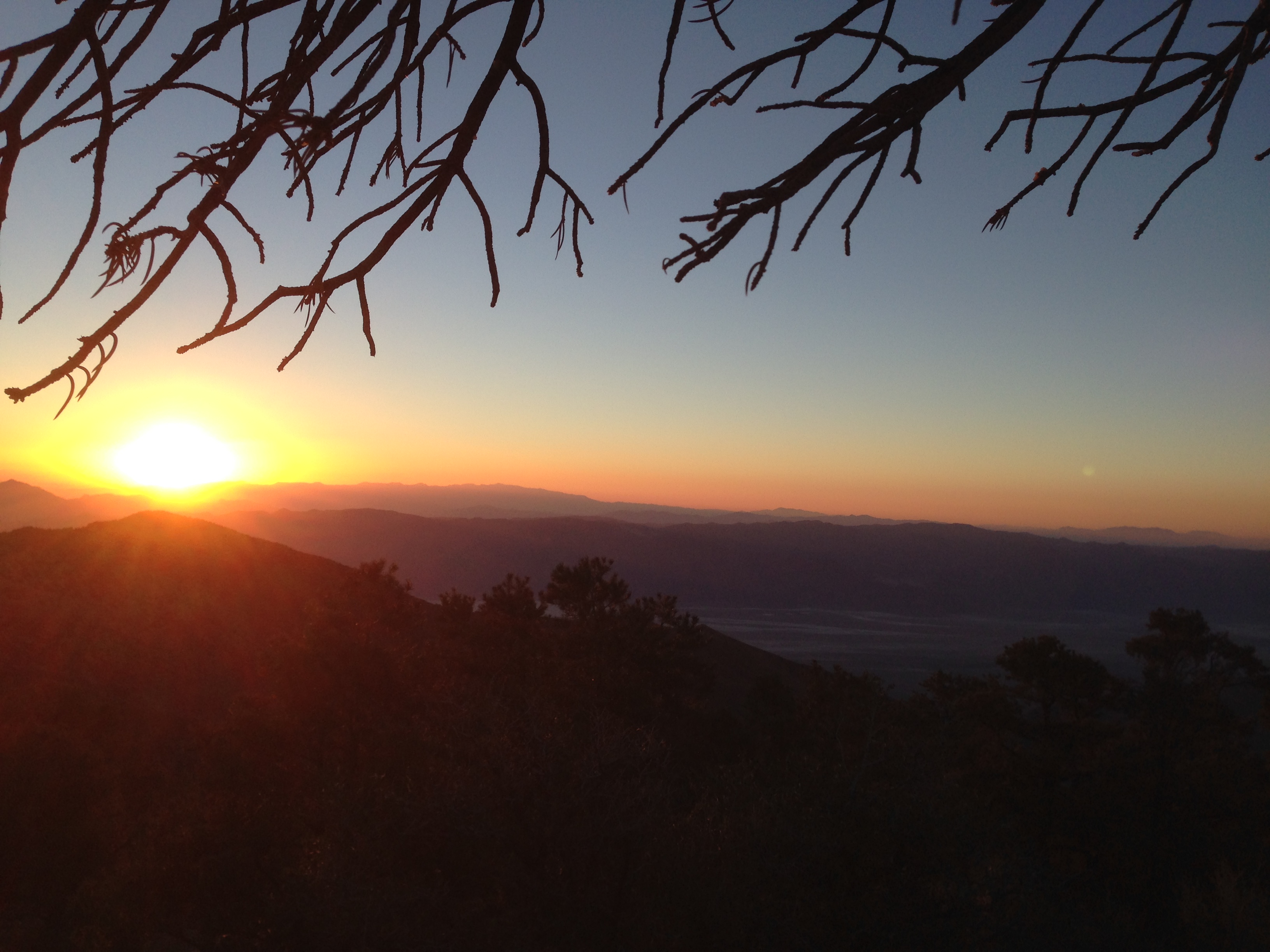
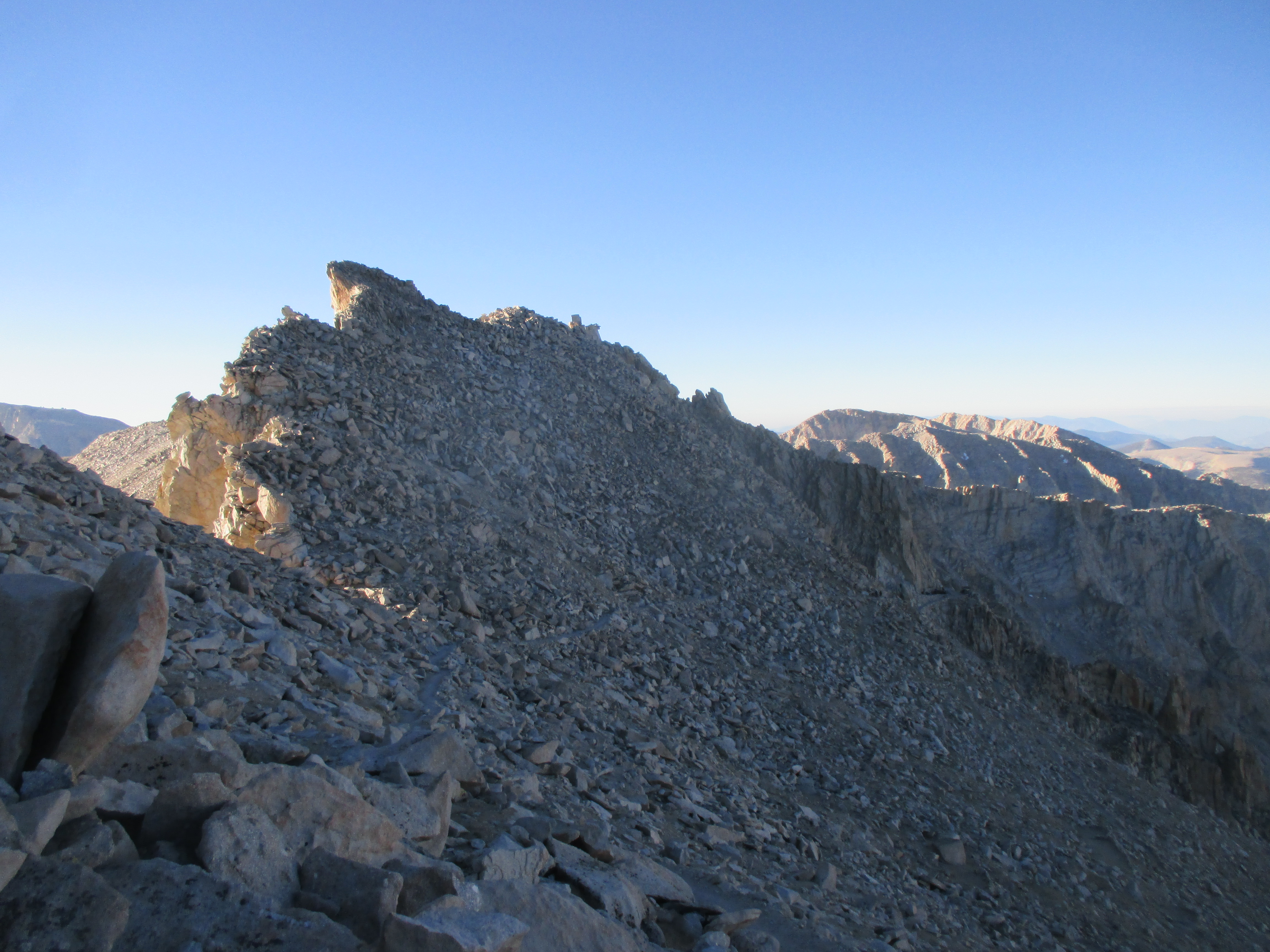
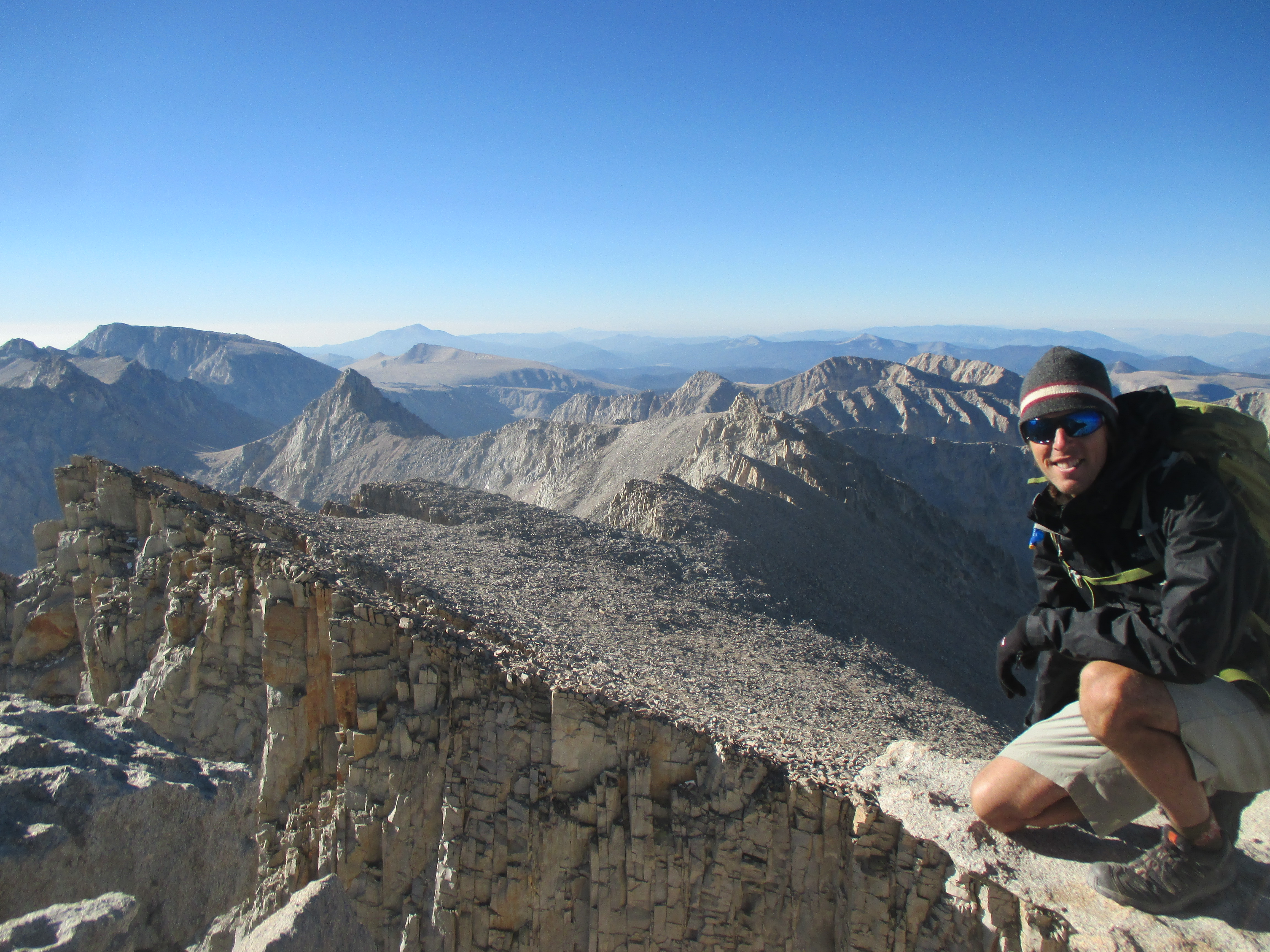
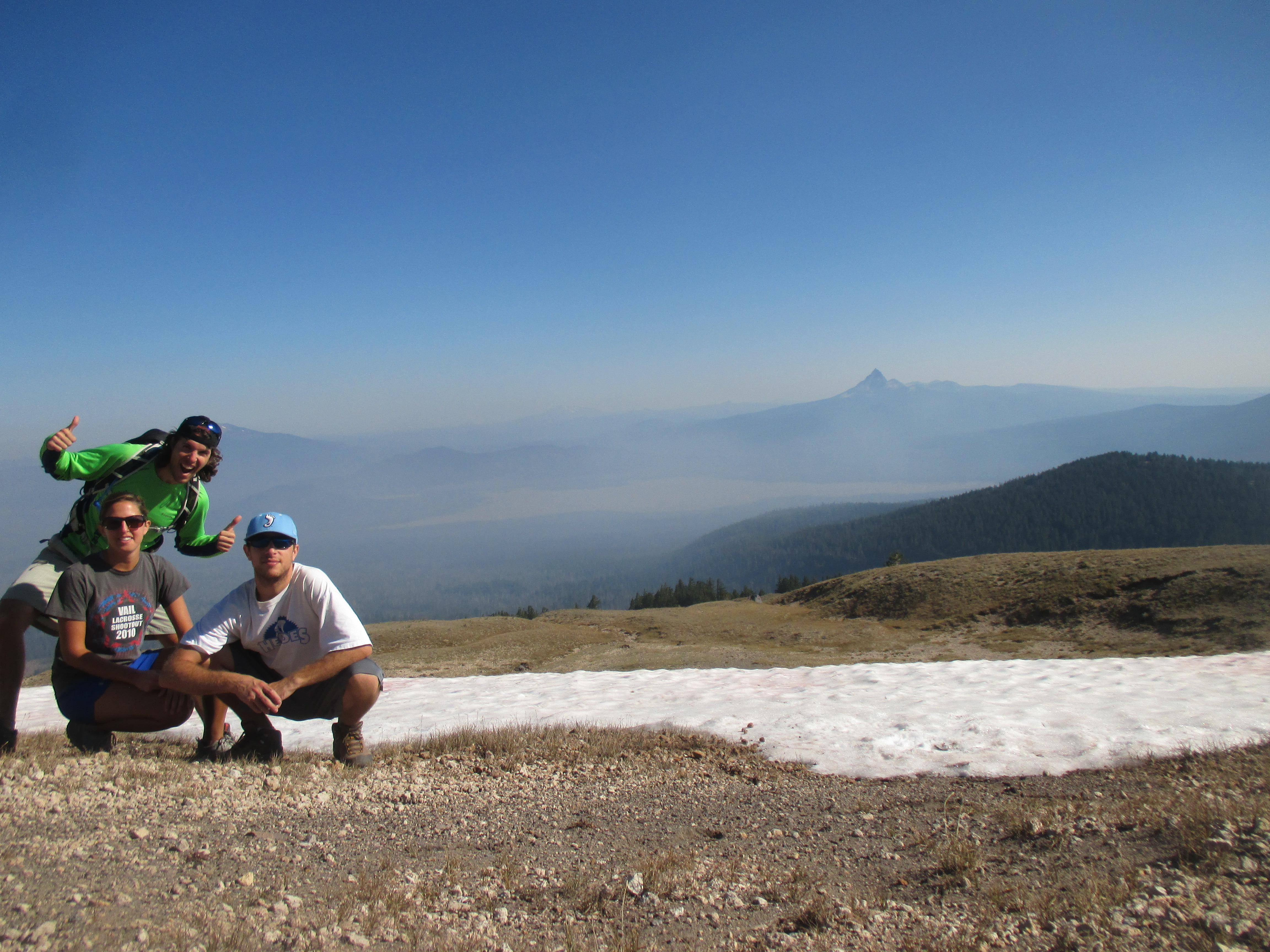
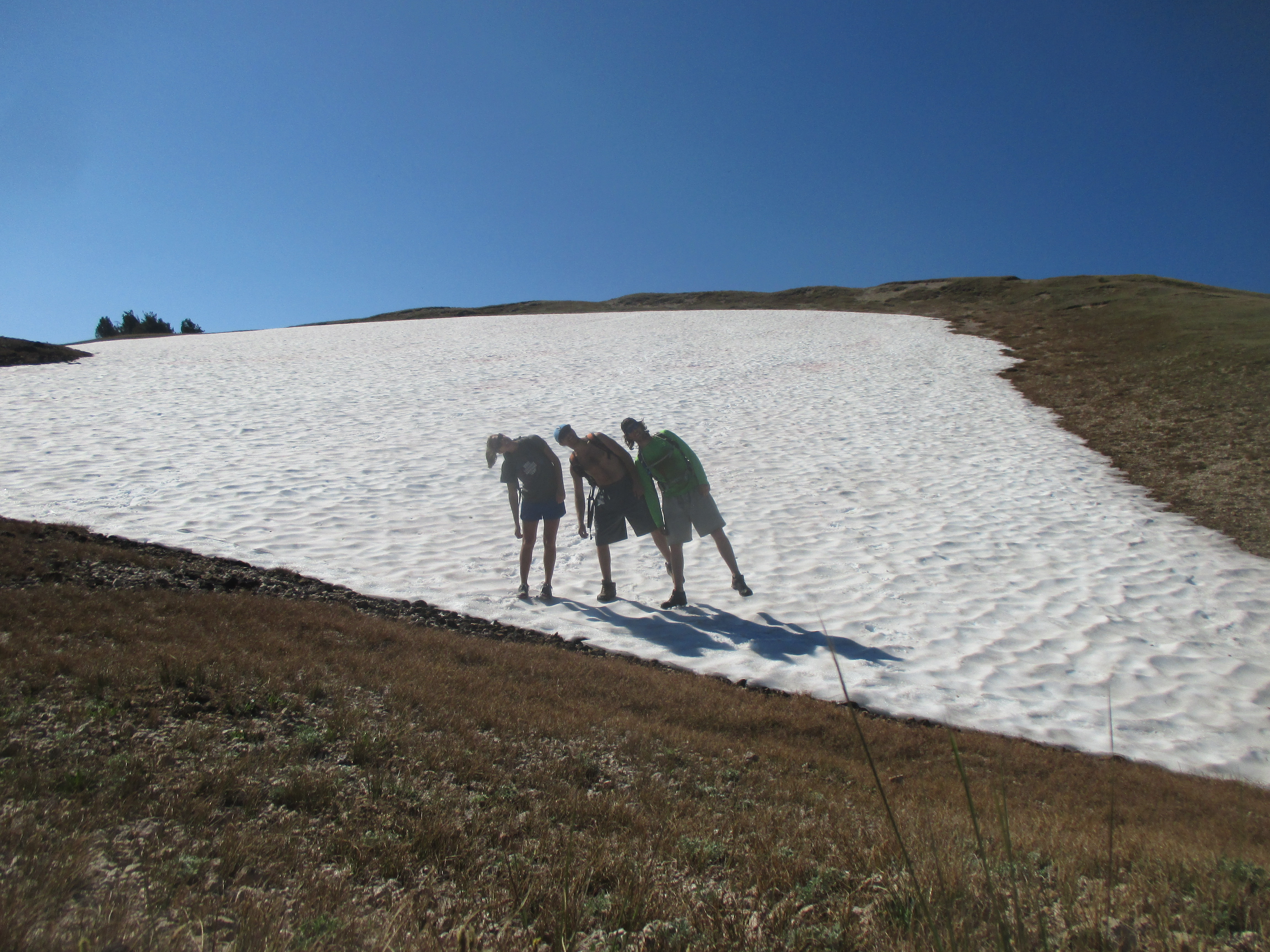
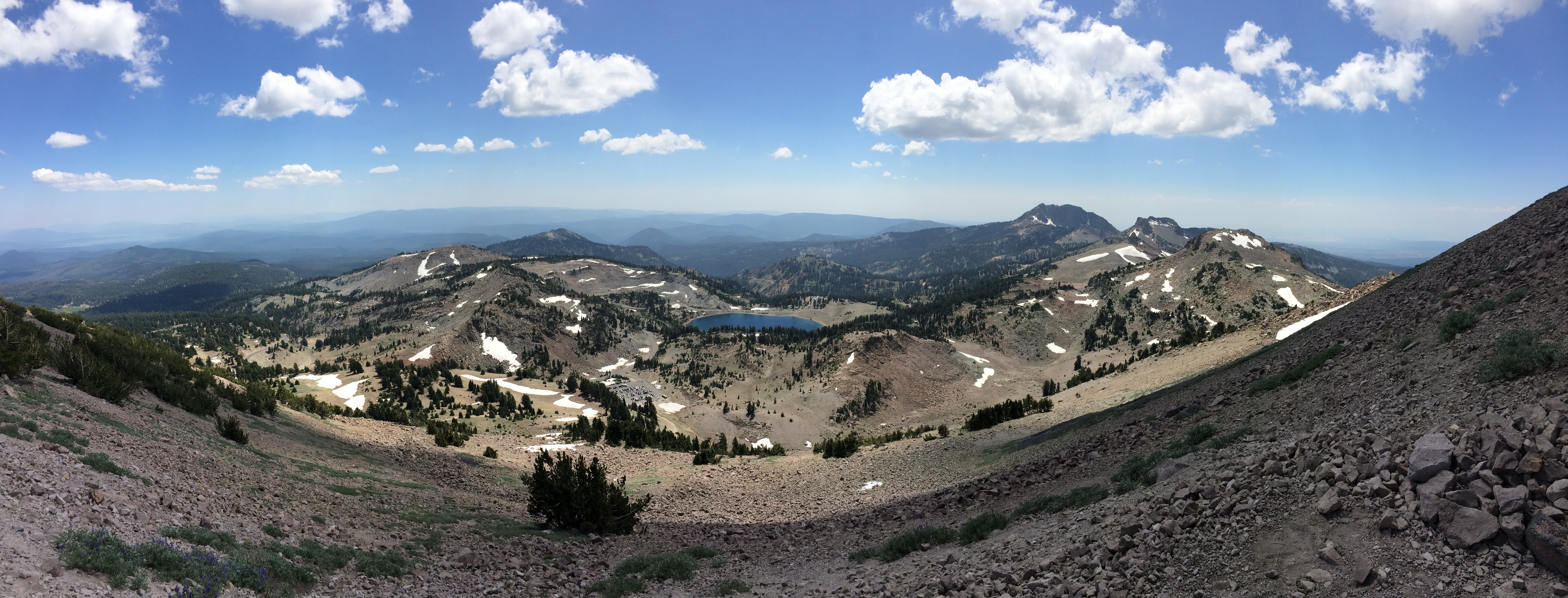
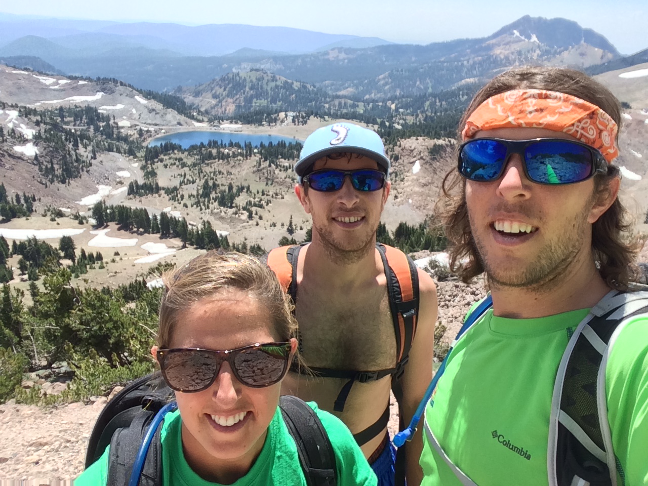
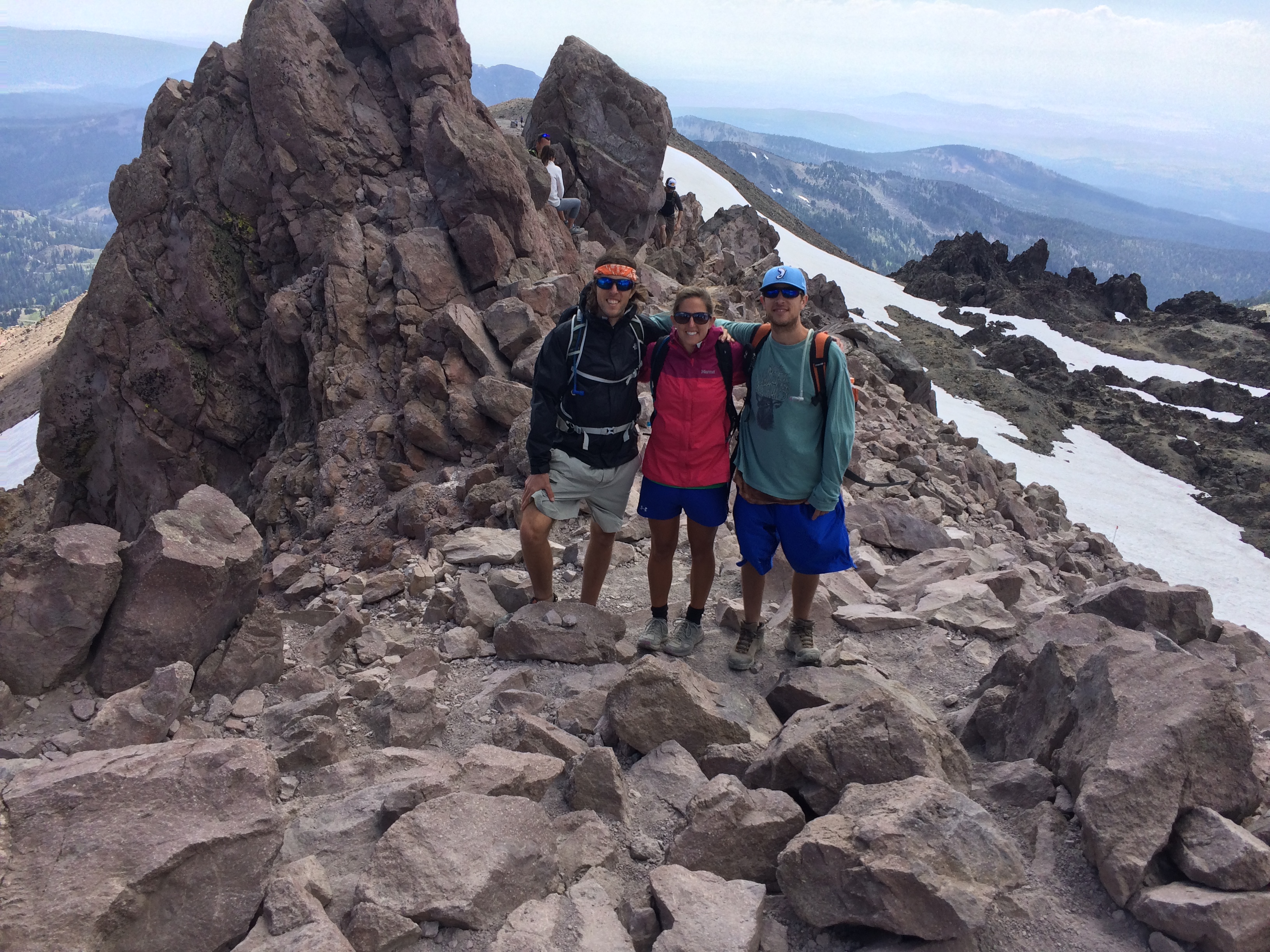
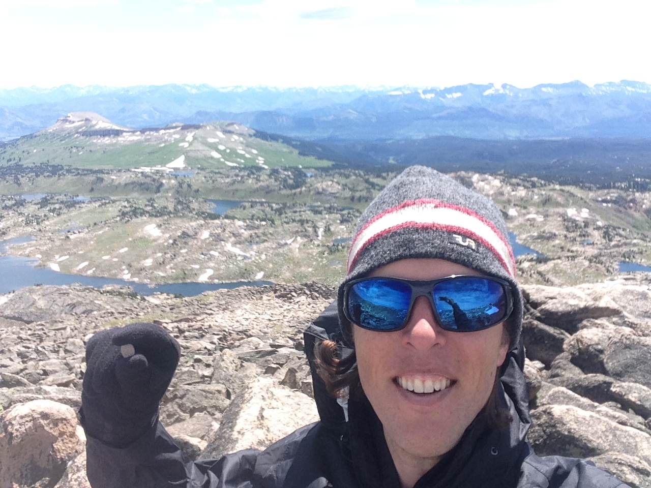
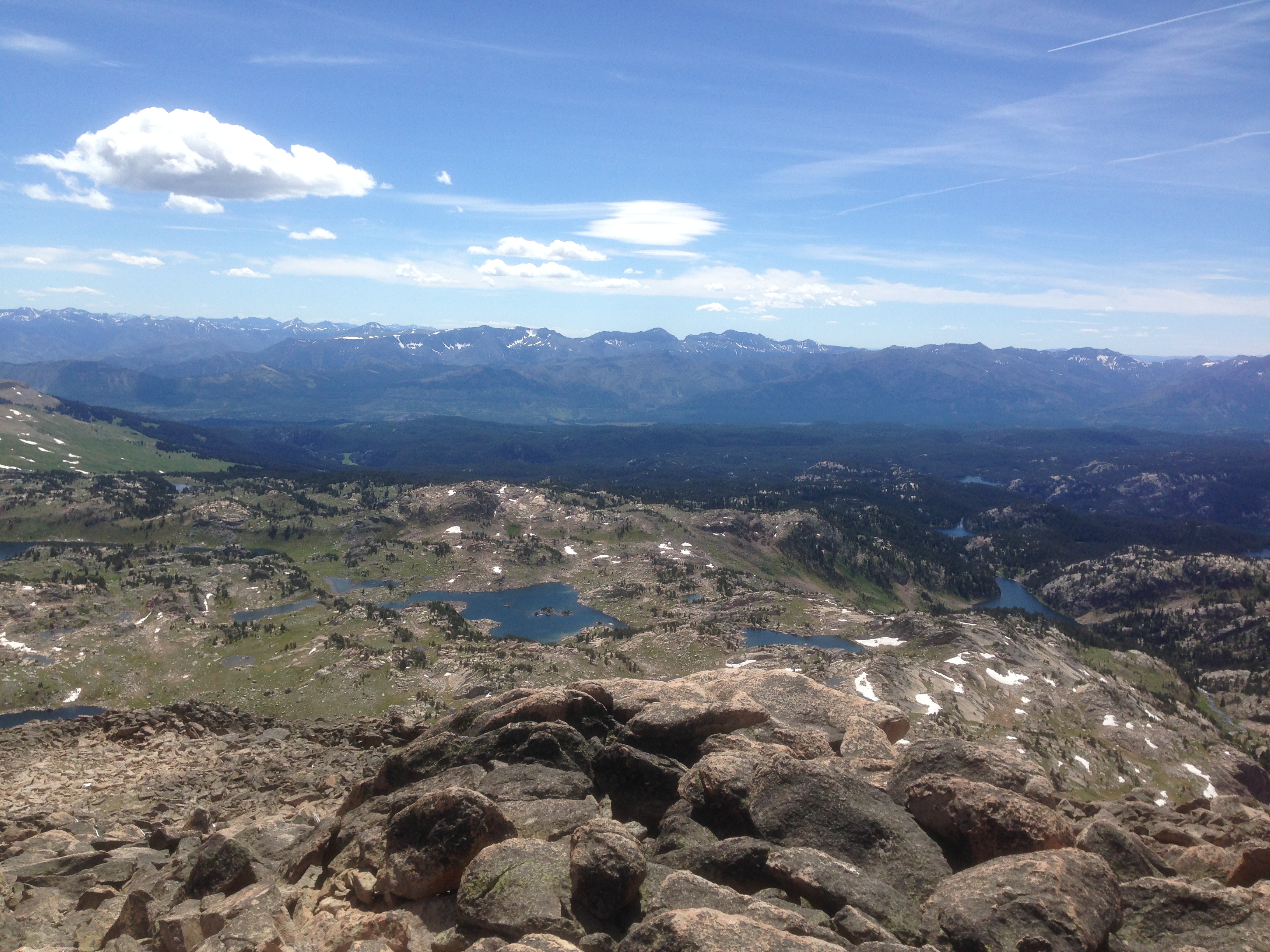
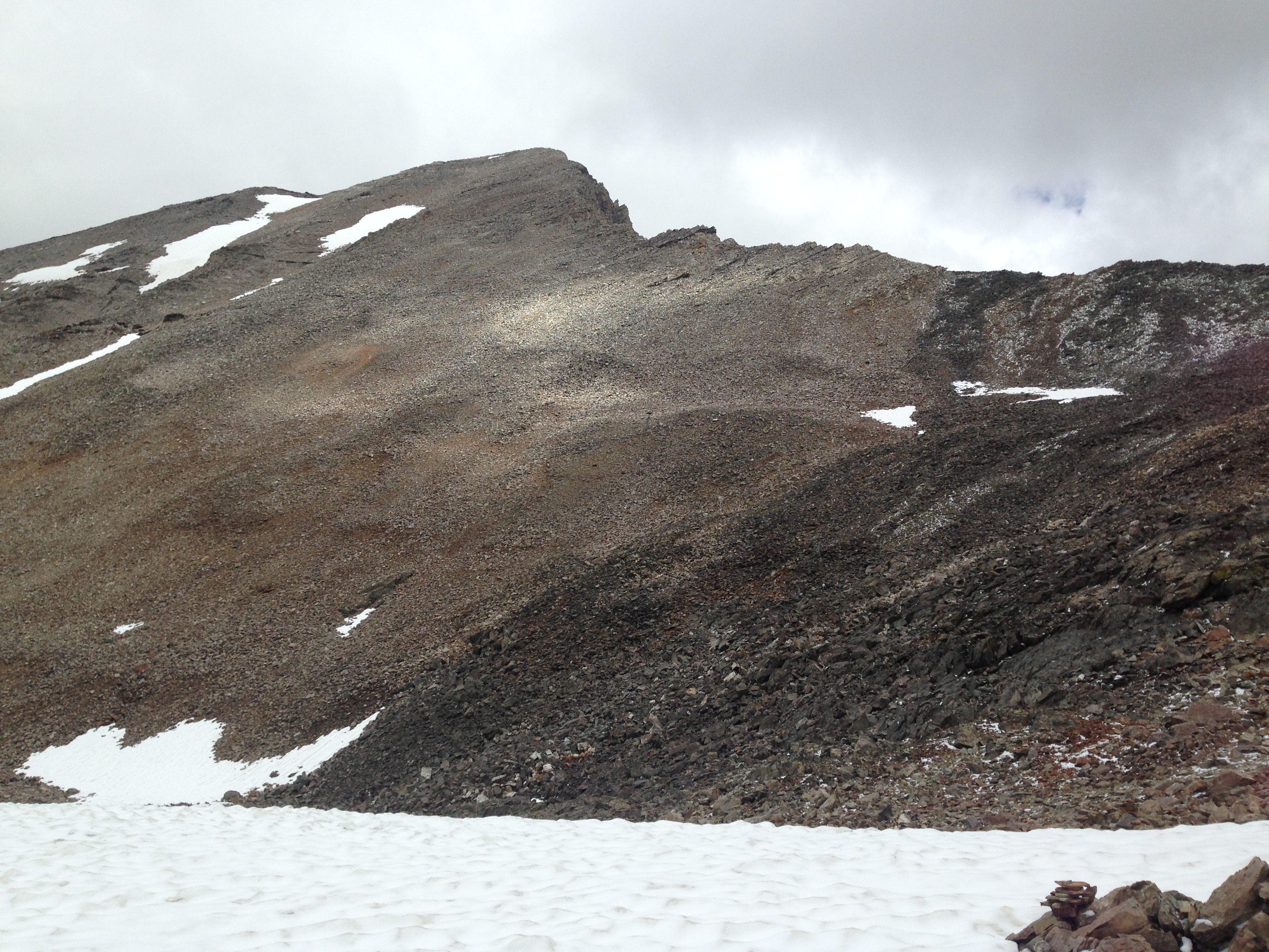
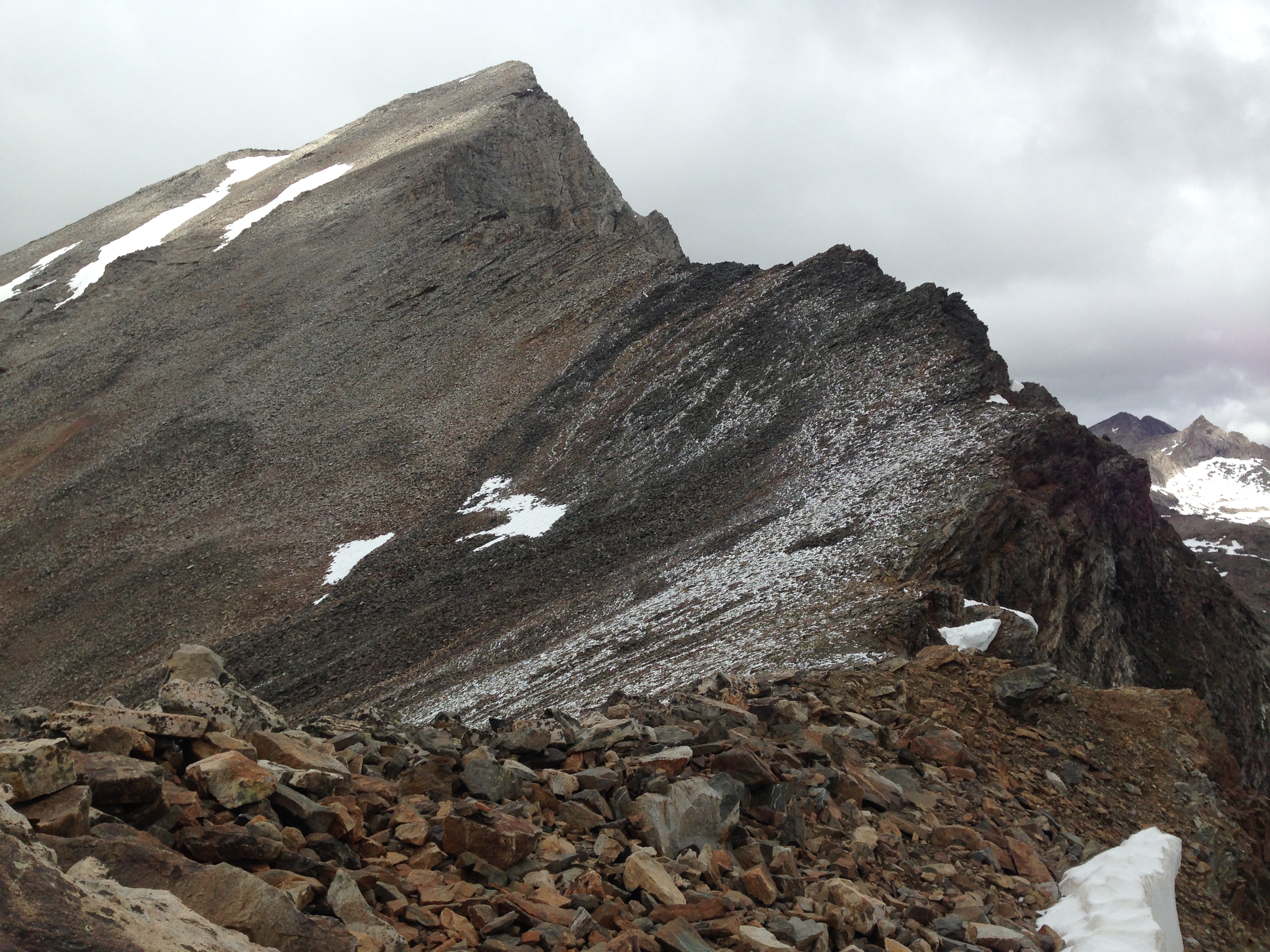
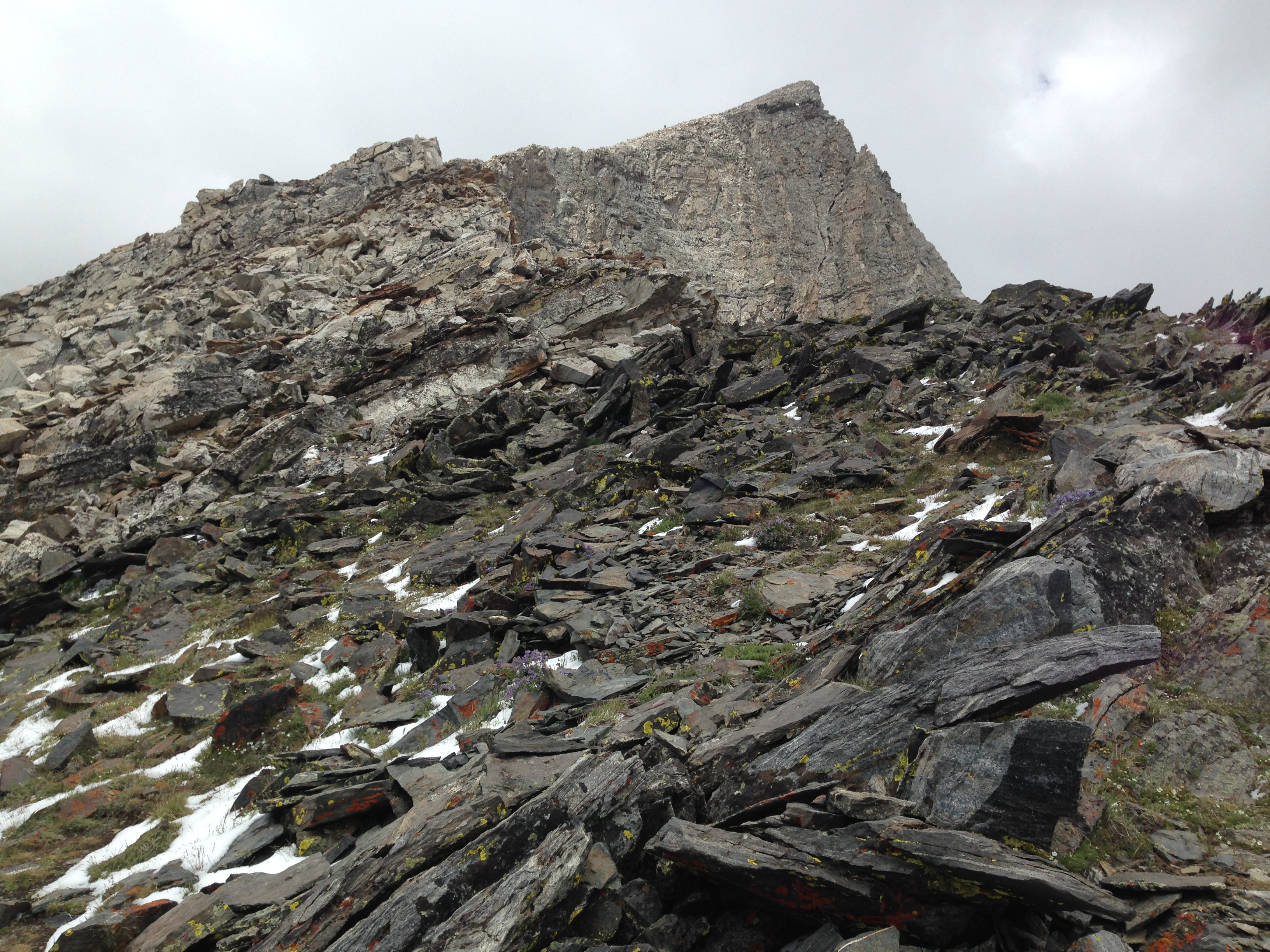
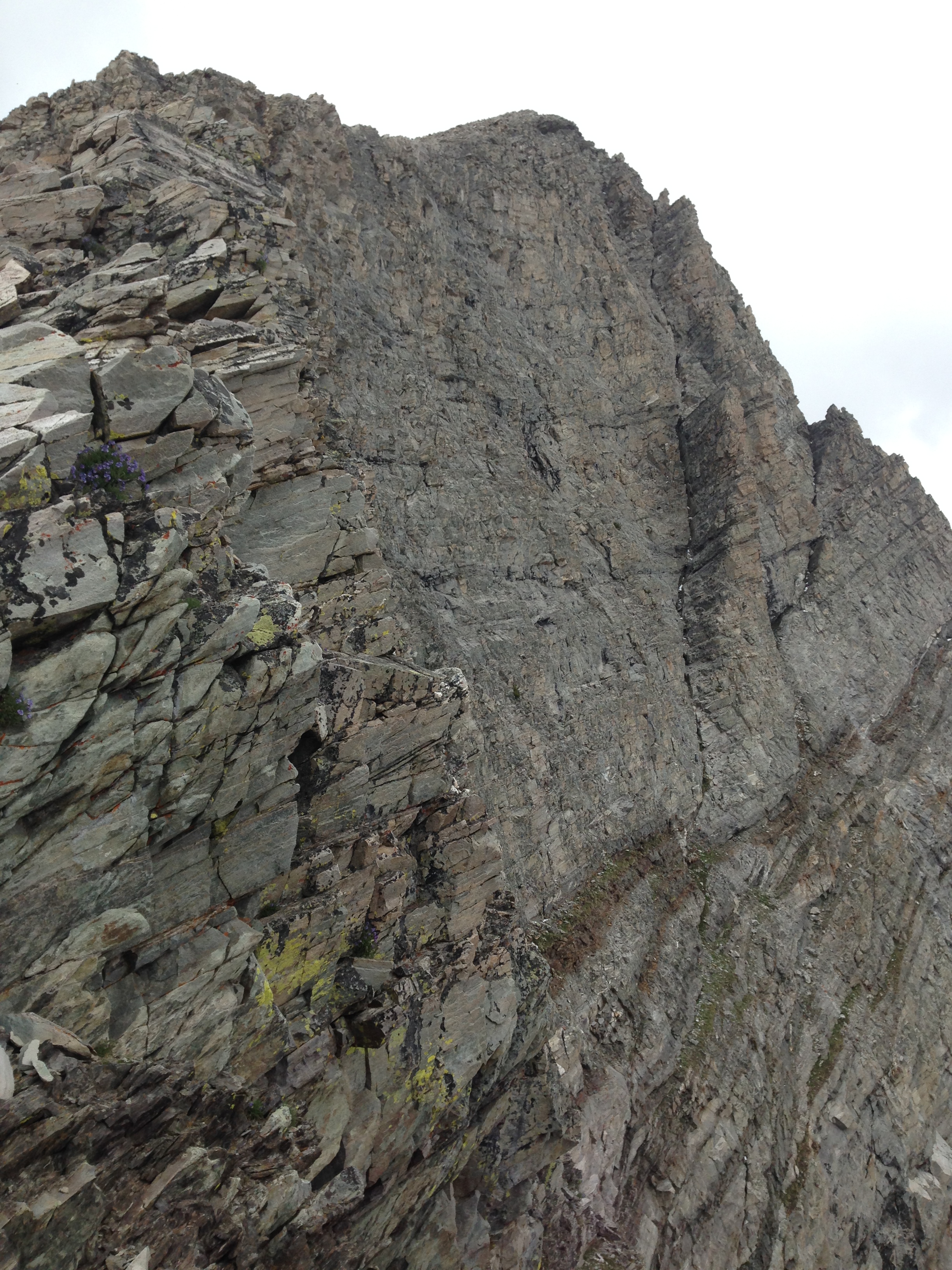
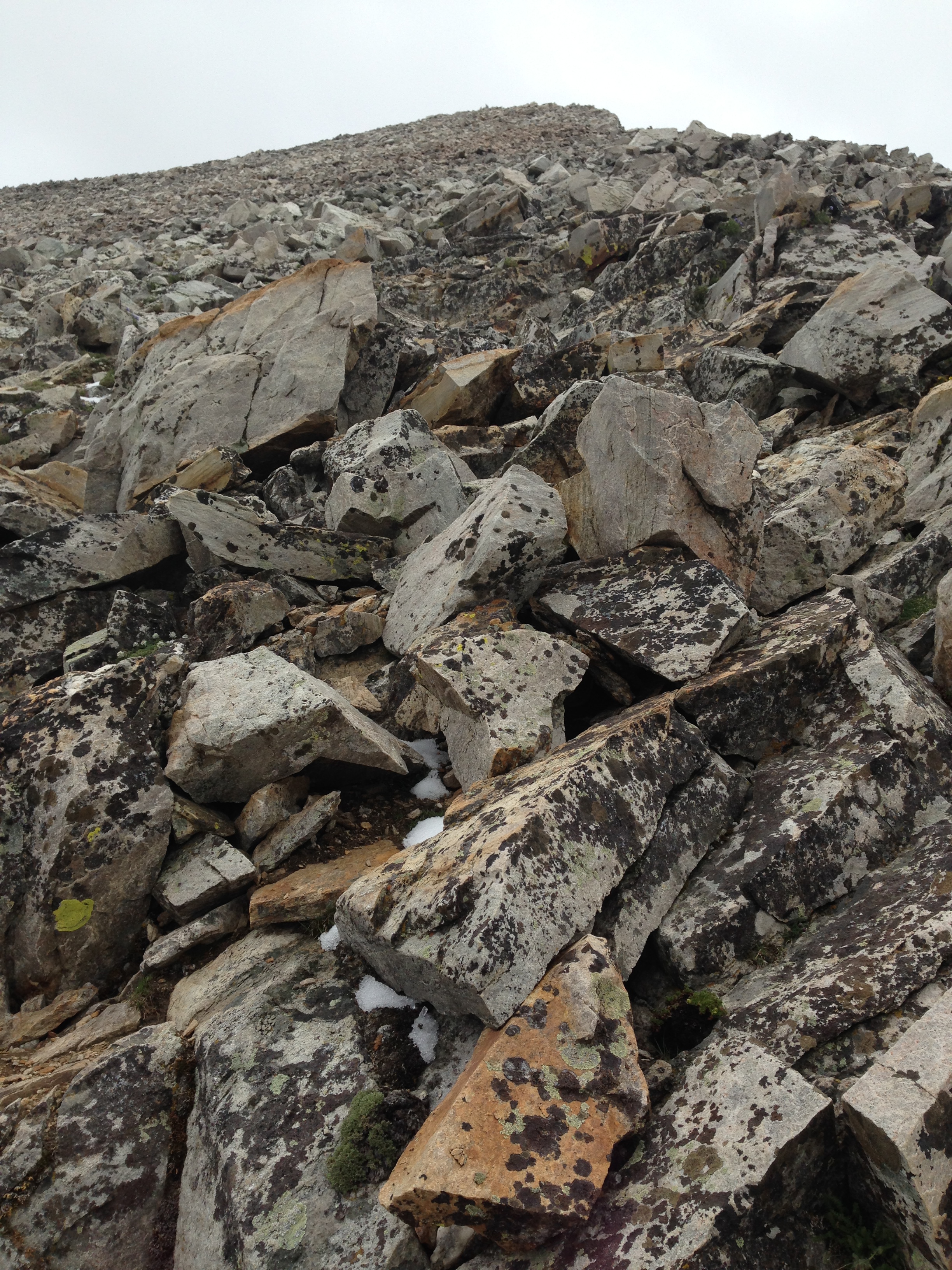
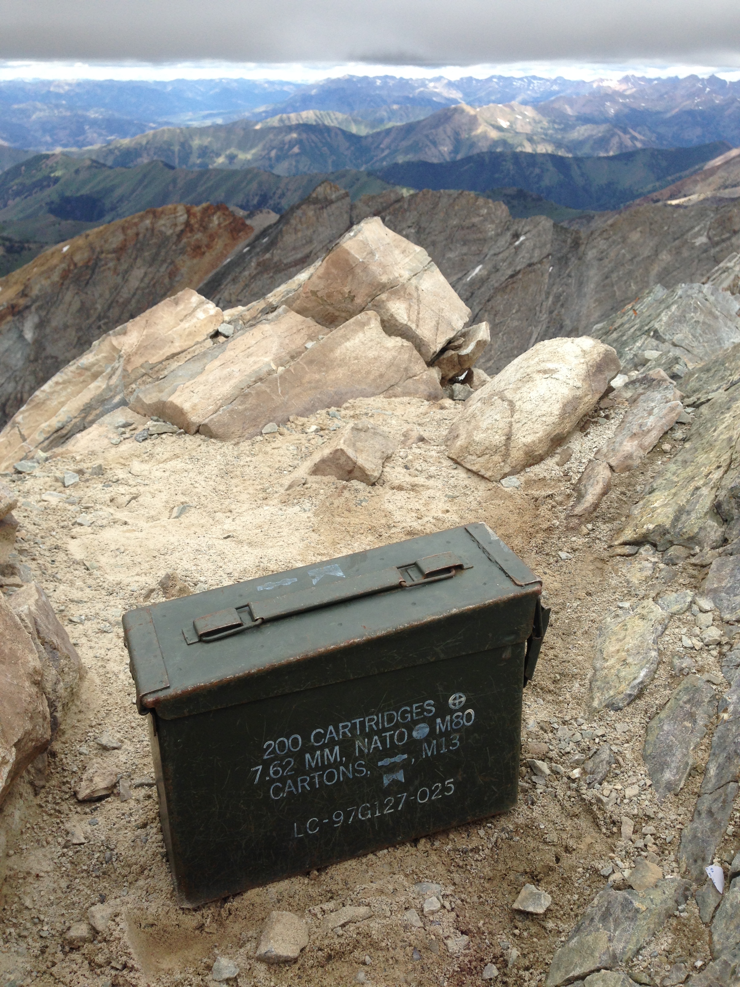
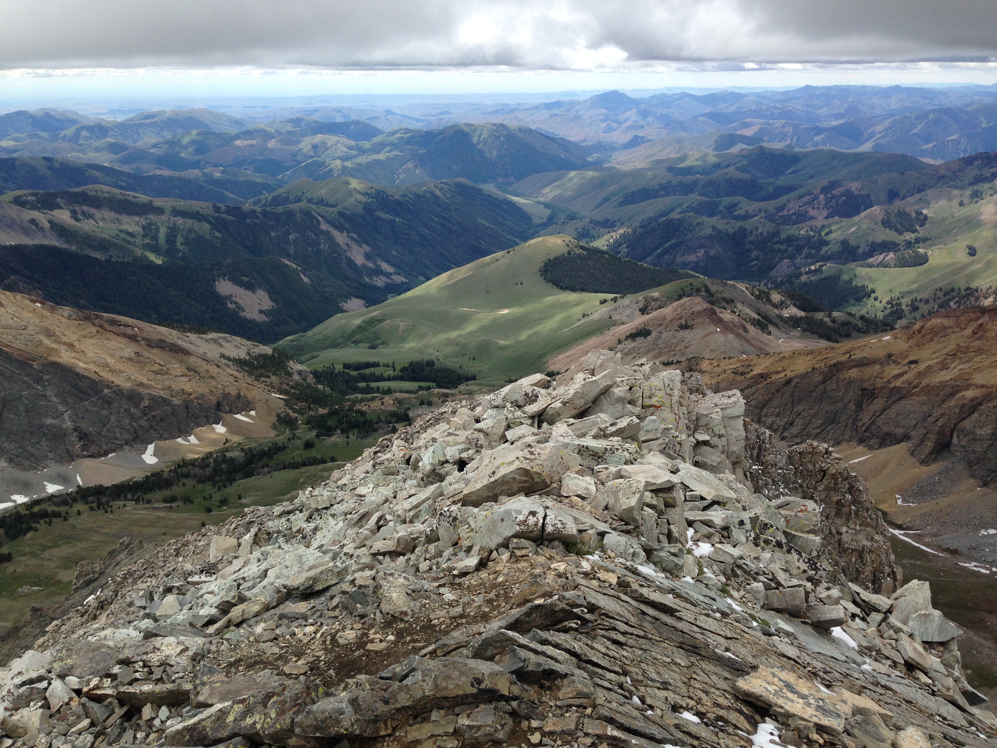
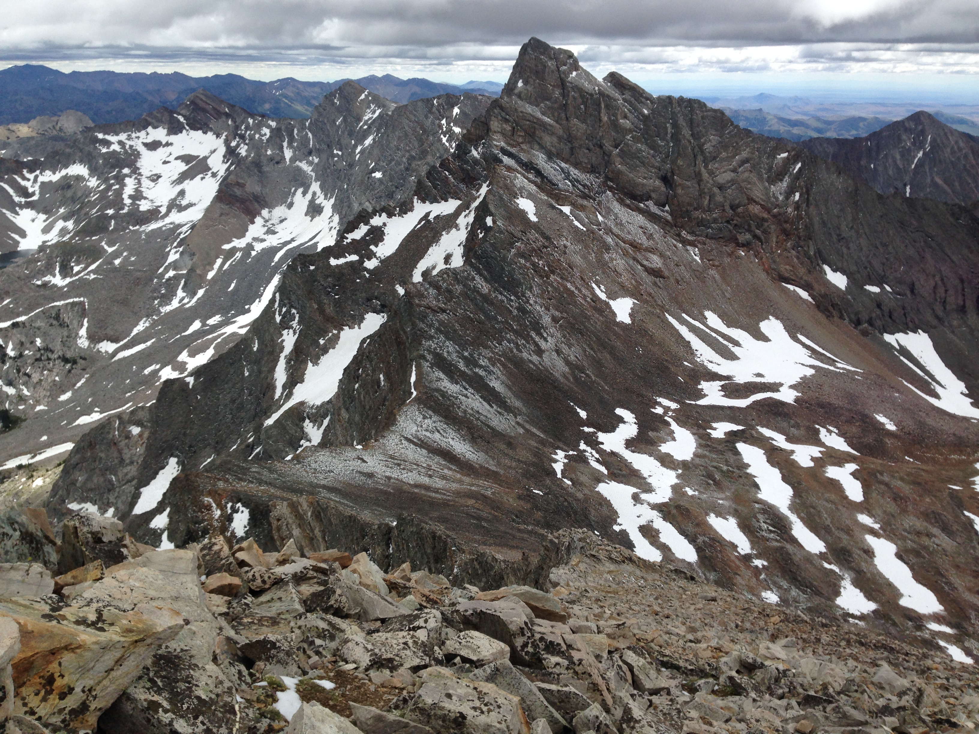
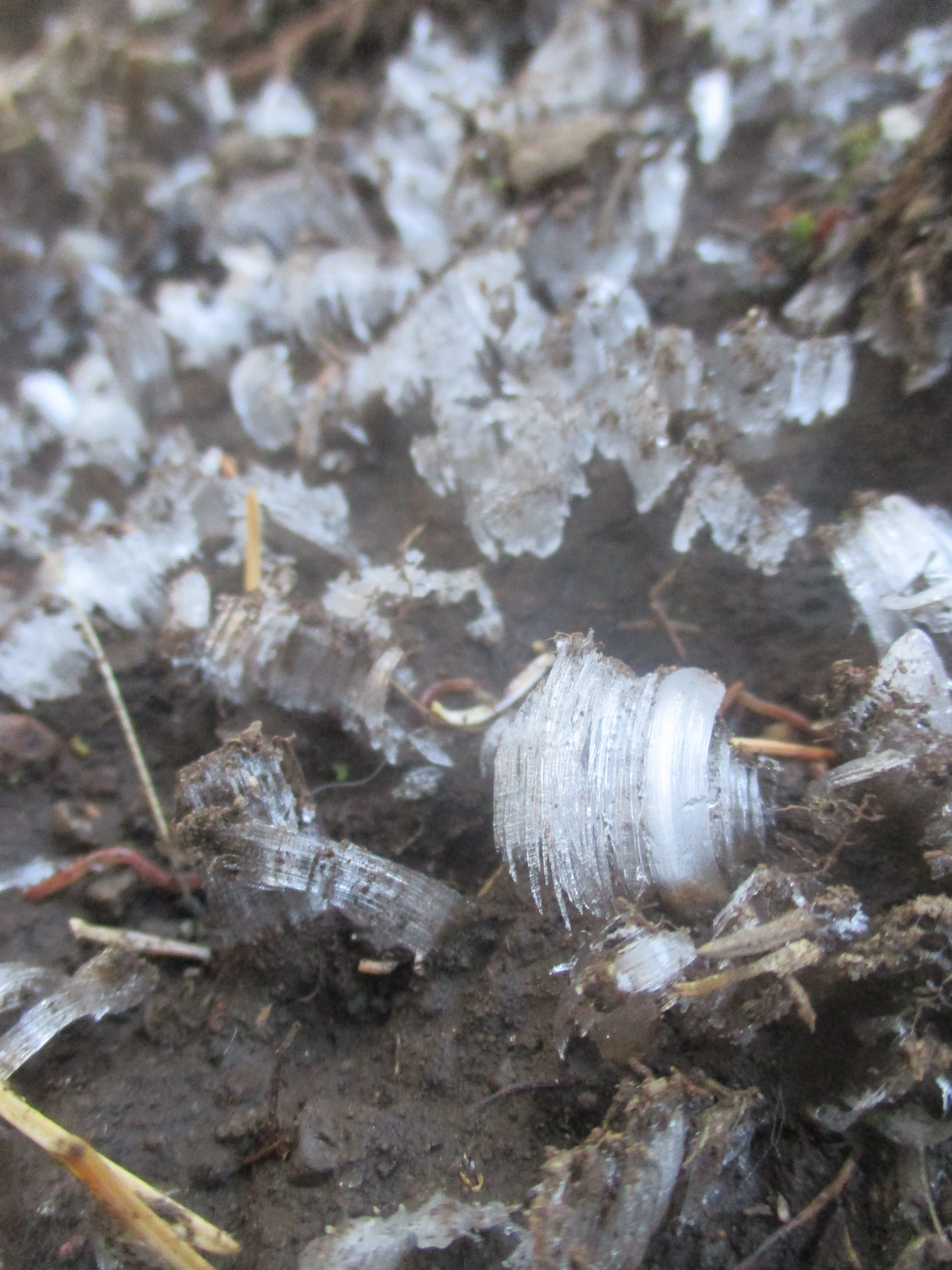
My next plan was to climb Mount Humphreys, the highest point in Arizona, but a rainy day had me wait out the day at the library in Flagstaff, AZ. The following morning, I began my ascent! The soil was still frozen solid from the night before and much of the trail surface has fascinating ice “flowers” about ½ inch tall. The five mile trail climbed several thousand feet over two hours, mostly in pines and aspens, until it popped above tree line for the final ¾ mile along a rocky ridge. The wind was whipping fiercely across the exposed rocks and my water froze in the tube of my camelbak. I had to hold the edge of my rain hood to keep the wind off my face. There were two men, around my age, at the summit, Issac and Abraham. We huddled together behind a pile of rocks as a windblock, and took a few pictures of the beauty surrounding us. After a few minutes, it was too cold to linger. We sped walked the exposed ridge back to the treeline were the forest protected us from the piercing winds for the descent.

img_2766 img_5734 humphrys-peak

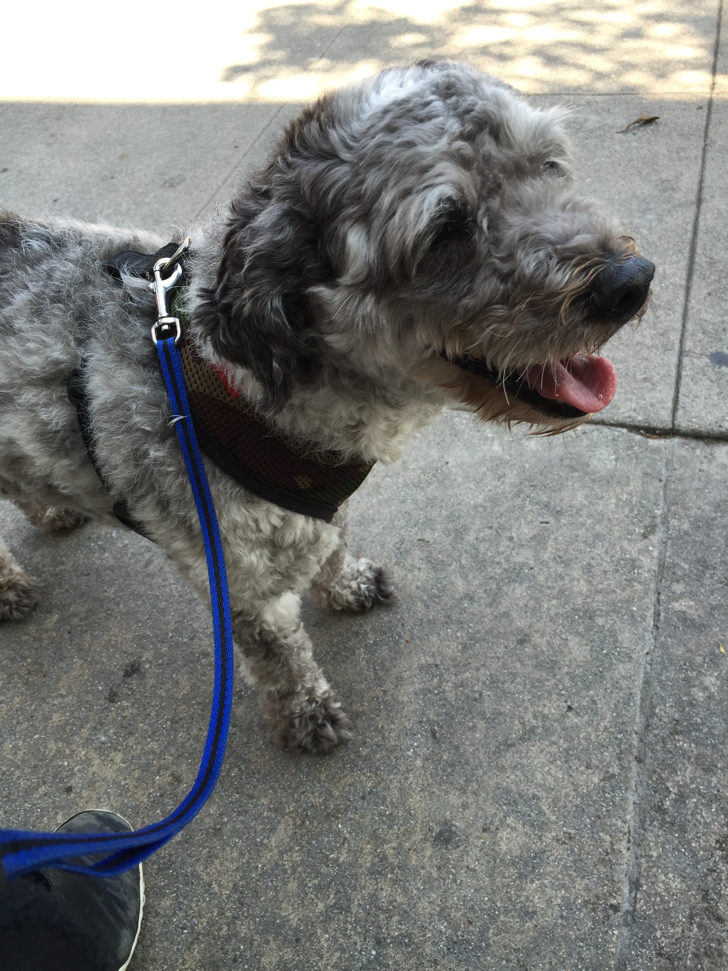
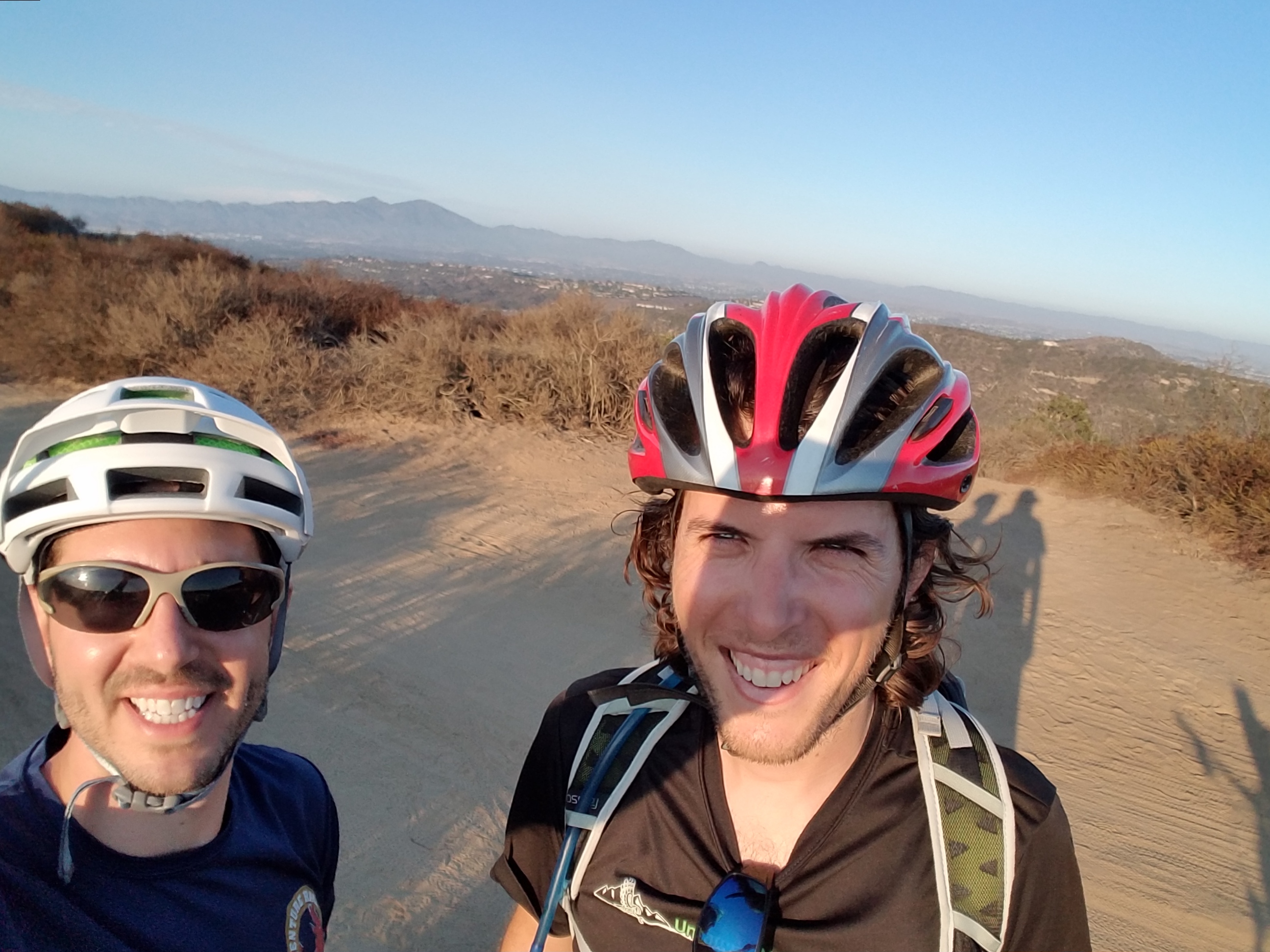
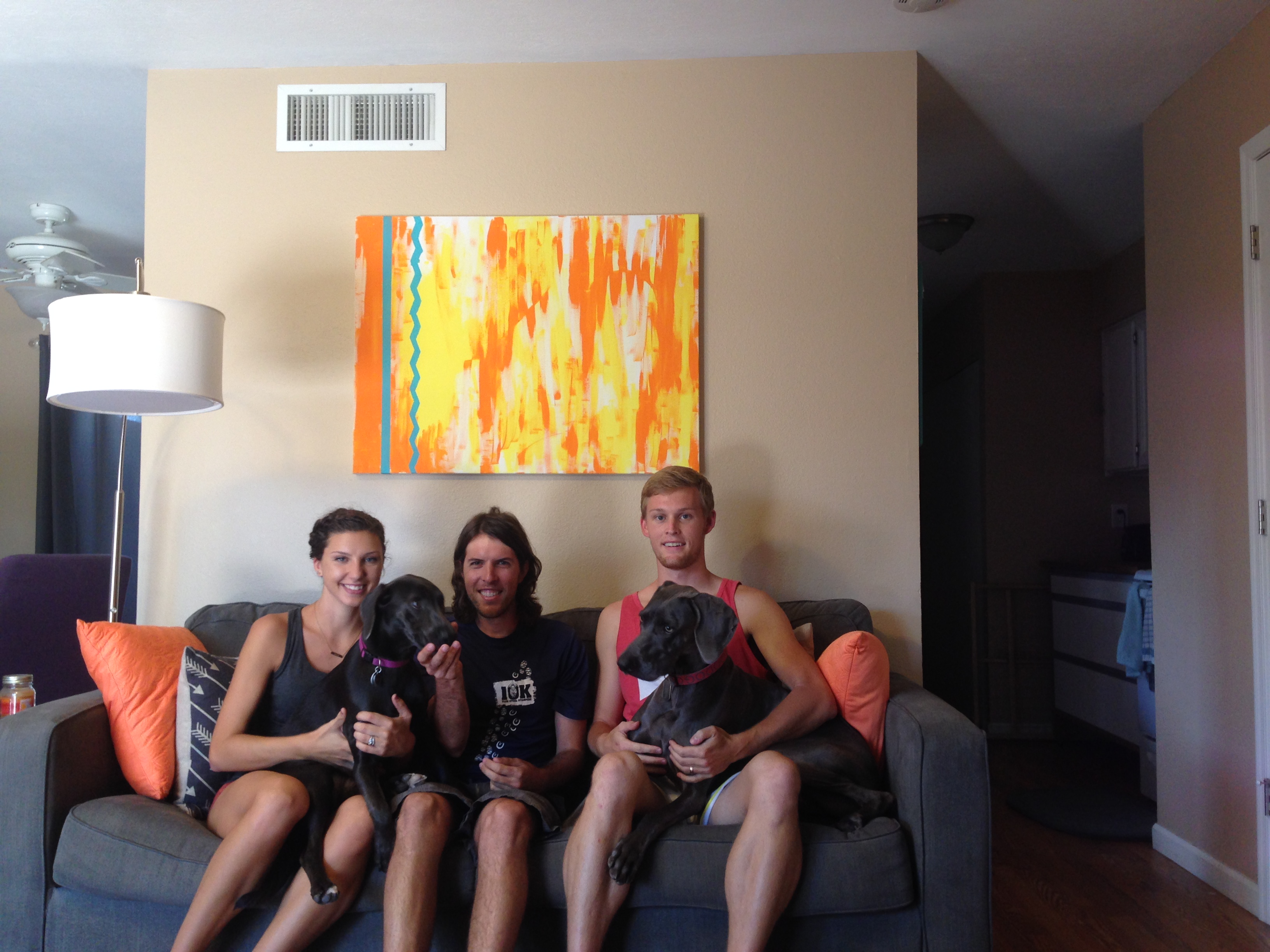
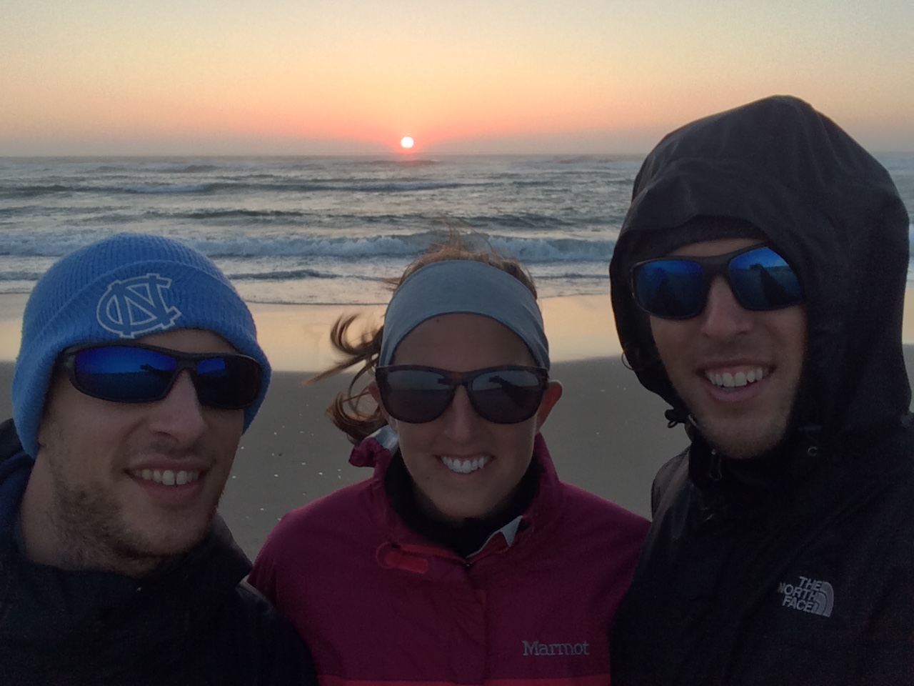
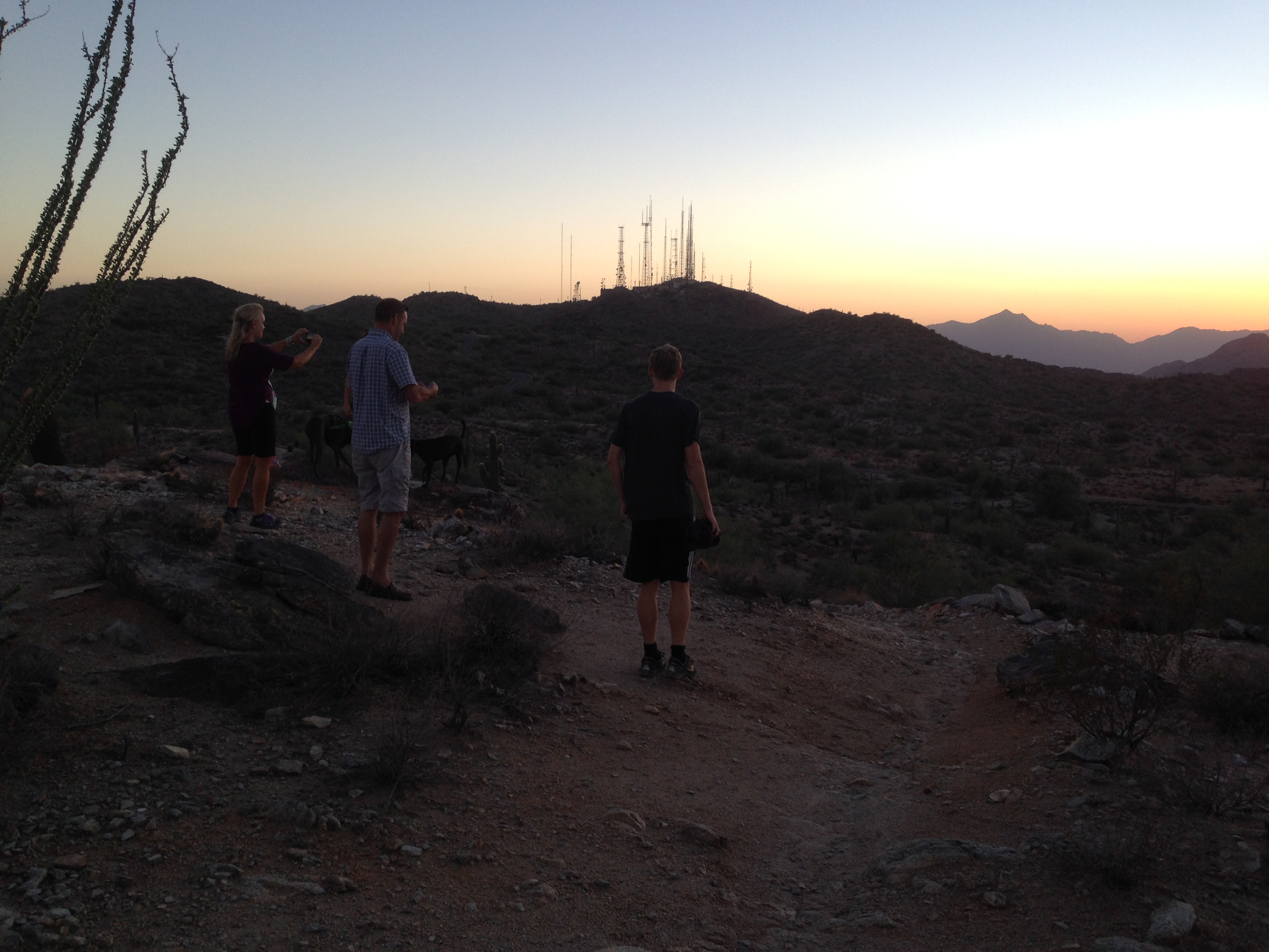
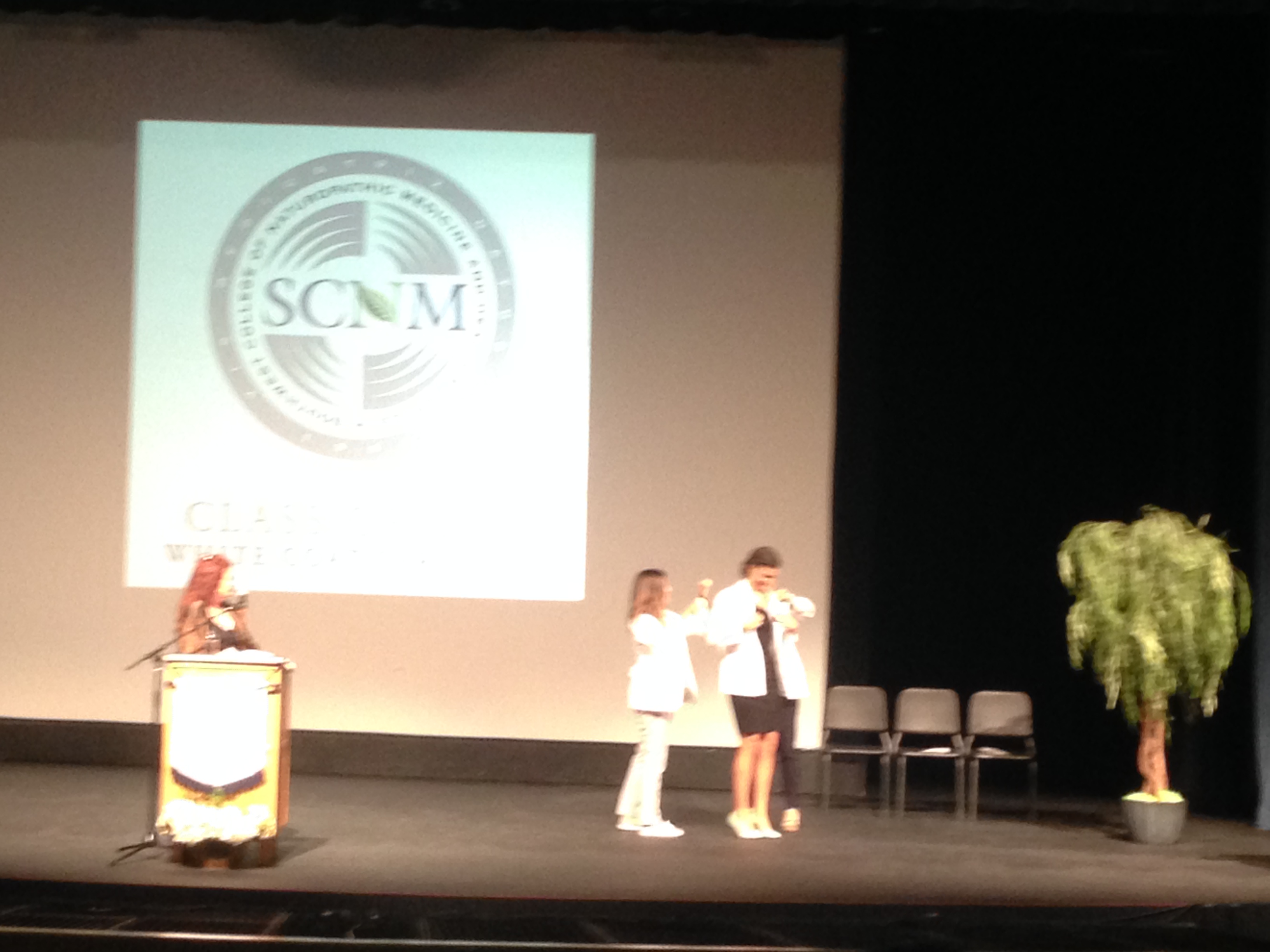
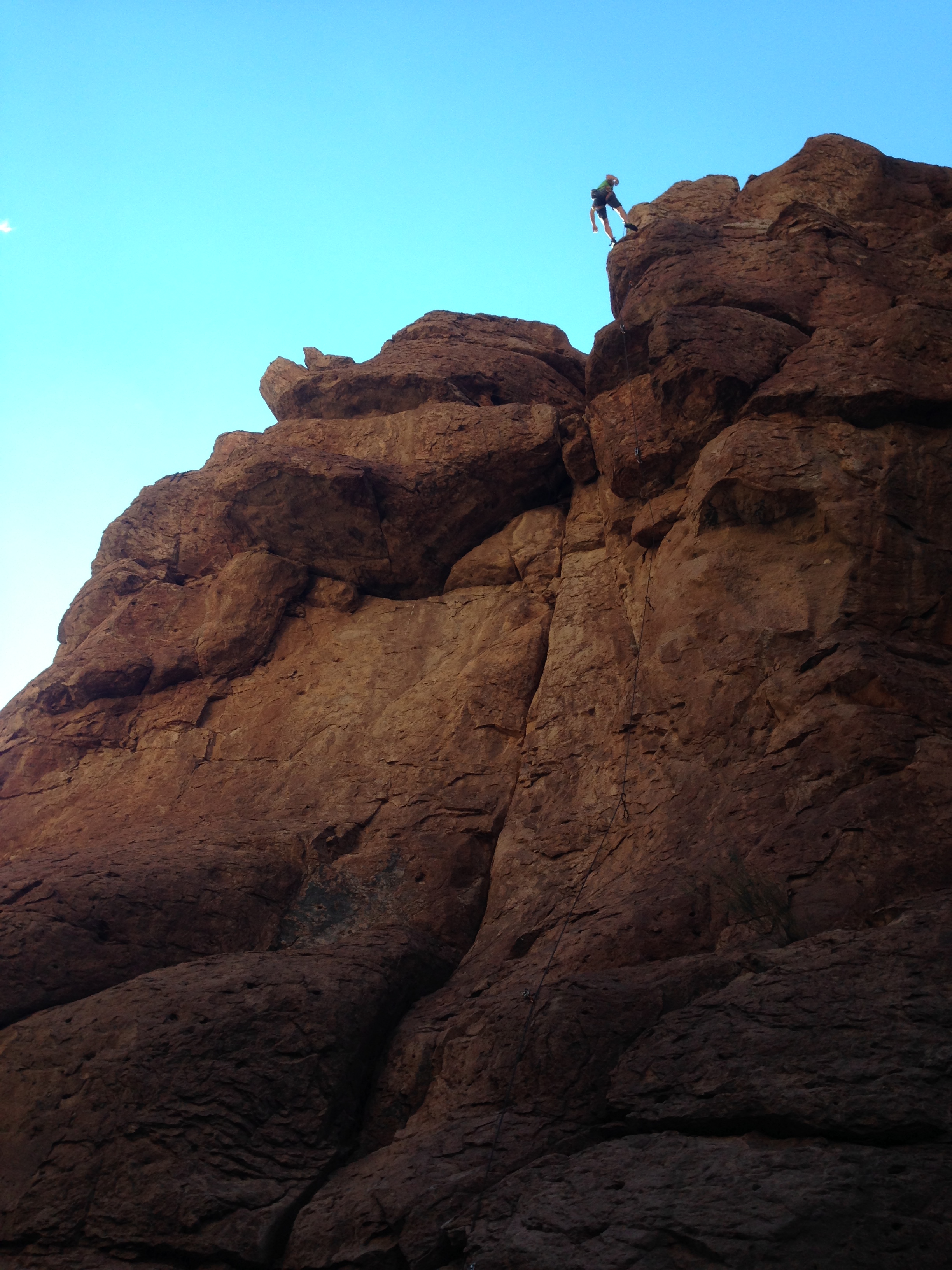
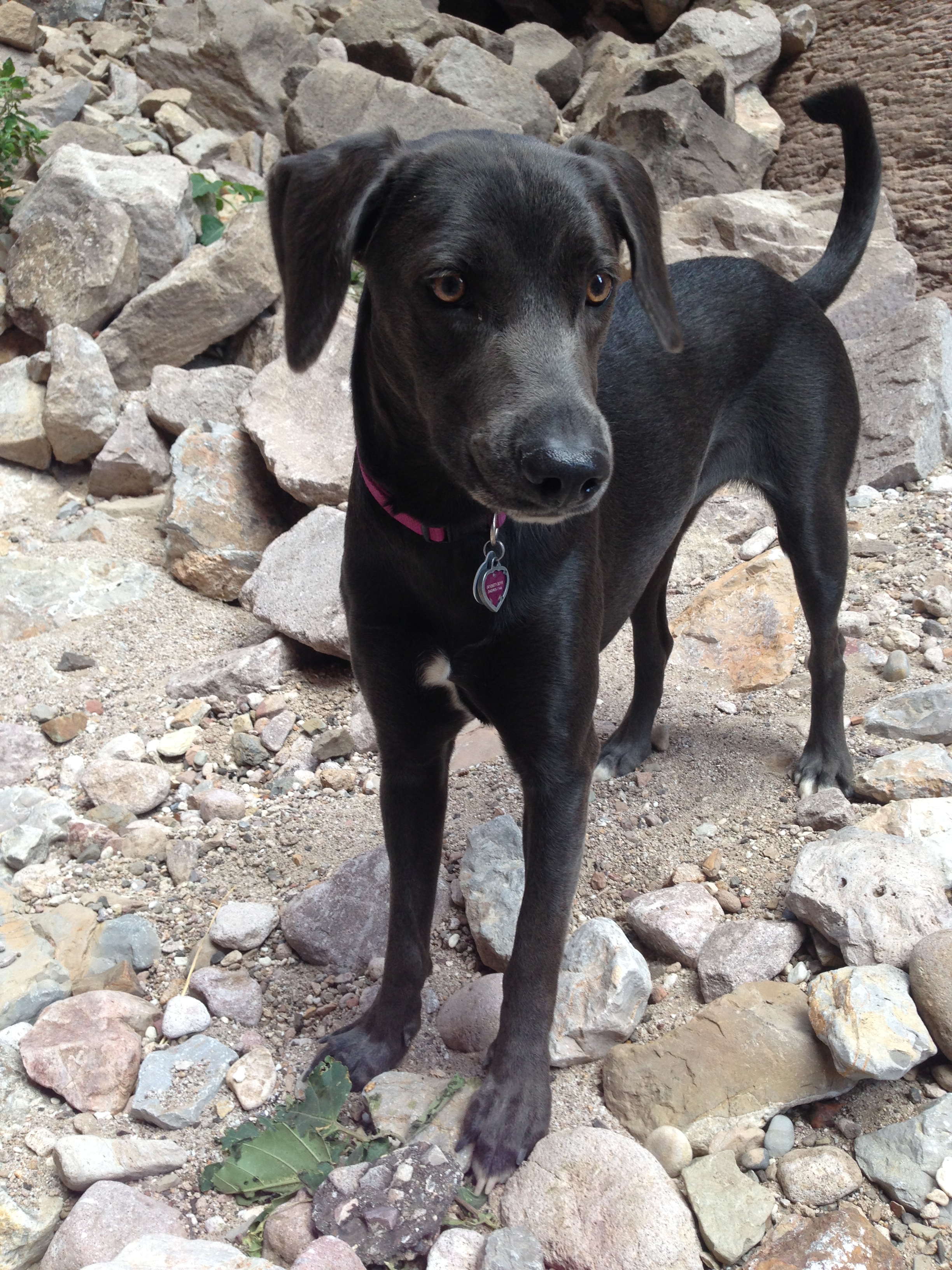
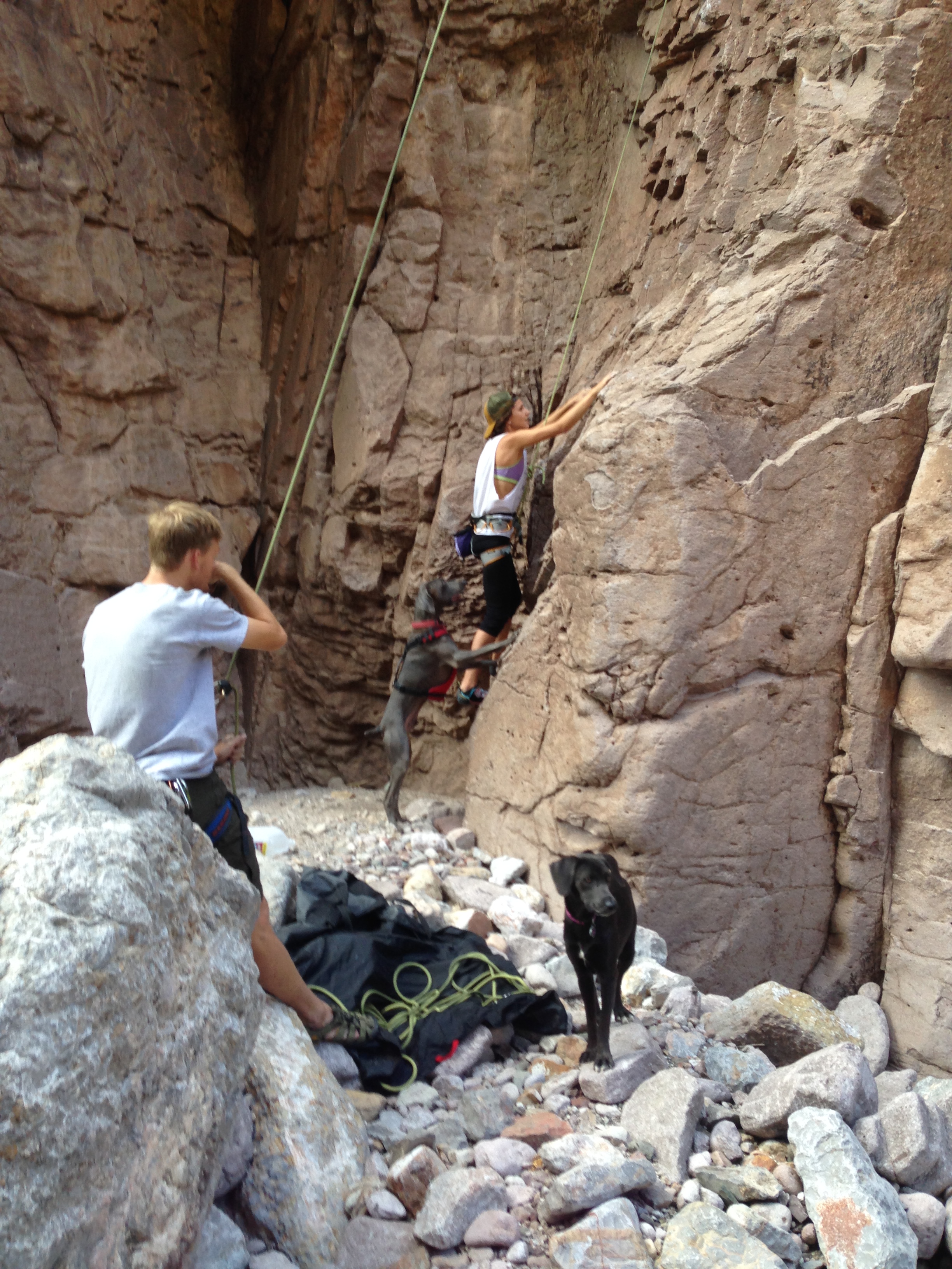
A three-hour drive South, brought me into Phoenix, AZ to meet back up with Maddie and Nathan, as well as Uncle Bryan, Aunt Lindy, and cousin Piper! We went for a sunset hike on South Mountain before bed. On Saturday, we ate lots of delicious food and, more importantly, we celebrated Maddie’s white coat ceremony as she proceeds through medical school. Piper even got to experience her first trip to a rock climbing gym and claims to have climbed even higher than Maddie! The following day, Maddie, Nathan, the dogs, and I drove out to an area called Atlantis for some real rock climbing. Neat climbing, much higher and harder than in the gym! Their friends had a very unique looking dog, Blue, that, despite his gentle demeanor, looked like a super-villan!

img_2773 img_2777 img_2785 img_2797 img_2803 img_2801

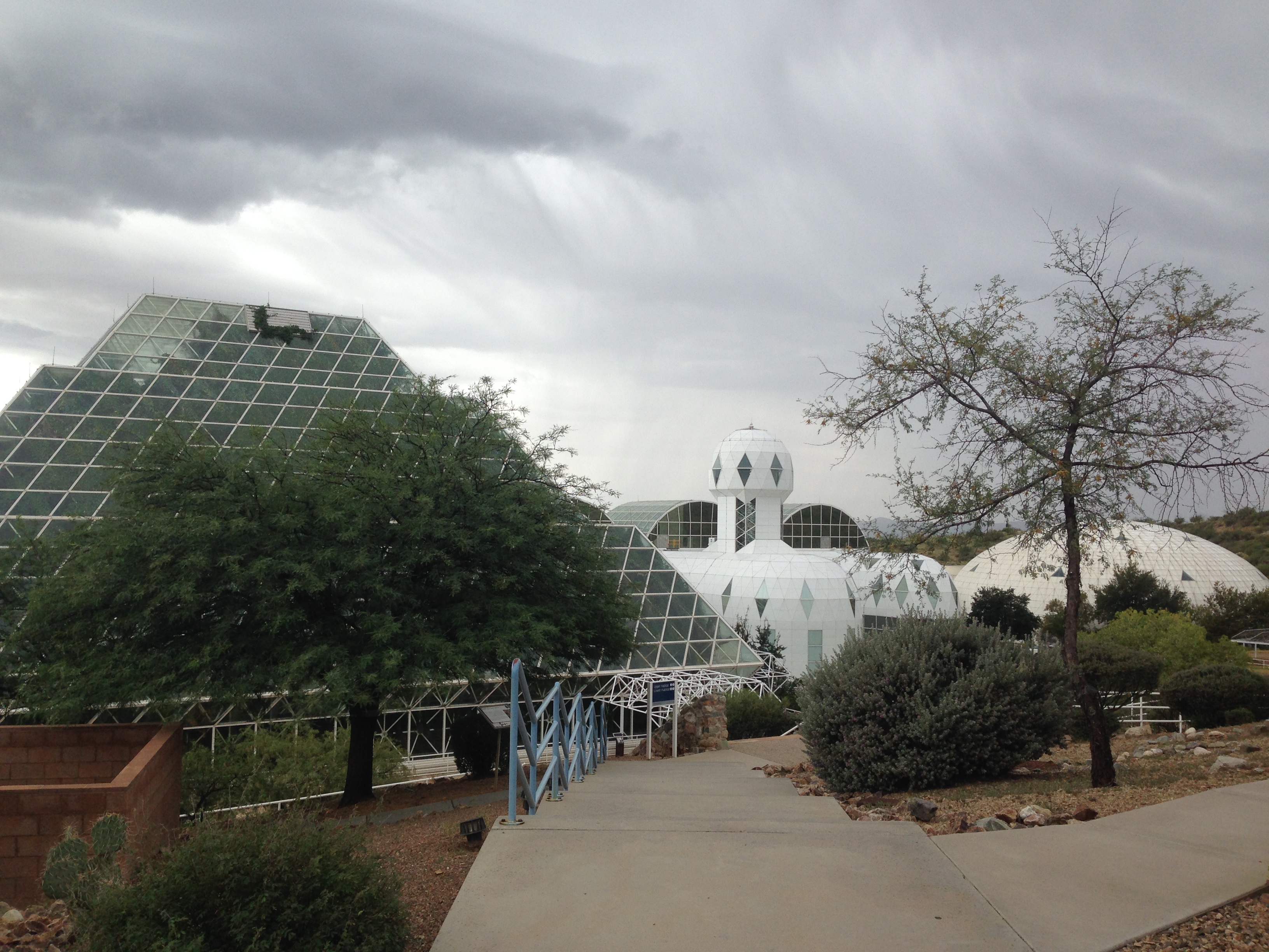
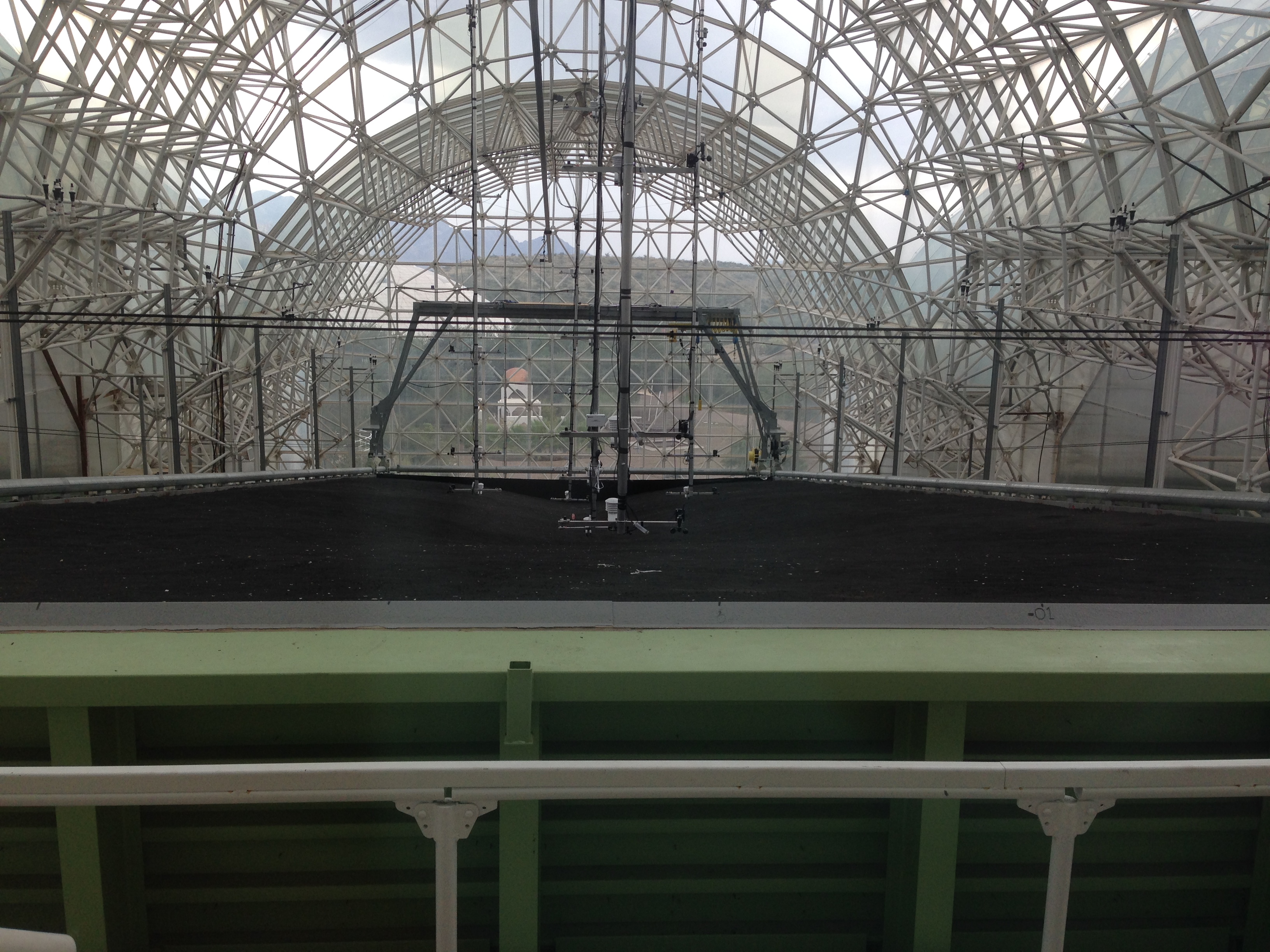
Heading out of Phoenix, I paid a visit to Biosphere 2, a massive, enclosed, bio dome where people once lived inside for two years straight to simulate and research possible colonization of another planet! I randomly arrived on the 25th anniversary of the day they began the first mission!

img_2807 img_2817

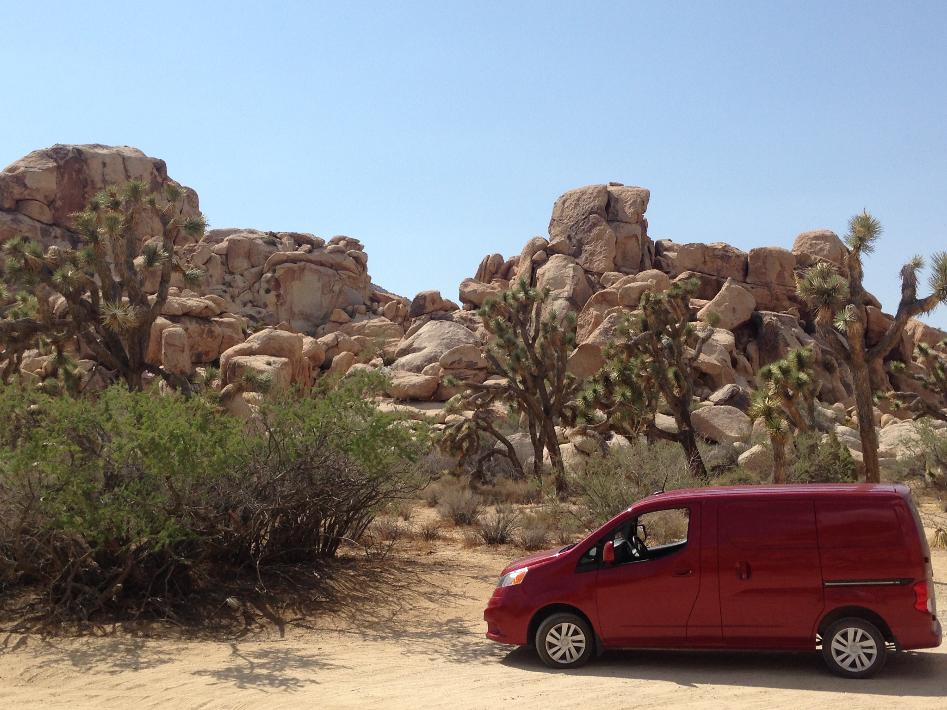
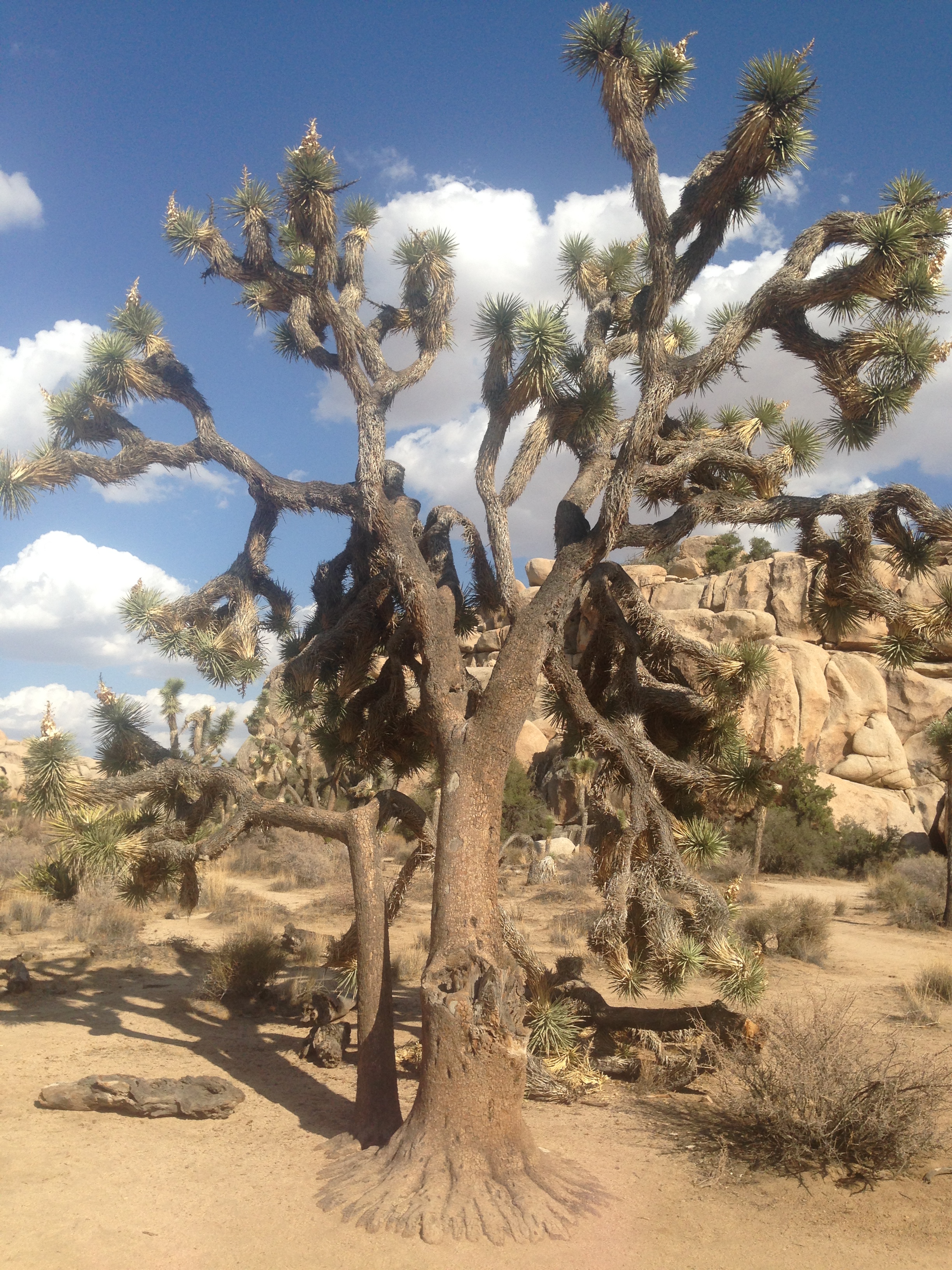
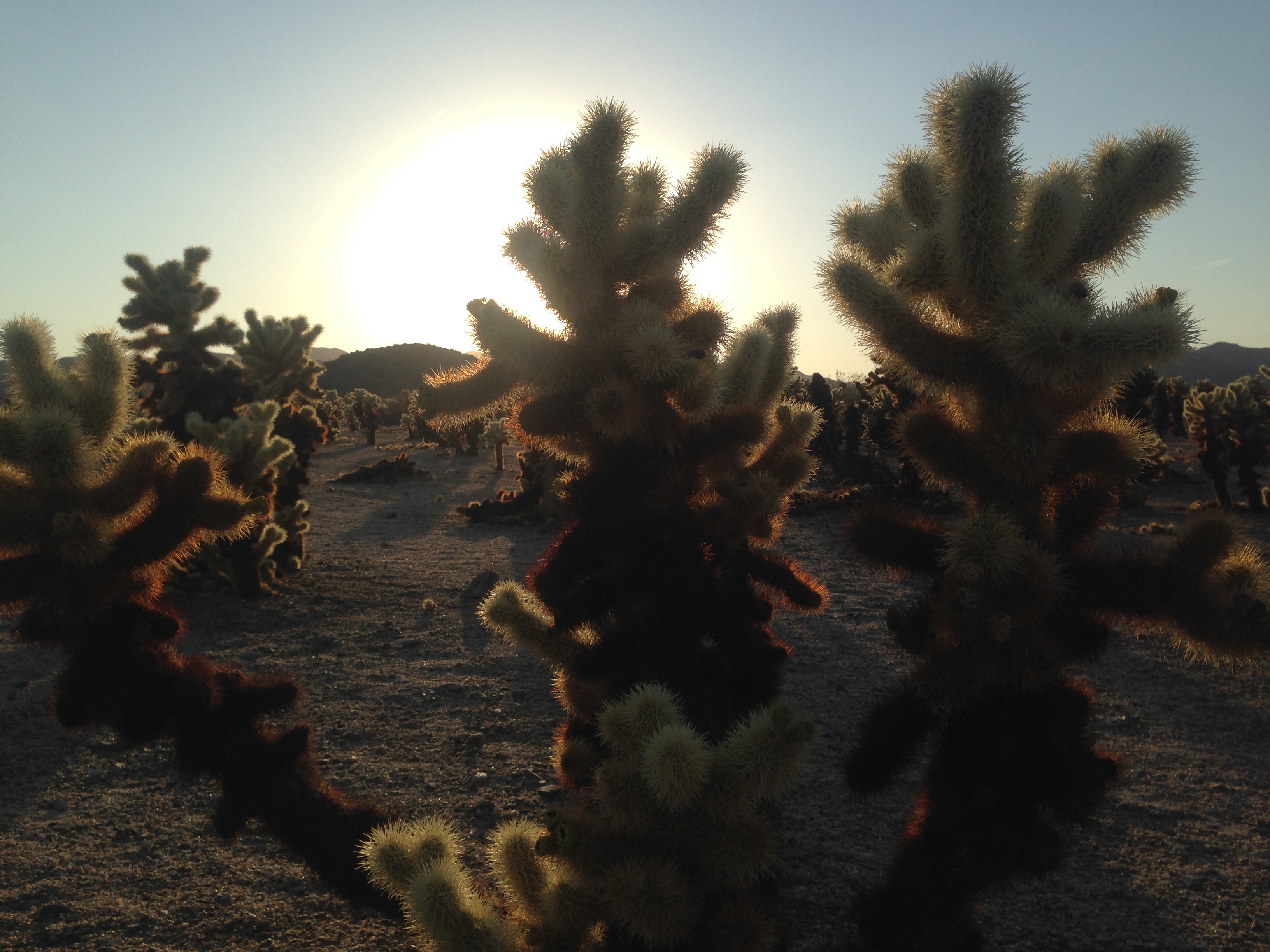
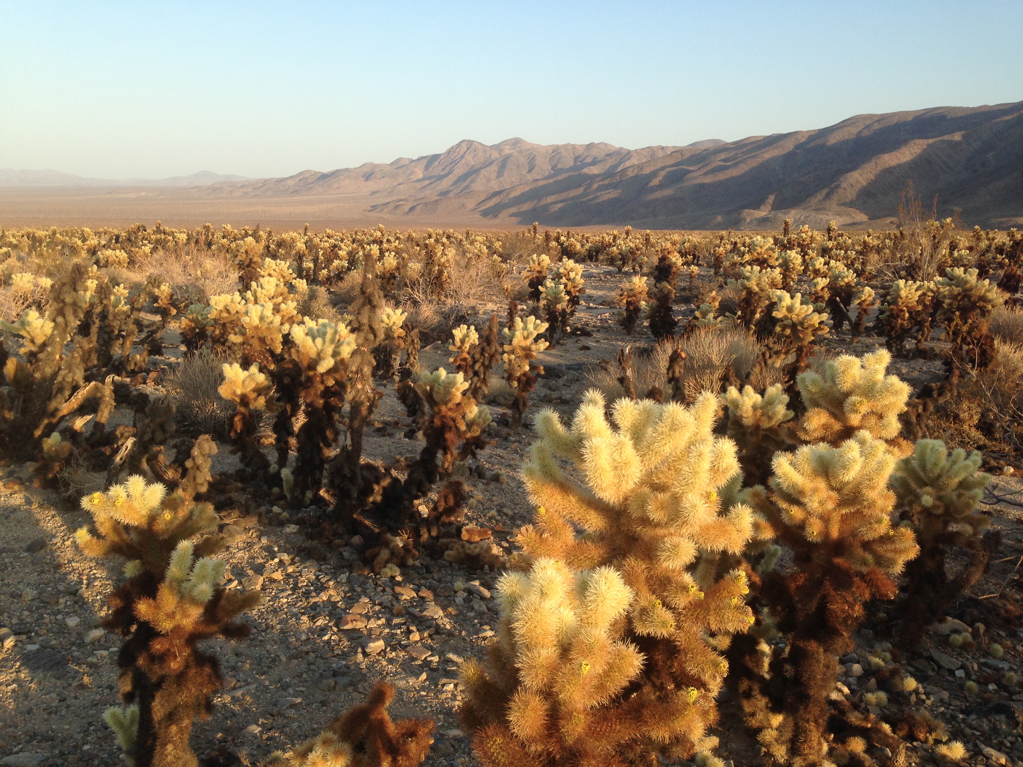
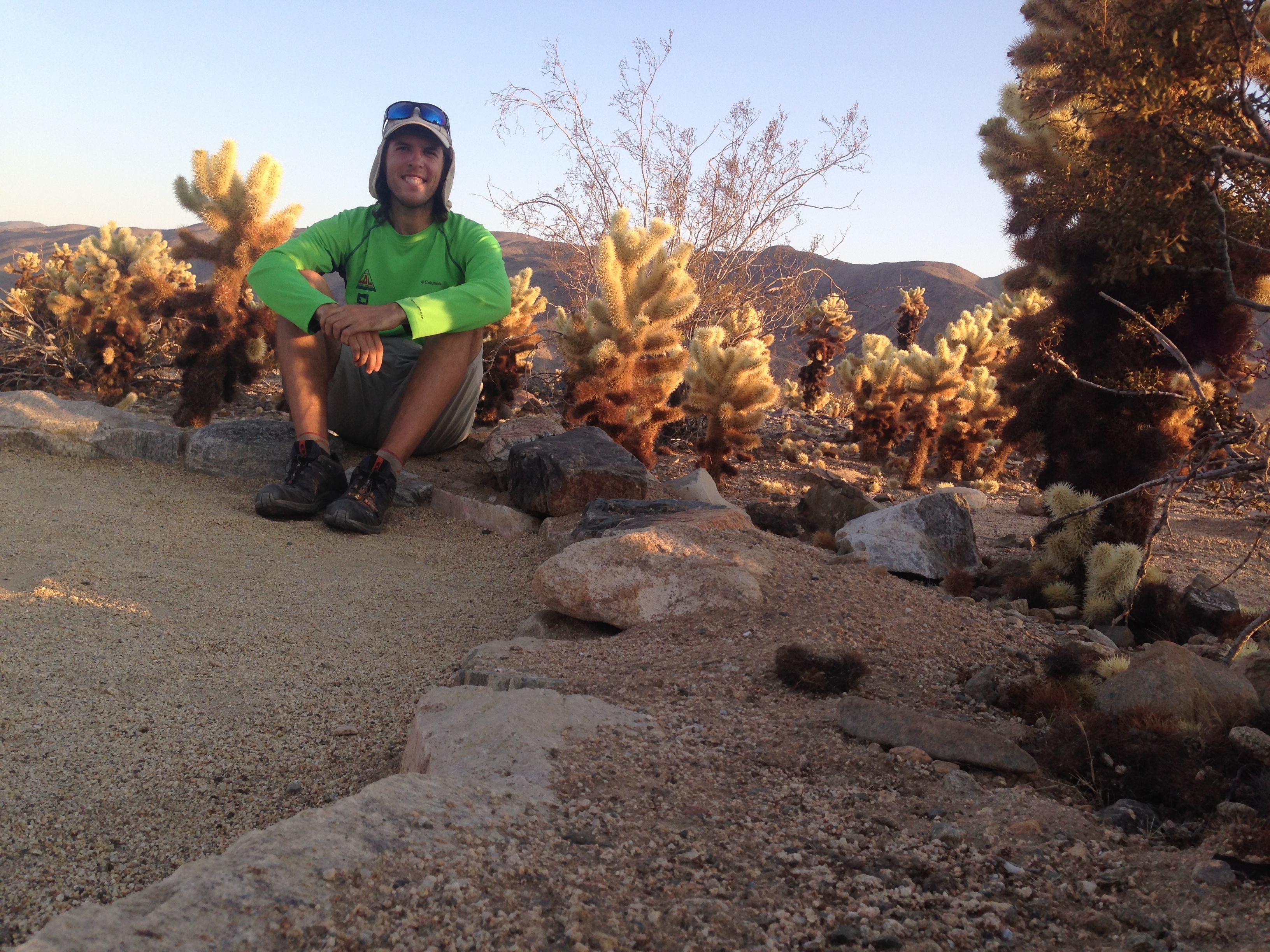
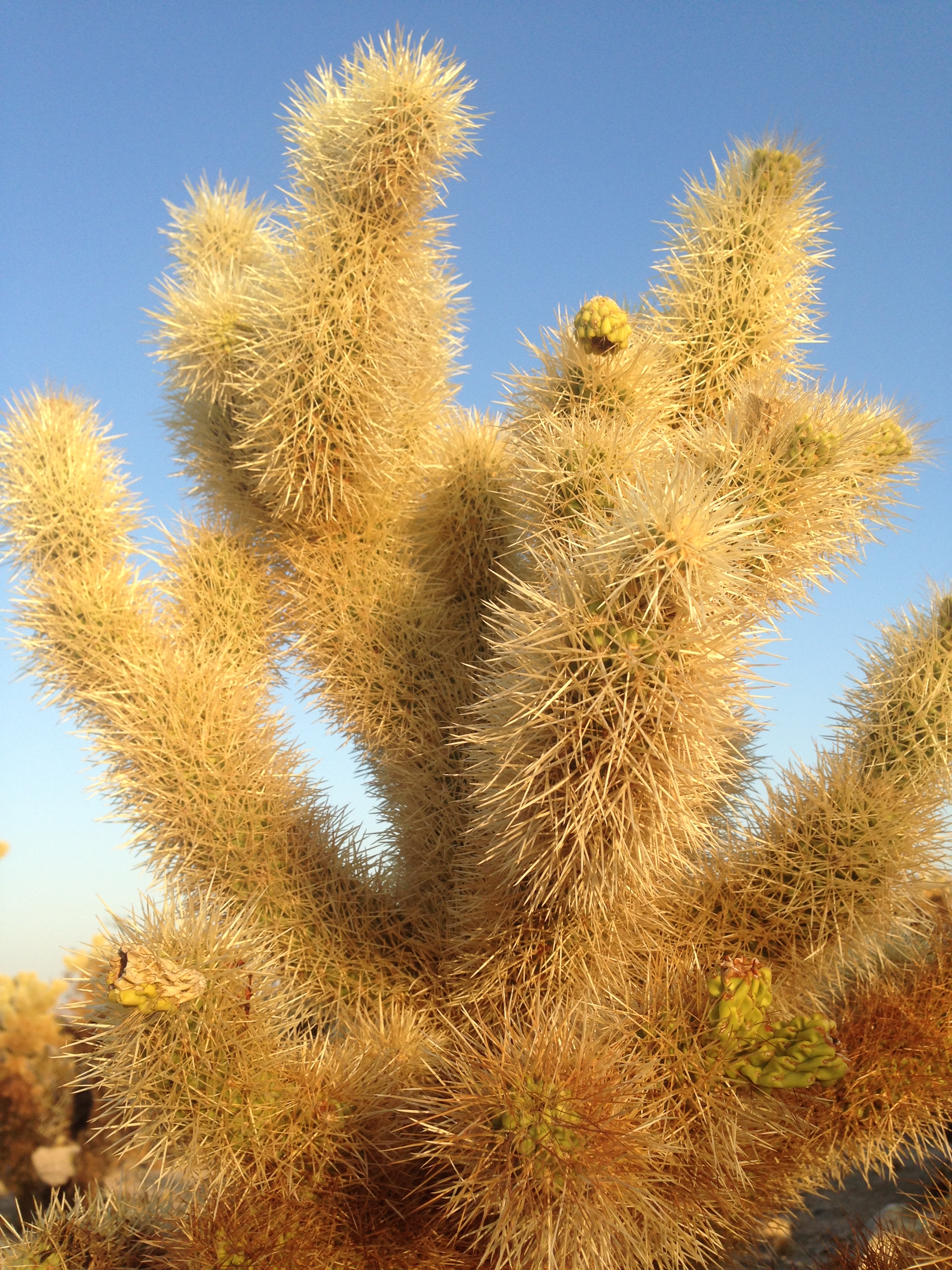
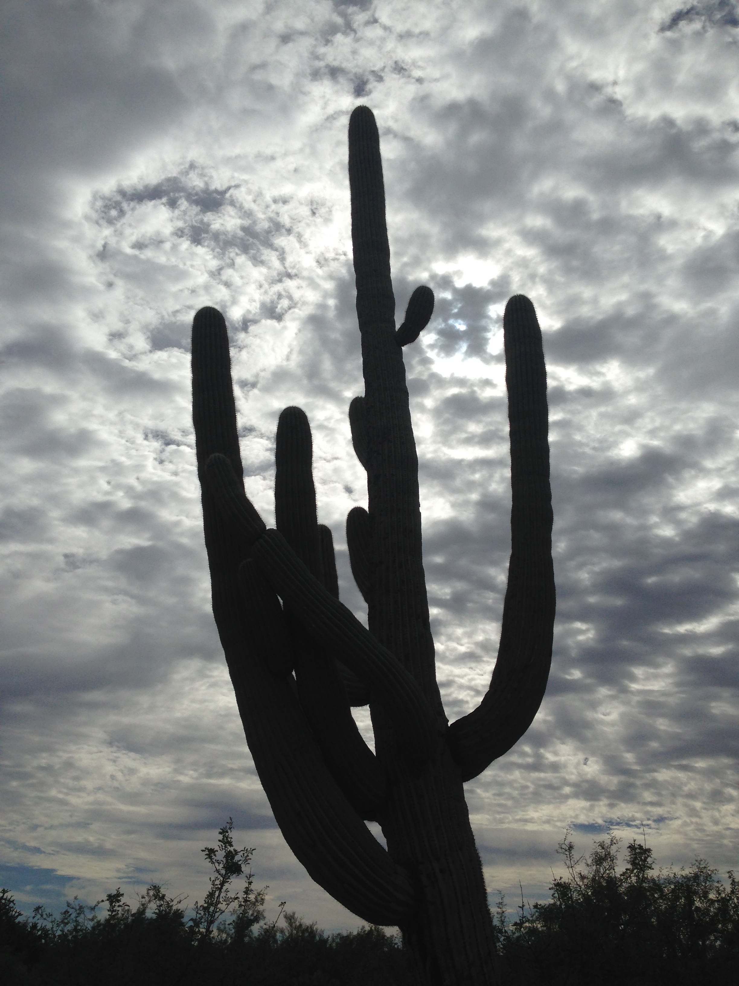
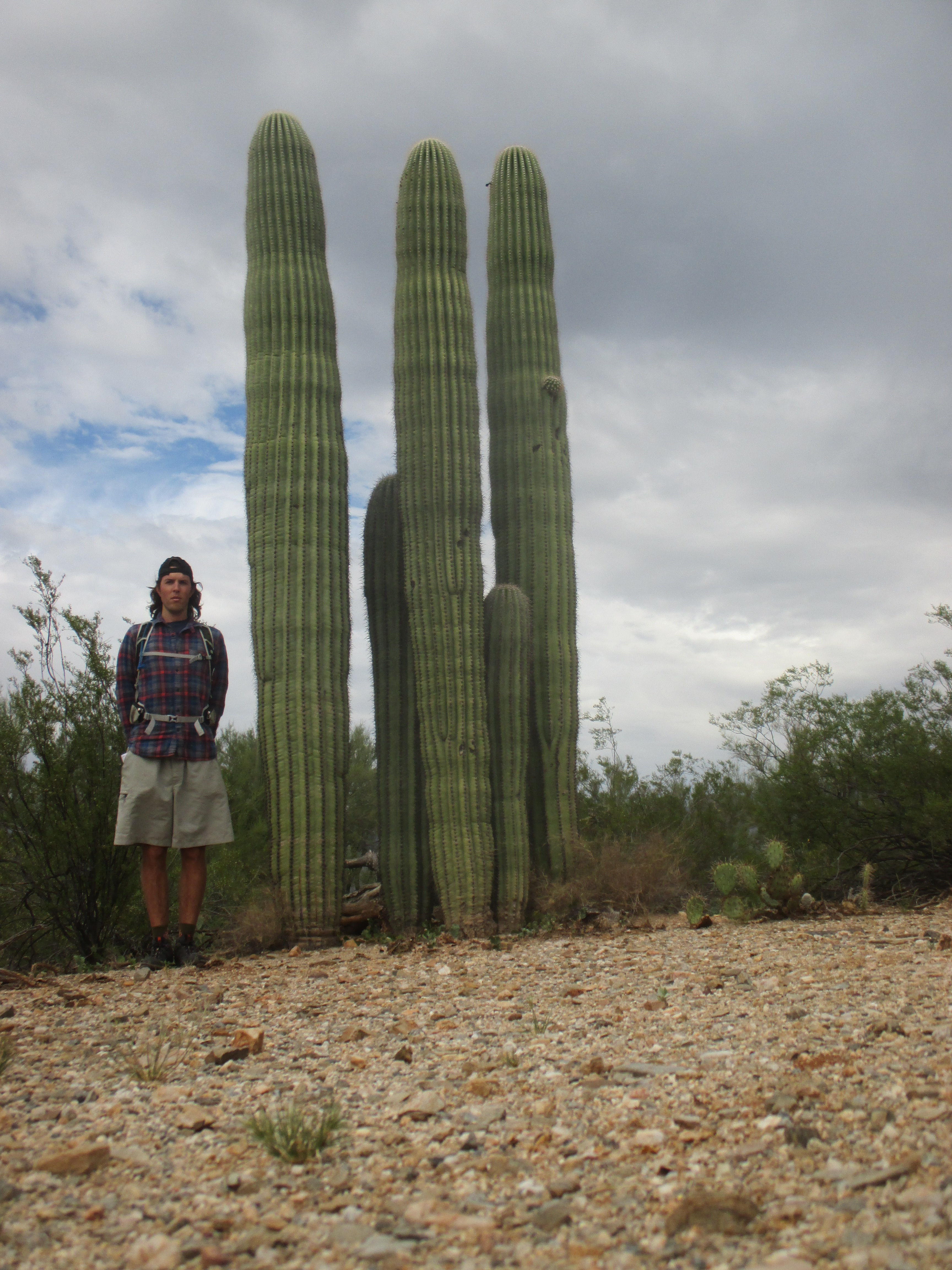
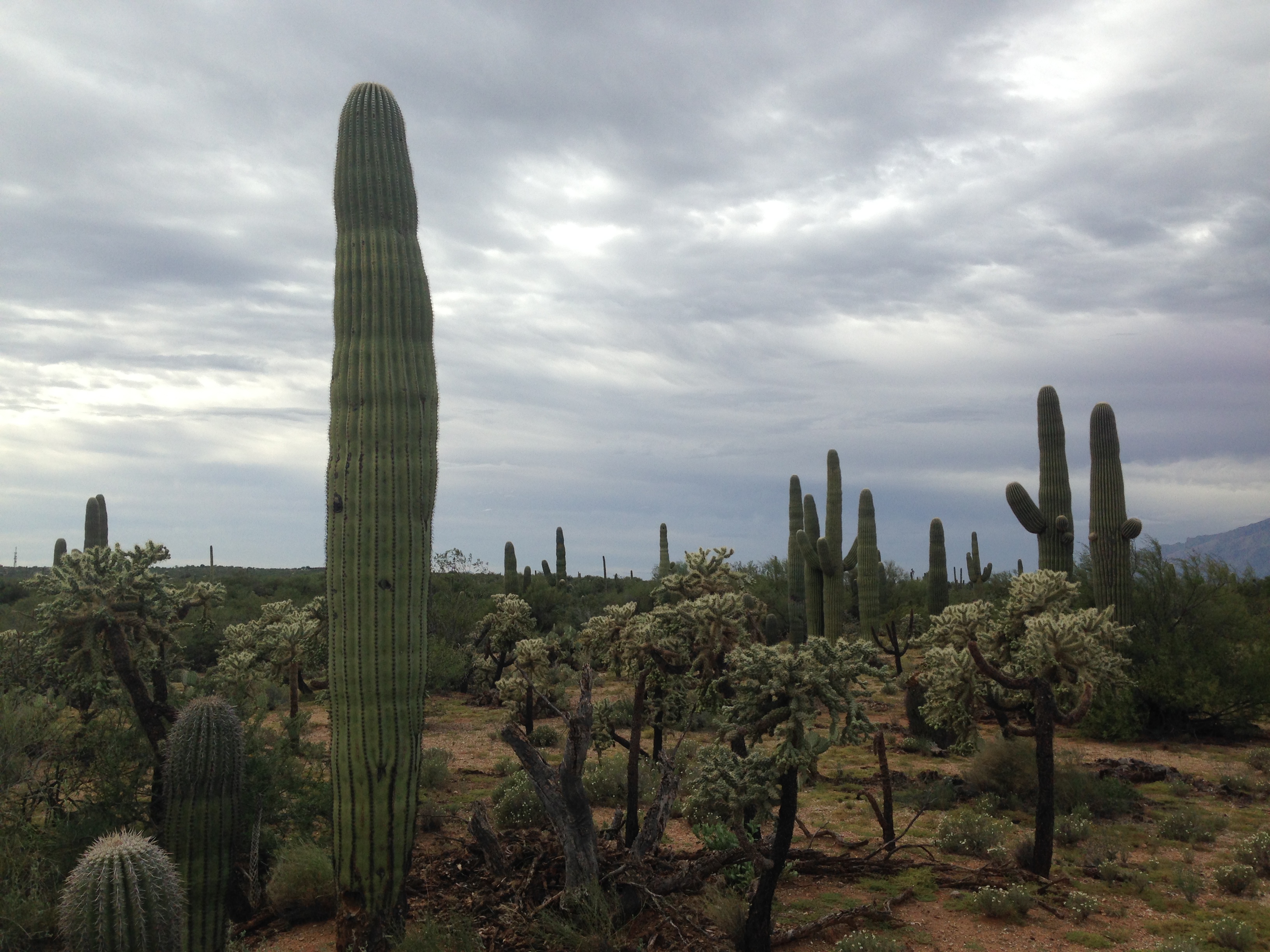
The last stop in Arizona was Saguaro National Park, home of the stereotypical cactus from the cartoons. A very neat hike through this desert climate, densely packed full of many cactus and shrub varieties. At night I had the most picturesque sunset down a lazy dirt road.

img_2842 img_5747 img_2825 img_2832 img_2859 img_2850

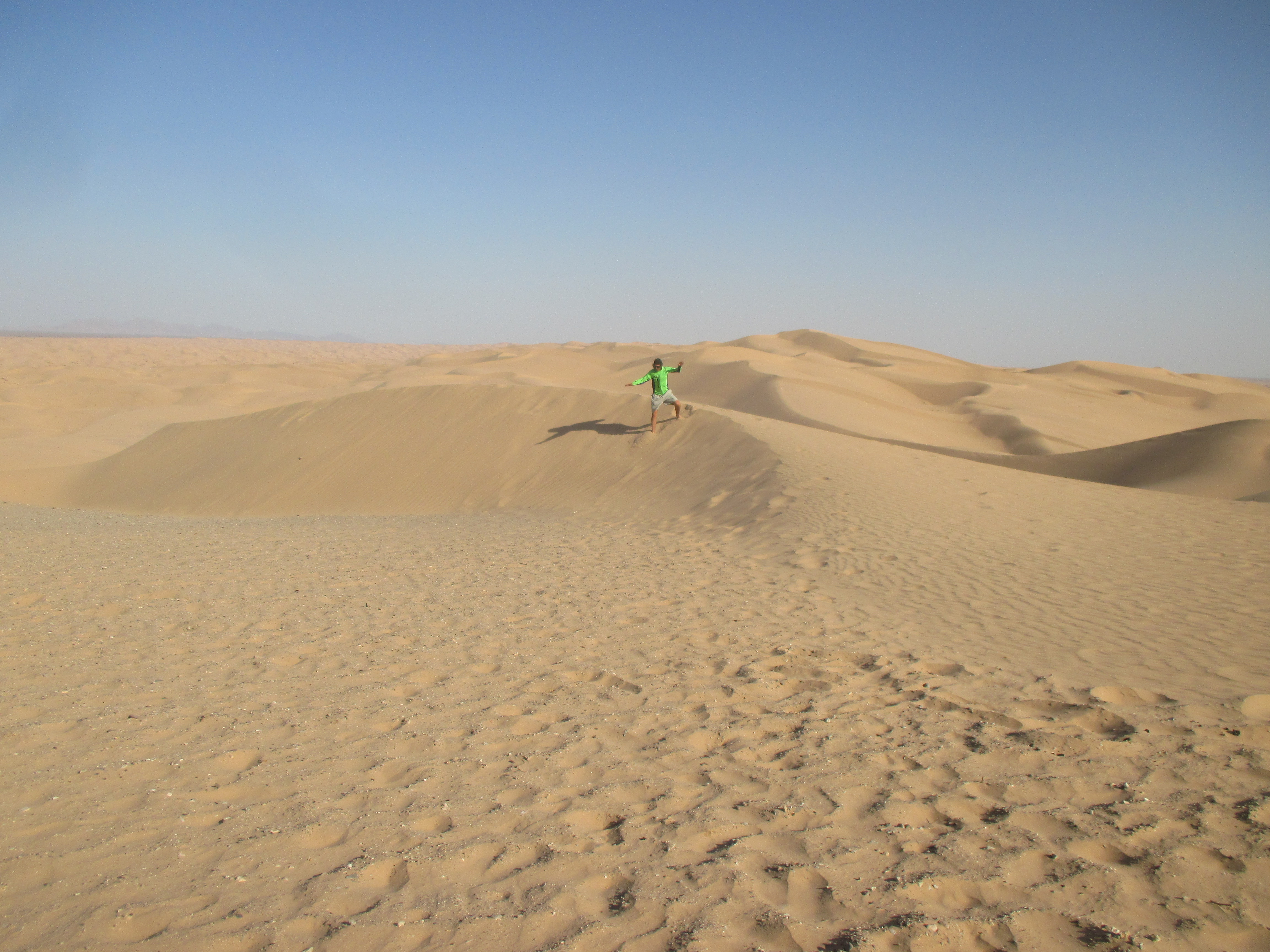
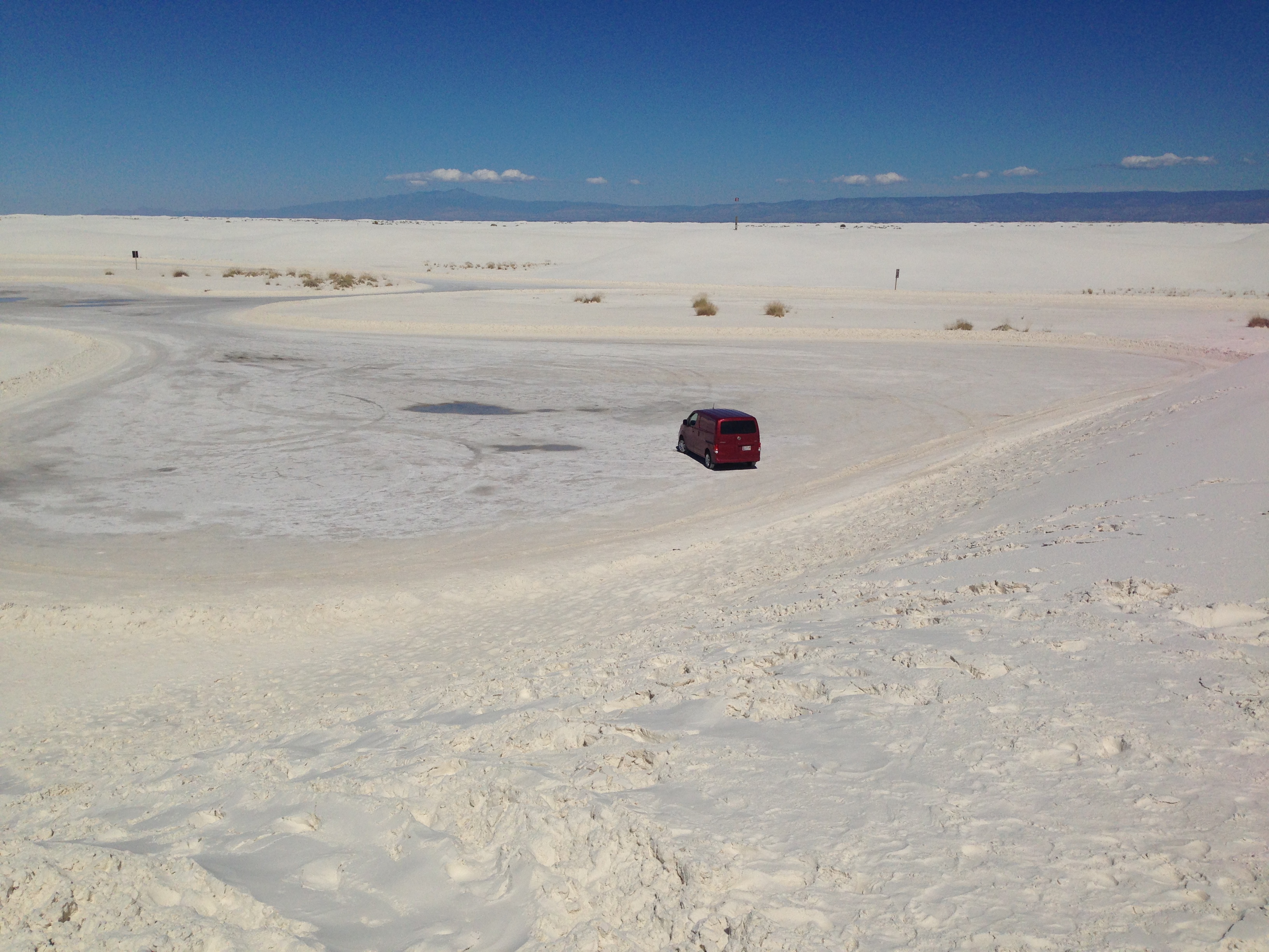
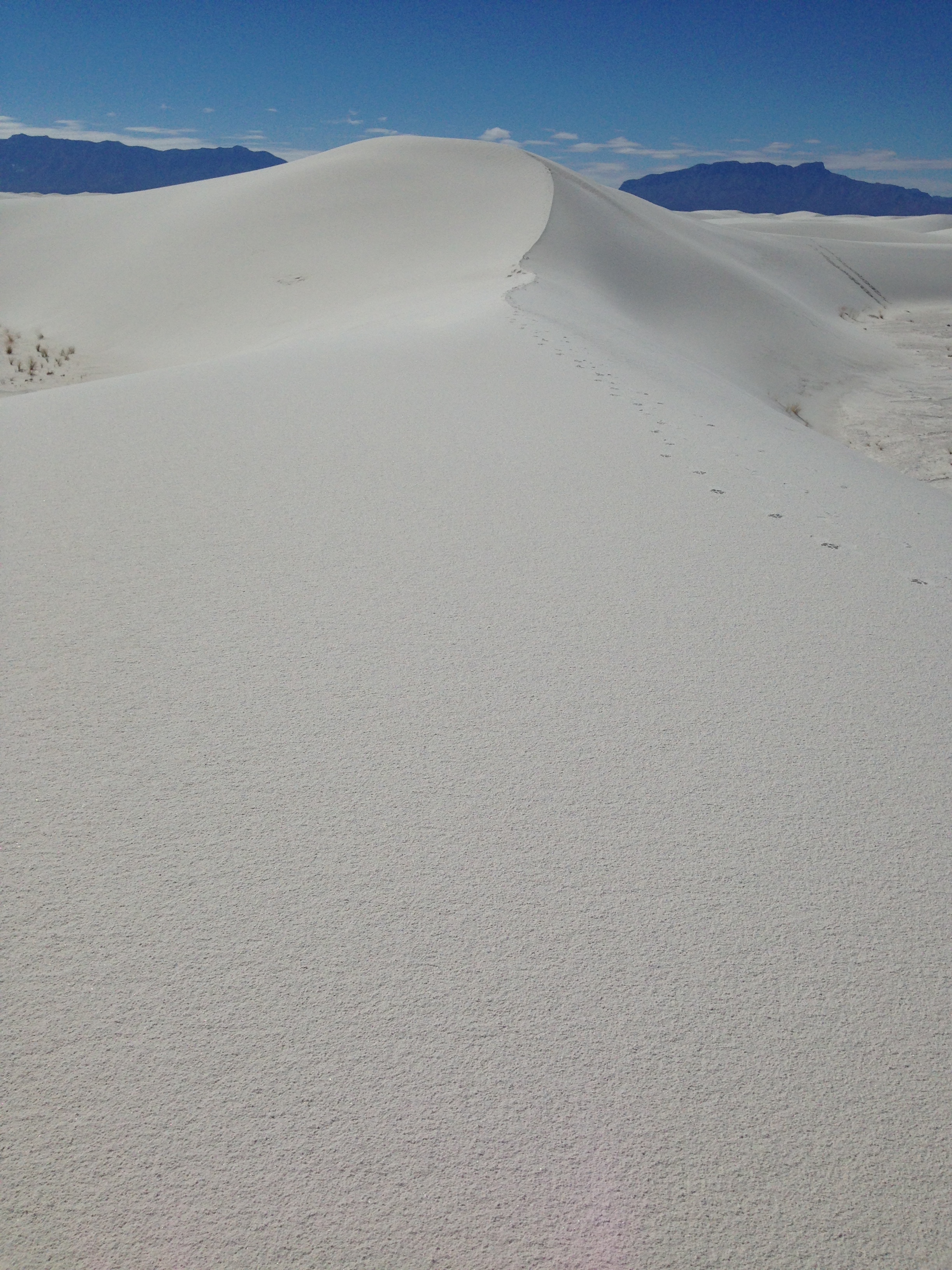
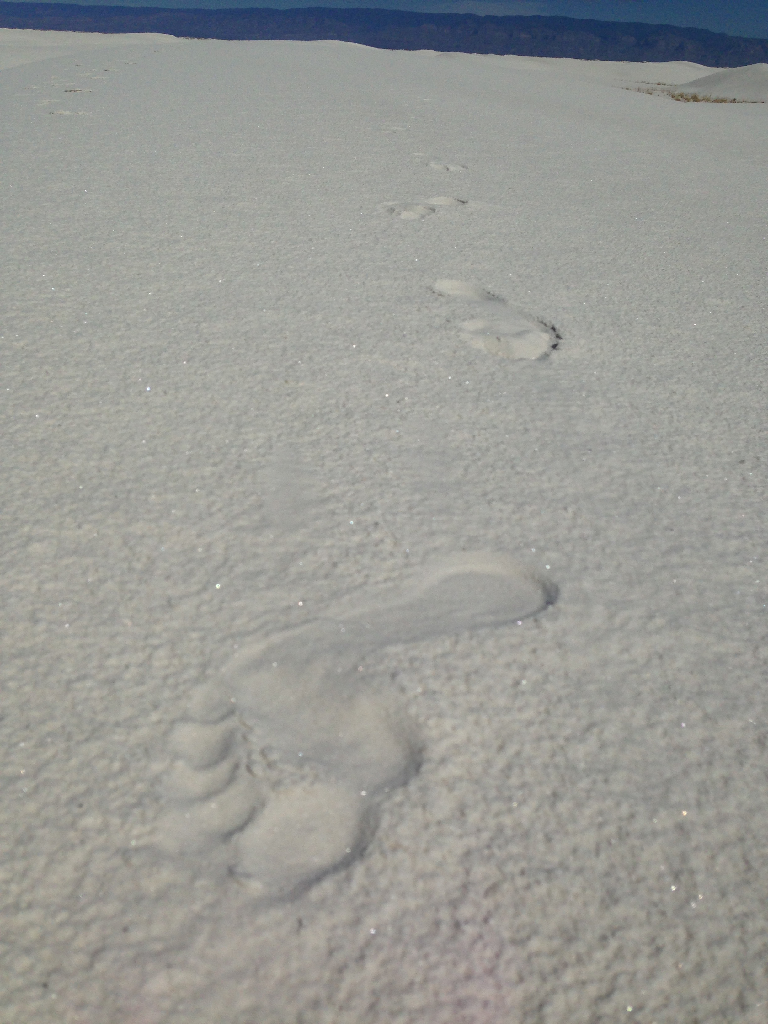
Entering into New Mexico, the next destination was White Sands National Monument. Just like the name alludes, the area was rolling sand dunes of pure white gypsum in every direction. The sand was still damp and cool from the morning rain and felt fantastic on the feet. Perfectly still and quiet out there in the middle of this expanse.

img_2866 img_2870 img_2876

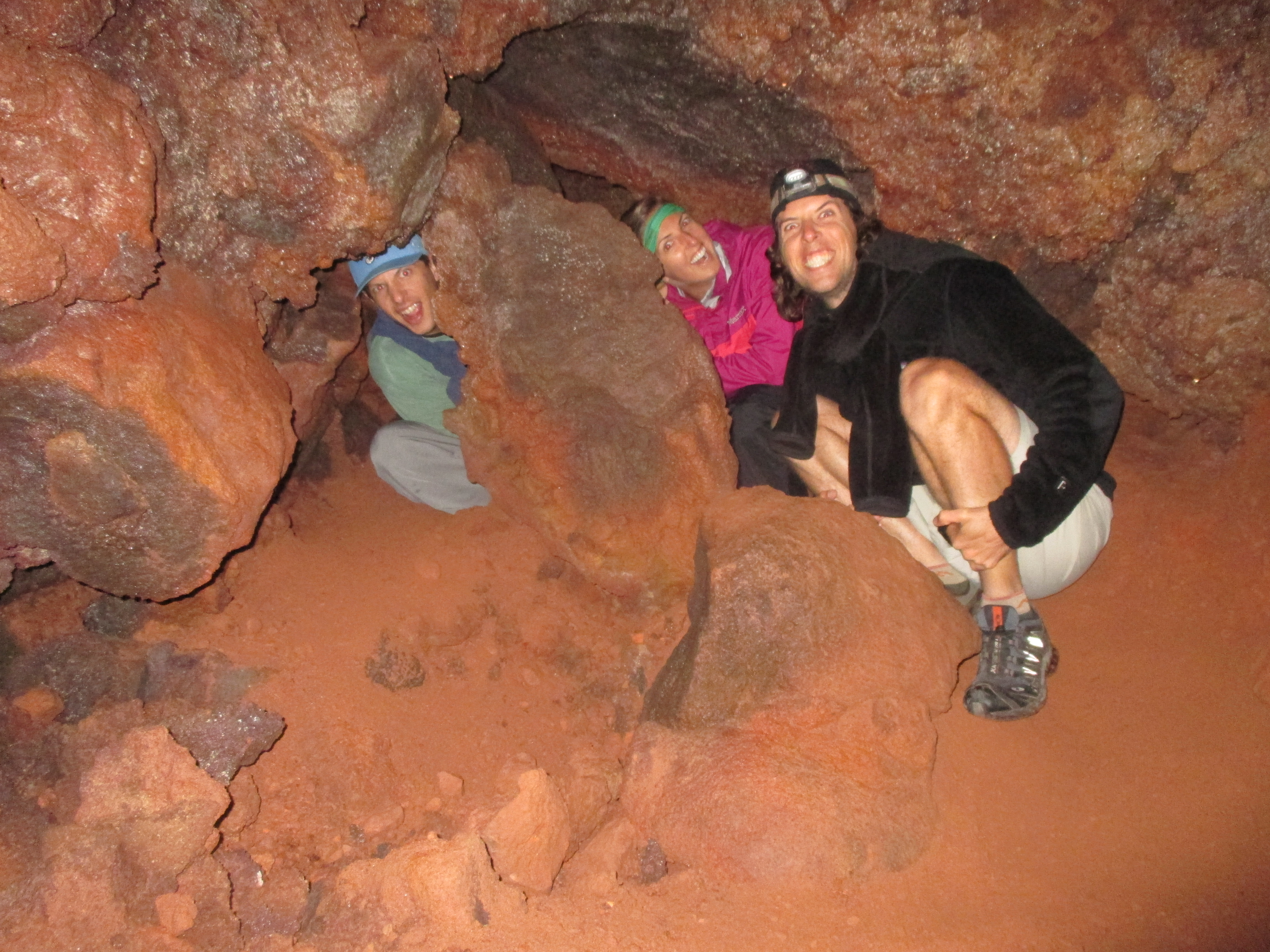
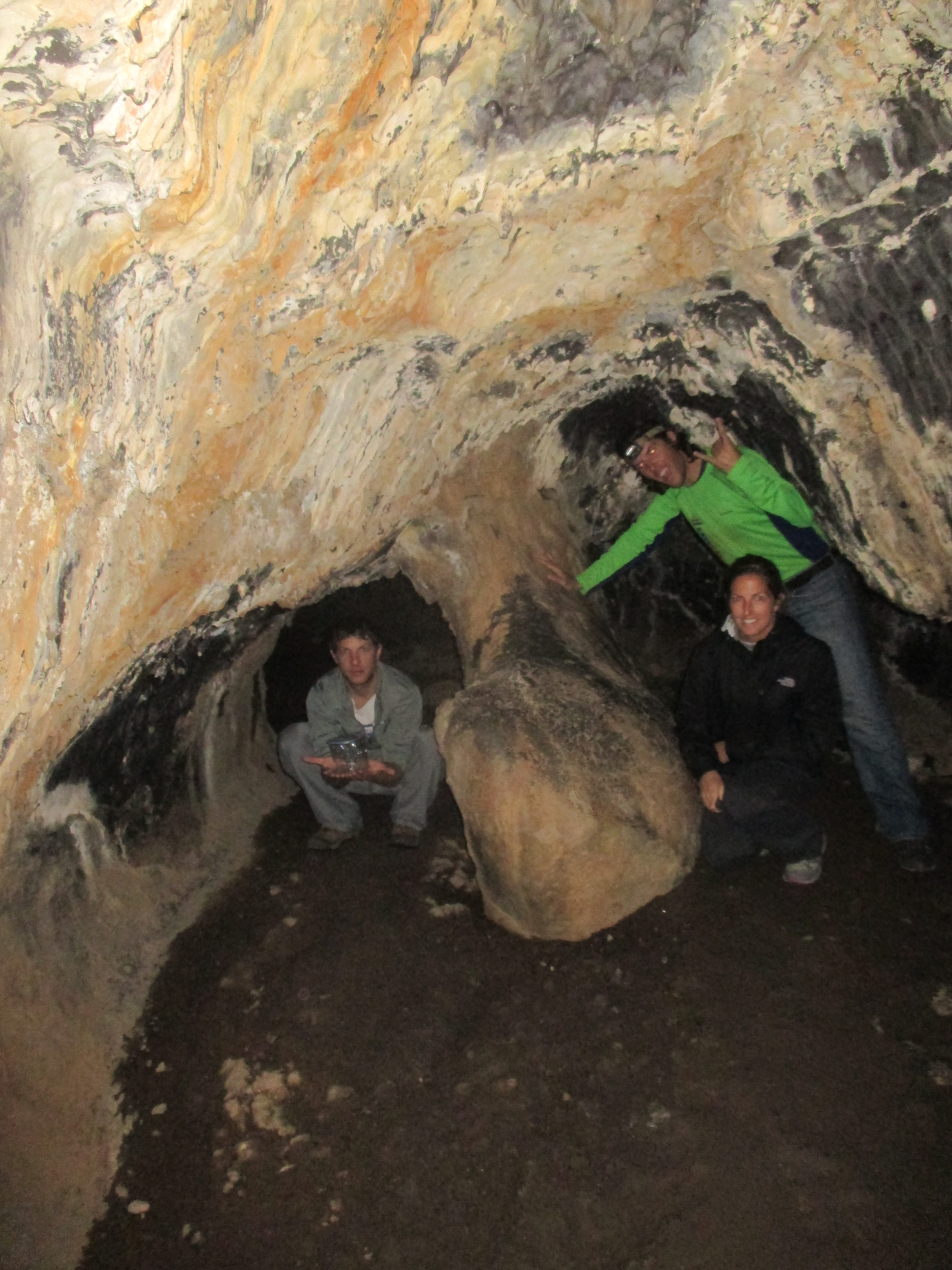
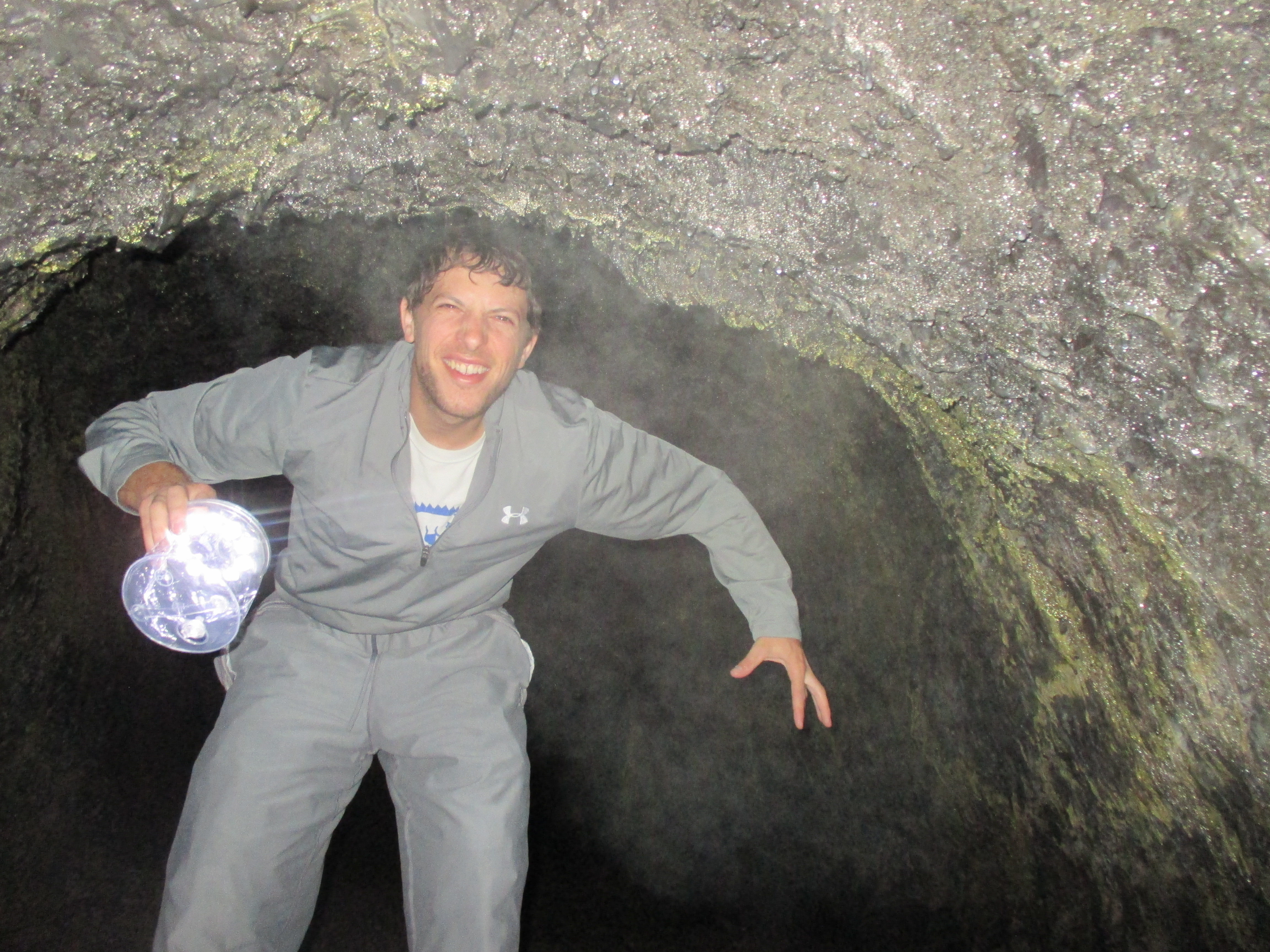
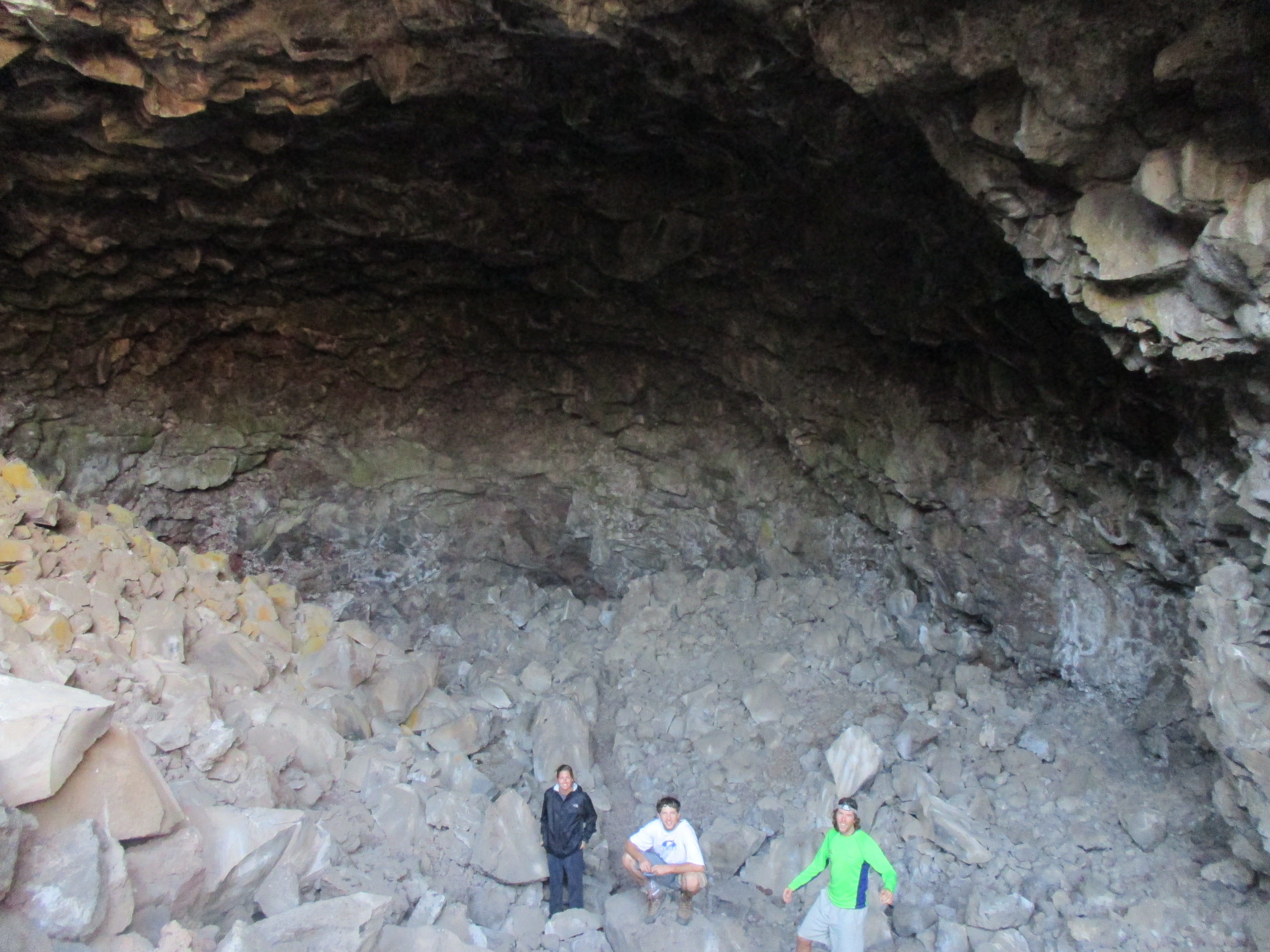
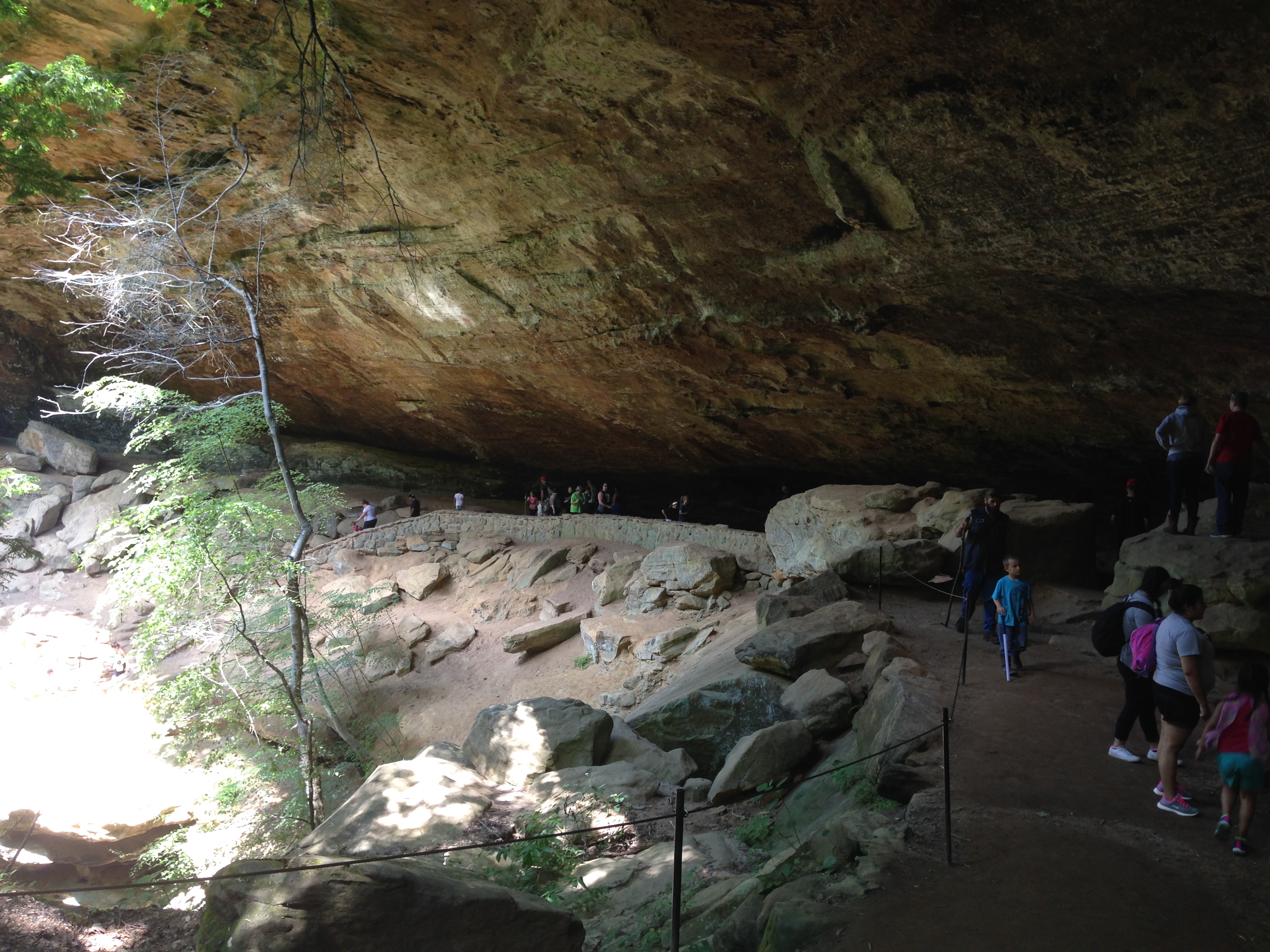
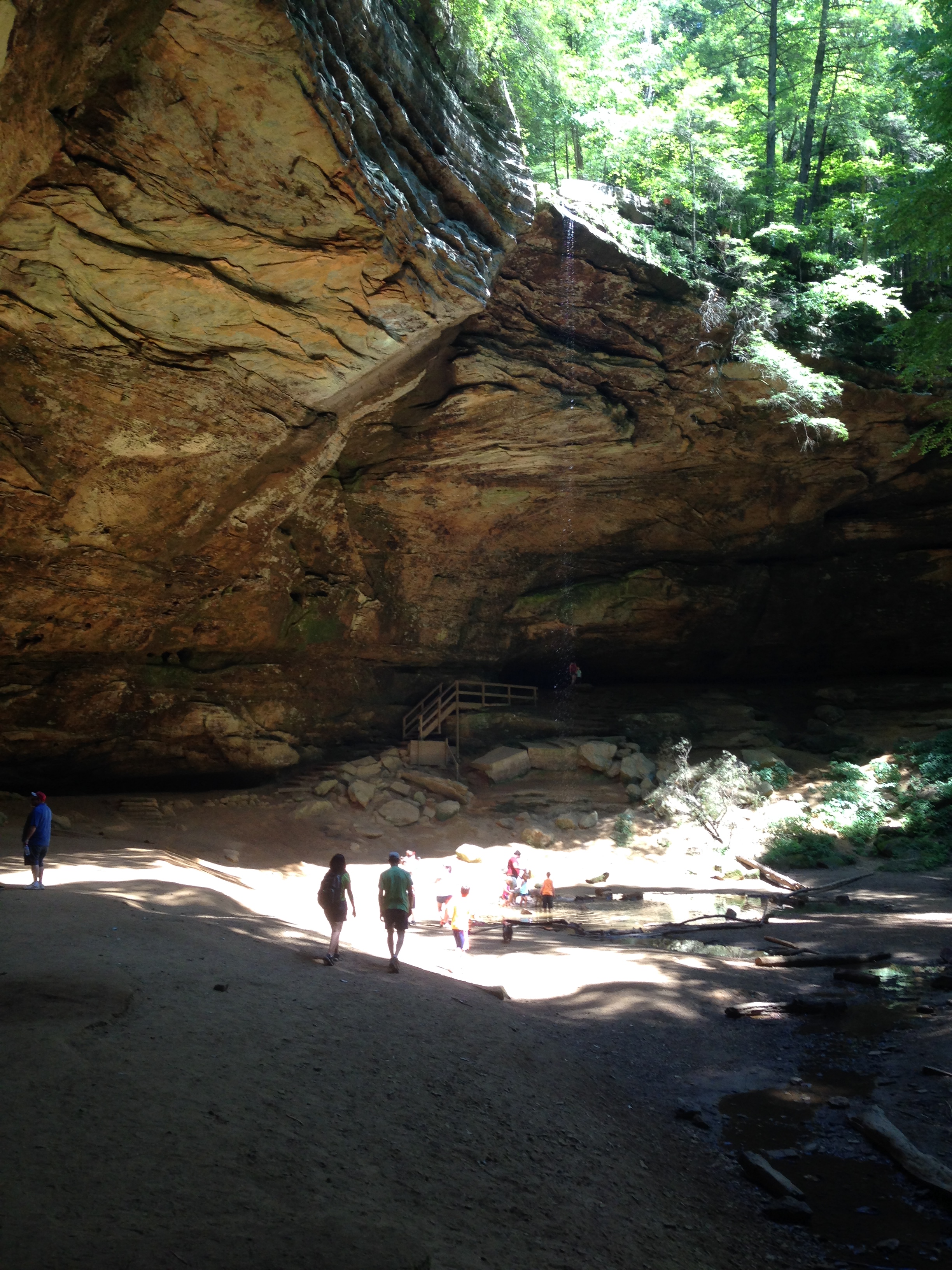
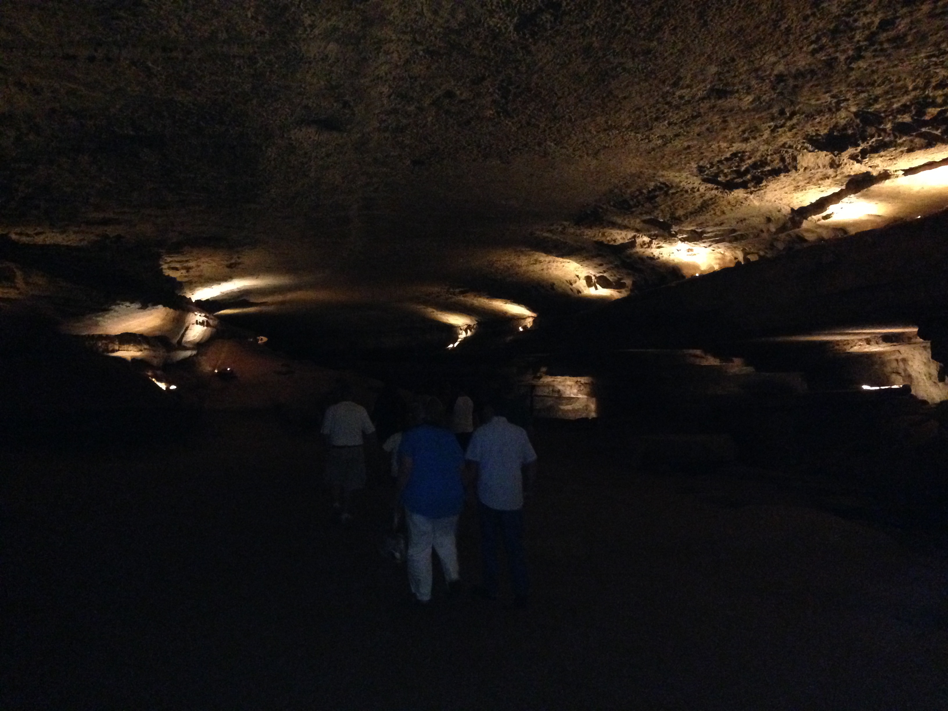
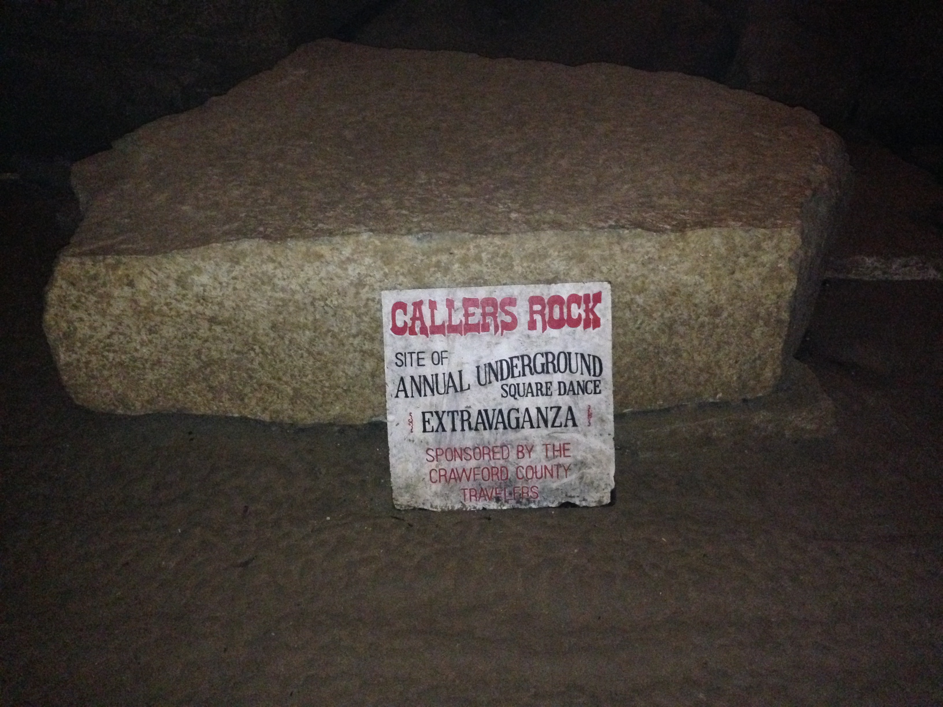
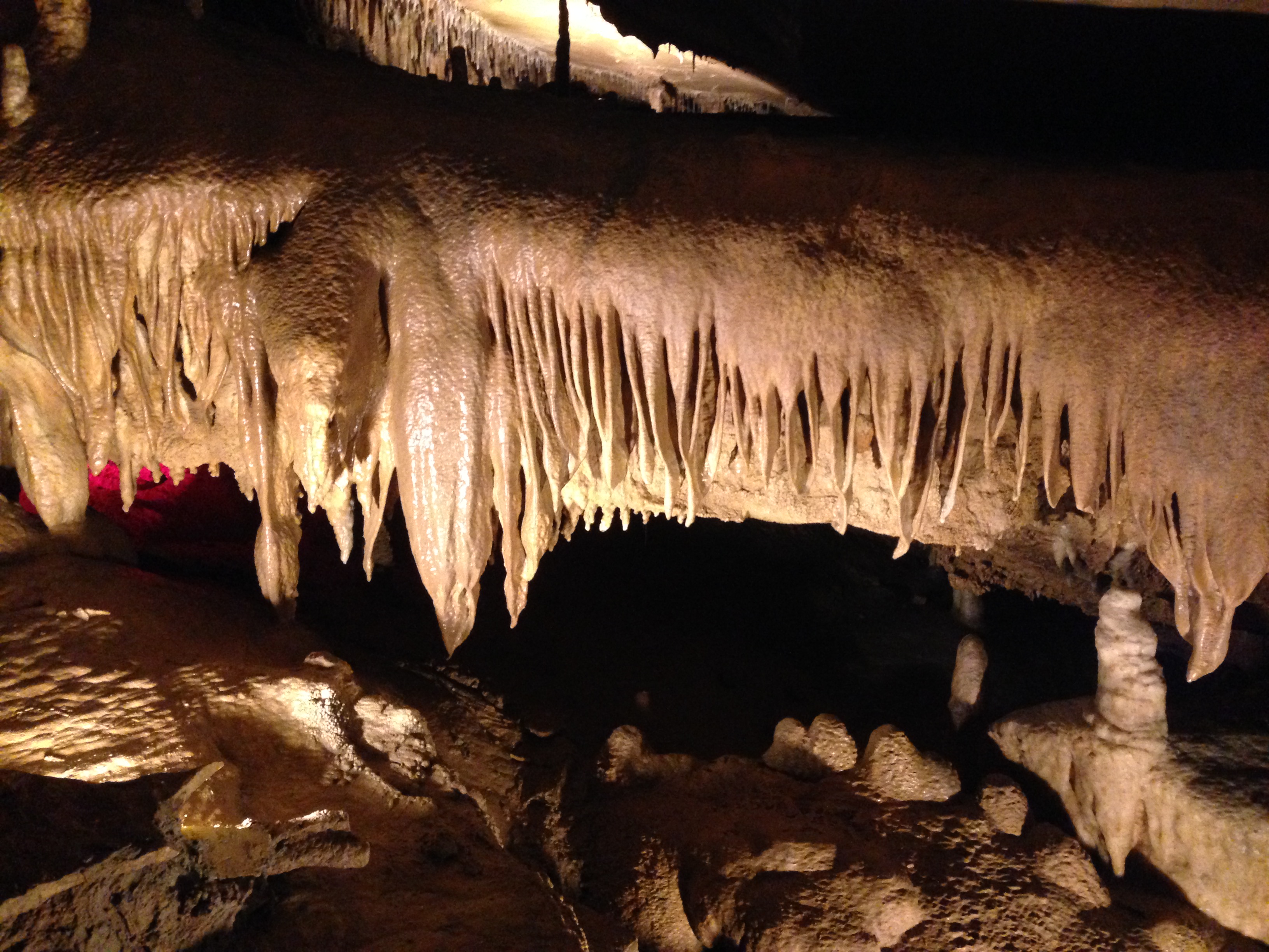
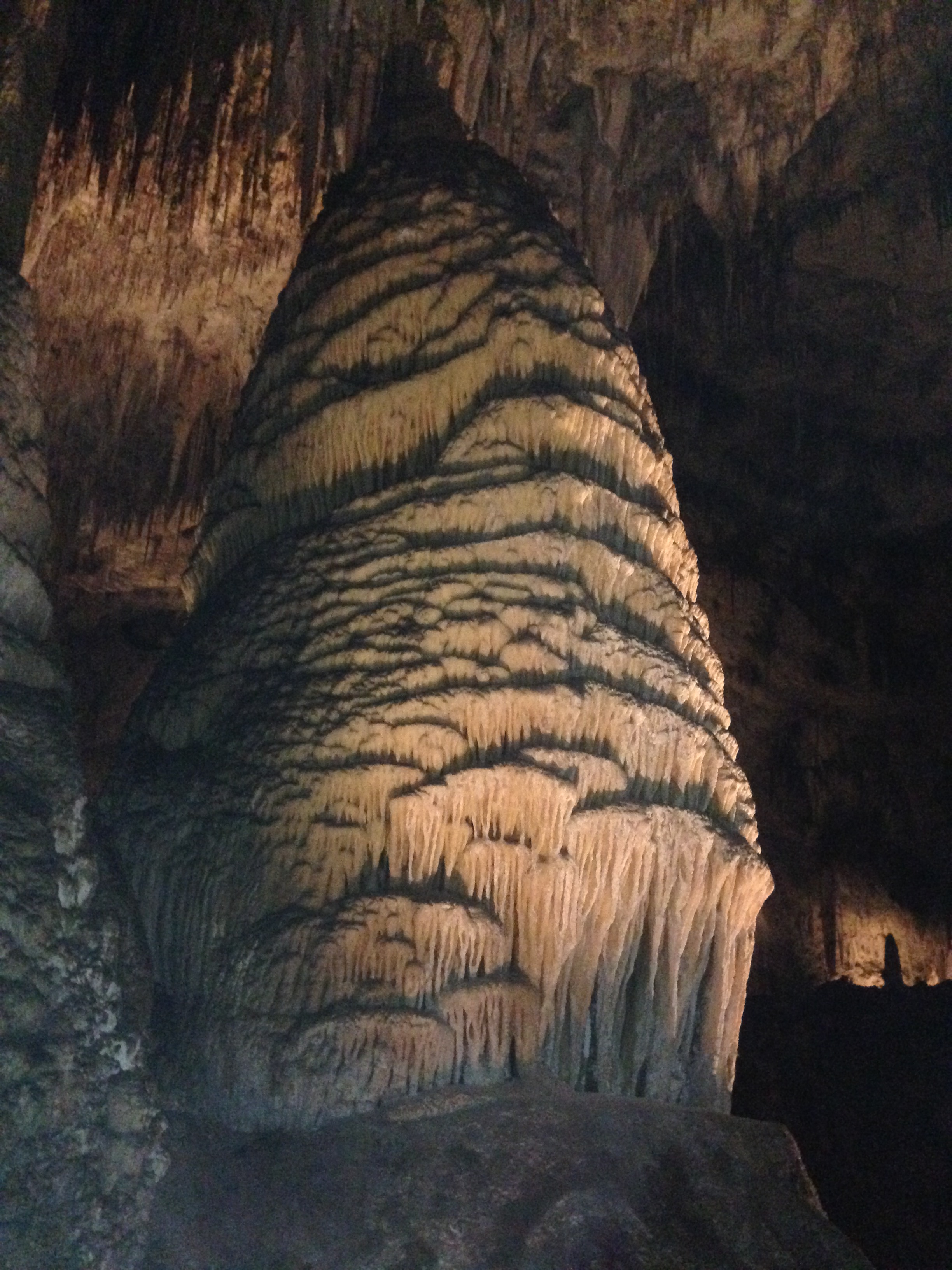
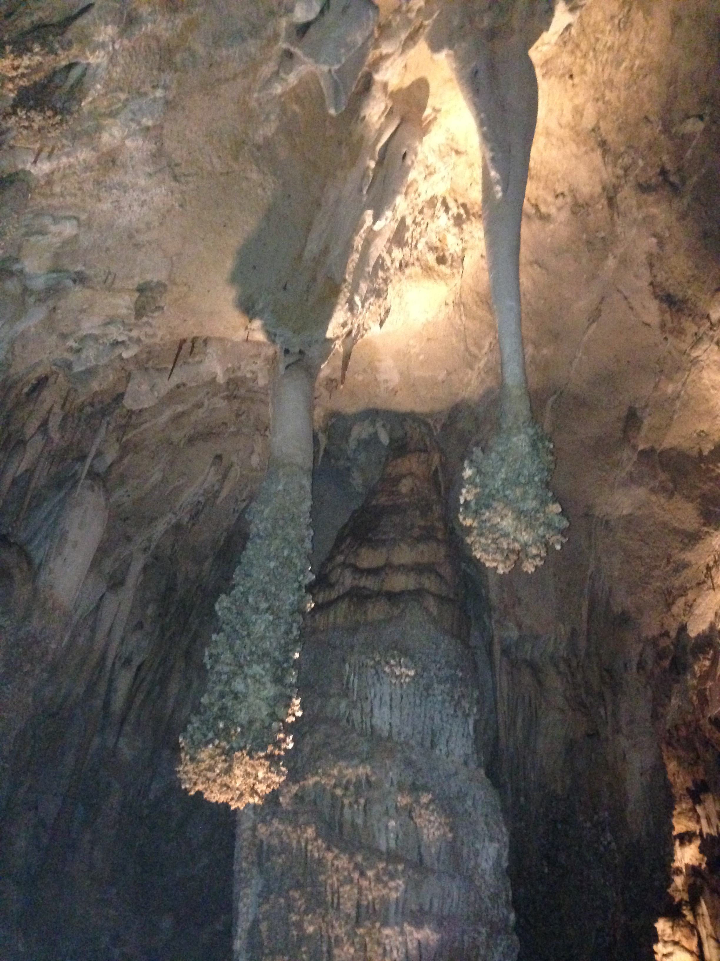
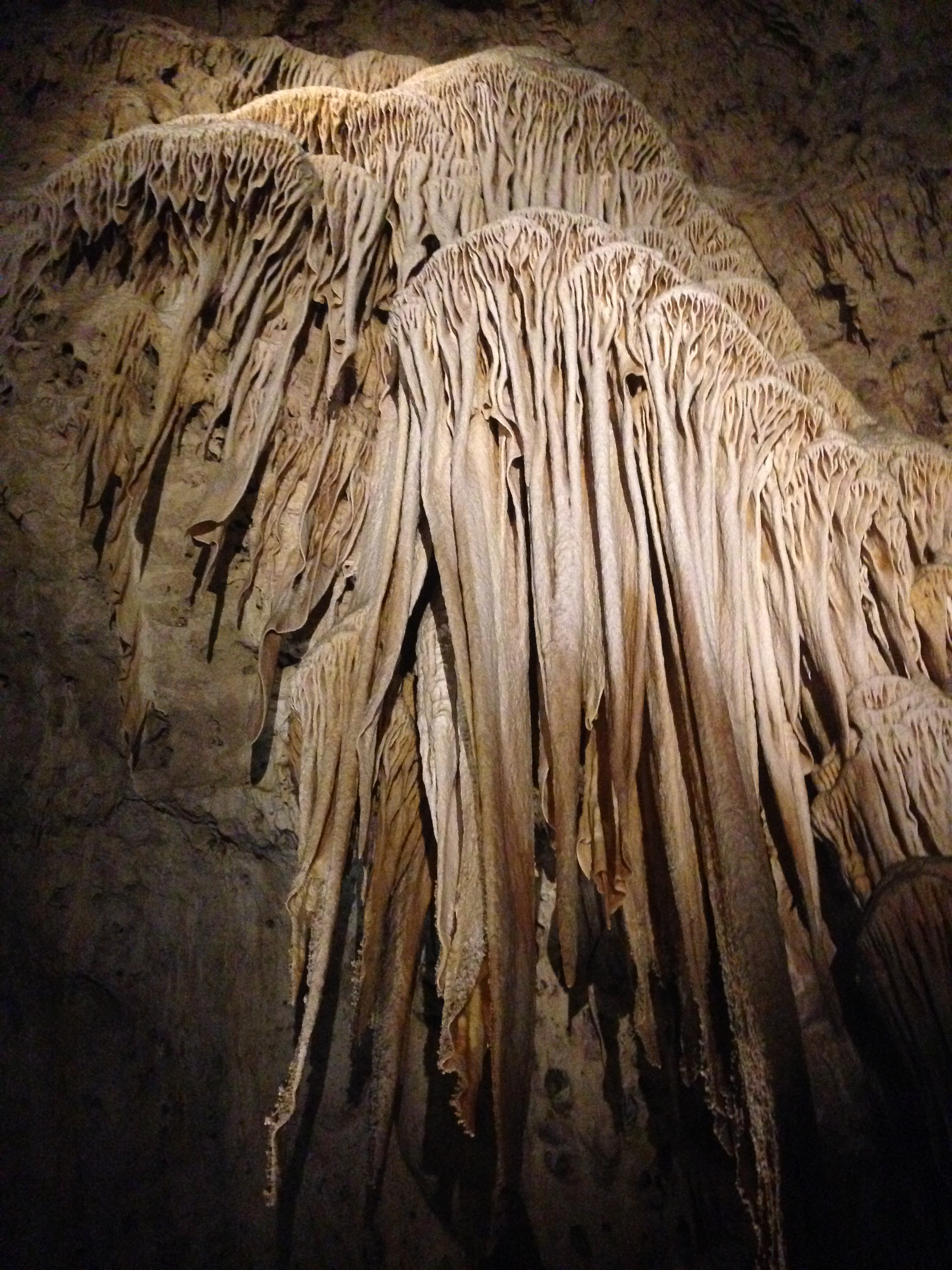
Carlsbad Cavern was my second stop in New Mexico. A large cave with massive rooms, miles of tunnels, and over 800 feet deep underground! The formations were equally as impressive, giant pillars, drippy walls, wavy curtains, and many different colors. The entire cave had a path built through it and dimly lit walls. There was even a fully functional tile bathroom, gift shop, and restaurant hundreds of feet down in the cave!

img_2887 img_2886 img_2888

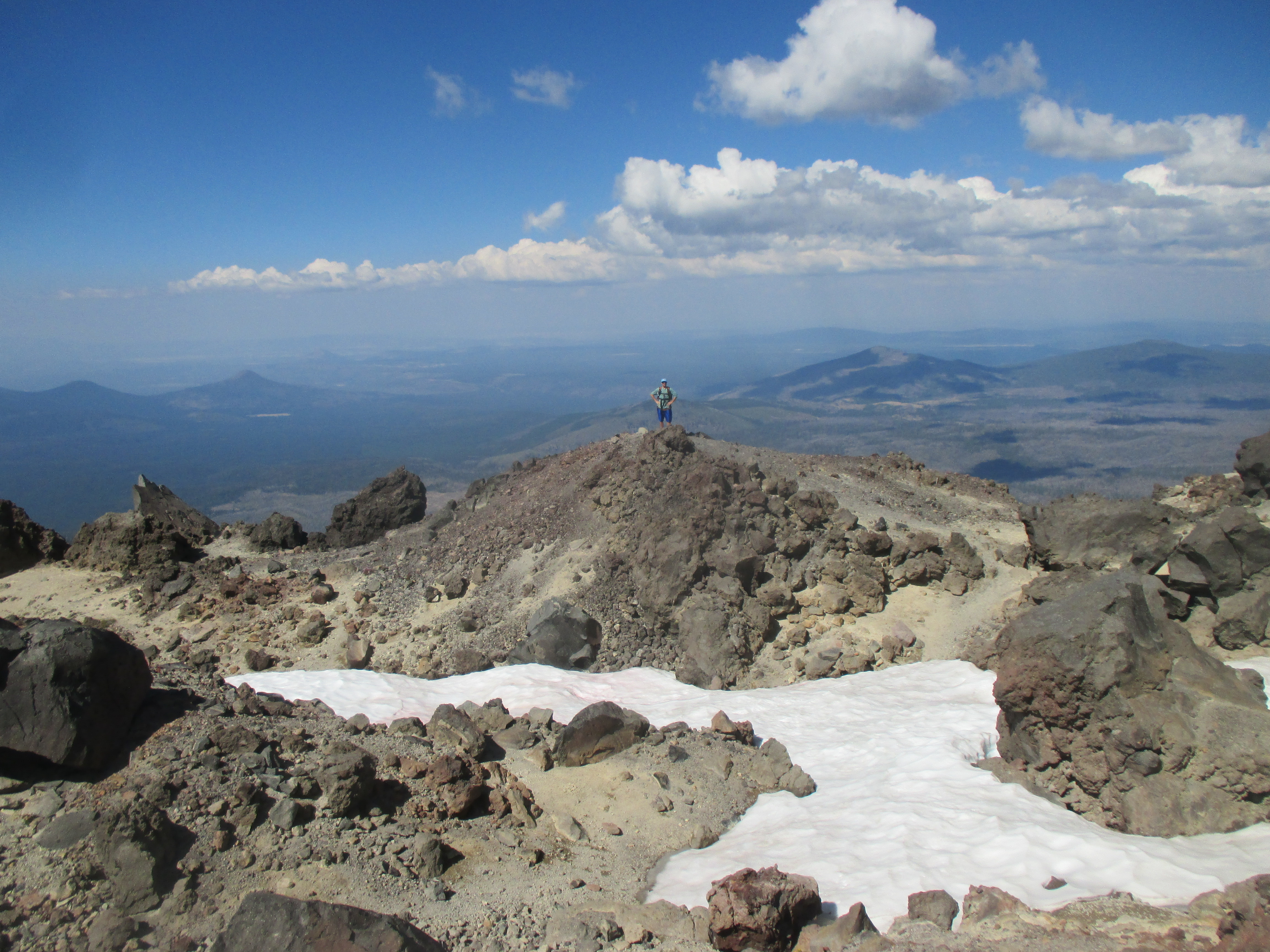
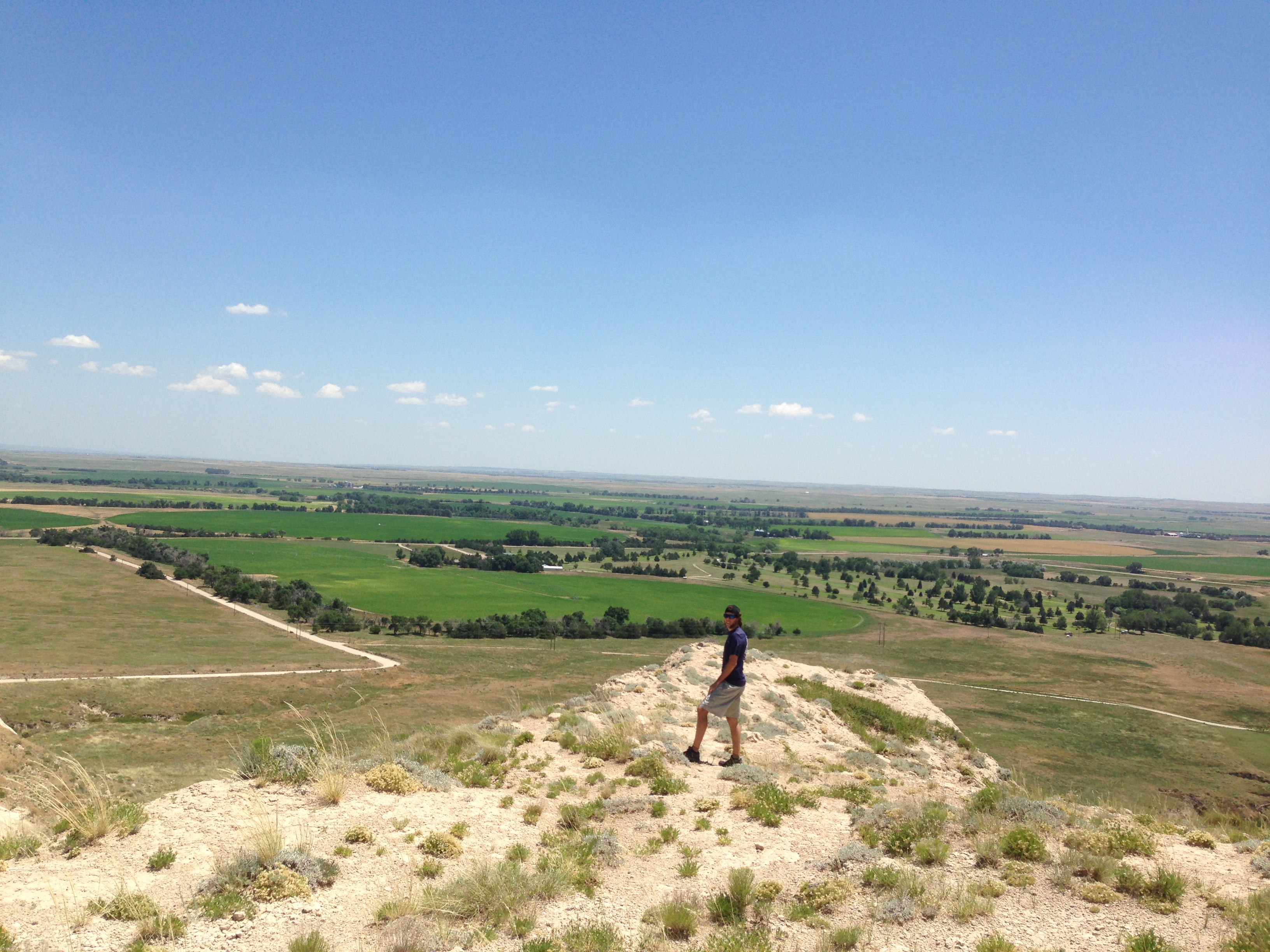
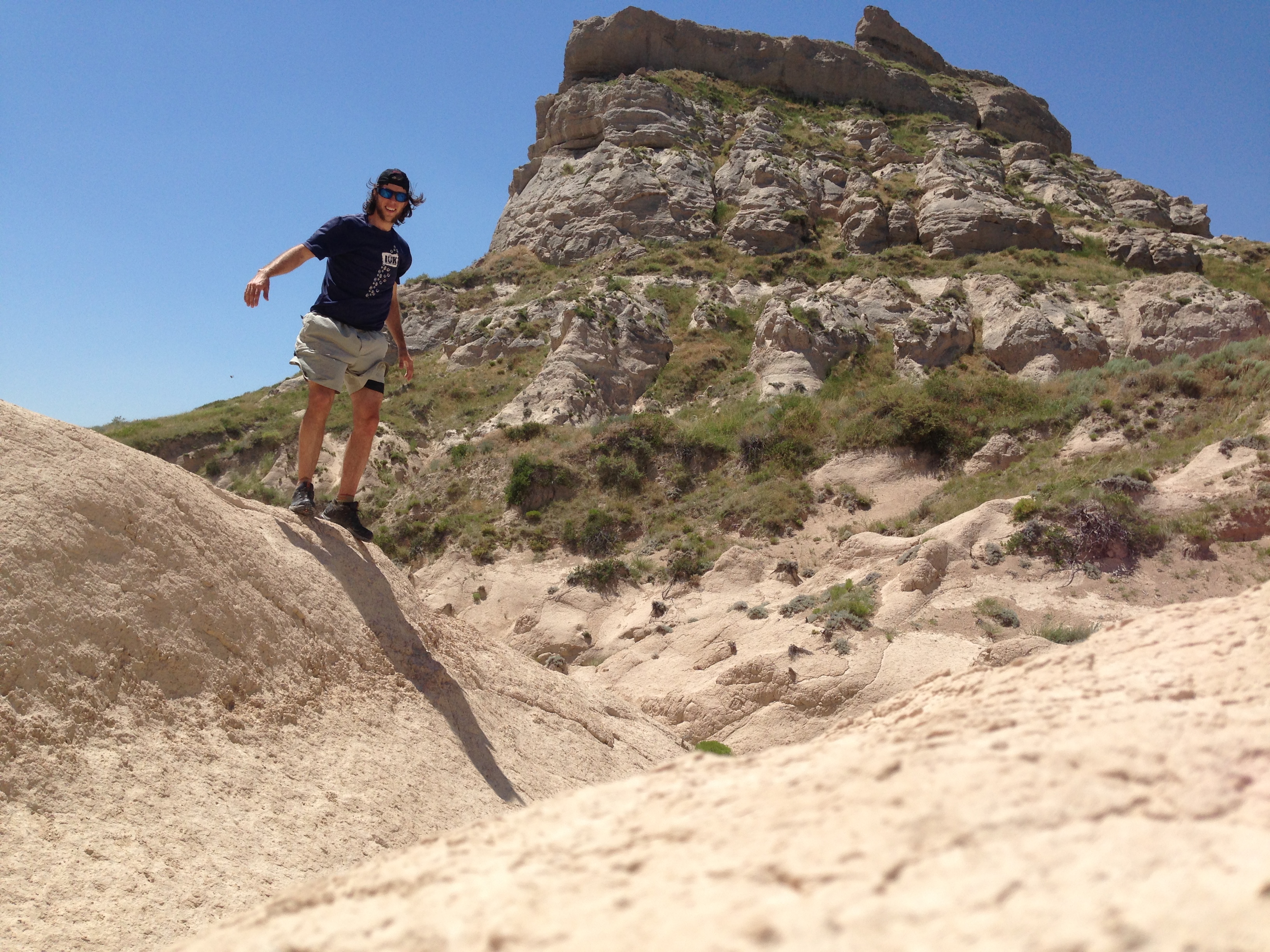
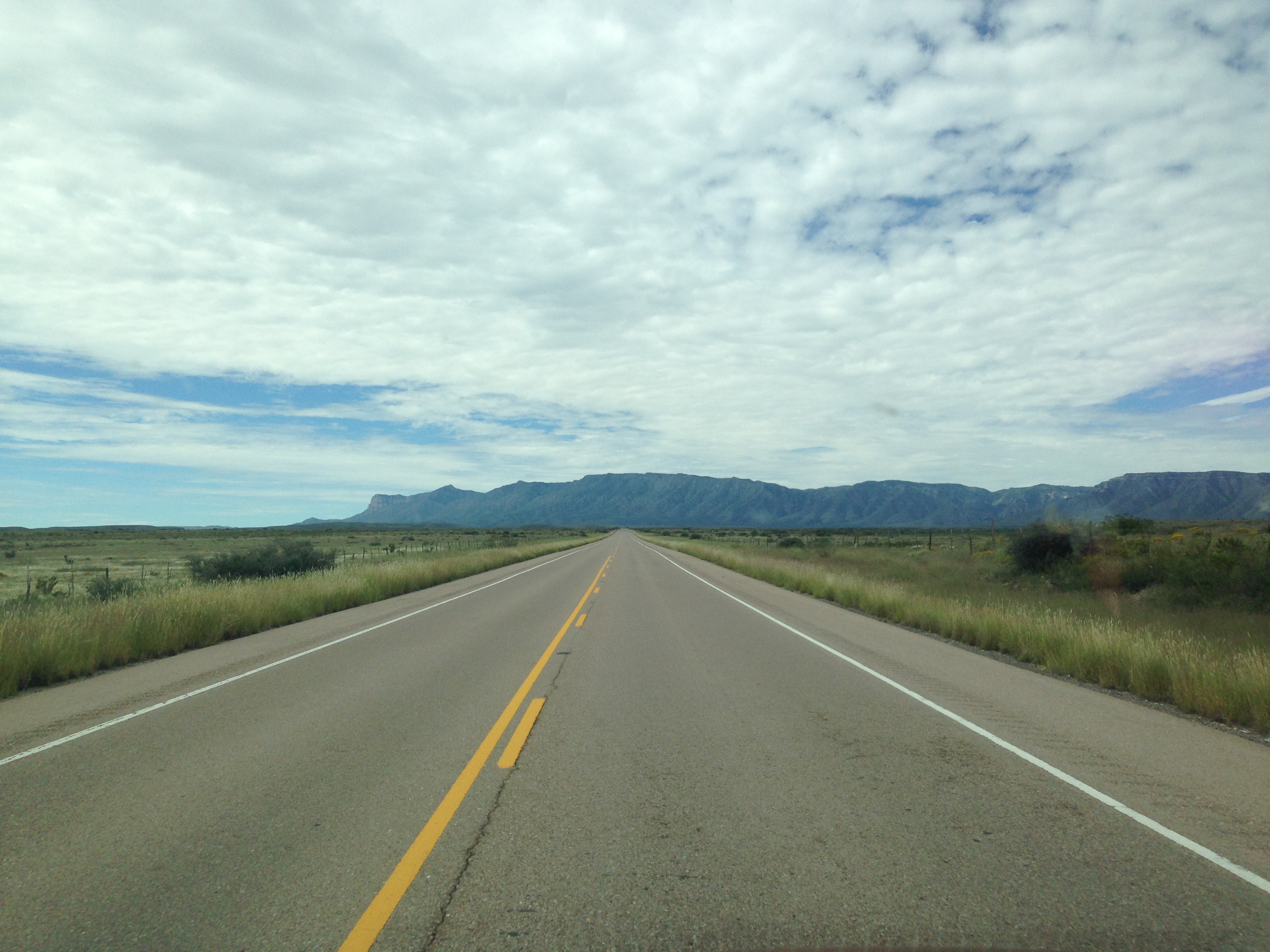
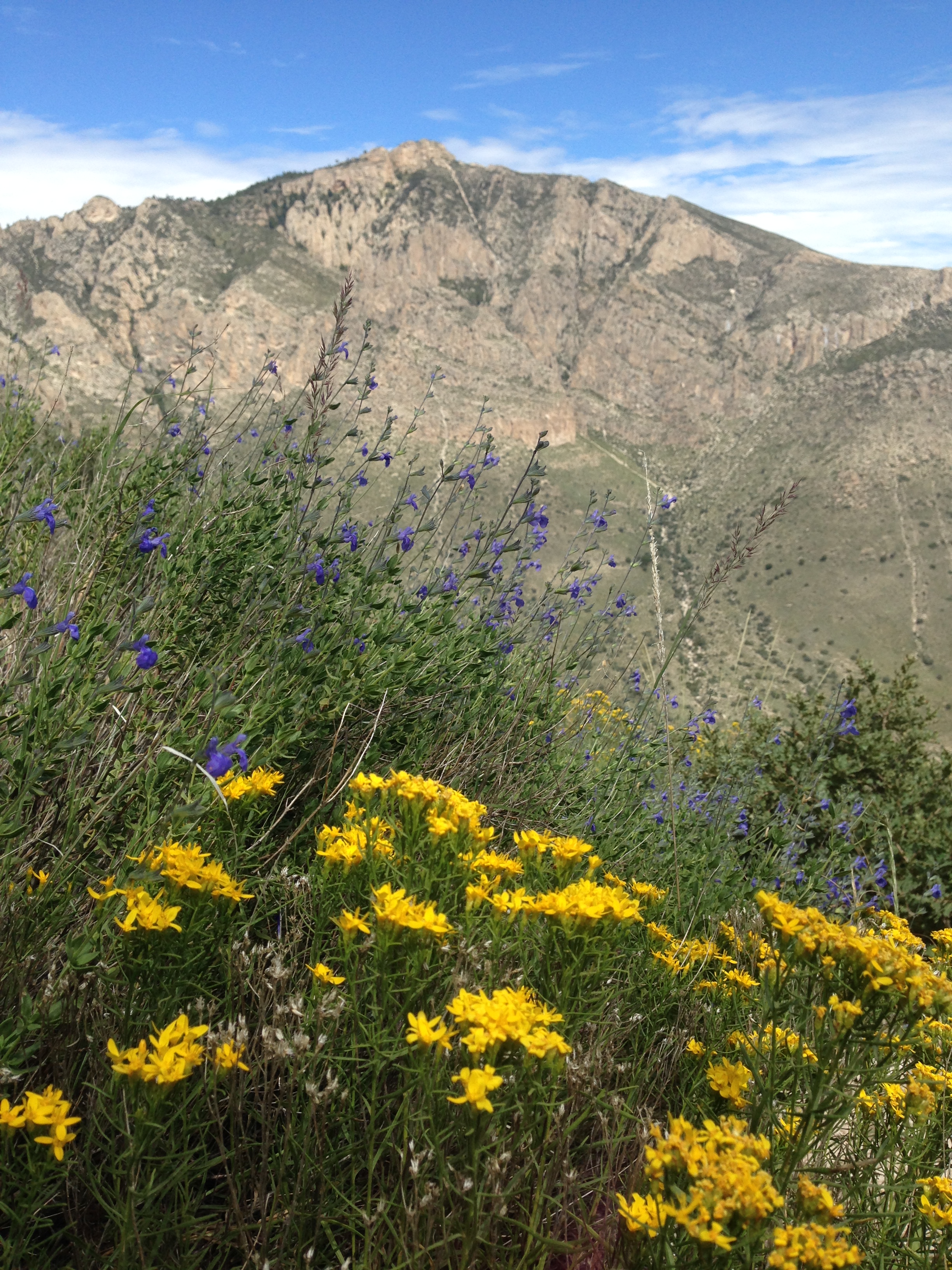
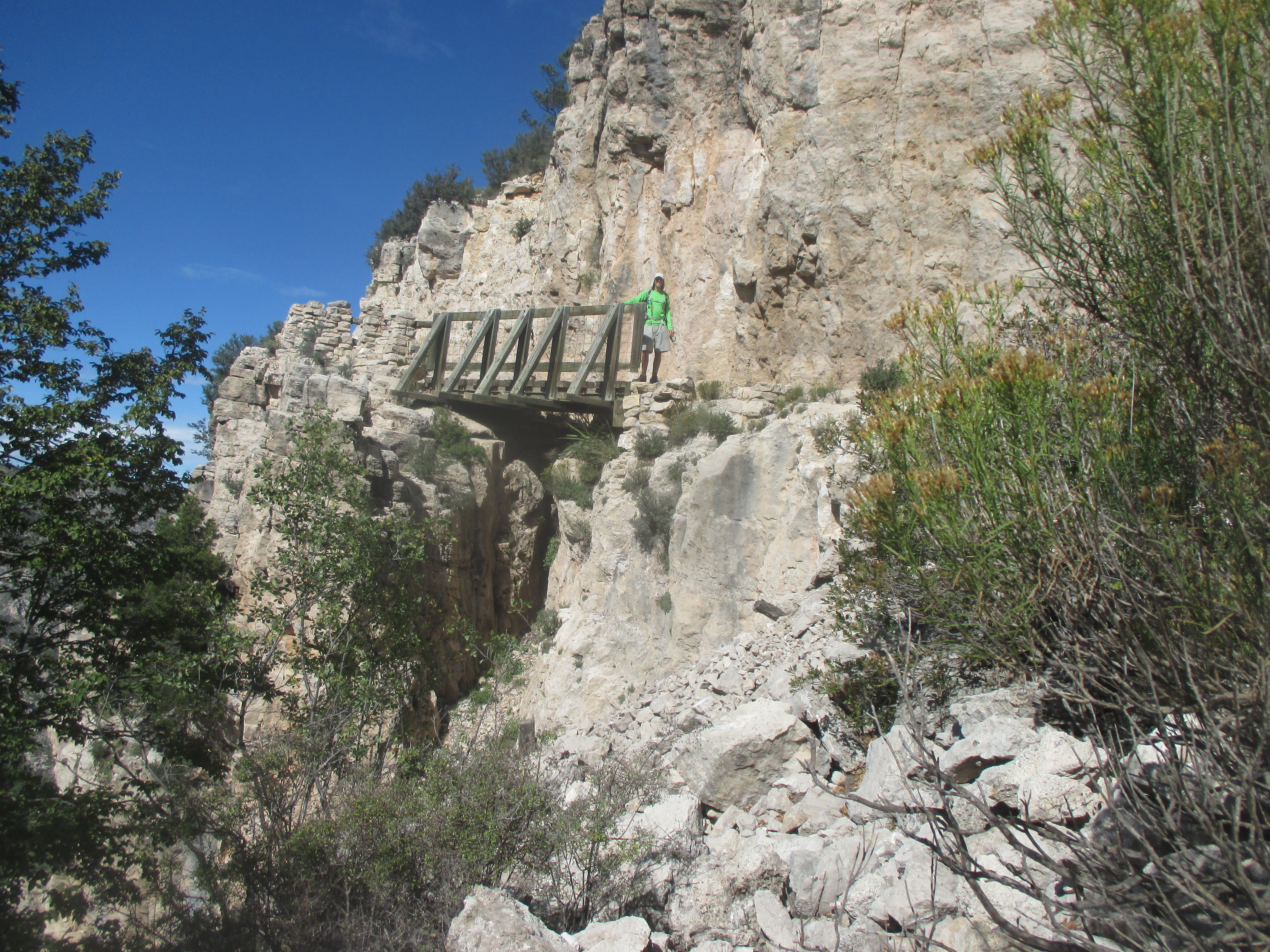
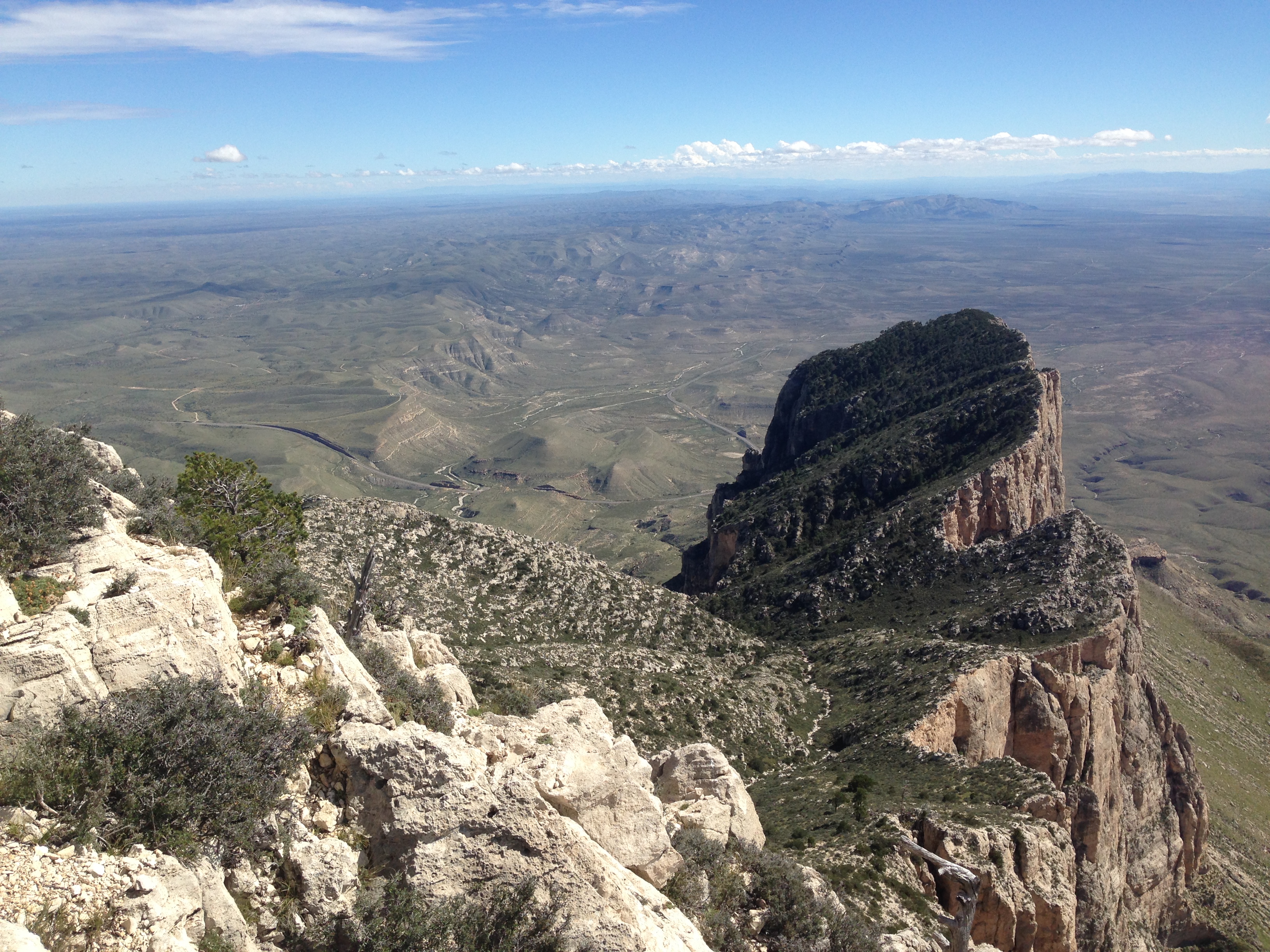
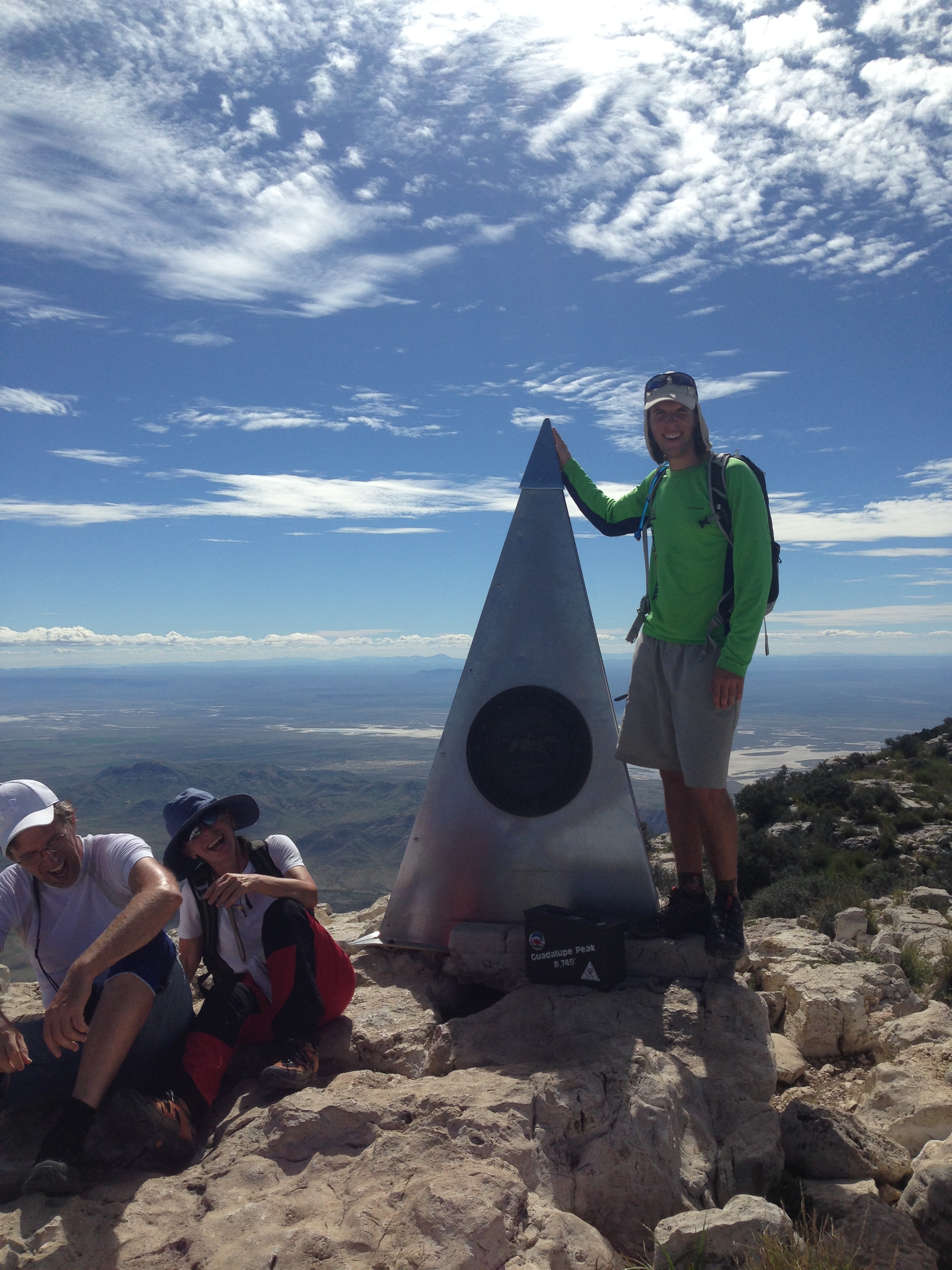
Heading South from New Mexico, I crossed into the great spaces of Texas, first to Guadalupe Mountains National Park. The mountains were dotted with green and brown, edge by tall, proud cliffs. I climbed 3,000 feet over four miles to the summit of Guadalupe Mountain, the highest point in Texas! The summit was marked by a metal pyramid dedicated to American Airlines and the old western postal route, when it was done by horses. A certain type of birds at the summit were flying at incredible speeds, when they passed close by or turned sharply, you could hear the wind tear below their wings. Texas had some of the best sunsets over the lowland scrub and stoic green mountains. Brilliant orange, deep purples, hazy blues, pinks, whites, and blacks, like an artist using every color on his pallet!

img_2889 img_2898 img_5749 img_2915 img_2903

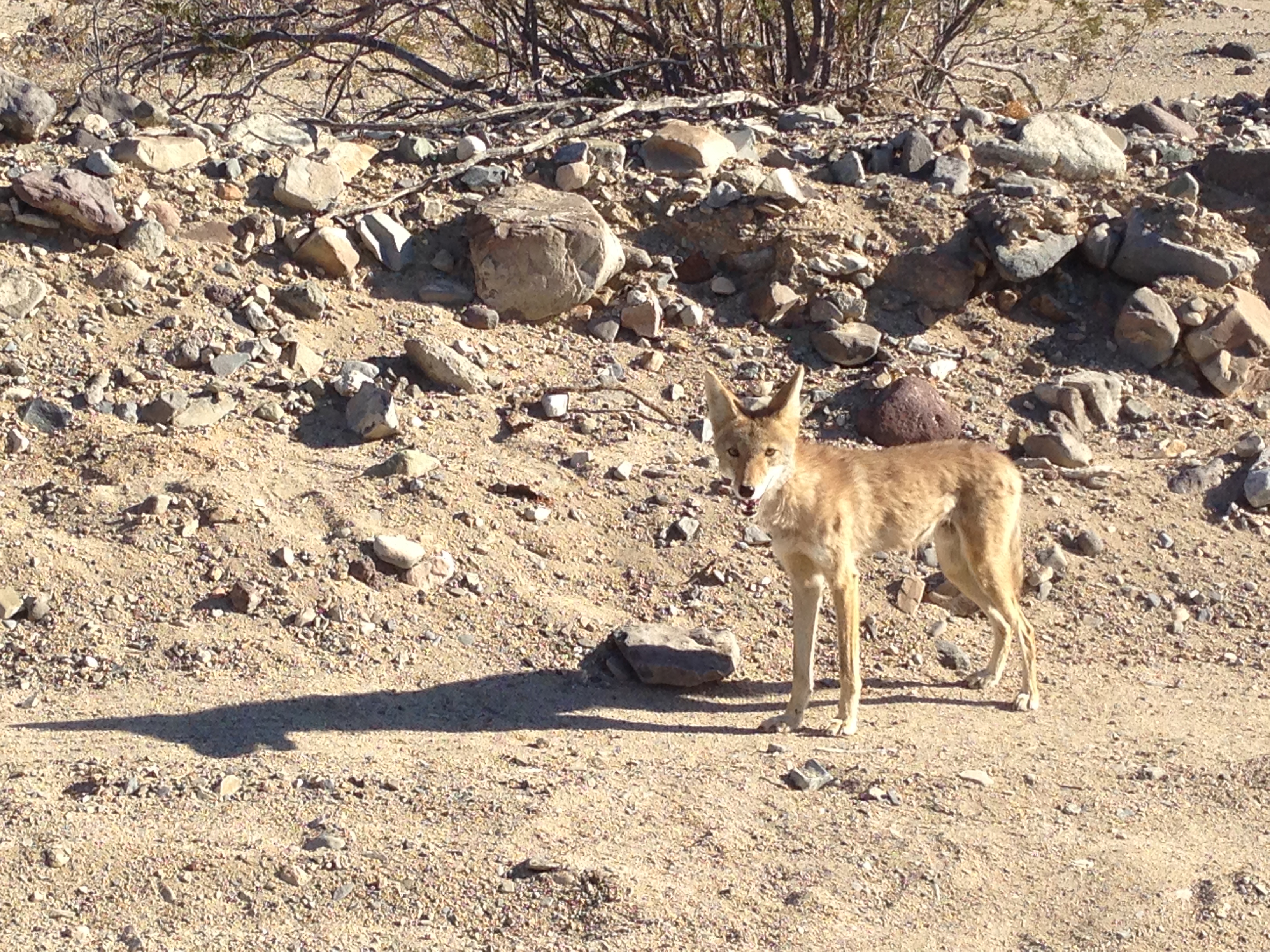
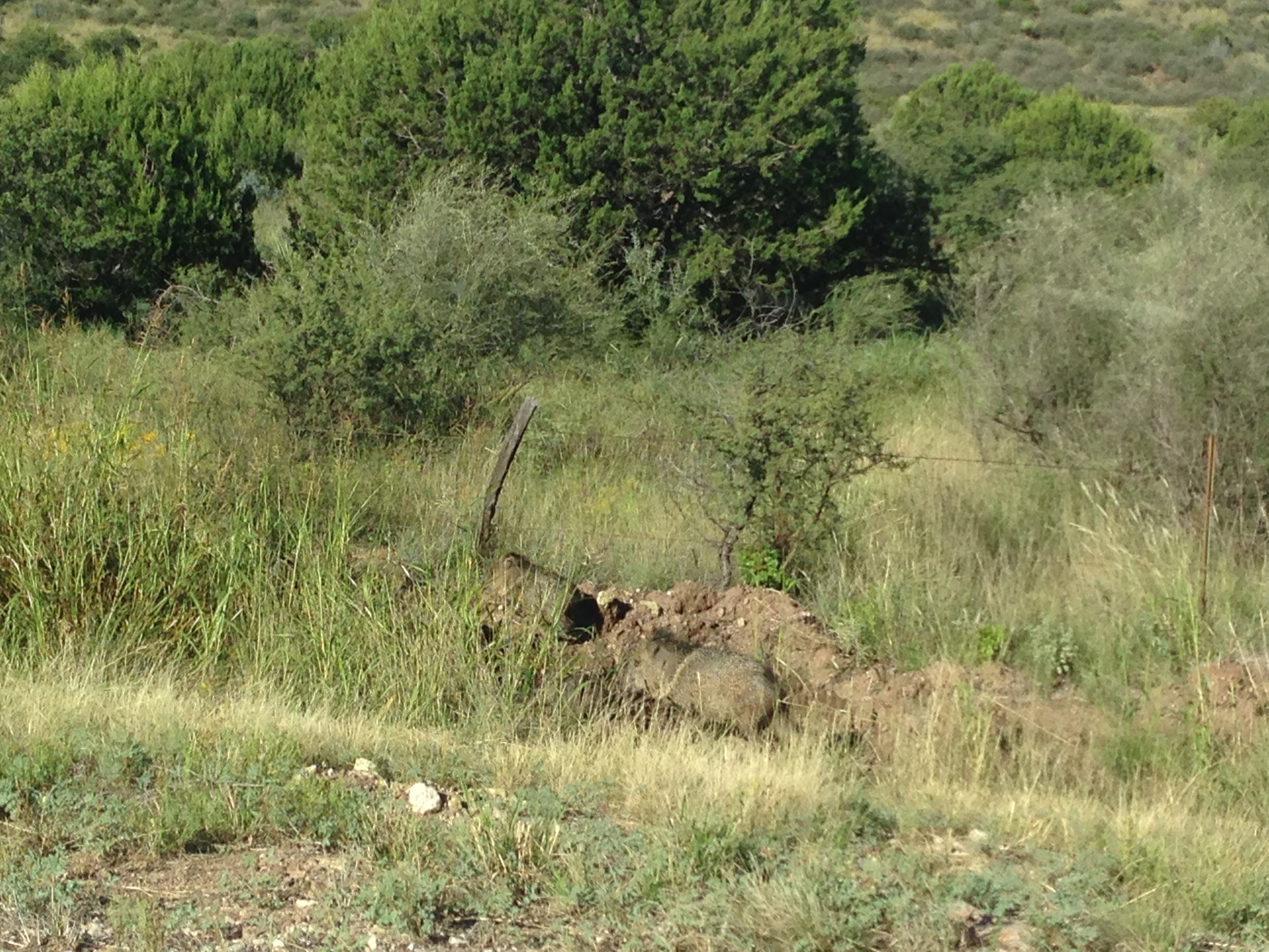
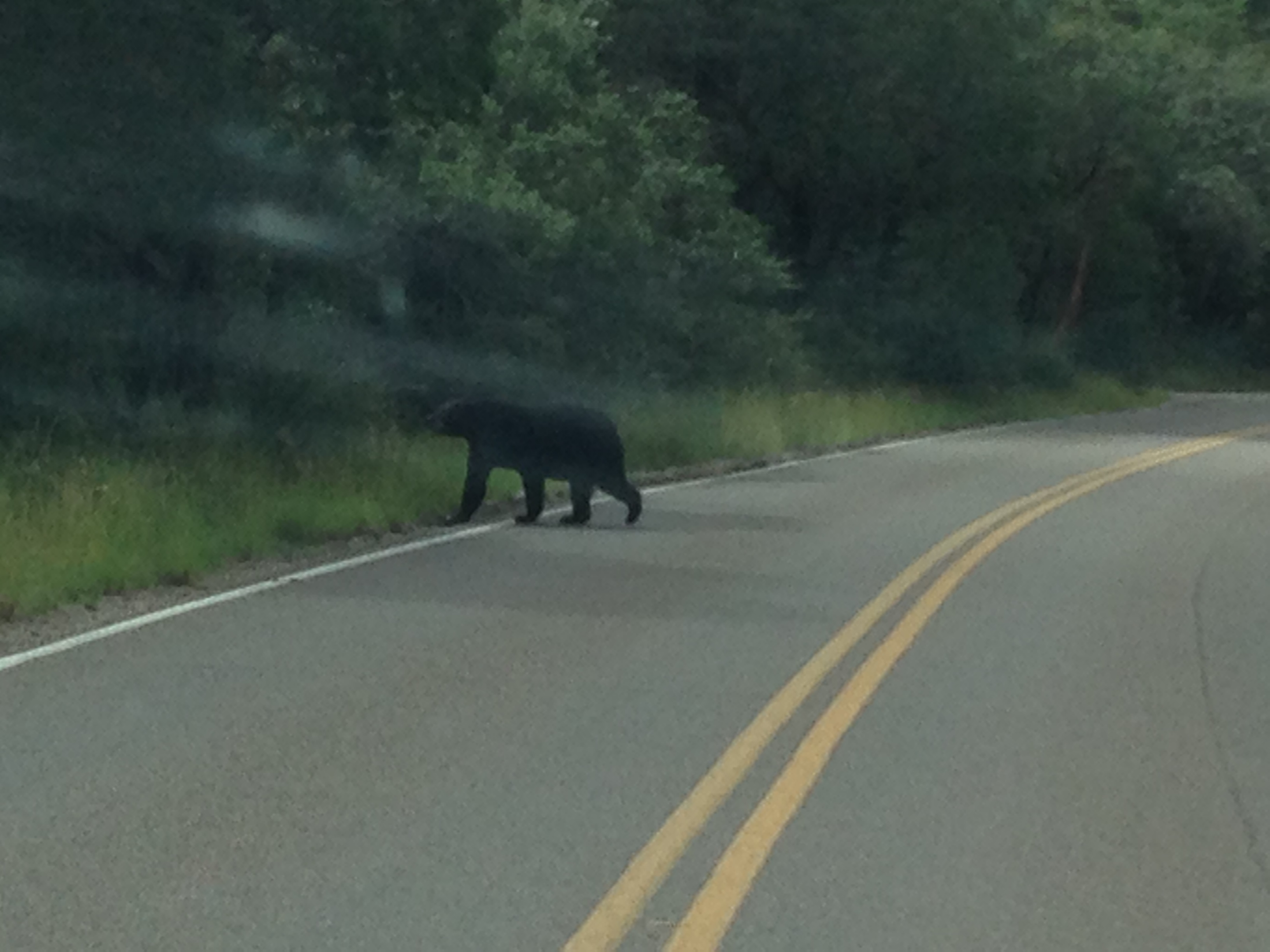
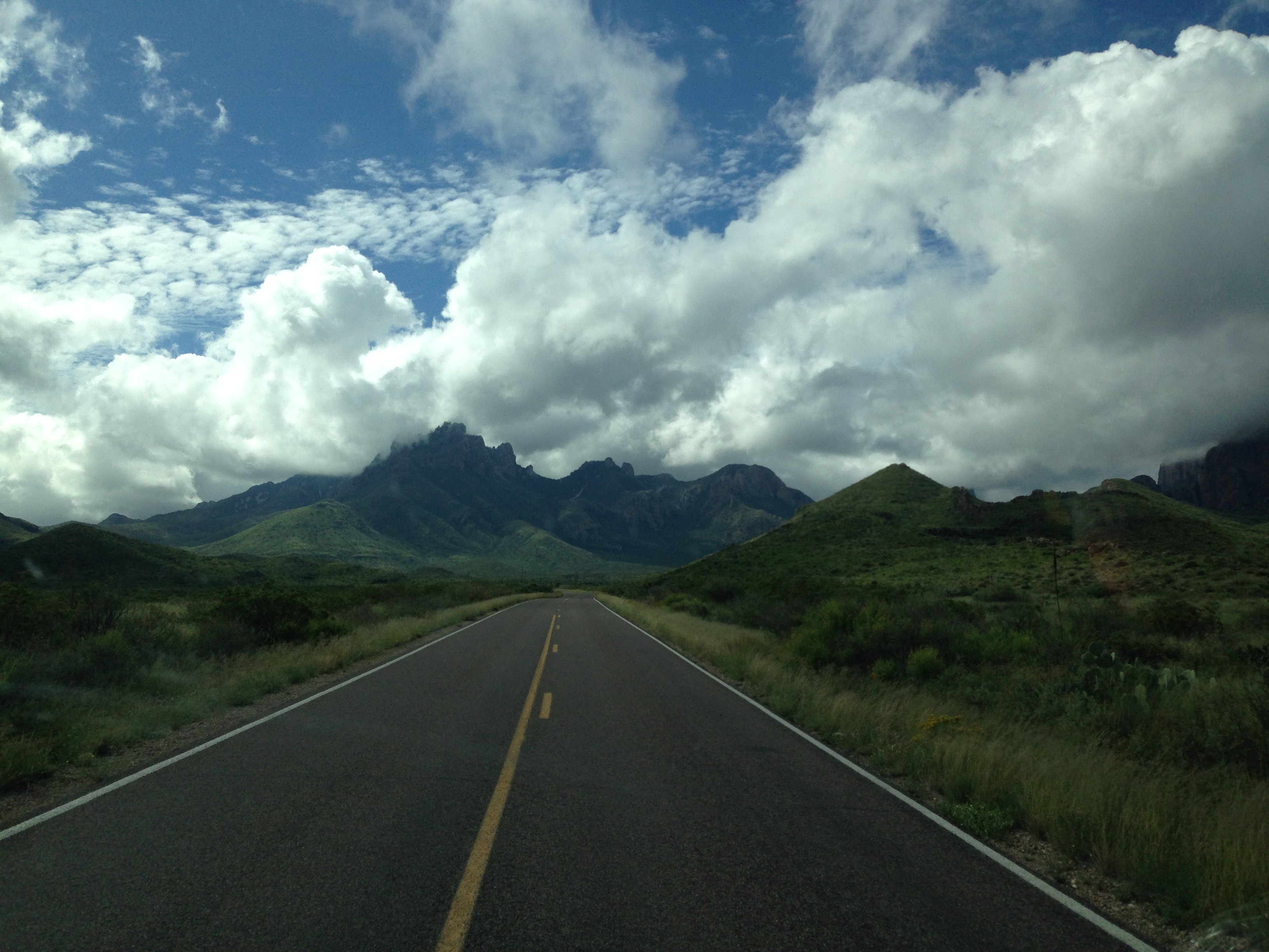
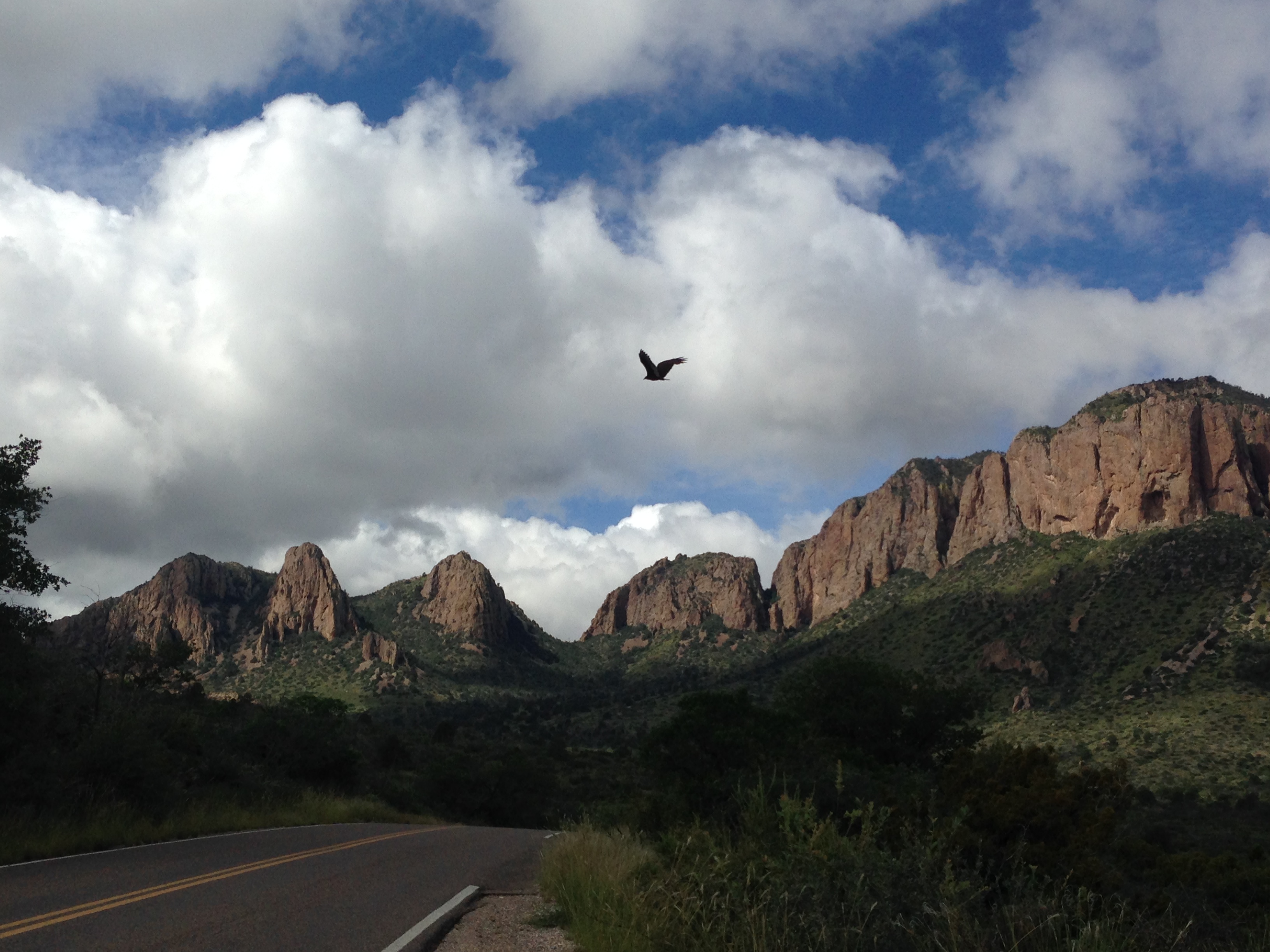
A few hundred miles along a road named The Texas Mountain Trail, took me to Big Bend National Park. Along the road I witnessed a pack of five javilinas, giant rodents which look like bristly-haired gray pigs, some antelope, a coyote, and two black bears in the park!

img_2938 img_2941

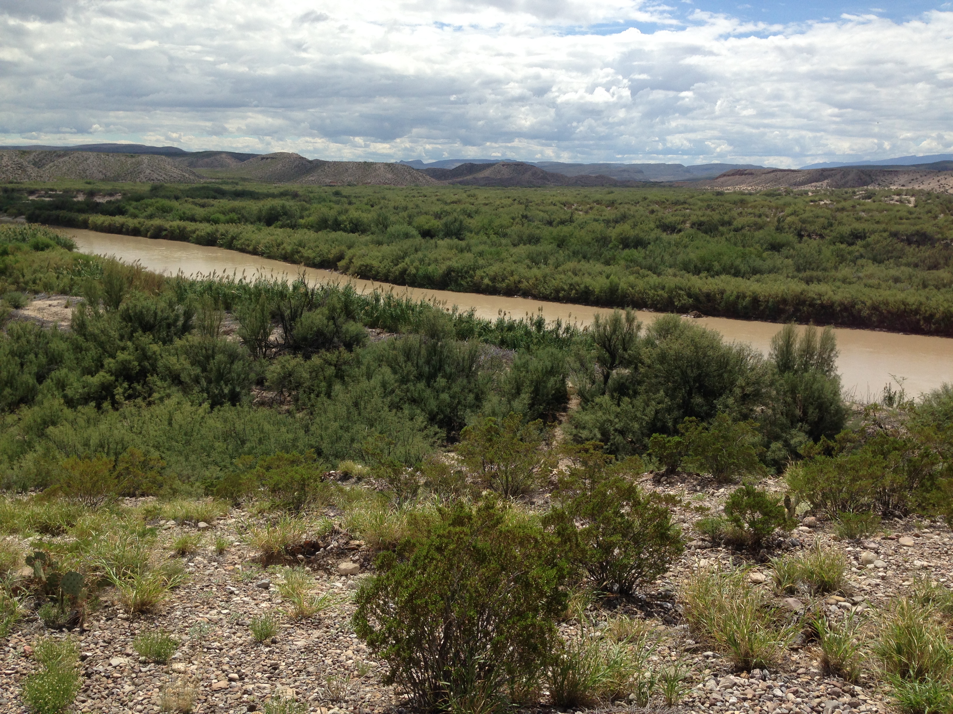
Some neat mountains in the park, but the highlight for me was going down to the Rio Grande River and looking across to Mexico on the other side! I even skipped a rock all the way across from the USA to Mexico!

img_2945 img_2942 img_2939 img_2940

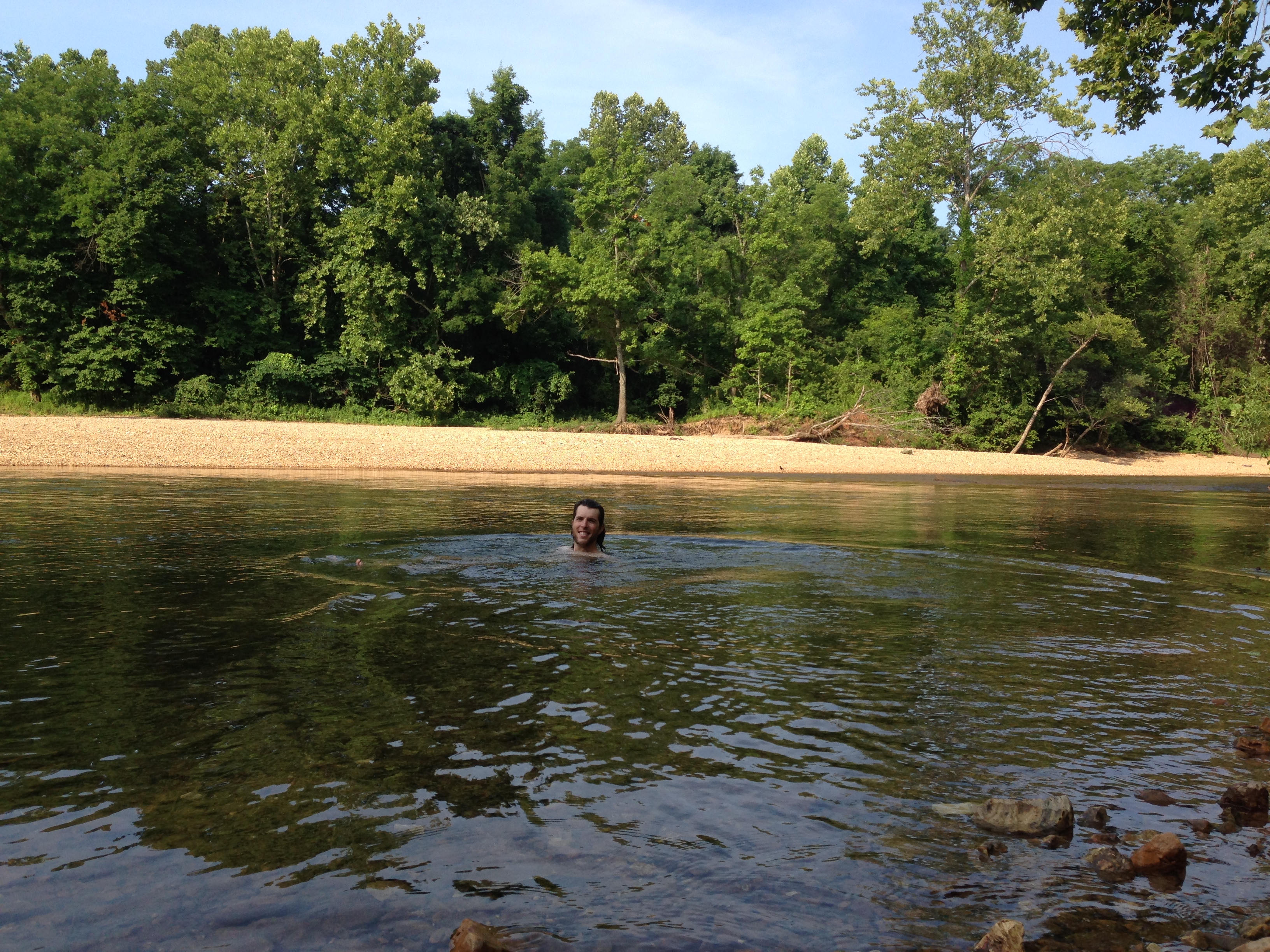
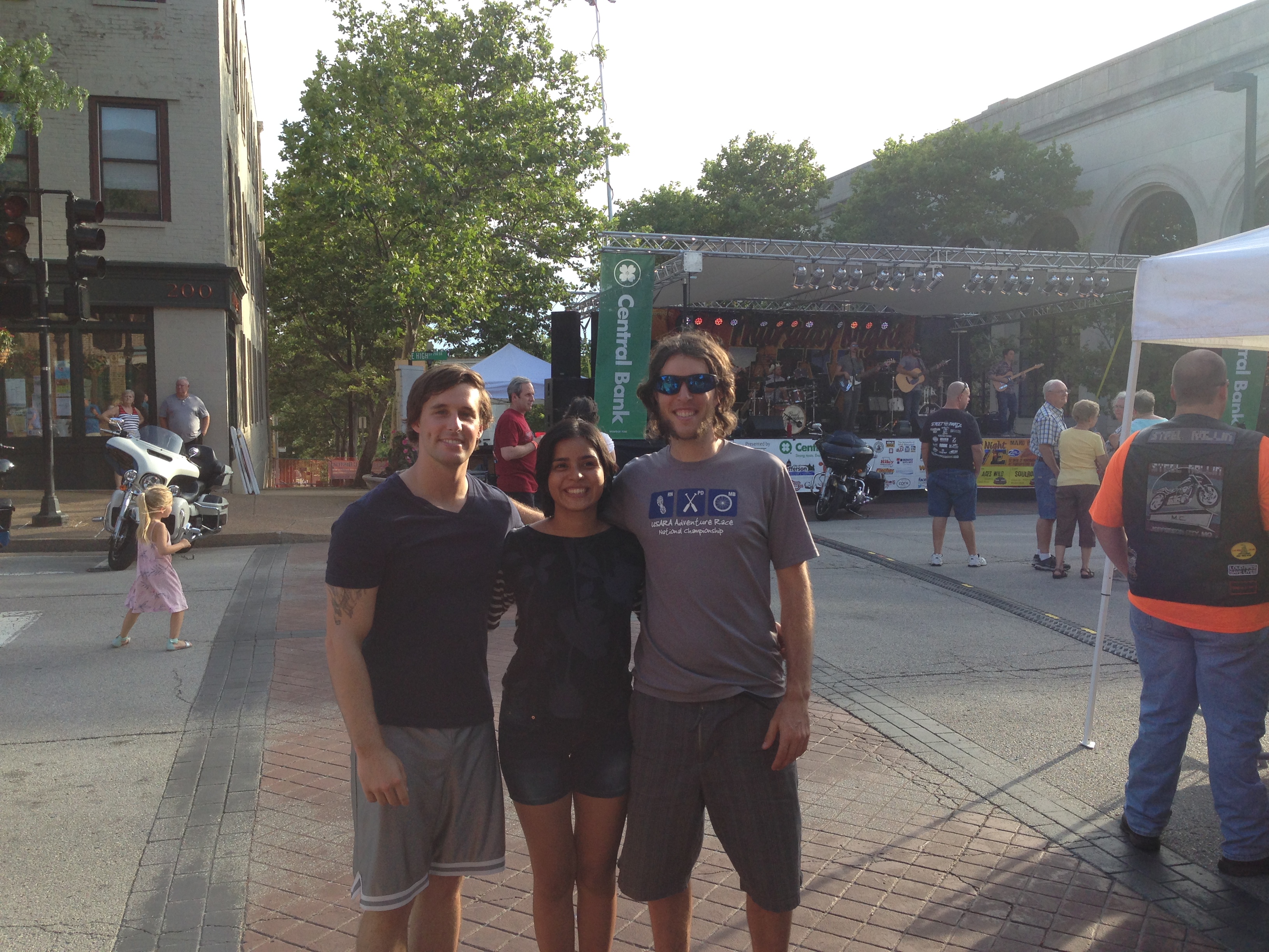
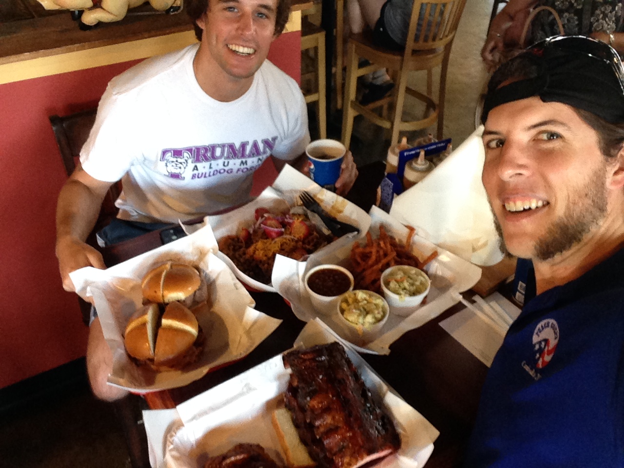
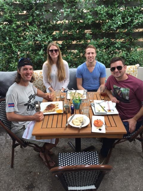
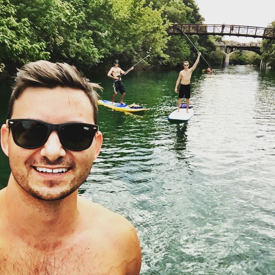
After passing through an immigration checkpoint and getting my van sniffed by a police dog, it was 500 miles from Big Bend to Austin, Texas, a long beautiful drive. In Austin, I met up with a Peace Corps friend, Sally. She showed me around some of the best taco and BBQ joints, took me swimming, and even watched bats fly out of a bridge downtown, while the sun set over the Colorado River! A wonderful day spent catching up with a wonderful woman! The next morning, Sally and I met an old friend of mine, Ross, and his friend, Josh, for brunch. After eating, Ross, Josh, and I went stand up paddleboarding (SUP) down the river and could even hear the music from the Austin City Limits music festival.

unnamed 14449753_10102295835918417_3049578250679567149_n

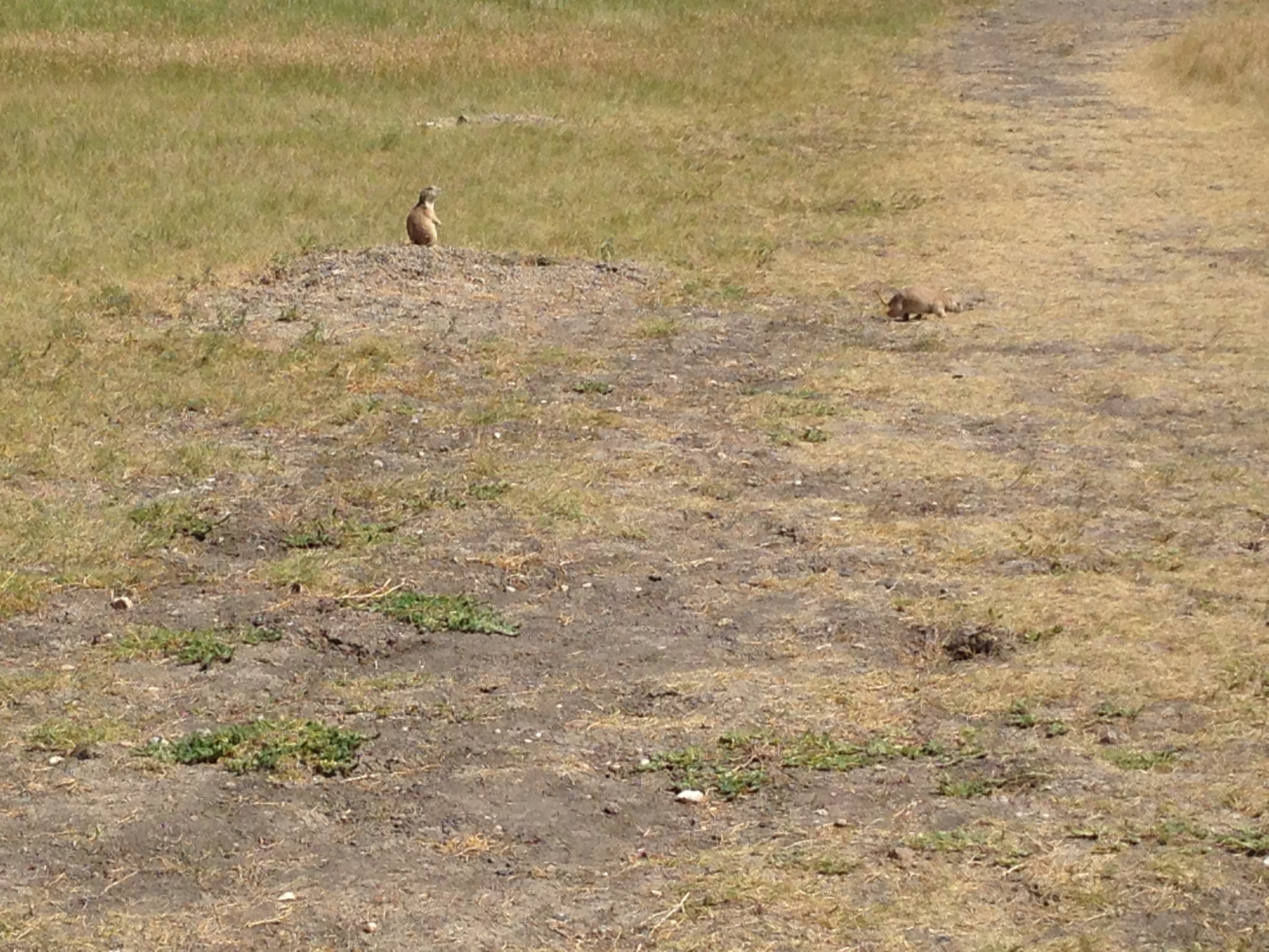
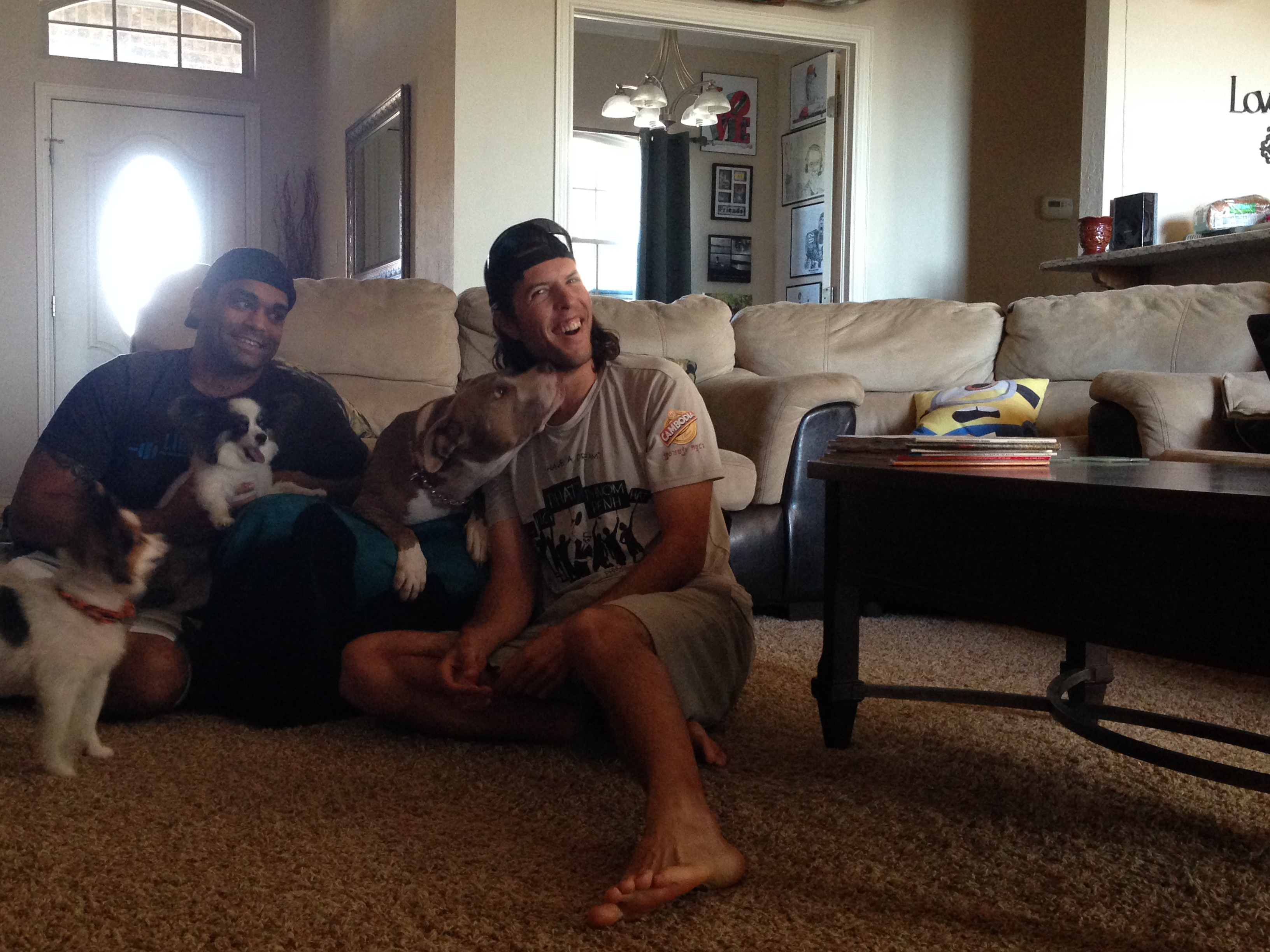
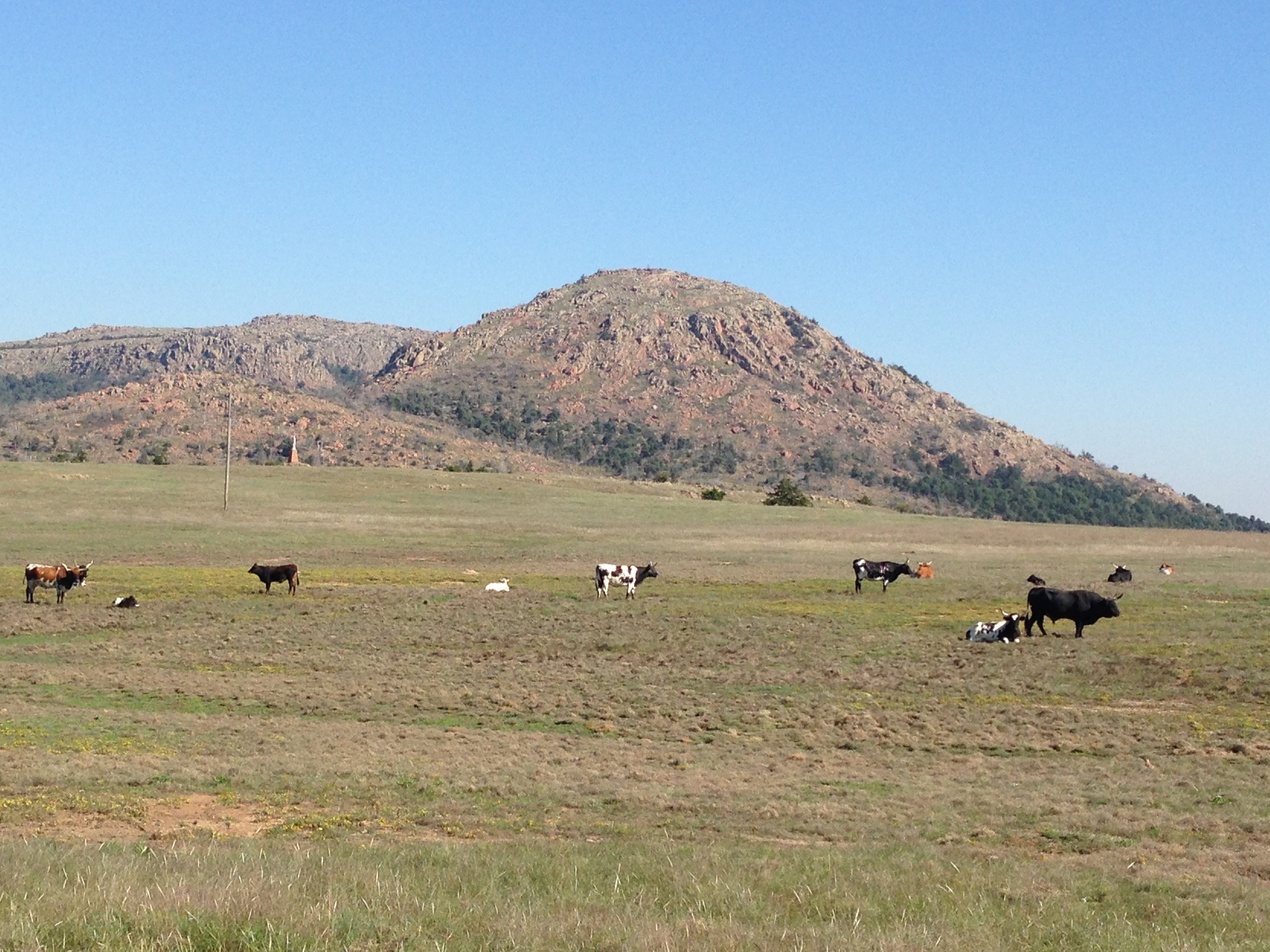
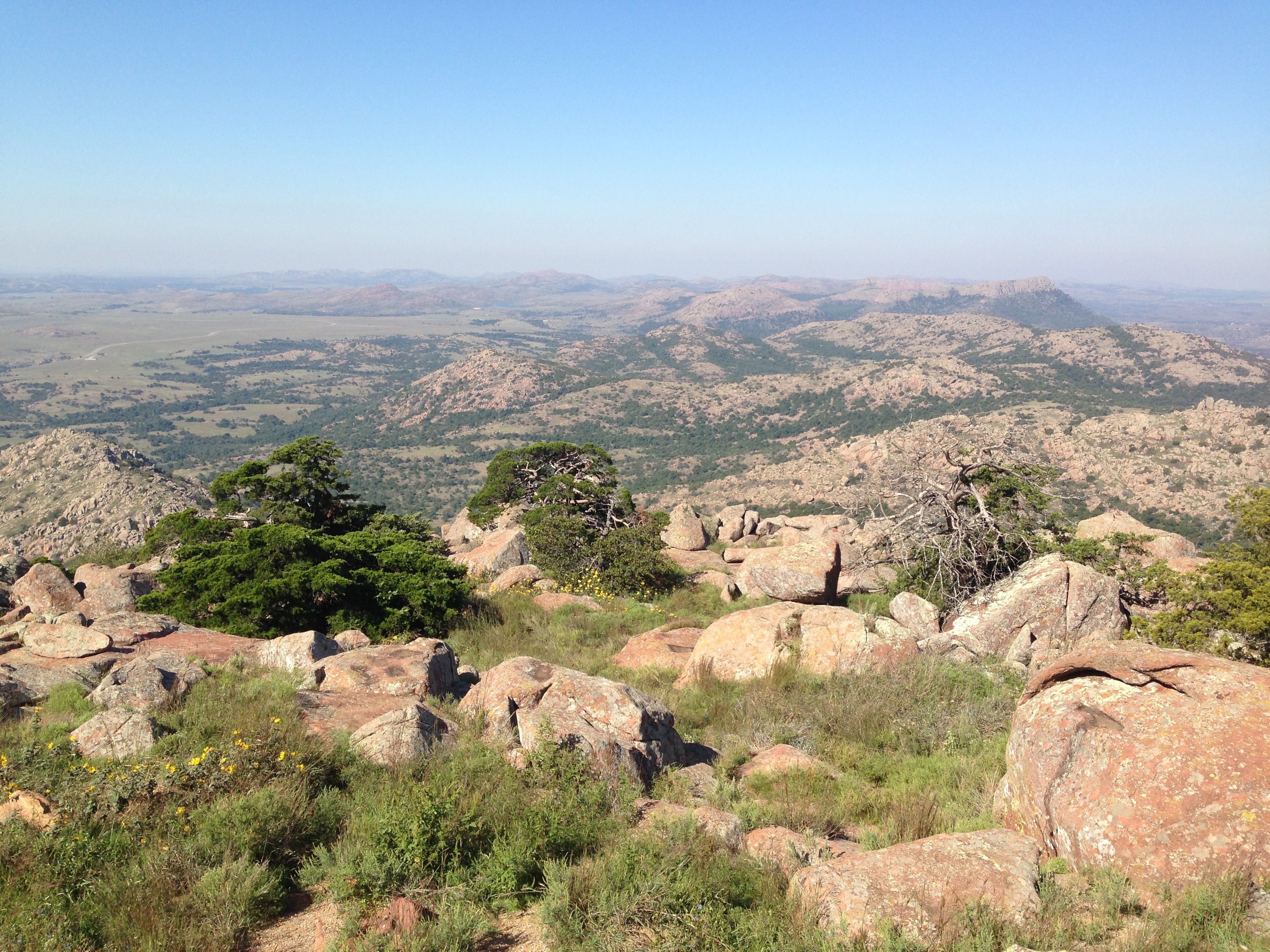
From Austin, I drove 350 miles North, to the small town of Elgin, Oklahoma, when a college friend now resides, Samit. I got to meet his new wife, Megan, and their dogs, Mackenzie, Lola, and Gizmo! Gizmo’s tongue is too long for his mouth, making him the most adorable dog ever! Megan cooked up delicious buffalo tacos for dinner, sumptuous! Samit and I drove out to Mount Scott for big views of the Wasatch Mountains and spotted some wild long-horn cows!

img_2957 img_2958 img_2960 img_2954

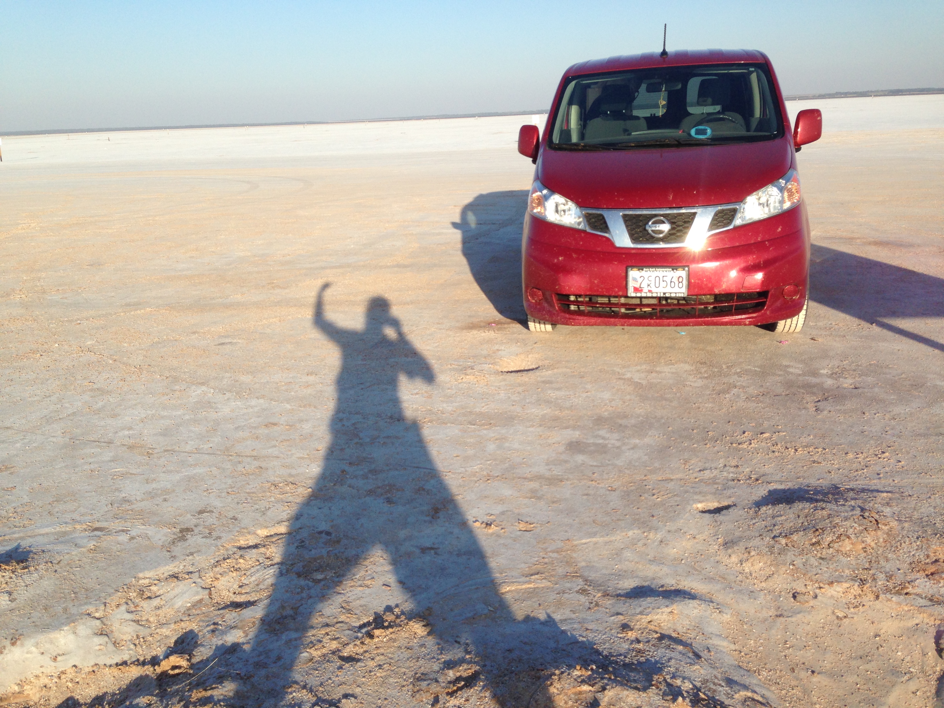
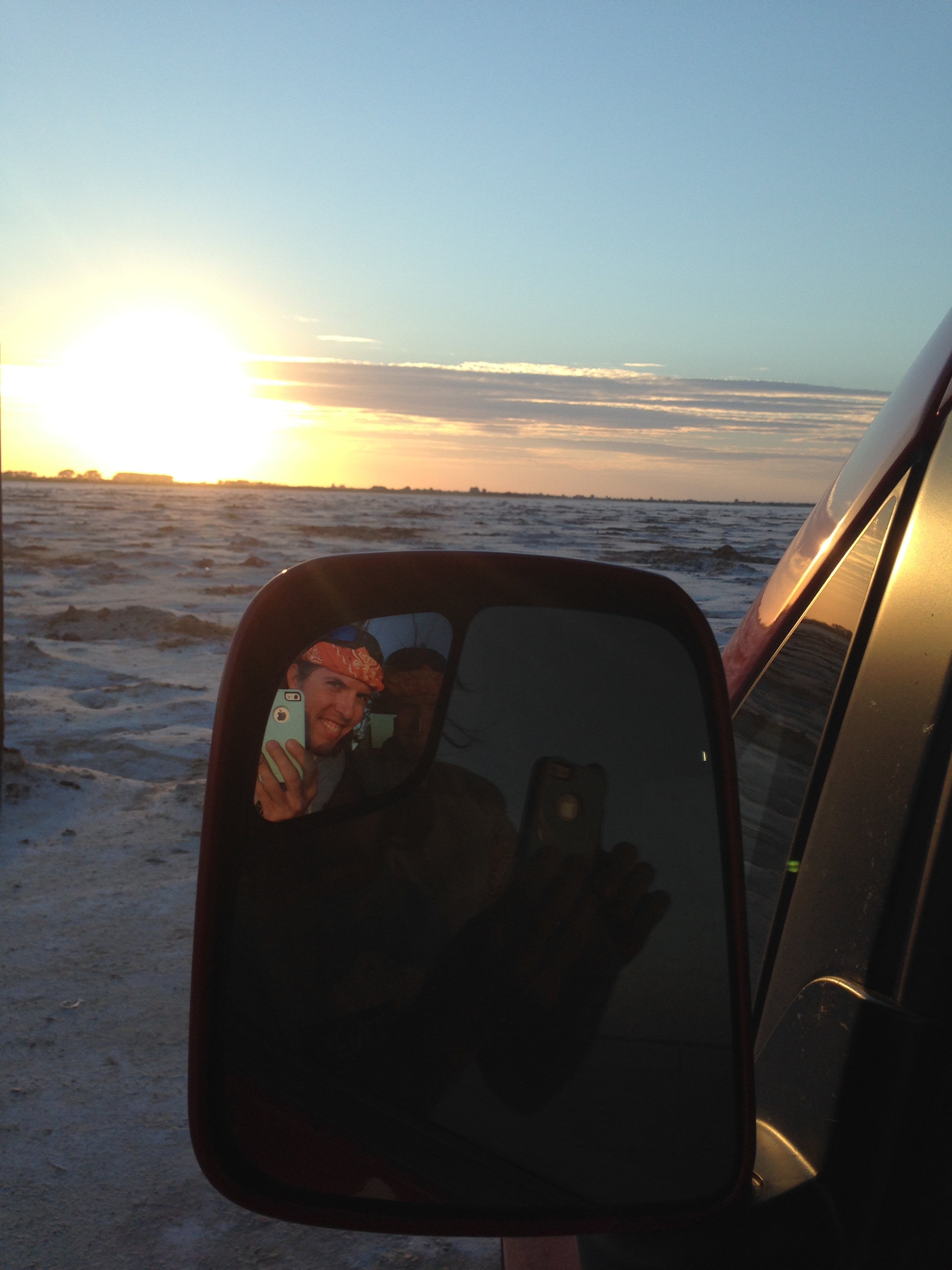
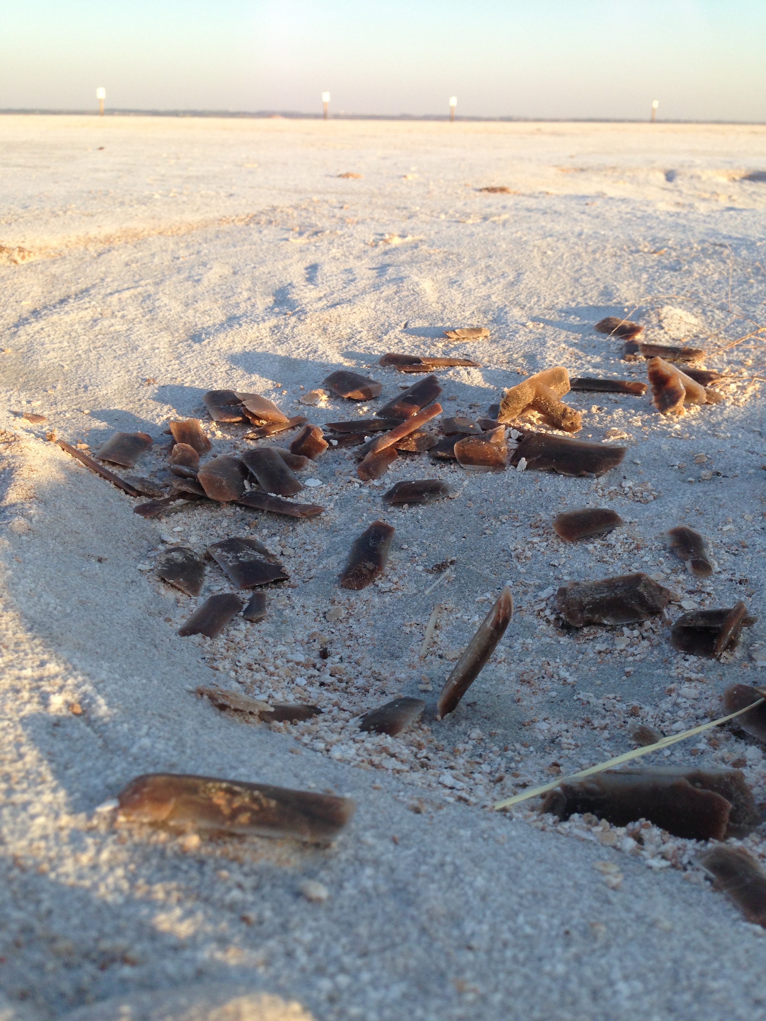
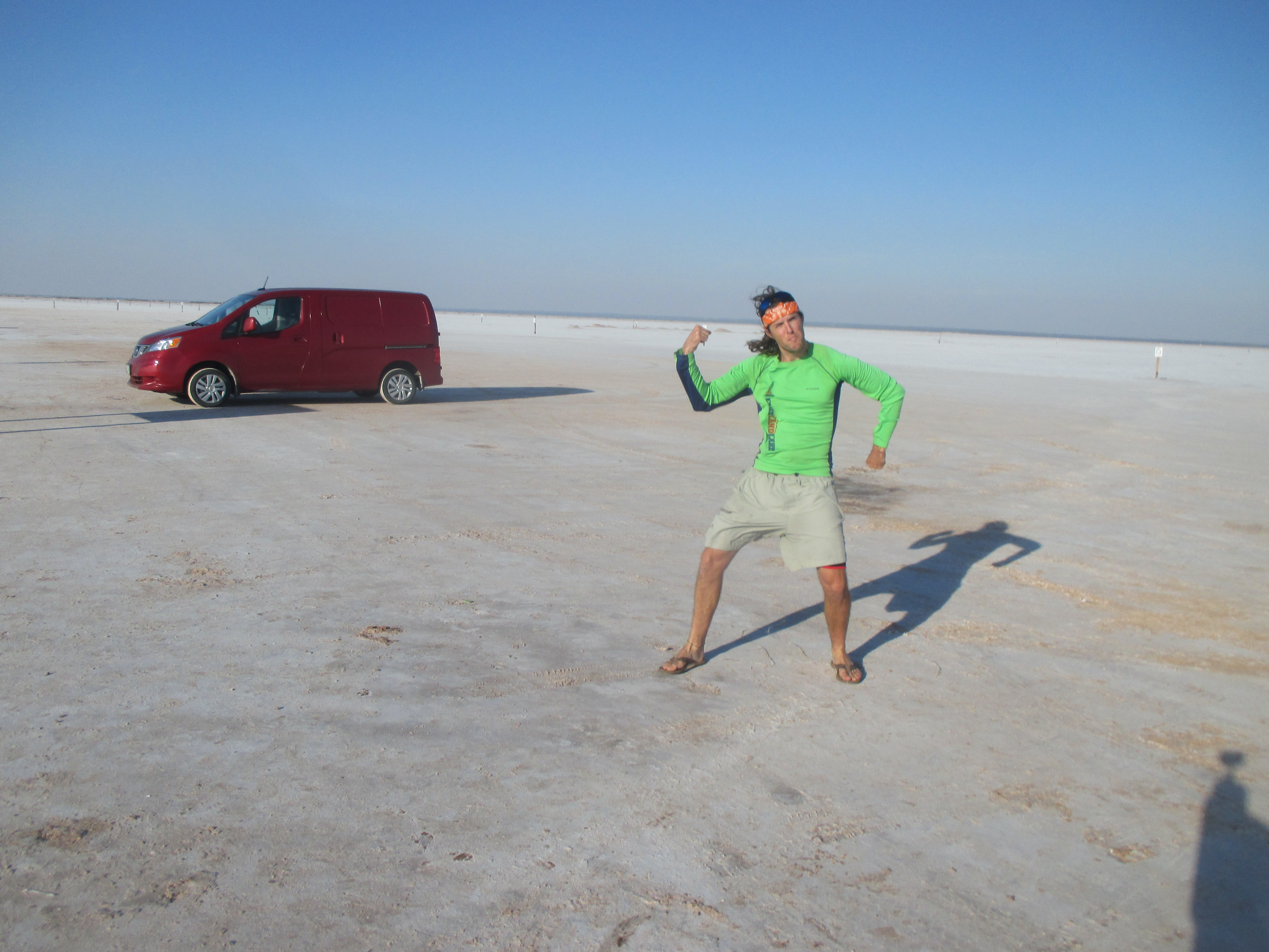
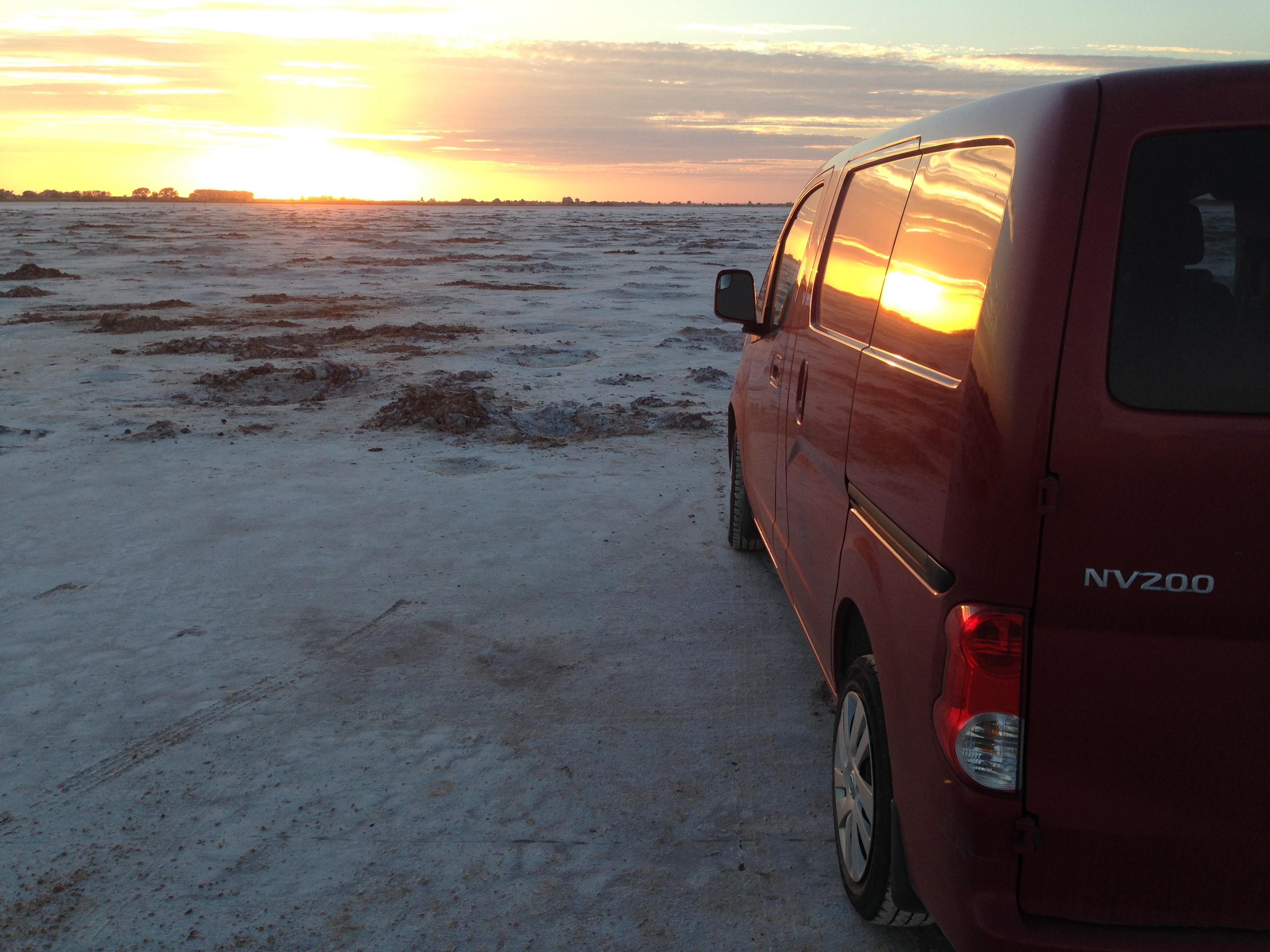
Further to the North, I visited Great Salt Plains State Park. A huge salt lake and salt flat next to each other. Driving out on the salt flat seemed like another world, white and flat as far as the eye could see. A portion of the salt flats was open to digging up beautiful crystals of salt and gypsum with a brown hourglass shape in them from the mud, known as selenite, this is the Oklahoma state crystal! Leaving the salt flats, I parked along a dirt road in a farmer’s field for the night. Around 2:00 AM, a storm blew in and the wind was so strong it was shaking my car to the point that I couldn’t fall back asleep. I drove into the nearby town of Jet where the buildings and trees seemed to stifle the wind enough to slumber once more.

img_2969 img_2980 img_2973 img_5753 img_2982 img_2989

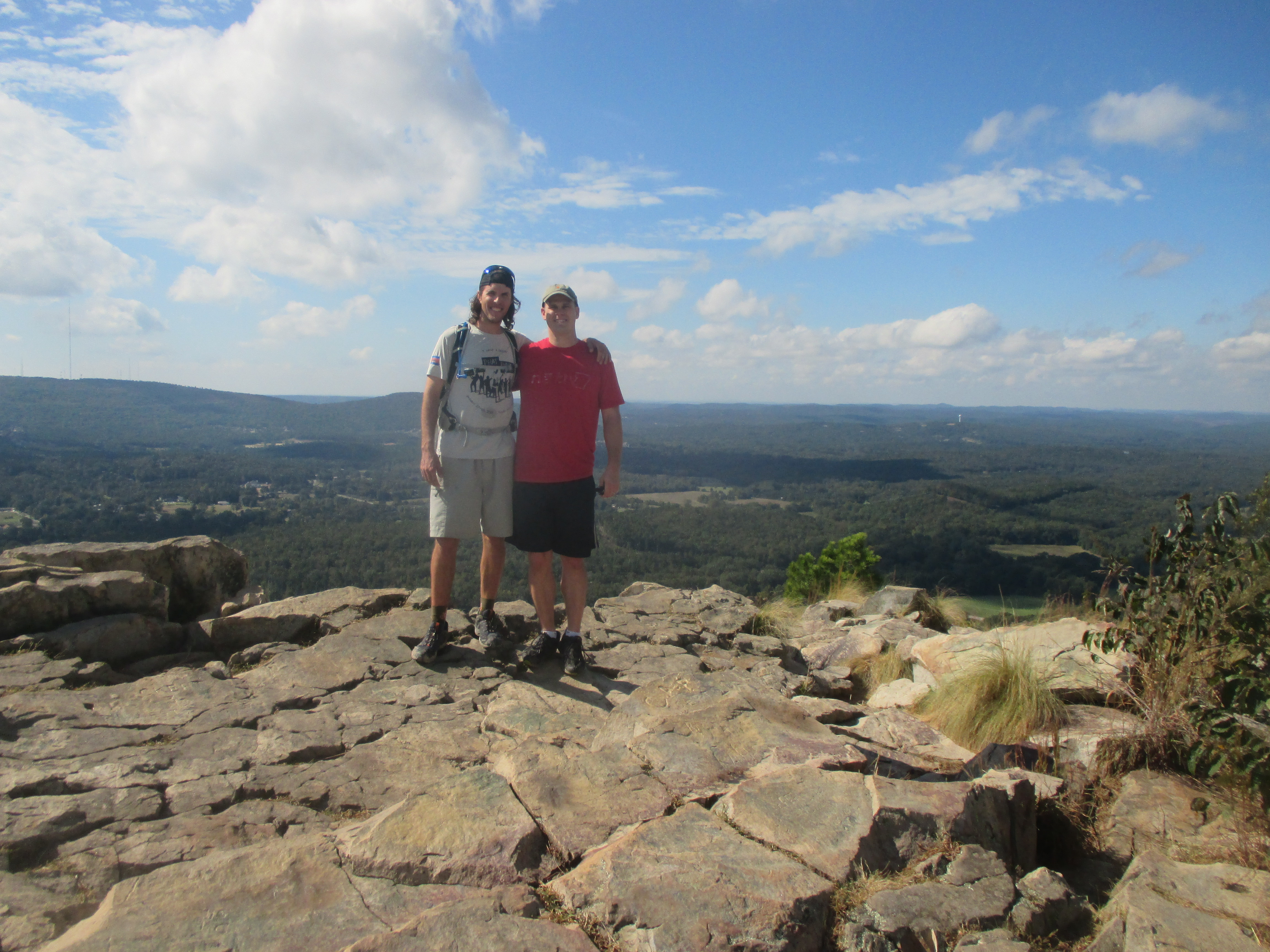
Five hundred miles to the East, I entered Little Rock, Arkansas, and visited the house of a great friend, Chris. Chris and I went for a hike up pinnacle Mountain for a view of Western Little Rock, then scrambled down a steeper side to a bushwhack through the woods.

img_5754

Chris showed me around Little Rock and we walked out “Big Dam Road”. When Chris’ wife, Libby, and the kids (Ethan and Elliot) arrived home, Ethan ran right up to me, very concerned, and asked, “What happened to your house?”, wondering why I was living in a van. The next morning, my alarm went off at 6:40 AM, and I got dressed for school. That’s right, school! Libby is a career development teacher at the local middle school and invited me to come in and speak to her students about Peace Corps! The sessions ran an hour each and with a few good stories and pictures, those kids ate it up! They had great questions and it was a pleasure to share that experience with them. I think their favorite part was ewww-ing at the list of bizarre foods I had eaten. Mid-day, Chris picked me up from school and we went into the old town of Hot Springs, Arkansas to see the famous old bath houses, hotels, and gangster activity from the days of old. It was an absolute pleasure to visit this family and to soak in the good, old-fashioned, Southern hospitality!

img_3007 img_3024 img_3028

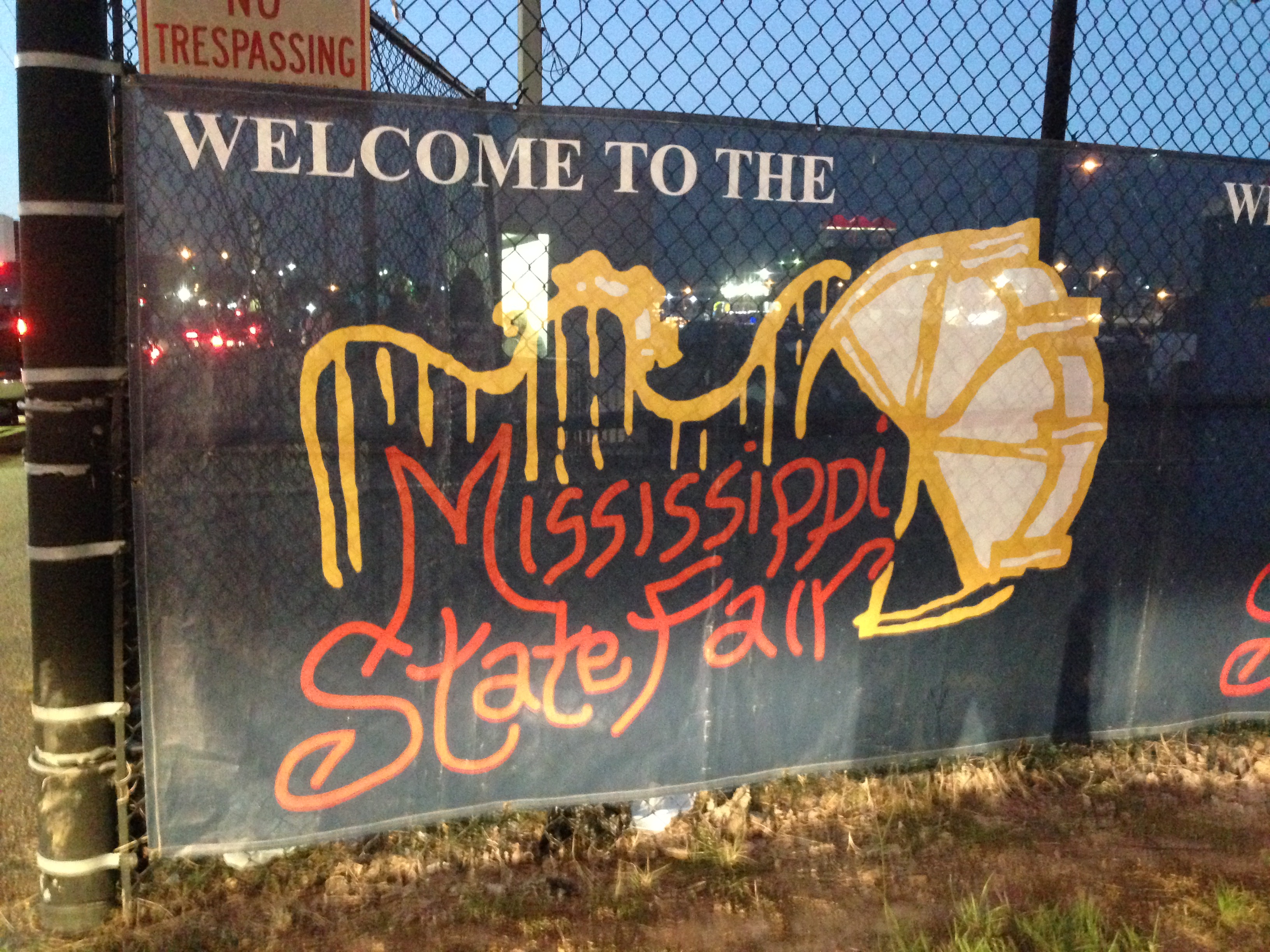
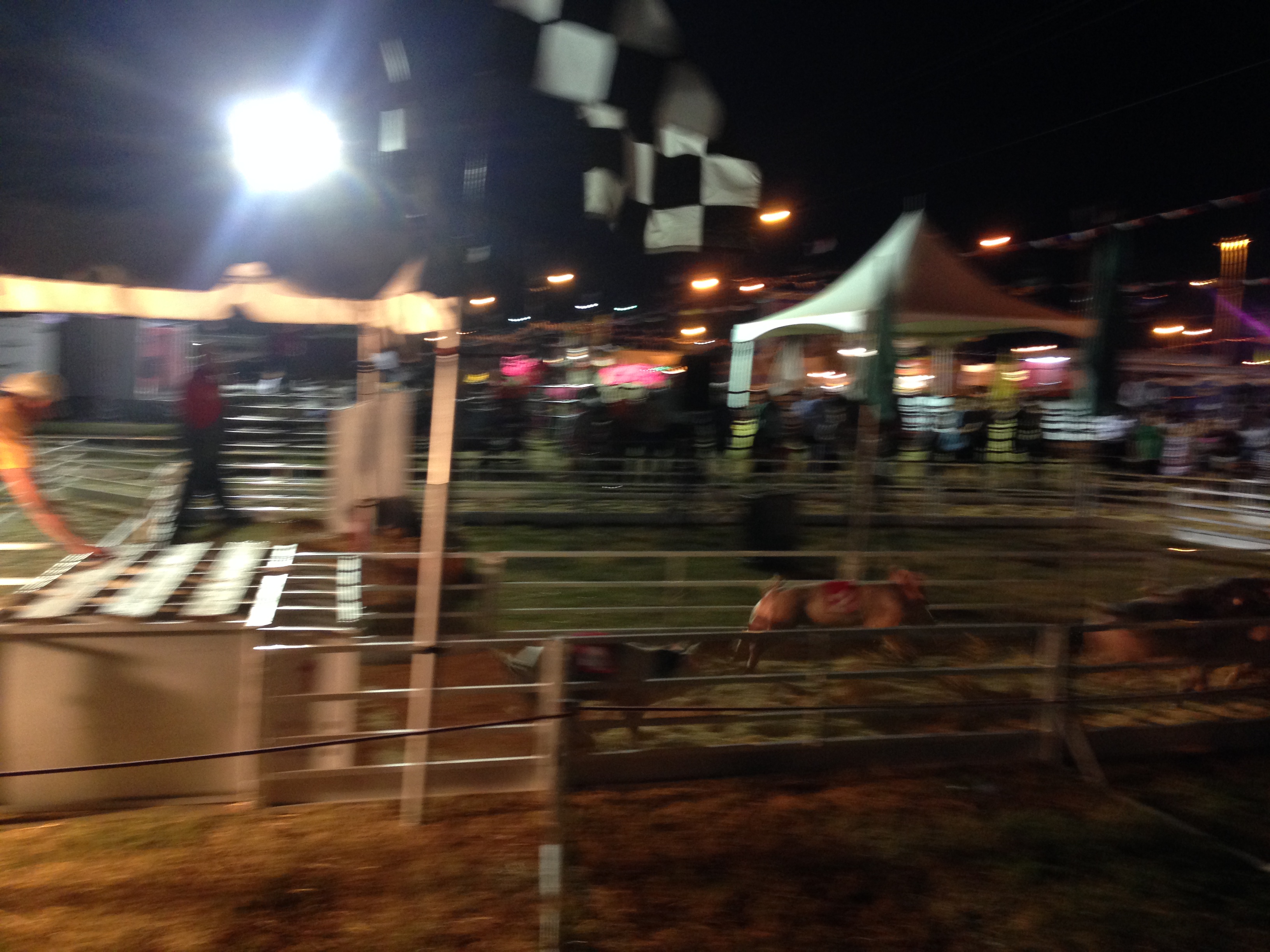
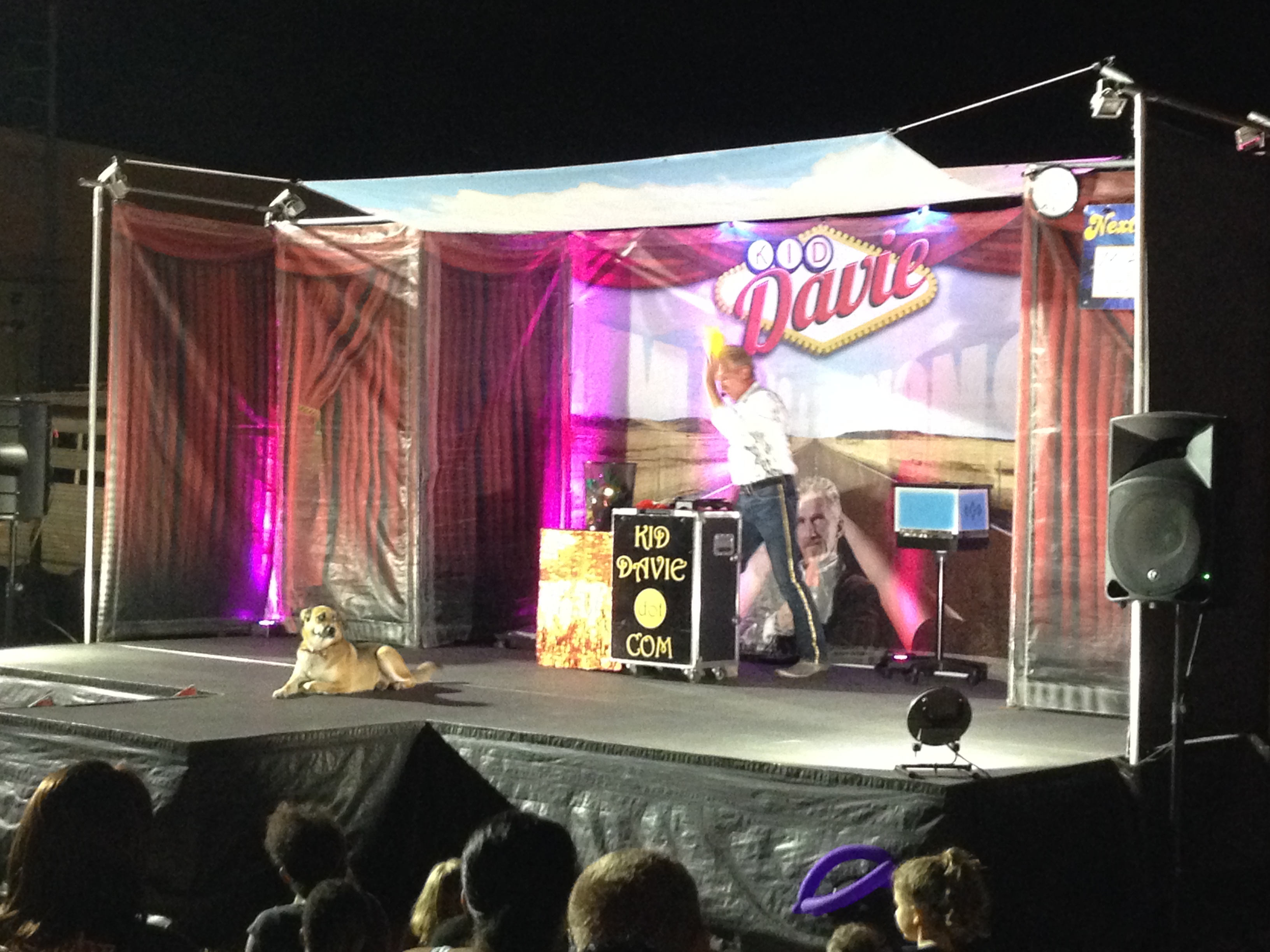
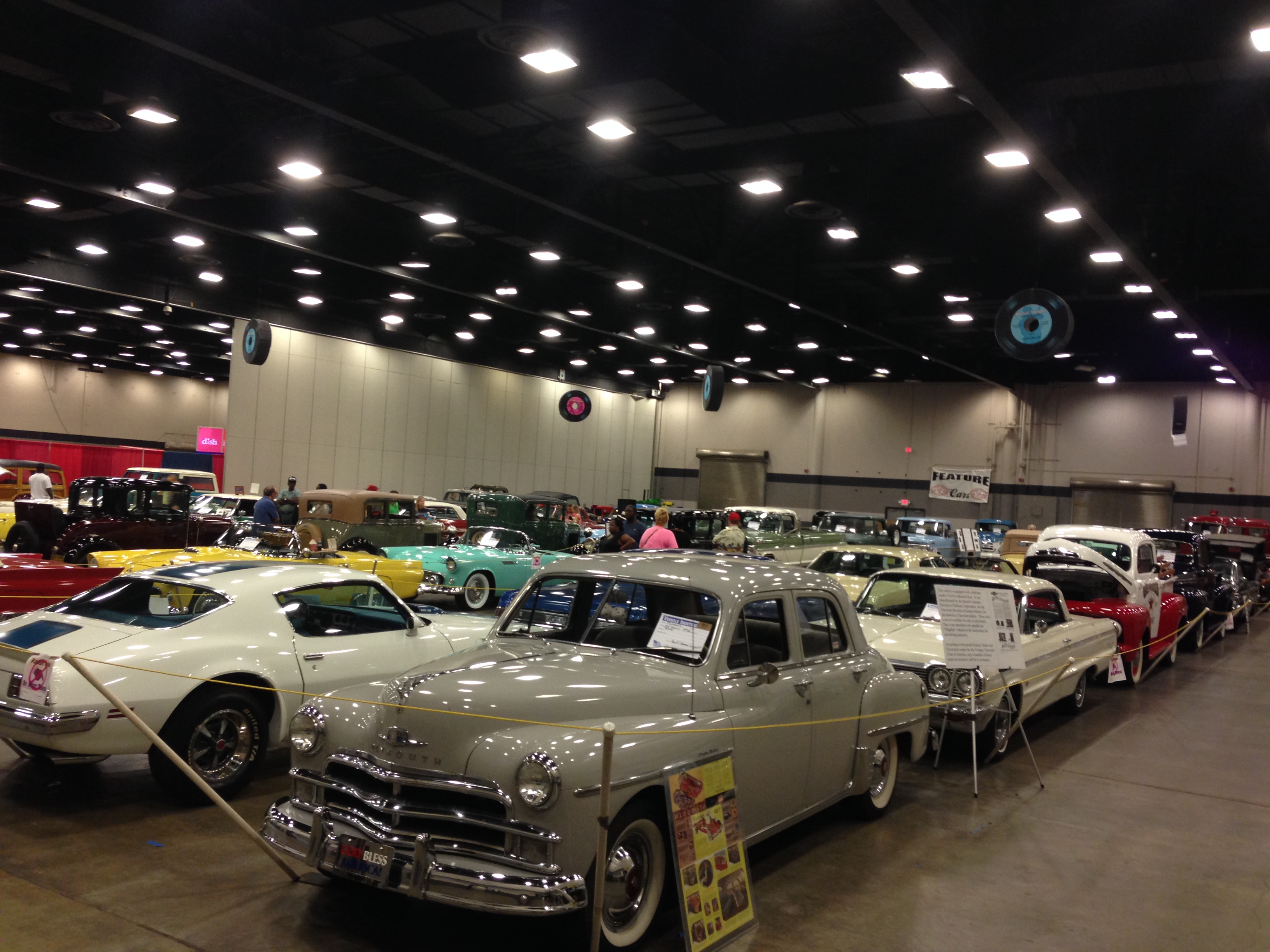
From Little Rock, my plan was to haul 1,100 miles, all they way down to my grandfather’s house in Florida, cutting through Louisiana, Mississippi, and Alabama. On the road, I looked for small things that could break up the drive, the first of which, I heard on the radio…the Mississippi State Fair! It was a fun night of watching people, pig races, games, a magician, and a classic car show. It was pretty cool, but I didn’t hear as many thick accents as I hopped to, and it didn’t seem much different from the Maryland State Fair. Sleeping in a hotel parking lot, I got woken up for the second time this summer by a cat climbing on the roof of my car!

img_3033 img_3036 img_3038 img_3040

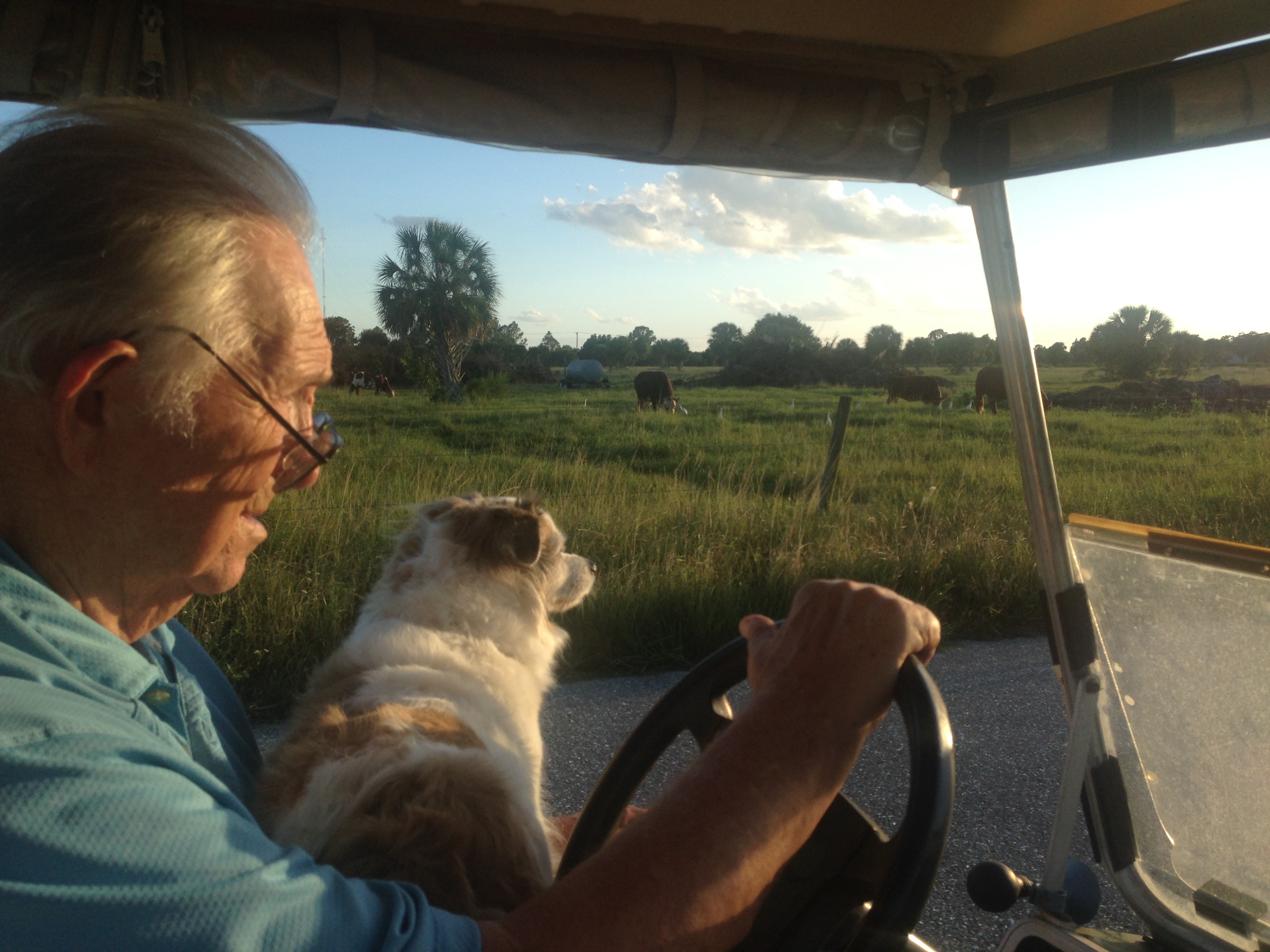
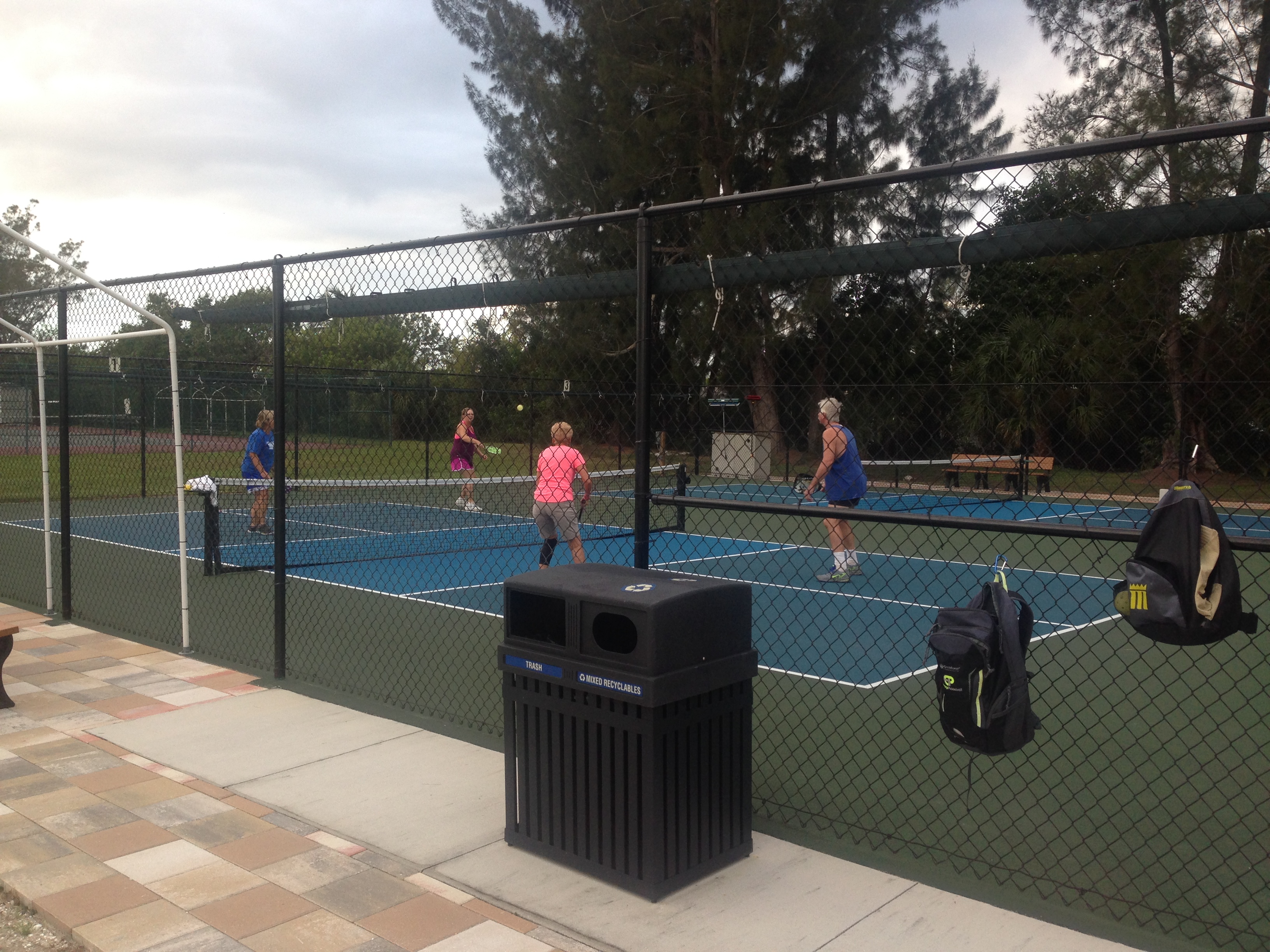
On the third day of driving, I arrived on the Gulf Coast of Florida to my grandfather’s house. I spent an entire week here, living it up in the retirement community, eating delicious home cooked meals, driving a golf cart around, working on the house, and playing lots of pickleball! His group of players get together every morning for a few hours of pickleball, and not to say that I was cocky about my abilities, but I was half their ages…they worked me up and down that court, little old ladies laughed in my face as they slammed shots over the net at me, it’s a humbling sport. Eventually, after enough days of practice, I got the hang of it and could hold my own. Around the house we worked on irrigation projects, put up hurricane shutters, planted a tree, fixed a gate, and installed a solar fan, Pop-pop and his dog, Bandit, always at my side. Out back, he had a star fruit tree with plenty of ripe fruit, I may have eaten my body weight in star fruit by the end of the week. The neighbors were so warm and friendly, each with a well-behaved lap dog and humorous banter. It was a wonderful week with wonderful company and a wonderful location, I was sad to leave!

img_3043 img_3047 img_3045

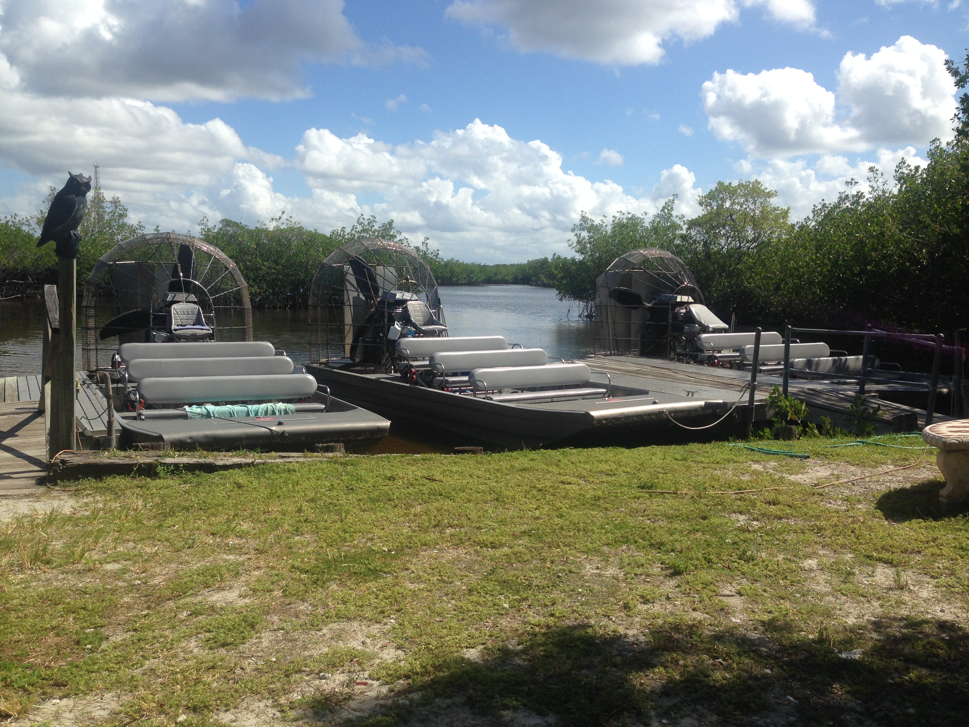
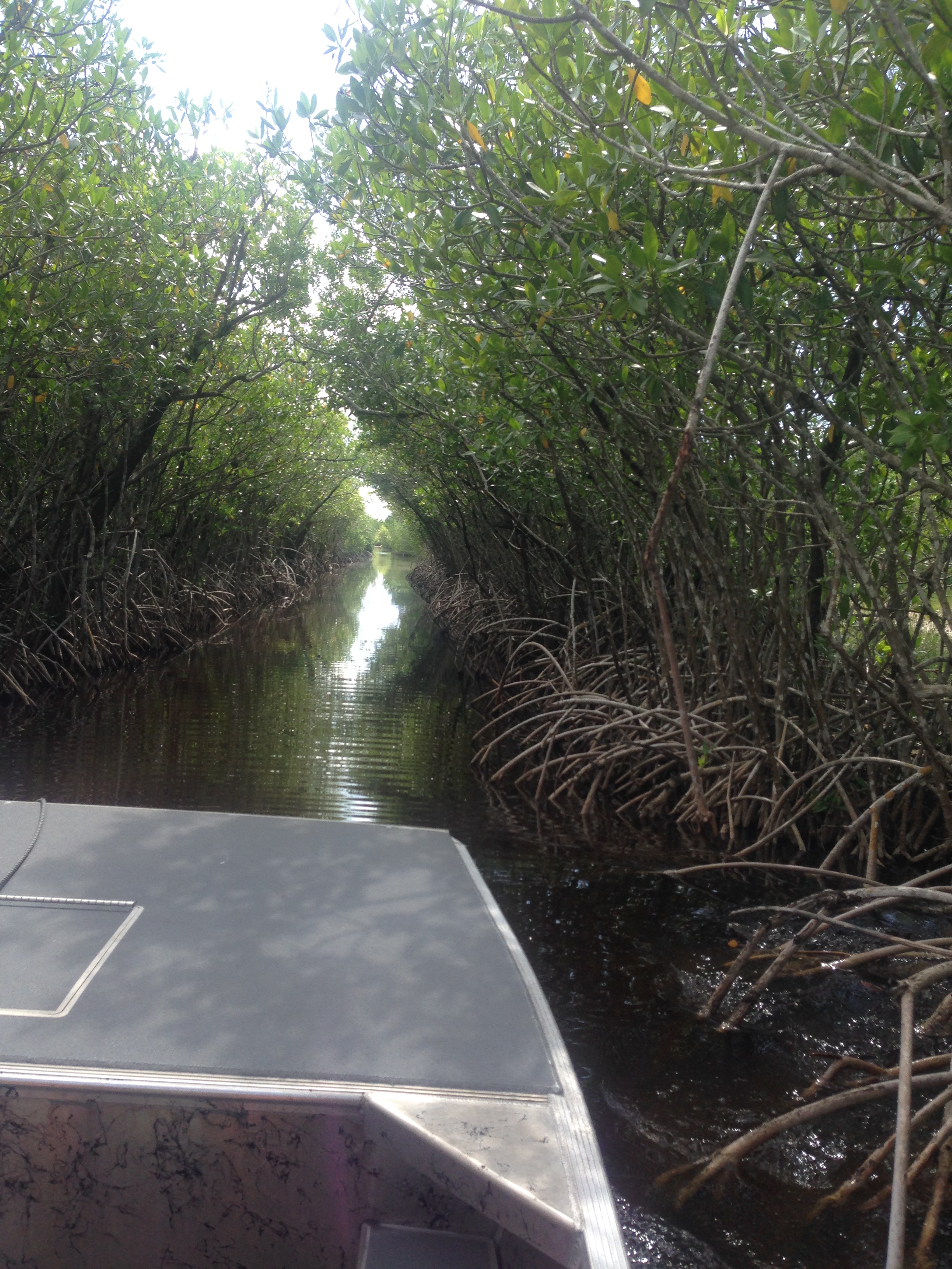
Further South, I visited the Everglades! It turns out that the National Park itself doesn’t have any hiking trails, but instead a beautiful canoe trail. I went out on a fan boat instead and got to see a few alligators. While I was so far South, I wanted to drive a bit of the Overseas Highway through the Florida Keys. Very beautiful sunset over the water, once it was dark I officially made my turn to head North back up the East Coast.

img_3050 img_3051 img_3054 img_3060

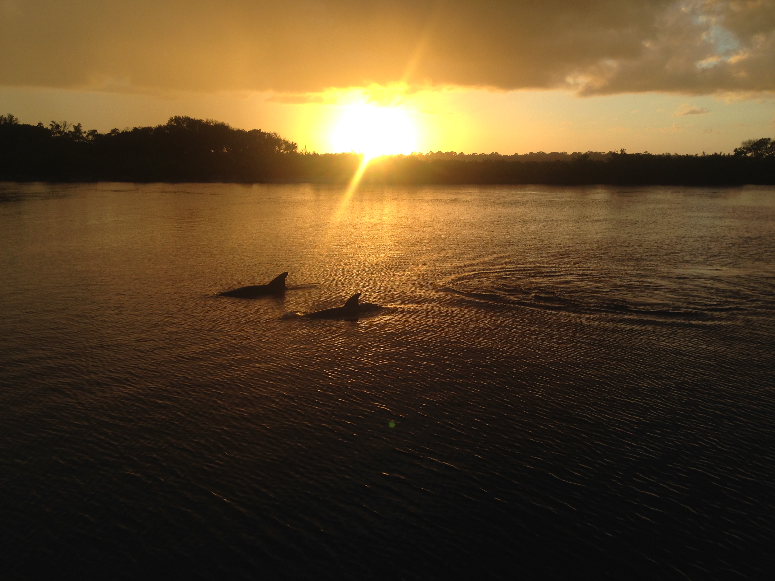
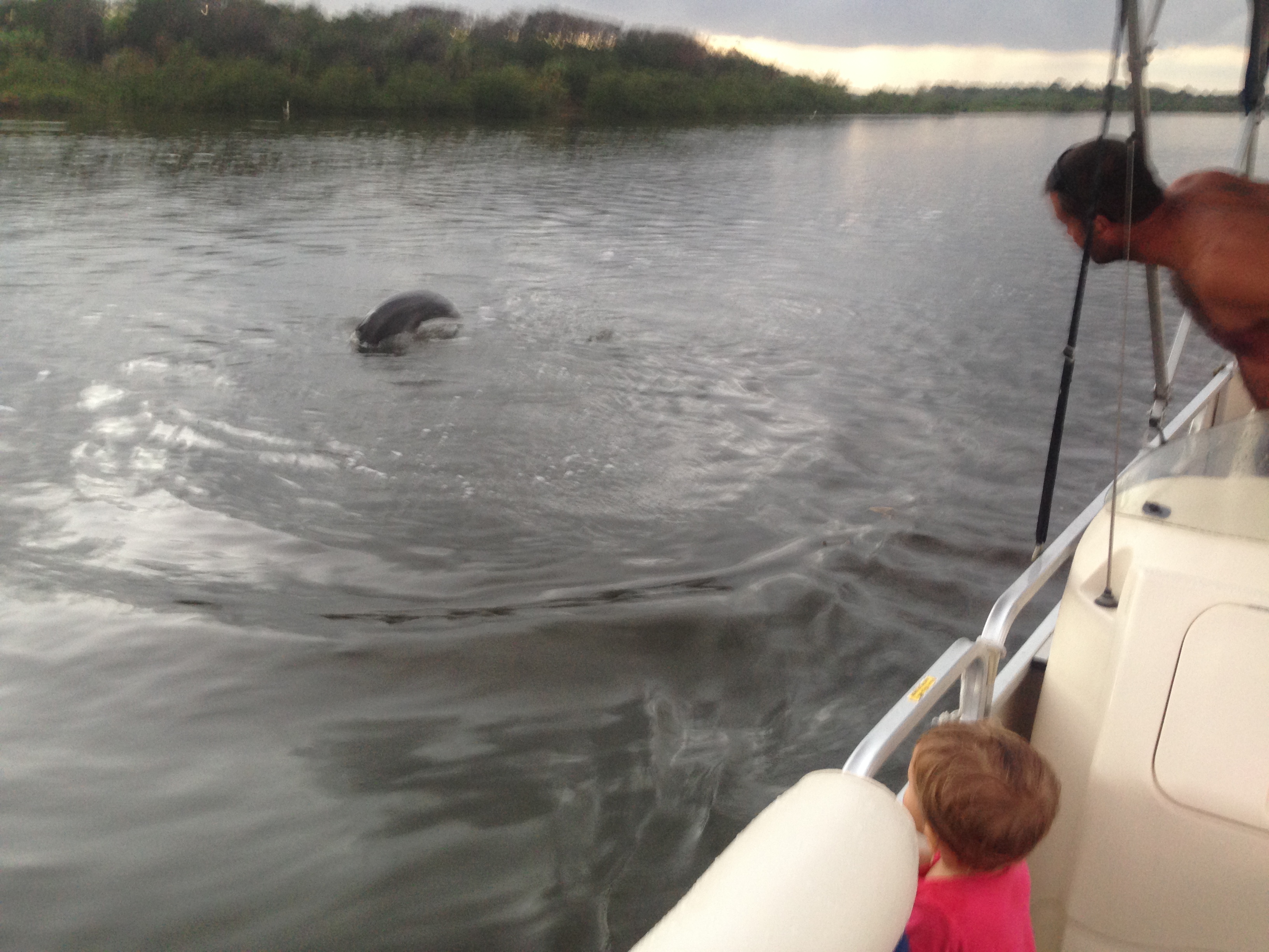
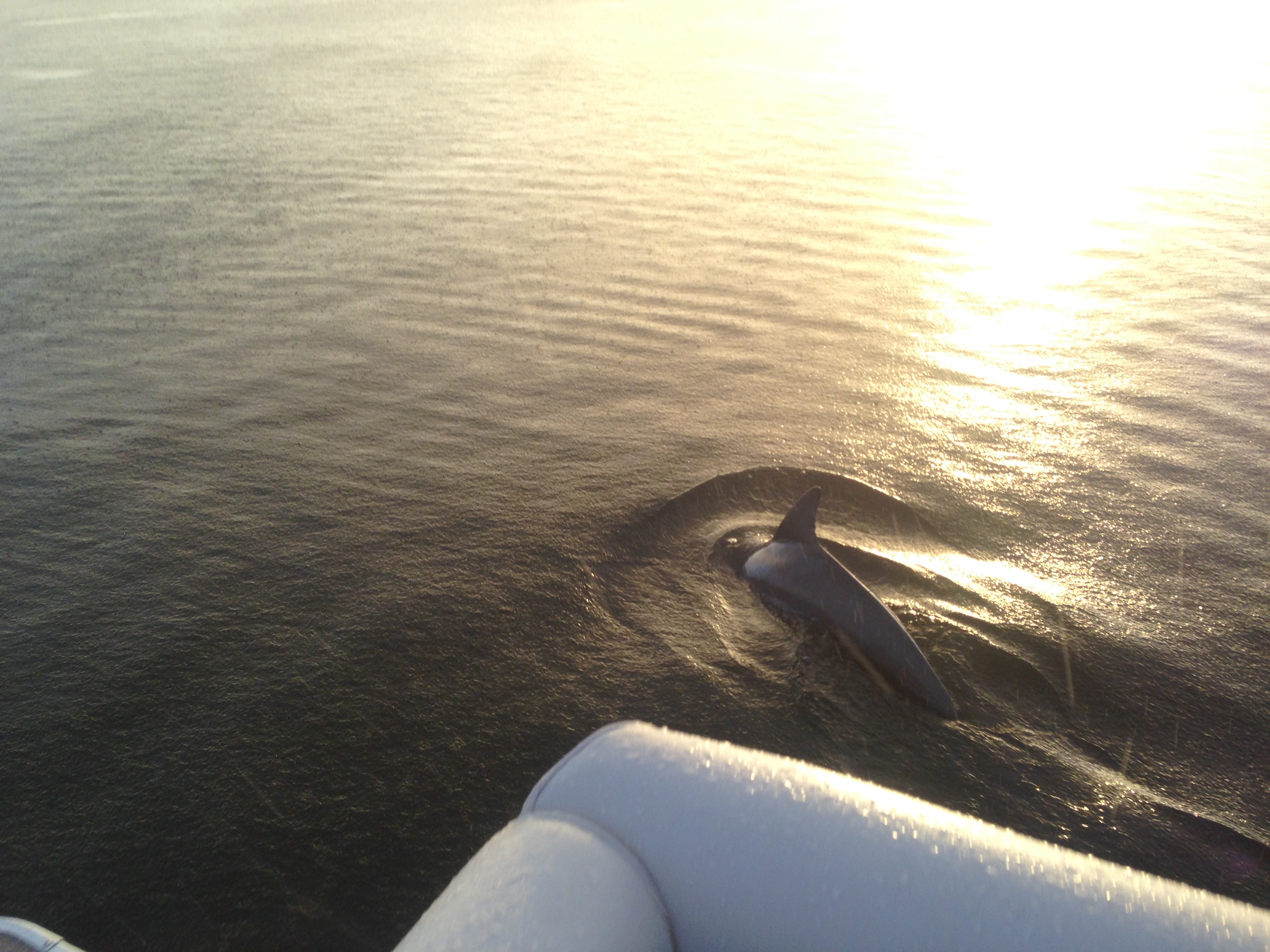
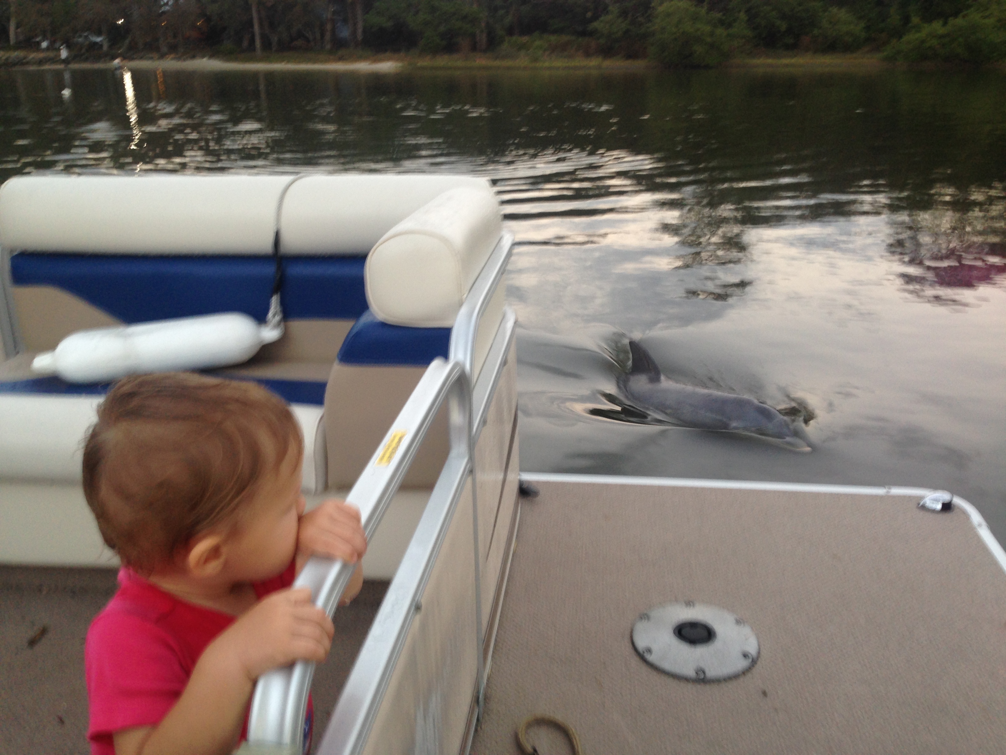
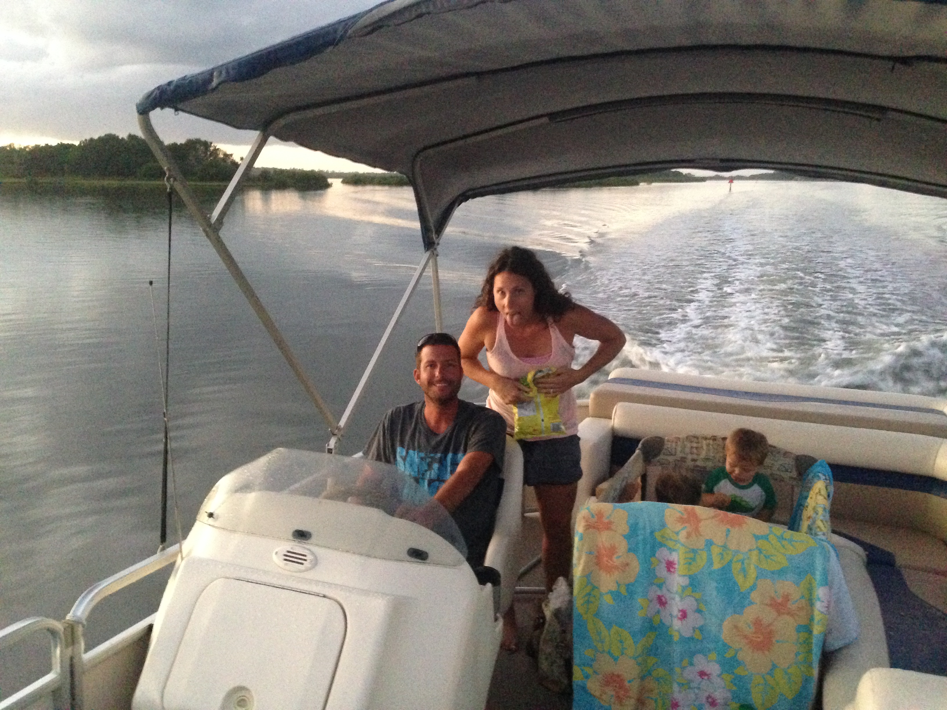
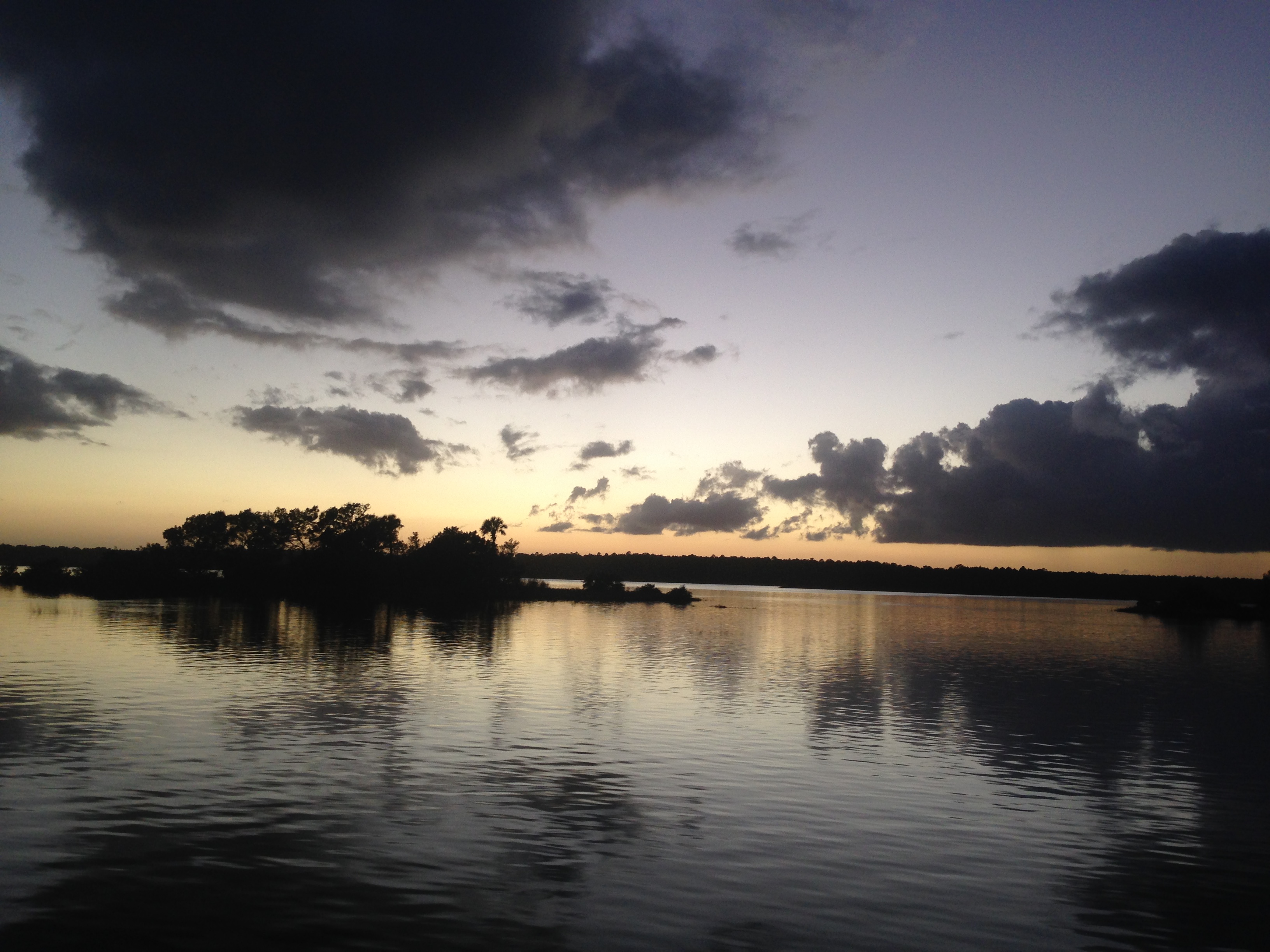
Along the Atlantic Coast of Florida, I popped in to visit my cousin, Katherine, her husband, Joey, their kids, Aydin and Grady, and their dogs, Saul and Paisley. We played with the dogs and play-dough, watched football, and cracked up at Grady giving the best stink-eye. For dinner, Joey cooked up the best fish tacos I’ve ever eaten. The second day, we decided to take out the pontoon boat after work and school. We chugged 45 minutes up the intercostal waterway before spotting some dolphins. We idled around and they continued to surface all around us for a long while. Some rain came in from the East, but only for a few minutes, leaving us chilly, but revealing an incredible double rainbow to one side and a dramatic sunset on the other, with dolphins all around! A fantastic evening with family and nature!

img_3133 img_3073 img_3216 img_3081 img_3192 img_3220 img_3218

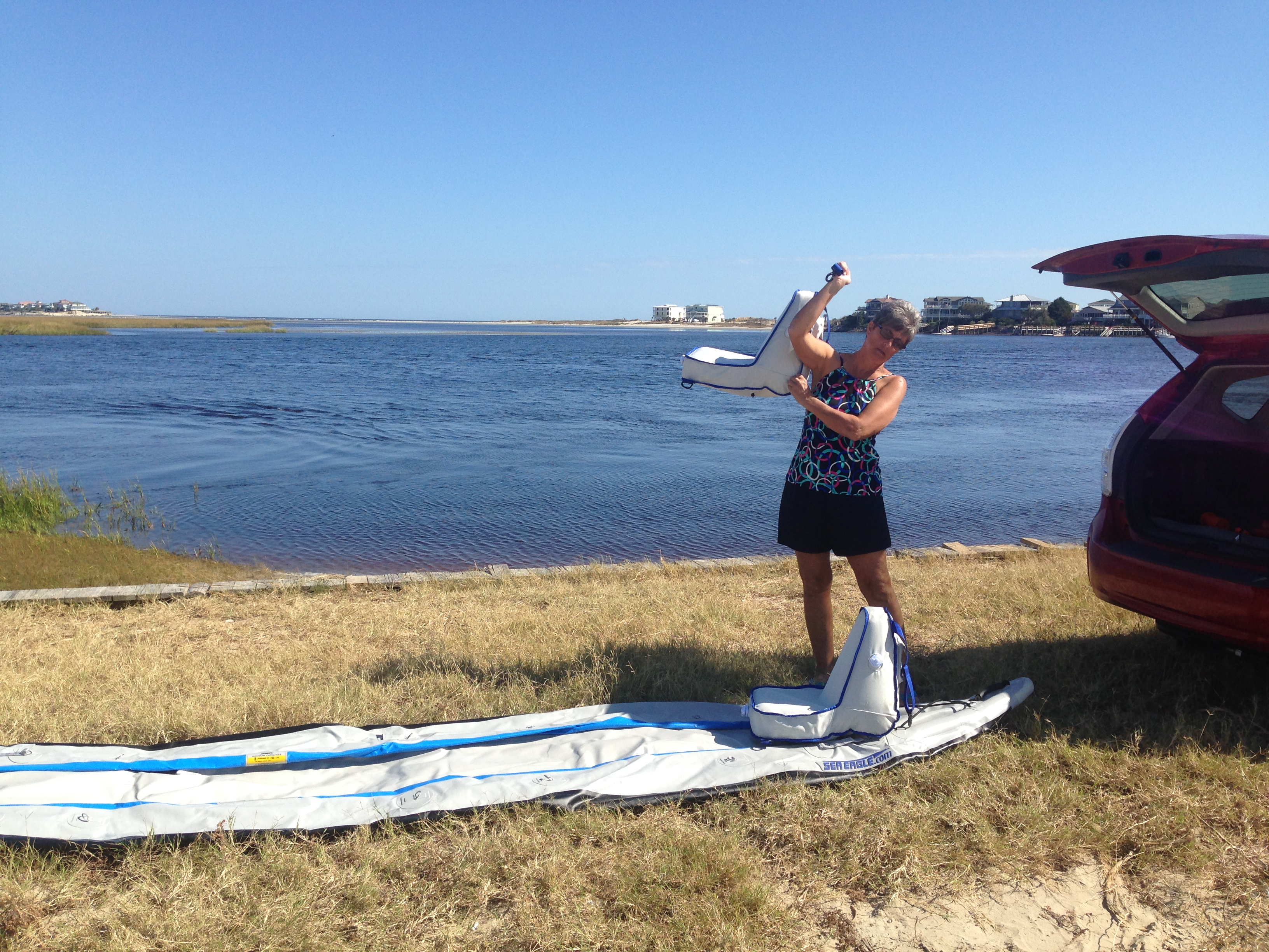
Further up the coast, I visited Aunt Janet and Uncle Steve in North Carolina. After a tour of their house, they took me to play pickleball! It was a good thing I had some practice down in Florida, their group were serious players! And some delicious BBQ didn’t hurt with the recovery effort either! The next day, we played more pickleball in the morning, then Aunt Janet and I went out on their inflatable kayak. We put in and paddled a half mile to the ocean, the tide was going out, so we moved quickly. Neither of us had ever paddled in the ocean before, so we aimed into the small waves and got a good soaking! Turning around, we through we could simply surf the waves back in, but when they pushed us from behind, it folded our kayak in half and we became swamped! Luckily, the water was only waist deep, so we simply walked it to the shore, drained it, then left it on the beach while we played in the waves for half an hour! Paddling back to the car was tough against the current, and before long we realized that the tide had dropped too much, so we walked back to the car, pulling the boat behind us in the shallows. On day three, more pickleball, what a blast! Afterward, Aunt Janet invited me on a bike ride around the neighborhood with her neighbor. They certainly are having a fun life in retirement!

img_3225

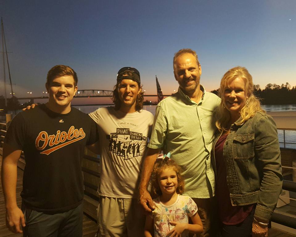
From Aunt Janet’s house, it was only a short jaunt to Uncle Bryan’s house to visit with him, Aunt Lindy, Jarrett, and Piper. In the evening, we walked along the boardwalk for dinner and feasted on delectable ice cream.

14606263_10208408015297159_8080208629688636368_n 14670804_10208408641592816_7278707368449896387_n

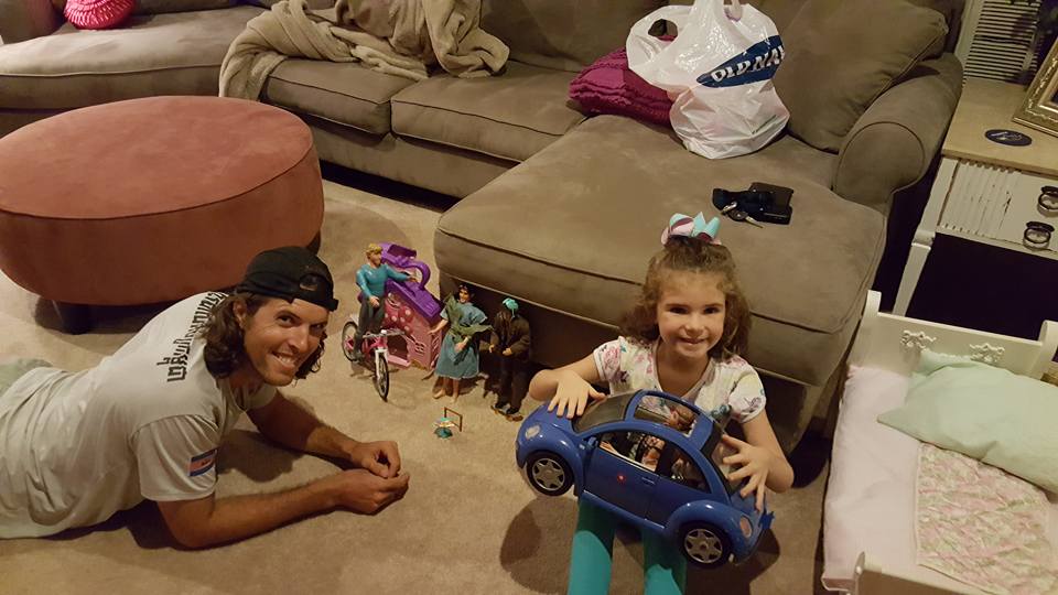
Afterward, Piper taught me how to play Barbie dolls for an hour, my favorite rule was that you couldn’t kill anyone, until she eventually decided to lift the rule and kill my dolls!

14519677_10208408893159105_7689729412954240934_n

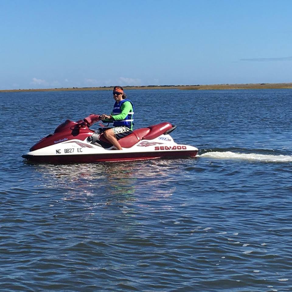
The following day, Uncle Bryan, Piper, and I took the jet-ski’s out for a few hours! Incredible fun. Piper liked to stop at the islands and play, so I just zipped around nearby and practiced 360’s and wave hopping. The jet-ski’s were very maneuverable, agile, buoyant, and blinding fast, cruising along at 45-50 mph on the flat water!

14633052_10208423107074444_7087197677875342824_n

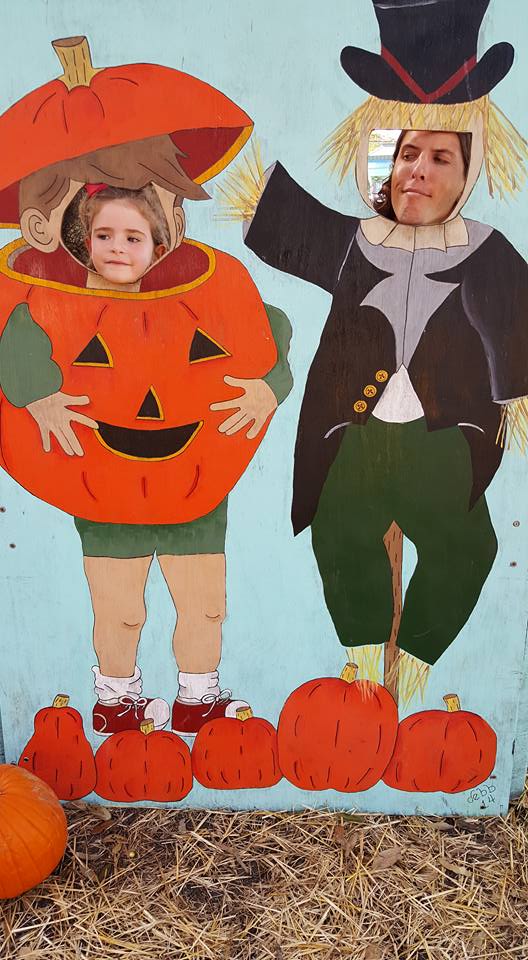
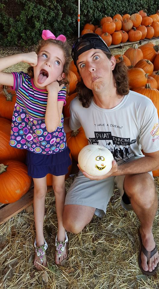
After lunch, Aunt Lindy, Piper and I went to a pumpkin patch for some decorating.

14642121_10208416497349205_3380917856123090818_n 14713751_10208416496829192_8887875733305401774_n

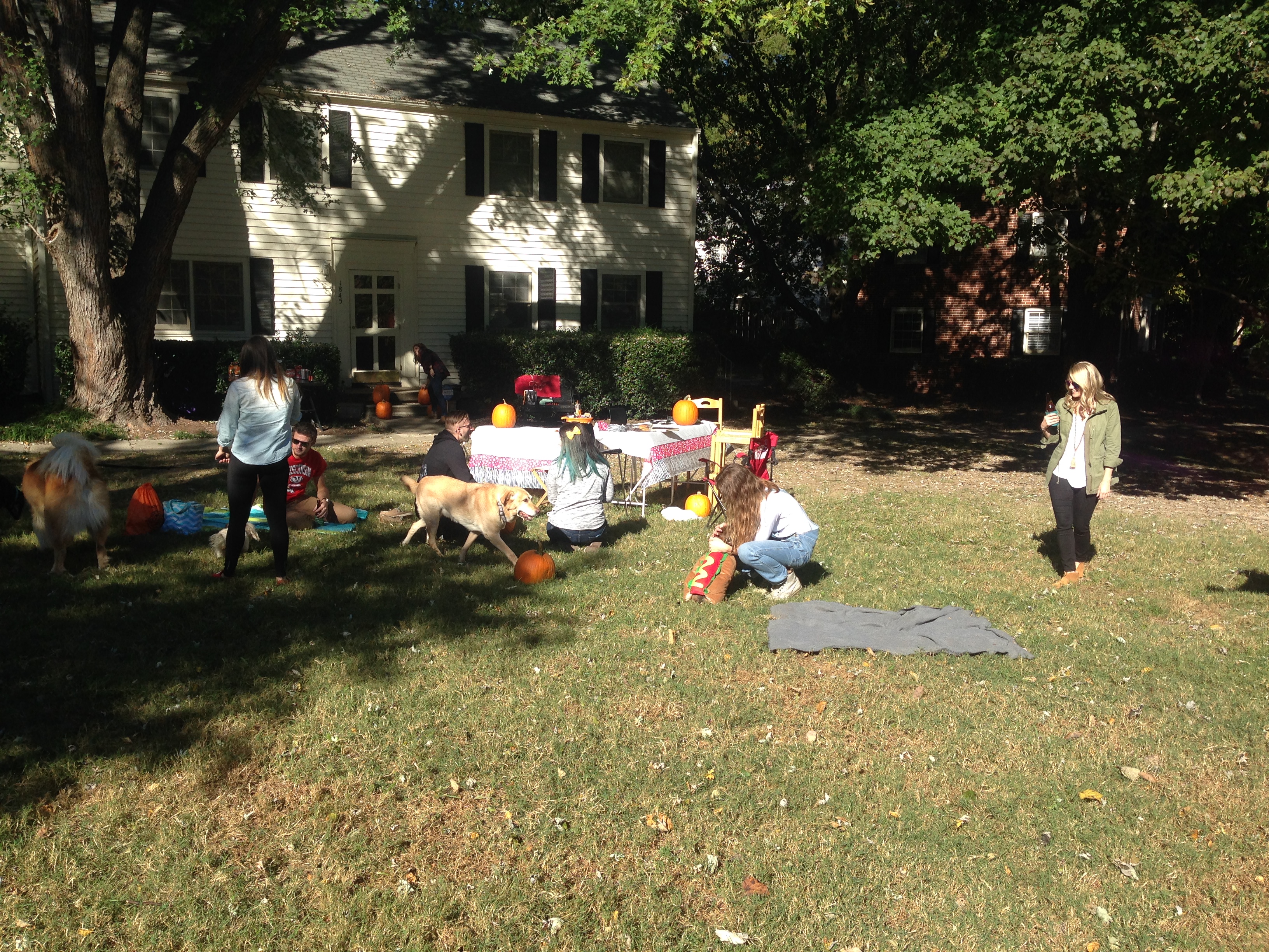
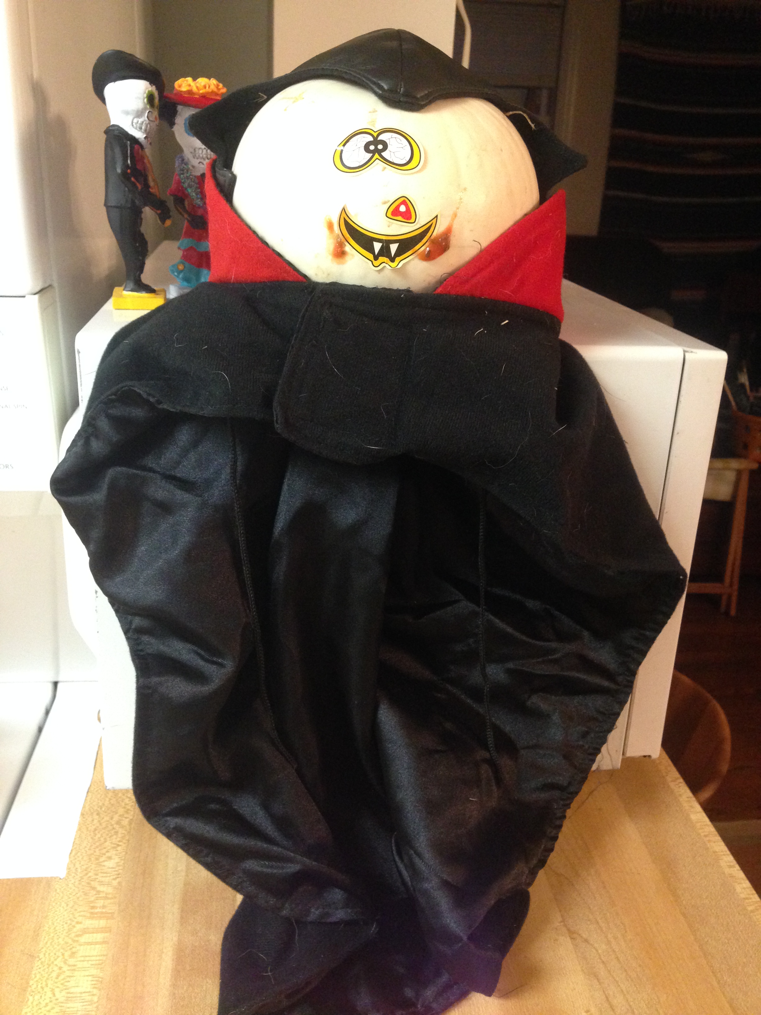
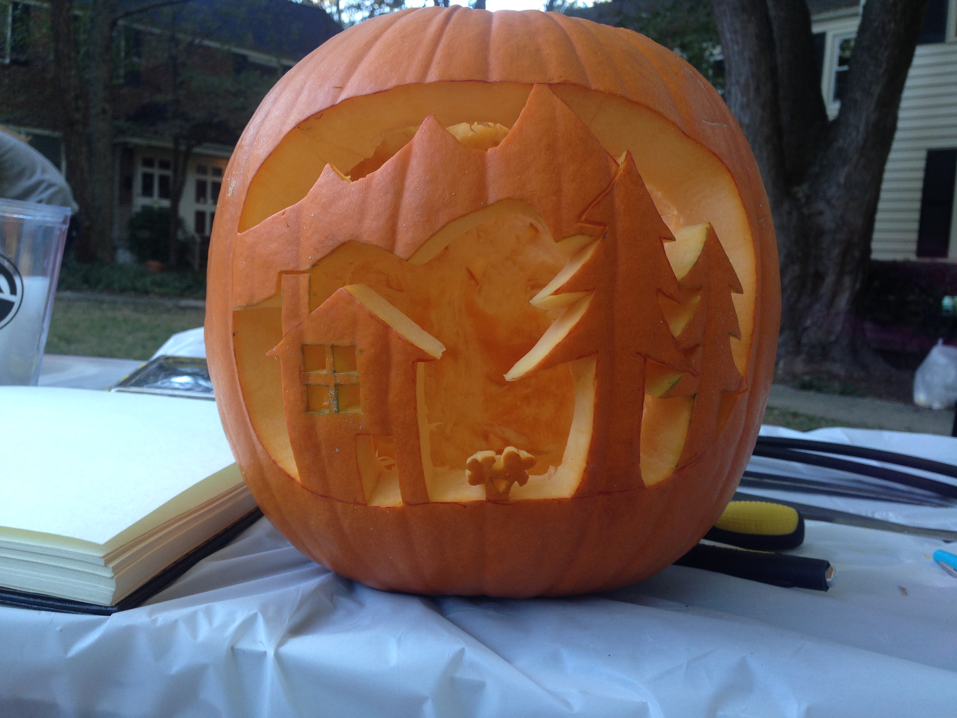
Onward to Raleigh, NC, I met up with an old friend from my very first job at the Fallston Swim Club, Megan! We hadn’t seen each other in over a decade, but picked right back up, she’s got a great sense of humor, wit, and is easy to get along with! She cooked up a gourmet dish of Chicago Chicken (bai sach moen), complete with chocolate covered strawberries for desert! In the evening we visited a Halloween decorated house and she gave me a walking tour of downtown Raleigh, but we passed on the telepathic dancing. The following morning, we broke our fast with pumpkin spice cinnamon rolls, picnic style on the lawn. With her dog, Basil, in a hot dog costume, we drove to a pumpkin patch to score some pumpkins for the afternoon carving party in her neighborhood.

unnamed-1

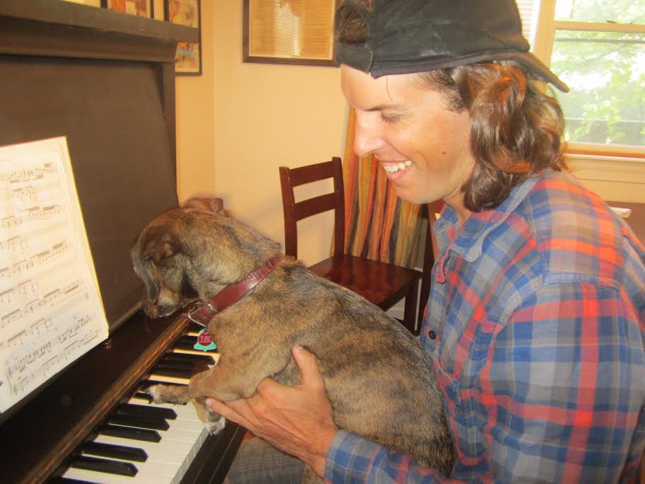
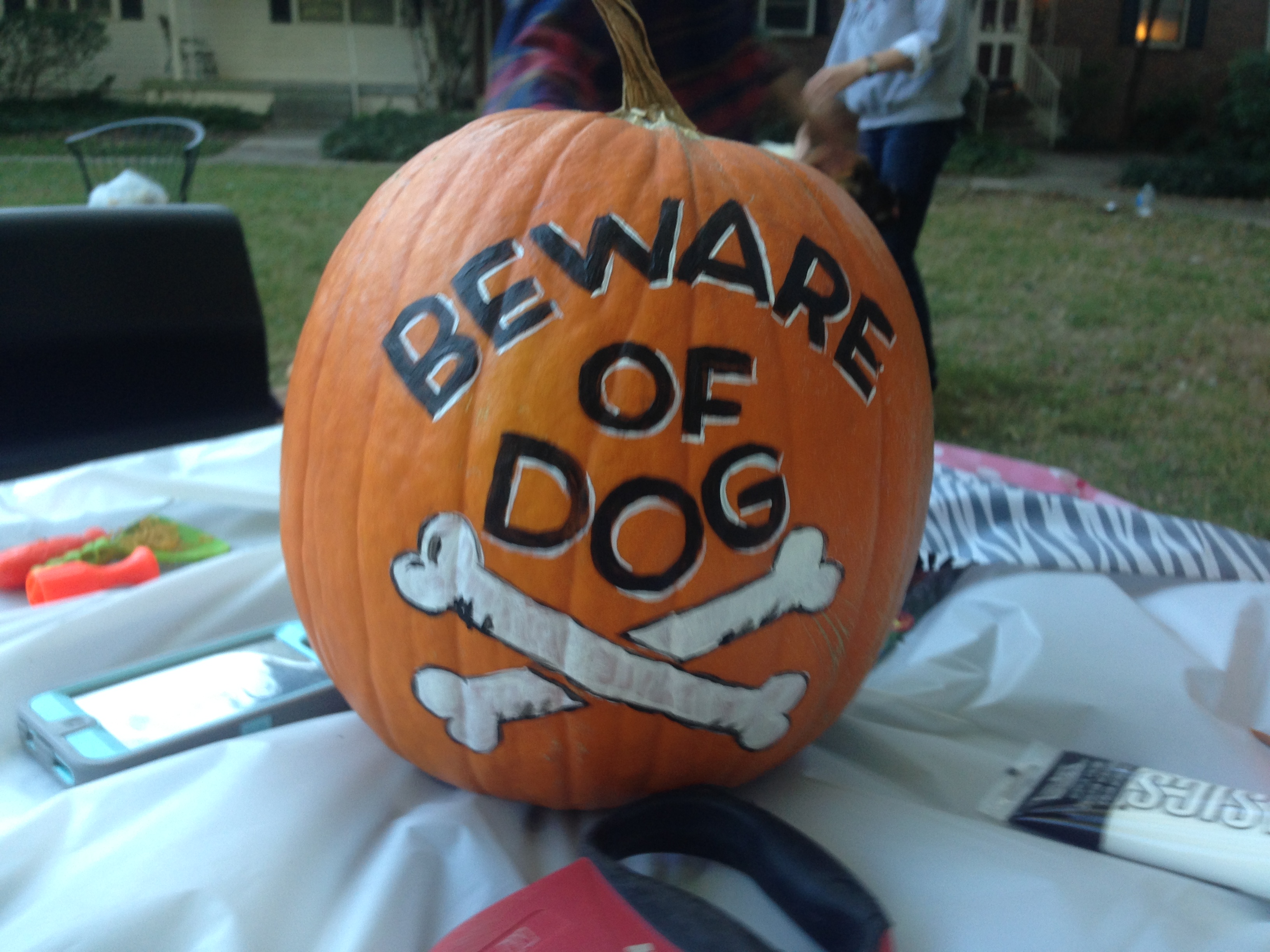
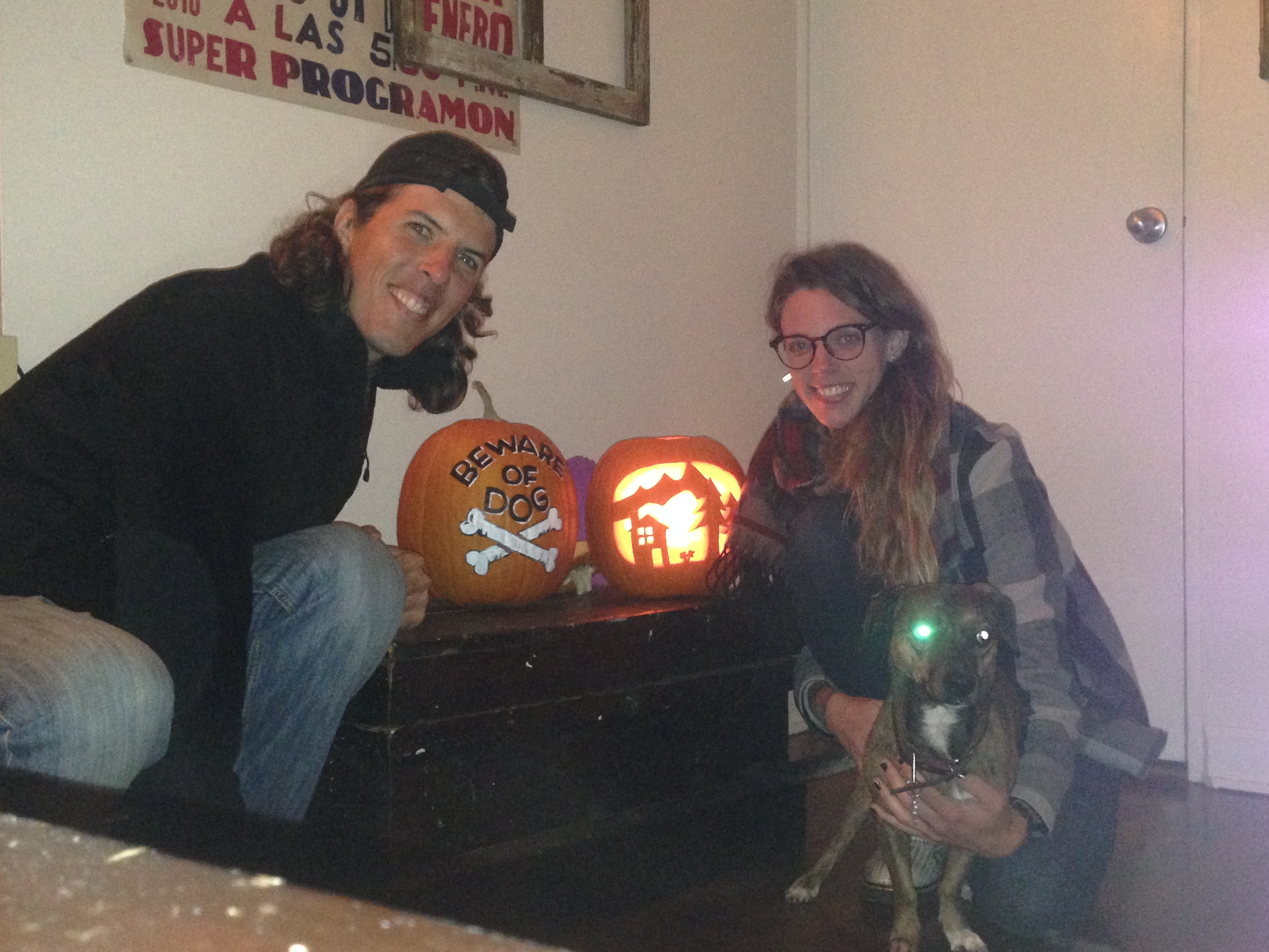
Back at the house, the neighbors gathered, there was maybe 15 of us, and equally as many dogs, it was a blast! With Megan’s artistic sketch, I carved a landscape, while she painted a “Beware of Dog” with crossbones. My favorite pumpkin however, was the image of a check engine light in your car, the carver was correct in saying it’s a scary thing! In the evening we visited a fundraiser at a local brewery, cooked pumpkin seeds, and did yoga. The last day, was low key, she taught me to play the piano and we hung out at a cafe, with Basil still in her hot dog costume, and basked in the sun on the lawn on a chilly day! Thanks Megan for all the fun, puzzles, and jokes!

img_3226 img_3230 img_3232 img_3228 img_3235

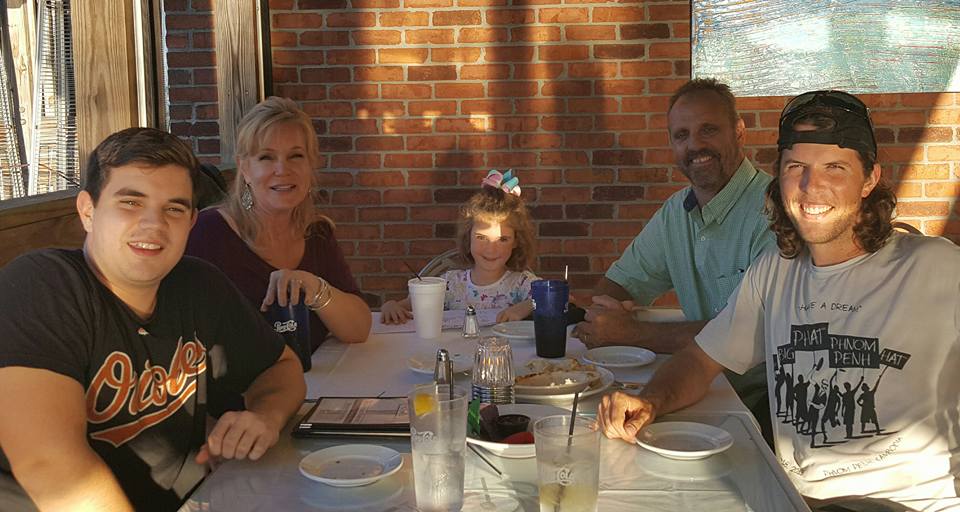
Into Virginia, I sauntered up to Richmond to visit my dear friend, Kathy, her wife, Heather, their two daughters, Sylvia and Hadley, and their dog, Kazzie! It was wonderful to see the kids and how quickly they are growing up. Kathy and I went for a night run, and one night we even ordered cookies through a late night cookie delivery company, Red Eye…they delivered fresh baked cookies right to the front door at 10:00 PM!

unnamed-2

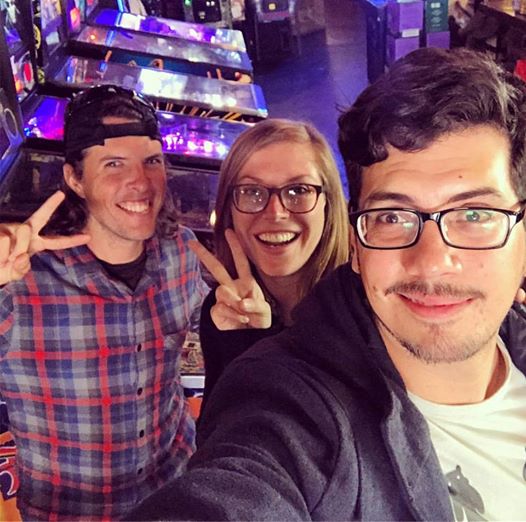
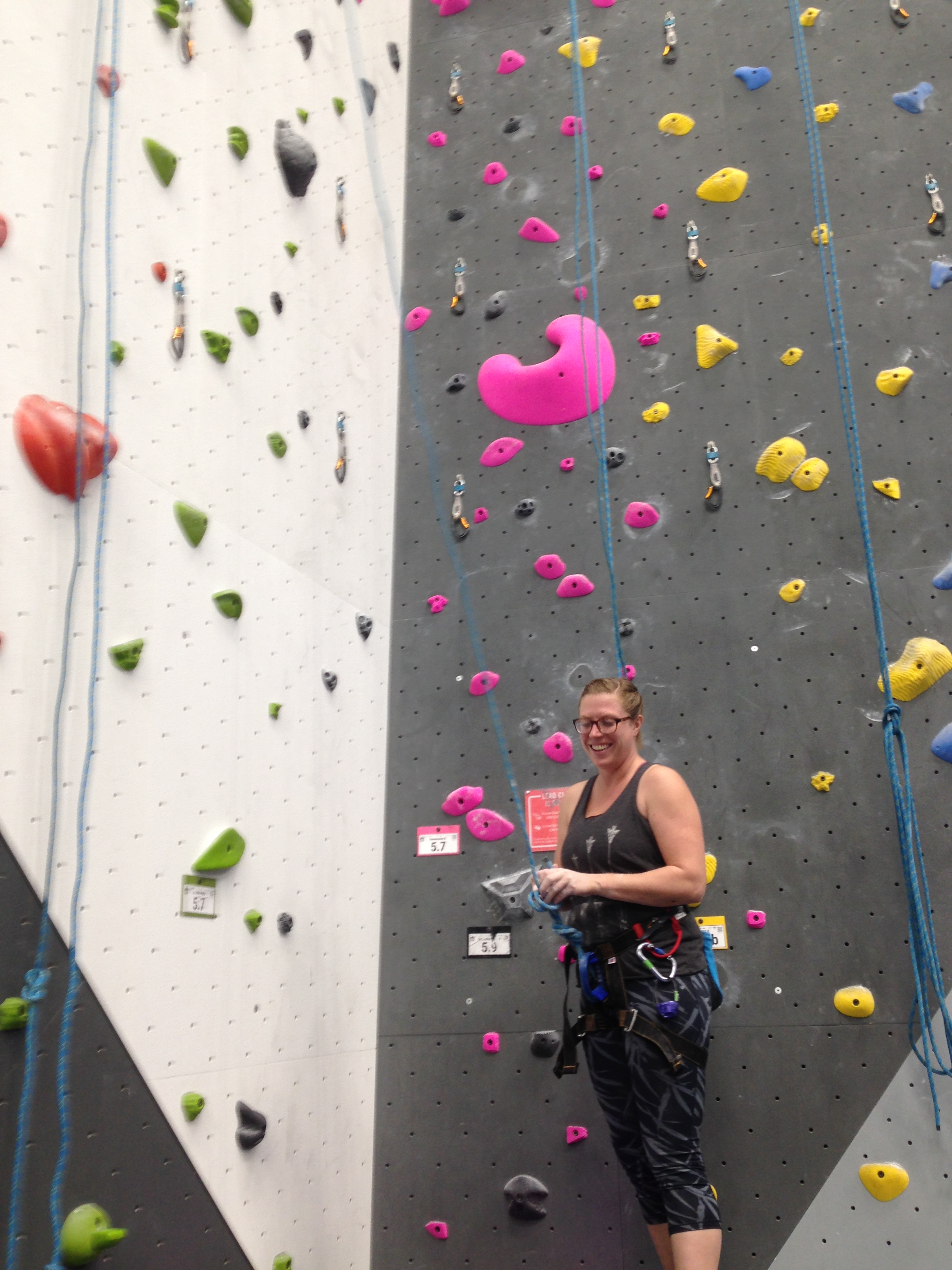
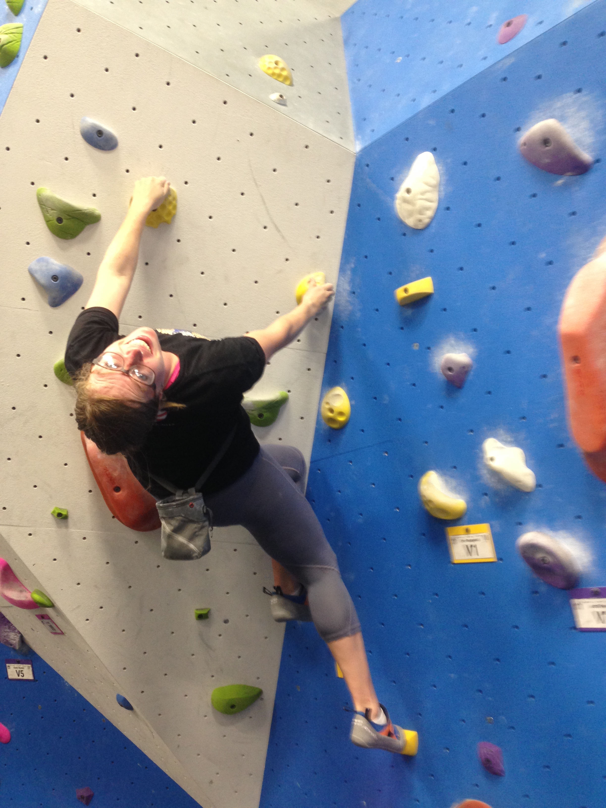
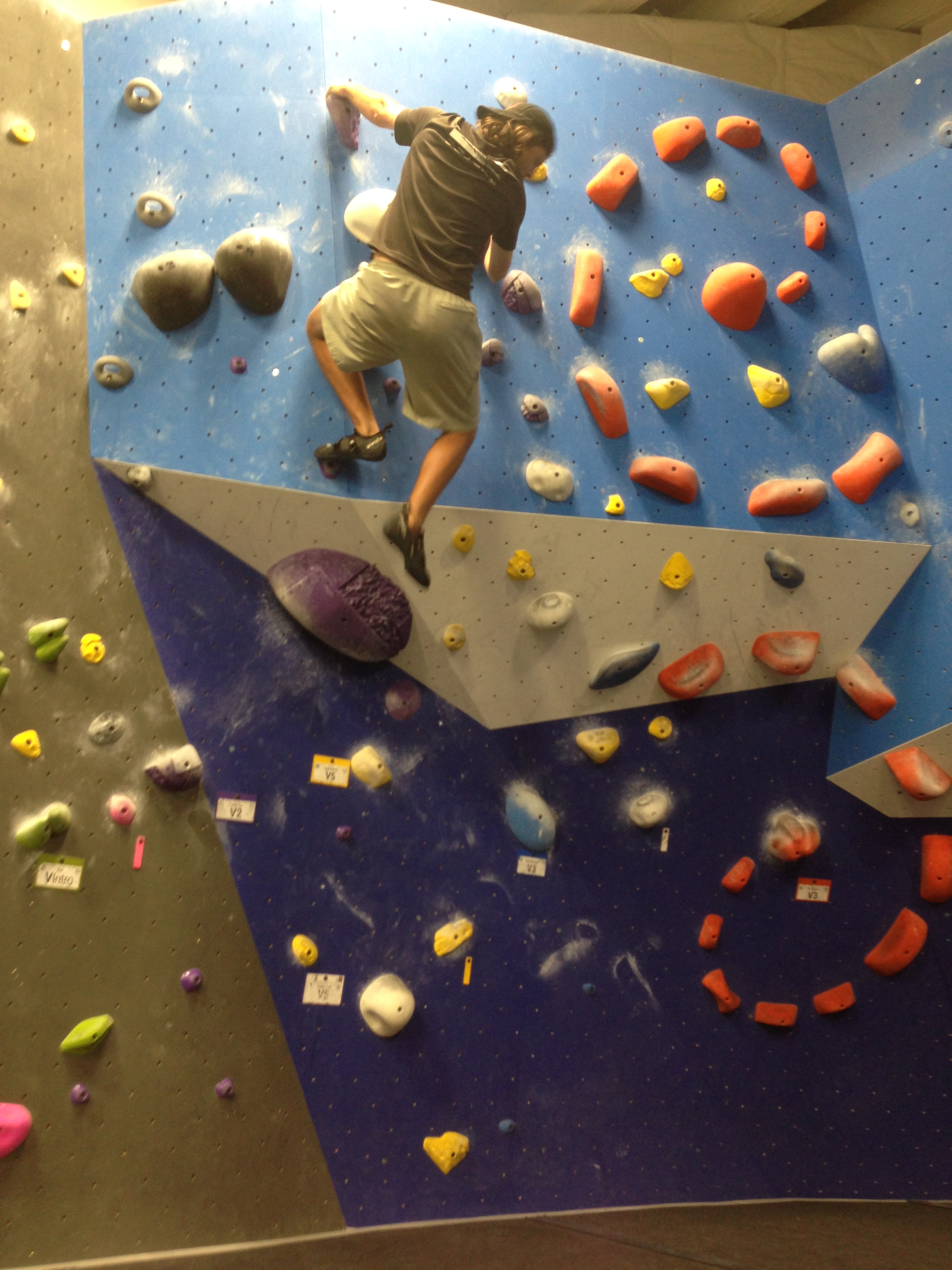
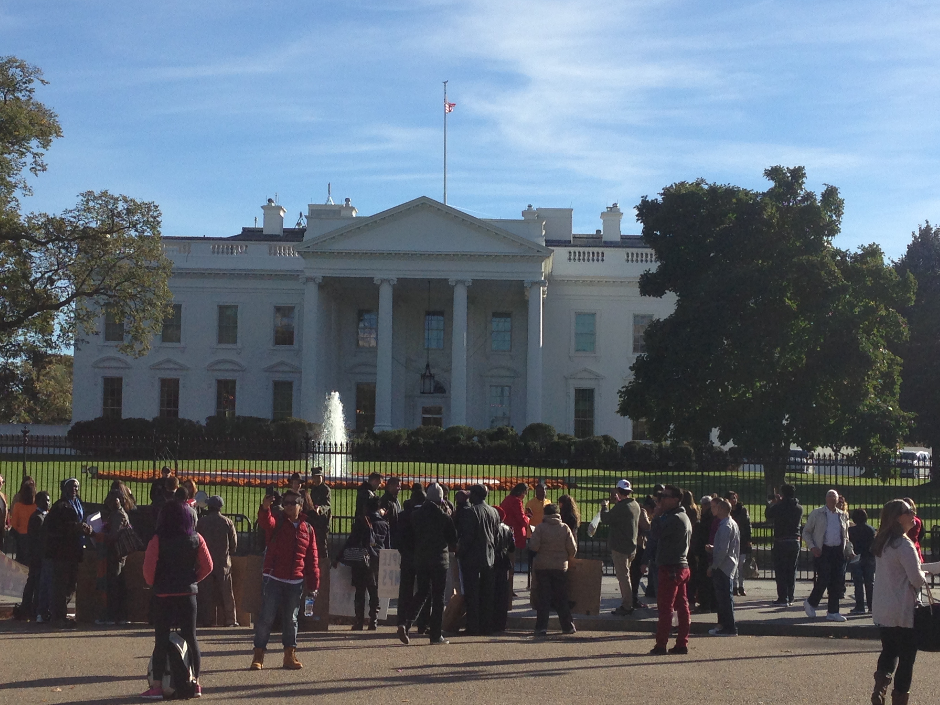
My final stop on this grand road trip was in Washington DC to visit some Peace Corps friends, Kelley, Roger, and Spencer. We played pin ball, board games, and Kelley dominated us in a hunting video game. Kelley and I twice went rock climbing at a new Earth Treks facility in DC, an absolute blast, and Kelley accomplished her hardest ever climb!

14702509_10153763531216557_6533607799370096286_n img_3318 img_3243 img_3319

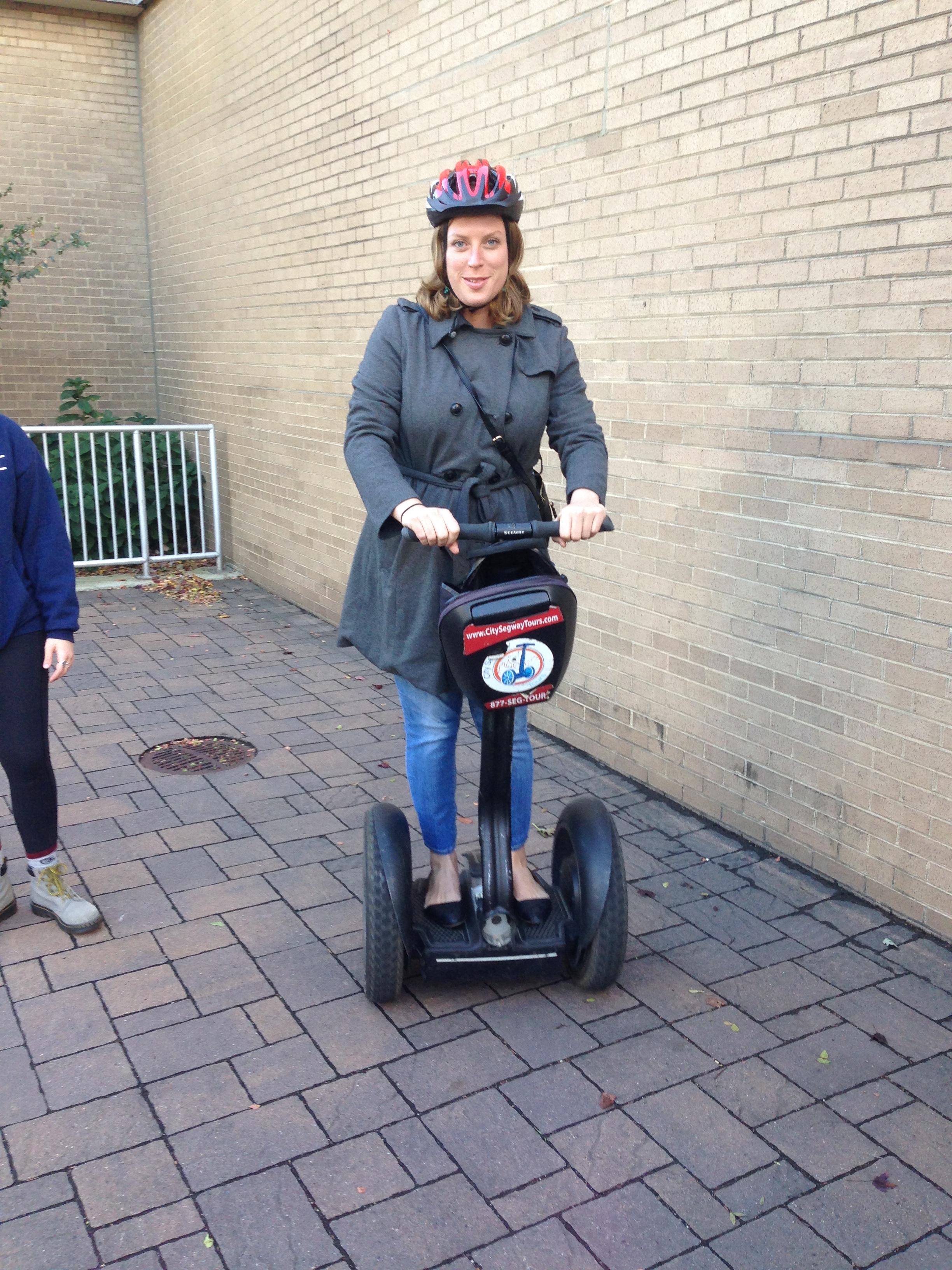
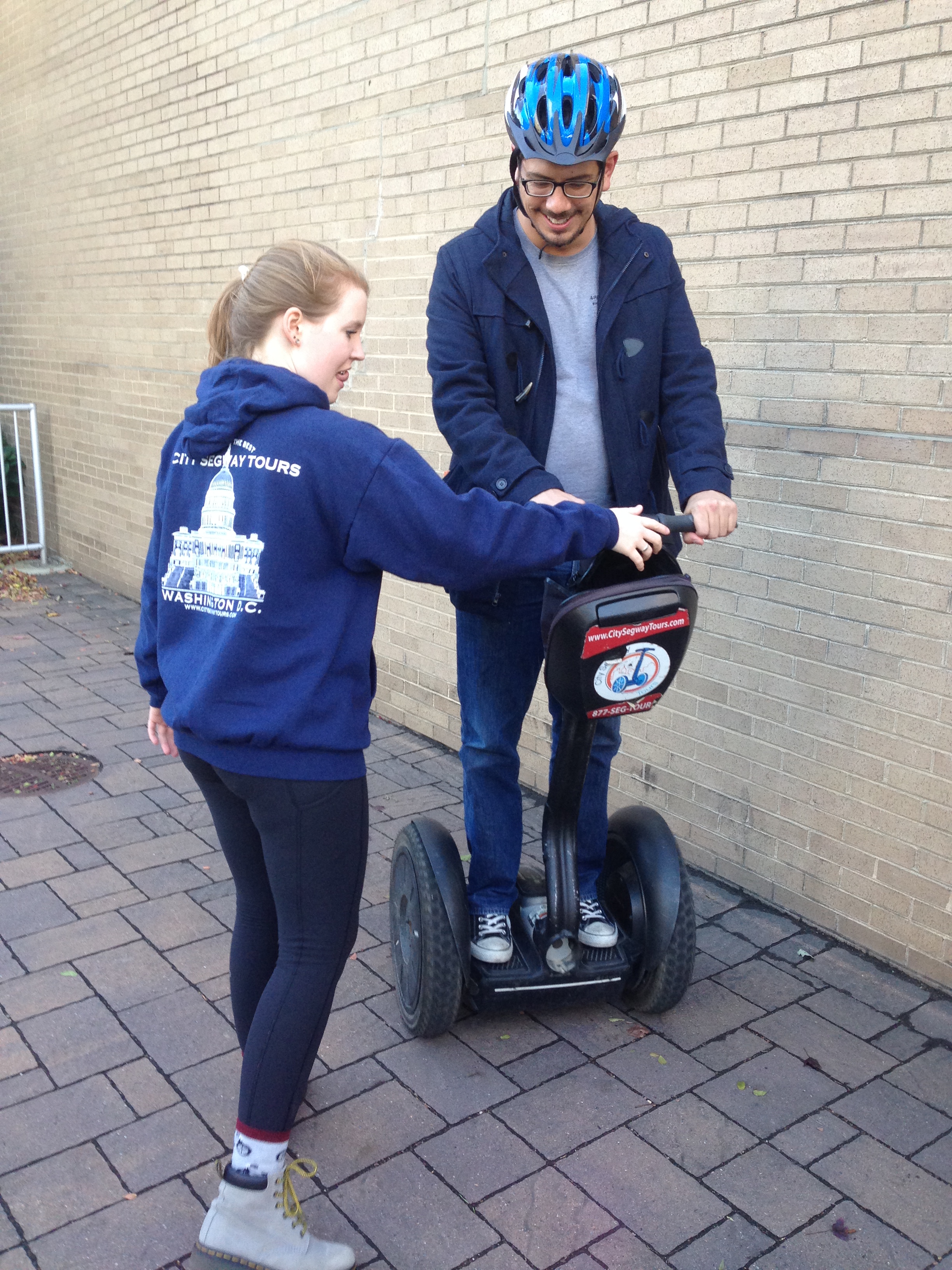
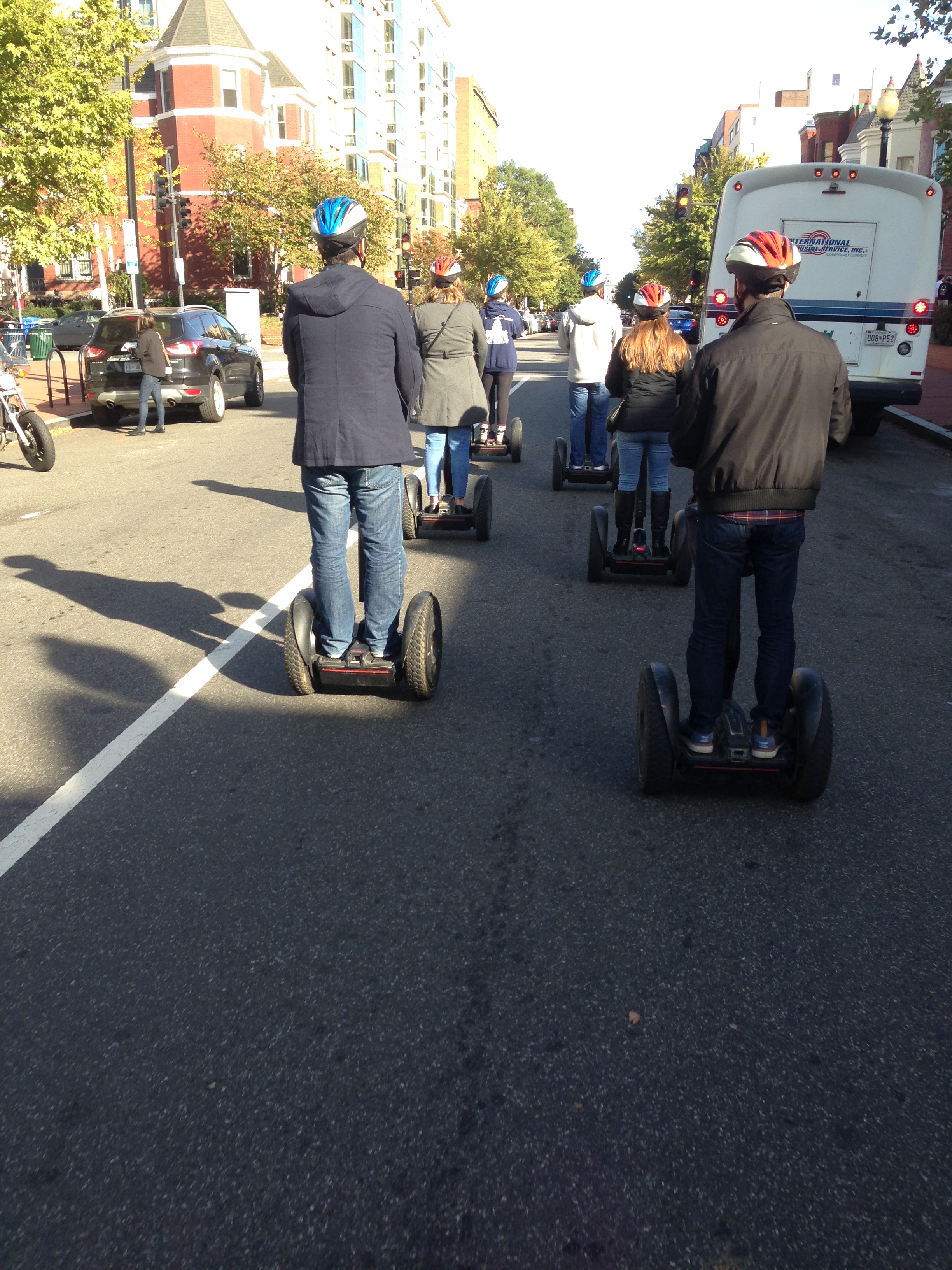
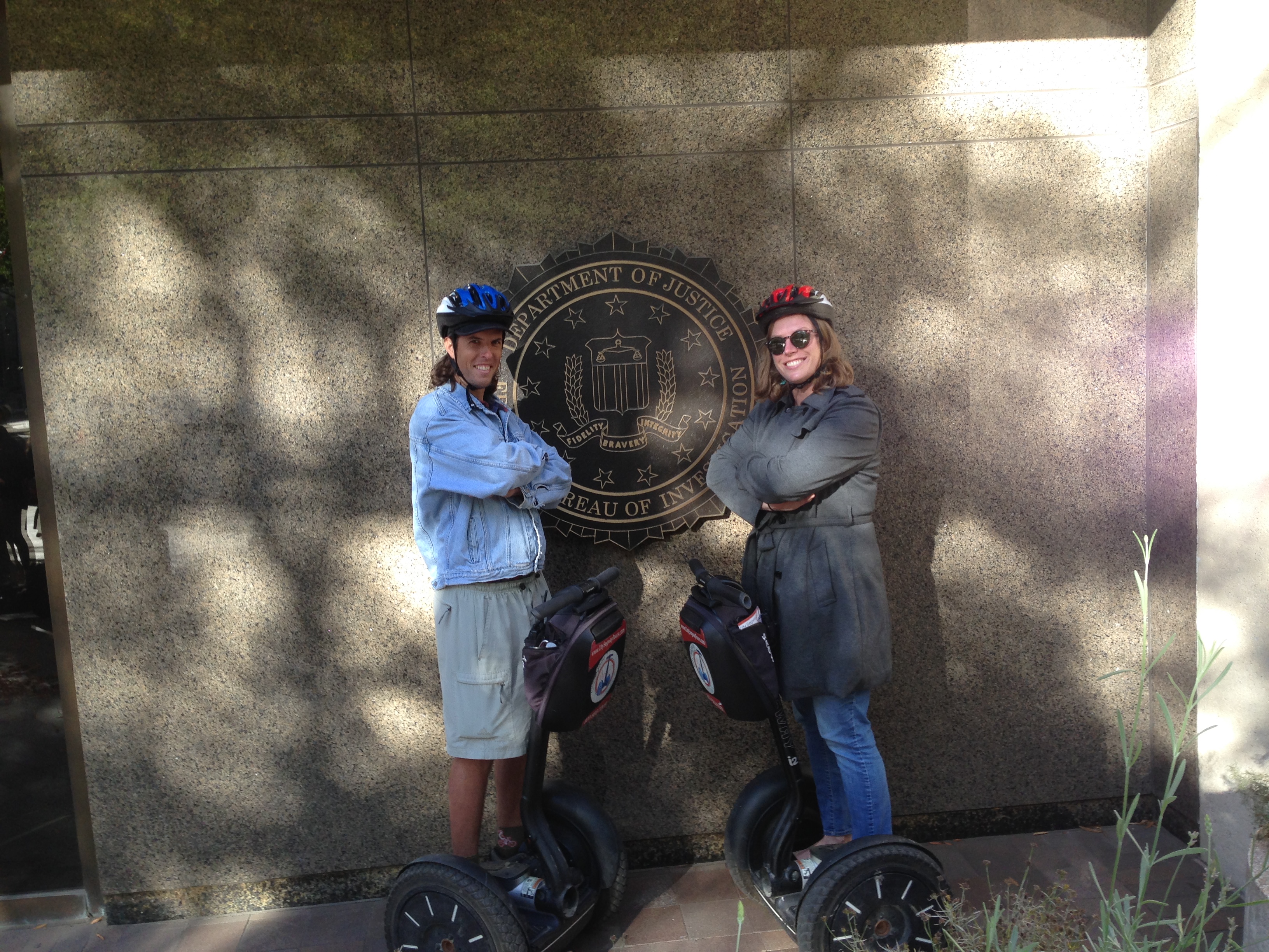
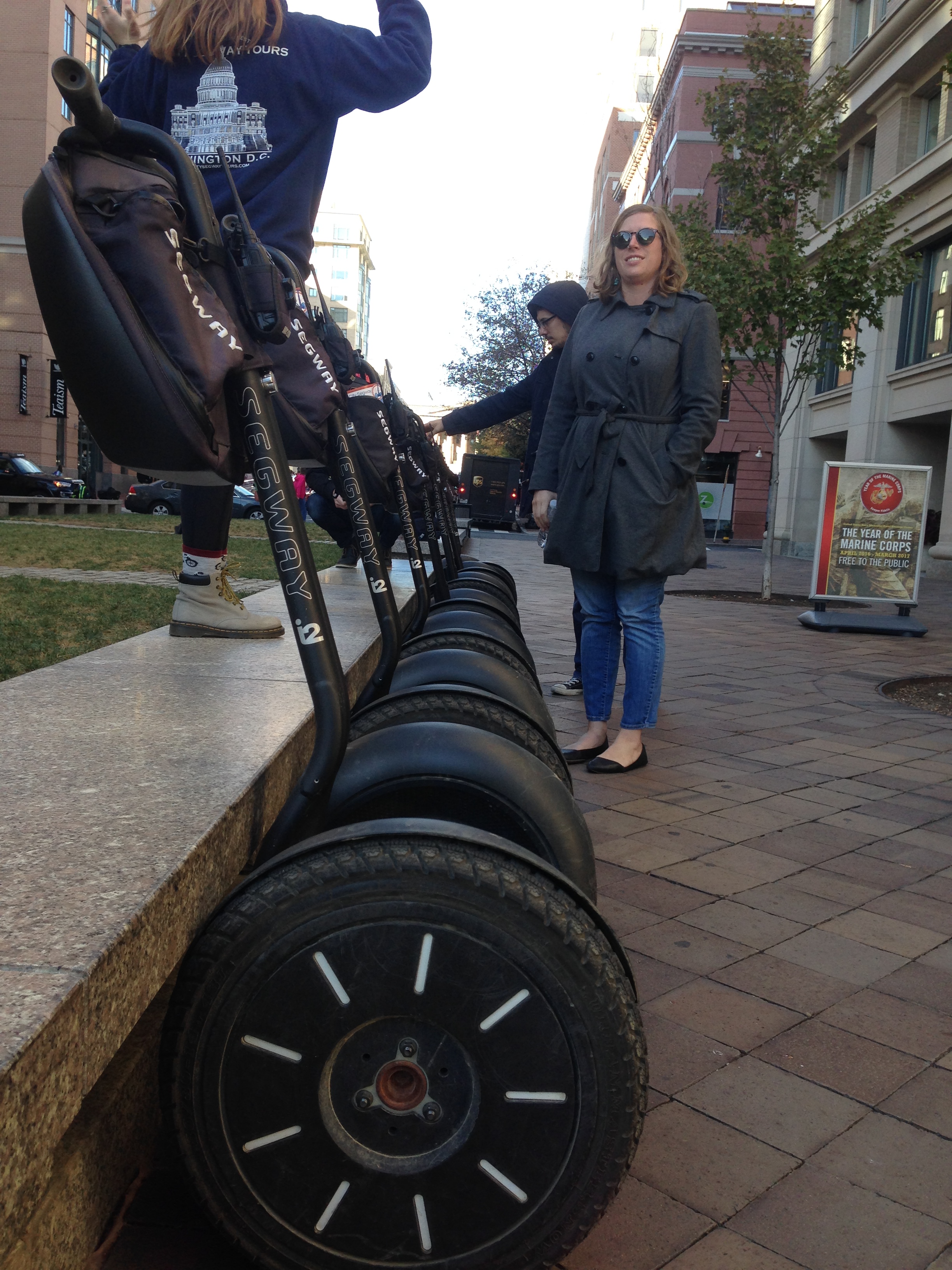
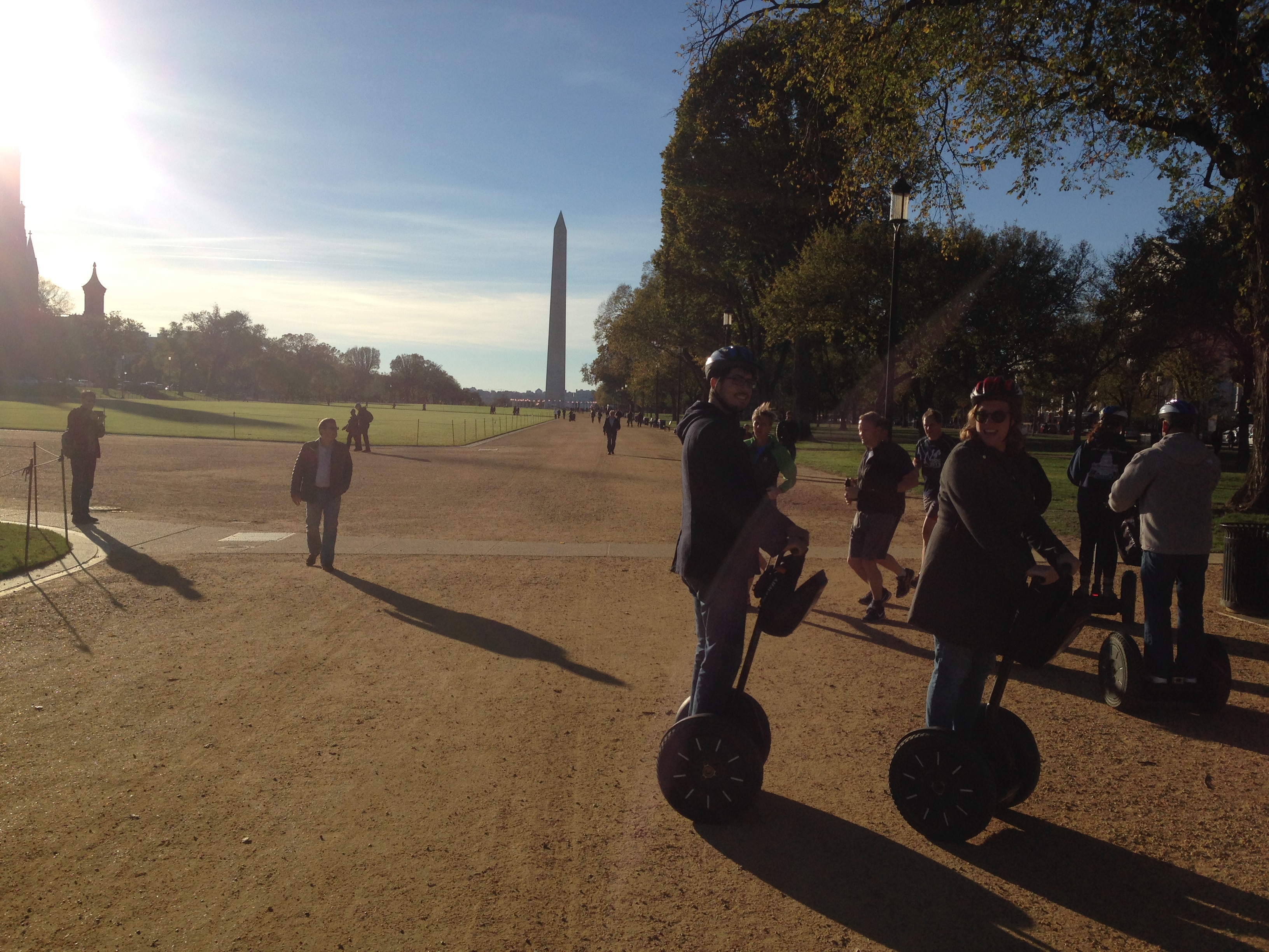
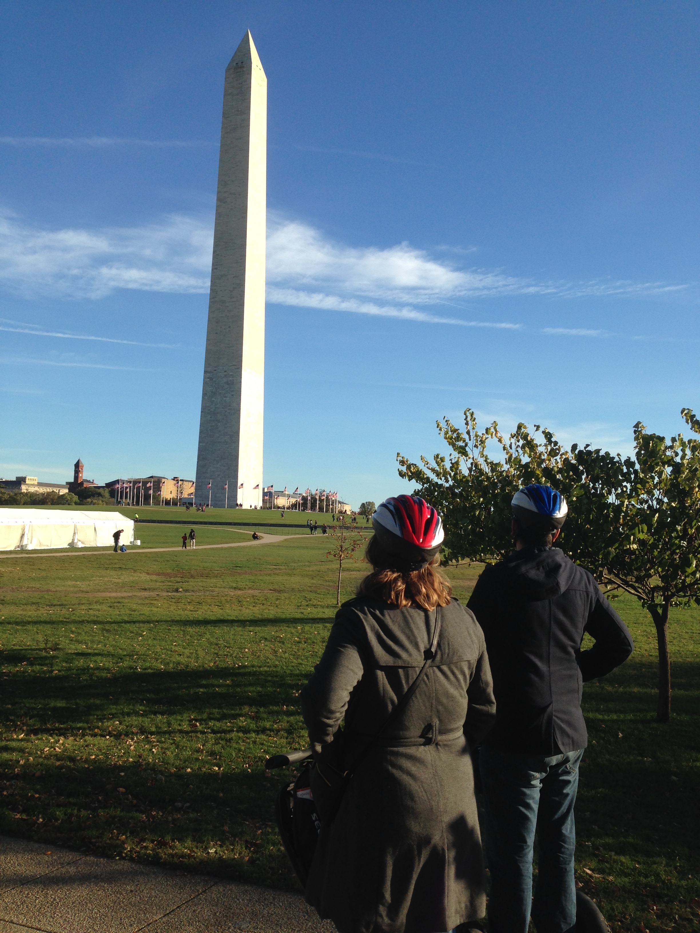
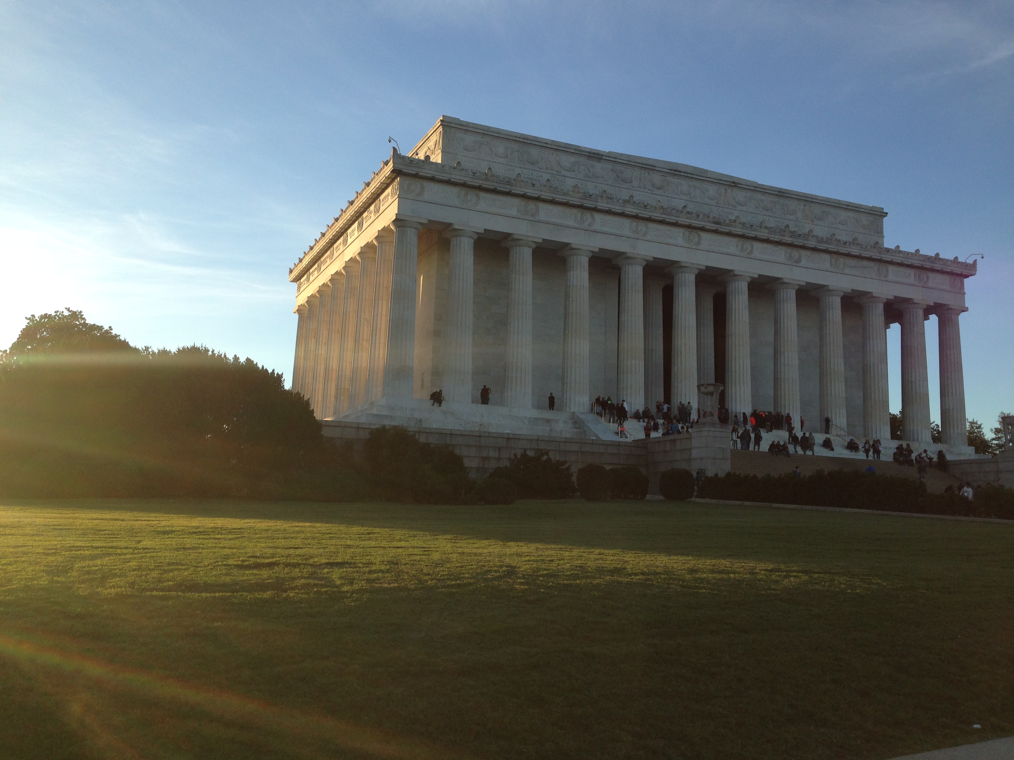
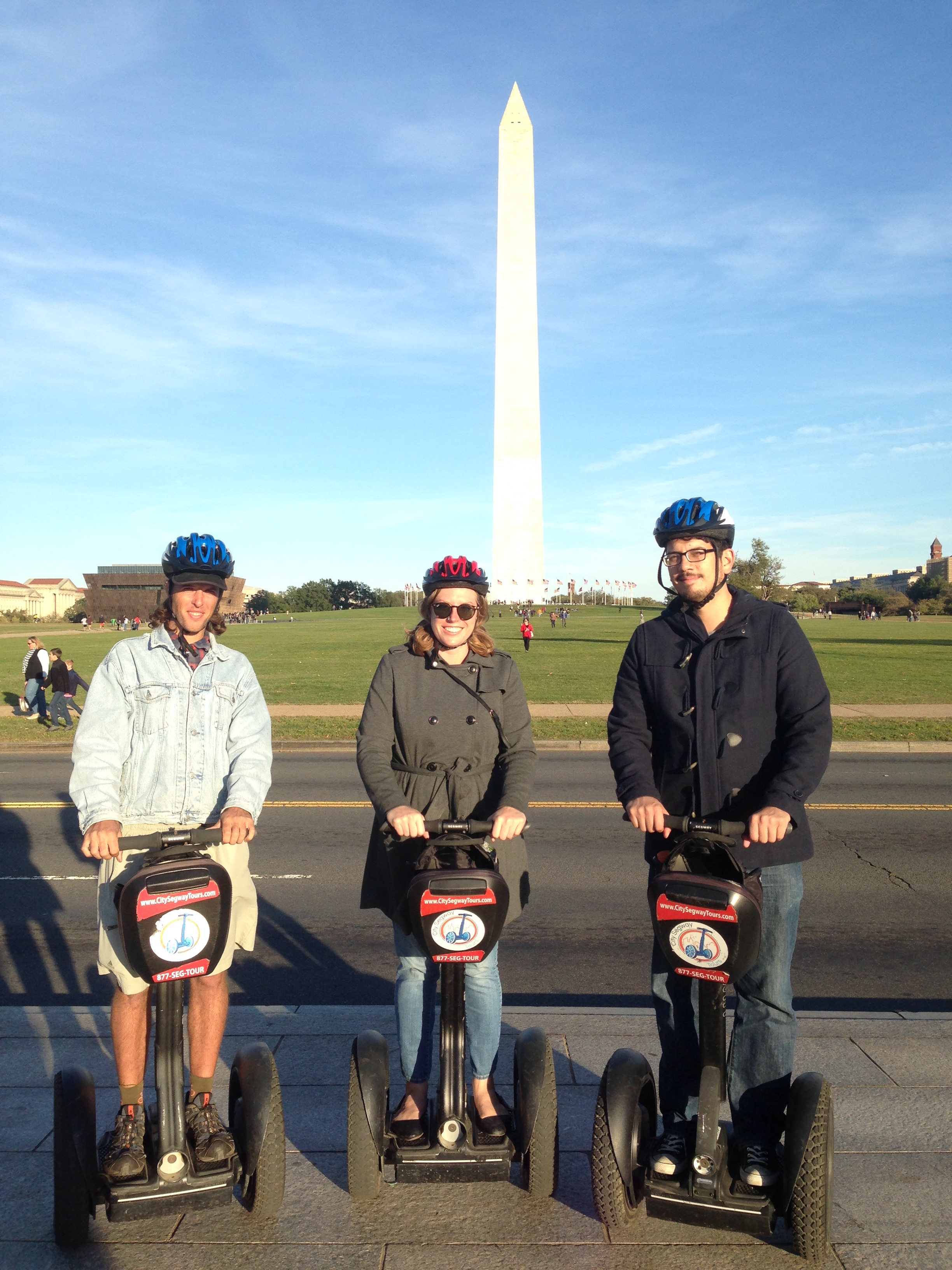
On Friday, we took a three-hour Segway tour around the National Mall, that is some serious fun. After a minute of balance practice, it was like second nature and at every stoplight we would turn in circles and goof around!

img_3267 img_3263 img_3269 img_3275 img_3280 img_3283 img_3289 img_3290 img_3303 img_3296

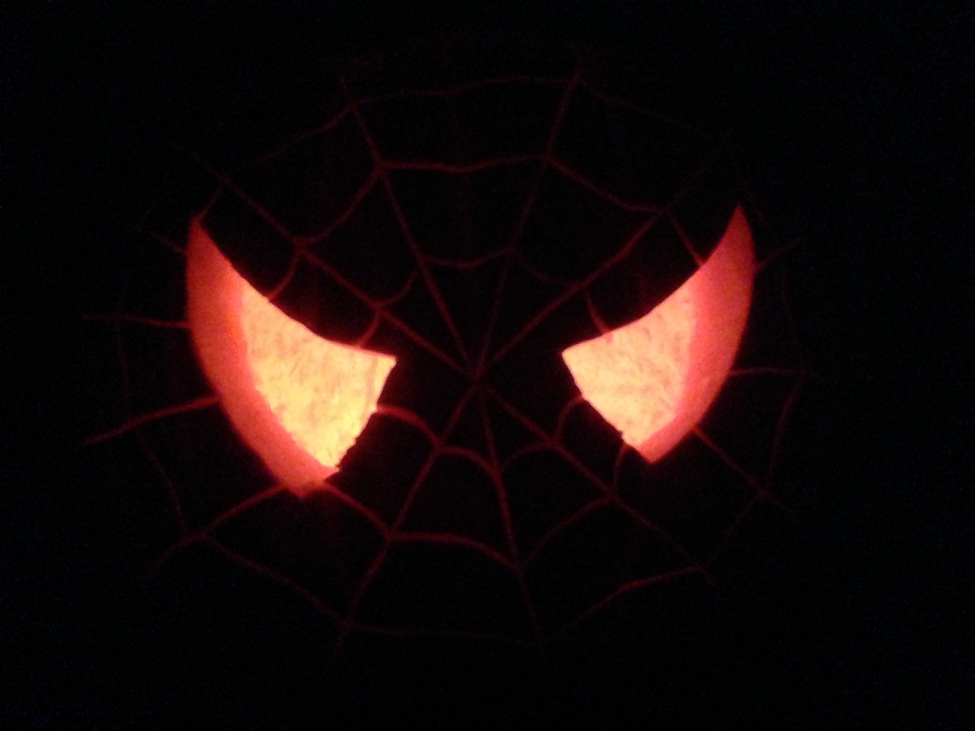
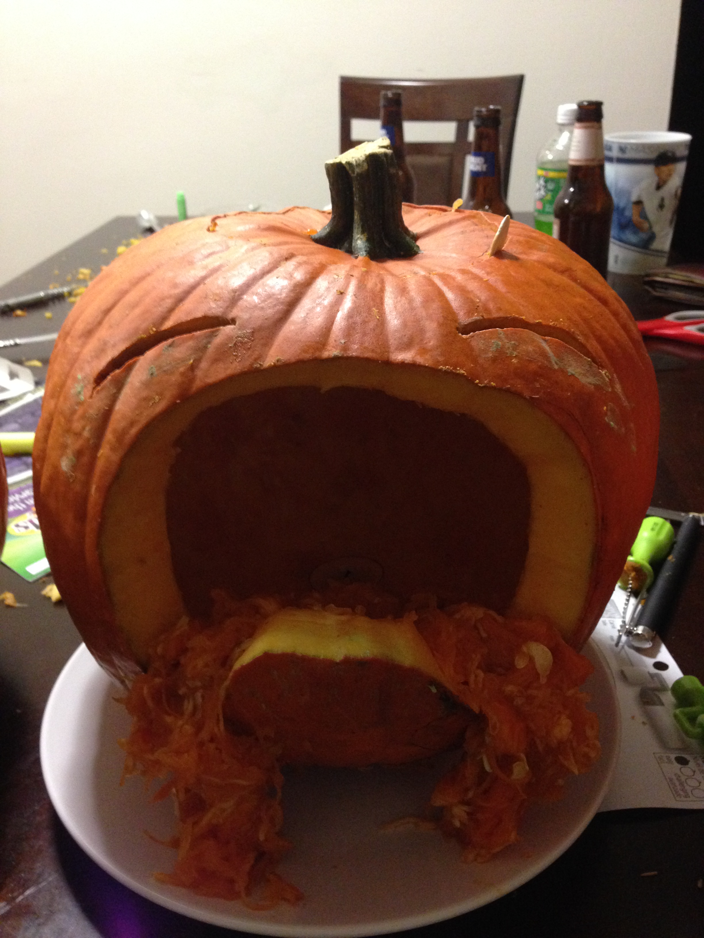
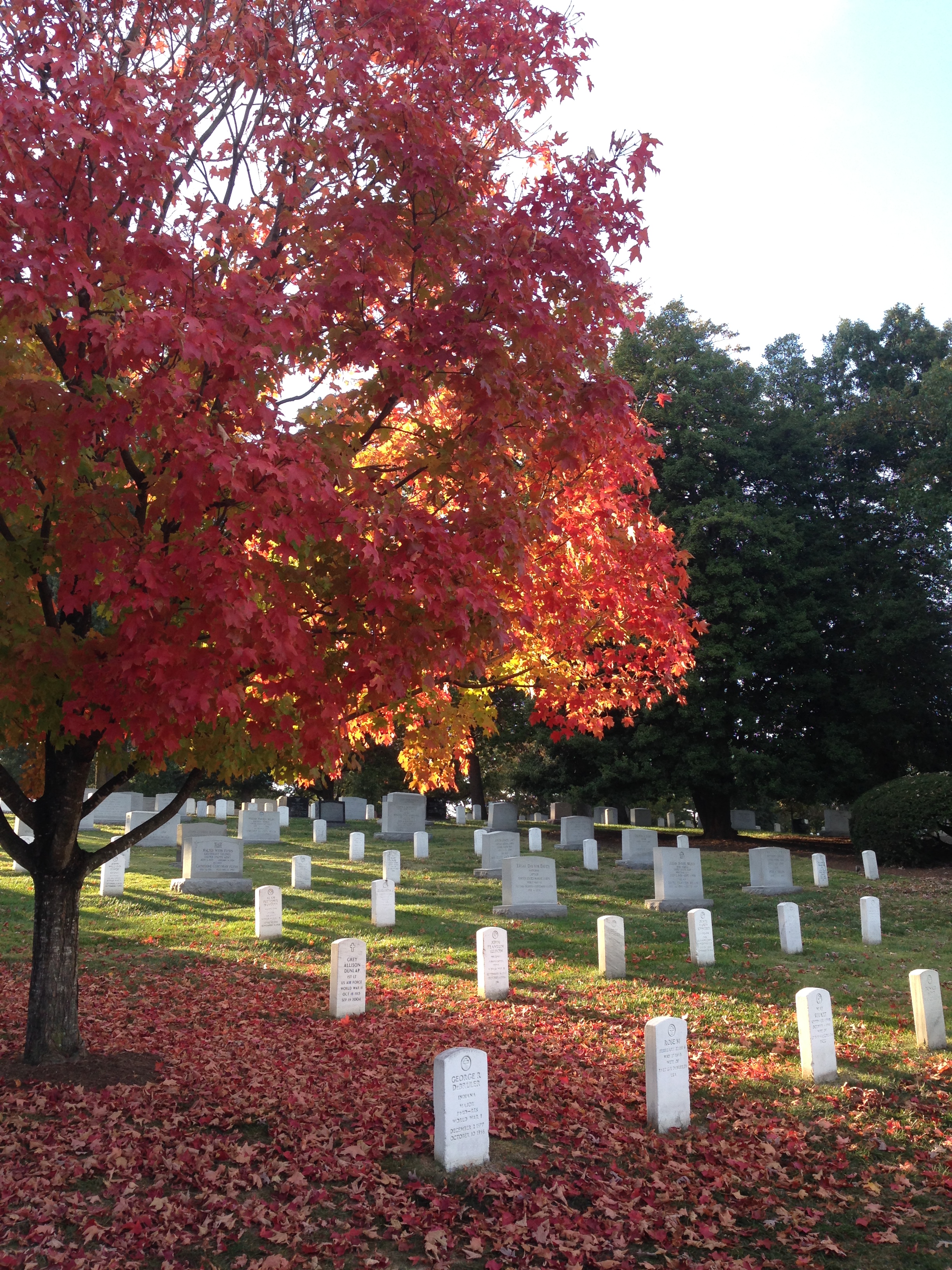
In the evening we carved pumpkins and watched videos of Bob Ross, the famous painter. On the last day, Kelley and I paid a visit to Arlington Cemetery to see JFK’s gravestone and the incredibly coordinated changing of the guard at the Tomb of the Unknown Soldier.

img_3313 img_3314

img_3326

From DC, it was a short drive to home sweet home in Northern Maryland, where I’m currently catching up with friends and family, completing this blog, and deciding where the wind will take me next! Thank you, from the bottom of my heart for following along on this blog, all the support and well wishes mean the world. And a special thanks to all of you who took me in along the journey, it was an incredible honor. See you when you see me!!!

img_5579

Image

“In wisdom gathered over time I have found that every experience is a form of exploration.” ― Ansel Adams

Still in Phoenix, Arizona, Nathan and I took a day trip up to the red rocks of Sedona, AZ for a bit of hiking and rock scrambling. First, we climbed the friction holds up the Bell formation, and signed the book at the summit to become members of the “Top of the Bell Club”.

Nathan had overheard that the formation next door, Courthouse, had some ancient ruins on one of the shelf ledges, so we began our exploration. Our first route brought us to a high underhand, Nathan was able to get up, but he proved to be spiderman. I struggled, so he offered me a leg to hold onto. As I put my full weight into the climb, the sandstone rock I was standing on sheared from the wall and I fell a few feet, crumpling on my right side into a small shrub and some rubble.

img_1947

Thankfully, only a few scratches and lumps and a bit shaken up…a few feet away and it would have been a much longer fall! We continued up the formation, but I was slow to trust any holds after the fall, and rain clouds caused us to turn back a little over halfway up, but we did find a few old mud walls of Native American dwellings! We went to a Cambodian restaurant for dinner, feasted on authentic grub, and everything was right in the world.

My last day in Phoenix, AZ, I had the pleasure of meeting up with two friends from Peace Corps, Rachel and Mary. We all went out to dinner, caught up on fun times, then when we were looking for an adventure, did some night time geocaching and found five different ones!

The path out of Phoenix was to the North East, first stopping at Petrified Forest National Park. It was a little lack luster in my opinion. Petrified wood is neat, and the landscape was open hills, but compared to most other parks, this was not my cup of tea.

img_1956

Another 100 miles down the road and I pulled up at the Canyon de Chelly just in time to catch some of the sunset color on the forming rain clouds over the canyon walls.

I slept in a parking lot there and in the morning, hiked the only visitor trail down into the canyon. Most of the canyon is off limits to visitors because it is still Navajo land, dating back hundreds of years, and many Navajo peoples still live and work in and around the canyon. The trail took me to an ancient dwelling known as the White House, with many brick rooms built into the cliffs on two levels.


I spent all day using binoculars to peer into cliffs across the canyon and spotted tons of small ancient dwellings. Others still were massive 100+ room communities with three story buildings! The acoustics in the canyon were incredible, when a cow mooo-ed from the canyon floor, I mistook it for a thunder clap at the rim of the canyon! On a sad note, the US army came in the 1800’s and killed many Navajo, captured more, and drove them from their homeland. One particularly horrific scene occurred at an area known as Massacre Cave, where 115 Navajo hid high in a cliff cove and the army opened fire on them from the top of the rim, slaughtering all of them. A sad history about how much of our country was formed.

Approaching the Arizona/Utah border, the horizon came to live as Monument Valley came into view. Massive rock formations remaining from millions of years past, now stand out against the eroded landscape.

I was fortunate to drive through the area as the sun was on it’s way down and had magnificent lighting through the whole area. Speaking with some of the Navajo folks, who sold crafts in the parking lots, I felt like I was back in Cambodia, making light banter with locals.

A few miles from Monument Valley was a rock formation known as The Mexican Hat Rock, for obvious reasons when you see the pictures. Todd, from LA, mentioned that you can scramble all the way up to the rock at the top…the view and experience certainly were worth it. I even parked for the night at a gravel access road near the rock, all to myself, under cover of the hat!

My route took me within five miles of “The Four Corners”, where the states of Arizona, New Mexico, Colorado, and Utah all touch in one spot. It’s a rip off that they charge a small fee to look at the plaque, really nothing else to do at the spot, but I couldn’t resist standing there once in my life.

img_2039

Furthering my exploration of ancient dwellings, I entered Colorado and stopped at the world famous Mesa Verde National Park. Compared to the remains in Canyon de Chelly, these were mansions! I took a ranger guided tour of an area known as The Balcony House, and viewed many more from across the canyon walls. It is so fascinating to learn about the sophisticated culture and livelihood of the American Indians, who are frequently portrayed as savage, simple-minded, antagonists in American History.

I heard an absurd statistic during my travels: The annual budget for all the national parks is equal to what the military spends in seven hours.

img_1964

Driving along The Million Dollar Highway into the San Juan Mountains, the temperatures plummeted from the hundreds in Southern California and Arizona, to the 40’s in Colorado. Near the town of Ouray, CO, I turned the van up a steep gravel road for six miles of driving along sheer drops with no guard rails. My destination was the summit of the 14,150 foot Mount Sneffels! One section of the road went right through a cliff where they had busted out a shelf big enough for cars, like a tunnel with only one side. Eventually the road became too steep and wildly rutted to dare taking the red rover any further, I proceeded on foot.

I hiked about four miles up the gnarly road to the start of the trail where a sign mentioned it was another 1.2 miles and 1,500 feet of elevation to the top. The climb was no frills, straight up a loose rock scramble with some moist mud.

The going was slow at high elevation, and one chute near the top made me feel particularly unsafe, it would have been a very painful fall, but my hands and feet remained true all the way to the summit, only my second time breaking the 14er ceiling! The views were enormous, lots of clouds, but they stayed high, there wasn’t even the slightest breeze…complete calm, still, and quite, not what we often think of for a summit that high. What a reward to the hard work to get to the summit, the view and experience was worth every step.

On the descent, I took a different route around the steep chute and felt more confident. I took a little bonus side trail to check out an old mine shaft, then slogged the four miles down the old mining road to the van. No problems with altitude sickness until the last quarter mile when I ran back to the car to get the long descent over with. Even that little bit of extra effort caused a headache for the rest of the day. That’s when I realized that altitude sickness has the same symptoms as a bad hangover: stabbing headache, pain behind the eyes, and nausea…interesting!

The night after Mount Sneffels, I drove a bit further until dusk, then pulled over in a large parking area at the top of a mountain pass for a great sleep in the chilly air. THUMP, THUMP, THUMP, THUMP….THUMP, THUMP, THUMP, THUMP…on the side of my van…I woke up hurriedly and looked out the window…what was a quiet, deserted location last night, now had me surrounded by traffic cones, heavy machinery, and dozens of construction workers…THUMP, THUMP, THUMP, THUMP…I cracked the sliding door for the man knocking, still in my sleeping bag. “You’ve got to move, you’re in the middle of an asphalt project!” Off I went.

img_2373

Many miles of open meadow took me to my next destination, Great Sand Dunes National Park. Nestled in the corner of a mountain wall and vast meadow, these dunes were quite a peculiar site!

After getting a map, my goal was made: I would hike to, then sandboard down the highest sand dune in North America, Star Dune, 755 feet above the meadow floor. Sand boards are not made for use with shoes, and this was essentially just a huge beach, so I set off with bare feet. I quickly noticed that I was the only person on the dunes without shoes, and as I hiked up the first ridge I discovered why. The fine grit of the sand tore up the inside of my arch and pads of my toes, while the sand, which reaches 140 degrees at mid-day, burned blisters into the soles of my feet.

I’m stubborn though, and I had climbed too far up the initial ridge to turn around. I forged onward to what I believed to be Star Dune! As I looked around however, I realized that the neighboring dune was higher and had a few people on it. So up I trudged, over to that dune where a bunch of middle school students sat and I offered up my sandboard for them to try on a small slope. They were the most polite, friendly, outdoorsy, children I have ever met, and they were out on a school field trip before the academic year started. Two kids were even doing backflips off the slopes while the chaperons encouraged them.

I sat down and consulted the non-detailed park map and concluded that I was sitting on High Dune, and that Star Dune was another 1.5 miles into the distance to the West.

img_5435

I made the tough choice to backtrack an hour to the car, ate lunch, drank lots of water, and put on shoes and socks. It was hot, I was tired, and my legs were a bit weary from yesterdays hike up Mt. Sneffels, but when else would I get the shot at this dune? Onward and upward I battled through the loose slopes, sandboard always in hand, periodically stopping to empty buckets of sand out of my shoes. Nearly to the base of Star Dune, I heard the number one safety concern of the dunes…lightning. Oh crap, I wasn’t going to get this close and turn back…I ran where I could, then struggled up the steep, loose, final pitch, but I steadily claimed the summit!

After a few pictures, I knew I had to get off the dunes, so I strapped on the sandboard and had the ride of my life! I had hiked in from the East, but proceeded out to the South for the most direct route to lower elevation, but every time I heard thunder I realized how exposed I still was, surrounded by sand and meadow. Luckily the storm was blowing in very slowly, I fought the energy-sapping heat and sand back to the parking lot for over an hour. The first rain drops began as I opened my van door, home sweet home! I rewarded myself with a burrito at a nearby restaurant and watched the lightning and rain come down in force through the window, happy to not be out there, and thrilled to have accomplished the mission.

img_2143

I drove my way up through Eastern Colorado, stopping to see the unique rock fins at Garden of the Gods, then pulled into Rocky Mountain National Park that evening.

img_2179

I found a remote parking area with no signs and set up shop for the night. A few minutes after I turned off my light a car pulled up…car door opens and closes…flashlight approaching the van…THUMP, THUMP, THUMP…”Park Ranger”…I opened the door…”ID please, do you have any weapons I should be worried about? Any warrants or probations?”…The tensions quickly lowered as we had a short talk, he mentioned that there was no camping or overnight parking there, but opened a map and showed me an area outside the park that was acceptable to sleep for the night. His last words to me…”Great set up by the way!”

14224961_973291279908_2529022022477904985_n

When I first started this trip, I received word from an old lacrosse friend from high school, Ben. He’s been living in Aspen, Colorado for years and invited me to stop by when I was in the area. When I was headed that way, he invited me to climb another 14er with him and some friends the following day. I met up with Ben at the La Plata Peak trailhead at 6:30 AM and he introduced me to the group: Lacy, his girlfriend; Brutus, his mini golden doodle; Karen; Kate; and Bear, Kate’s dog.

img_2219

We began to climb the 4.5 mile trail with approximately 4,000 feet of elevation gain. It was a cold morning, in the 40’s, but quickly warmed up as we worked hard and the sun came out. After we got above tree line things were looking a bit dark and foggy above us, and the wind was blowing it quickly towards us. As we approached an exposed ridge the precipitation began…hail! It stung as the wind whipped it into us and we sought shelter under some nearby boulders for a few minutes. We had all our clothes on, but it was cold since we weren’t moving, so we hiked up to the crest of the ridge. Reports from others and our own observations weren’t great, after a few pictures, the decision was made to turn back. I guessed we were pretty close, although we couldn’t see the summit through the clouds, so I decided to keep going and see if things got better or worse. I questioned my decision for a few minutes as the wind blew the hail into my bare legs so hard it felt like sandpaper and I had to put my rain pants on. There was a slick quarter inch of snow on the slope and the wind and cold were getting quite frosty. After 20 minutes the precipitation let up, and after 35 minutes I summited La Plata Peak just in time for the clouds to blow out, revealing their spectacular view!

It was still cold and windy at the top, but was able to enjoy a few minutes before the exposure led me back down to a nicer climate. I met back up with Ben and Lacy in the afternoon for a warm shower, great food, and great conversation with a friend I hadn’t seen in 14 years!

img_5442

The tour of Colorado next wove out to The Black Canyon of the Gunnison National Park. A crazy canyon, half a mile deep and quarter mile wide, carved through ancient rock by a river over millions of years. The resulting cleft in the relatively smooth shrub-land was a striking contrast. Another example of how nature never ceases to astound.

I was fortunate to hear from another acquaintance, Nikki, near the town of Durango, CO. I drove The Million Dollar Highway for a second time, past Mt. Sneffels, completing a loop of Colorado. Nikki and I briefly met in Cambodia as friends of friends, and she even biked out to visit my village and help with my English class one day. She and her friend, Stina, already had plans for their two days off, but graciously invited me along for the fun!

The first evening, we drove out to an alpine lake for some camping, sunset views, fire side conversation and ate the best concoction that has ever past my lips…get this: s’mores, but instead of graham crackers, pumpkin bread!

As we finished up a late breakfast, two men from Texas came over, mentioned that they had caught more trout than they could eat that morning, and gave us three! Our plan for the day was to climb a Durango icon, Engineer Mountain.

img_2226

A few miles of climbing through the woods opened into a meadow with the massive peak in the middle and a rock glacier to the North. I jokingly suggested that the trail should go straight up a crazy steep ridge in front of us…then it actually did! Straight up the dirt until it became a loose rock and talus field.

Our crux was a 20 foot wall, completely exposed to a cliff face and 100’s of feet drop below. Instead, we went over the ridge to a, still very sketchy, steep slope of crumbled rock and tried not to look down as we slowly climbed above this section.

After that, the ridge was about five feet wide, loose rock flakes all the way to the steep summit. We ate snacks, Nikki pointed out nearby peaks, then it was back down the way we came.

Back at Stina’s house, Nikki fried up the morning trout for first dinner and it was T, A, S, T, Y, tasty! For second dinner, we met up with Nikki’s old co-worker and we realized that none of the four of us were smart phone users!

img_2264

Nikki works for an incredible zipline company, Soaring, in a remote location out in the San Juan National Forest. When she learned that the next day, they only had two guests on the schedule, she pulled some strings to get four of her friends in! I was lucky to be on that list! To get to Soaring, you ride a historic railroad into the middle of nowhere with epic views over the river.

img_2267

On the train, we met our two fellow comrades, Joe and Bette. As we pulled into the meadow, the soaring staff were all present to greet us and it was immediately prevalent that this was no ordinary zipline company, the level of hospitality the staff showed was top tier, extremely courteous, safe, and professional.

After some safety and nature briefing we hit the cables, through the trees, over the river, you name it. Tricks were allowed, so you can imagine we were upside down and spinning every chance we got!

We ate gourmet lunch on a suspended platform in the trees over the river and the staff still bent over backwards for lunch service. Nikki pointed out lots of wild edibles to eat and other things of biological importance. The final cable was over a quarter mile long and hit speeds over 40 miles per hour! It was sad to finish and I can’t say enough about the level of expertise and care that every single staff member showed us, and not just because one was my friend, this company was in a class of it’s own, seriously check them out if you are in Colorado, you won’t be disappointed!

img_5479


After ziplining, I drove out to Canyon of the Ancients National Monument in the evening and found the area Nikki had recommended, Sand Canyon, a small, empty, dirt parking area waaaay out in the middle of no where.

img_2269

I hiked 1.5 hours down into the canyon and saw a few pueblo ruins just as dark fell. Then, of course, a 1.5 hour hike back up the canyon in the dark, guided by headlight.

It’s freakier being out here alone than it is in Maryland, just thinking about the remoteness and the animals. I held onto two small sticks and banged them together every few seconds to alert animals to my presence, rather than them jumping out at the last second and me screaming bloody murder. I saw a pair of yellow eyes in a tree at a distance and started talking as I walked, trying to scare it away and talk bravery into myself. As I got closer to the trailhead, I heard a dog barking in the distance each time I clapped my sticks together. The closer I got, the louder he got, until I realized that the barking was coming from the trailhead! Great, I’m tired, freaked out at night, in the middle of no where, now I have to fend off some big dog to get to my van. As it turns out, that dog was in a car, someone was randomly there in the small, remote parking area at 9:30 PM. So much for my plans to sleep there…and I thought I was the sketchy one coming out of the woods alone that late!

img_5330

From Colorado, I drove into Southern Utah. The town of Moab is world renowned for its “slick rock” mountain biking. I rented a full suspension 29er from Poison Spider Bikes and got to work! The riding was a blast, completely different than anything I’ve ever ridden, riding on the contouring and rolling red and white sand stone.

Contrary to the name, the rock is not slick, but rather the most traction I have ever ridden on! Much of the trail rides over the surface of the exposed rock, the trail is simply marked by painted dashes directly on the rock. I rode for four hours through the formations, along cliff faces, through sand and over rock. Truly special riding.

I briefly stopped into Arches National Park to check out some of the famous landmarks.

Canyonlands National Park was an area that I hadn’t heard much information about, but was a fantastic area to explore. Heading towards the Pinnacle area I passed Newspaper Rock, the largest and most dense set of petroglyphs I have seen.

img_2330

I parked at the Elephant Hill trail head and hiked a four hour loop through The Pinnacles, nearby Druid Arch, then back along the valley floor. I had the trail to myself all day to explore the large pillars, the tight cracks, the deep caves, shelfs, table tops, reds, browns, whites, tans, it was sensational.

Deep in the canyonlands, I even learned to harness magical spells.

img_2353

Between the mountain bike ride and the canyonlands hike the hot temperatures had me sweating so much that a few millimeters of salt caked up on my shirt and backpack.

img_2369

Leaving Canyonlands, my next destination took me back through the town of Moab. Out of the corner of my eye, I noticed a billboard. I made a mental note of the phone number and gave them a call on a whim, not thinking that they would still be open at this point in the evening. As luck would have it, they answered, and I jumped out of an airplane within the hour!

DCIM999GOPROG0121134.

DCIM999GOPROG0121134.

I had the honor of jumping tandem with Adam, a former marine who had taken a bullet through his jaw. After a little paperwork on the ground, five of us, including the pilot, crammed into a sardine can of a plane, watched the setting sun cast exotic shadows across the landscape for 20 minutes.

Then at 10,000 feet, we pooped the door and took the shortcut down!

Adam set me up with an altimeter, instructed me to pull the ripcord at 6,000 feet, then let me steer the parachute all the way down as we took in an epic sunset from an epic vantage point before landing in the soft dirt.

The staff of Skydive Moab were super friendly, professional, and experienced. The owner, Keith, was a great guy, he threw my pictures in for free, encouraged me to get certified some day, and recommended a great place to camp for the night. If you’re ever in Moab and feeling the adventure, jump with them, you won’t regret it!

I enjoy fiction and mythology, so when Ben, from Aspen, recommended that I check out Goblin Valley State Park, I was excited to check it out. What I discovered was even cool than I imagined! A huge valley of tiny spires of mud and sandstone, every shape and size imaginable!

img_2418

I hiked around amongst the goblins, climbed on formations, explored the small nooks, and had a blast.

I noticed a trail on the map to a location called “Goblin’s Lair” and had to scope it out. I envisioned a scoop out of the mud wall, but as climbed the rubble blocking the entrance, I was blown away at the chasm which lied beyond, an expanse the size of a king’s hall or grand ballroom! I climbed inside and marveled at the scope and splendor, several small holes in the roof provided ideal lighting.

img_2389

To my great surprise, there was a black climbing rope hanging down through the largest roof opening, then I heard two voices…a few minutes later, I jealously watched a couple rappel 90 feet into the Goblin’s Lair from above!

“I have discovered in life that there are ways of getting almost anywhere you want to go, if you really want to go.” ― Langston Hughes

After Brendan and Chelsea flew out of Sacramento, I got in touch with an old friend from studying abroad in Australia, Kevin. We did a quick tour of Old Sacramento, ate incredible Mexican food, shared good conversation, then it was time to get back on the road again, freedom in the wings!

img_1498

My next destination was to visit friends in Reno, but I pit-stopped at Lake Tahoe along the way. After texting my mother, I was informed that my cousin, Katie, was also at Lake Tahoe! After some quick communications, we were eating lunch together within an hour or two, along with her friend, Eric.

13900215_10153288290312609_952689139674019176_n

They graciously invited me to tag along on their plans for the day! A short hike to a waterfall at Fallen Leaf Lake, a drive by Emerald Bay, and then back to Eric’s house in Truckee, CA.

13912429_10153288592652609_1773691959477154123_n img_1501 img_1503

In the evening we walked down to “Truckee Thursday” for dinner from food trucks, live music, and a craft fair. Later that night we met up with Eric’s friends, Nate and Kat and drove to a concert at a local casino, the opening act was The Naughty Professor, and the headliner was Galactic. Pretty neat jams from both of these bands before we headed home around midnight.

img_1505

Katie just happened to be flying out of the Reno airport, so I was able to drop her off on the way to visit Sarah, Jason and their dog, Astor. Sarah and I met while studying abroad in Australia some 12 years ago, and have remained dear friends over the time and distance, and her husband, Jason, is a stand-up guy, the both showed me outstanding hospitality.

img_1508

On the first night in Reno, we met their friend, Brooklyn for Mexican food, I went out on a limb and tried the beef tongue, not half bad! We watched the sun set over the mountains from their back yard and caught up on the years since we last saw each other. After breakfast the next morning, we packed a daybag, threw the dog in the car and drove out to Lake Tahoe for a hike up a side trail to an alpine lake after an hours walk. The water was freezing, but Astor was loving playing fetch with her toy, I dove in with her, knowing I might not get another chance to visit this serene lake!

pic-1

In the evening, we visited Sarah’s brother, Brian and his girlfriend, Liz, for a cookout. Sausage, watermelon, corn, and potatoes on the grill…mmmm, mmmm, it was good eating and great company! Sarah and Jason are intrepid explorers and besides the wonderful friendship, they also gave me sage advice on what to visit and what not to visit in the area before setting off the next morning, many, many thanks to this loving couple!

img_1936

From Reno, it was 300 miles South to Death Valley, California. The scenery out in Nevada is barren and rugged, but nice to have stretches of long, open road, exactly what a road trip makes me think of. One car caught up to me but wouldn’t pass, once I got sick of him on my rear, I pulled into the left lane, hit the brakes, and he went by…reverse pass baby! In the big, open valleys, there were about a dozen small tornadoes, dust devils, at any given time, very beautiful to watch in the distance. One was swirling over the road as drove through and it gave me a harder shove than I expected! I stopped for gas frequently, as I saw signs reading “No services next 100 miles”. My first way-point was the “Car Forest” in Goldfield, NV. Neatly decorated cars, buried vertically in the dirt!

img_1512 img_1513 img_1519 img_1526 img_1521

Second way-point was the deserted mining town of Rhyolite. Some building still remained, but there is also some unique outdoor art, including a giant naked women made from cinder blocks.

img_1535 img_1538 img_1544 img_1541

Then, it was onto the main event…Death Valley! It was many miles down to the bottom and I slowly watched my dashboard thermometer tick high and higher, capping out at an astounding 128 degrees at 5:00 PM near Badwater Basin, the lowest point in North America, nearly 300 ft below sea level.

img_1560

I wanted the full experience of the area, so I refused to use my air conditioning the entire time, so hot. The wind blowing in my windows was scorching, much of the time, it was cooler to have the windows up to stifle the hot breeze!

img_1551 img_1562 img_1571 img_1581

After exploring the depths of the valley, I drove up to Dante’s View just in time for sunset, 5,000 feet above the valley floor, such splendor.

img_1582 img_1607

I chugged water all day, but still felt a little off and mentally slow from sweating my brains out. Even at 10:00 PM, in the dark, my thermometer still registered a sweltering 115 degrees.

img_5125

I knew I couldn’t sleep in that kind of head and had to get to cooler temperatures at higher elevations. I drove into the night to the opposite side of the park, seeing long-eared jack rabbits, and even some wild donkeys along the way! I watched the temperatures drop as I started up the road towards Telescope Peak at 8,000 feet. About two miles from the end of the road, the surface turned from pavement to loose gravel, the patch steepened, and a sign read, “4×4, high clearance vehicles recommended”. Oh well, I figured I could always back down slowly if I had to. The red Rover amazed me once again and despite some tricky areas, we chugged all the way to the top around 11:30 PM, a cool 75 degrees at the top!

img_1617

It was late, but I knew there would be a good sunrise, and Death Valley is famed as one of the best places in the country to view the stars, so I reluctantly set my alarm for 4:30 AM and rolled to sleep. When the alarm sounded, I sleepily got dressed in warm clothes, laid out on a log, and watched the stars glimmer across the galaxy…worth it! An hour later, the sun began to paint the sky. The sun rises and sets every single day, yet watching it never loses it’s majesty. I climbed a dead tree on the hill for a better vantage point.

img_1620 img_1626 img_5149

The descent down the steep gravel road was easier than the climb, I checked out some old charcoal kilns along the way, and even saw more donkeys and a small wolf along the road!

img_1629 img_1631 img_1638 img_1643

A short hike took me up a canyon to the remarkable Darwin Falls, which flows year round despite the hot, dry conditions elsewhere. It was hot, even early in the morning, I chugged lots of water, but was still dehydrated from the day before and couldn’t catch back up, I had a headache and no appetite the rest of the day.

img_1649

Driving West out of Death Valley, I saw a giant white wall on the far side of the plain…the high Sierras!

img_1657

Mount Whitney was my next goal, the highest peak in the lower 48 states! I got my hiking permits and bear canister from the visitor center, scarfed a pizza, then tried to find some relief from the heat. It’s hot this far South in August, makes things tough for van dwelling. I read a book under a tree at a park, but I couldn’t escape the ambient 99 degree weather. After a short nap in the grass, I was once again desperate for cooler temperatures at higher ground and drove up to 8,000 feet to an area known as Whitney Portal for camp. The rest of the day, I prepped gear and looked in awe at the granite behemoths surrounding me, mountains like I’ve never seen before!

img_1670 img_1666

I slept in until 10:00 AM, thanks to the shade of the mountains, then began my ascent to the trail camp area where I could set up my tent for the night. I climbed and climbed and climbed , ever so slowly to prevent altitude sickness and allow my lungs to gasp for the thin air. After about five hours and 4,000 feet of elevation, I sat down next to my tent and stared at the world around me, enormous white cliffs, bathed in sunlight, crystal clear ponds, and clear skies, I didn’t even bother to purify the stream water before drinking it, perfectly crisp snow melt!

img_1672 img_1679 img_5156 img_5165

My phone battery died from the chilly temperatures overnight, so my alarm didn’t go off, but when I woke up to pee in the early morning, around 5:00 AM, I saw the sky reveal the slightest hint of orange…go time! I left the tent and any gear i wouldn’t need for the summit and began plodding my way up the eternal set of switchbacks, probably 2,000 feet of climb with a brilliant sunrise along the way.

img_5181 img_5184

After reaching the crest trail at the top, it was only two miles and 1,000 feet higher to the top of the lower 48 states! The air was very calm and temperatures were quite reasonable for how high we were, lots of friendly people were going up and down.

img_5194 img_5205

After another hour, I saw the small hut at the summit and was greeted with 360 degree views of the magnificent mountains, lakes, clouds, and cliffs.

img_5201 img_5220 img_5233


Another hiker had randomly brought his friend’s didgeridoo to the top! I starred in awe at the views for at least 45 minutes, woofed down some prunes and granola bars, then began the trek back down.

img_5225

***Caution, potty language ahead*** Clear, blue skies lead me back the way I came, and about one hour from my tent, the prunes hit me and I had to poop terribly bad, however, due to how many people climb Mount Whitney, one of the requirements for getting a permit is that you can only poop into the prescribed bags that they give you, and you have to pack your waste down the mountain. I had mistakenly left my “wag bag” back at the tent! I fought hard to hold it and made it back to camp just in the nick of time.After packing my gear, the slog down 4,000 feet began and I had severe gas the entire way, but couldn’t trust it. The pain and cramps of trying to hold it while working hard physically was a bad mix, and eventually the pressure won out…I pooped my pants in minuscule amounts at least a half dozen times and I was praying for the parking lot bathroom at the bottom. (I apologize for the graphic descriptions here, I’m certainly not proud of these moments, but my aim is to give a realistic description of the highs and lows of the journey so you can best live in the moment with me.) I feared that perhaps the source of my discomfort wasn’t actually the prunes, but rather that I had contracted giardia from the untreated water, but that usually takes a few days to fester. I got to the van around 3:30 PM, completely pooped, both literally and figuratively, chugged two Gatorades and ordered a burger and fries from the small camp store, boy oh boy, were they scrumptious! After putting my gear away, my belly seemed to settle down, I returned the rented bear canister to the visitor center and the arduous mission had been accomplished!

img_5253 img_5255

My GPS showed that Sequoia National Park was only 33 miles from Mount Whitney as the crow flies, but over 200 miles of road to go South around the Sierra mountains! Along the drive, tons of smoke rose from a forest fire, so much that it actually blotted our the sun!

img_1688

The road that my GPS wanted to take was closed from the fire, so I diverted around through Bakersfield, CA, where I pulled into a hotel parking lot to sleep for the night. It was very hot in the van in this town and I couldn’t sleep. Around 11:00 PM, I started driving the remaining 100 miles to Sequoia National Park. As I left the pavement of the city and gained a little elevation, the temperature dropped from 96 to 76 degrees. I saw some tractor-trailers pulled off along the side of the highway, I assume to sleep, so I decided to do the same when I came to an empty turn-out. I was quick to fall asleep now that it was chillier and 1:00 AM.

img_1700

I was suddenly awoken at 4:00 AM as semi-trucks flew by my van, making lots of noise and the wind shook my car. I couldn’t get back to sleep with all the commotion, so I drove the rest of the way to Sequoia. Just before the entrance, I pulled into another hotel parking lot around 5:30 AM for a nap, not even bothering to put the privacy curtains up over the windows. I was comically woken up a little after 8:00 AM when I heard a family with two kids going around the parking lot calling out the states on the license plates, “WOAH, Maryland!!! Get in there, I’ll get your picture for the collection, it even has fireworks and says Bob Bell, just like daddy’s name, Bob!” THUMP, THUMP, THUMP, the little boy was banging all over the door for a minute straight. I really wanted to put my face up to the glass for an epic photo-bomb, or spring the doors open screaming, but figured it prudent to remain incognito and not let them notice my body inside. The Sequoia trees are something that everyone must see in person during their lifetime, the enormity of these trees cannot be expressed through the words or pictures here.

img_1719 img_1720

I walked a circle around one tree and counted 34 paces, there was even a tunnel cut out of a fallen log that I drove my car through!

img_1723 img_5261

I strolled out to “Tharps Log”, where an old rancher had lived inside a hollowed out, fallen over, dead tree!

img_5266 img_1724

I also had the honor of walking down to the General Sherman tree, the largest tree in the world by volume. A nearby sign mentioned that if the wood of the General Sherman tree was water, you could fill a bath tub everyday for 27 years before running out of water!

img_1732

After enough tree-gasms, I drove into the neighboring National Park, King’s Canyon. The canyon was similar to Yosemite valley, with massive carved, granite faces on both sides. I checked out some waterfalls, then drove back out as the setting sunlight ricocheted off the canyon walls.

img_1753 img_1735 img_1756 img_1767 img_1768 img_1776

I decided to try for one last destination for the day, the Boole Tree. I had no idea what this was, but the name on the map left me too curious to resist. I didn’t recall seeing a sign or the unpaved road for the trail on the drive down, so I watched the map and guessed where the access road was. I found a turn out that had a sign reading, “No Motor Vehicles”, and the trees were all burned from a recent forest fire, so I figured maybe the trail had been left to deteriorate. I found bits and pieces of old roads as I bushwhacked into the sunset, following a ridge and my compass off trail, I made a few arrows in the dirt with my feet as I went. Mostly, I was on loose, ashy, rough terrain and everything I touched left me marked black with soot.

img_1784img_1782

After an hours hike and a beautiful sunset, things were getting pretty dark, then I heard a large animal in the valley below…MRROOOOO…and at the same time, I spotted a large paw print in the sand. My mind instantly switched it’s lock from Boole Tree to bears and mountain lions. I immediately turned around and was sufficiently frightened by myself. I stumbled through the night by headlamp, steeply skirting the ridge and following a loose South bearing as the animal in the valley continued to bellow. I wasn’t on the same route as I went out on, considering there wasn’t an actual trail, but I didn’t want to get any closer to that noise down the hill. Every minute or so, I scanned the surroundings with my headlamp, looking for a pair of eyes stalking me. After 30 minutes, I discovered another section of road, I followed this for a bit until I decided I knew better than the road and went back into the woods, confident that I would find one of my arrows and come out right at my car! But, when things didn’t look familiar I was able to catch the road again. The funny thing was that this road was in good shape, it wasn’t a rutted out dead-end section like I was on earlier in the evening. You can imagine my surprise when I cam upon a sign reading, “Boole Tree Trail”!

img_1793

It turns out I was in the wrong area all along and there was in fact a beautiful gravel road, complete with signs! As I walked back to the paved road, I came upon an Asian couple, parked on the side, in an RV. I tried to talk to them, but they didn’t speak English and they were probably freaked out when someone came running down the road with a headlight at 9:00 PM when there were no other cars around. I walked half a mile down the paved road to my sweet house on wheels, and was relived to be there.

img_1794

I knew I had to find this elusive Boole Tree once and for all, I started the car, drove to the gravel road, past the Asian RV couple, probably freaking them out again, and 2.5 miles down the rutted road to the trail head where I climbed into my bed for the night. On the drive down the road to the trail, I saw lots of cow poop on the road, I’m pretty sure it turns out that I was all freaked out and running from a cow. When morning came, I hiked one miles out to the Boole Tree, another massive Sequoia in a grove of many huge stumps which had been harvested for lumber many years ago.

img_5273img_1802

When I first arrived, I heard lots of commotion off to the side of the trail, a big animal in the woods. I couldn’t get an angle on it to see what it was, but I could see the top of a pine tree, swaying back and forth and heard branches snapping, pretty sure that one was not a cow, a bear the best I can figure. The last hike in the area, was out to the Mark Twain stump, a giant that was cut down many years ago, so that cross sections of the tree could be sent around the world and put on display in museums.

img_1807

Los Angeles was 200 miles from Sequoia National Park. I was able to locate the Civic Musical Road along the way, which is a series of rumble strips along the road, created for an automobile commercial. When you drive over the area at a consistent 55 MPH, it plays a song! I arrived in LA in the evening and met up with my cousin, Laurie, and her husband, Todd.

img_6779

They are awesome fun, as always. We went to a comedy show at The Improv, visited their new condo in Malibu, walked the shore, ran a sand dune, grabbed a beer, watched a movie, and even found a place to eat Cambodian Food, The Golden Lake Eatery!

img_6784 pic-3img_6817img_6821img_6835

I was thrilled to speak Khmer with the woman running the store, and she was just as jolly and friendly as I remember Khmer people being.

img_6810

While in LA, I was able to grab tickets to a video game tournament for a game known as League of Legends, a game I enjoy playing, and the professional teams have become quite huge in recent years. Waiting in line, an employee asked for solos, then took me and another individual into the stadium and we filled two seats in the very front row! I’ll spare you all the nerdy details, but it was sensationally dorky!

img_1813 img_1820

Thanks again to Laurie and Todd (and their dog, Newton) for all the fun things, housing and feeding me, and the supportive love!

img_6799

An hour South from LA, in Newport Beach, I visited an old adventure racing friend, Josh. He just happened to have an extra mountain bike and helmet, so we hopped on and tore up some hilly trails along the coast during the sunset, we even saw a big hair tarantula! Sandy, but firm trails, great flow, great views, and a great friend!

pic-4

Officially turning East across the Southern USA, I drove 100 miles East to arrive at Joshua Tree National Park. Very scenic desert landscape, lots of boulders and rocks to climb on, and the Joshua trees themselves are crazy looking with branches in every direction.

img_1850 img_1871 img_1874 img_1880 img_1876 img_1877img_1897

One especially unique portion was the cholla cactus garden, where these cactus grew on a hillside for as far as you could see in every direction!

img_1886 img_1889 img_1891 img_1892

I slept in a turn-out on the side of the road in the park and was gifted a magical sunrise in the morning, I simply opened the sliding door on the side of the van and watched it directly from bed, snuggled up inside my warm sleeping bag in the cool morning air! Those are some of the greatest moments that this lifestyle provides.

img_1895

During some research, I discovered a neat hike known as the Painted Canyon, the entrance to the sandy dirt road had another sign reading, “4×4 high-clearance vehicles only”.

img_5286

There were a few small sandy patches that I was able to power through, but after 5 miles it happened…the car got stuck in the sand, in the middle of a canyon, in 105 degree heat…oh crap!

img_1900

I threw it in reverse, turned the wheels side to side and punched the gas and luckily I was able to grind back to solid ground. I just left the car there and walked the rest of the way to the start of the trail. The hike was a blast, rock scrambling through a tight sandstone slot canyon, a few ladder climbs, and gorgeous sunlight flooding in from above!

img_5282 img_1907 img_5285

Next stop was Slab City, CA, and old military base that Brendan had told me about, where people now live an “off-grid” lifestyle in the middle of the desert.

img_1926 img_5302 img_5303

Located along the entrance road to the area is a very impressive art project known as Salvation Mountain, decorated hills, cars, and junk turned art, all decorated with religious themes…something like an ultra devout Dr. Seuss!

img_5289 img_5287 img_5298 img_5296

Slab City itself was all but deserted this time of year considering the temperature was 110 degrees, most people move down to escape the cold Northern winters.

img_5301

Leaving Slab City, I called my cousin, Maddie, and her husband, Nathan, in Phoenix, Arizona, then decided to drive all five hours out to their house that evening. I randomly drove through an area known as the Imperial Sand Dunes, and what a treat it was, sand dunes as far as you could see in any direction and the highway runs right up the middle of it!

img_5306

I pulled into Phoenix around 9:00 PM, caught up with Maddie and Nathan, met their two dogs, Enzo and Gracie, and they even got me a birthday cake to celebrate my 32nd birthday. Another great birthday spent doing what I love and with people I love!

img_1948 img_1763

“The greatest gift our parents ever gave us was each other.” – Anonymous

It is my great honor to introduce my wonderful siblings, Brendan and Chelsea, for anyone who doesn’t have the privilege to know them personally. They both helped contribute to this blog post, Chels gave me lots of edits and reminders of details I’d forgotten, and Bren even submitted this excerpt:

Full Map

“Truly the adventure of a lifetime. So grateful to have been able to share it with my favorite adventurers. The pace was pushed. Endurance was tested.  Bloblins were faced.  So many highlights its tough to choose.  There’s nothing like seeing Jefferson Pine at the top of Sentinel Dome.  Or caving through Ape Cave for hours with no supplies thinking it was going to be 15 minutes.  Crater Lake was truly magical, and not just because it housed Wizard Island and a Phantom Ship.  After a grueling trek to the summit, Chelsea found the Dragon Tree.  It looked remarkable like a long skinny Chinese dragon.  We even took Targaryen pictures riding the reptilian tree. A surprise highlight was going to sleep in the tent only to be serenaded by a group of nearby campers belting out a beautiful version of A Whole New World.  Guys and girls, and great voices all around. Was fitting for the journey.  So much amazing wildlife. Elk, deer, lizards, frogs, crabs, whales, sea lions, a dragon kite, elephant seals, otters, banana slugs, anemones, chipmunks and pikas in the rocks, all kinds of cool birds both around the water and soaring through the mountain peaks.  Even caught some pics of an indigenous snow bunny on a boulder at the base of Lassen! (special thanks to the lady that brought her bunny from VA).  So many beautiful wildflowers and cool trees as well.  Other favorites included Fort Clatsop and The Devil’s Punchbowl rock formation.  Nothing could compare to the Oregon Dunes though. Watching the windswept sands race across the beach at sunset transported us to another land. 4 wheeling the dunes was truly intense and crazy fun. Easy to see why people camp out there and ride all summer.  I wholeheartedly plan on returning.  On the other side of the spectrum was the campfire dinners. So nice to enjoy bacon dogs and cooked peppers and eventually s’mores just like we did as youngins with our parents and friends.  There is definitely a simplicity in van life and camping that we all really enjoyed.  Special shout out to Whitney, Mason and his family for our mission briefing, Game of Thrones finale, amazing food and great company.  They even told us where to find the storied bridge troll of Seattle. Thanks to Amy for the best cupcake in all my days.  All the strangers we encountered were wonderful as well. Good, helpful people all around.  So lucky we got to share this experience.  As one of my favorite teachers used to say, it will be emblazoned on the fleshy tablets of our minds.”

IMG_1814


The three of us enjoyed a wonderful week at Ocean City, Maryland with our extended family before flying together from Baltimore to Seattle, where The Red Rover awaited us!

IMG_2516

Our first stop was at the famous Pike’s Place market in Seattle. Arts and crafts, loads of fresh seafood, and a wall completely covered in gum and designs people have made from gum!

IMG_1587 IMG_1589

Second stop was a troll under a bridge, wait what? Seriously, check it out! A giant troll sculpture built under a neighborhood bridge. Chelsea’s friend Whitney and her boyfriend, Mason, and their super cool dog, Beans, welcomed us into their Seattle home for the evening and cooked up a feast on the grill in the cool Northern air.

IMG_1598

Early morning we hopped on the Edmond-Kingston Ferry across the Puget Sound and drove towards Olympic National Park. A huge, scenic drive took us to the top of Hurricane Ridge for alpine views, then we continued all the way to the coast, to an area of the beach dubbed, “Hole-in-the-Wall”.

IMG_1682 IMG_1716

Cool temperatures accompanied our hike up the beach, full with gear for the night. Waves crashed to our left, black sand and rocks crunched under our feet, piles of driftwood laid to our right, and large sea stacks broke the horizon.

IMG_1636 IMG_4835 IMG_4840 IMG_4845 IMG_4902IMG_1701

We set up camp amongst the driftwood, tended a small fire, explored the coastal formations, ate dinner, and watched the tide come in as we slipped off to sleep.

IMG_1689 IMG_1706 IMG_2606 IMG_4832 IMG_4900 IMG_4876

Waking up to that view from your tent and eating breakfast on the beach was even further enhanced when a sea otter swam along side us for about 10 minutes on the walk back to the van!

IMG_4905 IMG_1626

Further along in Olympic National Park, we stopped into The Hoh Rainforest area for a hike amongst huge trees covered in hairy mosses that dazzled the forest floor with soft light, The Hall of Mosses. Brendan’s eye even caught a pack of elk laying along the river as we made our way back to the highway!

IMG_1730 IMG_1748 IMG_4912 IMG_1768IMG_2672

During our trip research, we discovered a random, un-named attraction along the Kalaloch Beach. A resilient tree is maintaining it’s grasp along the coast, despite the shore having been eroded away below it, resulting in an epic tree cave of sorts! We even felt like it resembled Brendan’s tattoo!

IMG_1379 IMG_1364 IMG_1377 IMG_1389

It was a bit overcast on the day we drove to Mt. St. Helens, we had lots of scenic views, but never quite got to see the full rim of the volcano through the clouds. After realizing we were unable to secure permits to hike to the summit, we instead explored a 1.5 mile long lava tube known as Ape Cave. We scrambled around in the cold, dark underground for hours, through large tunnels and over jagged rock piles.

IMG_4949 IMG_4928 IMG_4959

Our final view of the mountain crater was from a look-out known as Windy Ridge, and the name was fitting! We hiked up lots of steps in the wind and were greeted with a few slivers of sunshine in the distance, shining through the clouds, for a particularly scenic evening view of the mountainside.

IMG_1876 IMG_1890 IMG_2789 IMG_4972

Before long we had our evening camping rituals perfected. The tent popped right up as we all moved through our routine without instruction, flashlights at the ready, and ate dinner from the groceries in the van. I think we all enjoyed the simplicity and tranquility of those moments.

IMG_2284

We crossed from Washington into Oregon via “The Bridge of the Gods” and began an idyllic drive down the Pacific Coast Highway! Our first stop was a feature known as “Thor’s Well.” A unique hole in the rocky shoreline, maybe seven feet in diameter, where the water rises and falls with the waves and produces a drastic drainage from 360 degrees! We timed it perfectly with high-tide so the effect was in full-force. Nearby, waves amplified up rocky corridors and exploded with salty spray upon slamming the sea wall with a thundering boom!

IMG_1433 IMG_1472

A few miles further South on the Pacific Coast Highway was the Sea Lion Caves. It was a little bit touristy, but it was neat to see over 100 sea lions hanging out at the waters edge at this unique location!

IMG_1958 IMG_1960 IMG_4985

We finished our day on the Pacific Coast Highway at the Oregon Dunes National Recreation Area, the largest coastal dunes in America! We set up to camp nearby, then went to the ocean to watch the sun set over the crashing waves. Very windy on the beach, but we had phenomenal views on this preserved shoreline, simply incredible!

IMG_1998 IMG_1969 IMG_2006 IMG_2017

The next morning we rented sand boards, that’s right, it’s just like your thinking, snow boards for sand! At Honeyman’s Dune, we repeatedly walked up the 100+ foot dune, waxed our boards, then harnessed gravity to sail to the bottom! We all managed to pick it up well and Brendan even managed a nice jump!

IMG_2045 IMG_2036 IMG_2110IMG_4995

After returning the sand boards, we ate lunch, then rented 4-wheelers to ride on the dunes. It may have been the most fun thing I’ve ever done! Right as we started, a fog blew in and it was very windy in the dunes, it seemed straight out of a Mad Max movie, a whole different planet, and just like Mad Max, there were practically no rules! Ride anywhere you want, up anything, over anything, through the grasses, huge dunes, 100’s of feet tall, and flooring it at top speed around these things! We all got stuck a time or two in the loose sand, but were able to lift them out with some teamwork. In a relatively flat area, I was following Chelsea and rode up a little ridge at top speed, I didn’t realize the opposite side was a five foot drop off until I was sailing through the air and the 4-wheeler was upside down behind me! I landed on my side a few feet away, happy it wasn’t a bigger drop. Bren, Chels, and I were able to flip it right-side up. The flag pole had broken off, it leaked a little gas, but it started right up! At the end of the hour, the rental guy didn’t even seem to care, it must happen all the time! We were all jacked up after the whole experience, what a blast!

IMG_2148 IMG_4997 IMG_4999 IMG_2151

From the coast, we drove four hours inland to Crater Lake, Oregon. Once we were close, we ate a scrumptious dinner at a resort with views of the sunset over Diamond Lake. We arrived to Crater Lake in the dark, but gazed into an incredibly starry night. We didn’t sleep for long, in hopes of catching the sunrise over the lake. We broke camp in record time at 5:30 AM. Remarkable views rewarded us for the early morning decision, despite some smoke sitting in the crater due to a nearby forest fire on the West Rim.

IMG_2193 IMG_2285 IMG_2238 IMG_2207 IMG_5013

We bushwhacked up the side of the crater to the top of Llao peak for great pictures and played in a snowfield, sliding down on our butts and bellies!

IMG_5024 IMG_5033 IMG_5039

There was even a tree that looked remarkably like a dragon, the curves, the wings, the face…it had it all, so of course we took turns riding it!

IMG_2251 IMG_2253

A few hours South of Crater Lake, we crossed into California and visited Lava Beds National Monument. Neat lava flows, and tons of technical lava tube caves to explore! We spent some time in one particular cave known as Hopkins Chocolate, named after the person who discovered it and the brown formations on the ceiling. A short hike took us out to Symbol Bridge and Big Painted Cave, to view a few Native American cave paintings.

IMG_2305 IMG_3287 IMG_5050 IMG_5044 IMG_5052 IMG_3362

Lassen National Park was our next destination to the South. We managed to find some showers and laundry at a campground, so we took our time getting out in the morning. Lassen had beautiful forests and hills, but is also famous for the nearby volcanic vents and the massive volcano in the center of the park, Lassen Peak, which erupted just 100 years ago. A 2.5 mile hike up a a few thousand feet of elevation brought us to the windy summit and we enjoyed views of the lakes and forests below from the summit crater.

IMG_2357 IMG_2348

We even discovered an area along the summit crater where steam was venting from the mountain at 10,000+ feet, only slightly concerning!

IMG_2372 IMG_5057

Once down from the peak, we did another hike out to the Bumpass Hell area where a walk around the boardwalks revealed thermal vents, fumerals, and splattering mudpots.

IMG_2391

In the small town of Mineral, California we found some very friendly employees at a general store/restaurant/campground who were willing to open the store up for us so we could buy supplies for bacon hot dogs and smores to cook over the fire, a feast for the ages!

IMG_5070 IMG_5071

It was another 300 miles South to Yosemite National Park, but all of the campsites in the valley had long been booked up, so we camped out at the Don Pedro Reservoir on the outskirts of the park instead. Swimming in the reservoir, we noticed quite a peculiar growth forming on many of the grasses around the edge of the water. Something of a jellyfish, ranging from golfball size, to larger than a basketball! Later research revealed that these were called Bryozoans. We had a relaxing evening at the campsite, lounged in the hammock, cooked hotdogs over the fire, then slept under the stars without the rain fly on the tent. After learning that Yosemite gets terrible traffic this time of year, we decided to wake up at 3:30 AM, in order to drive to the valley before traffic picked up. It was a beautiful sight to witness the alpine glow of the morning sun coat the famed granite walls of the Yosemite Valley.

IMG_2408 IMG_1489IMG_5073IMG_2462

We were graced by a few elk along the side of the car in the early morning hours.

IMG_2420

Next, we exited the valley and drove around the backside of the ridge to a look-out known as Glacier Point for unbelievable views of Half Dome, the valley, and many different waterfalls. Unfortunately, Yosemite Falls, the highest in America, was dried up this late in the summer. Nearby, we hiked a few miles up a rounded mountain known as Sentinal Dome for 360 degree views of the park.

IMG_2445 IMG_2438 IMG_5079 IMG_5077

From Yosemite, we hauled West, back to the coast at San Francisco. Driving through town, we drove up a vertical wall, I couldn’t believe that the car wasn’t sliding backwards down the steepness of these roads. Once on top, we zig-zagged down the famous Lombard Street. A short few minutes later and we were driving over the Golden Gate Bridge! The nearby park afforded views of the Golden Gate, Alcatraz, and the ocean.

IMG_2493IMG_5084

A thick fog rolled in as the sun set behind us. A great Peace Corps friend, Amy, even joined us for a few hours at the top, brought us a cupcake, and recommended a nearby campground, Bootjack!

IMG_2499

It was a few miles to arrive at the campground, so by the time we got there it was completely dark out and we couldn’t locate the registration area. Fortunately, there was a young woman sitting in her car in the parking lot that we were able to ask for directions, she grabbed her lantern and skipped off into the woods with us lagging behind her. It turns out that she had forgotten her tent and was planning to sleep in her car, but as luck would have it, we happened to have an extra tent in the van! After a few minutes of following her in the dark, Brendan showed Chelsea and I his phone and it had s single word typed into it, so he didn’t have to say it out loud…”EARS.” I figured maybe she had some big ears, but as my headlight slowly panned up to her head, I was surprised to see six inch long, pointed elf ears. Now remember, this was in the middle of the night, in a strange campground, and she skipped through the forest by lantern as quiet as a whisper…I think all three of us considered for a time that perhaps, just perhaps, she was a real elf, a magical forest nymph!

IMG_2528

In the morning, we were in and out of sleep around 6:00 AM and noticed that outside of our tent, the tent we had loaned her was neatly folded on the picnic table and she had vanished, leaving behind a thank you note and a stuffed octopus that she had knit, named Mulberries…now I believe in elves!

IMG_2509

Nearby San Francisco is a grove of redwood trees knows as John Muir Woods where we were able to crane our necks at some of the world’s largest trees.

IMG_2515 IMG_2521 IMG_5092

A bit to the North, we drove up the coast to Point Reyes National Seashore. We were unable to walk down to the famous lighthouse, but oceanside cliffs provided outstanding views and the area was teaming with wildlife: pelicans, sea otters, elephant seals, harbor seals, deer, and we even saw the spray from the blow holes from whales out in the ocean!

IMG_3809 IMG_2550 (1) IMG_5117 IMG_5106

Our last night together, we drove into Sacramento and stayed in a hotel room for the evening. It was a nice way to pack up belongings, shower, watch the Olympics, and recap the many stories of our road trip! We loved sharing the tight quarters of three people living out of a small van and it is not a journey that we will soon forget. At 3:30 AM, I drove them to the airport and we said our loving goodbyes.

IMG_5112

“Climb the mountains and get their good tidings. Nature’s peace will flow into you as sunshine flows into trees. The winds will blow their own freshness into you, and the storms their energy, while cares will drop away from you like the leaves of Autumn.” ― John Muir

The Rocky Mountains. A spectacle I’ve long wanted to witness. When they first came into view I screamed at my windshield and pumped my fists. I poked around the town of Red Lodge looking for trail maps before taking the van up and over the famous Bear Tooth Pass along the border of Wyoming and Montana. The views were incredible, I saw snow for the first time in the trip and I learned what a real mountain looks like! I camped at Bear Tooth Lake, staged for a long hike the following morning.

IMG_0886 IMG_0888 IMG_0889

It was mid-July, but over night the temperatures at Bear Tooth Lake dropped into the 30’s. I put on some layers around 8:00 AM and began my first hike into the Rockies. My plan was to follow a mapped trail for a few miles to an intersection, and from there turn off trail towards the Continental Divide and get up on a huge ridge for a view of Bear Tooth Mountain. For the first time in my life, I left my intended route written on a paper and left it on my dashboard. I had fully charged my iPhone to use as a camera, but despite sleeping with the phone inside my sleeping bag, when I woke up the battery was sapped by the cold and wouldn’t turn on.

IMG_1156

The hike was above tree line for nearly the entirety and the view was astounding, I felt so tiny in this wilderness and these mountains. The navigation off of the trail was easy enough after years of adventure racing and orienteering, however every task as amplified ten fold…go around the next lake…easy enough…but the lake had huge cliffs and hills around the edges, snow patches to navigate around, and the boulders…oh my goodness the boulders…all day long was hopping from one rock to the next rock for hours and hours and hours, rocks all day, hoping that each one wouldn’t roll out from under me resulting in injury.

IMG_1079

As the day ticked into the afternoon, I realized I didn’t have enough time to get all the way to Bear Tooth Mountain, but I kept going to see how far I could get. I made it to the final ridge, huffing and puffing for thin air at higher altitude, heart beating out of my chest. Finally I was pooped, completely sapped for energy and my head was pounding form a headache due to exertion at altitude over 10,000 feet.

IMG_0999

Plan B was to summit Lonesome Mountain on the way back, a giant mass that I’d been circumnavigating all day. As I slowly approached the mountain base, what had looked like a nicely sloped ridge from a distance proved to be a 1,000 foot boulder pile to the summit. I stuffed my iPhone down my pants for the climb to try and warm it up for a summit photo. Step, step…breath, breath…step, step…breath, breath…I was gung-ho about reaching the top, but I was sauced…every hard exertion felt like when you stand up out of a chair too fast, triggering blurred vision, vertigo, and nausea. Around 3:00 PM I had submitted the highest mountain of my career, 11,409 feet! No signs or elevation markers at the top, I simply found a dime resting on the highest rock on the mountain, but in my altitude fogged brain, 10 cents seemed like an Olympic gold medal. I was able to turn on the camera for about 30 seconds and snapped 7 pictures before it succumbed to cold once more.

IMG_0891

The scramble back down the boulder ridge proved challenging because you no longer have your hands up in front of you to help pull your way up, plus now you’re not chasing a summit dream either. I was lucky enough to fulfill a second dream on the decent though…walk to the middle of a steep snow field, sit down, lift your hands and feet up, and slide down to the bottom of the snow pack on your butt! The hike back to the car was hours of slogging through the woods, I now had constant nausea and couldn’t eat anything and my head was pounding so hard that I wouldn’t have been surprised if it had exploded. I double and triple checked my navigation to keep my muddy brain from missing the trails on the way back. Finally, after 11 hours of hiking, climbing, and boulder hopping, not seeing a single other person, I saw The Red Roamer…home sweet home! I couldn’t even be excited though, I had bitten off more than I could chew this day and my head was in a different world. I forced myself to eat and drink and change my clothes, then it was right into the sleeping bag at 7:30 PM. I couldn’t even lift my head off the pillow without it pounding. I had pushed myself into a new type of exhaustion today. I woke up in the middle of the night around 2:00 AM and had a conscious thought and knew my mind was recovering.

IMG_0895

Another cold night in the 30’s, then continued the drive into Yellowstone National Park. I visited the park many years ago with my sister and grandfather, so I wasn’t planning to spend long here, plus I needed a rest day. The hot springs were bizarre, beautiful and serene, the geysers powerful and impressive. I saw a black bear, two elk, lots of bison, and witnessed Old Faithful erupt twice. America’s first National Park was very beautiful, but also drew big crowds this time of year.

IMG_0905 IMG_0964 IMG_0913

Driving through Southern Idaho was a treat, straight roads as far as the eyes could see, not a single car for miles, low scrub brush on both sides, just the open road to cruise! Randomly, out here in the middle of no where, I came across a massive nuclear development research station, also home to the world’s first nuclear power plant, ERB-1!

IMG_1001

Craters of the Moon National Monument in Idaho consisted of a large lava flow with many spouts, tubes, craters, and all things volcanic. By far, the coolest thing was that they let you explore the lava tube caves by yourself! I crawled through the small openings into the open cave below, and clicked on my tiny headlight to reveal the new world around me. It was a little frightening being by yourself down there in the pitch black, but after a mental pep talk, I continued to explore around. Despite the 90+ degree temperatures on the surface, there was still ice down in the caves!

IMG_1036 IMG_1030 IMG_1019 IMG_1028


A ranger had informed me that back country camping was allowed in Craters of the Moon, and recommended that I hike out of a location known as Echo Crater. I loaded up my backpacking gear in the van and set out on the 4 mile hike, not knowing what to think.

IMG_1042

By golly, as I got closer to the crater, the ground fell away from the middle of a mountain and I walked into the mouth of an old volcano, the walls maybe 300 feet high in places! I set up my tent at the lowest point in the crater, walked around the rim for beautiful views over the land, and wondered what a neat thing it was to be sleeping in a volcano! At dusk, pigeons living high in the walls would coo, creating an interestingly eerie audio performance as it bounced off the crater walls. I slept with the rain fly off the tent in hopes of some nice star gazing, but instead woke up in the middle of the night in the rain and had to quickly throw the fly on.

IMG_1048 IMG_1054 IMG_1073 IMG_1007

Further North in Idaho, I approached The Sawtooth Mountains, a gorgeous range of peaks. I caught wind of a big hike nearby and I was looking to set a new personal height record…Hyndman Peak! (The pictures here will slowly get closer to the peak to give you a sense of the scale.) Without a trail map or road map of the back roads, it took a little poking around until I found the gravel road leading up to the trail head, staged for a summit the following day. Another cold night that dropped below freezing. I started up the trail around 9:30 AM.

IMG_1080 IMG_1082

The first three miles were flat, following along a stream bank, filled with wildflowers of all shapes and colors. The trail turned uphill and the vegetation turned to beautifully scented sagebrush.

IMG_1088 IMG_1093

From there I climbed about 5,000 feet of elevation in just a few miles…up and up and up and up…past lakes and snow, surrounded by peaks in every direction!

IMG_1094 IMG_1099 IMG_1100

Eventually, vegetation gave way to piles of rocks, eroded away from the mountains over thousands of years.

IMG_1104

After a few hours of hiking I came to the final ridge, a steep rock scramble, steep on the left side and a sheer cliff on the right.

IMG_1106

Rock after rock I climbed, hand and foot, forever up. I would slowly follow this ridge for the next hour to the summit, breathing slow and moving steady.

IMG_1111 IMG_1116 IMG_1119

At long last, I took my final steps to the summit, 12,009 feet above sea level, Hyndman Peak! The temperatures were cold, but the air was calm, surprisingly little wind, the clouds formed a grey ceiling above me, I felt like I could have reached up and touched them. The summit had a metal, military ammunition box on the ground, filled with a summit banner, some log books, and a few knick-knacks that people carried to the top, the most interesting of which, was a condom!

IMG_1133

Breath taking views in every direction, sights I never imagined could exist or that I would ever lay eyes upon them. After a half hour at the summit, I began my slow descent through the scree pile along the ridge.

IMG_1128 IMG_1118 IMG_1126

The altitude headache from previous days came back to a small degree, but I could tell that my body was adapting to the elevation even after just a few days. After seven hours, I sat down in my van, devoured some food, and marveled at breaking the 12,000 foot ceiling for the first time!

IMG_1138 - Copy IMG_1139

Hells Canyon. This incredible area borders the Snake River on both sides, marking the boundary between Oregon and Idaho. A road winds itself through the canyon for nearly 50 miles of rolling beauty.

IMG_1142

The edges of the road were covered in wile blackberries, a tasty treat!

IMG_1141

I found a nice place to park and camp for the night along the river and spent the day relaxing and resting after the big hike up Hyndman. I did laundry in my bucket, soaped up and took a bath in the river, then read a book in the hammock while drying the clothes on a line. Truly a life in paradise!

IMG_1146 IMG_1149 IMG_1155

With almost comedic timing, within seconds of sitting in the hammock…BOOM…thunder cracked above my head and a drizzle would begin. I took down the clothes line and hammock and waited out the storm reading in the van, only to set it up again about an hour later.

IMG_1145 IMG_1159

Leaving Hells Canyon the next day, my GPS took me up the Kleinschmidt Grade road. A windy dirt road along the canyon wall for seven miles, with a sheer drop off and no guard rails the entire way. It was freaky and fun, but I’m very fortunate that no cars were coming in the opposite direction down this skinny death-trap!

IMG_1161

Glacier National Park would be the next destination for several days. I got the travel the going-to-the-sun road in both directions…very stunning, but very crowded this time of year. I set off early one morning on a 19 miles loop from the Two Medicine camping area to the continental divide and back via the Pitamaken Pass and Dawson’s Pass.

IMG_1170 IMG_1180 IMG_1193

Unfortunately, my camera battery was not cooperating again from the cold temperatures, but just google the area and be ready to pick your jaw up off the floor. Up on the ridge lines, you look down into these massive valleys carved out by glaciers, and walk the 20 foot strip of flat land still standing between the cliff walls. Then I heard something “baaaaaa” above me…it took a few seconds to locate the ten mountain goats above me on the cliff face. At the highest out crop, I took my last step and discovered a marmot all the way out on the tip, facing into the sun, whiskers blowing in the breeze, soaking up the warm sun on a cool day. I put on my rain jacket to stifle the breeze and when I turned around I was shocked to discover a mountain goat about 20 feet behind me. I stood still and observed it as it walked right by me, out to the tip of the outcrop where the marmot was, as if I didn’t even exist! The trail continued around a mountain peak for three miles at elevation along a scree slope, one mis-step on the 18-inch wide trail and you would have slid down the loose rock all the way to the bottom of the valley and likely to severe injury if not worse. After completing the hiking loop, I washed off in Two Medicine Lake back near the car, it was cold, cold, cold, from glacial snow melt. Ten seconds under the water to scrub off and I was out of there, my skin pink with cold!

IMG_1196 IMG_1200

The next two days in Glacier National Park were rainy and foggy, but still offered some exciting camping and lower altitude hiking. A hike nearby Bowman Lake started with a low fog that burned off just as I was arriving to an active tower used for fire spotting, complete with all the appliances!

IMG_1210 IMG_1222 IMG_1212 IMG_1217

As I was leaving Glacier, I stopped at a small camp store to buy some food supplies. As I walked towards the store I hear a lot of coughing, when I got closer I realized that everyone within 50 yards was hacking up a lung…I went into the store and before long, everyone in the store was also coughing! Then I felt it…an immediate spark in the throat and I began coughing myself…I realized that someone had discharged their bear spray (pepper spray used as a bear deterant) out front of the store!

IMG_1206

The road through Northern Cascades National Park offered enormous views of snowy peaks, lush pine forests and glacial lakes turquoise like jade. I had planned a long 20 miles hike up and over Devil’s Dome, but after taking an hour to reach the first turn, what I had estimated to take 20 minutes. It turns out, that I was looking at the wrong scale on the map, and my intended loop was really 50 miles in length!

Bear scat

Bear scat

IMG_1241 IMG_1244

Oh well, I enjoyed the hike and simply turned around after a few hours. Back at the trail head, I saw a hiker trying to hitch a ride, his name was Mike. He was heading in the opposite direction, but I had a full tank of gas and all the time in the world, so I gave him a lift back to his vehicle about 40 miles away. Mike had quite an impressive resume of hiking, turns out he’s even a triple-crown thru-hiker, having completed the AT, PCT, and CDT! On the way back into the park I pulled off for a 7 mile hike called the Maple Loop. Absolutely gorgeous views, ridge walking, blue lakes, tons of snow, peaks in every direction, waterfalls flowing down every cranny, incredible!

IMG_1254 IMG_1266 IMG_1283 IMG_1269 IMG_1275

On the final day in Cascades National Park, the van took me down a long gravel road, ending at the base of Cascade Pass. Right out of the parking lot the trail started up, some 40 switchbacks up and up the mountain side. Three mountain goats greeted me at the pass, as well as many glaciers in the distance.

IMG_1300

A side trail climbed several more miles up to the West arm of the Sahale Glacier. The views were insane, maybe even better than the previous days…so many peaks and so much snow…IN JULY!

IMG_1314 IMG_1318 IMG_1316

At the top, there was a young couple camping out…I didn’t even know that was an option! I enjoyed the view for a long time before getting cold and starting down. As I was turning to leave, five mountain goats came up to the glacier. The guy camping yelled something peculiar at me, “If you have to piss, do it, they will thank you for it!” It was comical, but OK, I urinated all over a rock, and I’ll be darned if those goats weren’t licking that rock dry within seconds. It turns out, it is difficult for them to get much salt and other electrolytes living as such high elevations, so they love when campers dish out some salty pee! I learned this from a 64 year old, retired forestry worker named Jeff on the hike down, he was a great guy and we shared conversation for the entire three hour descent.

IMG_1326 IMG_1344 IMG_1340

I am flying back to Maryland for a week of vacation with my family at Ocean City, so I slept one night near Seattle, parked on a street side. It was a little noisier than I’m used to, but I had my privacy screens up on all the windows, so I could sleep in peace. As I was fading into dreams, I heard some fumbling on the outside of the van…great, someone is trying to break into the van, or vandalize it, or some other tom-foolery in the middle of the night…I slowly pulled down the sheet separating the rear compartment from the front seats…there was thumping on the roof of the van…suddenly, with a loud BUMP, two cats landed on the hood of my car and chased each others tails before bouncing off into a yard! Sweet dreams everyone, look forward to the next blog entry when my siblings are flying out to join the road trip for two weeks on the West Coast!!!

IMG_1249

“See how nature–trees, flowers, grass–grows in silence; see the stars, the moon, the sun, how they move in silence.” -Mother Teresa

The morning after Elephant Rocks, I was pretty sweaty from the night before still, but found a beautiful river to wash off in during the morning drive.

image

Next stop: Jefferson City, Missouri. Home of the state capital, but also home of a Peace Corps friend, Devin. Devin was at work, but this lovely wife, Ankeeta, let me in and showed me around the town. We visited Central Dairy for ice cream on this extremely hot day, then walked around inside the Capital Building, I couldn’t believe that you could just walk in and explore the place without any security checks! We even ventured into the massive meeting room and I got to hold the official gavel (the size of a sledge hammer!). I doubt we were supposed to be in there, so we didn’t stay long. Devin arrived home in the evening and we helped Ankeeta fold Nepali dumplings, mo-mo, before feasting on the delicious dinner and playing board games into the night. Not a lot happens in Jefferson City, so after visiting a small music festival, we decided to two hours into St. Louis, Missouri to meet Ankeeta’s sister, cousin, and brother-in-law.

IMG_0359

There was much to do in St. Louis, and we did it all! First, Pappy’s Smokehouse, where we ordered the biggest thing on the menu (The “Atom Bomb”, named after Adam Richmond from Man Vs. Food). The BBQ was sensational.

IMG_0364

Second, was the free zoo at Forest Park. Third, we ventured 630 feet up to the top of the famous St. Louis Arch.

IMG_0367 IMG_0374 IMG_0383 IMG_0386 IMG_0394

Fourth, we walked past Busch Stadium (home to baseball’s St. Louis Cardinals).

IMG_0390

Fifth, we took a tour of the Anheuser Busch brewery. Sixth, we visited City Museum to play on the imaginative jungle-gym structures build in an old shoe factory.

IMG_0407 IMG_0412 IMG_0406 IMG_0414 IMG_0431 IMG_0418 IMG_0434

Seventh, we ate Imo’s Pizza (I wouldn’t recommend it!), toasted ravioli, and even “gooey-butter cookies”. The time spent with this group was worth the trip along!

Nebraska has the stereotype of being nothing but corn fields and while there were plenty of crops, it has beautiful open spaces and sensational rock formations among other attractions. The first of the cool rock formations were Jail and Courthouse, two sandstone behemoths all by themselves. I had them all to myself to climb around on and play to my hearts content.

IMG_0442 IMG_0444 IMG_0448 IMG_0452 IMG_0456

Second formation was Chimney Rock, a very slender spire and landmark for early Westward settlers. A local named Joe told me where to find an old settlers graveyard and a trail leading out to the spire to climb up to it.

IMG_0457 IMG_0464 IMG_0468 IMG_0482 IMG_0461

The third formation I visited was Scottsbluff, but on the drive there the emergency broadcast system came on the radio and warned about a storm with ping-pong ball sized hail and 80+ mph wind gusts. I found a bowling alley, which appeared to be closed, and parked right under their entrance awning to wait out the storm. luckily it was just rain, lightning, and wind where I was, but I heard later that a tractor-trailer was blown over on the highway and the highest recorded wind gust game in at 103 mph!.

IMG_0485

By the time the storm blew out, the gates at Scottsbluff was about to close, but the ranger offered to drive me to the top when she closed up and I could walk back to my car after the sunset. Sensational colors and scenery from this outlook and the generosity of the rangers made for a wonderful evening.

IMG_0490 IMG_0507 IMG_0514 IMG_0518 IMG_0616

Heading out of Nebraska, I stopped at a near area dubbed “Carhenge”, where a local had replicated Stonehenge using old vehicles!

IMG_0626 IMG_0630

From Nebraska, I crossed into South Dakota, to an area I’ve long fantasized about visiting, The Badlands. Just as epic as I always hoped, a place you really must come visit, seriously, don’t miss it. For starters, the entire park has an open hiking and camping policy, meaning you can literally walk or camp anywhere in the entire park that you’d like to, anytime of day, all over the formations, you name it! That’s the way nature is supposed to be.

IMG_0728 IMG_0732 IMG_0756

I took the scenic drive through the park, passing endless prarie dogs standing at attention and full of chatter.

IMG_0642

Towards the end, I came across the park’s heard of buffalo. I pulled into a nearby overlook to observe them for a bit and within a few minutes, the pack had moved in my direction and my van became part of the heard. The large males were about the size of my van, and probably weighed about the same, if not more. One male in particular was very vocal, grunting and snorting around to make sure everyone knew who was boss. They gave me inquisitive looks, got about 10 feet away, but never seemed bothered with me so I didn’t even have to put the windows up, really got to take in their musk!

IMG_0697 IMG_0665 IMG_0675 IMG_0694 IMG_0684

I stayed there for about two hours enjoying the sights, sounds, and smells before continuing on to a camping area for another wonderful sunset from the highest bluff in sight.

On my second day in the Badlands I drove down a four mile dirt road into the only point of access for the Southern Unit of the Badlands, to the top of Sheep Mountain.

IMG_0743

It seems as though no one ventures down into this area, I had 1000’s of acres to explore all to myself. I spent hours walking around the top of the table land, then ventured down to the bottom for a different perspective and followed a small stream up into one of the valleys. Every single eroded edge begged me to climb out on it where I was rewarded with views beyond comprehension, the entire landscape was like a drippy sandcastle. I returned to the top of the table for Sunset and proceeded to spend 30 minutes picking all of the seeds and briers out of my socks from the off-trail travel.

IMG_0725 IMG_0750

I was all to myself all day, then a man named Greg, age 49, pulled up on a motorcycle. Not just any motorcycle, but the same BMW GS that my father rides. He mentioned that he tipped his motorcycle for the first time in a sandy patch at the bottom of the mountain where there was some fresh road build and he was concerned about getting back out. He was camping out up here as well and we chatted for long hours through the sunset and watched the stars come out until after 11:00 pm.

IMG_0768

Greg and I both woke up a little after 7:00 am when the first rain drops came down. He was quickly packing up camp, knowing that if the sandy section was a problem when it was dry, it would be more challenging when wet. The rain picked up quickly, so Greg make his final preparations from inside my van. We exchanged contact info and I offered to follow him down in case he had any problems. Greg moved a little faster than I did and beat me down the mountain, but when I turned the corner, there he was standing in the road with his motorcycle laying on it’s side in the dirt. I helped him get it upright, but he didn’t have confidence in continuing on and was hoping to wait out the storm for better odds. The sky didn’t show any signs of letting up, but I obliged to wait it out with him and give him a dry place to sit, I couldn’t help thinking of my father and hoping that if he was ever in the same situation, that someone would do the same for him. We’re in the scorching Badlands after all, how much rain can they get?!?

IMG_0769

Well, after two hours of not letting up, Greg mentioned that we should try and get out in my van and he would treat us to food and a motel and he could get a ride back to the bike when things were dry. We slid about 200 yards down the road before my van couldn’t go another inch, we had waited too long and the fresh dirt/sand had turned into a super sticky, thick, slimy mess which coated everything it touched and provided zero traction.

IMG_0770

So we sat, we talked and talked and talked, Greg enjoyed sharing stories about his past. Greg has recently been practicing Buddhism, so after about six hours in the car he mentioned that he might meditate if I wanted to join him. Off we sent on our meditation journey, he did a great job of guiding and I actually had some neat sensations of numbness after remaining motionless and thoughtless for 30 minutes. As we drifted deeper and deeper…KNOCK, KNOCK, KNOCK…”Are you guys OK?” A man about my age, Brad, was standing at my window in the rain, he had normal clothes on underneaths, but on the outside he was wrapped in a bed sheet (Greg would later jokingly refer to him as the caped crusader). He was parked some 400 yards down the road, on the other side of the sandy section after his car couldn’t make it any further towards Sheep Mountain. We all decided there wasn’t much he could do for us, so he explored for a bit before returning to his car and leaving. Back to waiting in the car, I wasn’t very concerned during any of this, I had a jug of 7 gallons of water but no food, yet Greg had two sacks of food but no water, together we could have held out for several days. Finally, around 5:00 pm, after some nine hours of waiting out the rain in the van, the conditions let up and the sun smiled upon us!

IMG_0782 IMG_0789

IMG_0791

The sun and wind quickly went to work drying up the area and the parched landscape quickly soaked up the moisture. Greg and I walked around to scout out the road ahead of us, noting the firm and squishy sections, we unloaded the excess weight from Greg’s motorcycle, and we cooked soup in the middle of the road.

IMG_0774

Cooking soup

After waiting as long as we could for conditions to improve, around 7:00 pm, we decided to give it our best shot. Greg went first with me running along at his side. Mud sprayed everywhere, he slid around, but we got through the muck to firmer ground.

IMG_0778

Next, it was time for the van, she slid all over that road and I had to reverse out in a few tough sections, but thanks to the traction control, she clawed her way to dry land. I’m pretty sure this would have been the final resting place for the Hulk if it had made it this far! Greg and I were elated, but we still had two miles to the nearest paved road, so we remained cautiously optimistic. We his very little resistance on the way out, and the sun cast the most photographic light through the mountains to light our way to freedom. To celebrate, we drove an hour into Rapid City, South Dakota for a hotel room, hot shower, a midnight bowl of pasta and a slice of pie from Perkins Pancake House. We may have lost a day, but we found an adventure!

IMG_0795 IMG_0801

After that day of muddy adventures, the morning was spend organizing our gear, scrubbing mud out of the van, and taking it through the car wash…twice. Next stop was the Crazy Horse Mountain Memorial, where sculptors have been working for over 50 years to transform a granite mountain into a massive stature of this Native American hero. It’s still a long way from completion, but the scope of the project is astounding. To give you an idea of the scale, the entire sculpture of Mount Rushmore is the same size as Crazy Horse’s head! Two young woman did a demonstration of traditional hoop dancing, a fantastic display of characters and imagination. It’s saddening to travel this area and follow the plight of the American Indians as settlers pushed them off their lands, slaughtered them, broke their treaties and promises and forced them into reservations.

IMG_0803 IMG_0806

After Crazy Horse, I ventured to nearby Mount Rushmore, which I assume you all know what is there! The carvings were very impressive, but this area was very crowded. It was neat to see it in person and to learn about the men and methods who crafted this landmark.

IMG_0811

I camped for a night in the Black Hills surrounding Mount Rushmore and spent a day hiking the Black Elk Wilderness for eight hours. The highlight was summiting Haney Mountain, at 7242 feet it is the highest point in South Dakota, the highest peak I have yet summitted under my own power, and according to the plaque, the highest point East of the Rockies and West of the Pyrenees! The granite tops of these peaks were surprisingly covered in ladybugs, more than I have ever seen in one place, a swarm even, nearly a plague! After the hike I found a huge lake to take a swim in and wash off the sweat before nightfall.

IMG_0813 IMG_0825 IMG_0829

Heading North, I popped into the corner of Wyoming to see The Devil’s Tower! As I drove towards the area the night before, there was a huge lightning storm and high winds coming from the area, it felt like a fitting name for the monument! By morning the storm had cleared out and and immense column stood out on the horizon. A few rock climbers even make their way to the top!

IMG_0831 IMG_0846

From Devil’s Tower, the trip headed up to North Dakota to Theodore Roosevelt National Park. This was the 4th of July, but as I drove through 200 miles of open space without hardly a car or a building on either side, I had written off any chance of seeing fireworks for the night. The sun was beginning to set as I came to the entrance to the park and was astonished to pass through the little town of Medora. As I looked for a place to sleep for the night, I passed a parking lot overlooking the town and figured that if the town was going to shoot fireworks, I could probably see them from here. Soon enough, i was joined by lots of other cars and the locals said it was the best place to view them! I chatted with a very nice couple from Wisconsin as we watched locals shoot fireworks and light small floating lanterns which soared down the valley. The final even began around 10:30 pm and it rocked! The grand finale drove the performance home with several dozen concussion rockets. They even lit the hillside on fire, but the locals said it happens every year and they even had fire trucks set up above and below the hill in preparation. Another amazing night of the journey, and an Independence Day I won’t soon forget!

IMG_0865

IMG_0589

“With the new day comes new strength and new thoughts.” ― Eleanor Roosevelt

The Hulk! You wouldn’t like him when he’s angry! A superhero who is a beast, yet not always reliable…

After getting paperwork settled, doing some repairs, and gear sorting, I was prepared to set off to continue my journey of the USA by vehicle in the big green van. At 7:00 AM on the morning of departure, the car horn sounded…not just a beep, but a continuous, deafening, nuclear meltdown warning siren which woke up every neighbor in a mile radius. I ran out to the car, head vibrating with sound and disconnected the battery to shut it up. I feared it was my electrical work from repairing the horn the day before, but with Dad’s help we deduced that it was water in a component that had been dismounted when the handicap lift was installed on the van, problem solved, but it didn’t instill much confidence in me.

Hulk's Handicap Lift

Hulk’s Handicap Lift

Removing Hulk's steering wheel to replace the clock spring.

Removing Hulk’s steering wheel to replace the clock spring.

Horn blowing aside, the show must go on! I departed around 10 AM. My first stop was Muddy Creek Falls, the highest waterfall in Maryland. It took me about four hours to lumber my way out there, but I couldn’t drive away from the feeling of anxiety of the vehicle I had purchased. What seemed like a steal with only 50 thousand miles on it, was also 22 years old and officially deemed “Historic” in the state of Maryland. I didn’t trust the Hulk to reliably take me across the country, every bump and every sound felt like I was going to be stranded. I walked around the Muddy Creek falls area for a few hours, but my mind was thinking hard. I walked back to the van, sat in the back seat and called my most trusted advisers back home (Mom and Dad)…”I have a crazy idea that I need you to talk me out of…I’m going to come home, sell the Hulk, and get a different vehicle.”

Muddy Creek Falls

Muddy Creek Falls

image image

Of course they didn’t talk me out of the idea, but fully supported me and I think we all had our doubts of the Hulk. And so I turned back for home the same day. I climbed hill after hill of Western Maryland, watching my heat gauge climb every slowly higher with each exertion. Finally, towards the top of the Cumberland Gap, the needle tipped into the red zone and I heard the coolant begin to violently boil. I pulled off to the side of the highway in the grass, popped the hood and waited for 30 minutes. Sitting there, I felt great about my decision to U-turn. After letting the engine cool, I was able to get out of the mountains and had no problems the rest of the way home once I was out of the elevation. I arrived home around 10 PM after 8+ hours of driving that day…back the the drawing board. I put it up for sale that night.

Hulk's interior in the morning light.

Hulk’s interior in the morning light.

It took me about a week to sell the Hulk and acquire the new ride, a great week spent with family and friends. Here she is! A 2013 Nissan NV200, a spacious beauty which provides an outstanding 25+ MPG and drives like a dream! The verdict is still out on the nickname, so post your best ideas in the comments!

car 2 car 1

I spent days and nights designing, measuring, cutting, drilling, and sanding a sleeping platform and shelving unit for the new car. The finished product was exactly what I had in mind all this time, cozy, compact, concealed, and lots of storage. Here we go…plan C!

image image image image

The first day back on the road took me out to Savage River State Park in Western Maryland, had a nice hike, feasted on cherries and peanut butter sandwiches, then continued to drive until dark to make up for lost time. I slept great in a hotel parking lot.

image

Day two took me to Hocking Hills, Ohio to the Grandma Gatewood trail, named after the first woman to through-hike the Appalachian Trail, she was 61 years old when she accomplished the feat, and became a revolutionary long-distance hiker for many years afterward. Hocking Hills was a beautiful gorge with sculpted cliffs on both sides and scenic water formations through out, famed for Old Man’s Cave, but I personally enjoyed the massive amphitheater of Ash Cave all the more! I drove into Kentucky in the evening and had dinner at a highway rest stop before finding another hotel parking lot to bed down for the night.

image image

Old Man's Cave

Old Man’s Cave

Ash Cave

Ash Cave

Next stop was Wyandotte Cave, Indiana, but when I arrived the parking lot was barricaded and the building was half torn down. A worker suggested that I try the nearby Morenga Cave, a National Landmark! The cave was beautiful, a chilly 52 degrees, and filled with cheesy tour guide jokes, we spent an hour underground and walked a full mile.

image image image

There were great facilities in the park, so I stuck around to cook up some lunch on my small wood stove. A pot of brown rice and some stir-fry (bell peppers, garlic, peanuts, mushrooms and falafel). It tasted pretty good, but between the set up time, the cook time, and the clean-up time, I might revert to my methods of eating without cooking, simplicity. The outdoor showers were on, so I helped myself to a cold shower and hit the road!

image image image


In the evening I arrived at Mammoth Cave National Park, Kentucky, the longest known cave in the world, with over 400 miles of mapped cave passages! After exploring the visitor center for an hour or two I hiked around a bit as the evening cooled off, I gained an hour crossing into the Central timezone, so the night was still young. A beautiful evening of weather called for a twilight run, doing several half-mile hill repeats from the Green River up to the top of the gorge. A cleaned off with a soothing dip in the Green River before walking back to the van while hundreds of lightning bugs lit up the forest around me in every direction, a spectacular display of lights. I slept in the parking lot of the Mammoth Cave Hotel, a hot night, but no rain and a quiet corner left me comfortable to crack the doors while I slept. In the morning, I joined a tour of Mammoth Cave, we covered two miles underground over two hours and learned about the history of the cave, including Native Americans who explored several miles deep as many as 4,000 years ago! Unfortunately, my camera battery was dead here, so I wasn’t able to capture this neat place.

Looking over the Green River

Looking over the Green River

Who knew the Norse God had such a sweet tooth?

Who knew the Norse God had such a sweet tooth?

From Kentucky, I hauled 300+ miles into Missouri. A thunderstorm came upon us along the highway, the rain came down so hard and so strong that I couldn’t see the car just feet in front of me at 15 miles per hour. I pulled onto the shoulder with my flashers on, along with many other cars and waited out the 20 minute deluge. It was so fun to be safe and dry and snuggled up in my bed in the back of the van, I prepared lunch, read a book, this is what van life is all about!

My co-pilot

My co-pilot

I haven’t listened to a single CD yet, passing through so many towns, I just scan the radio and there is always fresh music on the radio. Crossing into Missouri I saw the Mississippi River for the first time in my life, and further into the state, went over the Missouri River.

Bridge over the Mississippi

Bridge over the Mississippi

An evening exploring Elephant Rocks State Park, Missouri was just what the doctor ordered. Giant boulders with a rough texture allowed for climbing, leaping, and pretending to be spider-man on this large rock formation.

image image image image image

I tried to make it up the nearby Buford Mountain for sunset, but time was quickly ticking by. Leaving my shirt in the van, I sprinted for a mile up the only trail I found, lungs on fire, gasping for air, but fueled by the orange light filling the forest limbs. I crested the mountain to find that both the sun had dropped behind the horizon and there was no clear viewing spot on this ridge trail. So the sunset escaped for today, but the great thing about the freedom of this lifestyle…everyday brings a new horizon to watch the sun fall!

Top of Buford Mountain

Top of Buford Mountain


“Life is a series of natural and spontaneous changes. Don’t resist them; that only creates sorrow. Let reality be reality. Let things flow naturally forward in whatever way they like.” ― Lao Tzu

I am no longer riding my bicycle across the country. Whew…that’s tough to say…I hate to give up, I hate to stop things that I’ve set my mind to, I’m much too stubborn. It’s been a challenge for me to accept, but I’m pleased to announce that the tour will continue by other means of travel!

First, let’s talk about bicycles and why I decided to finish that leg of the trip in Buffalo, NY. Surprisingly, it wasn’t the long miles, the sore butt, the hot/cold/rainy weather or the physical challenges of every day.

  1. Safety – Every day, hundreds of steel vehicles, weighing thousands of pounds, passed within feet of my body. The majority of vehicles were very respectful, but how many people have you seen texting and driving, or eating in the car, or changing a CD…it would only take one to ruin a cyclist, and there was plenty of roadkill and liquor bottles along the road sides to remind me of this.Car
  2. View – There were a few interesting sights along the way, but for the most part, everyday I saw roads, cars, and houses. Not a tremendous amount of natural beauty. I felt like I was just a car…a very slow, sweaty, exhaust inhaling car. I saw very little wildlife besides a few squirrels and birds, I saw my first deer after three weeks.48_Weeksville_Now_820
  3. Nutrition – We all love to pig out on junk food at times, but after a few weeks of eating gas station snacks, I was missing fruits and vegetables and had the desire to resume a healthier diet.o
  4. Loneliness – I was surrounded by people all day, but very little interaction. I rode alone, I ate alone, I slept alone. I had no sense of community with those around me or with long distance cyclists in general.
  5. Legality – Every night that I camped was in a random section of forest off the road side. I was diligent about locating hidden sites and never had a run in with other people, but I always had to sleep with one ear open.Biker-Dog1
  6. Fun – I often asked myself, “Am I having fun?” The answer was usually somewhere right in the middle, I wasn’t haven’t a blast, but it wasn’t un-fun either. Occasionally, I would see an event occurring, or see something listed for a time later in the afternoon and I always felt limited from these opportunities because I had to make my daily miles to make it to the next destination on time, or if the event was a few miles off of my route, I wasn’t going to ride 6 miles each way on top of what I already had scheduled!FUN-BAND-WALLPAPER

I did continue to experience some knee pain during the last days of the trip, however this was just the icing on the cake. I think I could have rested long enough to alleviate the symptoms and made some changes to my duration and intensity to help keep it at bay.

When you ride a bicycle by yourself for 6-8 hours a day, every day, you get lots of time to think. I pondered my decision to retire for a long time and contemplated my options going forward. I continued riding for days after I had made up my mind to ensure I wasn’t just in a phase. After 1000+ miles, I rested up for a day in Buffalo. NY and made final preparations…I rented a car, loaded my gear, and drove home to Maryland.

So what’s next? I purchased a big green van, nicknamed “The Hulk” and moved into it! With so many old friends still to visit and so many wonders of our country still to see, the tour must continue! My siblings, Brendan and Chelsea, are already booked to join up for two weeks in August.

image


“Whimsy doesn’t care if you are the driver or the passenger; all that matters is that you are on your way.” ― Bob Goff

I took my time leaving Courtney and Bella’s apartment, I slept in, ate breakfast, and packed up all my belongings nice and snug. I stepped out on the porch, locked the door behind me, and realized I had a flat tire! So I got to unpack my gear, break down the bike, patch the tube, put the bike back together, and pack it all up. Oh well, better here than out on the road somewhere!

Patching the flat

Patching the flat

Heading into Vermont I had a long, slow climb up Killington as I headed deep into the green mountains, still with a little snow at the ski resort on the peak. I was due for a lunch break as I passed a house with a couch at the end of their driveway with a sign reading, “FREE”. I sat down, enjoyed the mountain view and chowed down on camp food and water. After a minute or two, the owners of the house pulled up and had a good chuckle, stopping to ask for a picture and were glad that someone was using the couch they were trying to get rid of. Further up the climb, I popped into a bike/ski store to fill up on water when a woman said, “Hey! It’s the couch guy we told you about!” The owners of the house with the couch were in the bike store!

image

On the way down Killington, on the East side, I passed the legendary Appalachian Trail, my dear old friend. It was towards the end of the day, so of course I stopped to spend the night on hallowed ground. I got to hike around a little bit, and for once I wasn’t worried about getting discovered by people in my tent through the night…I was on home turf! It was a chilly night up at elevation.

image image image

In Vermont, I had some long straights before heading down some dirt roads to a relatives house. Beautiful mountain views, spacious farms, and another NASCAR track! Diane and her husband Tim were extremely hospitable…shower, laundry, and lots of rest! Tim cooked up a magnificent dinner then Diane took me for a tour of the property on an off road vehicle. We watched the sun set over the Adirondack Mountains from the living room and traded lovely stories of past travels. Homemade waffles for breakfast with Vermont Maple Syrup, come on, this journey is a challenge, I swear.

image image image

I saw my first other bike packers in White Hall, NY. They were heading the other way and shouted, “Where you heading?” I replied, “West, and you?”…”North”. They we were past, such a simple conversation, but it felt wonderful to feel like I wasn’t the only lunatic out there!

image

To break up the long trip from Vermont to Buffalo, NY, I found a few waterfalls to put on the route. The first was Canajoharie Falls, pretty nice, but I couldn’t get anywhere near them because of the steep terrain. I walked around for nearly two hours looking for a place to camp, but came up empty handed. Towards the end of the afternoon I had to settle for a little section cut out off the side of a power line, but it actually had a splendid view. I heard the mysterious animal from a few days back that sounded like a loud horn in the night, hunch confirmed…it’s a deer.

image image

My butt began feeling a little bit less sore. Still very sore, but at the end of the day it no longer consumes my every thought. What more could you ask for?!?

Along the Erie Canalway Trail, I ran into my first cross-country bike packers. Two woman, one about my age, and the other is 65! They are heading to Seattle along the Northern states and are moving at 25 miles per day to start. Very cool to talk to these two inspiring women!

image

I stopped at one of the locks along the Erie Canalway and watched them flood the lock to bring a large ship up the canal. Took about 15 minutes to flood the lock full of 10 million gallons of water and the boat to be on it’s way, completely gravity fed!

image

My second waterfall led me down Carry’s Hill road, the longest and steepest decent I’ve had so far, straight down for 1 miles, I was flying, what a sensational feeling of excitement. At the bottom was Chittenango Falls and my jaw hit the ground, absolutely beautiful cascades streaming down the cliff side.

image

Leaving Chittenango Falls, I had about 10 miles of a canal trail that I was hoping to find a place to camp, especially because the sky was getting dark and the forecast was calling for rain. The trail was a little too populated, there wasn’t much woodland nearby, and the nearby forest was very much a marsh. So I kept pushing on looking for a place to camp. Unfortunately, I quickly found myself in downtown Syracuse where everything was cement and I knew I would have to get a considerable way out the other side before there was any chance of some woods.

imageAs things became a bit more rural, I went up an access road to a water tower looking for a camp site. I scouted a little side trail, it looked somewhat maintained, but I was overdue to settle down, so I grabbed my bike and headed down the trail. Just down the trail I startled a man in a red shirt, he took off sprinting away from me, and I turned around and immediately sprinted away from him. I have no idea what he was up to, but neither of us wanted to stick around to find out! So I ticked off more miles and crept back into farm land. I saw a farm nearby that had some people outside, I even saw the name of the farm on an Adopt-a-highway sign, so I thought this might be a good place to ask for my first sleep over on private land. “Excuse me mam, I am cycling cross country and was looking for a place to set up my tent for the night, any chance I could stay in the corner of one of your fields?”…she stares at the smelly hobo on a bicycle…”I don’t know, I’d have to ask my husband and he’s not here right now.” We exchanged a little more small talk, but I got the message, the answer was no…back to the road! Around 7:00pm, I finally found an empty boy scout camp where I set up my tent deep in the woods. It was a lovely site, but it was a long day on the road.

image image

I work up at the boy scout camp during first light and hear small footsteps around my tent. Out of curiosity, I stuck my head out to see a flock of 12 huge turkeys walking through the woods with rays of light shining through the trees.

In Skaneateles, NY, I stopped for breakfast and treated myself after the long day before. Eggs, toast, sausage, potatoes and all you can drink water!

image

Near the end of a day, I was deep in farm country and didn’t have many options for forest camping nearby. I decided to try my luck again with asking a local for a favor. That’s where I met Larry, a 75 year old farmer with 55 acres who let me set up my tent next to his barn for the night. It was nice to read and relax without worry to getting caught for trespassing, and I walked around a bit watching some farmers run their equipment before seeing the sunset in the distance.

image image

After leaving Vermont the pain I had experienced in my knees had nearly diminished, sometimes it was gone completely! The last three days into Buffalo however it crept back and at times gave me shooting jolts of pain from under my knee cap. I could shut out the pain and pedal through it for the most part, but anytime I rested and started again, I felt it strongly.

image image image

I took my time the next few days, trying to spin the pedals in an easy gear as much as possible, I knew I could limp into Buffalo and get a good rest and recovery if I could make it there. To be sure, I made a reroute to bypass a nearby state park, for a more direct route. I battled into strong headwinds all day, every mile felt like three, the climbs were one after the other, I could feel myself mentally drifting into a dark place. The knee pain twinged so hard one time that I got the sensation that I needed to vomit. In the emotional roller coaster of adventure, this was a low point. Luckily, there is nowhere to go but up from there!

image image image

The next morning I had a half day into Hamburg, NY to visit my friend Emily from the Peace Corps. She welcomed me into her home before heading into Buffalo to check out Niagara falls and meeting her boyfriend, Dave, for dinner at the La Nova, the best wings and pizza in Buffalo, and boy of boy was I in heaven! The falls were remarkable, we walked the Cave of the Winds and were able to get close enough to stick your head right into the falls! The following day was a rest day, so I sat around and did absolutely nothing for as long as possible. When Emily got home from work we took her beautiful dog, Athena, for a walk on the beach, you should have seen this dog fly when catching a Frisbee, she was remarkable! Later in the Afternoon we met up with Dave to race go-karts. Not just any go-carts, this suckers were 0-45 mph in 3 seconds flat! It blew me away how fast those things could hold corners and accelerate out the other side, both Dave and Emily beat me, but that’s some serious fun. We stayed up playing card games late into the night before drifting off into sweet, peaceful sleep in a warm, dry house.

image image image

And I wish you all a very happy Memorial Day from the town that started it!!!

image

“The cure for anything is salt water — sweat, tears, or the sea.” ― Karen Blixen

The wheels on the bike go round and round, round and round, round and round…oh hey, welcome back, glad you could keep up! The weather has been much nicer to me in the second week on the road, as has the beauty of the landscape and the ease for finding campsites.

image

Shortly into my day out of Nick’s house in Wallingford, CT, I was slowly cycling along a road in front of a firehouse and was looking over at it, checking out the building. Suddenly, an alarm rang out from the building with tremendous force…it was so loud, the vibration of the sound was so terrifying, and I was so caught off guard…my body went into fight or flight mode and my legs sprinted for their lives before I even realized what was happening…I suddenly began to weep crying and laugh hysterically at the same time as my mind was processing the events.

Nick and I

Nick and I

Nick described the North-East corner of Connecticut as the “Quiet-corner” and once I passed through the city of Hartford all my dreams came true…beautiful farm land and rolling hills, the sun came out for the first time in eight days and I could see my shadow for the first time since the start of the trip. A woman at a gas station where I was buying food became the first person to ask me where I was going and where I had come from, I almost gave her a bear-hug. I removed my rain jacket and climbed ridges to view high lakes. I even passed a NASCAR race track in the quaint town of Stafford before finding a camp site on the CT/MA border.

image image

At dusk while , some animal was making loud horn-like calls maybe 100 feet away from my tent. I couldn’t see it, so still have no idea what it was, maybe a deer or a large bird, due to the volume of the call, it had to be a decently sized animal. I slept with one ear open.

image image image

As I’ve gotten further North, I’ve noticed that street signs are usually only marked for the cross street, and not for the street you are on. This makes my directions tracking a bit tricky, and sometimes I have to guess and ride for a few miles before I can confirm I’m on the right road, that’s all part of the fun though, and I don’t mind getting lost because I get a little human interaction when asking for directions! One intersection in particular got me good and I had to ask for lots of directions and ride miles out of the way to get back on course. My favorite direction giver was a teenager at a plant nursery who was watering plants, he told me, in a thick Boston accent, to “keep on that road for days and days”.

image image image


I’ve noticed that I miss having someone to share stories about the same experience with. While hiking the AT, you could talk with any of the other hikers and the would get where you were coming from, while in Peace Corps, the other volunteers were the perfect outlet, but out here on the road, I’m yet to run into another long-distance cyclist.

image image image

Had a few cold nights heading to Maine, slept in long john bottom, long johns top, a long sleeve fleece, thick socks, and had my 40 degree sleeping bag fully zipped up and around my head like a mummy with only my nose and mouth exposed. I still slept soundly enough, but that was about the limits of the gear I have packed.

image

The mapping I am using occasionally puts me on old railroad beds that have been converted to recreational paths, they are a great break from traffic and street signs and I usually adore them. The exception being the Roakingham Recreational Rail Trail…my directions called for 9 miles, and it was sand…loose and thick, like walking on a beach. Riding the bicycle was completly out of the question. I sucked it up and began walking the bike for a few hours into the evening. On the plus side, I was in the forest, there were no cars, and I was thrilled to have my butt off the bike seat! I camped near the rail trail and hung my food for the first time since I started the trip, feeling that I was getting more remote and potentially into bear territory.

image image

I saw a historical sign along the road side for General John Stark…Game of Thrones anyone?!? Further down the road I passed a stone marking his birth place.

image

A field of rotting butternut squash

A field of rotting butternut squash

Crossing into Maine, my left knee was feeling a bit sore, but I had energy, so I was pushing out fast miles North on highway 4, and arrived at Nate’s house in Sanford, Maine around 3:00pm. I’ve never met Nate in person before, we both play video games with a mutual friend and have spoken with each other on countless occasions, but I had never even so much as seen a picture of him. Nate and his family showed me exceptional hospitality and I immediatly felt like a part of his family. I showered, did laundry, Nate cooked hamburgers and corn on the cob and his girlfriend made potato salad, we even played some video games. My favorite part of the night was when we drove out to his step-daughters school to watch her 6th-grade band recital, where Isabella crushed it on the percussion!

image image image

Heading through Portland, the Eastern Trail took me through the massive Scarborough Swamp, really neat area that looked like it had recently been flooded. Coming across the bridge into Portland, Maine, I went from being the only bicycle on the road, to a bicycle explosion, a neat little city with friendly bike paths. A Peace Corps friend, Meghan, took me in for the night, we walked around town for a bit and feasted on rice, beans, chicken and vegetables for dinner. In the morning, Meghan took me down to the waters edge to dip my wheels into the Atlantic Ocean before officially turning West, she even hopped on her bicycle and rode out with me for a few miles!

image image image

I pulled off a road near Lake Ossipee and was scouting for a campsite for the night, all alone walking around, when a giant turkey squawked for dear life and flapped it wings loudly to get away! That will get the heart pounding!

image


The bugs have been out in full force already. When I scout for campsites, set up camp, and eat outside of my tent, the gnats, flies, and mosquitoes are relentlessly biting and flying into my eyes. I can’t believe how many ticks I’ve pulled off so far for how early it is into the season. I get into my tent as soon as possible…my sanctuary, my only little bubble to call mine, imperveous to the bigs and rain, where I can snuggle up for bed and read a book in peace at the end of each day!

image

I crave vanilla soft-serve ice cream at the end of a long day. So far, food and water have been pretty easy to come by, and I haven’t had to carry much food weight, just resupply more often.

image image

I found a great campsite off the side of a road near a river. I love the sound of water while I sleep to drown out the noises of the night. I was on top of a bluff just off the road, but couldn’t be seen from the bottom. At dusk, I heard two cars stop right at the bottom of the hill, I heard car doors close and some talking. What are the chances, there are no shoulders on this long river road, why would they stop right here?!? I just kept quiet and after 30 minutes I could hear them leave. Around 7:30am, as I was waking up and about to break camp, they came back and stopped directly at the bottom of the hill again, what?!? I still have no idea what interest they had in that spot, but my tent site was good, they never saw me, I just had to be very quiet packing everything up, and muffled every zipper and found a round-about path back to the road. They were probably just doing some fishing, just a funny coincidence that we both picked the same spot on this deserted road.

image image

My most recent day on the road was the coldest by far and also very windy. I had some extended climbs over ragged mountain and saw my first sizeable waterfall, although when I hiked down and tried to get a picture, my camera battery died, I later found out that this sometimes happens when they get too cold. As I crested the mountain, I was looking forward to an extended downhill, what goes up must go down! Although, as I went over the mountain, the winds were hitting me square in the face and blowing so hard that I couldn’t drift down the hill, I had to be actively peddaling into the wind to keep moving, not only did I have to pedal, but I was in my very easy gears for climbing, it was such a bizzare experience to be working so hard to move downhill that I kept looking around to make sure that I was indeed in a downward slope!

image

I was thrilled to finish out that cold and windy day in Claremont, NH at the house of Courtney and Zach, who graced me with a warm shower and some warm snacks! We met Courtney’s sister, Bella, for her birthday celebration at Harpoon Brewery for a sensational meal and even soft-serve ice cream for desert!!! Coutrney and Bella have gone so far above and beyond generosity and are letting me take my first rest day at their house. Zero miles, lots of calories, and a couch…rest day baby! Happy to let me knees and butt take a long overdue break. Plus, I have access to a computer to share this beautiful journey with all of you! Thanks for riding with me!

image image image image