“In wisdom gathered over time I have found that every experience is a form of exploration.” ― Ansel Adams

Still in Phoenix, Arizona, Nathan and I took a day trip up to the red rocks of Sedona, AZ for a bit of hiking and rock scrambling. First, we climbed the friction holds up the Bell formation, and signed the book at the summit to become members of the “Top of the Bell Club”.

Nathan had overheard that the formation next door, Courthouse, had some ancient ruins on one of the shelf ledges, so we began our exploration. Our first route brought us to a high underhand, Nathan was able to get up, but he proved to be spiderman. I struggled, so he offered me a leg to hold onto. As I put my full weight into the climb, the sandstone rock I was standing on sheared from the wall and I fell a few feet, crumpling on my right side into a small shrub and some rubble.

img_1947

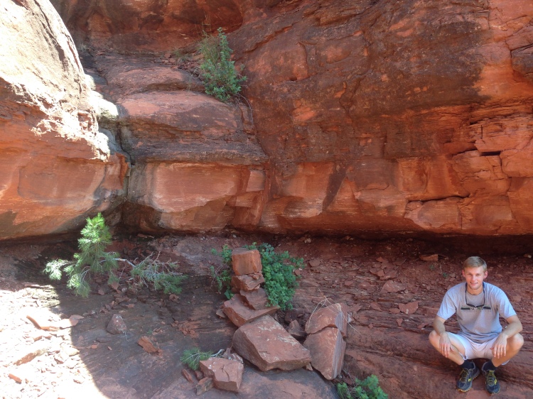
Thankfully, only a few scratches and lumps and a bit shaken up…a few feet away and it would have been a much longer fall! We continued up the formation, but I was slow to trust any holds after the fall, and rain clouds caused us to turn back a little over halfway up, but we did find a few old mud walls of Native American dwellings! We went to a Cambodian restaurant for dinner, feasted on authentic grub, and everything was right in the world.

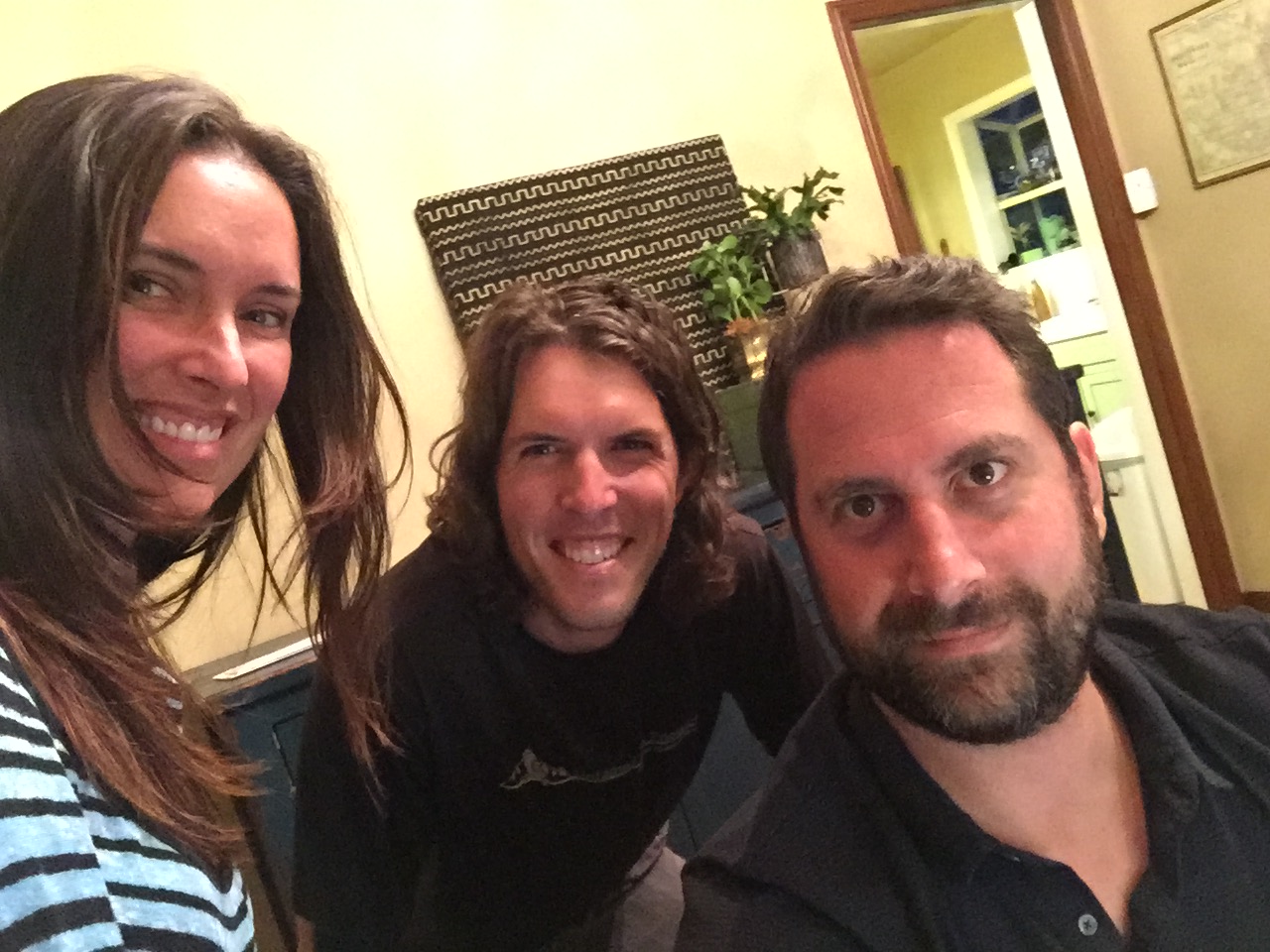
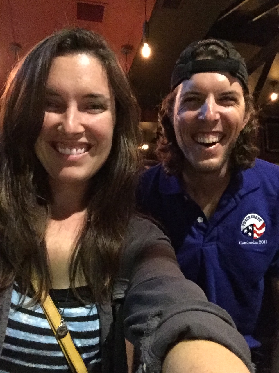
My last day in Phoenix, AZ, I had the pleasure of meeting up with two friends from Peace Corps, Rachel and Mary. We all went out to dinner, caught up on fun times, then when we were looking for an adventure, did some night time geocaching and found five different ones!

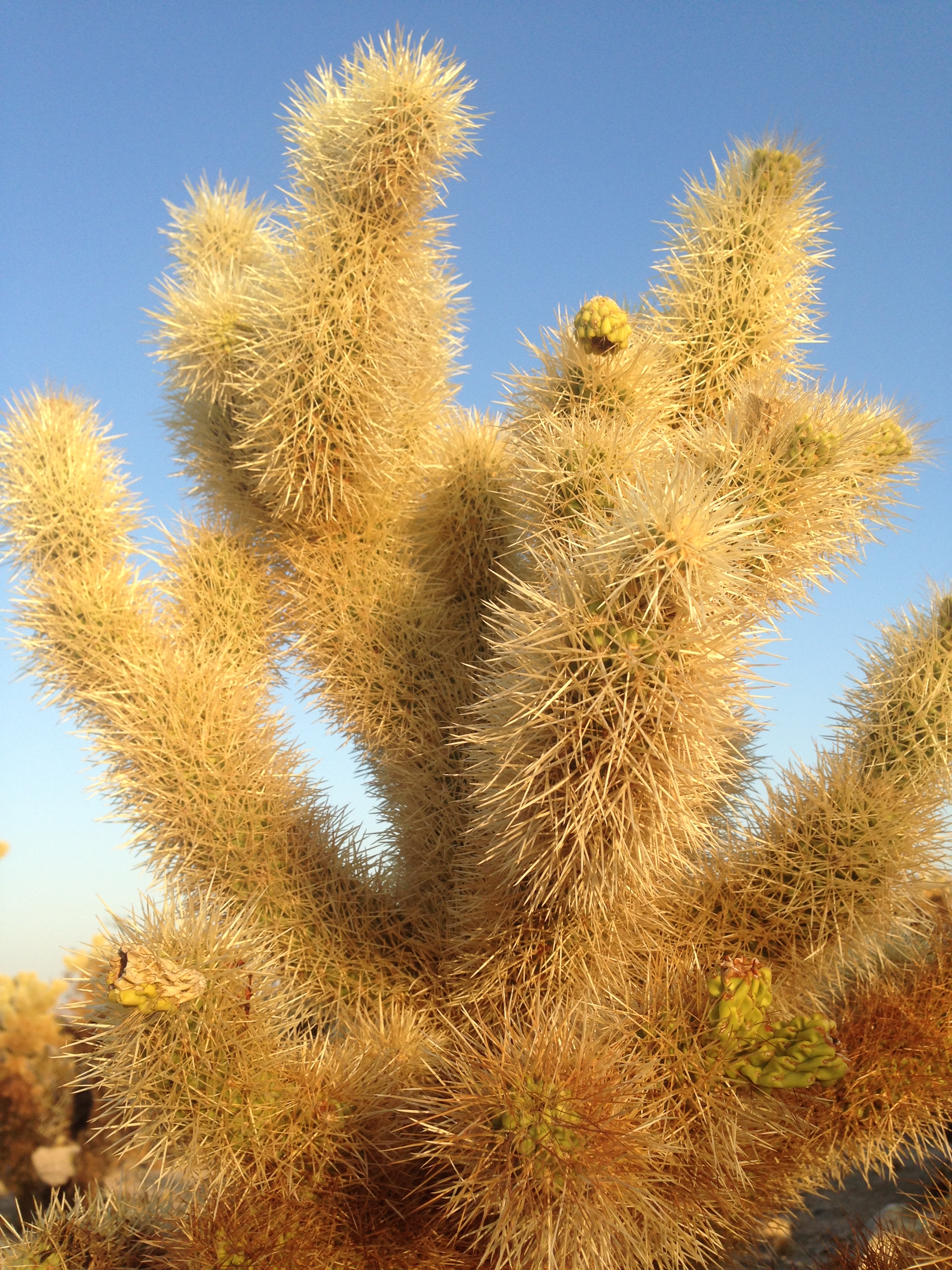
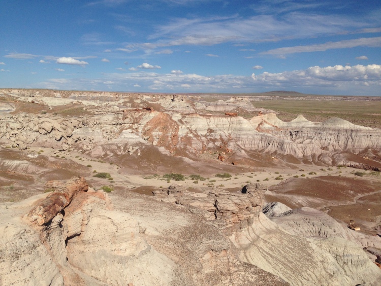
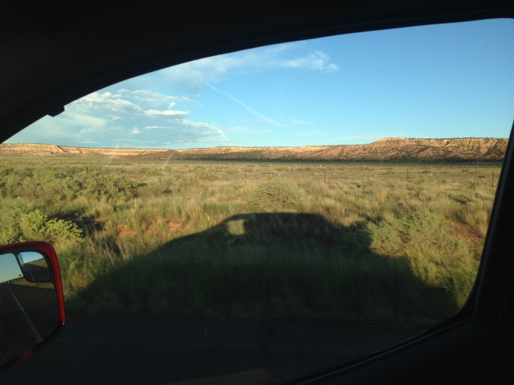
The path out of Phoenix was to the North East, first stopping at Petrified Forest National Park. It was a little lack luster in my opinion. Petrified wood is neat, and the landscape was open hills, but compared to most other parks, this was not my cup of tea.

img_1956

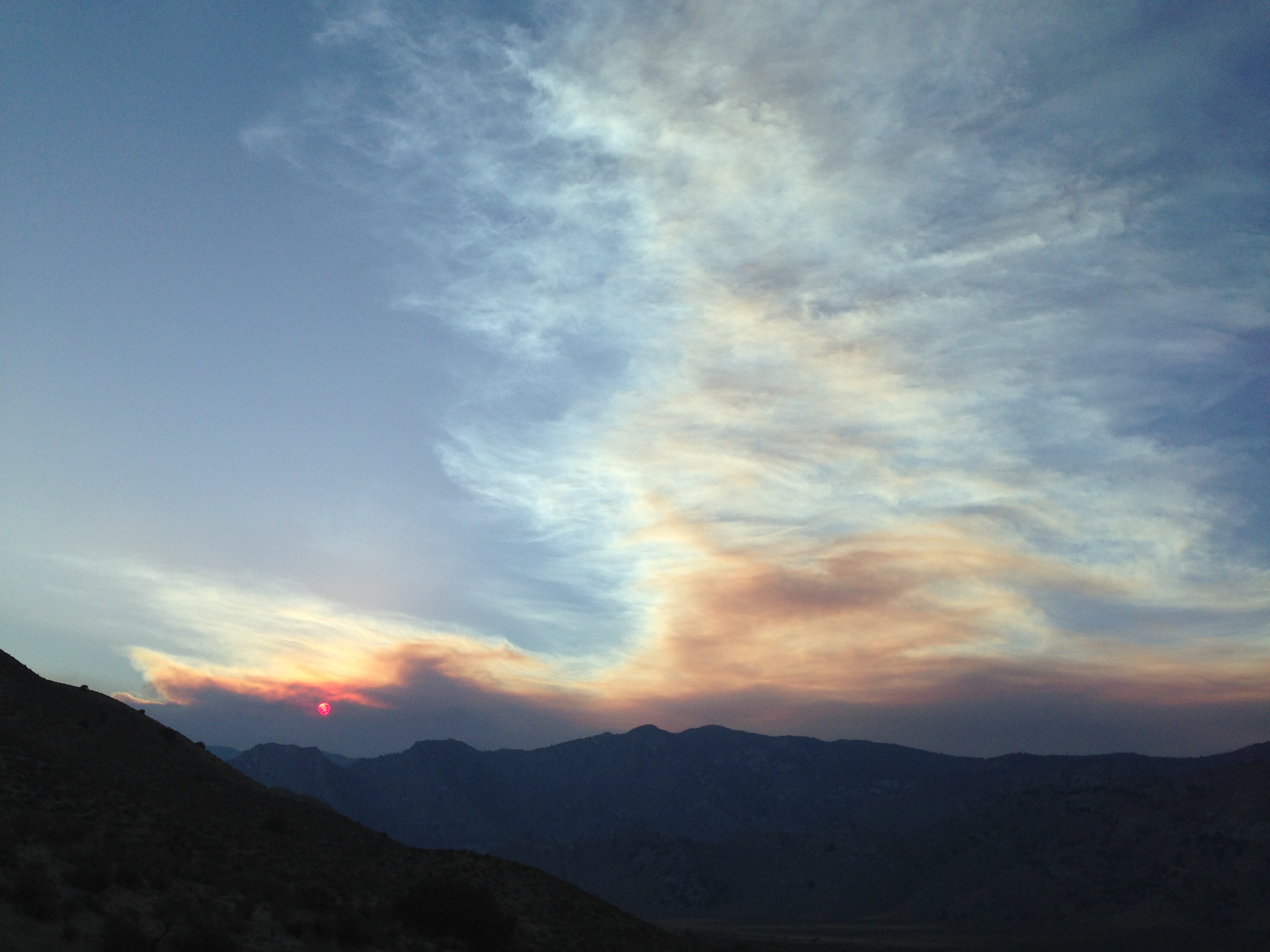
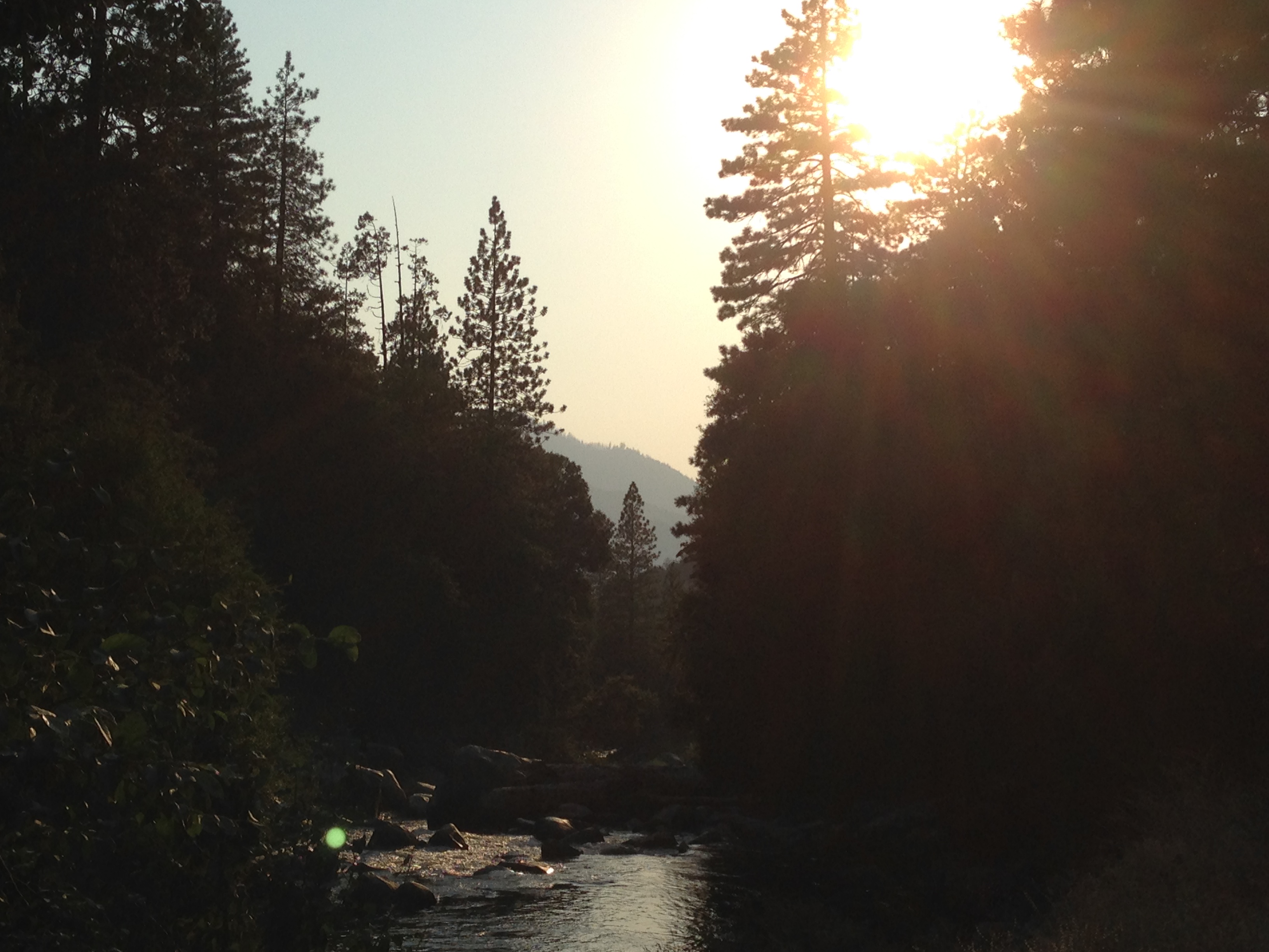
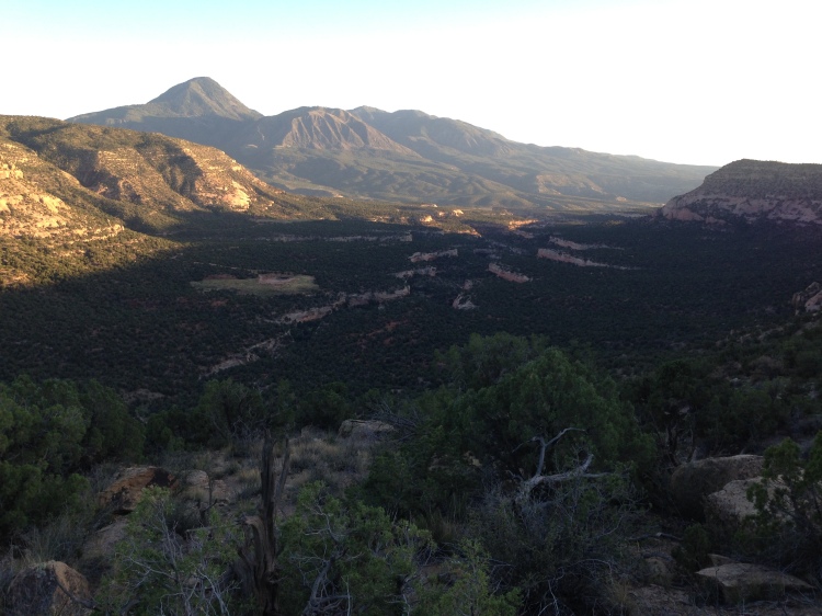
Another 100 miles down the road and I pulled up at the Canyon de Chelly just in time to catch some of the sunset color on the forming rain clouds over the canyon walls.

I slept in a parking lot there and in the morning, hiked the only visitor trail down into the canyon. Most of the canyon is off limits to visitors because it is still Navajo land, dating back hundreds of years, and many Navajo peoples still live and work in and around the canyon. The trail took me to an ancient dwelling known as the White House, with many brick rooms built into the cliffs on two levels.


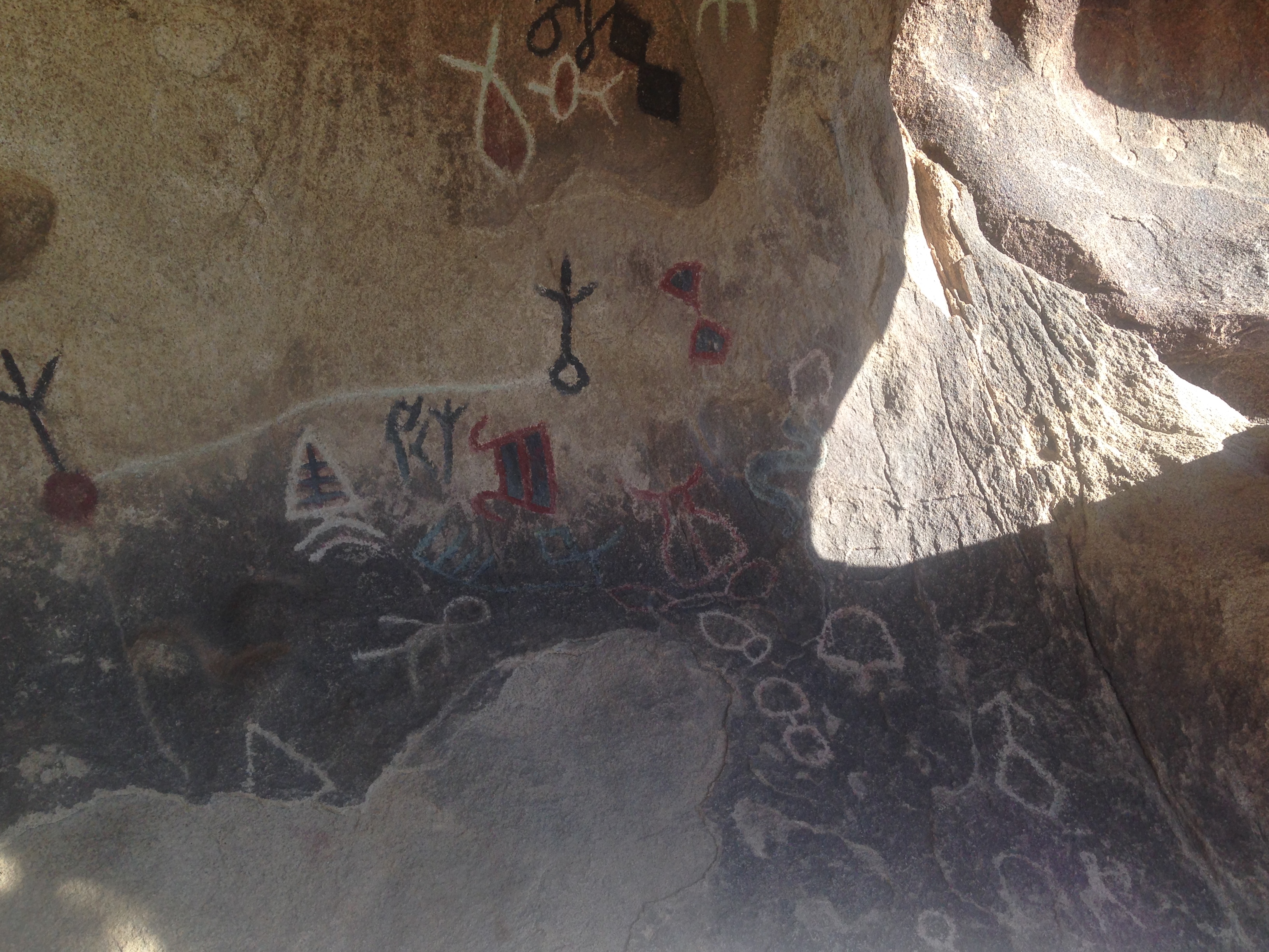
I spent all day using binoculars to peer into cliffs across the canyon and spotted tons of small ancient dwellings. Others still were massive 100+ room communities with three story buildings! The acoustics in the canyon were incredible, when a cow mooo-ed from the canyon floor, I mistook it for a thunder clap at the rim of the canyon! On a sad note, the US army came in the 1800’s and killed many Navajo, captured more, and drove them from their homeland. One particularly horrific scene occurred at an area known as Massacre Cave, where 115 Navajo hid high in a cliff cove and the army opened fire on them from the top of the rim, slaughtering all of them. A sad history about how much of our country was formed.

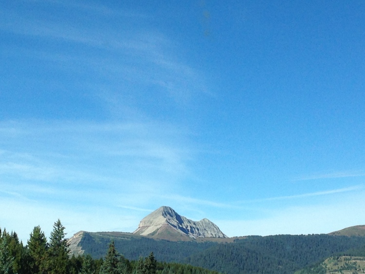
Approaching the Arizona/Utah border, the horizon came to live as Monument Valley came into view. Massive rock formations remaining from millions of years past, now stand out against the eroded landscape.

I was fortunate to drive through the area as the sun was on it’s way down and had magnificent lighting through the whole area. Speaking with some of the Navajo folks, who sold crafts in the parking lots, I felt like I was back in Cambodia, making light banter with locals.

A few miles from Monument Valley was a rock formation known as The Mexican Hat Rock, for obvious reasons when you see the pictures. Todd, from LA, mentioned that you can scramble all the way up to the rock at the top…the view and experience certainly were worth it. I even parked for the night at a gravel access road near the rock, all to myself, under cover of the hat!

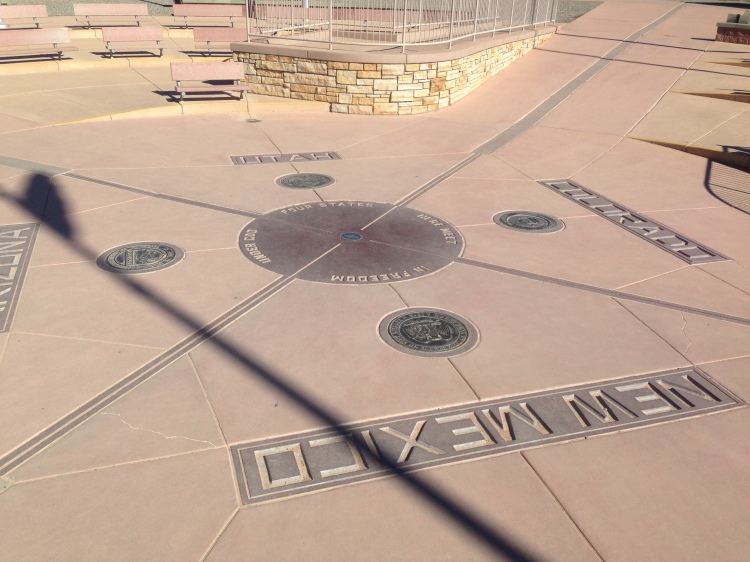
My route took me within five miles of “The Four Corners”, where the states of Arizona, New Mexico, Colorado, and Utah all touch in one spot. It’s a rip off that they charge a small fee to look at the plaque, really nothing else to do at the spot, but I couldn’t resist standing there once in my life.

img_2039

Furthering my exploration of ancient dwellings, I entered Colorado and stopped at the world famous Mesa Verde National Park. Compared to the remains in Canyon de Chelly, these were mansions! I took a ranger guided tour of an area known as The Balcony House, and viewed many more from across the canyon walls. It is so fascinating to learn about the sophisticated culture and livelihood of the American Indians, who are frequently portrayed as savage, simple-minded, antagonists in American History.

I heard an absurd statistic during my travels: The annual budget for all the national parks is equal to what the military spends in seven hours.

img_1964

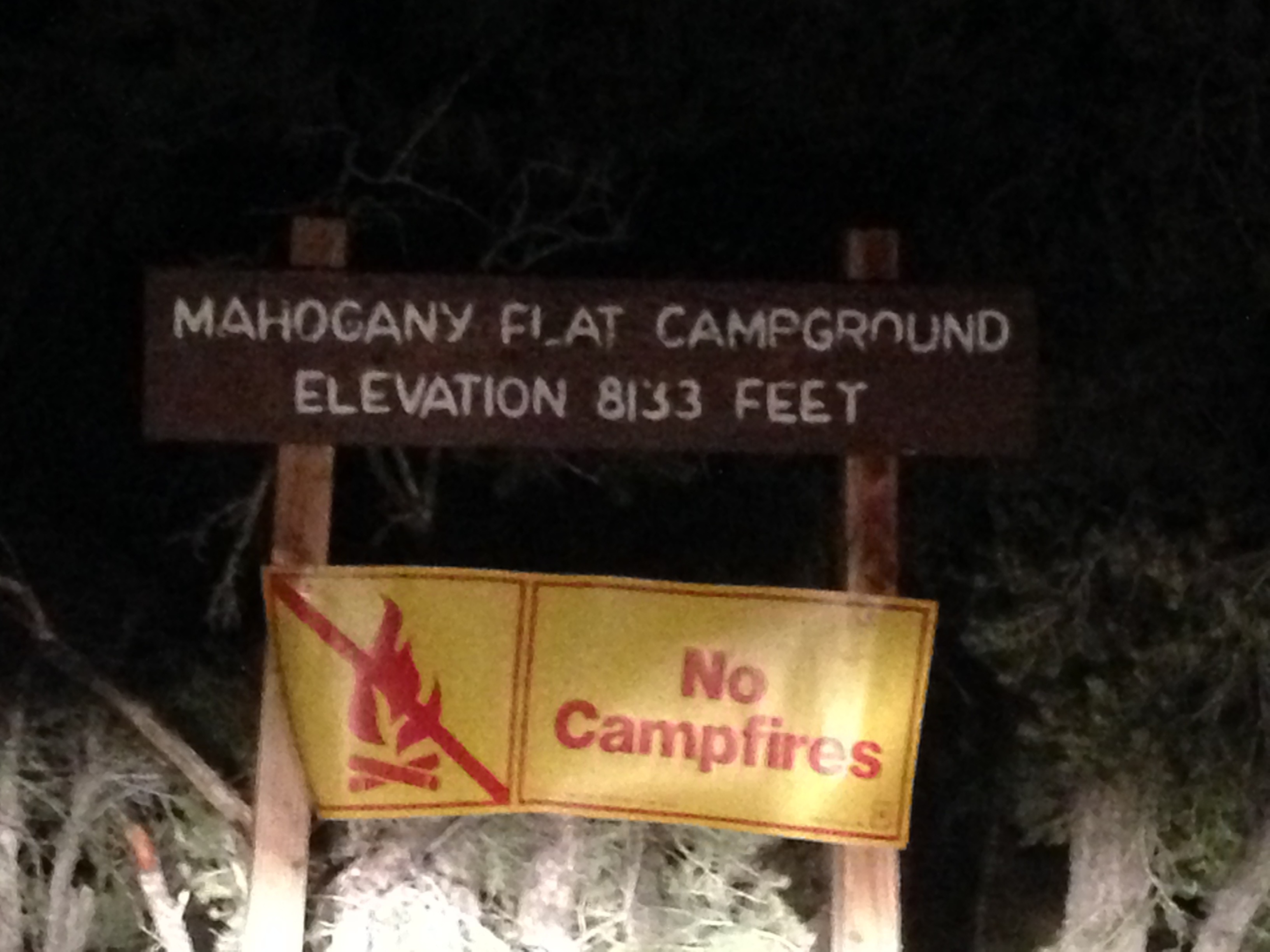
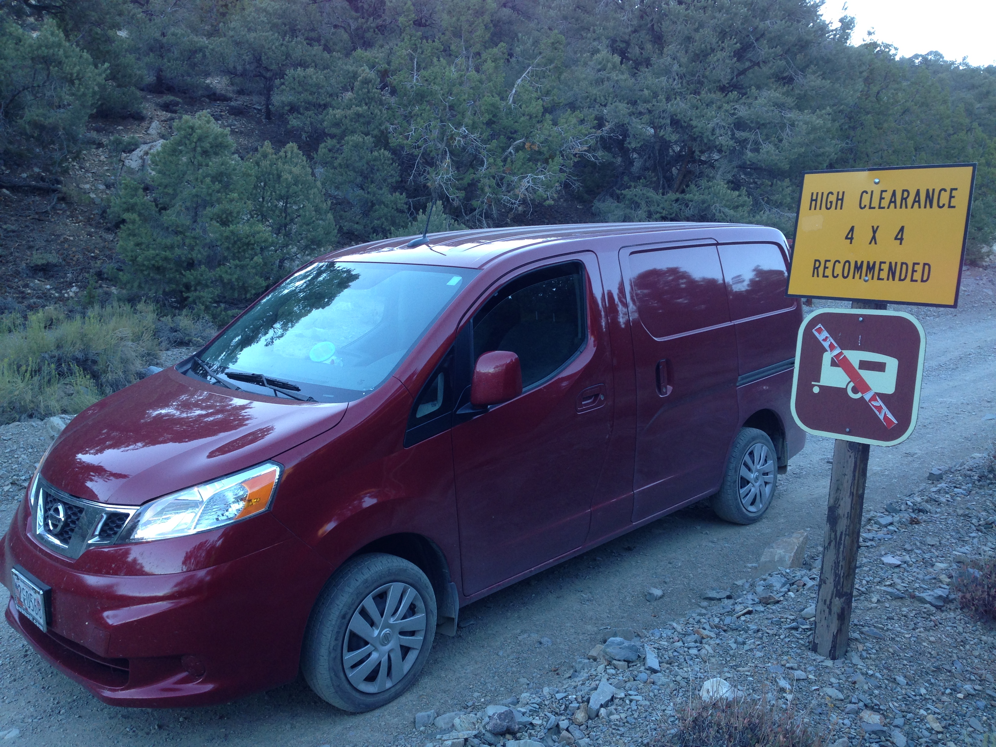
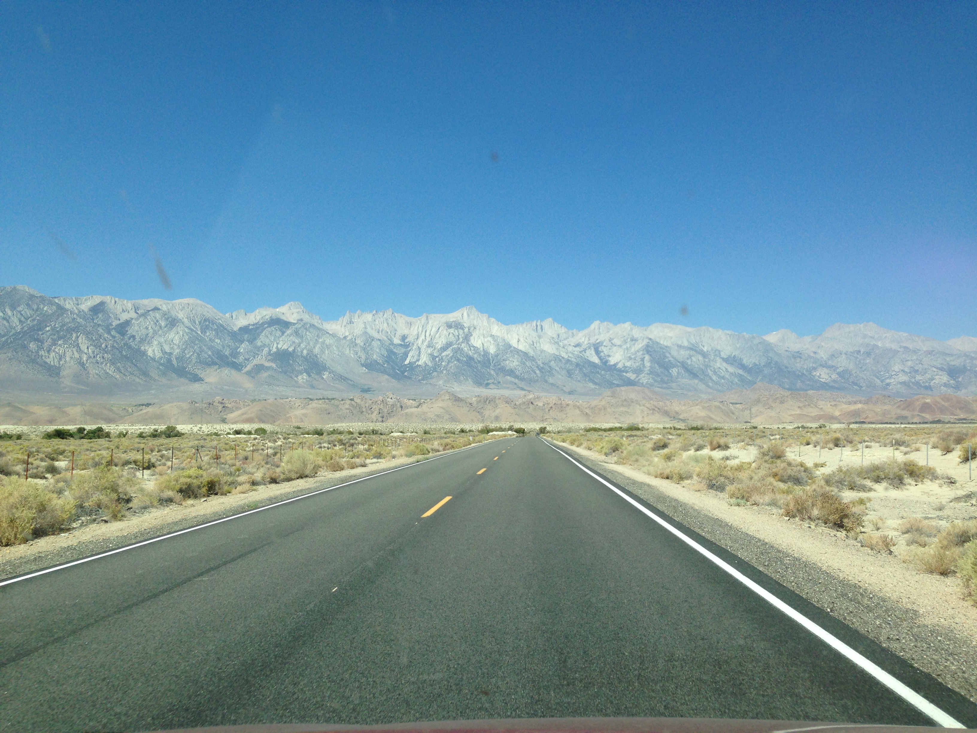
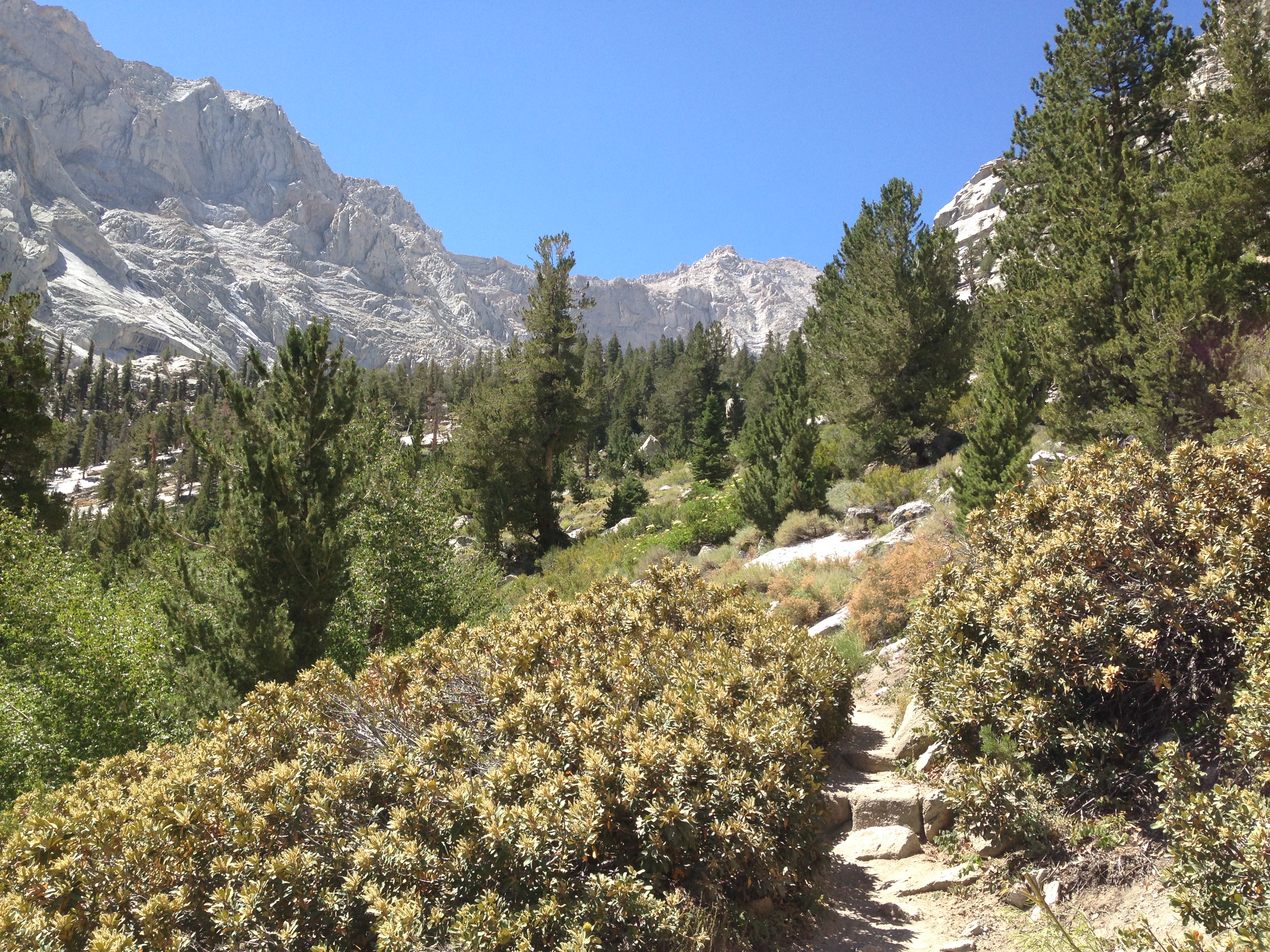
Driving along The Million Dollar Highway into the San Juan Mountains, the temperatures plummeted from the hundreds in Southern California and Arizona, to the 40’s in Colorado. Near the town of Ouray, CO, I turned the van up a steep gravel road for six miles of driving along sheer drops with no guard rails. My destination was the summit of the 14,150 foot Mount Sneffels! One section of the road went right through a cliff where they had busted out a shelf big enough for cars, like a tunnel with only one side. Eventually the road became too steep and wildly rutted to dare taking the red rover any further, I proceeded on foot.

I hiked about four miles up the gnarly road to the start of the trail where a sign mentioned it was another 1.2 miles and 1,500 feet of elevation to the top. The climb was no frills, straight up a loose rock scramble with some moist mud.

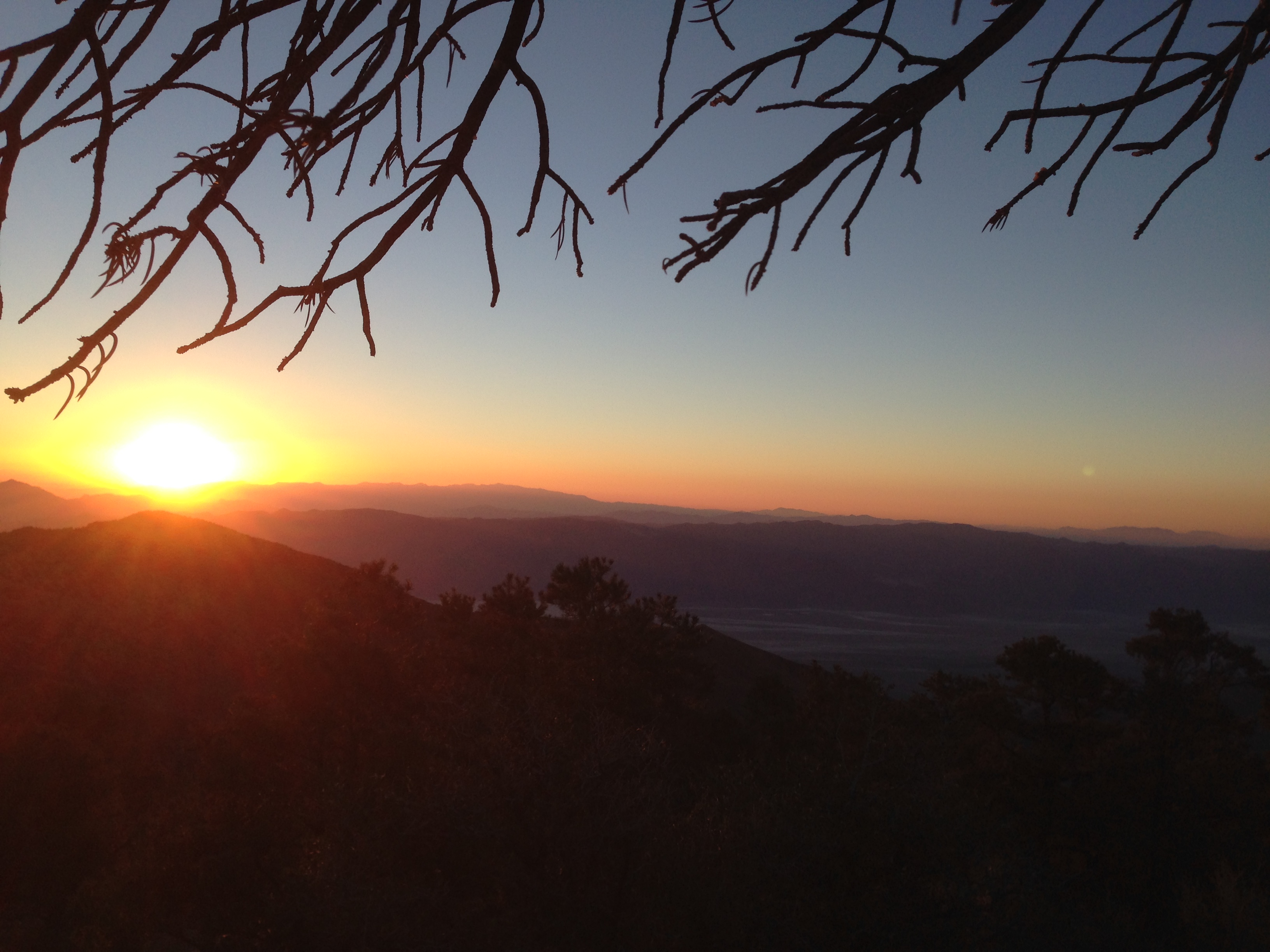
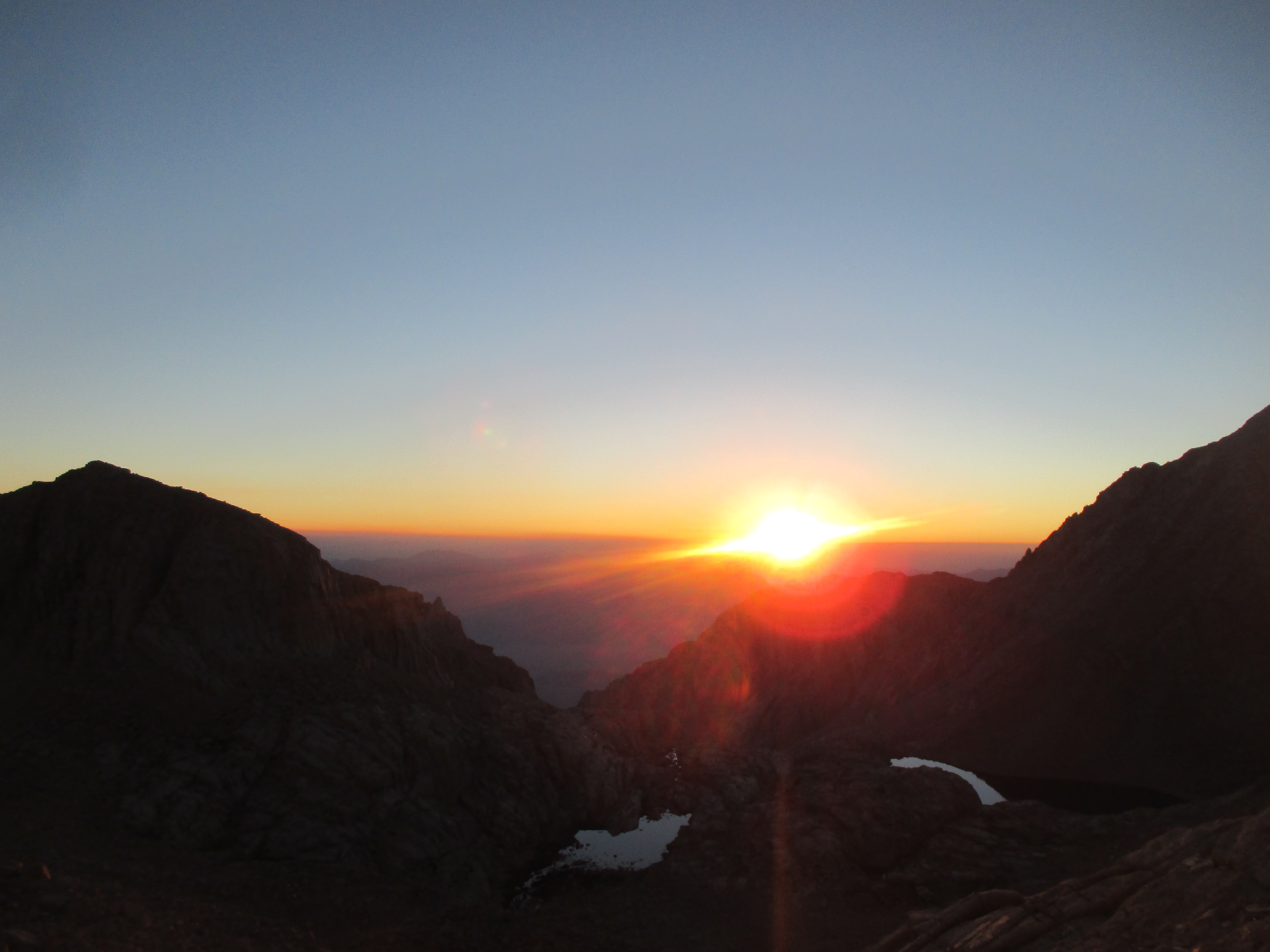
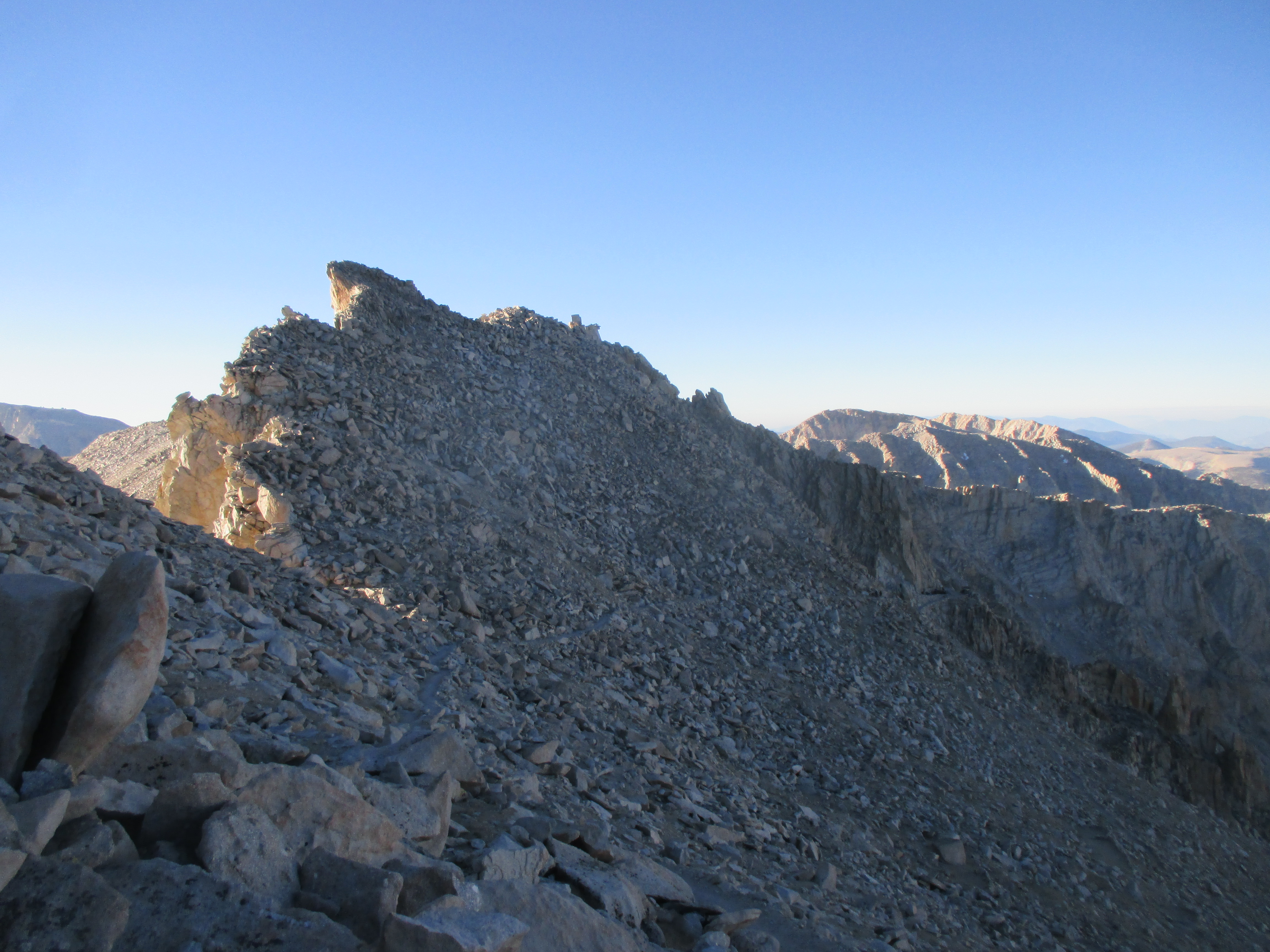
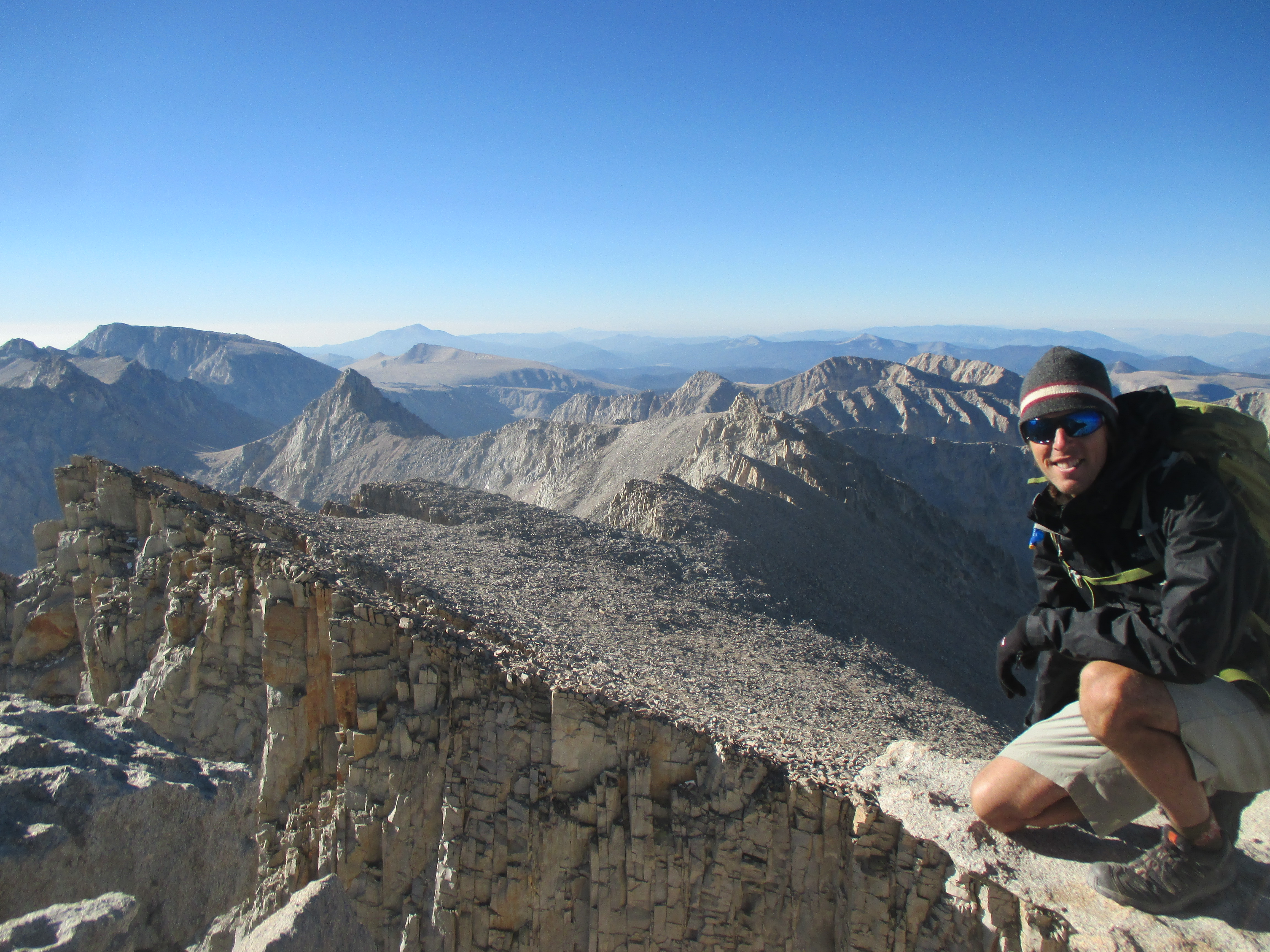
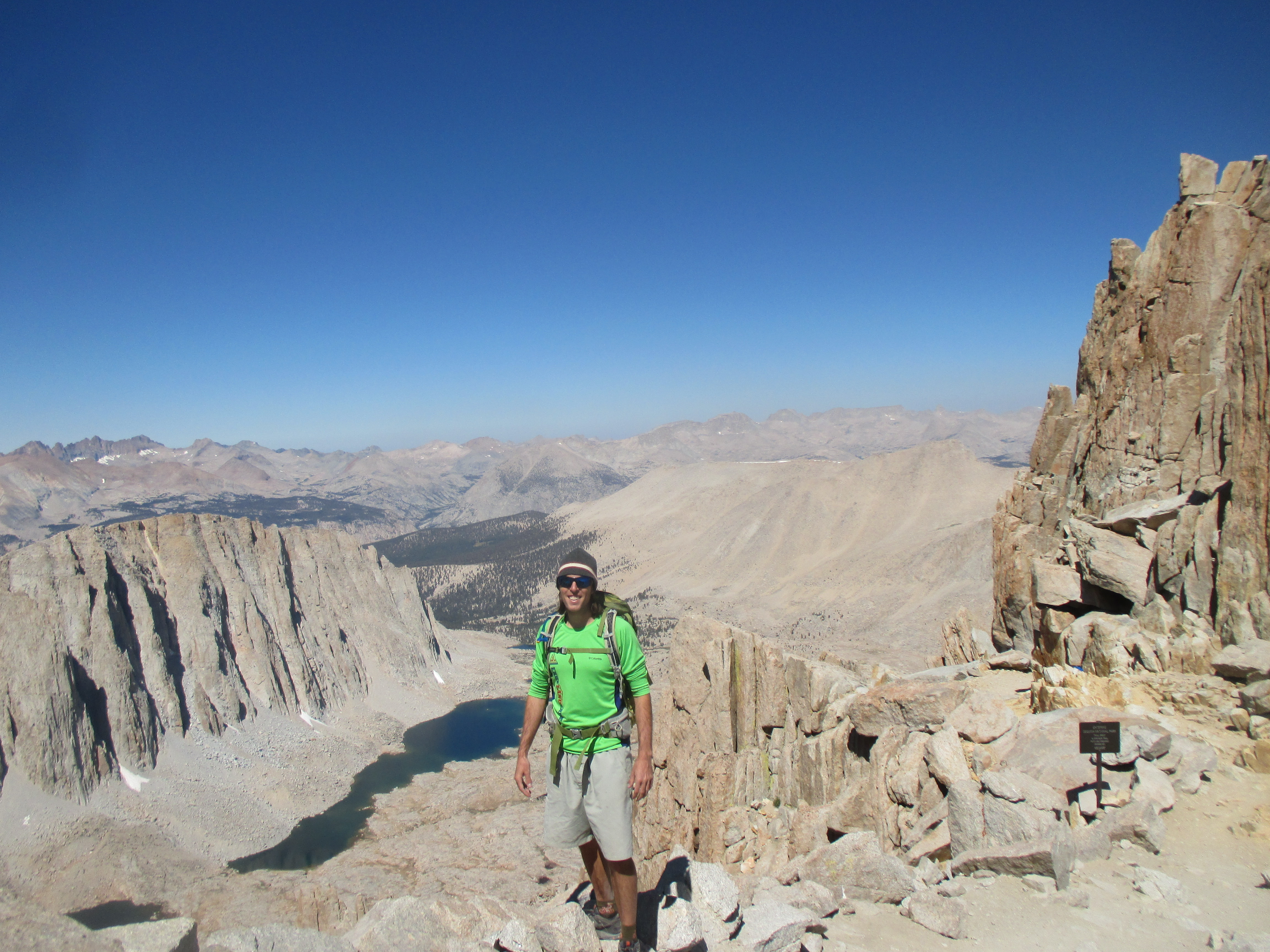
The going was slow at high elevation, and one chute near the top made me feel particularly unsafe, it would have been a very painful fall, but my hands and feet remained true all the way to the summit, only my second time breaking the 14er ceiling! The views were enormous, lots of clouds, but they stayed high, there wasn’t even the slightest breeze…complete calm, still, and quite, not what we often think of for a summit that high. What a reward to the hard work to get to the summit, the view and experience was worth every step.

On the descent, I took a different route around the steep chute and felt more confident. I took a little bonus side trail to check out an old mine shaft, then slogged the four miles down the old mining road to the van. No problems with altitude sickness until the last quarter mile when I ran back to the car to get the long descent over with. Even that little bit of extra effort caused a headache for the rest of the day. That’s when I realized that altitude sickness has the same symptoms as a bad hangover: stabbing headache, pain behind the eyes, and nausea…interesting!

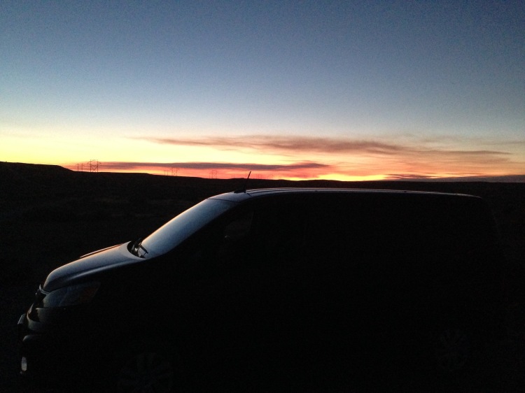
The night after Mount Sneffels, I drove a bit further until dusk, then pulled over in a large parking area at the top of a mountain pass for a great sleep in the chilly air. THUMP, THUMP, THUMP, THUMP….THUMP, THUMP, THUMP, THUMP…on the side of my van…I woke up hurriedly and looked out the window…what was a quiet, deserted location last night, now had me surrounded by traffic cones, heavy machinery, and dozens of construction workers…THUMP, THUMP, THUMP, THUMP…I cracked the sliding door for the man knocking, still in my sleeping bag. “You’ve got to move, you’re in the middle of an asphalt project!” Off I went.

img_2373

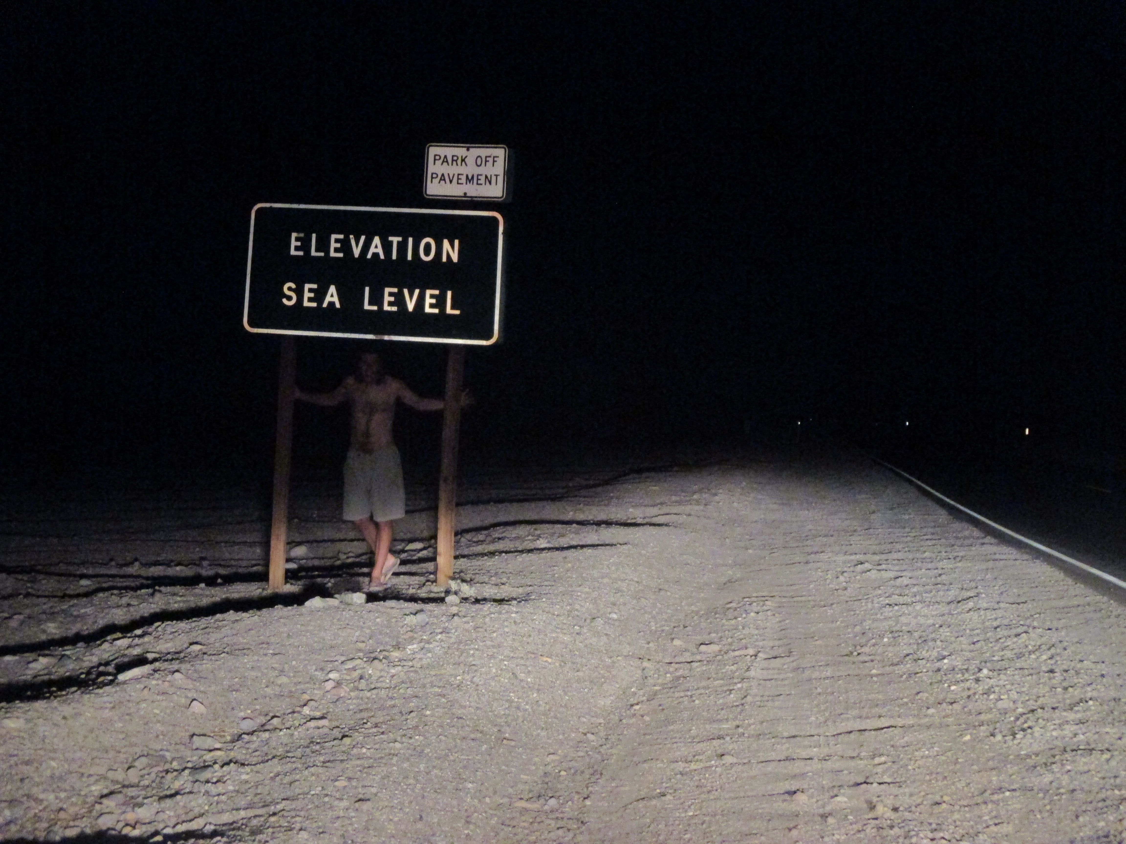
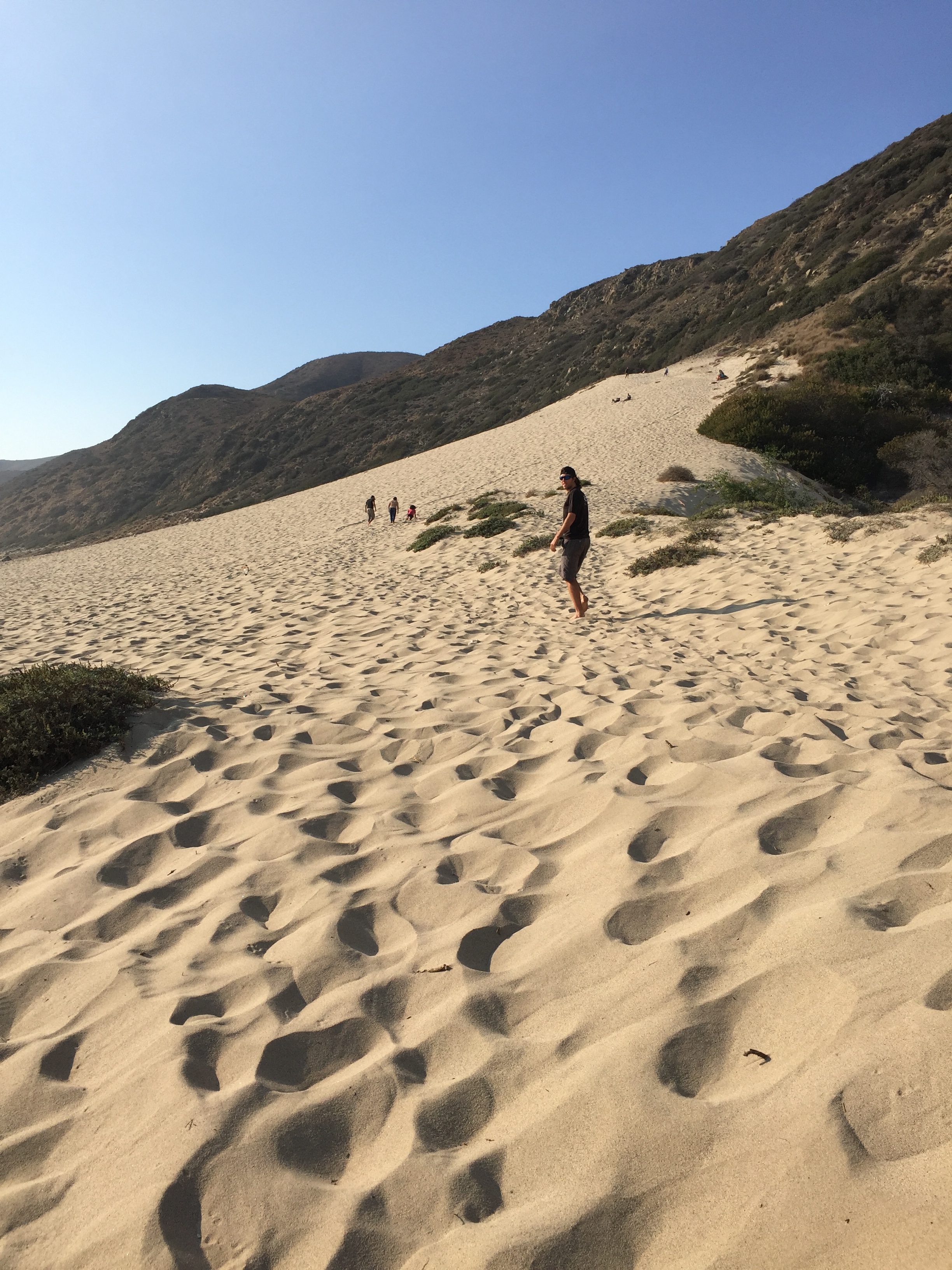
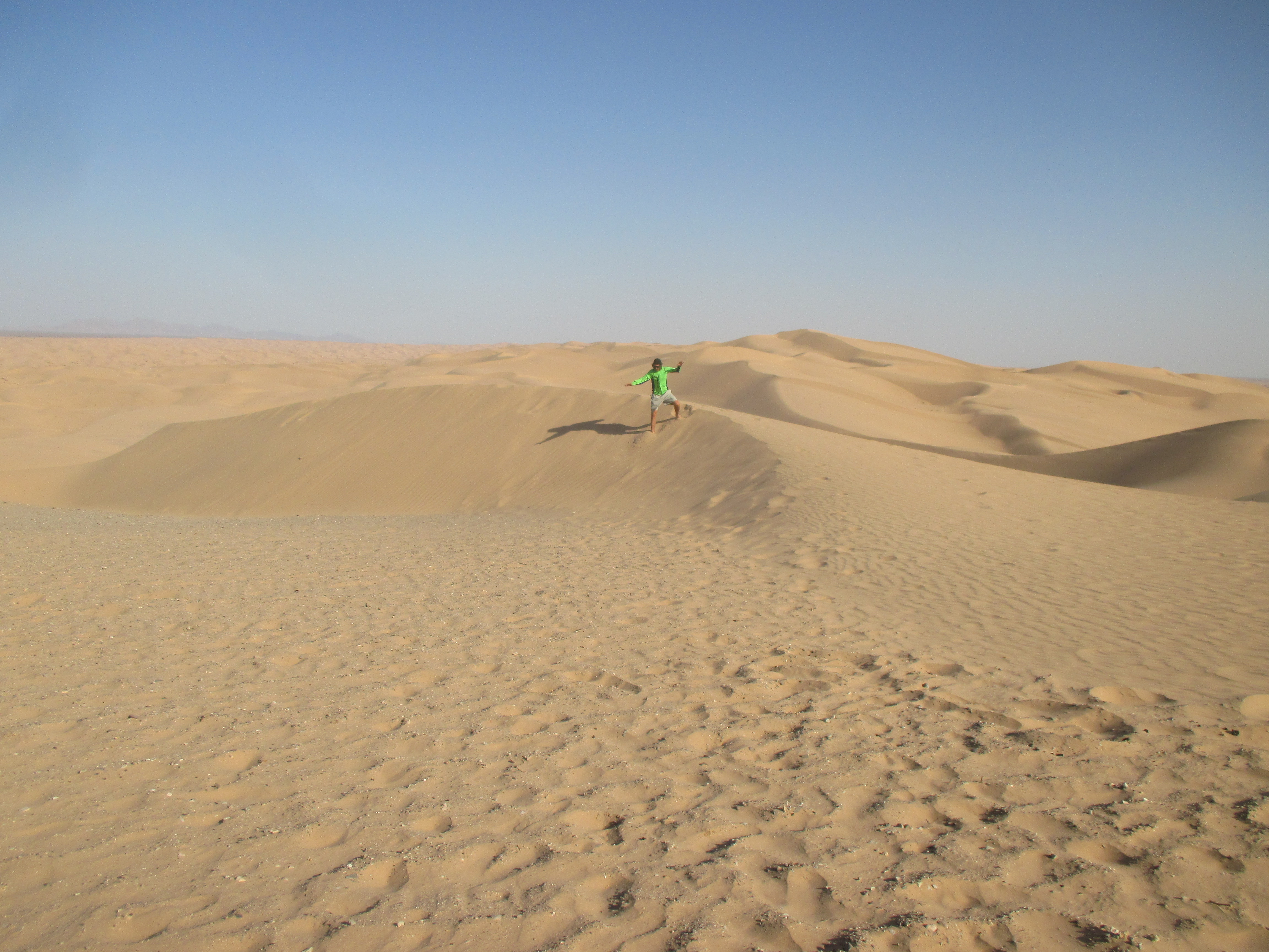
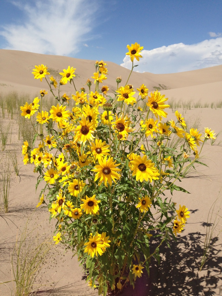
Many miles of open meadow took me to my next destination, Great Sand Dunes National Park. Nestled in the corner of a mountain wall and vast meadow, these dunes were quite a peculiar site!

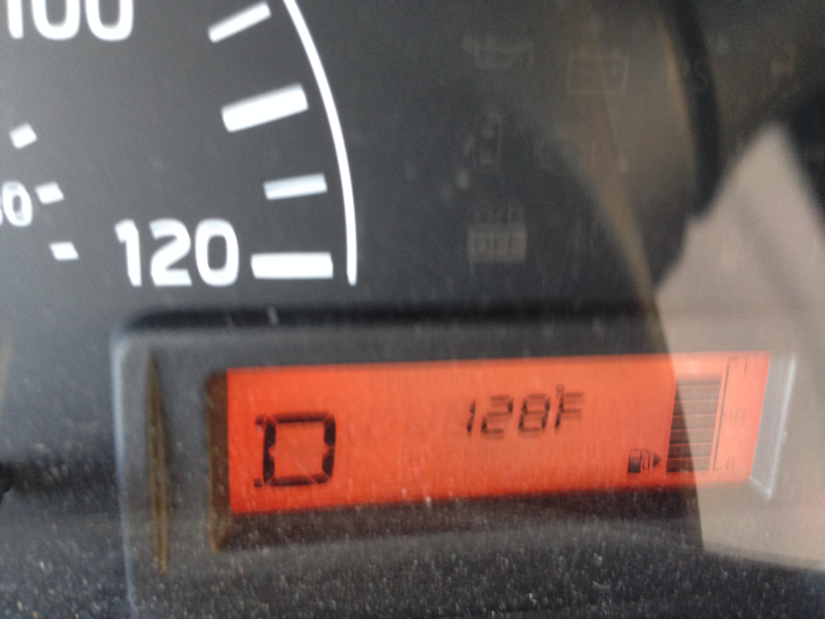
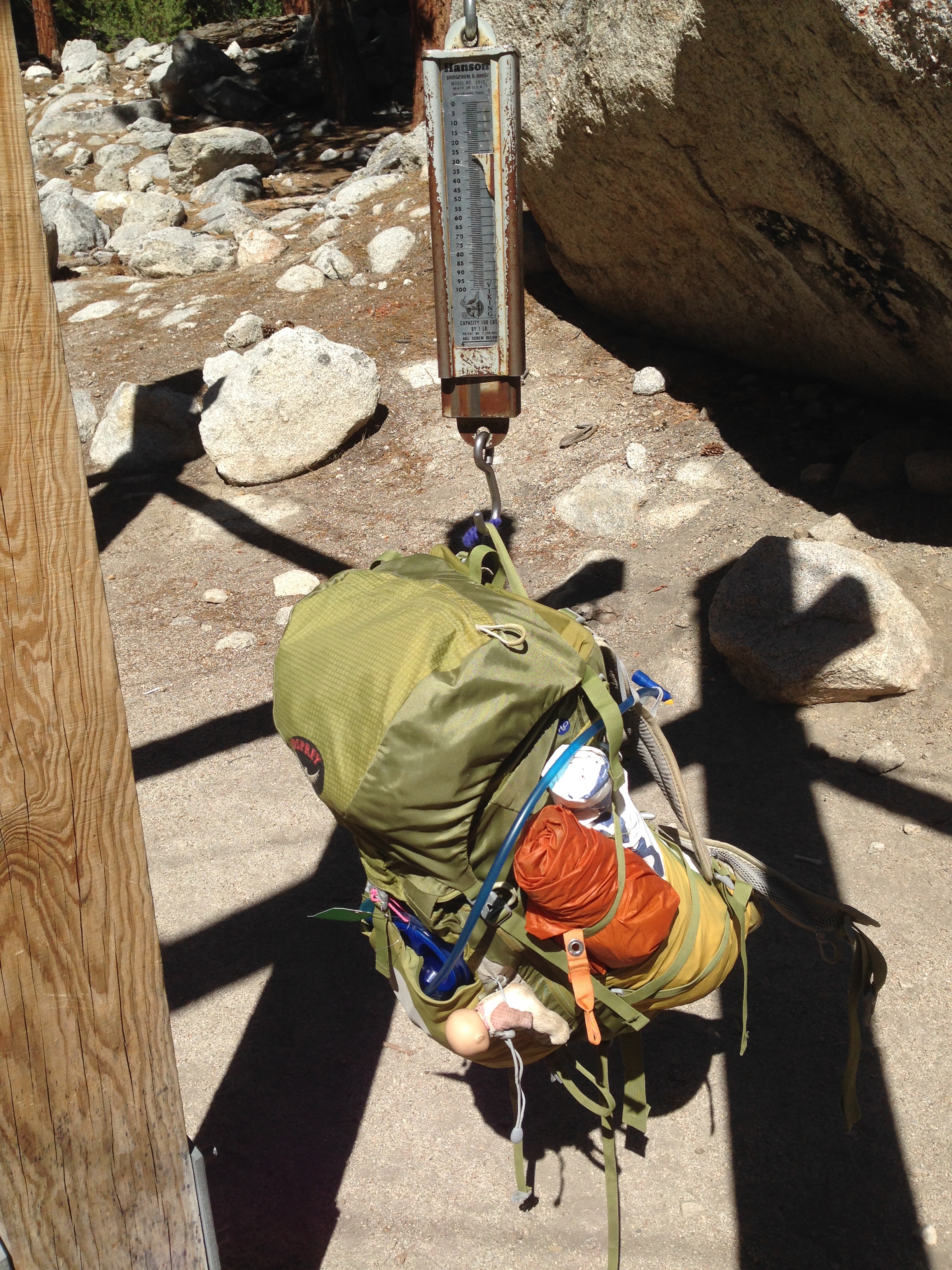
After getting a map, my goal was made: I would hike to, then sandboard down the highest sand dune in North America, Star Dune, 755 feet above the meadow floor. Sand boards are not made for use with shoes, and this was essentially just a huge beach, so I set off with bare feet. I quickly noticed that I was the only person on the dunes without shoes, and as I hiked up the first ridge I discovered why. The fine grit of the sand tore up the inside of my arch and pads of my toes, while the sand, which reaches 140 degrees at mid-day, burned blisters into the soles of my feet.

I’m stubborn though, and I had climbed too far up the initial ridge to turn around. I forged onward to what I believed to be Star Dune! As I looked around however, I realized that the neighboring dune was higher and had a few people on it. So up I trudged, over to that dune where a bunch of middle school students sat and I offered up my sandboard for them to try on a small slope. They were the most polite, friendly, outdoorsy, children I have ever met, and they were out on a school field trip before the academic year started. Two kids were even doing backflips off the slopes while the chaperons encouraged them.

I sat down and consulted the non-detailed park map and concluded that I was sitting on High Dune, and that Star Dune was another 1.5 miles into the distance to the West.

img_5435

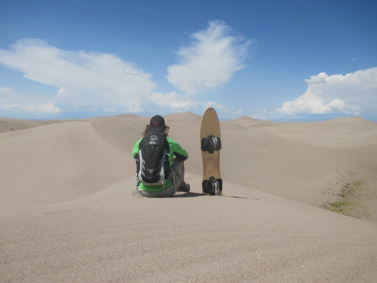
I made the tough choice to backtrack an hour to the car, ate lunch, drank lots of water, and put on shoes and socks. It was hot, I was tired, and my legs were a bit weary from yesterdays hike up Mt. Sneffels, but when else would I get the shot at this dune? Onward and upward I battled through the loose slopes, sandboard always in hand, periodically stopping to empty buckets of sand out of my shoes. Nearly to the base of Star Dune, I heard the number one safety concern of the dunes…lightning. Oh crap, I wasn’t going to get this close and turn back…I ran where I could, then struggled up the steep, loose, final pitch, but I steadily claimed the summit!

After a few pictures, I knew I had to get off the dunes, so I strapped on the sandboard and had the ride of my life! I had hiked in from the East, but proceeded out to the South for the most direct route to lower elevation, but every time I heard thunder I realized how exposed I still was, surrounded by sand and meadow. Luckily the storm was blowing in very slowly, I fought the energy-sapping heat and sand back to the parking lot for over an hour. The first rain drops began as I opened my van door, home sweet home! I rewarded myself with a burrito at a nearby restaurant and watched the lightning and rain come down in force through the window, happy to not be out there, and thrilled to have accomplished the mission.

img_2143

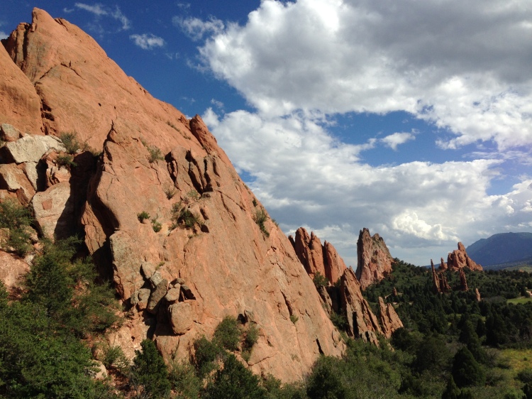
I drove my way up through Eastern Colorado, stopping to see the unique rock fins at Garden of the Gods, then pulled into Rocky Mountain National Park that evening.

img_2179

I found a remote parking area with no signs and set up shop for the night. A few minutes after I turned off my light a car pulled up…car door opens and closes…flashlight approaching the van…THUMP, THUMP, THUMP…”Park Ranger”…I opened the door…”ID please, do you have any weapons I should be worried about? Any warrants or probations?”…The tensions quickly lowered as we had a short talk, he mentioned that there was no camping or overnight parking there, but opened a map and showed me an area outside the park that was acceptable to sleep for the night. His last words to me…”Great set up by the way!”

14224961_973291279908_2529022022477904985_n

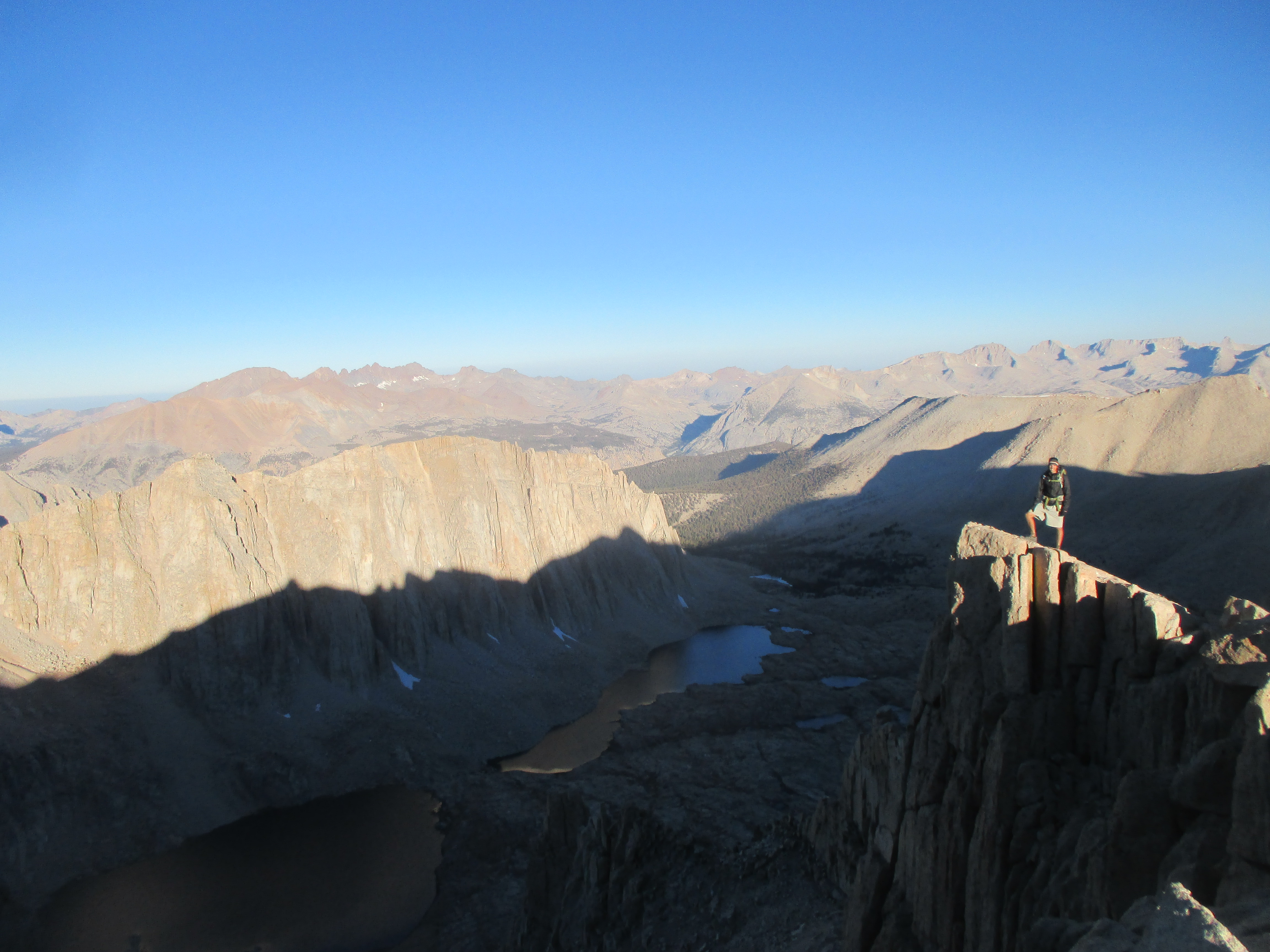
When I first started this trip, I received word from an old lacrosse friend from high school, Ben. He’s been living in Aspen, Colorado for years and invited me to stop by when I was in the area. When I was headed that way, he invited me to climb another 14er with him and some friends the following day. I met up with Ben at the La Plata Peak trailhead at 6:30 AM and he introduced me to the group: Lacy, his girlfriend; Brutus, his mini golden doodle; Karen; Kate; and Bear, Kate’s dog.

img_2219

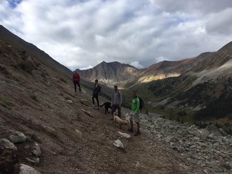
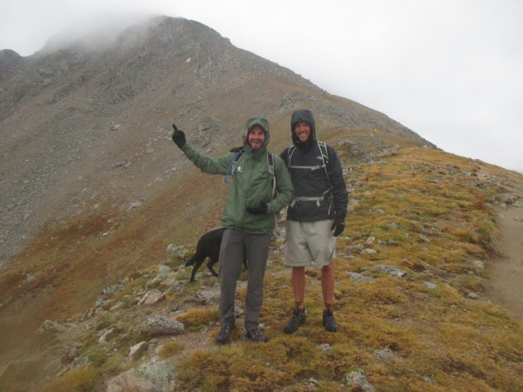
We began to climb the 4.5 mile trail with approximately 4,000 feet of elevation gain. It was a cold morning, in the 40’s, but quickly warmed up as we worked hard and the sun came out. After we got above tree line things were looking a bit dark and foggy above us, and the wind was blowing it quickly towards us. As we approached an exposed ridge the precipitation began…hail! It stung as the wind whipped it into us and we sought shelter under some nearby boulders for a few minutes. We had all our clothes on, but it was cold since we weren’t moving, so we hiked up to the crest of the ridge. Reports from others and our own observations weren’t great, after a few pictures, the decision was made to turn back. I guessed we were pretty close, although we couldn’t see the summit through the clouds, so I decided to keep going and see if things got better or worse. I questioned my decision for a few minutes as the wind blew the hail into my bare legs so hard it felt like sandpaper and I had to put my rain pants on. There was a slick quarter inch of snow on the slope and the wind and cold were getting quite frosty. After 20 minutes the precipitation let up, and after 35 minutes I summited La Plata Peak just in time for the clouds to blow out, revealing their spectacular view!

It was still cold and windy at the top, but was able to enjoy a few minutes before the exposure led me back down to a nicer climate. I met back up with Ben and Lacy in the afternoon for a warm shower, great food, and great conversation with a friend I hadn’t seen in 14 years!

img_5442

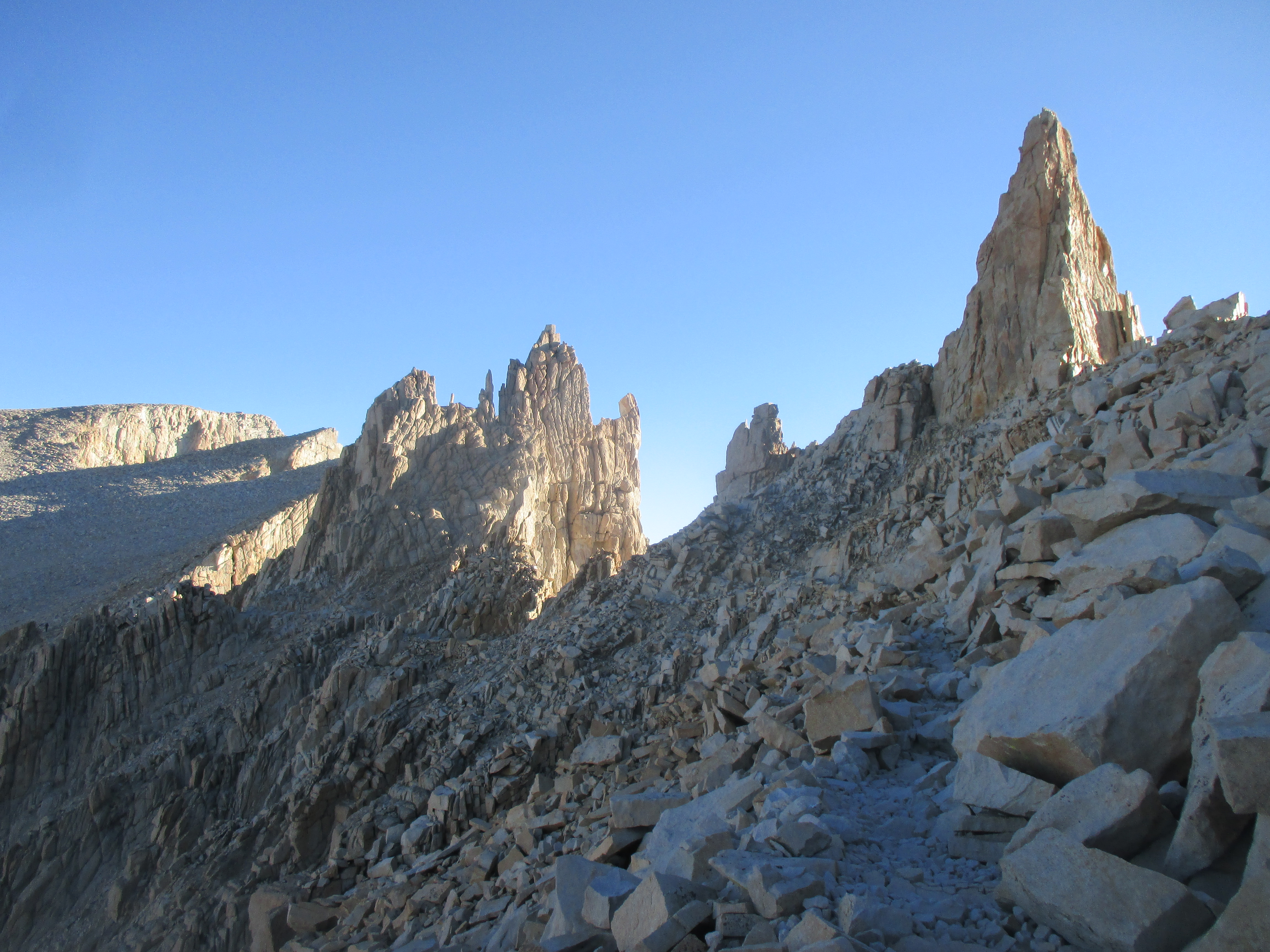
The tour of Colorado next wove out to The Black Canyon of the Gunnison National Park. A crazy canyon, half a mile deep and quarter mile wide, carved through ancient rock by a river over millions of years. The resulting cleft in the relatively smooth shrub-land was a striking contrast. Another example of how nature never ceases to astound.

I was fortunate to hear from another acquaintance, Nikki, near the town of Durango, CO. I drove The Million Dollar Highway for a second time, past Mt. Sneffels, completing a loop of Colorado. Nikki and I briefly met in Cambodia as friends of friends, and she even biked out to visit my village and help with my English class one day. She and her friend, Stina, already had plans for their two days off, but graciously invited me along for the fun!

The first evening, we drove out to an alpine lake for some camping, sunset views, fire side conversation and ate the best concoction that has ever past my lips…get this: s’mores, but instead of graham crackers, pumpkin bread!

As we finished up a late breakfast, two men from Texas came over, mentioned that they had caught more trout than they could eat that morning, and gave us three! Our plan for the day was to climb a Durango icon, Engineer Mountain.

img_2226

A few miles of climbing through the woods opened into a meadow with the massive peak in the middle and a rock glacier to the North. I jokingly suggested that the trail should go straight up a crazy steep ridge in front of us…then it actually did! Straight up the dirt until it became a loose rock and talus field.

Our crux was a 20 foot wall, completely exposed to a cliff face and 100’s of feet drop below. Instead, we went over the ridge to a, still very sketchy, steep slope of crumbled rock and tried not to look down as we slowly climbed above this section.

After that, the ridge was about five feet wide, loose rock flakes all the way to the steep summit. We ate snacks, Nikki pointed out nearby peaks, then it was back down the way we came.

Back at Stina’s house, Nikki fried up the morning trout for first dinner and it was T, A, S, T, Y, tasty! For second dinner, we met up with Nikki’s old co-worker and we realized that none of the four of us were smart phone users!

img_2264

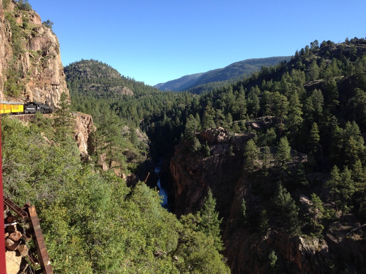
Nikki works for an incredible zipline company, Soaring, in a remote location out in the San Juan National Forest. When she learned that the next day, they only had two guests on the schedule, she pulled some strings to get four of her friends in! I was lucky to be on that list! To get to Soaring, you ride a historic railroad into the middle of nowhere with epic views over the river.

img_2267

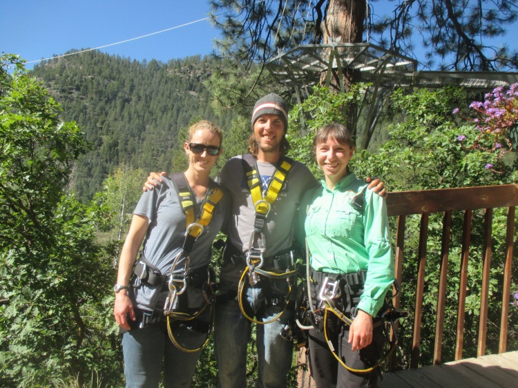
On the train, we met our two fellow comrades, Joe and Bette. As we pulled into the meadow, the soaring staff were all present to greet us and it was immediately prevalent that this was no ordinary zipline company, the level of hospitality the staff showed was top tier, extremely courteous, safe, and professional.

After some safety and nature briefing we hit the cables, through the trees, over the river, you name it. Tricks were allowed, so you can imagine we were upside down and spinning every chance we got!

We ate gourmet lunch on a suspended platform in the trees over the river and the staff still bent over backwards for lunch service. Nikki pointed out lots of wild edibles to eat and other things of biological importance. The final cable was over a quarter mile long and hit speeds over 40 miles per hour! It was sad to finish and I can’t say enough about the level of expertise and care that every single staff member showed us, and not just because one was my friend, this company was in a class of it’s own, seriously check them out if you are in Colorado, you won’t be disappointed!

img_5479


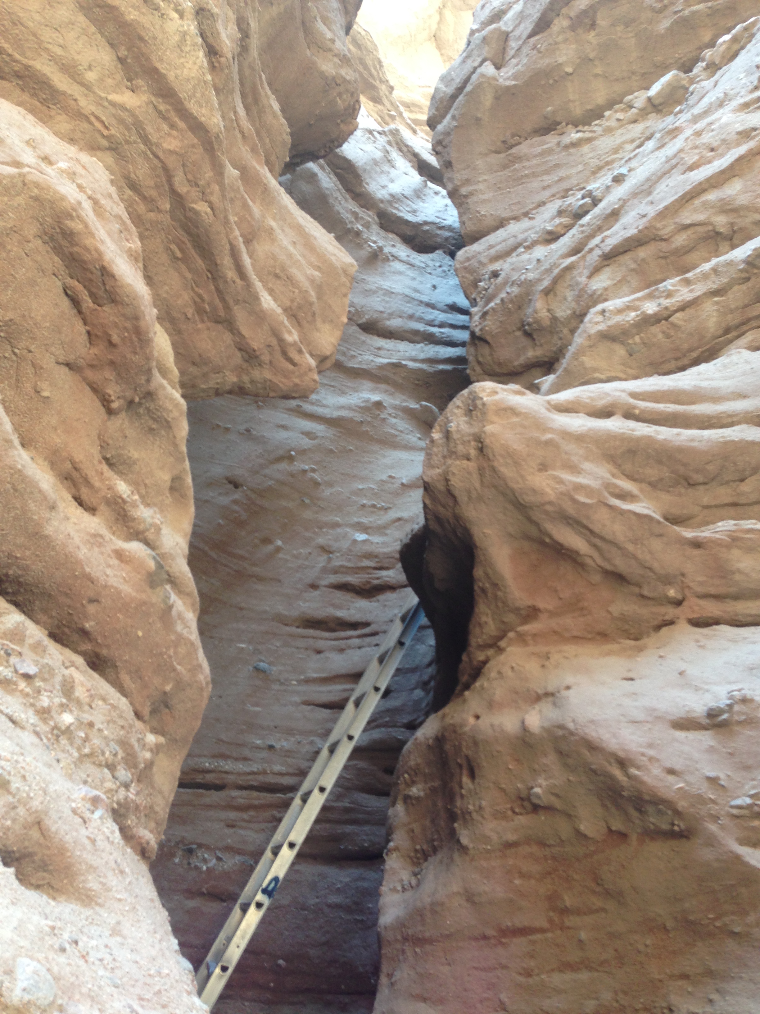
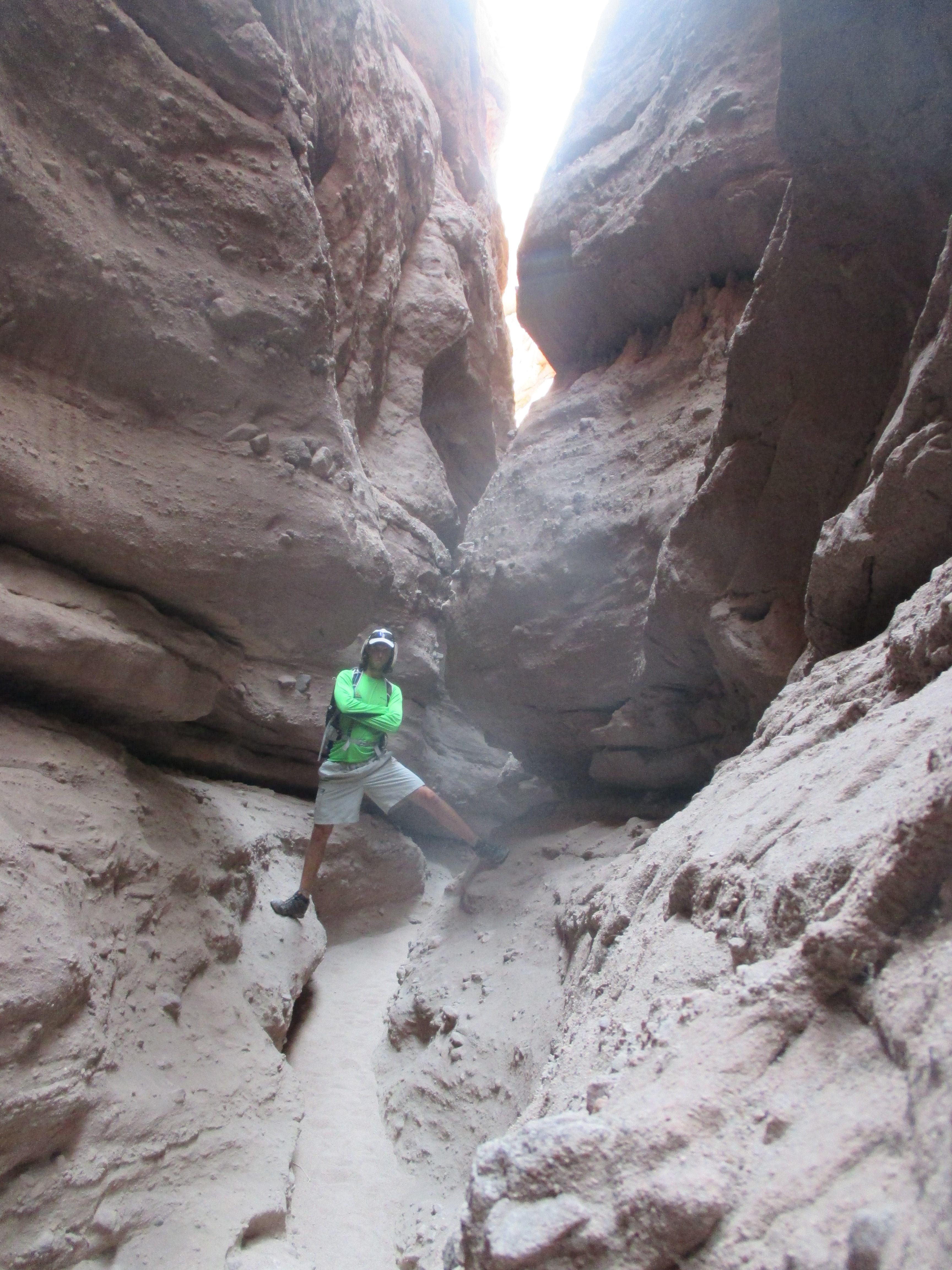
After ziplining, I drove out to Canyon of the Ancients National Monument in the evening and found the area Nikki had recommended, Sand Canyon, a small, empty, dirt parking area waaaay out in the middle of no where.

img_2269

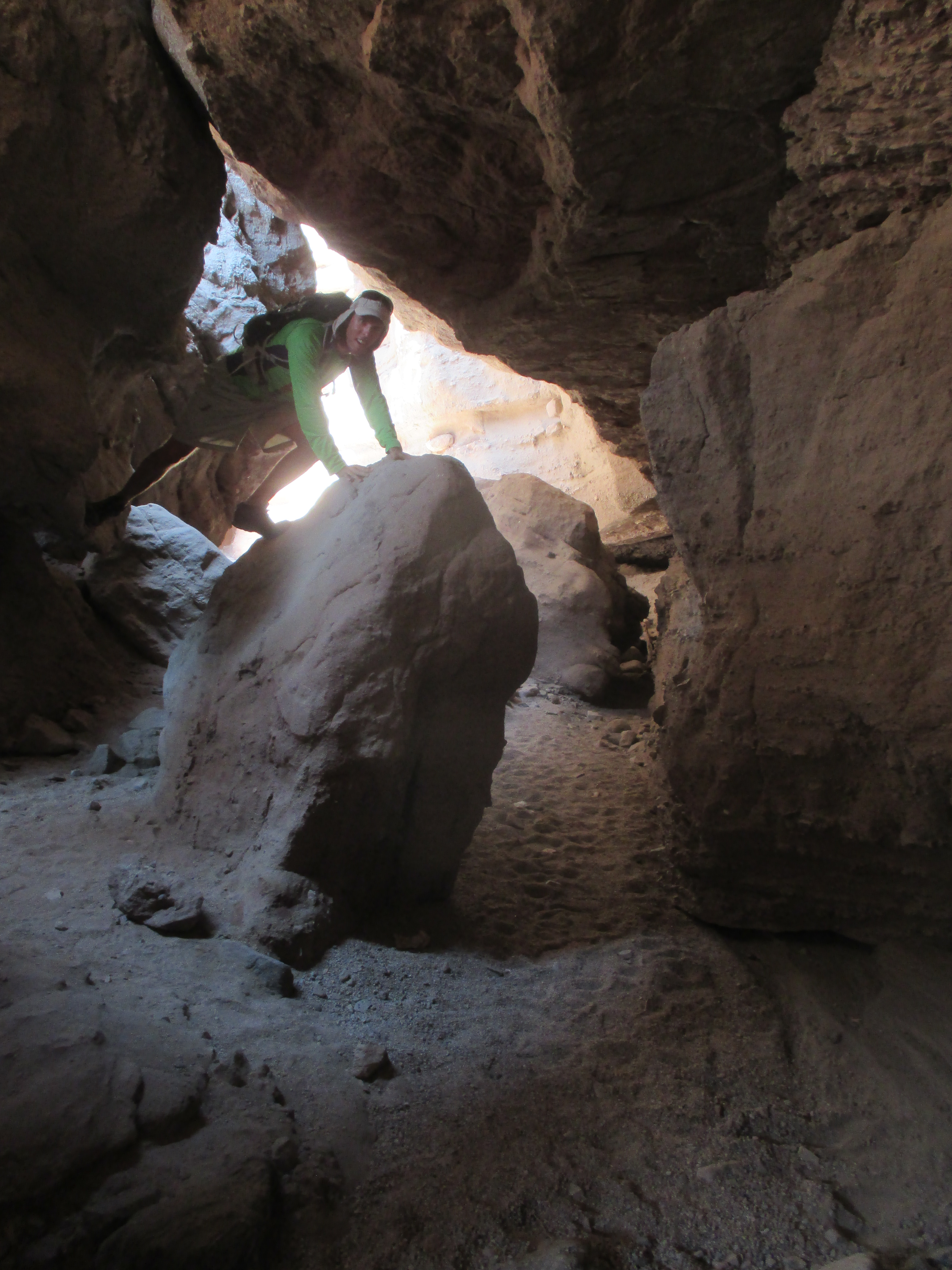
I hiked 1.5 hours down into the canyon and saw a few pueblo ruins just as dark fell. Then, of course, a 1.5 hour hike back up the canyon in the dark, guided by headlight.

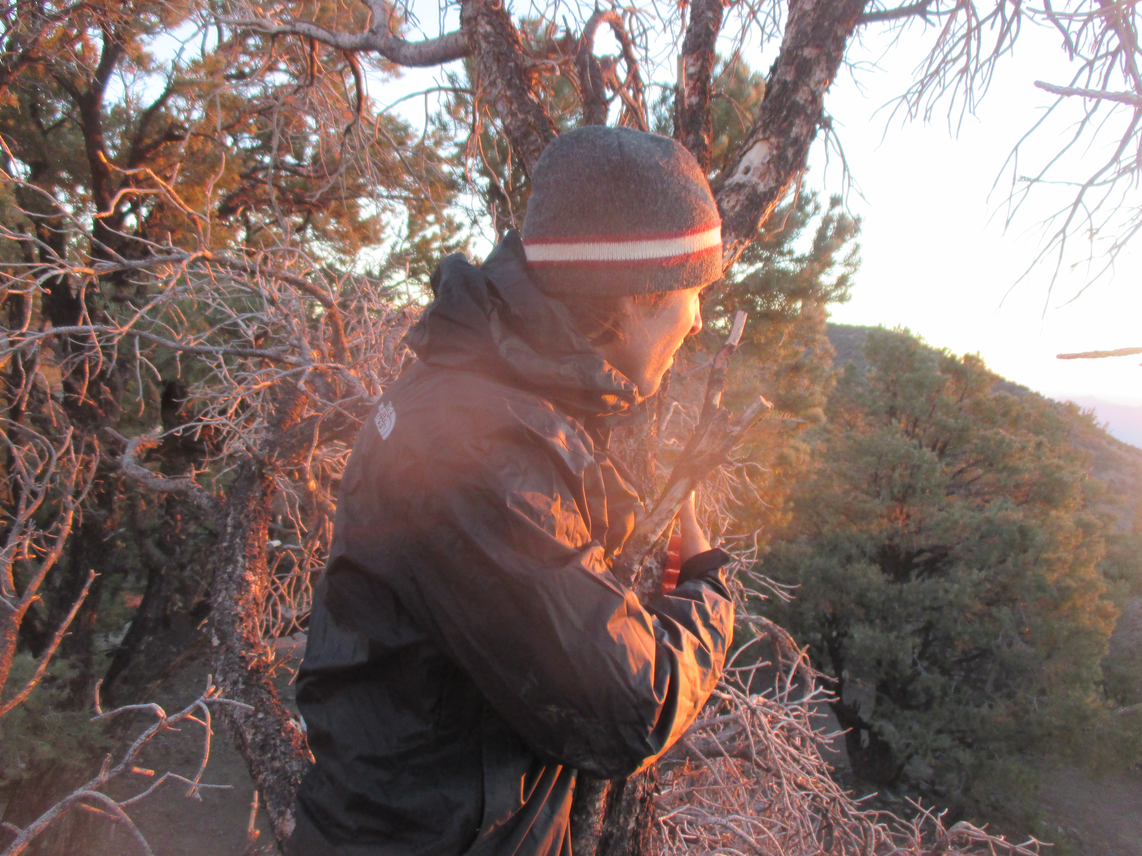
It’s freakier being out here alone than it is in Maryland, just thinking about the remoteness and the animals. I held onto two small sticks and banged them together every few seconds to alert animals to my presence, rather than them jumping out at the last second and me screaming bloody murder. I saw a pair of yellow eyes in a tree at a distance and started talking as I walked, trying to scare it away and talk bravery into myself. As I got closer to the trailhead, I heard a dog barking in the distance each time I clapped my sticks together. The closer I got, the louder he got, until I realized that the barking was coming from the trailhead! Great, I’m tired, freaked out at night, in the middle of no where, now I have to fend off some big dog to get to my van. As it turns out, that dog was in a car, someone was randomly there in the small, remote parking area at 9:30 PM. So much for my plans to sleep there…and I thought I was the sketchy one coming out of the woods alone that late!

img_5330

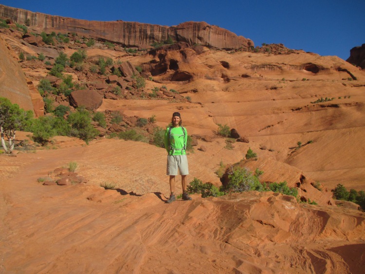
From Colorado, I drove into Southern Utah. The town of Moab is world renowned for its “slick rock” mountain biking. I rented a full suspension 29er from Poison Spider Bikes and got to work! The riding was a blast, completely different than anything I’ve ever ridden, riding on the contouring and rolling red and white sand stone.

Contrary to the name, the rock is not slick, but rather the most traction I have ever ridden on! Much of the trail rides over the surface of the exposed rock, the trail is simply marked by painted dashes directly on the rock. I rode for four hours through the formations, along cliff faces, through sand and over rock. Truly special riding.

I briefly stopped into Arches National Park to check out some of the famous landmarks.

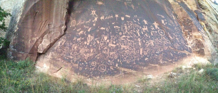
Canyonlands National Park was an area that I hadn’t heard much information about, but was a fantastic area to explore. Heading towards the Pinnacle area I passed Newspaper Rock, the largest and most dense set of petroglyphs I have seen.

img_2330

I parked at the Elephant Hill trail head and hiked a four hour loop through The Pinnacles, nearby Druid Arch, then back along the valley floor. I had the trail to myself all day to explore the large pillars, the tight cracks, the deep caves, shelfs, table tops, reds, browns, whites, tans, it was sensational.

Deep in the canyonlands, I even learned to harness magical spells.

img_2353

Between the mountain bike ride and the canyonlands hike the hot temperatures had me sweating so much that a few millimeters of salt caked up on my shirt and backpack.

img_2369

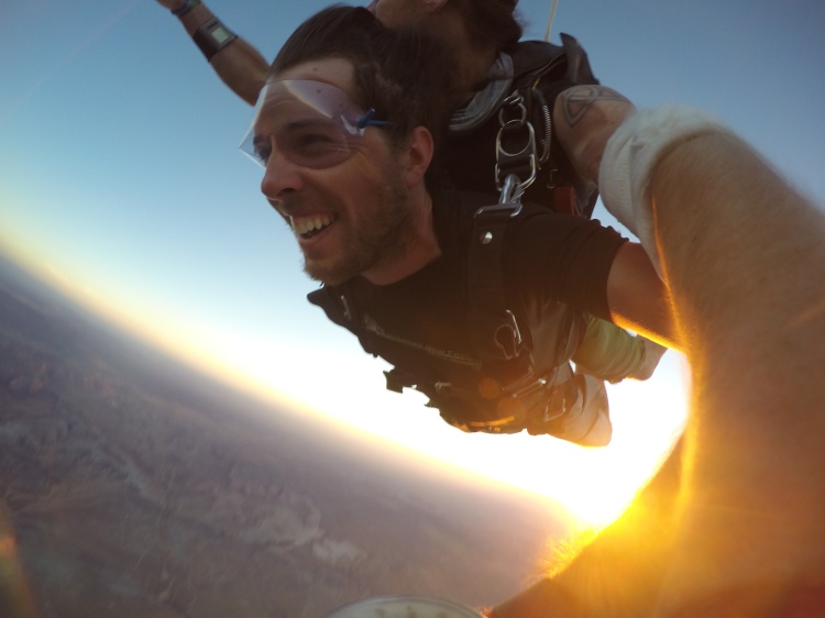
Leaving Canyonlands, my next destination took me back through the town of Moab. Out of the corner of my eye, I noticed a billboard. I made a mental note of the phone number and gave them a call on a whim, not thinking that they would still be open at this point in the evening. As luck would have it, they answered, and I jumped out of an airplane within the hour!

DCIM999GOPROG0121134.

DCIM999GOPROG0121134.

I had the honor of jumping tandem with Adam, a former marine who had taken a bullet through his jaw. After a little paperwork on the ground, five of us, including the pilot, crammed into a sardine can of a plane, watched the setting sun cast exotic shadows across the landscape for 20 minutes.

Then at 10,000 feet, we pooped the door and took the shortcut down!

Adam set me up with an altimeter, instructed me to pull the ripcord at 6,000 feet, then let me steer the parachute all the way down as we took in an epic sunset from an epic vantage point before landing in the soft dirt.

The staff of Skydive Moab were super friendly, professional, and experienced. The owner, Keith, was a great guy, he threw my pictures in for free, encouraged me to get certified some day, and recommended a great place to camp for the night. If you’re ever in Moab and feeling the adventure, jump with them, you won’t regret it!

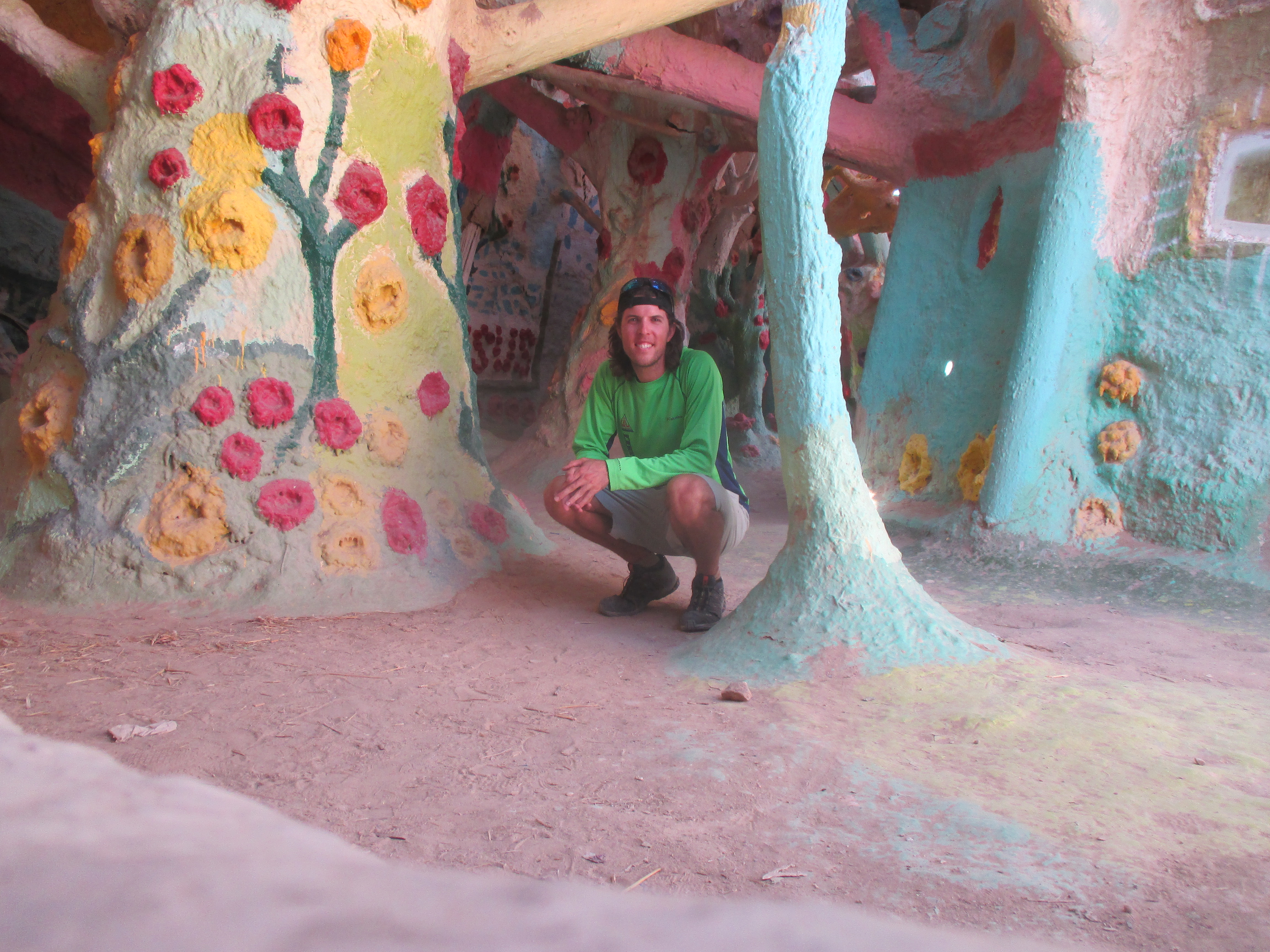
I enjoy fiction and mythology, so when Ben, from Aspen, recommended that I check out Goblin Valley State Park, I was excited to check it out. What I discovered was even cool than I imagined! A huge valley of tiny spires of mud and sandstone, every shape and size imaginable!

img_2418

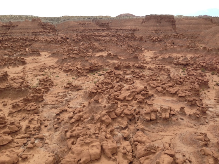
I hiked around amongst the goblins, climbed on formations, explored the small nooks, and had a blast.

I noticed a trail on the map to a location called “Goblin’s Lair” and had to scope it out. I envisioned a scoop out of the mud wall, but as climbed the rubble blocking the entrance, I was blown away at the chasm which lied beyond, an expanse the size of a king’s hall or grand ballroom! I climbed inside and marveled at the scope and splendor, several small holes in the roof provided ideal lighting.

img_2389

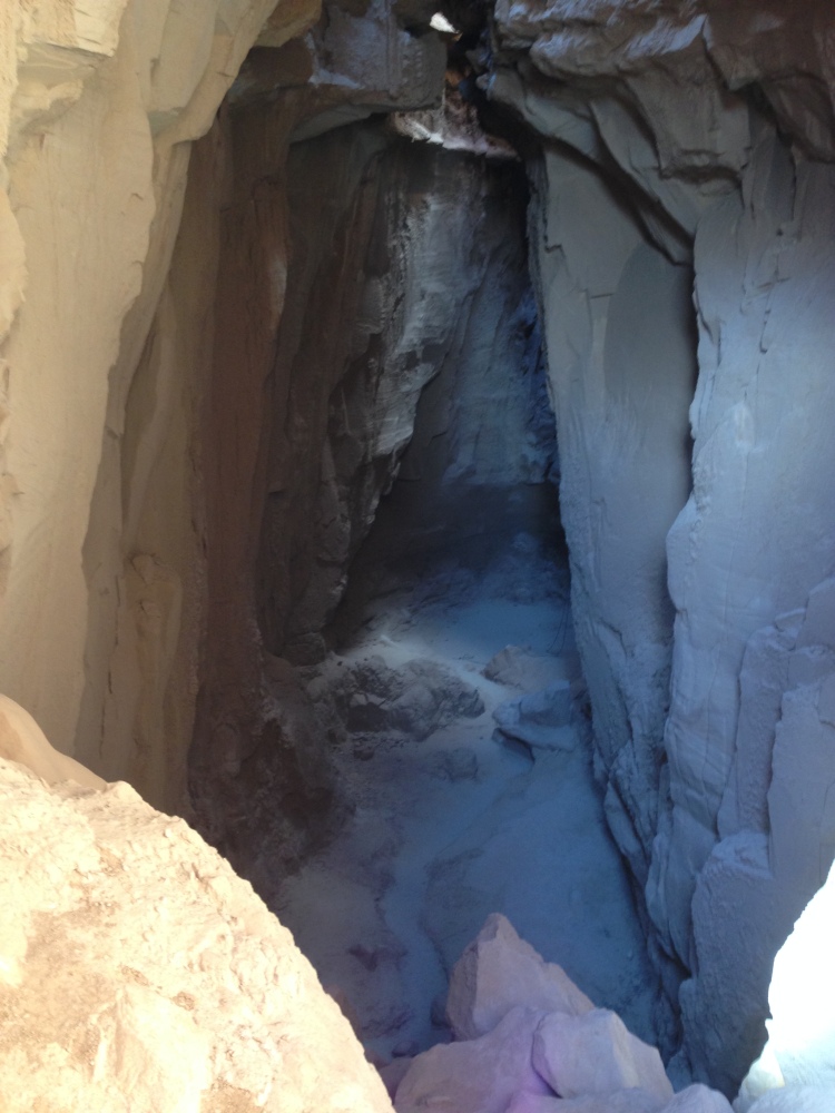
To my great surprise, there was a black climbing rope hanging down through the largest roof opening, then I heard two voices…a few minutes later, I jealously watched a couple rappel 90 feet into the Goblin’s Lair from above!

“I have discovered in life that there are ways of getting almost anywhere you want to go, if you really want to go.” ― Langston Hughes

After Brendan and Chelsea flew out of Sacramento, I got in touch with an old friend from studying abroad in Australia, Kevin. We did a quick tour of Old Sacramento, ate incredible Mexican food, shared good conversation, then it was time to get back on the road again, freedom in the wings!

img_1498

My next destination was to visit friends in Reno, but I pit-stopped at Lake Tahoe along the way. After texting my mother, I was informed that my cousin, Katie, was also at Lake Tahoe! After some quick communications, we were eating lunch together within an hour or two, along with her friend, Eric.

13900215_10153288290312609_952689139674019176_n

They graciously invited me to tag along on their plans for the day! A short hike to a waterfall at Fallen Leaf Lake, a drive by Emerald Bay, and then back to Eric’s house in Truckee, CA.

13912429_10153288592652609_1773691959477154123_n img_1501 img_1503

In the evening we walked down to “Truckee Thursday” for dinner from food trucks, live music, and a craft fair. Later that night we met up with Eric’s friends, Nate and Kat and drove to a concert at a local casino, the opening act was The Naughty Professor, and the headliner was Galactic. Pretty neat jams from both of these bands before we headed home around midnight.

img_1505

Katie just happened to be flying out of the Reno airport, so I was able to drop her off on the way to visit Sarah, Jason and their dog, Astor. Sarah and I met while studying abroad in Australia some 12 years ago, and have remained dear friends over the time and distance, and her husband, Jason, is a stand-up guy, the both showed me outstanding hospitality.

img_1508

On the first night in Reno, we met their friend, Brooklyn for Mexican food, I went out on a limb and tried the beef tongue, not half bad! We watched the sun set over the mountains from their back yard and caught up on the years since we last saw each other. After breakfast the next morning, we packed a daybag, threw the dog in the car and drove out to Lake Tahoe for a hike up a side trail to an alpine lake after an hours walk. The water was freezing, but Astor was loving playing fetch with her toy, I dove in with her, knowing I might not get another chance to visit this serene lake!

pic-1

In the evening, we visited Sarah’s brother, Brian and his girlfriend, Liz, for a cookout. Sausage, watermelon, corn, and potatoes on the grill…mmmm, mmmm, it was good eating and great company! Sarah and Jason are intrepid explorers and besides the wonderful friendship, they also gave me sage advice on what to visit and what not to visit in the area before setting off the next morning, many, many thanks to this loving couple!

img_1936

From Reno, it was 300 miles South to Death Valley, California. The scenery out in Nevada is barren and rugged, but nice to have stretches of long, open road, exactly what a road trip makes me think of. One car caught up to me but wouldn’t pass, once I got sick of him on my rear, I pulled into the left lane, hit the brakes, and he went by…reverse pass baby! In the big, open valleys, there were about a dozen small tornadoes, dust devils, at any given time, very beautiful to watch in the distance. One was swirling over the road as drove through and it gave me a harder shove than I expected! I stopped for gas frequently, as I saw signs reading “No services next 100 miles”. My first way-point was the “Car Forest” in Goldfield, NV. Neatly decorated cars, buried vertically in the dirt!

img_1512 img_1513 img_1519 img_1526 img_1521

Second way-point was the deserted mining town of Rhyolite. Some building still remained, but there is also some unique outdoor art, including a giant naked women made from cinder blocks.

img_1535 img_1538 img_1544 img_1541

Then, it was onto the main event…Death Valley! It was many miles down to the bottom and I slowly watched my dashboard thermometer tick high and higher, capping out at an astounding 128 degrees at 5:00 PM near Badwater Basin, the lowest point in North America, nearly 300 ft below sea level.

img_1560

I wanted the full experience of the area, so I refused to use my air conditioning the entire time, so hot. The wind blowing in my windows was scorching, much of the time, it was cooler to have the windows up to stifle the hot breeze!

img_1551 img_1562 img_1571 img_1581

After exploring the depths of the valley, I drove up to Dante’s View just in time for sunset, 5,000 feet above the valley floor, such splendor.

img_1582 img_1607

I chugged water all day, but still felt a little off and mentally slow from sweating my brains out. Even at 10:00 PM, in the dark, my thermometer still registered a sweltering 115 degrees.

img_5125

I knew I couldn’t sleep in that kind of head and had to get to cooler temperatures at higher elevations. I drove into the night to the opposite side of the park, seeing long-eared jack rabbits, and even some wild donkeys along the way! I watched the temperatures drop as I started up the road towards Telescope Peak at 8,000 feet. About two miles from the end of the road, the surface turned from pavement to loose gravel, the patch steepened, and a sign read, “4×4, high clearance vehicles recommended”. Oh well, I figured I could always back down slowly if I had to. The red Rover amazed me once again and despite some tricky areas, we chugged all the way to the top around 11:30 PM, a cool 75 degrees at the top!

img_1617

It was late, but I knew there would be a good sunrise, and Death Valley is famed as one of the best places in the country to view the stars, so I reluctantly set my alarm for 4:30 AM and rolled to sleep. When the alarm sounded, I sleepily got dressed in warm clothes, laid out on a log, and watched the stars glimmer across the galaxy…worth it! An hour later, the sun began to paint the sky. The sun rises and sets every single day, yet watching it never loses it’s majesty. I climbed a dead tree on the hill for a better vantage point.

img_1620 img_1626 img_5149

The descent down the steep gravel road was easier than the climb, I checked out some old charcoal kilns along the way, and even saw more donkeys and a small wolf along the road!

img_1629 img_1631 img_1638 img_1643

A short hike took me up a canyon to the remarkable Darwin Falls, which flows year round despite the hot, dry conditions elsewhere. It was hot, even early in the morning, I chugged lots of water, but was still dehydrated from the day before and couldn’t catch back up, I had a headache and no appetite the rest of the day.

img_1649

Driving West out of Death Valley, I saw a giant white wall on the far side of the plain…the high Sierras!

img_1657

Mount Whitney was my next goal, the highest peak in the lower 48 states! I got my hiking permits and bear canister from the visitor center, scarfed a pizza, then tried to find some relief from the heat. It’s hot this far South in August, makes things tough for van dwelling. I read a book under a tree at a park, but I couldn’t escape the ambient 99 degree weather. After a short nap in the grass, I was once again desperate for cooler temperatures at higher ground and drove up to 8,000 feet to an area known as Whitney Portal for camp. The rest of the day, I prepped gear and looked in awe at the granite behemoths surrounding me, mountains like I’ve never seen before!

img_1670 img_1666

I slept in until 10:00 AM, thanks to the shade of the mountains, then began my ascent to the trail camp area where I could set up my tent for the night. I climbed and climbed and climbed , ever so slowly to prevent altitude sickness and allow my lungs to gasp for the thin air. After about five hours and 4,000 feet of elevation, I sat down next to my tent and stared at the world around me, enormous white cliffs, bathed in sunlight, crystal clear ponds, and clear skies, I didn’t even bother to purify the stream water before drinking it, perfectly crisp snow melt!

img_1672 img_1679 img_5156 img_5165

My phone battery died from the chilly temperatures overnight, so my alarm didn’t go off, but when I woke up to pee in the early morning, around 5:00 AM, I saw the sky reveal the slightest hint of orange…go time! I left the tent and any gear i wouldn’t need for the summit and began plodding my way up the eternal set of switchbacks, probably 2,000 feet of climb with a brilliant sunrise along the way.

img_5181 img_5184

After reaching the crest trail at the top, it was only two miles and 1,000 feet higher to the top of the lower 48 states! The air was very calm and temperatures were quite reasonable for how high we were, lots of friendly people were going up and down.

img_5194 img_5205

After another hour, I saw the small hut at the summit and was greeted with 360 degree views of the magnificent mountains, lakes, clouds, and cliffs.

img_5201 img_5220 img_5233


Another hiker had randomly brought his friend’s didgeridoo to the top! I starred in awe at the views for at least 45 minutes, woofed down some prunes and granola bars, then began the trek back down.

img_5225

***Caution, potty language ahead*** Clear, blue skies lead me back the way I came, and about one hour from my tent, the prunes hit me and I had to poop terribly bad, however, due to how many people climb Mount Whitney, one of the requirements for getting a permit is that you can only poop into the prescribed bags that they give you, and you have to pack your waste down the mountain. I had mistakenly left my “wag bag” back at the tent! I fought hard to hold it and made it back to camp just in the nick of time.After packing my gear, the slog down 4,000 feet began and I had severe gas the entire way, but couldn’t trust it. The pain and cramps of trying to hold it while working hard physically was a bad mix, and eventually the pressure won out…I pooped my pants in minuscule amounts at least a half dozen times and I was praying for the parking lot bathroom at the bottom. (I apologize for the graphic descriptions here, I’m certainly not proud of these moments, but my aim is to give a realistic description of the highs and lows of the journey so you can best live in the moment with me.) I feared that perhaps the source of my discomfort wasn’t actually the prunes, but rather that I had contracted giardia from the untreated water, but that usually takes a few days to fester. I got to the van around 3:30 PM, completely pooped, both literally and figuratively, chugged two Gatorades and ordered a burger and fries from the small camp store, boy oh boy, were they scrumptious! After putting my gear away, my belly seemed to settle down, I returned the rented bear canister to the visitor center and the arduous mission had been accomplished!

img_5253 img_5255

My GPS showed that Sequoia National Park was only 33 miles from Mount Whitney as the crow flies, but over 200 miles of road to go South around the Sierra mountains! Along the drive, tons of smoke rose from a forest fire, so much that it actually blotted our the sun!

img_1688

The road that my GPS wanted to take was closed from the fire, so I diverted around through Bakersfield, CA, where I pulled into a hotel parking lot to sleep for the night. It was very hot in the van in this town and I couldn’t sleep. Around 11:00 PM, I started driving the remaining 100 miles to Sequoia National Park. As I left the pavement of the city and gained a little elevation, the temperature dropped from 96 to 76 degrees. I saw some tractor-trailers pulled off along the side of the highway, I assume to sleep, so I decided to do the same when I came to an empty turn-out. I was quick to fall asleep now that it was chillier and 1:00 AM.

img_1700

I was suddenly awoken at 4:00 AM as semi-trucks flew by my van, making lots of noise and the wind shook my car. I couldn’t get back to sleep with all the commotion, so I drove the rest of the way to Sequoia. Just before the entrance, I pulled into another hotel parking lot around 5:30 AM for a nap, not even bothering to put the privacy curtains up over the windows. I was comically woken up a little after 8:00 AM when I heard a family with two kids going around the parking lot calling out the states on the license plates, “WOAH, Maryland!!! Get in there, I’ll get your picture for the collection, it even has fireworks and says Bob Bell, just like daddy’s name, Bob!” THUMP, THUMP, THUMP, the little boy was banging all over the door for a minute straight. I really wanted to put my face up to the glass for an epic photo-bomb, or spring the doors open screaming, but figured it prudent to remain incognito and not let them notice my body inside. The Sequoia trees are something that everyone must see in person during their lifetime, the enormity of these trees cannot be expressed through the words or pictures here.

img_1719 img_1720

I walked a circle around one tree and counted 34 paces, there was even a tunnel cut out of a fallen log that I drove my car through!

img_1723 img_5261

I strolled out to “Tharps Log”, where an old rancher had lived inside a hollowed out, fallen over, dead tree!

img_5266 img_1724

I also had the honor of walking down to the General Sherman tree, the largest tree in the world by volume. A nearby sign mentioned that if the wood of the General Sherman tree was water, you could fill a bath tub everyday for 27 years before running out of water!

img_1732

After enough tree-gasms, I drove into the neighboring National Park, King’s Canyon. The canyon was similar to Yosemite valley, with massive carved, granite faces on both sides. I checked out some waterfalls, then drove back out as the setting sunlight ricocheted off the canyon walls.

img_1753 img_1735 img_1756 img_1767 img_1768 img_1776

I decided to try for one last destination for the day, the Boole Tree. I had no idea what this was, but the name on the map left me too curious to resist. I didn’t recall seeing a sign or the unpaved road for the trail on the drive down, so I watched the map and guessed where the access road was. I found a turn out that had a sign reading, “No Motor Vehicles”, and the trees were all burned from a recent forest fire, so I figured maybe the trail had been left to deteriorate. I found bits and pieces of old roads as I bushwhacked into the sunset, following a ridge and my compass off trail, I made a few arrows in the dirt with my feet as I went. Mostly, I was on loose, ashy, rough terrain and everything I touched left me marked black with soot.

img_1784img_1782

After an hours hike and a beautiful sunset, things were getting pretty dark, then I heard a large animal in the valley below…MRROOOOO…and at the same time, I spotted a large paw print in the sand. My mind instantly switched it’s lock from Boole Tree to bears and mountain lions. I immediately turned around and was sufficiently frightened by myself. I stumbled through the night by headlamp, steeply skirting the ridge and following a loose South bearing as the animal in the valley continued to bellow. I wasn’t on the same route as I went out on, considering there wasn’t an actual trail, but I didn’t want to get any closer to that noise down the hill. Every minute or so, I scanned the surroundings with my headlamp, looking for a pair of eyes stalking me. After 30 minutes, I discovered another section of road, I followed this for a bit until I decided I knew better than the road and went back into the woods, confident that I would find one of my arrows and come out right at my car! But, when things didn’t look familiar I was able to catch the road again. The funny thing was that this road was in good shape, it wasn’t a rutted out dead-end section like I was on earlier in the evening. You can imagine my surprise when I cam upon a sign reading, “Boole Tree Trail”!

img_1793

It turns out I was in the wrong area all along and there was in fact a beautiful gravel road, complete with signs! As I walked back to the paved road, I came upon an Asian couple, parked on the side, in an RV. I tried to talk to them, but they didn’t speak English and they were probably freaked out when someone came running down the road with a headlight at 9:00 PM when there were no other cars around. I walked half a mile down the paved road to my sweet house on wheels, and was relived to be there.

img_1794

I knew I had to find this elusive Boole Tree once and for all, I started the car, drove to the gravel road, past the Asian RV couple, probably freaking them out again, and 2.5 miles down the rutted road to the trail head where I climbed into my bed for the night. On the drive down the road to the trail, I saw lots of cow poop on the road, I’m pretty sure it turns out that I was all freaked out and running from a cow. When morning came, I hiked one miles out to the Boole Tree, another massive Sequoia in a grove of many huge stumps which had been harvested for lumber many years ago.

img_5273img_1802

When I first arrived, I heard lots of commotion off to the side of the trail, a big animal in the woods. I couldn’t get an angle on it to see what it was, but I could see the top of a pine tree, swaying back and forth and heard branches snapping, pretty sure that one was not a cow, a bear the best I can figure. The last hike in the area, was out to the Mark Twain stump, a giant that was cut down many years ago, so that cross sections of the tree could be sent around the world and put on display in museums.

img_1807

Los Angeles was 200 miles from Sequoia National Park. I was able to locate the Civic Musical Road along the way, which is a series of rumble strips along the road, created for an automobile commercial. When you drive over the area at a consistent 55 MPH, it plays a song! I arrived in LA in the evening and met up with my cousin, Laurie, and her husband, Todd.

img_6779

They are awesome fun, as always. We went to a comedy show at The Improv, visited their new condo in Malibu, walked the shore, ran a sand dune, grabbed a beer, watched a movie, and even found a place to eat Cambodian Food, The Golden Lake Eatery!

img_6784 pic-3img_6817img_6821img_6835

I was thrilled to speak Khmer with the woman running the store, and she was just as jolly and friendly as I remember Khmer people being.

img_6810

While in LA, I was able to grab tickets to a video game tournament for a game known as League of Legends, a game I enjoy playing, and the professional teams have become quite huge in recent years. Waiting in line, an employee asked for solos, then took me and another individual into the stadium and we filled two seats in the very front row! I’ll spare you all the nerdy details, but it was sensationally dorky!

img_1813 img_1820

Thanks again to Laurie and Todd (and their dog, Newton) for all the fun things, housing and feeding me, and the supportive love!

img_6799

An hour South from LA, in Newport Beach, I visited an old adventure racing friend, Josh. He just happened to have an extra mountain bike and helmet, so we hopped on and tore up some hilly trails along the coast during the sunset, we even saw a big hair tarantula! Sandy, but firm trails, great flow, great views, and a great friend!

pic-4

Officially turning East across the Southern USA, I drove 100 miles East to arrive at Joshua Tree National Park. Very scenic desert landscape, lots of boulders and rocks to climb on, and the Joshua trees themselves are crazy looking with branches in every direction.

img_1850 img_1871 img_1874 img_1880 img_1876 img_1877img_1897

One especially unique portion was the cholla cactus garden, where these cactus grew on a hillside for as far as you could see in every direction!

img_1886 img_1889 img_1891 img_1892

I slept in a turn-out on the side of the road in the park and was gifted a magical sunrise in the morning, I simply opened the sliding door on the side of the van and watched it directly from bed, snuggled up inside my warm sleeping bag in the cool morning air! Those are some of the greatest moments that this lifestyle provides.

img_1895

During some research, I discovered a neat hike known as the Painted Canyon, the entrance to the sandy dirt road had another sign reading, “4×4 high-clearance vehicles only”.

img_5286

There were a few small sandy patches that I was able to power through, but after 5 miles it happened…the car got stuck in the sand, in the middle of a canyon, in 105 degree heat…oh crap!

img_1900

I threw it in reverse, turned the wheels side to side and punched the gas and luckily I was able to grind back to solid ground. I just left the car there and walked the rest of the way to the start of the trail. The hike was a blast, rock scrambling through a tight sandstone slot canyon, a few ladder climbs, and gorgeous sunlight flooding in from above!

img_5282 img_1907 img_5285

Next stop was Slab City, CA, and old military base that Brendan had told me about, where people now live an “off-grid” lifestyle in the middle of the desert.

img_1926 img_5302 img_5303

Located along the entrance road to the area is a very impressive art project known as Salvation Mountain, decorated hills, cars, and junk turned art, all decorated with religious themes…something like an ultra devout Dr. Seuss!

img_5289 img_5287 img_5298 img_5296

Slab City itself was all but deserted this time of year considering the temperature was 110 degrees, most people move down to escape the cold Northern winters.

img_5301

Leaving Slab City, I called my cousin, Maddie, and her husband, Nathan, in Phoenix, Arizona, then decided to drive all five hours out to their house that evening. I randomly drove through an area known as the Imperial Sand Dunes, and what a treat it was, sand dunes as far as you could see in any direction and the highway runs right up the middle of it!

img_5306

I pulled into Phoenix around 9:00 PM, caught up with Maddie and Nathan, met their two dogs, Enzo and Gracie, and they even got me a birthday cake to celebrate my 32nd birthday. Another great birthday spent doing what I love and with people I love!

img_1948 img_1763